• ⚠️ Emergency contact in Spain - Dial 112 and AlertCops app. More on this here.
  • Remove ads on the forum by becoming a donating member. More here.

Search 74,075 Camino Questions

LIVE from the Camino Counting pilgrims on the Via Augusta (Nov. 2024)

Umwandert

Active Member
Time of past OR future Camino
Current Caminos: Via Augusta + Camino Manchego
I have to admit, the title is probably a little too optimistic. It is highly unlikely to meet any pilgrims at all in Andalusia in December. On my last three winter caminos in Andalusia (Via Serrana, Camino Estrecho, Camino de Fray Leopoldo) I came across a grand total of one (!) pilgrim. I will probably rather count cows, dogs or telegraph poles.

I have two non-contiguous weeks available for Caminos in November/December and am dedicating myself first to the Via Augusta, which I have also had my eye on in previous years. I expect long flat stretches without the slightest incline, a rather monotonous landscape, but interesting places and towns. As far as I know, there are no albergues, so I have booked hotels and private accommodation.

I start on Monday from Seville heading south. I'm walking this route in reverse because I'd like to have the stage along the Atlantic as the highlight at the end. As I'm totally out of shape, I've opted for a particularly lazy option. I will hike three of the six stages with a day pack and take the train to my accommodation in Seville or Jerez in the evening.

I am happy to post my experiences here and look forward to suggestions and information from the forum experts. After all, the Via Augusta has a sub-forum here and appears more frequently in the comments than my first three Andalusian Caminos.
 
Ideal sleeping bag liner whether we want to add a thermal plus to our bag, or if we want to use it alone to sleep in shelters or hostels. Thanks to its mummy shape, it adapts perfectly to our body.

€46,-
I have to admit, the title is probably a little too optimistic. It is highly unlikely to meet any pilgrims at all in Andalusia in December. On my last three winter caminos in Andalusia (Via Serrana, Camino Estrecho, Camino de Fray Leopoldo) I came across a grand total of one (!) pilgrim. I will probably rather count cows, dogs or telegraph poles.

I have two non-contiguous weeks available for Caminos in November/December and am dedicating myself first to the Via Augusta, which I have also had my eye on in previous years. I expect long flat stretches without the slightest incline, a rather monotonous landscape, but interesting places and towns. As far as I know, there are no albergues, so I have booked hotels and private accommodation.

I start on Monday from Seville heading south. I'm walking this route in reverse because I'd like to have the stage along the Atlantic as the highlight at the end. As I'm totally out of shape, I've opted for a particularly lazy option. I will hike three of the six stages with a day pack and take the train to my accommodation in Seville or Jerez in the evening.

I am happy to post my experiences here and look forward to suggestions and information from the forum experts. After all, the Via Augusta has a sub-forum here and appears more frequently in the comments than my first three Andalusian Caminos.
I look forward to reading your posts as I will be starting the ESTRECHO in March and starting out on the AUGUSTA in April 2025
 
Walked it in early Apr 22. No other pilgrims, not even a boot print ! Not hilly, I found it well marked except in the towns. The loop out of (into) Cadiz was not particularly exciting. The views (for you) coming down into Santa Maria are great. An option could be to grab the boat from there to Cadiz.
 
€2,-/day will present your project to thousands of visitors each day. All interested in the Camino de Santiago.
I will be following your posts with interest as my wife and I intend to walk from Cadiz to CDS, beginning in September next year, I noted that the first sections as far as Jerez de la Frontera can be accessed by train so we intend to stay in Cadiz and walk these sections for the first few days returning to our hostel each evening. The section that concerns me is from Los Cabezas to Utrera which is about 34 km. I am hoping to break it up using a bus (or taxi) if possible, and treturning to where we fish the following morning. Cheers and Buen Camino, Peter
 
The section that concerns me is from Los Cabezas to Utrera which is about 34 km
In 2025 you have still time enough to get some training as this part has only about 260 m of incline/decline. in 2023 I walked from Cadiz to Sevilla in seven days. 29.0km 29k.6m 29.2km 29.9km 32.5km 25.0km 17.5km
 
I have to admit, the title is probably a little too optimistic. It is highly unlikely to meet any pilgrims at all in Andalusia in December. On my last three winter caminos in Andalusia (Via Serrana, Camino Estrecho, Camino de Fray Leopoldo) I came across a grand total of one (!) pilgrim. I will probably rather count cows, dogs or telegraph poles.

I have two non-contiguous weeks available for Caminos in November/December and am dedicating myself first to the Via Augusta, which I have also had my eye on in previous years. I expect long flat stretches without the slightest incline, a rather monotonous landscape, but interesting places and towns. As far as I know, there are no albergues, so I have booked hotels and private accommodation.

I start on Monday from Seville heading south. I'm walking this route in reverse because I'd like to have the stage along the Atlantic as the highlight at the end. As I'm totally out of shape, I've opted for a particularly lazy option. I will hike three of the six stages with a day pack and take the train to my accommodation in Seville or Jerez in the evening.

I am happy to post my experiences here and look forward to suggestions and information from the forum experts. After all, the Via Augusta has a sub-forum here and appears more frequently in the comments than my first three Andalusian Caminos.
Will be happy to hear your experiences, I am planning on walking from Tarifa next year & was thinking the Camino Estrecho then the Camino Augusta to Sevilla or the Estrecho to Algeciras then the Via Serrana to Sevilla, how did you find the Via Serrana?
 
Get a spanish phone number with Airalo. eSim, so no physical SIM card. Easy to use app to add more funds if needed.
I look forward to reading your posts as I will be starting the ESTRECHO in March and starting out on the AUGUSTA in April 2025
I will be starting the Estrecho from Tarifa in March weighing up whether to head west or go north on the Via Serrana from La Linea near Gibraltar
 
Thanks for the messages. I am happy to reply.

The loop out of (into) Cadiz was not particularly exciting. The views (for you) coming down into Santa Maria are great. An option could be to grab the boat from there to Cadiz.
@Blister Bill: That's pity. I was really looking forward to that.

I noted that the first sections as far as Jerez de la Frontera can be accessed by train so we intend to stay in Cadiz and walk these sections for the first few days returning to our hostel each evening. The section that concerns me is from Los Cabezas to Utrera which is about 34 km. I am hoping to break it up using a bus (or taxi) if possible, and treturning to where we fish the following morning.
@Peter Brandon: I plan to use the train for this part of the camino (my last two days) as well. I will stay in Jerez and commute back from Puerto Real and Cadiz. I will walk Utrera-Las Cabezas tomorrow and look for possible places where you can take public transport.

Will be happy to hear your experiences, I am planning on walking from Tarifa next year & was thinking the Camino Estrecho then the Camino Augusta to Sevilla or the Estrecho to Algeciras then the Via Serrana to Sevilla, how did you find the Via Serrana?
@Joseph Carmona: I loved the Via Serrana, although it was a very challenging camino, mostly due to bad weather. I wrote about it in great detail here.
 
Day 1: Sevilla - Utrera (normally 35 km, shortened to 26 km by me)

IMG_4368.webp


Aller Anfang ist schwer (All beginnings are hard), as we say. At around 9am I'm at the cathedral, which is still closed, and get a stamp from the nearby tourist information centre. Then I make my way to the metro. There are two alternatives for this stage, either via Alcala de Guadaira (officially 36 kilometres) or via Dos Hermanas (35 kilometres). Both are too long for me for a first stage, especially as I'm out of shape. This stage is also the final stage of the Via Serrana, which I walked two years ago (via Alcala). At 41 kilometres, it was my longest Camino day ever.

So I shorten the stage by taking the metro and chose the other alternative via Dos Hermanas.

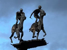
It takes me 30 minutes to get from the centre of Seville to the southern terminus at Olivar de Quintos. From there, it's only 1 km to a large roundabout with a metal statue with two riders on a horse, which the Camino passes. And then I'm on my way!

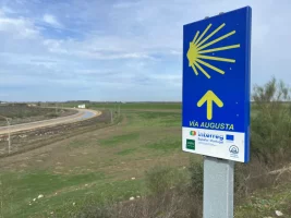
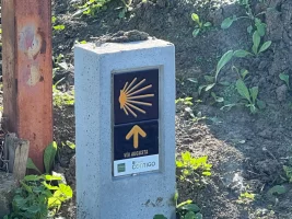
By the way, I use the tracks of the Asociación Gaditana Jacobea ‘Vía Augusta’. They also have tracks for the Camino Estrecho and the Via Serrana.

Today's first stage is divided into three similar sections:

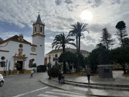
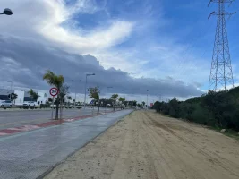
(1) Urban hiking on pavements (at the beginning there is a bridleway next to it) and through the less than edifying outskirts of Dos Hermanas. The town itself is nothing remarkable. But the square in front of the church, where I stopped for lunch in a café, is quite pretty. This first part is 100 per cent asphalt.

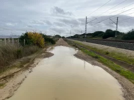
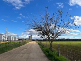
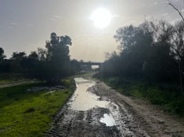
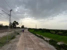
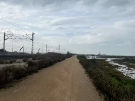
(2) Straight as a die for 8 kilometres next to the railway line heading south. It starts to rain here and I have to put on my rain poncho, but fortunately it soon passes. Nevertheless, there are a lot of large puddles to avoid on the dirt track.

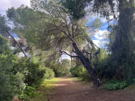
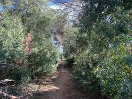
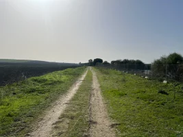
(3) Another 9 kilometres along a natural path, where there are finally a few trees and a bit of a Camino feeling for the first time. The path leads along olive groves and fields. The railway line runs further east and is out of sight. Here I encounter the first animals and have a little scare with a yapping little white dog just before Utrera.

I reach Utrera from a less attractive side, a few neglected-looking farms and ugly industrial buildings. At 16:30, after just over 26 kilometres, I'm at Utrera station, just in time to see a train to Sevilla Santa Justa pull away. Fortunately, the Cercanias run every 20-30 minutes or so.

Number of pilgrims met on the way: zero (nobody else was walking on the way either)
Number of trains passing by: 10
Number of animals on the loose: 14, four dogs (three of them relaxed) and ten rabbits

IMG_4295.webp

Best moment: My lunch break in the centre of Dos Hermanas (picture above). Some local senior citizens had gathered in the square in front of the church and the atmosphere was almost like a Sunday afternoon. They must have been magnetised by a loudspeaker playing Julio Iglesias' cuddly ballads from the 70s. What kind of music would work in my city? Marlene Dietrich or Hildegarde Neff perhaps?

Preview: Tomorrow 32km without any services from Utrera to Las Cabezas de San Juan. Then with my full bag pack. Luckily the forecast is for clouds but no rain. I'm excited and looking forward to tomorrow!

To be continued...

IMG_4266.webpIMG_4275.webpIMG_4281.webpIMG_4330.webpIMG_4350.webpIMG_4351.webpIMG_4371.webpIMG_4387.webp
 
Last edited:
The one from Galicia (the round) and the one from Castilla & Leon. Individually numbered and made by the same people that make the ones you see on your walk.
Preview: Tomorrow 32km without any services from Utrera to Las Cabezas de San Juan. Then with my full bag pack. Luckily the forecast is for clouds but no rain. I'm excited and looking forward to tomorrow!
Well I have good and bad news. The good news is there are services as the way marking (2022) deviates you through the small town of Teejano. The bad news is I had it clocked at just over 34km but depends a little IO suppose of start and finish locations. You can shorten it by not going via Teejano and continuing straight on. Some of the old painted over waymarking is still there. Buen camino!
 
Fail to prepare? reduce your risk by buying this book full of practical info.
2nd ed.
No birds and pigs?
@WalkingInGers: Well, a lot of traces of human pigs:
IMG_4322.webpIMG_4328.webp

Well I have good and bad news. The good news is there are services as the way marking (2022) deviates you through the small town of Teejano. The bad news is I had it clocked at just over 34km but depends a little IO suppose of start and finish locations. You can shorten it by not going via Teejano and continuing straight on. Some of the old painted over waymarking is still there. Buen camino!
@Blister Bill: As I walk in reverse I usually don't see any trail markers. But thanks to your post I had noticed Trajano. According to Google Maps there are two bars and a supermarket there. When I got to the crossroads (actually a bridge) I decided not to take the detour as I was already quite late, there were still 2 hours of daylight left and I still had over 10 km to go.

Our stages were MUCH shorter than yours!
@HeidiL: This happens when walking in reverse. Since I don't always check Wikiloc, sometimes I make mistakes and walk in the wrong direction. I usually notice this quickly. But of course it increases the mileage. The mentioned 41 km for Utrera to Seville instead of 36 (for a non-reverse stage) came about because I made an unnecessary detour in Alcala to find a tourist office (which didn't exist) and in Seville, where I foolishly chose a hotel that was almost 3 km from the cathedral on the other side of the river.
 
Last edited:
Day 2: Utrera - Las Cabezas de San Juan (32km usually, 34km for me)

IMG_4482.webp

I take a suburban train (C-1) from Seville to Utrera, which is 20 minutes late. I buy some provisions in Utrera, as there are no catering facilities on today's stage. Then I look for the town hall. It takes three employees 20 minutes to find the right stamp for pilgrims. So it's 9.45am when I finally set off on a dirt track at the southern end of the village.

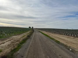
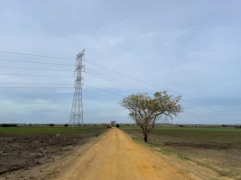
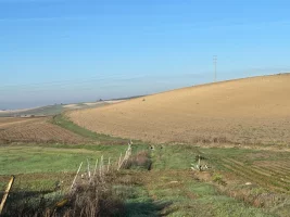
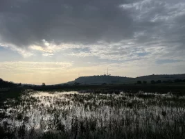
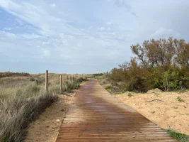
During the first hour, I come across joggers and people walking their dogs. The path is flat through fields. After a while, the path suddenly turns yellow and I automatically think of ‘Somewhere over the rainbow’. Unlike Judy Garland in the 1939 hit movie, however, I don't find any funny companions. After 10 kilometres, Utrera is still visible (no wonder, everything is super flat here). The Camino runs in long straight stretches. I take a break every 5 kilometres and drink plenty, I have 3 litres of water with me. It is cloudy and pleasant at 18 degrees.

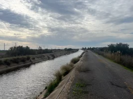
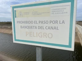
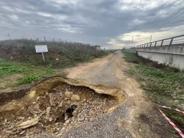
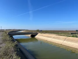
I reach the canal and wonder about wikiloc, the Asociación Gaditana Jacobea wants me to run over the railway tracks (which is not possible because of a fence). The railway and canal run dead straight parallel here. I take the bridge and then it's monotonous straight ahead for hours. Technically the path is easy, but mentally I find it difficult to walk for so long without the slightest distraction. I think it was here where a forum member was stopped by the police some years ago and gave up the Via Augusta. It is apparently forbidden to walk next to the canal, although there is plenty of space and I can't imagine how you could accidentally fall into the canal. I only realise later that there is a path on the other side of the canal directly alongside the railway tracks, which is now probably official.

After an eternity, I switch to the other side of the canal and then walk along the railway line. Again wikiloc wants me to walk over the tracks, but a fence prevents me from doing so. At 4pm I reach the junction to Trajano, a village 1km off camino that @Blister Bill recommended to me. It's 4pm, I still have 10 kilometres to go and I'm afraid that everything there is closed for siesta. So I walk on.

IMG_4540.webp

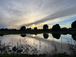
After another eternity, I leave the railway line and continue through fields. Then the path gets muddy and I have to keep knocking the mud off my shoes. I actually wanted to arrive before dusk, but I either started too late, took too many breaks or simply walked too slowly. The path drags on endlessly, and at 6 p.m. I witness a beautiful dusk. I know from my disastrous first day on the Via Serrana that I have about 30 minutes before it gets really dark. And now I can finally see Las Cabezas again, it's on a hill. I reach the town at 18:30, visit a supermarket and check into my hotel (NOVO Apartahotel, 61 euros). This Camino is not cheap.

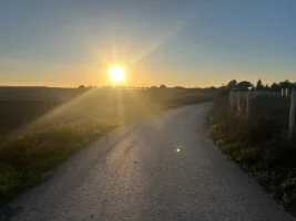
Pilgrims Count: 1!!! Actually, it doesn't count because I didn't meet the pilgrim on the route. I saw him from the train window as he left Utrera in the direction of Seville (the train line runs alongside the Camino there)
Free-Roaming animals on the camino: none.
Most scaring moment: At the end of the 'wizard of Oz' route, I suddenly hear a shot (not like a rifle shot, more like a cannon). This is repeated several times, once very close to me. I flinch, but don't see anyone. Possibly a system to scare the birds away from the fields?

Preview: 29 kilometres from Las Cabezas de San Juan to El Cuervo de Sevilla. This route will hopefully be a little more varied, as there is a lake and, with Lebrija, a town on the way.

Stay tuned.

IMG_4432.webpIMG_4442.webpIMG_4457.webpIMG_4467.webpIMG_4469 2.webpIMG_4476.webpIMG_4511.webpIMG_4557.webp

To be continued...
 
Last edited:
Those fields of rape seed are stunning and yes bird (pilgrim) scarers. I had pretty inexpensive accommodation. I think the most I paid was €40 at El Cuervo. You go on a bit of a horse shoe out of town tomorrow. I tracked 31.5km. It was my toughest day of the 6 due to walking all day into a very strong and cold head wind and I think psychologically coming from the south walking past Utrera.
 
Fail to prepare? reduce your risk by buying this book full of practical info.
2nd ed.
Day 3: Las Cabezas de San Juan - El Cuervo de Sevilla (usually 29km, 30km for me)

IMG_4596.webp

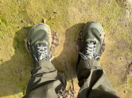
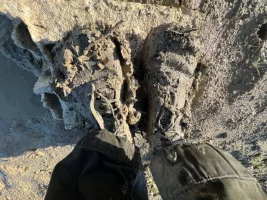
I leave Las Cabezas at 9:30 and quickly realise that yesterday's long stage is still in my legs. I cross the motorway and am quickly back in the fields. The grass on the side of the track is soaking wet from the morning dew. After just a few kilometres, the ground turns to earth. Wet earth. At first I run along the edge, but then the path widens and there is mud everywhere, with water standing on the fields in places. I sink ankle-deep and have to lace my shoes tighter to avoid losing them in the mud. I struggle very slowly for about a kilometre through very deep mud and my shoes become heavy. This is what it's like to hike in oversized clown shoes, I think.

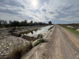
The path and my shoes remain muddy, but now there is more grass at the edges, I walk along them, which means that my non-waterproof trail runners are now soaking through too. I finally reach the canal and continue along the edge of it, studiously ignoring the no trespassing signs. Over the next few kilometres, which drag on endlessly, I only meet one man with a dog and one mountain biker. I occasionally see rubbish and dead fish floating in the canal.

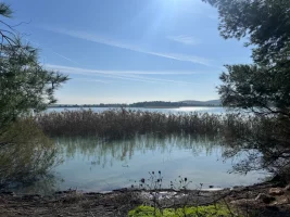
I have excellent conditions, sunshine, no clouds and 20 degrees. But the monotony of the seemingly endless straight path is getting to me, just like yesterday. There is practically no shade all the way, and in summer at 35 degrees (or even higher) it must be unbearable. When I leave the canal at around 12:30, I pass through fields again, this time recognising cotton plants. I'm looking forward to the lake marked on the map, which turns out to be a fenced-in reservoir for irrigation purposes. I take a break every 6 kilometres today. Once again, I force myself to drink a lot.

IMG_4687.webp

Now the surface changes to tarmac. At around 14:45 I reach the outskirts of Lebrija, the only village on the stage. The road is blocked by a fence, roadworks. A gate on the side has been trampled down, so I walk through the deserted building site. At the other end, I have to squeeze between two posts like a snake. Then I treat myself to a long break and a stamp in a café in Lebrija. The Camino doesn't go through the town centre.

After the refreshment, I feel ready for the last 11 kilometres. The route no longer takes me through a remote area, but along garden sheds, farms and fields where people are working. From the open gate of Club Deportivo Hipico, a small dog suddenly shoots towards me, fortunately it only wants to be petted, which I am happy to do. A few minutes later, I overlook a second dog lying on the road (it's the same colour as the path), which barks viciously at me but doesn't attack. Things calm down after that. When I take my last break at 17:15, I realise that once again I won't arrive before sunset.

I particularly enjoy the last hour of daylight, but I'm already tired. Instead of staggering sleepily towards my destination, I am woken up by a cacophony of wild dogs barking behind fences. I reach the town sign of El Cuervo de Sevilla at 18:30 in the twilight, 20 minutes after the sun has set. And this time, unlike yesterday, I find my hotel at the first attempt (Hotel Enfasis, 50 euros).

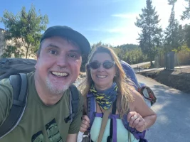
Pilgrim Count: One(!), for real this time. I meet Karen from the Netherlands half an hour before Lebrija. Before I can even say a word, she greets me in fluent German. Has my shirt with the Adidas logo given away my nationality? Then it becomes clear that she thinks I'm a priest called Johannes! We laugh together as we realise the mistake. Just 10 minutes earlier, she had met a German who was also walking the Via Augusta in reverse(!). And he told her that his friend, the priest in question, was walking a little behind him. Mysteriously, I didn't overtake him. We chat for a while, Karen is an experienced pilgrim (she walked for example from Astorga to Almeria, so two long caminos in reverse). I warn her about the mud battle 12 kilometres further on and we take a photo. This encounter was my highlight of the day!

Saddest moment: A large dead dog in the canal, which looked pregnant (or blown up by putrefaction gases).

Preview: 25km to Jerez de la Frontera. The weather is supposed to stay good, I'm looking forward to a city that, unlike Seville or Cadiz, I don't know yet. I will take a rest day there. Let's see if I meet priest Johannes and his friend...

To be continued...

IMG_4615.webpIMG_4652.webpIMG_4658.webpIMG_4696.webpIMG_4708.webpIMG_4728.webp
 
Last edited:
I stayed in hotel Enfasis, bumping into the owner at lunch. Must be inflation, I had the distance at just over 30km tomorrow. The only stop available enroute is a motorway petrol station accessed through the fence about 18km from Jerez. Jerez is a great town worthy of time - enjoy!
 
Get a spanish phone number with Airalo. eSim, so no physical SIM card. Easy to use app to add more funds if needed.
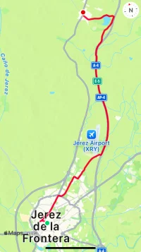
Day 4: El Cuervo de Sevilla - Jerez de la Frontera (25km officially, 28km for me)

IMG_4799.webp

According to the Wikilocs of the Asociación Gaditana Jacobea, which I use for hiking in reverse, today is the shortest stage. So I take my time and only set off after 10am. I buy water and fruit at the supermarket and soon leave the village. After a slight incline (a rarity on the Via Augusta), I follow a gravel path through fields towards the motorway.

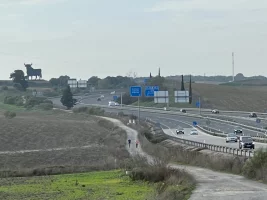
After 4 km, I reach the A-4 motorway (leading to Cadiz) and am delighted to find a picnic area with a table and bench (the first one I see along the way; there are only benches to rest on in the towns, not along the way). I take a break and thanks to @Blister Bill I see that there is a rest area in the middle of the long stretch along the motorway (thanks for the tip!) I continue on and initially overlook the fact that I should cross over to the other side of the motorway, I expect a bridge, but it's a subway. Luckily Wikiloc warns me after 100 metres with a loud noise that I'm going the wrong way (a mild electric shock would also work).

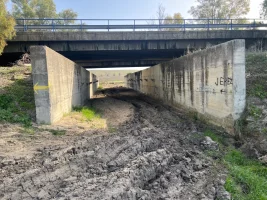
The subway looks as if a bulldozer had driven through it a few days ago, deep grooves of now largely dried mud. On the other side, the route continues southwards on stable ground (small puddles can still be seen here and there). And again the route is monotonously straight ahead. Unlike walking for kilometres along the railway line or the canal, however, it is very loud here. After a while, I can tell the difference between lorries, electric cars and normal cars by their noise without looking. I take my second break in the grass.

IMG_4809.webp

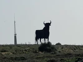
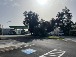
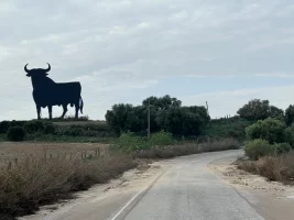
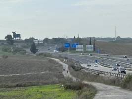
Then I reach the service area and see a 14-metre-high black bull silhouette made of sheet metal (a former advertisement for a brandy from the Osborne Group, there are 80 of these 'toros' all over Spain). The service area is fenced in and I find the hole in the fence described by @Blister Bill (in the caravan parking area). I had actually been thinking of a cheeseburger for lunch, but there is no restaurant, just a shop selling bocadillos and sweets alongside the usual petrol station stuff. I take a lunch break, it's already 2pm.

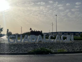
Then I continue stubbornly along the noisy motorway, only after a total of 14km (half the stage!) do I cross the motorway and come to a busy arterial road to Jerez. Now it gets stressful, because there is no shoulder I could run on, Wikiloc stubbornly shows the road, but next to it there is a bridleway with deep hoofprints. I bravely jump over a ditch to get there. But I soon have to get back on the road and make my way to the roundabout, where large letters indicate Guadalcacin, right next to a particularly ugly chemical plant.

Hooray! A pavement! I'm back in civilisation! After a few minutes, however, my feet hurt so much from the paving stones that I switch to the other side, where there is a quiet residential street next to the main road, where there is not much traffic at all. I reach the town centre and, as @Paul-CH had predicted, there are places to eat here. It is now 5pm and I take a break in Bar Ramon, where guests sip their tea on cable drums.

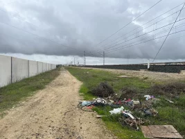
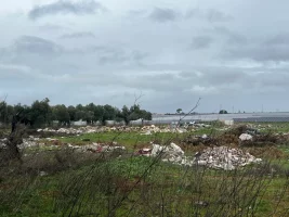
I now realise that I won't make it to the finish by sunset again, but as I'm expecting urban walking (with pavements and streetlights) it's no big deal (I hate walking in the dark). Between Guadalcacin and Jerez, I walk on an unkempt and partly overgrown path, a farmer has simply added a section of the path so that I am walking in a field. This is followed by allotments (or is it a slum? There is a lot of rubbish lying around). After half an hour, I reach the outskirts of Jerez.

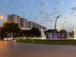
The apartment, which I have booked for the next few days, is located between the city centre and the train station. I walk for more than an hour through various neighbourhoods, including a park, as dusk falls and night falls. By the time I arrive at 18:50, I'm exhausted and looking forward to my rest day in the morning.

Pilgrim Count: Zero, I only met four cyclists along the motorway.
Free roaming animals on path: None, apart from a few chicken in Guadalcacin.
The moment when I want to storm into the office of the Asociación Gaditana Jacobea and shake someone in charge: when I leave the motorway and Wikiloc forces me onto the arterial road without a shoulder, I almost get run over and then pass a livestock breeding that emits such a stench that I almost throw up. First I have to endure hours of motorway noise, then I have to dodge lorries and now I need a gas mask? So really... I have to put myself together, after all I usually like challenges. A short time later, I discover that the tracks are not precise (this is not the first time) and the Via Augusta actually runs along the bridleway on the other side of the road.

Preview: First a rest day in Jerez and then 25 km to Puerto Real and more motorway hugging.

To be continued...

IMG_4772.webpIMG_4782.webpIMG_4793.webpIMG_4814.webpIMG_4835.webpIMG_4857.webpIMG_4881.webpIMG_4889.webp
 
Last edited:
A short time later, I discover that the tracks are not precise (this is not the first time) and the Via Augusta actually runs along the bridleway on the other side of the road.
Sounds like quite the day. You definitely weren't on the right path. I've never used wikilocs (other than for research) as so many seem to be cyclists tracks that don't always follow the actual path. Hard in reverse. I had a wonderful horse encounter just near the "bull" with a thoroughbred who had thrown his rider and was determined not to be caught. A lot of fun helping. There's another bull before you descend to Santa Maria - I never knew the background story to them.. Hope you have time to see one of the horse shows with a sherry in hand!
 
Sounds like quite the day. You definitely weren't on the right path.

@Blister Bill: You are absolutely right. I subsequently compared the Asociación Gaditana Jacobea markings on Wikiloc with the route on the Buen Camino app and came up with three deviations for this stage alone.

(1) BuenCamino leads the pilgrim further north out of El Cuervo and in a curve towards the motorway, thus avoiding the sight of the slightly run-down houses on the edge of the town.

(2) After leaving the motorway, BuenCamino immediately sends the pilgrim onto the bridleway and then there is another path behind the allotments, while Wikiloc stays on the road without a shoulder all the way to the roundabout with the letters of Guadalcacin.

(3) From the Bar Ramon in Guadalcacin to Jerez, BuenCamino leads the pilgrim north of the railway line in a semi-urban ambience to Jerez, while I staggered with Wikiloc south of the tracks over chickens, reeds, fields and slum-like allotments with serious rubbish problems towards the city.

I was so amazed that I also compared my earlier stages. There are quite some differences here too, but the apparently forbidden walk along the banks of the canal also exists on BuenCamino. And Trajano is not crossed there on the long stage (Utrera - Las Cabezas) either.

I really need to look into the details more on future reverse adventures. Apparently the Via Augusta really has been rerouted in some places and neither the Wikiloc files of the Asociación Gaditana Jacobea nor BuenCamino are up to date. However, the BC app is much more up to date.
 
Last edited:
The 2024 Camino guides will be coming out little by little. Here is a collection of the ones that are out so far.
@Blister Bill: You are absolutely right. I subsequently compared the Asociación Gaditana Jacobea markings on Wikiloc with the route on the Buen Camino app and came up with three deviations for this stage alone.

(1) BuenCamino leads the pilgrim further north out of El Cuervo and in a curve towards the motorway, thus avoiding the sight of the slightly run-down houses on the edge of the town.

(2) After leaving the motorway, BuenCamino immediately sends the pilgrim onto the bridleway and then there is another path behind the allotments, while Wikiloc stays on the road without a shoulder all the way to the centre of Guadalcacin.

(3) From the Bar Ramon in Guadalcacin to Jerez, BuenCamino leads the pilgrim north of the railway line in a semi-urban ambience to Jerez, while I staggered with Wikiloc south of the tracks over chickens, reeds, fields and slum-like allotments with rubbish problems towards the city.

I was so amazed that I also compared my earlier stages. There are quite some differences here too, but the apparently forbidden walk along the banks of the canal also exists on BuenCamino. And Trajano is not crossed there on the long stage (Utrera - Las Cabezas) either.

I really need to look into the details more on future reverse adventures. Apparently the Via Augusta really has been rerouted in some places and neither the Wikiloc files of the Asociación Gaditana Jacobea nor BuenCamino are up to date. However, the BC app is much more up to date.
Sounds really frustrating. Probably not enough detail but this was my gps track. Only thing that annoyed me was going around the lake at the end of the day instead of turning left at Santa Lucia and going straight into town. I just used what was on the website and followed the arrows which is always tricky in reverse. Should be far more straightforward for the next two legs !
 

Attachments

  • IMG_5572.webp
    IMG_5572.webp
    124.6 KB · Views: 6
Day 5: Jerez de la Frontera - Puerto Real (25km officially, 26km for me)

IMG_5101.webp

I start shortly after 9 with a small handicap. On my day off I got a huge blister on the second toe of my left foot. Once you tie your shoes loosely and don't marinate your feet with deer tallow (the secret weapon of the German-speaking pilgrim world) and then you need Compeed...

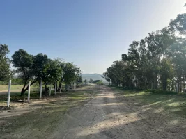
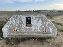
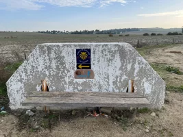
Today I get out of the city much quicker than I got in the day before yesterday. I soon reach the Carretera N-4, which then joins the motorway to Cadiz. The road is sandy at first and I come across quite a few joggers and mountain bikers, the latter even hours later. I pass a bench for pilgrims decorated with the shell symbol and can see the Osborne bull from afar, the second on this Camino, as announced by @Blister Bill. I take my first break there.

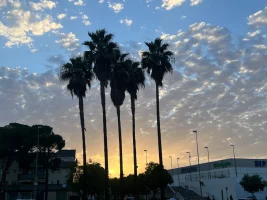
The weather is cloudy today and the sun isn't really coming through, so I walk in long trousers and a jacket. I follow the motorway for an hour in total, then cross it and continue along the other side. But not for long, then it continues with fields on the right and a fenced estate on the left. Palm trees come into view. And then the silhouette of the outskirts of El Puerto de Santa Maria begins to emerge.

To my surprise, there is quite a long downhill section, I pass the casino and walk on tarmac on a road with little traffic and no shoulder. It takes me quite a long time to cross various residential areas and a dual carriageway. The Camino doesn't lead directly into the centre, but at some point kiosks come into view and it becomes more urban. I take a lunch break with a bocadillo andaluz (tortilla, bellpepper, ham) and sit down in a small park.

Then it's over the Rio Guadalete and along a very long arterial road through Valdelagrana. After a while, the pavement hurts my feet and I switch to a neighbouring residential road with hardly any traffic. I pass a big station wagon with a group of men from my home town (Moin!) and am a little annoyed because it takes so long to get back into nature.

IMG_5140.webp

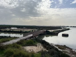
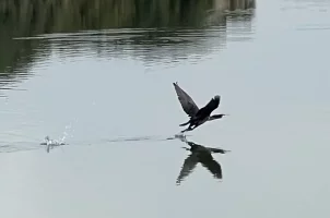
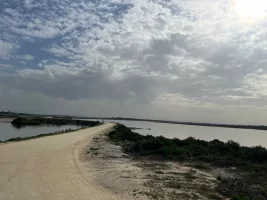
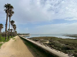
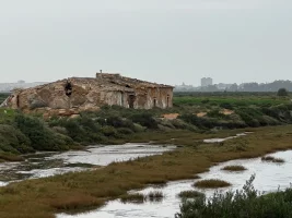
This happens finally a short time later, as I walk for around 6 kilometres through the Salinas de los Desamparados wetlands. At first I meet day trippers here, but am soon alone with the fantastic views over the bay towards Cádiz and the numerous birds. I treat myself to another break, as there are two old chairs by a shed where fishing equipment is apparently kept – a nice invitation that I gladly accept. In the meantime, the sun has come out and I free myself from my lower trouser legs.

I walk towards Puerto Real in a good mood and am amazed to realise that, although I am hardly any faster than two days ago, I will arrive at my destination much earlier. The reasons are surely that I set off an hour earlier, take fewer and shorter breaks and am only hiking with a day pack. I reach Puerto Real shortly before 4pm and decide to walk along the almost deserted promenade into the town (the Camino leads further inland into the centre). I recognise the town hall building (looks like a neglected sports complex) and know that the tourist information office is next to it. I had already been here a year ago, when I started in Puerto Real in the direction of Algeciras on the Camino Estrecho (also in reverse).

There is no stamp for me, as the town hall and tourist information centre are closed (it's Saturday), so I sit down in a nearby café (one next to the other). Life is buzzing here, the whole town seems to be on its feet. After a refreshment, I get my stamp and walk to the railway station. The C-1 Cercanias leaves for Jerez about once an hour and only takes 20 minutes. The train is full to bursting, many people are dressed smartly, apparently they are going out in Jerez on Saturday evening.

I arrive at my flat in Jerez at around 5.45pm and am very satisfied with today. So we can go into the final tomorrow!

Pilgrim Count: One (!!!). Unfortunately I only saw him in passing, I was eating my bocadillo in the park of Puerto de Santa Maria when I saw him walking past. An elderly gentleman with a walking stick and a large rucksack, clearly recognisable as a pilgrim.
Free-roaming animals: None, especially no mean dogs. The Via Augusta is much more pleasant in this respect than the Via Serrana, for example.
Best moment: My break with relaxed birdwatching in the Salinas de los Desamparados, simply heavenly!

Preview: Last stage on Sunday, 27 km around the bay of Puerto Real to Cadiz, and the last kilometres along the Atlantic. I'm really looking forward to it and hope that it won't rain (not impossible according to the weather forecast).

To be continued…

IMG_5005.webpIMG_5006.webpIMG_5013.webpIMG_5019.webpIMG_5065.webpIMG_5073.webpIMG_5132.webpIMG_5200.webp
 
Last edited:
Thanks for these very interesting reports! It sounds like BuenCamino is serving you well where the Asociación Gaditana Jacobea tracks are not up-to-date. You probably know this already, but I've found the "search by passing area" feature on Wikiloc is also very useful for seeing what deviations local walkers are using between two points. I use the feature to circle my starting and ending points on the main Wikiloc map (lower left on the app screen), and then chose what alternatives I want to view by their posting date to get a sense of what might have changed recently. I don't know if this would be helpful to you or not, but thought I would mention it just in case.
 
The one from Galicia (the round) and the one from Castilla & Leon. Individually numbered and made by the same people that make the ones you see on your walk.
Glad to hear you enjoyed the day and in comfortable time. Before the decent to Santa Maria you can see Cadiz and the horseshoe route you will walk tomorrow. It gave me a memorable view of 1.5 days of walking I can't recall having on any other camino. I had a beautiful sunrise crossing the Rio San Pedro on a very cool/misty morning and it was absolutely beautiful. Again your route is quite different based on your picture of the bull. I had 29km from Puerto Real to the 0km marker on the Iglesia de Santiago Apóstol in Cadiz. San Fernando is halfway (railway station) but the Camino didn't actually go through town requiring a detour for some food. The walking is very easy mostly on sandy tracks. Only people encountered were exercising near the naval base. Enjoy your last day. Buen Camino.
 
Day 6: Puerto Real - Cadiz (officially 27km, 28km for me)

IMG_5281.webp

I take the 9:47 train from Jerez to the south, which takes 20 minutes to Puerto Real. There I don't go into the centre of the town, but walk purposefully along the railway line to the east. I come across people walking their dogs. At the end of the village, at a roundabout, I have a deja-vu, as I walked here a year ago towards Medina Sidonia on the Camino Estrecho (also in reverse). Back then, I had to cross the bridge to walk to Jarana on the other side of the railway. Today, however, I'm supposed to stay on the side of the railway facing the bay.

I can't find the way, Wikiloc shows a path to the right below the bridge, but it is blocked by a gate (behind it a dilapidated building), I climb down a steep slope just before I reach the bridge and then see a yellow arrow, so the right path leads down to the left before the bridge. Another problem with Wikiloc. After that I'm on a sandy gravel path that now runs in a horseshoe shape along the entire bay. As @Blister Bill announced, I can see my destination of Cadiz right at the start of this stage.

The wetlands pass by on my right, while trains rush through on my left from time to time, the weather is cloudy but supposed to stay dry. But no way, as I pass Jarana (the houses are on the other side of the motorway) and under a bridge, the first drops start to fall. And I left my rain poncho in Jerez because my weather app only showed a 5 per cent chance of rain. Fortunately, it only drizzles lightly and stops after a few minutes. San Fernando on the horizon, on the other hand, is lit up directly by the sun.

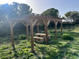
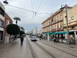
A wooden structure with two benches comes into view and I take a short break. I keep coming across mountain bikers and joggers. Then I reach San Fernando. While the BuenCamino App leads the pilgrims past the village along the railway, Wikiloc (the Asociación Gaditana Jacobea) wants me to walk through the middle of the village, which is fine by me. If a town is in the middle of the stage, it's perfect for a lunch break. The outer districts look a little run-down, but the pedestrian area, through which a tram runs, looks very pretty and very lively. I sit down at a street café with pretty tablecloths, which turns out to be a Peruvian restaurant. And so I eat a delicious ceviche.

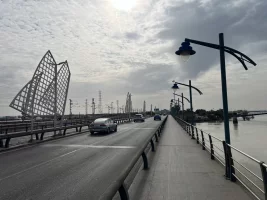
Refreshed, I set off again at 2 pm, first through the town, then across a futuristic pedestrian bridge over the motorway and railway line. And then I'm back on a sandy path with the wetlands on my right. The skyline of Cadiz with the tower and the bridge to the mainland can now be recognised more clearly. I pass a railway station in the middle of nowhere, then suddenly it starts raining again, harder than a few hours ago. The rain is coming diagonally from behind, after a few minutes my back half is soaking wet, while everything in front remains dry. Bizarre. I speed up, because Cadiz seems to be bathed in sunshine. After 20 minutes, the spook is over, but I remain wet on one side.

I reach a bridge within sight of the sea, and now I have to make a decision: you can either walk to Cadiz on the side of the bay to the right of the motorway and railway, or to the left of it on the side of the ocean. Of course I decide in favour of the latter and cross the bridge. I realise that Wikiloc obviously wants to steer me onto the hard shoulder of the motorway (!) and discover a path with wooden beams through the dunes. The direct route to the beach is still blocked. However, I soon reach a car park where motorhomes are parked. From there I walk to the beach, which is deserted.

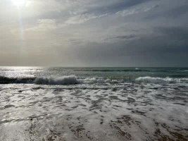
And then, conveniently, the sun comes out. I take off my shoes and socks and lie down on the sand for a break. The waves are quite choppy. After a quarter of an hour, I stand up and now look like an insufficiently breaded schnitzel as the sand sticks to my wet backside. No matter! I walk through the surf and feel great, even though the water is freezing cold.

IMG_5486.webp

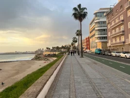
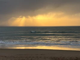
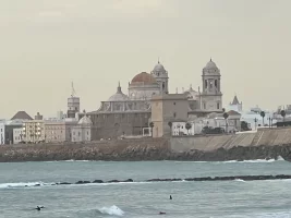
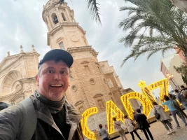
I reach the first houses in Cadiz shortly before 5pm, now there are still 4 km to go along the promenade. The last hour of my Camino, the finale! Numerous locals are strolling along. The sun is already very low. I keep taking photos and treat myself to an ice cream. As the sun sets at 6 p.m., I reach the square in front of the cathedral, where the Via Augusta begins. This is exactly when the large letters of Cadiz are illuminated. I see that the cathedral is still open and hurry inside. There I get my last stamp for this Camino. And then I'm happy and a little sad that it's over.

As night falls quickly, I walk slowly to the railway station. I have just missed the hourly Cercanias, but I can catch a Renfe Media Distancia train (more expensive, but faster). I have to show my ID at the ticket office and am given a seat reservation. In 33 minutes I'm back in Jerez and another quarter of an hour later in my flat.

Pilgrims Count: Zero
Passing Trains: 16
Free-Roaming Animals: None
Best Moment: The hour on the beach!

Preview: I'll post my review of the Via Augusta shortly, for now I just need to let the week sink in.

IMG_5287.webpIMG_5333.webpIMG_5370.webpIMG_5387.webpIMG_5398.webpIMG_5452.webpIMG_5463.webpIMG_5510 2.webp
 
Last edited:
Congratulations on completing the VA. To get your stamp from the church of Santiago you have to time it for one of the opening times as they only open for services. There's something wacky with the wikilocs track you've had as I walked right beside the beach. The track in 2022 didn't go through San Fernando but as I needed something to eat deviated through. My only complaint with the marking was in the towns. I've never walked a route backwards but have often mused it must be far harder. The one thing I do know is never trust weather app !
 
The 2024 Camino guides will be coming out little by little. Here is a collection of the ones that are out so far.
My summary of the Via Augusta
IMG_5005.webp

It was six days from Seville to Cadiz (Via Augusta in reverse), at the end of November, according to the Wikiloc tracks of the Asociación Gaditana Jacobea officially 172.4 km, according to Gronze officially 175.4 km. Although I took the metro to the southern outskirts at the beginning and thus saved about 10 km, I actually walked 174.5 km.

Did I like it?

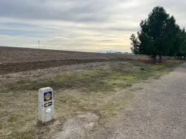
Yes, absolutely, I was lucky with the weather, my idea of commuting to Seville or Cadiz for half the stages worked brilliantly, there were plenty of trains. I met exactly two pilgrims (and saw a third from the train window). I had problems finding the right way in places, which is of course nothing new when you walk in reverse. What was new for me, however, was that the Asociación's Wikiloc tracks were apparently either out of date or imprecise in a number of places. I had also used the Asociación's tracks on the Via Serrana two years ago and had (almost) no problems there, but there I also walked the right way round. I don't think pilgrims starting in Cadiz will have any problems though, I came across quite a few arrows and signposts.

Would I walk the Via Augusta again?

(dramatic pause)... No, I wouldn't, not even the right way round. It was just too monotonous for that. If I compare the Via Augusta with the three other Andalusian Caminos (Via Serrana, Camino Estrecho, Camino de Fray Leopoldo), all of which I also walked in November and December, it offers no wow moments and significantly less variety. I would walk the Via Serrana again at any time. There is also no pilgrim infrastructure with hostels on the Via Augusta (but this is practically the case with all Andalusian trails, with the exception of the two major trails, the Via de La Plata and the Camino Mozarabe).

Why was it so monotonous?

Because the Via runs straight ahead for miles, right next to important infrastructure, the very noisy motorway, the busy Seville-Cadiz railway line and the Canal del Bajo Guadalquivir, sometimes for 4 hours a day. I've done the maths:

Day 1: Seville - Utrera (variant via dos Hermanas): 7.4 km next to the railway tracks
Day 2: Utrera - Las Cabezas de San Juan: 2.9 km next to the motorway, 13 km next to the canal
Day 3: Las Cabezas de San Juan - El Cuervo de Sevilla: 4.8 km next to the canal
Day 4: El Cuervo de Sevilla - Jerez de la Frontera: 13.2 km next to the motorway,
Day 5: Jerez de la Frontera - Puerto Real: 7.6 km next to the motorway
Day 6: Puerto Real - Cadiz: 6.4 km next to the motorway, 5.7 km next to the railway line (partly next to both)
IMG_5013.webp

This means a total of 30.1 km along the motorway or dual carriageway, 13.1 km along the railway line and 17.8 km along the canal. That's 61 km in total, a massive 35 per cent of the entire Via Augusta! I understand, of course, that pilgrims used to take the direct route between the towns and that this is where the infrastructure runs today, but for me personally this is just too excessive. The Camino de Fray Leopoldo also runs alongside the motorway on 4 of its 10 stages, but never for more than 2 hours and there is much more nature to enjoy on each stage.

The via as a preliminary programme

However, I am not surprised that the Via Augusta is more popular and attracts more pilgrims than the other three Caminos, as it is a natural extension of the Via de la Plata (from coast to coast). And I have to admit, it is certainly an excellent preparation for the long stages without services, which are not uncommon on the Via de la Plata. It is also extremely flat and the surface is very walker-friendly, with less tarmac than many other caminos. And last but not least, I have encountered practically no ill-tempered free-roaming dogs or hoofed animals.
IMG_4931.webp

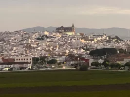
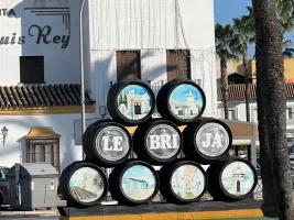
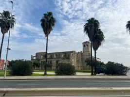
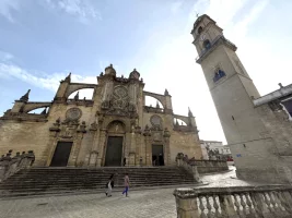
Another big plus: the Via Augusta offers highly interesting cities such as Seville, Jerez (picture above) and Cadiz and some of the stage towns are also quite charming. A pilgrim I met had spent the night in Lebrija and raved about this place in particular, which I unfortunately only passed through.

My personal Andalusian winter Camino ranking (so far):

1st place Via Serrana
: La Linea - Sevilla, 10 days (incredibly multi-faceted, with varied terrain, picturesque little towns, a Via Verde with 20 tunnels and a spectacular gorge with vultures), I wrote a detailed report here.

2nd place Camino Estrecho: Algeciras - Puerto Real, 6 days (with the sea, a mountain and flatland, one lone albergue, and a fantastic view of Africa), I wrote a summary here.

3rd place Camino de Fray Leopoldo: Alpandeire - Granada, 10 days (remote and completely unmarked for explorers, with challenging long climbs and descents in the first part and the Caminito del Rey as a special extra). If it weren't for the motorway hugging in the second part of the Camino, this would be my second place! I wrote a summary here.

4th place Via Augusta: Cadiz-Sevilla, 6 days, as described.

I would also like to walk the other Andalusian Caminos in the future, especially the Camino del Sur (Huelva - Zafra) and the Camino Mozarabe (with a decent pilgrim infrastructure), of course also in winter.

Thank you for the attention and helpful tips from the readers of my thread. It was a pleasure!
 
Last edited:

❓How to ask a question

How to post a new question on the Camino Forum.

❓How to ask a question

How to post a new question on the Camino Forum.

Forum Rules

Forum Rules

Camino Updates on YouTube

Camino Conversations

Most downloaded Resources

This site is run by Ivar at

in Santiago de Compostela.
This site participates in the Amazon Affiliate program, designed to provide a means for Ivar to earn fees by linking to Amazon
Official Camino Passport (Credential) | 2024 Camino Guides
Back
Top