• Remove ads on the forum by becoming a donating member. More here.

Search 74,075 Camino Questions

Where do ( did ) you walk ( locally ) in 2022?

Status
Not open for further replies.
Fail to prepare? reduce your risk by buying this book full of practical info.
2nd ed.
3rd Edition. Vital content training & pack guides avoid common mistakes, bed bugs etc
@Icacos You gave me a great laugh this morning! Some of my family call me "a dreary day walker" - they rarely want to join me 😊 It's okay though - these kind of days lend themselves to solitary walking. The snow, mud and rain we've had these past weeks have me thinking "maybe I can do a winter camino".

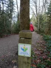
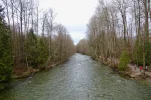
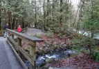
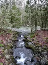
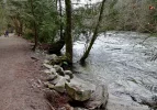
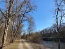
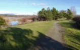
I did have some welcome company for a walk yesterday. My step-mom and brother joined me for a 10 km walk along the Troubalay PoCo Trail beside the Coquitlam River. This trail is also part of the 28,000 km Trans Canada trail system that connects every province and territory, from the Pacific to the Atlantic to the Arctic oceans.

DSC03986.webp DSC03971 (2).webp DSC03975.webp DSC03982.webp DSC03976.webp DSC03992.webp DSC03993.webp
 
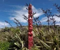
Tuis on a harakeke stalk
walking the Escarpment Track - a vertiginous trail, narrow, exposed, with two swing bridges
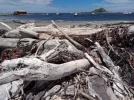
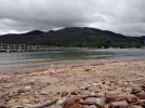
whiling time at Plimmerton Beach...

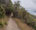
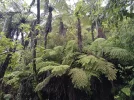
Te Araroa trail, NZ (2022). Paikakariki to Porirua (9 hours)
View attachment 116655View attachment 116656View attachment 116657

View attachment 116658View attachment 116659View attachment 116660

View attachment 116661View attachment 116662View attachment 116663
Hi Lovingkindness
some amazing photos here
Reminds me of the South West Coast trail in Cornwall
 
3rd Edition. Vital content training & pack guides avoid common mistakes, bed bugs etc
Hi Lovingkindness
some amazing photos here
Reminds me of the South West Coast trail in Cornwall
...I purchased my very first pair of hiking boots in Penzance, Cornwall! They were half a size too small and bruised my toes and nails. I walked the coastal paths for 9 days, staying in YHA hostals for the very first time. It was a gorgeous experience.
 
Last edited:
Awesome day....

Te Araroa trail: Porirua via Colonial Knob and Mt Kaukau to Ngaio (7-8 hours).

2 Te Araroa trail NZ (2022). view towards Kapiti Is. From a lookout point on the way to Coloni...jpg3 Te Araroa trail NZ (2022). Colonial Knob r.jpg4 Te Araroa trail NZ (2022). view towards the Orongoronga Range r.jpg
On the way to Colonial Knob

6 Te Araroa trail NZ (2022). in the distance, Mt Kaukau television transmitter mast r.jpg7 Te Araroa trail, NZ (2022). Back-country sheep farming near Old Coach Road r.jpg8 Te Araroa trail, NZ (2022). Porirua to Mt Kaukau r.jpg
a distant view of Mount Kaukau television mast; Back-country sheep farming

8a Te Araroa trail NZ (2022). Track up to Mt Kaukau r.jpg9 Te Araroa trail NZ (2022). Track up to Mt Kaukau r.jpg10 Te Araroa trail NZ (2022). Wellington city and Harbour viewed from Mt Kaukau r.jpg
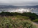
Mount Kaukau; Wellington city

11 Te Araroa trail NZ (2022). across the Cook Strait. the South Island. Viewed from Mt Kaukau r.jpg
The South Island, viewed from Mt. Kaukau, Wellington
 
Last edited:
A selection of Camino Jewellery
Maybe I handed you a cup of water long ago. 🙂
💞
Or flat Coke. 😊
If it was between 1984 and 1991, maybe!
I think of race day volunteers in the same way as hospitaleos. Without these wonderful people, the whole system stops.

Waikanae to Paikakariki, 22 kms
Lovely to see Kapiti Island, a fantastic place. I would love to go back and see the birds now that it's free of rats - I went in 1992, just as that effort was getting underway.
The next day is so dramatic...oh, my! Love it.
And then...
Awesome day....
Wow. I'll say.
It’s a bird, it’s a plane, no it’s a Goodyear blimp.

😂
 
Annual take No. 1 grandson to town on the ferry day.

Looking back towards Northcote Point
IMG_20220117_125718.webp

Under the bridge
IMG_20220117_125900.webp

The city in the background and then much closer
IMG_20220117_125906.webp IMG_20220117_130017.webp

A ferry navigates in the narrow berth
IMG_20220117_131303.webp

Checking out the yachts in the Viaduct Harbour
IMG_20220117_132123.webp IMG_20220117_132355.webp

An old beauty
IMG_20220117_132652.webp

A modern super yacht
IMG_20220117_133105.webp

and finally, No. 1 has his swim
IMG_20220117_133435.webp
 
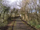
Today. About 20km along our local cycle path to Llanelli in west Wales. Asphalt surface using the route of one of the earliest railways in the UK. A small section slowly being rebuilt by a train enthusiast group. I have walked it many times but today was the first time I've seen a giraffe. The walk was partly to try out a new pair of boots. But also a confidence check for myself after gallbladder surgery in late November. Both boots and abdomen seem fine so I'm ready to return to Spain next week for a second Via de la Plata journey.
IMG_20220118_110557.webp
IMG_20220118_113424.webp
IMG_20220118_114949.webp
IMG_20220118_131006.webp
 
A selection of Camino Jewellery
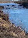
A river walk this afternoon. Rainy on and off and foggy but beautiful in a west coast wintery way. Pretty soaked and chilled by the time I got home 2 hours later but now sitting by the fire with a cup of tea listening to the fog horns from the boats passing by.

DSC04181.webp DSC04176.webp DSC04189.webp DSC04202 (1).webp DSC04205 (1).webp DSC04188 (2).webp
 
My daily walk in the park...

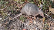
The first animal I've seen in over two weeks since we arrived. It's an armadillo, but I think it should be spelled armourdillo.
IMG_20220118_121510940_HDR.webp

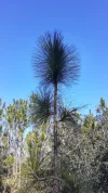
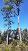
This is a very young Longleaf Pine tree, and yet its needles are full size. The mature trees grow 80-100 feet tall and their needles can reach 12-18 inches long.
IMG_20220118_121958403_HDR.webp
IMG_20220111_105700227_HDR.webp

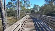
One of the numerous boardwalks in the park.
IMG_20220111_105600363_HDR.webp
 
Train for your next Camino on California's Santa Catalina Island March 16-19
Get a spanish phone number with Airalo. eSim, so no physical SIM card. Easy to use app to add more funds if needed.
A selection of Camino Jewellery
Te Araroa trail NZ (2022): The Southern Walkway

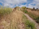
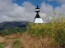
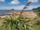
A meander along the city greenbelt through parks and hilltop suburbs to trail's end (Nth Island, southbound): Oriental Bay to Island Bay, Wellington...

Te Araroa trail NZ (2022). fortification, Oriental Bay, Wellington.jpgTe Araroa trail NZ (2022). Oriental Bay resident, Wellington.jpgTe Araroa trail NZ (2022). Oriental Parade villas, Wellington.jpg

Te Araroa trail NZ (2022). View from Mt Victoria lookout, Wellington.jpgTe Araroa trail NZ (2022). view from Mt Victoria lookout, Wellington r.jpgTe Araroa trail NZ (2022). Up to Mt Albert. Wellington r.jpg

Te Araroa trail NZ (2022). Mt Albert trig, Wellington r.jpgTe Araroa trail NZ (2022). End of the trail. Island Bay, Wellington r.jpgTe Araroa trail NZ (2022). Island Bay. Trail end. Wellington r.jpg

Te Araroa trail NZ (2022).Te Ara o Nga Tupuna. The path of our ancesters r.jpg
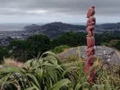
Te Araroa trail NZ (2022): Te Ara o Nga Tupuna: The path of our ancesters, Carved post marking a heritage trail which coincides in places with the Te Araroa trail.
 
Last edited:
So, Peg IS real!
Oh yes. You should hear her complain about walking in the cold. I remarked to her recently "But you used to ski at 20 below (-29⁰ C)".

She mentions to people once in awhile how she hated those mornings when she listened to the radio and heard that where she was headed to work had the coldest recorded temperature in the continuous states (aka the lower 48). Happens about a dozen times a winter.
 
The 2024 Camino guides will be coming out little by little. Here is a collection of the ones that are out so far.
No pictures from yesterday' s walk but these links give you an idea.


Ideal pocket guides for during & after your Camino. Each weighs only 1.4 oz (40g)!
On Saturday at the Nooitgedacht Dam Nature Reserve observing Birds Buffalos and flowers and weekdays in the wetlands and high vleis (marshes) around my village Dullstroom South Africa ....CCD2B984-3CD1-4AB0-8D34-948FA608B277.webp
 

Attachments

  • CAD71795-7E03-4E23-A1D7-B9BED2683A40.webp
    CAD71795-7E03-4E23-A1D7-B9BED2683A40.webp
    345.2 KB · Views: 9
  • FA8C2185-051F-45D1-A20A-8983A0069DEF.webp
    FA8C2185-051F-45D1-A20A-8983A0069DEF.webp
    409.3 KB · Views: 13
...and ship it to Santiago for storage. You pick it up once in Santiago. Service offered by Casa Ivar (we use DHL for transportation).
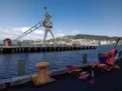
...a day roaming the Wellington waterfront and purchasing supplies for the next stage of the journey. I now have a beautiful -8 degrees sleeping bag and new trail runners with a sturdier sole. Apparently, many Te Araroa trampers wear trail runners in the North Island and a tougher shoe or boot for the South. So, I've bowed to TA tradition, too. What I love about trail runners is the flexible soles, being able to feel the shape of root and rock under foot and adjust accordingly. I have more confidence in trail runners when scrambling and climbing than I ever had in boots... Soon I will set sail for the South Island then set off along the Queen Charlotte Walkway.

Te Araroa trail NZ (2022) Miromiro Sings of White Rata. Oil on board by Clare Reilly..jpg Te Araroa trail Nz (2022) Civic Square, Wellington..jpgTe Araroa trail NZ (2022) Wellington waterfront.jpgTe Araroa trail NZ (2022) Wellington waterfront r.jpg
(1) "Miromiro Sings of White Rata". Oil on board by Clare Reilly.
(2) Civic Square, Wellington

Memoria plague. Frank Kitts park. Waterfront Wellington.jpg Te Araroa trail NZ (2022) Wellington waterfront plague.jpg
(5+6) Memorial plaques, Frank Kitts Park, Welington... As a girl I remember my mother telling me about the arrival of 700 Polish orphans in New Zealand. The children were first settled in a camp in Pahiatua, not very far from where Mother attended school. New Zealand was abuzz with interest in the children. As the train travelled from Wellington, local children and adults lined the tracks to wish the orphans well. My interest in Poland began with my mother's stories. Decades later I walked across Poland, often speaking about the orphans with the folk who showed me hospitality.... 1966 film, Story of 700 Polish Children. NZ Archives

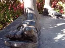
Te Araroa trail NZ (2022). Wellington waterfront historic crane r..jpg272162083_10158820946638925_1738665346810556322_n.jpgWellington railway station. feet of Mahatma Ghandi.jpgMahatma Ghandi. Wellington Railway Station.jpg
(9) the feet of Mahatma Ghandi
 
Last edited:
Isn't nature wonderful!
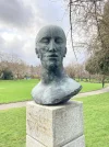
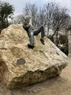
A sculpted head with a lot of meaning invested in it.
A chair in memory of an actor, Dermot Morgan (famous for his part in a tv soap, Father Ted). It does invite to sit in it and survey the Square (Merrion Square, also home to the impossibly reclining Oscar Wilde...)
A view of an emigrant ship from the other side of the river, and nearby, the interior of the CHQ building, housing the Emigrant museum.
On looking again at the photo I noticed a full complement of furniture - almost all Covid restrictions were lifted from 06.00 today.
BC606150-9139-4099-8111-497FA6AC85D2.webpE9011F42-E2EB-4BEA-80B3-CC856FEBA999.webp668F84A6-C894-46D2-9603-B840F884C1D5.webpBA4E5647-971E-4D71-A8C1-01D9FD7D5F1F.webpB12D3469-9DEA-48C8-BB12-992CC2F0BEF9.webp0A57FB4B-E5E2-4EE0-A662-E8720D91FCF2.webp
 
Train for your next Camino on California's Santa Catalina Island March 16-19
The sun is back!
 

Attachments

  • CB26DF5F-5328-4FF0-ADDC-B6888A29D4E7.webp
    CB26DF5F-5328-4FF0-ADDC-B6888A29D4E7.webp
    473.3 KB · Views: 10
  • E3D367CC-F4F7-45B5-B3E0-8C6C1251B498.webp
    E3D367CC-F4F7-45B5-B3E0-8C6C1251B498.webp
    943.2 KB · Views: 7
  • AA9C87A0-BE05-408E-899C-770465D2B018.webp
    AA9C87A0-BE05-408E-899C-770465D2B018.webp
    289.9 KB · Views: 7
  • BDCAF729-9FB6-4A28-A74A-F9054CB12382.webp
    BDCAF729-9FB6-4A28-A74A-F9054CB12382.webp
    158.5 KB · Views: 8
Train for your next Camino on California's Santa Catalina Island March 16-19
1643044027149.webp

Since we are in the middle of winter and since I don't like to walk in the snow, when the weather is bad I do my time at the gym on a treadmill and a minimum of 20x up/down these stairs as quickly as possible (almost-but-not-quite running). I would post photos of the treadmill and the sidewalk in our neighborhood, but thought they would be even less interesting.
 
Fail to prepare? reduce your risk by buying this book full of practical info.
2nd ed.
This morning’s stroll. Marina Del Rey, SoCal. 8.6 mile drive from my home. I used to walk to MDR in the before times. Ever so nice.

BTW: Best time to visit Southern California is January. You can tan on beach. Next day drive hour and a half to mountains for snowboarding and skiing. Amusement parks not too full. And more.

If you zoom out last pic you can see snow capped mountains.

E75DDEBB-9E30-4D02-8C86-EA827D4A0FBF.jpeg81009A0F-2830-4022-BB79-BD2D1F092470.jpeg16395540-FBF3-479F-9919-154F8FF51E35.jpegDE9CCBCE-5A28-4D0B-A869-7E0B8B6CDEBA.jpeg0DA38829-6BF9-44CA-9206-33499D47FA33.jpeg1B879F98-8E69-4863-86E2-38FD6574DB86.jpegD8FD5887-0BF8-4A94-8F32-FEDE1B10B037.jpegA76FE1B6-501A-4CA4-8D46-F7CF3E3DF7B6.jpeg1A0F67C4-680B-421A-BA69-A39E7BEB3CAE.jpeg
 
A walk into the village today for two specific reasons. I was told by a friend that a favourite coffee shop had recently started to serve Basque Burnt Cheesecake. Thought I should investigate - it was pretty scrumptious! Also along the way, I wanted to see a new neighbour that arrived yesterday - The historic Blue Cabin which will be moored along the river, supporting an artist-in-residence program. The cabin moves to a new location every 2 years. Steveston is its second site.

The Blue Cabin was built in 1927 by a Scandinavian craftsman and sat between the low and high tide lines along the shore in North Vancouver. It has resisted ownership for nearly 100 years. It was home to maritime labourers and families – and since the late ‘60s was a place of creative respite and subsistence for Vancouver artists Al Neil and Carole Itter. Slated for demolition in 2014, the Cabin was saved by a consortium of arts organizations who have transformed it into a unique, floating artist residency that offers artists and the public a unique, shifting view of the region and the ideas and histories that inform it.

DSC04939.jpeg DSC04937.jpeg DSC04941.jpeg DSC04919.jpeg DSC04902.jpeg DSC04880.jpeg DSC04899.jpeg DSC04884 (1).jpeg DSC04887.jpeg
 
3rd Edition. Vital content training & pack guides avoid common mistakes, bed bugs etc
Train for your next Camino on California's Santa Catalina Island March 16-19
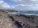
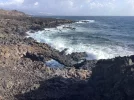
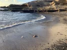
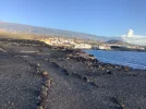
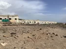
A walk by the coast again today as the mountains were covered with clouds and rain.
From Puerta de Guimar to Candelaria, about 11 km and almost four hours.
beautiful stony man made paths and very undulating in parts

Many plants and animals are found here that are unique to the world.
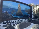
Passing a little house built into the cliff with some salt pans nearby

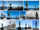
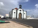
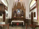
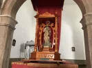
Entering the square the Basilica of the Black Madonna was the first thing we saw.
Also in the square were the very imposing statues of the nine Kings of the aboriginal guanches of Tenerife( photo taken from the internet)
Each King had his name chiselled into the rock beneath and what wonderful names they were.274C7077-7F20-443E-BDCD-A22E833D0D53.webpA6B5AF1F-12BA-49A8-9198-9F966DCD7AD8.webpF41BE9CD-9B4B-479A-867B-10A521B90236.webp702F5D24-3195-4B35-AD84-D51D2AF12071.webpBB33379C-B6C1-46D8-BA40-EBB4E94D604C.webp5A1A332E-01D7-4F8F-BDFB-1EDC9790DC56.webp0F73C37A-60AF-4087-B1C1-15957D36D1C1.webp1D0E536E-C7EC-40CD-ACBB-09630DA249DA.webp6235D05D-8F45-42D5-A99F-902254BBD19A.webp7CB9F95B-6436-439A-B8C9-23995279E1C3.webp
 
€2,-/day will present your project to thousands of visitors each day. All interested in the Camino de Santiago.
Nightwalk
Night life in a Burmese monastery:
Nightfall these days has been lovely - I suspect the ash from Tonga.
20220125_181955.webp
Sunce I have no change of scene, I get fascinated by light and shadow.
20220127_191724-01.webp
As it gets dark I can see out to the lane next to the meditation hall where people are doing their walking meditation ever so mindfully.
20220127_191904.webp
(The inside corridor shot is edited, the other two are as is.)
 
Get a spanish phone number with Airalo. eSim, so no physical SIM card. Easy to use app to add more funds if needed.
Night life in a Burmese monastery:
Nightfall these days has been lovely - I suspect the ash from Tonga.
View attachment 117351
Sunce I have no change of scene, I get fascinated by light and shadow.
View attachment 117352
As it gets dark I can see out to the lane next to the meditation hall where people are doing their walking meditation ever so mindfully.
View attachment 117353
(The inside corridor shot is edited, the other two are as is.)
And are there night sounds too? Insects and frogs? Or are you so accustomed to those sounds that you don’t notice them anymore?
 
And are there night sounds too? Insects and frogs? Or are you so accustomed to those sounds that you don’t notice them anymore?
Frogs in the rainy season, not now.
Crickets.
The occasional Barn Owl or Scops Owl.
Oh, and catfights. 😂
Sounds from outside: Cars on a nearby road.
The sometimes loudspeakers blasting music (not so much, these days).

Edit. Reminded this morning - in the Mango and Vi Apple seasons, fruit hitting tin roofs.
An interesting experience when you are quietly minding your own business, and there have been similar sounds from other (much more malignant) sources. 😮
 
Last edited:
13k, coming and going, with a local train part way. Photos taken along the bay, at speed, from the train. One, just hilarious. As they say here, in Ireland: Where would you get it? That is actually a little laugh at yourself phrase...
Anyway, at the counter for buying one or two items in a supermarket, this is what I could not resist taking:

6446B450-C9DD-4A25-9CE3-97FE4385E91E.webp

BE145C45-53AC-4AB5-98DF-96F1A80255C2.webpB626FF8A-E39E-42DC-BFE5-3BC6C99387E5.webp
The last photo shows what was a popular swimming spot in olden days. As people got into the way of foreign travel for holidays, local spots fell out of favour. Only one along the bay has been restored to date, and is now in private hands. Pity.
 
Holoholo automatically captures your footpaths, places, photos, and journals.
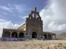
Another walk along the coast and past the former leper colony near Abades
Its a ghost town with no name and a leper colony conceived towards the end of the Spanish civil war.
When the disease was rampant, no one lived in this area and so built conveniently out of the way
Then it was no longer needed as scientists had discovered Dapsone, a drug that revolutionised the treatment of this disease
the many buildings are still standing there and we counted about 30 of them dotted about the area.
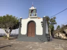
passed and visited some churches
A lovely fishing village where we had coffeeDFE66DEF-3D76-41D9-A691-EB94EA9DE53D.webpE428380E-F4CA-4368-AFE5-31FF82A41C25.webp1AEE34D8-D289-4E61-8B17-323D312F7ABE.webpF9E29E22-318D-423F-BD61-86EC96445A03.webp26125B36-5925-47F5-AF38-9E32C777B356.webp455AA612-6826-4ED6-9111-1C3B4FD7D8A7.webp0EDF6778-8D5A-4CD6-A908-13BA0D0C2D91.webp36466E3E-4C57-4956-B80A-98CDEE81211E.webp834468F8-D7AA-4870-9C5F-A77A5E6F554D.webp
 
Holoholo automatically captures your footpaths, places, photos, and journals.
Today's bike ride/ walk was along the free running river (the Iller river, a short 140km river coming from the Alps and joining the Danube in Ulm), on an open dirt road under the blue, blue sky! Not really Camino related in any way except for the hiking boots I'm hoping to wear on Via Gebennensis. Have a great new week, everyone!

IMG_2692.jpgIMG_2690.jpgIMG_2686.jpg
 
Join the Camino cleanup. Logroño to Burgos May 2025 & Astorga to OCebreiro in June
A 12 km walk from Chio to El Jaral
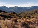
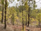
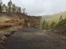
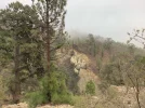
Tenerife really is a walkers paradise 23E92D97-825E-40AC-BD0D-DAB11F9ABF4D.webpA0D756D7-C6BE-4367-BAE9-76CD677FAF04.webpF284CCB0-FABB-4088-97DB-457DC8C85499.webpE137A1FD-3457-42D8-A550-AB6F14A54CAE.webp47597894-C329-4084-A7F5-9AF0C949678C.webp33E27CC5-CC12-4117-B050-D5DCF27D80BC.webpEF0FAA3A-E9D2-44F3-AABA-F3EC773AB7B8.webp077C73CB-D90E-4F87-9B9D-30B703EFCBC4.webp

Because of the terrain, it took us over 5 hours

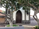
Passed two village churches but both closed
Too early for the cafe/bar!
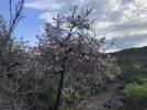
The apple blossom was in bloom all over the hillside
Rough stony paths carved into the mountain side and the Barrancos
Met no one all day
 
Te Araroa Trail (Southbound): Queen Charlotte Track, Ship's Cove to Anakiwa...

Hi All
...and so the journey continues. After gathering supplies in Wellington and visiting old friends I set sail from Wellington across the Cook Strait to Picton. The next stage of the Te Araroa Trail began in Ships Cove.

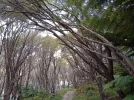
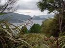
Day 1...a sunny day in the Marlborough Sounds walking along the Queen Charlotte Walkway.10 hours from Ship,s Cove to Punga Cove. As the sun rose cicadas beat out a rhythm so intense one could hardly think. White noise diminishing frantic thought. I had my backpack and food transported by water taxi intending to camp out at a DOC site..but...as soon as I arrived at Punga Cove and saw the cabins I just had to have a shower and sleep in a bed.

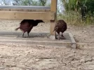
Day 2...Punga Cove to Portage: a long easy walk on a wide dusty track. Sun hitting aromatic plants, sweet spicy air. Shameless Wekas appearing from clumps of grass, from behind rocks, near every picnic table and scenic spot...

Day 3...Portage to Anakiwa (5 1/2 hours): uphill in the rain, soggy clothes , muddy feet, followed by three hours in steam as sun burnt off mist and surface water. Significant place: Anakiwa, where my great great grandfather's brother set up home in the 1860s on 200 acres of bush.

1 TA Trail NZ. Queen Charlotte Track. South Island. .jpg2 TA Trail NZ. Queen Charlotte Track. South Island. Punga.jpg3 TA Trail NZ. Queen Charlotte Track. South Island. Wekas scrapping.jpg
4 TA Trail NZ. Queen Charlotte Track. South Island. Manuka Lane.jpg5 TA Trail NZ. Queen Charlotte Track. .jpg6 TA TRail NZ. queen Charlotte Track. Day 2 Punga Cove to Portage.jpg
7 TA Trail NZ. Queen Charlotte Track..jpg8 TA Track NZ. Queen Charlotte Track. .jpg9 TA Trail NZ. Queen Charlotte Track. Pungas.jpg
10 TA Trail NZ.  end of Queen Chqrlotte Track.  Anakiwa jetty.jpg
Anakiwa jetty. Opposite the Outward Bound School.
https://www.outwardbound.co.nz/
 
Last edited:
From the parador to El portillo
17 km at fast speed in case we missed the bus
we always seem to be running for the bus!

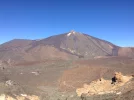
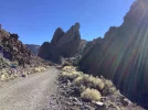
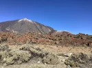
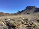
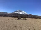
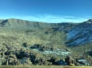
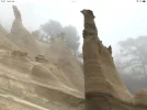
Some amazing rock formation and we walked under the watchful eye of Teide all the way

We did saunter up there a few years ago via Montana Blanca and stayed in the Altavista refuge and at almost 3718 mt (12198ft) we didn’t sleep a wink due to the altitude
The next morning, up we went to the crater which didn’t smell so good!, but we saw the sun rise, an amazing sight.
we were the only two people there that morning
needless to say, we got the cable car down.

now just happy to let the youngsters have a go!
Teide with snow and Teide from a photograph last year
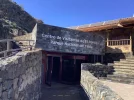
The little church at the Parador

the latest “Planet of the apes“ 4A65FBA5-3062-4159-811C-607ECE1BC7AE.webp1CA13977-F9EA-4315-98C8-C2693A6A0F14.webp59A36CB0-2A66-4612-9587-2A764FFBE56C.webp830DF413-11D1-482B-927A-A6EA296F7AA3.webp3CF7AE84-09A1-49A1-AC87-320489D8C5CA.webp7836CC25-58CB-4F30-9A01-16FE17882563.webpFD7E53B0-C8AE-499D-9039-4B080CABD291.webp95B76334-3744-4569-812D-474DE8ACFA32.webp3DE4E2A6-BB8B-4E43-8054-4CF32FE766EA.webpF5503239-8361-41A1-ADF4-67E69F54313B.webpwas filmed in the National park of Teide
 
Get a spanish phone number with Airalo. eSim, so no physical SIM card. Easy to use app to add more funds if needed.
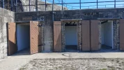
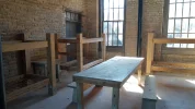
We toured an interesting Civil War fort on the Gulf a few days ago; the closest I've been to emulating Europe's old brick and stone buildings in a very long time.
IMG_20220127_112259976_HDR.webp
IMG_20220127_113828212.webpIMG_20220127_114312593.webp
IMG_20220127_115342279.webp

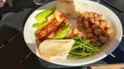
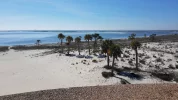
Afterward we had lunch at a cafe with outdoor seating and a great view. I had grilled fish and fried okra, which I never have opprtunity to get "up north". We finished with a hike along the beach.
IMG_20220127_131502586_HDR.webp
IMG_20220127_125055793.webp
 
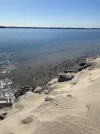
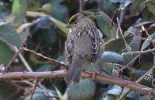
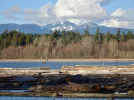
It was a good day at Iona - where the Fraser River meets the ocean at the Strait of Georgia. Clear and cold, first walking through the interior paths, then along the river and back along the beach side of the strait. On the way, a Golden-crowned Sparrow and a solitary Sanderling foraging along the beach.

DSC05102.jpeg DSC05114.jpeg DSC05105 (1).jpeg DSC05113.jpeg DSC05134.jpeg DSC05139.jpeg DSC05185.jpeg
 
Join the Camino cleanup. Logroño to Burgos May 2025 & Astorga to OCebreiro in June
Te Araroa Trail NZ (Southbound): Notes from a tired scrambler...

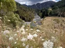
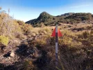
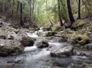
From Anakiwa I followed the Linkpath (slips in places) to Havelock, hitched a ride to Pelorous Bridge then walked 14 kms in the heat along asphalt and gravel to the Pelorous Track. Before I could reach the trailhead dark clouds rolled in. Worried about camping in rain, I approached a farmer herding calves and cows. I was offered shelter in a vacated cottage. Bliss. For the next three days I tramped the Pelorous Track to Captain Creek Hut then Rocks Hut before detouring over Dun Mountain Saddle and the Coppermine trail to Nelson.

The weather forecast for the Richmond Ranges and Tasman this coming week is for rain, rain and more rain. I will find other things to do as I wait out the big Wet. It is too dangerous at alpine level slithering up and down rocks. Streams can expand into rivers and visibility will be poor.

1 TA Trail NZ. Linkpath.  Native flower. .jpg2 TA Trail. Linkpath. Direction Havelock.jpg3 TA Trail NZ. Tinline River. Near Pelorous Track trailhead..jpg
4 TA trail NZ. Pelorous River.jpg4a TA Trail. Pelorous Track. Captain Creek Hut.jpg5 TA Trail NZ. Swing bridge over the Pelorous River.jpg
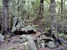
6 TA Trail NZ. Majestic tree, fallen..jpg7 TA Trail NZ. Staircase of roots. Pelorous track.jpg7a Rocks Hut to Nelson.jpg
9 TA Trail NZ. View from Dun Mountain Saddle.jpg

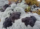
Native flowers

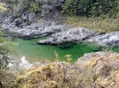
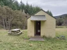
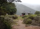
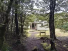
Captain Creek Hut, 4 campers and 4 trampers in bunks. Beautiful emerald pools for swimming, sandflies a fiery scourge. In the gloaming awakening trust, rehydrated dinners churning in sleep.

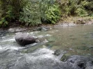
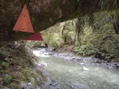
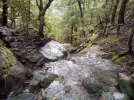
Many river crossings on narrow swing bridges. Counting every step. Squashing panic -one of the bridges had rusted, broken bars, the approach to another involved side-stepping on footholds across a stony expanse.

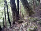
Majestic tree, fallen
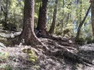
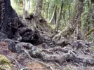
Uphill scrambling. Roots like rickety stairs.
 
Last edited:
Te Araroa Trail NZ (Southbound): Notes from a tired scrambler...

From Anakiwa I followed the Linkpath to Havelock, hitched a ride to Pelorous Bridge then walked 14 kms in the heat along asphalt and gravel to the Pelorous Track. Before I could reach the trailhead dark clouds rolled in. Worried about camping in rain, I approached a farmer herding calves and cows. I was offered shelter in a vacated cottage. Bliss. For the next three days I tramped the Pelorous Track to Captain Creek Hut then Rocks Hut before detouring over Dun Mountain Saddle and the Coppermine trail to Nelson.

The weather forecast for the Richmond Ranges and Tasman this coming week is for rain, rain and more rain. I will find other things to do as I wait out the big Wet. It is too dangerous at alpine level slithering up and down rocks. Streams can expand into rivers and visibility will be poor.

View attachment 117713View attachment 117714View attachment 117715
View attachment 117716View attachment 117717View attachment 117718
View attachment 117719View attachment 117720View attachment 117721
View attachment 117722

Native flowers

Captain Creek Hut, 4 campers and 4 trampers in bunks. Beautiful emerald pools for swimming, sandflies a fiery scourge. In the gloaming awakening trust, rehydrated dinners churning in sleep.

Many river crossings on narrow swing bridges. Counting every step. Squashing panic -one of the bridges had rusted, broken bars, the approach to another involved side-stepping on footholds across a stony expanse.

Majestic tree, fallen
Uphill scrambling. Roots like rickety stairs.
Pleased to see that you are waiting out the storm. It looks like a biggie. Up to 600mm of rain expected in the next 24 hours (2 feet for non metricians) in the Nelson ranges.
 
Last edited:
Te Araroa Trail NZ (Southbound): Notes from a tired scrambler...

From Anakiwa I followed the Linkpath to Havelock, hitched a ride to Pelorous Bridge then walked 14 kms in the heat along asphalt and gravel to the Pelorous Track. Before I could reach the trailhead dark clouds rolled in. Worried about camping in rain, I approached a farmer herding calves and cows. I was offered shelter in a vacated cottage. Bliss. For the next three days I tramped the Pelorous Track to Captain Creek Hut then Rocks Hut before detouring over Dun Mountain Saddle and the Coppermine trail to Nelson.

The weather forecast for the Richmond Ranges and Tasman this coming week is for rain, rain and more rain. I will find other things to do as I wait out the big Wet. It is too dangerous at alpine level slithering up and down rocks. Streams can expand into rivers and visibility will be poor.

View attachment 117713View attachment 117714View attachment 117715
View attachment 117716View attachment 117717View attachment 117718
View attachment 117719View attachment 117720View attachment 117721
View attachment 117722

Native flowers

Captain Creek Hut, 4 campers and 4 trampers in bunks. Beautiful emerald pools for swimming, sandflies a fiery scourge. In the gloaming awakening trust, rehydrated dinners churning in sleep.

Many river crossings on narrow swing bridges. Counting every step. Squashing panic -one of the bridges had rusted, broken bars, the approach to another involved side-stepping on footholds across a stony expanse.

Majestic tree, fallen
Uphill scrambling. Roots like rickety stairs.
lovingkindness,
These are beautiful photos thanks for sharing your adventure. Do take care.
Looking forward to reading/seeing more posts when the weather clears.
 
A selection of Camino Jewellery
Sabine…
waffles and cream
oh to be able to eat them!!

Last week the weather forecast wasn’t too bad and himself wanted to acclimatise a bit before going up to Teide
this walk was about halfway and a circular walk from Vilaflor

up and up and more up, passing deserted terraces and beautiful woods.
No sooner up and the rain started so we weren’t able to view the Paisaje properly
The last 3 photos are from the internet

The Paisaje are volcanic in origin and the result of erosion.

as we hotfooted it down, the heavens opened even more and the hailstones did not spare us

the 12 km walk took us nearly 6 hours and we got soaked to the skin for our troubles!
Just made the only bus going down27182CF7-EC83-43BC-8E25-21D7868A89ED.webp5589AD97-14F0-4151-8EC2-3530CF0A5F39.webpED80FE18-2A4F-4D62-9207-233220AED753.webp8943E9C7-68CD-4044-98F5-3A8589014F5D.webpA1828140-782B-47FB-8B36-D28682717973.webp682426FE-3C1A-4FBB-8ED7-E1175BD0D03E.webpCA0DB08F-7ADF-4F32-9724-7906A3E18D2F.webpD289AF48-37F1-4338-B454-E0D5D59F13AC.webp761981EA-D28C-44CF-ACE6-10389C01970E.webp52EEF720-894E-40FE-8455-ACE4640D2648.webp
 
Holoholo automatically captures your footpaths, places, photos, and journals.
The walk of the Apple Blossoms from the Santiago del Teide church 7067E475-50D8-452D-A847-6CE174B81D6F.webp0E24C65E-5EFC-4BEA-B33F-13CEA9EB8A9C.webpBD7CDAB7-29B5-4023-9DD4-0DE19179E460.webpFC49B424-4016-4690-B0F8-C681540B3D08.webpAAEC87B6-6637-4E66-8AE9-E3DDB2B11733.webpF94013C9-7FF0-42D7-96BB-6F14B73A8500.webp6EF6D38A-BDA2-4EAF-8E95-0625FD97C9FC.webp5B19082D-819B-4791-8DF5-82EB214E414C.webp8385B18B-2039-4E61-8A6F-1AD321360690.webp9C29B9BD-FA4C-4F08-AA4D-C28F483F7D7A.webp

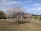
the whole are was covered in the beautiful apple blossom trees and looked even more amazing against the black lava flows

The trees were growing out of small patches of clay between the same lava flows

Many people were visiting the area just to see the trees in full bloom


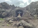
Passed the altar of Calverio and spotted a little grotto built into the rocks
Many of the paths were quite stony with loose lava
12 km took us about five hours
 
Perfect memento/gift in a presentation box. Engraving available, 25 character max.
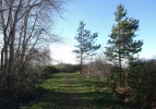
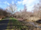
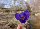
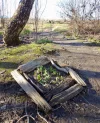
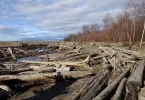
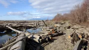
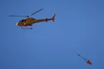
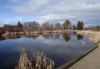
A good long walk near home today. Signs of spring - there must be crocus' growing somewhere - there was a bloom left on the rail of a fence. I haven't been out along the tidal flats in some time - the strong winter storms and king tides have changed the course of the usual path. A good person(s) has been through with a chain saw, opening up the original path and creating new diversions, putting planks down along the more muddy areas and even creating a little barrier with drift wood around a patch of daffodil shoots. Watched a Talon fire fighting helicopter and water bucket heading out into the Georgia Straight for what must have been a training exercise - no wildfires this time of year that I've heard about.

DSC05215.webp DSC05233.webp DSC05240.webp DSC05244.webp DSC05247.webp DSC05255.webp DSC05268.webp DSC05274.webp DSC05278.webp
 
A good long walk near home today. Signs of spring - there must be crocus' growing somewhere - there was a bloom left on the rail of a fence. I haven't been out along the tidal flats in some time - the strong winter storms and king tides have changed the course of the usual path. A good person(s) has been through with a chain saw, opening up the original path and creating new diversions, putting planks down along the more muddy areas and even creating a little barrier with drift wood around a patch of daffodil shoots. Watched a Talon fire fighting helicopter and water bucket heading out into the Georgia Straight for what must have been a training exercise - no wildfires this time of year that I've heard about.

View attachment 118080 View attachment 118088 View attachment 118082 View attachment 118083 View attachment 118084 View attachment 118085 View attachment 118086 View attachment 118087 View attachment 118081
Theatregal,
Your's are such upbeat thoughts/photos; thanks for sharing these delightful signs of spring along the Georgia Strait. Carpe diem.
 
The 2024 Camino guides will be coming out little by little. Here is a collection of the ones that are out so far.
A walk into the village today for two specific reasons. I was told by a friend that a favourite coffee shop had recently started to serve Basque Burnt Cheesecake. Thought I should investigate - it was pretty scrumptious! Also along the way, I wanted to see a new neighbour that arrived yesterday - The historic Blue Cabin which will be moored along the river, supporting an artist-in-residence program. The cabin moves to a new location every 2 years. Steveston is its second site.

The Blue Cabin was built in 1927 by a Scandinavian craftsman and sat between the low and high tide lines along the shore in North Vancouver. It has resisted ownership for nearly 100 years. It was home to maritime labourers and families – and since the late ‘60s was a place of creative respite and subsistence for Vancouver artists Al Neil and Carole Itter. Slated for demolition in 2014, the Cabin was saved by a consortium of arts organizations who have transformed it into a unique, floating artist residency that offers artists and the public a unique, shifting view of the region and the ideas and histories that inform it.

View attachment 117258 View attachment 117257 View attachment 117259 View attachment 117256 View attachment 117255 View attachment 117261 View attachment 117254 View attachment 117252 View attachment 117253
I make burnt Basque Cheesecake for special holidays!
20191216_094034.webp
 
Holoholo automatically captures your footpaths, places, photos, and journals.
3rd Edition. Vital content training & pack guides avoid common mistakes, bed bugs etc
The one from Galicia (the round) and the one from Castilla & Leon. Individually numbered and made by the same people that make the ones you see on your walk.
The 2024 Camino guides will be coming out little by little. Here is a collection of the ones that are out so far.
Hi all! What a wet summer this is turning out to be.

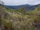
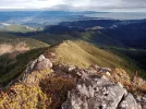
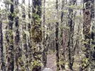
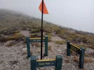
…With a 3-day window of good weather this past week, I decided to go back up into the Richmond Ranges and pick up the Te Araroa trail not far from where I had left off. Heading up to Hacket Track from a car park at the end of Aniseed valley, I followed an alpine route via Starveall hut to Old Man hut before descending the soggy side of the ranges to Lake Chalice. After overnighting in Lake Chalice hut I walked up and out of the ranges in heavy rain. At a turn off I hitched a ride on a 40-ton logging truck travelling past Renwick and Havelock before winding through the Whangamoa Saddle back to Nelson -a serpentine road as scary as the rock climbing and scrambling experienced after Old Man…

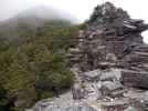
The adventure included multiple stream crossings, negotiating erosion and slips, clambering over many fallen trees, hour after hour of scrambling ascents and descents, some rock climbing, avoiding wasps.

Photos: Te Araroa trail, Richmond Ranges (SOBO): Hacket hut to Starveall hut

*8 stream crossings then a 900m ascent through Beech and podocarp forest via Pyrimid Rock to Starveall hut, 1180m.

1 TA Trail NZ. Hacket hut. Richmond Ranges.jpg2 TA Trail NZ. direction Starveall hut. Richmond Ranges.jpg3 TA Trail NZ. Multiple Stream crossings. Richmond ranges.jpg
4 TA Trail NZ. Multiple stream crossings. Richmond Ranges.jpg5 TA Trail NZ. Direction Starveall hut. Richmond Ranges..jpg6 TA Trail NZ. Direction Starveall hut. Richmond Ranges.jpg
7 TA Trail NZ. Pyramid Rock. Richmond Ranges.jpg8 TA Trail NZ. Direction Starveall hut. Richmond Ranges.jpg10 TA Trail NZ. Starveall Hut 1180 m. Richmond Ranges.jpg
9 TA Trail NZ. Root scrambling. Richmond Ranges.jpg

Mt Starveall - Mount Richmond Forest Park - Nelson Trails

“Starveall Hut is located a few kilometers below Mt Starveall summit. Mt Starveall is named after the experience of a stockman, who in the mid 1800s was searching the Richmond Ranges for a suitable route to drive sheep from Nelson to Wairau Valley. After leading his stock to the summit of Mt Starveall he found that they were unable to consume any of the alpine vegetation, and declared that the mountain would ‘starve all’ of his flock.”
 
Last edited:
...and some more photos:

TA Trail NZ: Starveall hut via Slaty hut to Old Man hut. Richmond ranges

1 TA Trail NZ. View to Nelson from MT Starveall. Richmond Ranges.webp2 TA Trail NZ. Alpine vegetation. Direction Slaty hut. Richmond Ranges.webp3 TA Trail NZ. Alpine Beech forest. Direction Slaty Hut. Richmond Ranges.webp
4 TA Trail NZ. After Slaty hut. Direction Old Man. Richmond Ranges.webp5 TA Trail NZ. Direction Old Man. Richmond Ranges.webp6 TA Trail NZ. Alpine Beech. Direction Old Man. Richmond Ranges.webp
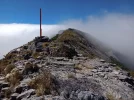
7 TA Trail NZ. Old Man summit. Richmond Ranges.webp8 TA Trail NZ. After Old Man. Richmond Ranges.webp9 TA Trail NZ. After Old Man. Richmond Ranges (2).webp10 TA Trail NZ. Old Man hut. Richmond Ranges.webp

Notes from DOC: Slaty hut to Old Man hut

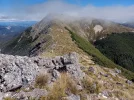
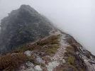
'The Alpine Route sidles around the basin below Slaty Peak before climbing gradually back onto the main ridge, which is followed right through until Old Man Peak. The route is entirely above the bushline, except when it descends into forested saddles before Ada Flat and at the base of Old Man Peak.

There is a sign-posted junction at the summit of Old Man Peak (1514 m), with the left-hand route leading down to Lake Chalice or to the Forks/Top Valley.

...The Alpine Route continues along the main summit ridge. Old Man Hut is located on a natural grassy clearing 200 m below the ridge, and is reached on a sign-posted access track."
 
...and ship it to Santiago for storage. You pick it up once in Santiago. Service offered by Casa Ivar (we use DHL for transportation).
Old Man hut via Goulter River to Lake Chalice hut:

...and then down and around to Lake Chalice on the soggy side of the ranges. Multiple stream crossings, scrambling descents and ascents, clambering over gigantic fallen trees, slips, forceful waters after heavy rain. I would have liked to have taken a shot of the 40-ton logging truck and the fellow driving it but I was so elated at getting a ride out of the ranges that I forgot...

The weather forcast for the next few days is rain. I'm not sure how I will get myself back up to the Te Araroa trail but hope to later next week. Cheers, LK.

1 TA Trail NZ. Leaving Old man hut. Richmond Ranges.jpg2 Old Man circuit. Multiple stream crossings. Richmond Ranges.jpg3 Old Man circuit. Richmond Ranges.jpg

4 Old Man circuit. Multiple stream crossings. Richmond Ranges.jpg5 Old Man circuit. Stream crossings. Richmond Ranges.jpg6 Old Man circuit. Stream crossings. Richmond Ranges.jpg

7 Old Man circuit. Richmond Ranges.jpg8 Old Man circuit. River crossing. Richmond Ranges.jpg9 Old Man circuit. Richmond Ranges.jpg
10 Old Man circuit. Lake Chalice hut. Richmond Ranges.jpg

DOC notes: Old Man Hut circuit.
"From Old Man Hut descend steeply to a stream, following it to the Goulter River. From there, follow the undulating track to the western end of Lake Chalice and on to Lake Chalice Hut. From the hut the benched track climbs to Staircase Road."
 
Ideal sleeping bag liner whether we want to add a thermal plus to our bag, or if we want to use it alone to sleep in shelters or hostels. Thanks to its mummy shape, it adapts perfectly to our body.

€46,-
That hut looks similar to some of the albergues...awww.😀
Yes, basic but oh, so appreciated. Finding kindling and dry wood for the cast iron wood burners can be a challenge. Sometimes though, a thoughtful tramper has left a ready supply for those who follow. What a feeling, the moment one first glimpses 'home', after many adventures, tired, wet and hungry... and if the fire has already been lit and there's hot water for a cup of tea, ahhhh.... but not always.
 
what an amazing adventure you are having LK
looks like a beautiful place
wonderful photos
I am in awe of the ridges, peaks and vegetation, too. I love stream crossings -assessing water flow, depth, the best place to plunge in. Finding myself tramping along razor-back ridges, scree slopes and rocky peaks is like deja vu. In my early years my father flew about the Southern Alps and glaciers photographing. Afterwards he would invite friends over for home movies and a slide show. His photos have imprinted on my soul.
 
Ideal sleeping bag liner whether we want to add a thermal plus to our bag, or if we want to use it alone to sleep in shelters or hostels. Thanks to its mummy shape, it adapts perfectly to our body.

€46,-
Should have been 10km, but got lazy and took a bus part way home, so just 9km.
Looking north across Dublin Bay from Blackrock.
Harbingers of Spring!
A side wall of the pub where Oscar is lounging outside on a fine bench.
Photos are rebelling, let them sit as they choose...
7ADEAF06-5151-4407-83F8-99696BE46C69.webp

E491ED99-4BFA-4A2A-A560-1EEFAD5F6461.webpC48C2759-66CB-45EB-B1E0-4191702EC224.webpB34EB55A-15C3-4BA1-9545-1C263FE9FCF5.webp13445C86-9EC7-4870-8433-ACFBF55C7602.webp
 
Status
Not open for further replies.

❓How to ask a question

How to post a new question on the Camino Forum.

Most read last week in this forum

I was hoping to do a walk over ninety days so I researched a long stay visa. This walk would have gone through four countries but the majority of the time would have been in France. So I applied...
Hi all - I have often wondered about the whole cutting grams, going as light as .. (I do it too!!) .. thinking about the "real" world with soldiers on the march and what they carry .. Roman...
Hi everyone! Probably more of a niche post but i’m starting my camino next week from Porto and i decided that i’ll be wild/stealth camping along my route. Packing my 1 person tent and sleeping...
My wife and I are planning to buy a house in the north-west of Spain for our retirement. Today, while scrolling through the ads, I noticed this: https://www.idealista.com/inmueble/106560131/...
Seems like everyone is longing to go home. I don't! I want to just walk and walk and live the Camino. Anyone recognizes? Greetings to you wonderful people from a heavy rain Santiago. And thanks...
Apologies to those who detest frivolous questions - please move on; nothing to see here. When I walked my first camino from Chartres to SdC (autumn/winter, 1998), no matter where I stayed -...

Featured threads

❓How to ask a question

How to post a new question on the Camino Forum.

Featured threads

Forum Rules

Forum Rules

Camino Updates on YouTube

Camino Conversations

Most downloaded Resources

This site is run by Ivar at

in Santiago de Compostela.
This site participates in the Amazon Affiliate program, designed to provide a means for Ivar to earn fees by linking to Amazon
Official Camino Passport (Credential) | 2024 Camino Guides
Back
Back
Top