irrie
Member
- Time of past OR future Camino
- 2023 Camino Portugues 2024 Via Francigena
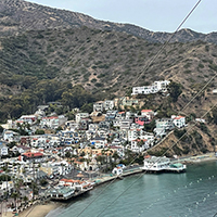
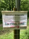
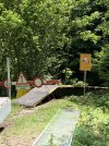
Today we were really looking forward to the walk in the gorge de l’Orbe (stage Jougne to Orbe) on the Via Francigena in Switserland. After the long steep descent from Ballaigues to the river Orbe (over 200 heightmeters) there was a sign at 10 meters from the bridge telling it was closed!!! Why not put that sign at the beginning of the descent in the village? We were very disappointed. It isn’t mentioned in the VF-app. The only thing we could do is to go to Le Day and take there the bus to Orbe.


 So better stay away
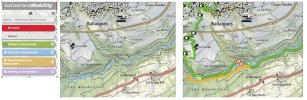
 are marked with closures. That's why the French and Italian maps exist. These are adapted by these countries.
 )
)