kiwiDavid
Member
- Time of past OR future Camino
- Camino Frances 2012 - SJPP-Finisterre
Have wondered how to place GPS tracks onto offline maps and came across a great post - 'Melanie and Michael Go Walking' - their Blog mentions iPhone but it's good for Android too.Link below: https://memismsblogs.com/maps-me/
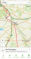
Great features mentioned by M & M are you don't need mobile data or connection and it will show you your position in relation to the VF by satellite. Downloading the Maps.me app and then emailing the VF KMZ files to my phone and opening them with Maps.me was pretty straight forward.Then just downloaded the offline maps around the route as it appeared. I placed both VF and Lightfoot routes alongside each other. NB:You can find VF & Lightfoot KMZ files on this Forum which worked for me but I had to open the files leg by leg (except for the Lightfoot ones - 2 files). PS: Hoping people won't think I'm way overthinking this but I have a lot of time on my hands at the moment and I love planning.
Great features mentioned by M & M are you don't need mobile data or connection and it will show you your position in relation to the VF by satellite. Downloading the Maps.me app and then emailing the VF KMZ files to my phone and opening them with Maps.me was pretty straight forward.Then just downloaded the offline maps around the route as it appeared. I placed both VF and Lightfoot routes alongside each other. NB:You can find VF & Lightfoot KMZ files on this Forum which worked for me but I had to open the files leg by leg (except for the Lightfoot ones - 2 files). PS: Hoping people won't think I'm way overthinking this but I have a lot of time on my hands at the moment and I love planning.


