• Remove ads on the forum by becoming a donating member. More here.

Search 74,075 Camino Questions

Cell phone service and navigation apps

Camo

Active Member
Time of past OR future Camino
2024
Moderator note: This post and several following ones have been moved from another thread on a slightly different topic.

When I use the Gronze Maps app I only use it for navigation
But as you say it does not work without a data connection, so why not use google maps to start with and download the map data before you leave "home".
 
Last edited by a moderator:
Holoholo automatically captures your footpaths, places, photos, and journals.
But as you say it does not work without a data connection, so why not use google maps to start with and download the map data before you leave "home".
Because Google Maps does not show the Camino routes. I have a data connection while I'm on the Camino, so that's not a problem.
 
I have a data connection while I'm on the Camino
That's great news and totally different to my 2015 experience in UK and 2022 in Greece where it was sporadic at best and not just in The Sporades (joke in there😃) - so you are saying good old Spain is not backward at all and has mobile reception over the full length of all Caminos?
 
A selection of Camino Jewellery
That's great news and totally different to my 2015 experience in UK and 2022 in Greece where it was sporadic at best and not just in The Sporades (joke in there😃) - so you are saying good old Spain is not backward at all and has mobile reception over the full length of all Caminos?
I get better cell reception in Spain (and France and Portugal) than I do in my hometown in Oregon!
 
so you are saying good old Spain is not backward at all and has mobile reception over the full length of all Caminos?
This is an odd jokey sort of way to ask if Spain has good mobile reception. Generally, yes, but no, there is not reception over the full length of all Caminos. I have encountered gaps on some of the less populated routes - various canyons have poor reception, and one area of the Lana has coverage from one provider but not others.

I get better cell reception in Spain (and France and Portugal) than I do in my hometown in Oregon!
I do too, in the suburbs of Vancouver, BC. There are some geographic features combined with a large body of unpopulated water, that mean the cell coverage is imperfect.
 
The one from Galicia (the round) and the one from Castilla & Leon. Individually numbered and made by the same people that make the ones you see on your walk.
But as you say it does not work without a data connection, so why not use google maps to start with and download the map data before you leave "home".
That is always an option for those car touring, but not generally, at least not yet, for those walking the camino, or any other pilgrimage route I have walked recently. I find it works best for the final kilometre or two when I am looking for accommodation or a restaurant, but not for walking route finding generally.
 
That is always an option for those car touring, but not generally, at least not yet, for those walking the camino
Yes it is always an option for car touring (or bike) as long as you simply want to go shortest path A to B but for example the Romanesque Track around Porto zig zags to take in all the Romanesque buildings etc so needs to be SET UP to include them before "send to phone".

Same with Caminos where there is a defined "yellow arrow track(s)" which must first be set up BUT the big advantage as you say is that instead of B etc being a town name it will be your reserved hostel name so no jumping around from app to app as it is all in Google Maps.

And you are also correct that Google may not have found and ACTIVATED some sections of the route, particularly side tracks in wooded areas that the AI can't see in the satellite imagery.

To that end I have been working with Google Content Partners for over a year to REPAIR all those bits and the great majority are now fixed, BUT seems Google has (understandably?) pulled the plug (sunset as they say) on that 2 weeks ago.

Google works in strange ways and this is hard to understand for Caminos where there is a cool billion euros spent on food/accom pa

So the answer is to simply set up your trip for the day (best on a laptop) and check against mappy etc it is correct and send to phone
 
This is an odd jokey sort of way to ask if Spain has good mobile reception.
That is an incredibly generous interpretation of a comment that many would take as a slur. Why anyone would make a comment suggesting that Spain or any other country is backward in a conversation about mobile coverage is just a little beyond me.
 
Get a spanish phone number with Airalo. eSim, so no physical SIM card. Easy to use app to add more funds if needed.
That is always an option for those car touring, but not generally, at least not yet, for those walking the camino, or any other pilgrimage route I have walked recently. I find it works best for the final kilometre or two when I am looking for accommodation or a restaurant, but not for walking route finding generally.
Mapy.cz is much better than Google Maps for following hiking and cycling trails, and regions can be downloaded to use offline.
 
Mapy.cz is much better than Google Maps for following hiking and cycling trails, and regions can be downloaded to use offline.
I use the Open Street Maps OSMAnd+ app for preference, but almost any decent mapping application using open source mapping would be preferable to having to rely on Google Maps. Even if one can download regions to have them available off-line, Google seems reluctant to include walking and cycling trail data to provide routing solutions that match the Camino paths. One only has to look at the efforts that @Camo made earlier in the year to realize how dangerous it could be to rely on Google Maps in places along the CF. I don't have the time to repeat the efforts he took at the time, and still get inaccurate and misleading results that don't follow the Camino route.
 
Last edited:
The one from Galicia (the round) and the one from Castilla & Leon. Individually numbered and made by the same people that make the ones you see on your walk.
Yes it is always an option for car touring (or bike) as long as you simply want to go shortest path A to B but for example the Romanesque Track around Porto zig zags to take in all the Romanesque buildings etc so needs to be SET UP to include them before "send to phone".

Same with Caminos where there is a defined "yellow arrow track(s)" which must first be set up BUT the big advantage as you say is that instead of B etc being a town name it will be your reserved hostel name so no jumping around from app to app as it is all in Google Maps.

And you are also correct that Google may not have found and ACTIVATED some sections of the route, particularly side tracks in wooded areas that the AI can't see in the satellite imagery.

To that end I have been working with Google Content Partners for over a year to REPAIR all those bits and the great majority are now fixed, BUT seems Google has (understandably?) pulled the plug (sunset as they say) on that 2 weeks ago.

Google works in strange ways and this is hard to understand for Caminos where there is a cool billion euros spent on food/accom pa

So the answer is to simply set up your trip for the day (best on a laptop) and check against mappy etc it is correct and send to phone
But why go to all the work to set it up on Google Maps when I can use Wise Pilgrim or Buen Camino or Camino Ninja to navigate without data and they have done all the set up for me?
 
Moderator note: This post and several following ones have been moved from another thread on a slightly different topic.


But as you say it does not work without a data connection, so why not use google maps to start with and download the map data before you leave "home".
As David says, there is a whole host of apps that will mark the camino route ten times better than Google Maps and most of them work offline. Not only that, they have really useful information about stuff like where to eat and spend the night. For anyone actually walking the camino, Google Maps is a waste of time.
 
That's great news and totally different to my 2015 experience in UK and 2022 in Greece where it was sporadic at best and not just in The Sporades (joke in there😃) - so you are saying good old Spain is not backward at all and has mobile reception over the full length of all Caminos?


This is the second time this week that someone here on the forum makes a lame joke about Spain being backwards and I find it utterly annoying when people think this.

No, Spain is not a backward country. Yes, of course there sometimes is less good or non existent mobile connection for a short while. Depending on the provider.
In general mobile reception is very good in Spain. Better than in the village ( in a valley ) where I live in Belgium and where I only have decent connection on the seventh step of the stairs or in the corrner of my backgarden.
 
Last edited:
Ideal sleeping bag liner whether we want to add a thermal plus to our bag, or if we want to use it alone to sleep in shelters or hostels. Thanks to its mummy shape, it adapts perfectly to our body.

€46,-
As David says, there is a whole host of apps that will mark the camino route ten times better than Google Maps and most of them work offline. Not only that, they have really useful information about stuff like where to eat and spend the night. For anyone actually walking the camino, Google Maps is a waste of time.
I don't know I would go quite that far. It can be useful in a town, once you have reached your destination, to find your way to a local point of interest or to see where a nearby supermarket is. I just don't think I would use it for the actual Camino part.
 
This is an odd jokey sort of way to ask if Spain has good mobile reception. Generally, yes, but no, there is not reception over the full length of all Caminos. I have encountered gaps on some of the less populated routes - various canyons have poor reception, and one area of the Lana has coverage from one provider but not others.


I do too, in the suburbs of Vancouver, BC. There are some geographic features combined with a large body of unpopulated water, that mean the cell coverage is imperfect.
I was pleasantly surprised how good the reception was in a Spain, and also suffer from dropouts within 20 minutes walk from my house in North Vancouver..😀
 
As David says, there is a whole host of apps that will mark the camino route ten times better than Google Maps and most of them work offline. Not only that, they have really useful information about stuff like where to eat and spend the night. For anyone actually walking the camino, Google Maps is a waste of time.
I downloaded a gpx track, which I think David shared in a post on the forum somewhere. I used this in google maps through my whole Camino, alongside other apps..worked well for me..
 
Train for your next Camino on California's Santa Catalina Island March 16-19
I downloaded a gpx track, which I think David shared in a post on the forum somewhere. I used this in google maps through my whole Camino,
Could you explain please how you used the gpx in Google Maps? Do you mean directly or did you use "directions" to "draw the route"? Normally a gpx etc imports into Google Earth or MyMaps

But with Caminos the big problem is always WHICH file to use as there is no central body like for UK walking trails that issues such a file that corresponds with the yellow arrows.

I started my Web-Apps the same way ie a file from this forum but was later told it was not THE file (where THE file does not seem to exist or you are threatened with legal action if you use it)

But I then found mappy and used it to correct the routes
 
I don't know I would go quite that far. It can be useful in a town, once you have reached your destination, to find your way to a local point of interest or to see where a nearby supermarket is. I just don't think I would use it for the actual Camino part.
Good point. I've used it myself to find the way out of town, it's amazing how many camino routes are elaborately marked once you are in open country but apparently don't exist in town. I haven't been walked through Vigo, but that is notorious.

Incidentally, so far as phone coverage is concerned, Spain puts my own country, Australia, to shame, but that is mainly the fault of the providers.
 
Get a spanish phone number with Airalo. eSim, so no physical SIM card. Easy to use app to add more funds if needed.
It can also be the fault of the sheer size of your country!
That is partly true, there´s not a lot of point providing mobile phone coverage to vast empty spaces where nobody lives, but even in urban areas, phone coverage in Australia is not great. I can only remember not having coverage once in Spain, on the Lana, and even then a friendly builder lent us his phone to call the ayuntamiento for the key to the albergue.
 
Could you explain please how you used the gpx in Google Maps? Do you mean directly or did you use "directions" to "draw the route"? Normally a gpx etc imports into Google Earth or MyMaps

But with Caminos the big problem is always WHICH file to use as there is no central body like for UK walking trails that issues such a file that corresponds with the yellow arrows.

I started my Web-Apps the same way ie a file from this forum but was later told it was not THE file (where THE file does not seem to exist or you are threatened with legal action if you use it)

But I then found mappy and used it to correct the routes
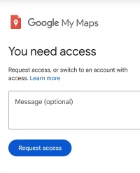
I used this https://www.google.com/maps/d/u/0/viewer?mid=1kY-ZPBKbZuHddt5e9JBCqHmAwG93kFVP&ll=40.10951631110862%2C-3.0533069999999984&z=7 as a starting point, and then edited it to take out the routes I didn't want. I added it to My Maps in Google. Appears to be created by CNIG which seems to be a legit organization...It was very accurate and useful t get through towns that didn't have great signage, including ironically, Santiago De Compostella :)
 
It can also be the fault of the sheer size of your country!
Or as Effie would say "How embarrassment" :) if only we had taller mountains!

But on the plus side we have the highest toilet in Oz right next to Mt Kosciusko (this spell checker likes it with an S as it used to be) and an environmentally friendly genius design so no toilet paper floating around the roof of Australia.
 
Holoholo automatically captures your footpaths, places, photos, and journals.
I used this https://www.google.com/maps/d/u/0/viewer?mid=1kY-ZPBKbZuHddt5e9JBCqHmAwG93kFVP&ll=40.10951631110862%2C-3.0533069999999984&z=7 as a starting point, and then edited it to take out the routes I didn't want. I added it to My Maps in Google. Appears to be created by CNIG which seems to be a legit organization...It was very accurate and useful t get through towns that didn't have great signage, including ironically, Santiago De Compostella :)
That link seems dead for me - could you please try again as I am very interested
 
Train for your next Camino on California's Santa Catalina Island March 16-19
As a near-Luttite, I proudly confess to not using ANY apps to walk a Camino. Too often I pass people stopped in the middle of the road, hunched over their phones, trying to determine their next step, when 3 steps later, an obvious arrow presents itself. I prefer to look at a page in say a Brierley guide, or a page in Gronge the day before, and ON the day, merely walk . Look up. There are the arrows. Look up. There is everything you need to know and more. Look down, you miss it all. When did we become so unresourceful we needed an app to cross the street?
 
As a near-Luttite, I proudly confess to not using ANY apps to walk a Camino. Too often I pass people stopped in the middle of the road, hunched over their phones, trying to determine their next step, when 3 steps later, an obvious arrow presents itself. I prefer to look at a page in say a Brierley guide, or a page in Gronge the day before, and ON the day, merely walk . Look up. There are the arrows. Look up. There is everything you need to know and more. Look down, you miss it all. When did we become so unresourceful we needed an app to cross the street?
I don’t know why someone would feel proud not to use technology at our disposal. Personal choice of course but it is possible to use apps, and look up, and not miss things! There is no need to hunch over your phone, you can just glance!! Use of technology certainly doesn’t indicate that folks are unresourceful in my view.
 
A selection of Camino Jewellery
I was pleasantly surprised how good the reception was in a Spain, and also suffer from dropouts within 20 minutes walk from my house in North Vancouver..😀
Why were you surprised? Did you expect less in Spain? It’s a pretty developed place!
 
Last edited:
I used this https://www.google.com/maps/d/u/0/viewer?mid=1kY-ZPBKbZuHddt5e9JBCqHmAwG93kFVP&ll=40.10951631110862%2C-3.0533069999999984&z=7 as a starting point, and then edited it to take out the routes I didn't want. I added it to My Maps in Google. Appears to be created by CNIG which seems to be a legit organization...It was very accurate and useful t get through towns that didn't have great signage, including ironically, Santiago De Compostella :)
That looks like the work of @David Tallan, presumably based on the CNIG kml files they provide. When I last looked, these files were provided to the CNIG by the Federación Española de Asociaciones de Amigos del Camino de Santiago.
 
As a near-Luttite
Rabbit hole alert: from the admittedly little I know of 19th century English social history, it might be conceded that the Luddites had a point. But on a more serious note, you are absolutely right. I remember walking the camino in 2015 and for the first time meeting a pilgrim who was following the route on a GPS. The general consensus was that here was a sadly deluded but harmless eccentric. What is the point in looking at a screen for information that has been beamed backwards and forwards across the ether via complex and expensive technologies when the very same information is there in front of you, along with lots of interesting stuff that comprises the new and exciting environment you are travelling through? It doesn't really make a lot of sense.

But there is another issue. The camino is not invulnerable, or rather the route is not invulnerable and there are constant local pressures to divert it it or block it. Local associations go to enormous effort to maintain the camino and one of the main ways of doing it is by physically marking the route Fr. Valiño style with those bright yellow arrows. It was noticeable when I walked a section of the Francés this year that a lot of the waymarks are fading. There could be a lot of reasons for this but it could be that the waymarks are regarded as redundant or local associations have lost interest and support. The waymarks may be a 20th century innovation but they have become an integral part of the camino and what it means. So I suggest we all use the waymarks as much as possible, be aware of where we are and keep our phones in our pockets - until we get lost.
 
The focus is on reducing the risk of failure through being well prepared. 2nd ed.
I don’t know why someone would feel proud not to use technology at our disposal. Personal choice of course but it is possible to use apps, and look up, and not miss things! There is no need to hunch over your phone, you can just glance!! Use of technology certainly doesn’t indicate that folks are unresourceful in my view.
If your phone was lost or stolen on day 2 of your Camino, would it in any way impact your ability to continue on your way? It would not for me because I don't rely on it. I feel that makes me more resourceful. Feel free to disagree.
 
So I suggest we all use the waymarks as much as possible, be aware of where we are and keep our phones in our pockets - until we get lost.
Good advice and I really have not used a GPS "hunch type" device for 11 years so don't know if one still needs to hunch but as I keep saying the genius of the Google Map satnav is you can leave it IN the pocket (volume turned off or on) and it says "turn right in 20 meters" etc even in the dark which was the big issue Hector had (he never said what he was using) as he left his auberge thingo in the dark going around in circles looking for yellow arrows (adding 50km to his trip).

Then once on the trail and hanging out for that cafe barista latte thingo you will have programmed a cafe into the satnav and it will keep updating you on the distance TO the Cafe.

Way to go in my book :)
 
3rd Edition. More content, training & pack guides avoid common mistakes, bed bugs etc
That looks like the work of @David Tallan, presumably based on the CNIG kml files they provide. When I last looked, these files were provided to the CNIG by the Federación Española de Asociaciones de Amigos del Camino de Santiago.
Correct - I originally found a link from @David Tallan when I was preparing for my walk, but could not figure out how to link it to this thread. I subsequently modified a version of his link to only include the CF. I found it very useful on several occasions during my walk.
 
Why were you surprised? Did you expect less in Spain? It’s a pretty developed place!
Nothing to do with thinking Spain would be undeveloped, as I have been many times before.

I was pleasantly surprised for two reasons.
  1. I am used to having dropouts so close to my own home, which is also a pretty developed place..not a case of expecting less in Spain, more like expecting more in my own neck of the woods :)
  2. It was first time using my Canadian phone plan in Spain. The plan covers all countries in Europe, without the need for additional SIM, and also no roaming charges. I was therefore happy that it worked flawlessly
 
If your phone was lost or stolen on day 2 of your Camino, would it in any way impact your ability to continue on your way? It would not for me because I don't rely on it. I feel that makes me more resourceful. Feel free to disagree.
No it wouldn’t… it’s just a town to town, village to village walk after all, though if my phone was stolen I guess it would mean I would stop anyway until I was sure that my online security was under minimal threat. I won’t pretend I can use proper navigation equipment though. That’s why I do Camino, due to its logistical ease.
 
Train for your next Camino on California's Santa Catalina Island March 16-19
A
Nothing to do with thinking Spain would be undeveloped, as I have been many times before.

I was pleasantly surprised for two reasons.
  1. I am used to having dropouts so close to my own home, which is also a pretty developed place..not a case of expecting less in Spain, more like expecting more in my own neck of the woods :)
  2. It was first time using my Canadian phone plan in Spain. The plan covers all countries in Europe, without the need for additional SIM, and also no roaming charges. I was therefore happy that it worked flawlessly
Ah ok thank you! Just interested in what folks expect when they come to Spain/Europe etc. Some people (not you) seem quite surprised that things work pretty seamlessly and are developed around finances, tech, transportation, even food.
 
As a near-Luttite, I proudly confess to not using ANY apps to walk a Camino. Too often I pass people stopped in the middle of the road, hunched over their phones, trying to determine their next step, when 3 steps later, an obvious arrow presents itself.
Nowadays, says the internet (I am making use of modern technologies), the term "Luddite" often is used to describe someone who is opposed or resistant to new technologies.

This puzzles me: How can one be a near-Luddite (or is near-Luttite something different?) and making use of this online forum and its online resources? And how does one know what people, being hunched over their phones or not, are looking for? If it were me, I'd probably be looking for the quickest and shortest way to my accommodation after having arrived in town. No yellow arrow will be pointing to it. And asking Apple Maps (in my case but it's similar to Google Maps) to lead me to my well deserved bed beats asking another foreigner who will only reply: "I don't know either and I won't get my mobile phone to tell you". 😂

Apologies for the thread drift but I am not sure what this thread is for anyway. Is it about "Don't use cell phone services and navigation apps"??? :cool:
 
Last edited:
It can also be the fault of the sheer size of your country!
I too find the mobile coverage in Spain to be excellent. I have stood on top of many a remote hill/mountain in Spain and had full 4g coverage. In UK where I live (South East England in a very populated area) there are many places where there is no mobile signal or only 3g. Spain is significantly larger than UK and less densely populated.
 
...and ship it to Santiago for storage. You pick it up once in Santiago. Service offered by Casa Ivar (we use DHL for transportation).
As a near-Luttite, I proudly confess to not using ANY apps to walk a Camino. Too often I pass people stopped in the middle of the road, hunched over their phones, trying to determine their next step, when 3 steps later, an obvious arrow presents itself. I prefer to look at a page in say a Brierley guide, or a page in Gronge the day before, and ON the day, merely walk . Look up. There are the arrows. Look up. There is everything you need to know and more. Look down, you miss it all. When did we become so unresourceful we needed an app to cross the street?
If you use wikiloc then there is no need to look at anything as you can set it to notify you if you move off of the path.
 
I know that this thread was created by moderators who - thankfully! - removed off-topic comments from a thread about the Gronze Maps app.

People who lack experience of using map apps and navigation apps because they either have never walked on a Camino in Spain or don't use such apps for whatever personal reasons and personal convictions while walking on a Camino in Spain appear to have preconceived ideas about how and why others use such apps, and their lack of hands-on practical experience prevents them from making meaningful and helpful comments on why a particular app may be more useful to a particular pilgrim than another one.

To think that those who make use of map apps and navigation apps could not find their way to Santiago without them is absurd. These apps have numerous purposes and are used in different ways. And that's good the way it is.
 
Last edited:

❓How to ask a question

How to post a new question on the Camino Forum.

Most read last week in this forum

I saw a video with a rather harsh criticism of a small, municipal albergue on one of the less traveled caminos. They paid 9€. I thought: What does it cost a small municipality to renovate and keep...
On my last Camino (2023) I noticed that there were lots of tourists. It reminded me of a couple of quotes that I have read since my first Camino (2015) “A tourist demands, a pilgrim is grateful”...
"A complete guide to the world's greatest pilgrimage"[sic] by Sarah Baxter. In a British newspaper, The Telegraph. A right wing daily that does print interesting articles and essays...
I've been trying to figure out how to use the Gronze app and as a first step I need to translate into English - I searched topics on the Forum, thought I found what I was looking for, and Yay! I...
Day 42 Week 6 460km walked (give or take) Today I had a revelation, an epiphany and a Divine Intervention... all in one day. Today the exreme pain in my soul is dissipating some... healed by the...
Planning my 1st Camino in 2025, when is the best time to see the field of sunflowers in full bloom?

Featured threads

❓How to ask a question

How to post a new question on the Camino Forum.

Featured threads

Forum Rules

Forum Rules

Camino Updates on YouTube

Camino Conversations

Most downloaded Resources

This site is run by Ivar at

in Santiago de Compostela.
This site participates in the Amazon Affiliate program, designed to provide a means for Ivar to earn fees by linking to Amazon
Official Camino Passport (Credential) | 2024 Camino Guides
Back
Back
Top