Search 74,075 Camino Questions

Camino Primitivo - Scared of Heights

Gingerbaldy

New Member
Time of past OR future Camino
May / Jun 24 Primitivo
Hi All,

I am planning to do the Camino Primitivo in late May / early June this year for my 50th.
I know the 1st few days past through the Asturian mountains, and I am a little nervous as scared of heights.
Do any of the pathways have a sheer drop next to them? I have walked the Llanberis Path up Snowdonia Path and that was ok, so I am hoping that this is similar (fingers crossed not worse) as I do love a good view.

Thanks for any input in advance.

Hoping to see some of you later this year.
 
The one from Galicia (the round) and the one from Castilla & Leon. Individually numbered and made by the same people that make the ones you see on your walk.
Get a spanish phone number with Airalo. eSim, so no physical SIM card. Easy to use app to add more funds if needed.
I know the 1st few days past through the Asturian mountains, and I am a little nervous as scared of heights.
Try not to imagine the worst. Of course there are parts where (with backpack etc ., ) you have to exert yourself a little - there are ups and downs… but no nearby cliffs on the primitivo that I recall. The caminos usually find the best path to Santiago. It’s not anywhere near an Everest type walk. It’s beautiful and so inspiring. If you ever look up ‘YouTube ‘. Check out some videos … Efren Gonzalez… has posted some gorgeous videos/vlogs etc taken in part with a drone to capture the full picture. ❤️❤️❤️❤️

Good luck and buen camino.
 
As a vertigo-sensitive person, I can assure you that there is very little. If you are very sensitive, there is a km or two walking toward the dam at Grandas de Salime which can be disconcerting, but the only bit which bothered me at all was crossing the bridge at that dam. I just waited until two German pilgrims appeared and they happily walked on either side of me to get me across.
 
Train for your next Camino on California's Santa Catalina Island March 16-19
Try not to imagine the worst. Of course there are parts where (with backpack etc ., ) you have to exert yourself a little - there are ups and downs… but no nearby cliffs on the primitivo that I recall. The caminos usually find the best path to Santiago. It’s not anywhere near an Everest type walk. It’s beautiful and so inspiring. If you ever look up ‘YouTube ‘. Check out some videos … Efren Gonzalez… has posted some gorgeous videos/vlogs etc taken in part with a drone to capture the full picture. ❤️❤️❤️❤️

Good luck and buen camino.
Thanks for the input Annie, will definitely look up Efren's video / blogs.
 
Get a spanish phone number with Airalo. eSim, so no physical SIM card. Easy to use app to add more funds if needed.
Have not been on Primitivo but hiked some Carpathian mountains, Machu Picchu and even a glacier in Alaska
sometimes, the nature and views are SO BREATHTAKING that you simply forget to be scared!
While absolutely do be careful and exercise prudent caution - dont worry and dare to push yourself out of the comfort zone (even if a little bit)
The seldom spoken but much applicable word on Camino is ULTREIA! I believe it would apply here is well
Good luck and Buen Camino
 
The 2024 Camino guides will be coming out little by little. Here is a collection of the ones that are out so far.
€2,-/day will present your project to thousands of visitors each day. All interested in the Camino de Santiago.
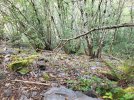
I include some pictures on my Primitivo posts back in September, because another future pilgrim had a similar question. The two steepest sections were after the point where Hospitales and Pola reunite (no pics of that, I was actively using poles) and the section going down to the dam, as stated above. Those are the foresty pics.

BL; if the open drops don't bother you, and the forested switchbacks down to the dam don't bother you, you'll be fine. If they do, pull up the bike route on the Buen Camino app for those sections.
 

Attachments

  • 20230919_114857.jpg
    20230919_114857.jpg
    6.2 MB · Views: 54
  • 20230919_091102.jpg
    20230919_091102.jpg
    8.2 MB · Views: 53
  • 20230918_131708.jpg
    20230918_131708.jpg
    7.1 MB · Views: 46
  • 20230918_131651.jpg
    20230918_131651.jpg
    5.8 MB · Views: 44
  • 20230920_121802.jpg
    20230920_121802.jpg
    10.7 MB · Views: 40
  • 20230920_121758.jpg
    20230920_121758.jpg
    10.6 MB · Views: 52
  • 20230920_104908.jpg
    20230920_104908.jpg
    8.1 MB · Views: 57
I include some pictures on my Primitivo posts back in September, because another future pilgrim had a similar question. The two steepest sections were after the point where Hospitales and Pola reunite (no pics of that, I was actively using poles) and the section going down to the dam, as stated above. Those are the foresty pics.

BL; if the open drops don't bother you, and the forested switchbacks down to the dam don't bother you, you'll be fine. If they do, pull up the bike route on the Buen Camino app for those sections.
Exactly. Several people I was with chose to take the road rather than the steep, rocky trail at the point where the Hospitales and the Pola reunite, but even the trail is just really steep (and slippery) rather than by a sharp drop.
 
There is a Roman gold mine called "A Freita" in Hospitales 1 km more or less before Puerto del Palo on the right side. The Camino goes close to the mine but you must walk about 2 mts to your right if you want to see the mine and I think it could have some vertigo sensation.
 
Last edited:
Ideal sleeping bag liner whether we want to add a thermal plus to our bag, or if we want to use it alone to sleep in shelters or hostels. Thanks to its mummy shape, it adapts perfectly to our body.

€46,-
Hi All,

I am planning to do the Camino Primitivo in late May / early June this year for my 50th.
I know the 1st few days past through the Asturian mountains, and I am a little nervous as scared of heights.
Do any of the pathways have a sheer drop next to them? I have walked the Llanberis Path up Snowdonia Path and that was ok, so I am hoping that this is similar (fingers crossed not worse) as I do love a good view.

Thanks for any input in advance.

Hoping to see some of you later this year.
Just to say best wishes! I have a huge fear of heights and all I would say is no two peoples ‘fear’ is the same. I did a hike once with a girl who was the only person I have ever met with a comparable fear, but the part of the walk that scared me, didn’t scare her and vice versa. Ribadeo Bridge on the Norte was my moment of reckoning and I managed to walk across it!
 
I include some pictures on my Primitivo posts back in September, because another future pilgrim had a similar question. The two steepest sections were after the point where Hospitales and Pola reunite (no pics of that, I was actively using poles) and the section going down to the dam, as stated above. Those are the foresty pics.

BL; if the open drops don't bother you, and the forested switchbacks down to the dam don't bother you, you'll be fine. If they do, pull up the bike route on the Buen Camino app for those sections.
Thanks for the photos. The forested switchbacks look ok, similar to a small mountain near Bergen Norway, and that was ok.
Your last picture is stunning, looking forward to seeing that in person.
 
...and ship it to Santiago for storage. You pick it up once in Santiago. Service offered by Casa Ivar (we use DHL for transportation).
Exactly. Several people I was with chose to take the road rather than the steep, rocky trail at the point where the Hospitales and the Pola reunite, but even the trail is just really steep (and slippery) rather than by a sharp drop.
I will keep my eyes out, and if I am troubled the road sounds like a good option. Knowing my luck I will get run over here
 
There is a Roman gold mine called "A Freita" in Hospitales 1 km more or less before Puerto del Palo on the right side. The Camino goes close to the mine but you must walk about 2 mts to your right if you want to see the mine and I think it could have some vertigo sensation.
If the path is not that close, I should be fine - 2mts (metres?) Now I know it is there I may brave a peek.
 
Just to say best wishes! I have a huge fear of heights and all I would say is no two peoples ‘fear’ is the same. I did a hike once with a girl who was the only person I have ever met with a comparable fear, but the part of the walk that scared me, didn’t scare her and vice versa. Ribadeo Bridge on the Norte was my moment of reckoning and I managed to walk across it!
Thank you.
That is true. I have surprised myself a few times and even managed to walk over a glass floor, it did take me about 30mins to get the courage.
Well done for completing your moment of reckoning..
 
Train for your next Camino on California's Santa Catalina Island March 16-19
As a vertigo-sensitive person, I can assure you that there is very little. If you are very sensitive, there is a km or two walking toward the dam at Grandas de Salime which can be disconcerting, but the only bit which bothered me at all was crossing the bridge at that dam. I just waited until two German pilgrims appeared and they happily walked on either side of me to get me across.
Thanks. I have seen the dam crossing on a video log and I will have to prepare myself for that..
Hopefully I will have the company of other pilgrims at that stage too.. Or I may crawl
 
Thank you.
That is true. I have surprised myself a few times and even managed to walk over a glass floor, it did take me about 30mins to get the courage.
Well done for completing your moment of reckoning..
Those glass floors are scary indeed! I try not to look down or my brain tries to tell me I will fall through.
As for bridges and dam crossings. I proceed as they always seem to have some type of fencing, but even so I don't look down into the lovely water below, but keep my eyes on the prize...which is the end on the other side.
 
Train for your next Camino on California's Santa Catalina Island March 16-19
……as I do love a good view.
Going up to Hospitales my guidebook recommended places for a picnic because of the magnificent view. I passed through cloud in those places and was extremely grateful for those poles in the grassy area set up in such a distance from each other that you could just make them out to find your way…
 
No sheer drops to worry about! Being from Alberta and close to the Canadian Rockies, I would classify Spanish mountains more of the rounded foot hills variety. No ropes or pitons required!
The only challenging bit was the final decent from the Hospitales route. A little steep and rocky, but fine with poles and taking your time.
Don't let this discourage you from the Hospitales route on the Primitivo as it really is quite beautiful on a clear day.
The Primitivo remains as my favorite Camino route in Spain by a wide margin.
 
Hi All,

I am planning to do the Camino Primitivo in late May / early June this year for my 50th.
I know the 1st few days past through the Asturian mountains, and I am a little nervous as scared of heights.
Do any of the pathways have a sheer drop next to them? I have walked the Llanberis Path up Snowdonia Path and that was ok, so I am hoping that this is similar (fingers crossed not worse) as I do love a good view.

Thanks for any input in advance.

Hoping to see some of you later this year.
There are alternative routes which obviously you would do well not to attempt. Sounds like you wouldn't so no worries.
 
The one from Galicia (the round) and the one from Castilla & Leon. Individually numbered and made by the same people that make the ones you see on your walk.
Going up to Hospitales my guidebook recommended places for a picnic because of the magnificent view. I passed through cloud in those places and was extremely grateful for those poles in the grassy area set up in such a distance from each other that you could just make them out to find your way…
Those markers were great. Except for a brief sunny respite at the first tree grove (when I had views over the clouds) I had zero great views until well after the Hospitales - mist, mist and more mist.
I'm going back....
 
No sheer drops to worry about! Being from Alberta and close to the Canadian Rockies, I would classify Spanish mountains more of the rounded foot hills variety. No ropes or pitons required!
So, you don't know Picos de Europa ( Torrecerredo, Naranjo de Bulnes, Peñasanta, etc). Also in Pyrinees there are quite a few peaks with "patio" ( courtyard).
 
Ideal pocket guides for during & after your Camino. Each weighs only 1.4 oz (40g)!
GingerBaldy, I cannot guarantee you weather, only location ;). I also met some young people who took the road down from the powerplant that day...there weren't a lot of cars, and they seemed much more relaxed than i was ;)

I think Peter may still be a little...peeved?regretful?... that I got mostly clear skies in late Sep (4 days with some rain out of 13 walking), but was struggling too much to really appreciate it, whereas he had lots of energy to look at mists a couple of months prior. TBH, sometimes *I* want to re-do that specific pilgrimage... but my husband and I are saving up for the Ingles onto Finisterre/Muxia in 25.

Ah well. Thanks for the trip back in my memory, and, of course, Buen Camino.
 
Dbier, thanks for your comment.
I will try my best to stay on the path, but if I stray there is like you say a possible next time.
Living in England I am used to the fluctuating weather and to be fair being a ginge, if it is misty it saves using some suncream, every cloud...
Buen Camino for 25
 
Hi All,

I am planning to do the Camino Primitivo in late May / early June this year for my 50th.
I know the 1st few days past through the Asturian mountains, and I am a little nervous as scared of heights.
Do any of the pathways have a sheer drop next to them? I have walked the Llanberis Path up Snowdonia Path and that was ok, so I am hoping that this is similar (fingers crossed not worse) as I do love a good view.

Thanks for any input in advance.

Hoping to see some of you later this year.
Not that I remember at all. Lots of ascents and descents and spectacular scenery. Do it!
 
A selection of Camino Jewellery
I think Peter may still be a little...peeved?regretful?... that I got mostly clear skies in late Sep (4 days with some rain out of 13 walking), but was struggling too much to really appreciate it, whereas he had lots of energy to look at mists a couple of months prior.
Naah. But if you had said envious then you'd have hit the nail on the head!
I still had a wonderful Camino though - and if an excuse was needed, it gives me an excuse to go back again. Many do the Frances multiple times, why shouldn't I do the Primitivo?
Enjoyed the Inglès too - Buen Camino @dbier!
 
I think of the 3 Camino I have done (Frances, Portuguese and Primitivo), Primitivo is by far the nicest. No fear of falling, you are always on a path, and can stay well away from the edge. Frankly, the walk up to the Virgin from St. Jean on the first day of the Frances was probably more dicey with strong winds.

Do the Primitivo, lovely views, good Camino spirit. And btw, you do have a choice of Hospitales or Pola if you want to avoid a bit of ridge walking. But you'll come back to that steep downwards path anyways. Hospitales has great views, provided it is not misty and rainy, in which case you don't see much. The Pola route was nice though, serene walk through the woods as I remember.

Buen Camino.
 
The only sheer drop I recall was from the top of a three tier bunk in the Municipal at Borres. Long since replaced
I assume you mean the bunk and not the albergue, with its poor water problems. Great views though!!!
 
Get a spanish phone number with Airalo. eSim, so no physical SIM card. Easy to use app to add more funds if needed.
Hi All,

I am planning to do the Camino Primitivo in late May / early June this year for my 50th.
I know the 1st few days past through the Asturian mountains, and I am a little nervous as scared of heights.
Do any of the pathways have a sheer drop next to them? I have walked the Llanberis Path up Snowdonia Path and that was ok, so I am hoping that this is similar (fingers crossed not worse) as I do love a good view.

Thanks for any input in advance.

Hoping to see some of you later this year.
Hi. I thought I would share this thread that I started when I was faced with Ribadeo Bridge! It’s brings it all back!

I am also looking at a trek (non Camino) where I am pretty sure I will face heights issues. I have been studying YouTube videos but many of the shots are ‘arty’ and don’t give me a proper definitive viewpoint. It’s hard when you ask others as it is such a personal thing!

 
Hi All,

I am planning to do the Camino Primitivo in late May / early June this year for my 50th.
I know the 1st few days past through the Asturian mountains, and I am a little nervous as scared of heights.
Do any of the pathways have a sheer drop next to them? I have walked the Llanberis Path up Snowdonia Path and that was ok, so I am hoping that this is similar (fingers crossed not worse) as I do love a good view.

Thanks for any input in advance.

Hoping to see some of you later this year.
Not at all from memory. I walked it 18 months ago aged 67.
 
Get a spanish phone number with Airalo. eSim, so no physical SIM card. Easy to use app to add more funds if needed.
HI, the only place that I think may trigger you is the steep path going down from Puerto del Palo down to the abandoned village at Montefurado, but I am fairly certain you can bypass that on the road.... otherwise my favorite Camino thus far... hoping to walk it again some day... Buen Camino!
 
Hi Barb,
Thanks for your reply.
I have watched a few YouTube videos and from the messages above including yours, I am going to stick to the path, that is unless I get lost :).
thanks for all of you input everybody.
Hope you get to do I again soon.
 
Exactly. Several people I was with chose to take the road rather than the steep, rocky trail at the point where the Hospitales and the Pola reunite, but even the trail is just really steep (and slippery) rather than by a sharp drop.
Are they well marked (the bike routes), or is a guidebook or app necesarry?
 
...and ship it to Santiago for storage. You pick it up once in Santiago. Service offered by Casa Ivar (we use DHL for transportation).
Bike routes? I’m not clear as to what you’re asking. I wouldn’t walk the Primitivo without some sort of guidebook or app. I wouldn’t even try and cycle most of it but if I did I would use the roads like the locals do.
BL; if the open drops don't bother you, and the forested switchbacks down to the dam don't bother you, you'll be fine. If they do, pull up the bike route on the Buen Camino app for those sections.
 
BL; if the open drops don't bother you, and the forested switchbacks down to the dam don't bother you, you'll be fine. If they do, pull up the bike route on the Buen Camino app for those sections.
Ah, well yes. No the bike routes aren’t way marked. The route suggested on Buen Camino and a couple of others make use of the local road network and, unless you live there, a navigation app is probably essential
 
3rd Edition. More content, training & pack guides avoid common mistakes, bed bugs etc
Ideal pocket guides for during & after your Camino. Each weighs only 1.4 oz (40g)!
A selection of Camino Jewellery
On the "Long and Winding Road" thread, I posted today a photo of what I think was the steepest, most treacherous descent on the Primitivo.
If you are speaking of the downhill slope made up of giant pieces of gravel with no switchbacks to help slow you down as the "trail" followed huge power lines, then that was my scariest descent for sure! I could barely hold myself back with my hiking pole in order to walk slower! I took no picture of that! I personally think it is a road specifically made for workers installing and maintaining those power lines.
 
Ideal pocket guides for during & after your Camino. Each weighs only 1.4 oz (40g)!
Yep, that's the area. Again, *i* was concentrating too much to take a pic, except at that one rock outcropping.

OP, when you use the Buen Camino app, you can set a switch to show the bike alternatives. The road down to Montefurado (?) is one of them.
 
On the "Long and Winding Road" thread, I posted today a photo of what I think was the steepest, most treacherous descent on the Primitivo.
Right after the Hospitales route joins up with the Pola route after it does its steep climb, where they both descend together, if my memory is correct.
Yes, your memory is correct. That was quite a scramble.
I personally think it is a road specifically made for workers installing and maintaining those power lines.
If you mean the track David's talking about, then no, the substation and power lines are off to the left of the main road as you are heading downhill.
The track concerned - which I also scrambled down (I would not dignify my progress with the term walked) is too narrow for vehicles - less than a metre wide in places. It was STEEP! I've just checked my YouTube video, no power lines in the immediate vicinity. (They, like the substation, are way off to the left). Looking on Google Maps you can see that this trail forms the base of a triangle, cutting from 1 point on the road down to the next.

Many people took the road rather than walk this section. Had it been raining I would have definitely done the same.
 
Peter, I never took a road as an alternative option on the Primitivo, so we certainly shared that same path as David's picture at some point. Possibly I got off piste accidently, or there are two similar treacherous sloping downhill sections on the Primitivo. I definitely recall being very near power lines. I wonder if the path was altered a bit to make it a bit "safer". I walked it in 2016 as my second Camino, so possibly my memory could be a bit fuzzy, although it is a vivid recollection.
EDIT- The huge gravel pieces looked new and freshly laid; golden yellow color of limestone; wide enough and straight for a truck, and there was no meandering or side places of dirt.
Probably a little mystery and I'll not know for sure if we are speaking of the same spot.
 
Last edited:
The one from Galicia (the round) and the one from Castilla & Leon. Individually numbered and made by the same people that make the ones you see on your walk.
Ah, well yes. No the bike routes aren’t way marked. The route suggested on Buen Camino and a couple of others make use of the local road network and, unless you live there, a navigation app is probably essential

On the "Long and Winding Road" thread, I posted today a photo of what I think was the steepest, most treacherous descent on the Primitivo.
Thanks for the photo, David, I hopefully will be ok on the path, fingers crossed
 

❓How to ask a question

How to post a new question on the Camino Forum.

Featured threads

❓How to ask a question

How to post a new question on the Camino Forum.

Featured threads

Forum Rules

Forum Rules

Camino Updates on YouTube

Camino Conversations

Most downloaded Resources

This site is run by Ivar at

in Santiago de Compostela.
This site participates in the Amazon Affiliate program, designed to provide a means for Ivar to earn fees by linking to Amazon
Official Camino Passport (Credential) | 2024 Camino Guides
Back
Back
Top