• ⚠️ Emergency contact in Spain - Dial 112 and AlertCops app. More on this here.
  • Remove ads on the forum by becoming a donating member. More here.

Search 74,075 Camino Questions

LIVE from the Camino Camino Manchego in December

Umwandert

Active Member
Time of past OR future Camino
Current Caminos: Via Augusta + Camino Manchego
I've been in Ciudad Real since yesterday evening and will be walking the Camino Manchego in five stages to Toledo from tomorrow. I found very little information about this Camino and decided to do it at very short notice. After the Via Augusta, I actually wanted to walk the Camino del Sur, but that requires 7 days and I only have 6 available. So I switched plans.

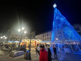
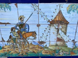
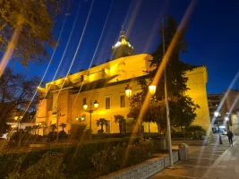
Ciudad Real is a charming, not so small town with 74,000 inhabitants in Castilla-La Mancha, around an hour south of Madrid by train. Today I visited the Don Quixote Museum and the cathedral and went to the Christmas market in the city centre. The weather was sunny at 16 degrees, but it's supposed to get much colder tomorrow. So I also paid a visit to the Decathlon store on the eastern outskirts of the city to top up my equipment for cold days.

I've never walked a Camino in La Mancha before and I'm excited to see what awaits me. I've been reading @AlanSykes' reports with interest. He walked most of the Camino Manchego in October. Having had mixed experiences with official Wikiloc tracks on the Via Augusta, this time I'm using the Buen Camino app, which maps the Camino Manchego.

To be continued...


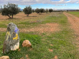
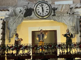
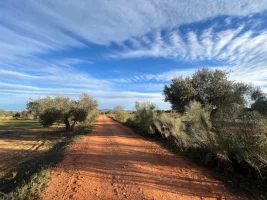
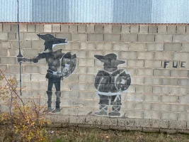
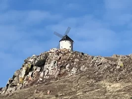
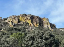
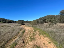
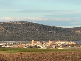
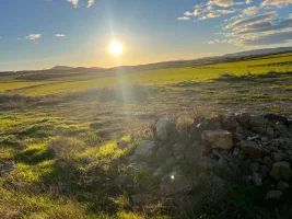
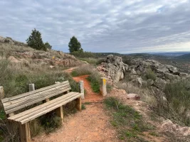
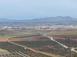
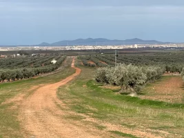
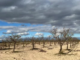
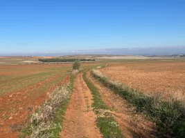
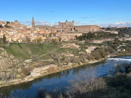
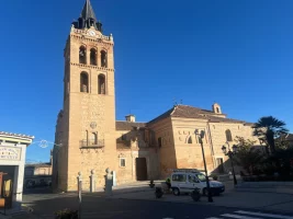
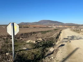
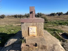
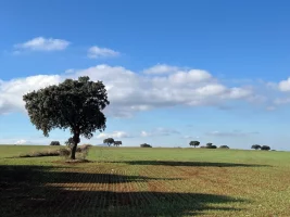
IMG_5602.webpIMG_5643.webpIMG_5668.webpIMG_5678.webp
 
A selection of Camino Jewellery
Ideal pocket guides for during & after your Camino. Each weighs only 1.4 oz (40g)!
Day 1: Ciudad Real - Malagon (according to Buen Camino 27 km, I walked 29 km)

IMG_5804.webp

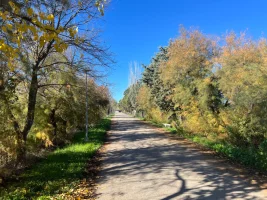
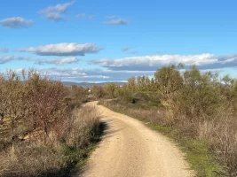
I was worried about the drop in temperature. When I stepped out of the hotel at 9.30am it was 5 degrees and I could see my breath. However, the sky was clear and the sun was shining. Well wrapped up, I left Ciudad Real past Puerto de Toledo and headed north. Initially on tarmac, the surface soon changed to gravel. At first I encountered a lot of joggers, later also mountain bikers.

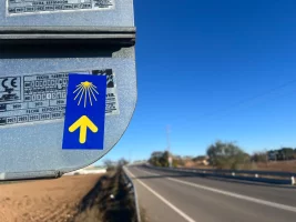
At some distance from the railway line, I walked through fields and noticed the first Camino markings (small stickers on signs). I trusted the Buen Camino app, but soon there were slight deviations. There were several prohibition signs next to the path, but it was not closed off. I continued northwards on wide concrete slabs that tanks could drive on, perhaps a road was planned here that was never completed? By now it was more than 10 degrees. Gloves were not necessary, but I occasionally used my hood because of the wind.

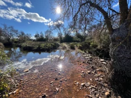
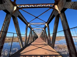
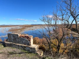
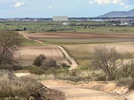
The path was flat and easy to walk on, with gently undulating hills on the horizon. After a bend, the view opened up and a large wetland came into view. Very picturesque! I crossed the Puente de Hierro steel bridge to the other side. There were also many day trippers from the surrounding area here, as it was Sunday. Then I continued through olive groves and under the railway line to the first village on the path. Peralvillo consisted of just a few streets and an open bar. I treated myself to a Colacao and a Coca-Cola and got tapas to go with it, there was no stamp (‘Soy autonomo’ replied the owner), but at least my credential was signed.

IMG_5784.webp

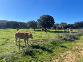
This was followed by a beautiful path through a nature reserve (?), always alongside a river. I saw plenty of birds. There were walkers and cyclists here too. I was pleasantly surprised, I had imagined the path to be much more lonely. Walking past cow pastures, grazing horses and still in bright sunshine was great fun. The surface eventually changed to tarmac and the houses of Fernán Caballero came into view.

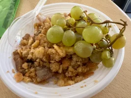
This village is much larger than Peralvillo, but seemed totally deserted. Bars on the windows everywhere, parked cars but not a soul on the streets. Almost eerie. I reached the centre with the church and walked around it (unfortunately closed). It was 3pm. Two people came out of a neighbouring building and I took a closer look. It was a cafeteria, which was obviously not privately run but by the village. Once again my credential was signed, once again I ordered something to drink and this time I received migas, a speciality from La Mancha, as tapas. It looked like a Bavarian bread dumpling (Semmelknödel) that someone has sat on. The dish is actually made with toasted bread, but also with paprika, olive oil, garlic and fatty meat. It is eaten with grapes and I really enjoyed it!

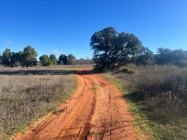
Freshly fortified, I set off on the last section of the route to Malagon. I passed the cemetery and continued northwards along dirt roads. The wind picked up and I had to put my hood on. Then Buen Camino wanted to send me right onto the main road, while the arrows continued to point left. As I could already see the church tower of Malagon (an advantage when everything is so flat) I trusted the arrows. This path along a stream is maybe a little longer, but certainly much more pleasant than having to walk alongside the road. I'd had enough of that on the Via Augusta. I reached Malagon in the evening sun at 5.15pm and found the Los Molinos guesthouse ten minutes later.

I had called there a few days ago and reserved a room (25 euros) by phone. booking.com offered no choice in the town, only 7 km off camino. But according to google maps there are three accommodations in Malagon. However, the bar Los Molinos was barred and closed. After my call, the owner came out into the street and guided me in, the guesthouse is round the corner from the bar. I later had dinner in a nearby restaurant. After sunset it got really cold.

A successful start! Tomorrow I'm heading further north, 35 km to Urda, and I'll have to start earlier and probably take fewer long breaks. As the sun rises at 8.25am and sets at 5.50pm I only have just nine and a half hours of daylight for hiking. And I would like to arrive before sunset. Conveniently, I've pre-booked all the accommodation on this Camino (it's December and there are no albergues).

To be continued...


IMG_5712.webpIMG_5743.webpIMG_5771.webpIMG_5836.webpIMG_5859.webpIMG_5863.webpIMG_5898.webpIMG_5922.webp
 
Last edited:
A selection of Camino Jewellery
Day 2: Malagon - Urda (35km officially and for me, as there was no room for error)

IMG_5995.webp


The crucial question today was: would I manage to complete the longest stage by sunset? 35km in 9.5 hours on a flat path should actually work. But you don't walk a route like this without a plan. My plan looked like this: Hike the first 10km without a break to the only town on the route, then walk for an hour, followed by a 10-minute break. And repeat.

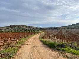
I'm not a morning person, especially not in winter. I found it correspondingly difficult to leave the hotel at 8am. It was 1 degree outside, I had breakfast in a nearby café and packed a chocolate triangle (Triangulo de chocolate) for later. There were a few clouds in the sky, but the sun was already making its presence felt. I walked the first few kilometres out of Malagon on dirt tracks through olive groves and vineyards. Unlike the day before, I didn't meet lots of walkers or cyclists. Only one lone mountainbiker.

I passed a chemical plant and a hilltop and suddenly the sun disappeared and the cold wind picked up. I now used both the hoods of my jumper and my jacket and plunged deep into the olive groves. I reached Fuente el Fresno at around 11.15am and saw my first windmill high above the town on a hill. In the centre, I first went to the town hall to get a stamp and then took a break in a bar. While I was sipping my hot colacao, a basketball game was on TV (the TV is always on in the bars). I bought a few more drinks at the supermarket.

The way out of the town was about 10 kilometres along the N-401 road to Toledo. At first I made good progress on a gravel track with lots of benches along the side, but then the benches disappeared and I continued along a dirt track. Luckily the sun had returned and it was now 8 degrees. I was glad I didn't have to walk on the road as there was a lot of traffic, no shoulder and the cars were speeding.

After my first break, I had to cross over to the other side of the road and was suddenly on a cañada, an old track where cattle were herded through the countryside (@VNwalking had provided more information about the cañadas here). The ground now became much rockier and I was forced to lift my legs and pay more attention to the ground than to the landscape around me. With the road still in sight, I struggled northwards.

The last kilometre before the turn-off tom Urda I had to get onto the road, but there was a one metre wide shoulder. A restaurant came into view, ideal for a break, but it was closed. Here I also met a hiker (not a pilgrim), he was carrying two rucksacks (it looked like he had his entire household with him). He was accompanied by a dog on a lead.

IMG_6099.webp

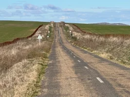
After the junction, I still had 10 kilometres to go, but there was only the road and no path alongside it. This road looked smaller and as if nothing had been done to it since the 60s, dirty grey potholed asphalt. There was a slight ascent and I could see for kilometres. There was hardly any traffic, maybe four cars an hour. I don't normally like walking long distances on tarmac, but after the strenuous cañada, this old road suited me just fine. I quickly got into my rhythm and no longer had to pay attention to the surface.

Fun fact: I had a countdown, the remaining kilometres were displayed on small signs next to the road. 10, 9, 8... After I had passed the 6, a dirt track suddenly appeared on the left and a yellow arrow. I didn't really want to leave the road, but as there were hardly any stones on the path, I turned off. The path ran parallel to the road. I took my last break at 4.30pm and was confident that I would make it to sunset (5.50pm).

Urda didn't turn up for a long time. Even 3 kilometres before the finish I couldn't see any town because it was obviously located in a hollow. It wasn't until shortly after 5pm that I finally saw the church towers. I particularly enjoyed the last hour, as the sun bathed the path and the fields in a particularly beautiful golden light. At 5.30pm I reached the first houses and at 5.50pm I was standing in front of my hotel La Casa del Medico Hosteria Rural (66 euros). Precision landing!

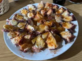
However, everything was closed and nobody opened the door. And to my dismay, I couldn't make a phone call either because I had no network coverage. So I ran into the nearest open shop, a tobacconist's, and asked for help in my mediocre Spanish. Amazingly, I actually remembered the word for network coverage (cobertura). The girl behind the counter called the number for me and ten minutes later I was pretty exhausted in my warm room. Dinner (pulpo) was then in a nearby bar (this time Game of Thrones was on the TV).

Conclusion: A great day, I'm proud of how my plan worked out. And very glad that the sun was shining, otherwise it would have been more difficult. My legs will definitely remember the 35km tomorrow (28km to Los Yebenes). The Camino de Manchego can also be completed in four days, in which case the destination would be Sonseca tomorrow, but that's too far for me.

To be continued...

IMG_5977.webpIMG_6017.webpIMG_6030.webpIMG_6052.webpIMG_6069.webpIMG_6129.webpIMG_6130.webpIMG_6149.webp
 
Last edited:
€2,-/day will present your project to thousands of visitors each day. All interested in the Camino de Santiago.
Day 3: Urda - Los Yebenes (28km officially, 27km for me due to some bushwacking)
IMG_6186.webp

I was the only hotel guest at the Casa del Medico, so I was surprised when an incredibly rich breakfast awaited me at 9am, including queso con membrillo (soft cheese with quince jelly). Freshly fortified and in a good mood, I left the hotel at 10am in 4 degree celsius and went to a supermarket to stock up on provisions, as today's stage was without any food options.

As soon as I left the town centre, I had network coverage again. That was important, of course, because otherwise I might not have found my way without the Buen Camino app. At first, I walked along a dirt track next to an arterial road. My destination was the N-401 to Toledo, which I had left yesterday to get to Urda. Urda is actually a diversion, I realised, you could also walk directly from Fuente el Fresno to Los Yebenes.

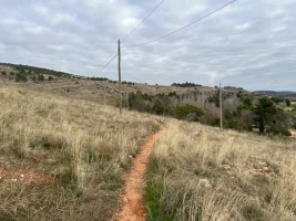
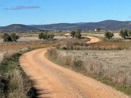
Soon crooked mojones appeared next to the dirt track, the sun was fortunately already shining strongly and there was hardly any wind, so I didn't need a hood. Unlike yesterday, this time I didn't have to walk on the less busy road; about 4 kilometres before the junction with the N-401, the Camino turned right into the fields. This section was very nice to walk, firm ground, the range of hills on the right and every now and then a farmer on a tractor waving.

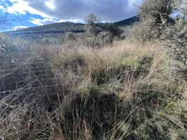
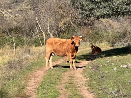
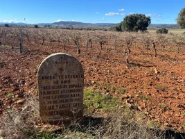
Buen Camino, however, made no sense to me, the app showed a strange spike that I ignored. Every now and then there were yellow arrows. One clearly pointed to the right behind a gate with a sign ‘Vaca sueltas’ (free-roaming cows). I opened and closed the gate, the landscape was now characterised by trees, an arroyo flowed to the left and the path became increasingly grassy. I dodged a few cow pats and then, around a bend, there they were: the vacas sueltas, in the middle of the path, looking at me challengingly.
IMG_6224.webp

Fortunately, I know what to do in such situations. I took a deep breath... and heartily sang a Dolly Parton country song ("Joleeeene"). It worked, the cattle made way and I was able to pass unscathed. Dolly Parton always works with cattle. The path was now almost enchanted and I passed a ruined castle crumbling away on the hill to my right. Then I came to a fork in the road and two arrows that contradicted each other. One (a sticker on the back of a sign) pointed left across the arroyo, the other, on the style of sign on the other side, pointed right further along the ridge.

I consulted Buen Camino and realised that I should have been walking much closer to the road already for some time. So I turned left, hopped over a few stones across the arroyo without falling into the water and felt good. But…. “That was a bloody mistake” I shouted to some young cattle just 10 minutes in. I was standing on a grassy area at the edge of a dug up field, the path had disappeared. There was a fence to the right, the arroyo behind it, another fence to the left of the field, and behind that, undergrowth and the road. According to the app, the Camino should run here, but there was no sign of it. "What do I do now?" I asked the cattle, who showed me their rumps and ran off northwards.

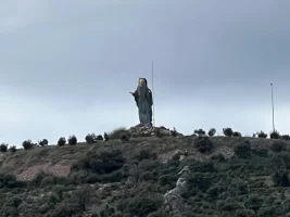
I walked across the field and examined the fence, it was 2.50 metres high, tightly knotted wire and not under power. What would Dolly Parton do, I wondered? As a patented country girl, she would of course have a pair of wire cutters in her handbag. I followed along the fence and was lucky, after 10 minutes someone (a desperate pilgrim?) had actually cut the fence open so that I could easily hop into the knee-high bushes behind it. After a few minutes of bushwacking, I was finally on the N-401. There was plenty of traffic here, but a one metre wide shoulder. According to the app, the Camino would cross the N-401 in 2 kilometres, so I continued on the road, watched by a huge statue of the Madonna on a hill to the left.

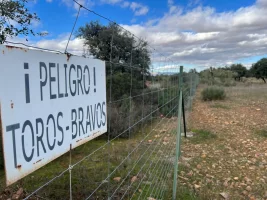
After 2 kilometres I actually found an arrow that sent me left onto a dirt track. But even here the path disappeared after a while and I had to fight my way over a scree field with lots of stones. As my trail runners are already quite worn out, I felt every stone and got annoyed. And again I was fenced in, running on an area to the left of the road that was perhaps 50 metres wide and fenced in on both sides. A path appeared behind the left-hand fence, but there was also a sign warning me that ‘Toros Bravos’ were waiting for me behind the fence. Does Dolly Parton also work with bulls? I'd rather not find out.

I realised that I was making better progress along the fence on the right-hand side (i.e. towards the road) because there were fewer stones there. An hour later I came to an open gate, beyond which was freedom, the road! But a big yellow arrow pointed to the left and I dutifully followed the now more passable path. At some distance from the road, I continued northwards, Los Yebenes had already been shining in the sun on the hillside in front of me for some time. I, on the other hand, was walking in the shade, as quite a few clouds had gathered in the meantime.

For the next few kilometres, I had to cross the road again and again as the Camino happily jumped from dirt track to dirt track. About 6 kilometres before the village, I came to an end and joined the road. Buen Camino still indicated a path on the right-hand side, but I didn't see it. I now marched at a brisk pace towards Los Yebenes, which was only approaching very slowly.
IMG_6321.webp

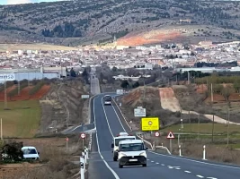
When I reached the exit from the motorway to my destination, a white car suddenly stopped, a man in a yellow high-visibility waistcoat jumped out and shouted across the road, asking what I was doing here. Fittingly, I was only 20 metres from a ‘No pedestrians’ traffic sign. I shouted back that I had lost my Camino and wanted to get to Los Yebenes as quickly as possible. He kindly let me move on. After leaving the N-401, I discovered a parallel dirt track on the right-hand side and took it. The last few kilometres dragged on endlessly, especially as the road was now constantly climbing slightly, as the town is located on a slope. At 4.45pm I reached some farms and was greeted by an orchestra of barking dogs. The gates were open twice, but thankfully the dogs didn't get as far as the path.

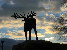
At 5pm I reached the industrial estate and ten minutes later the first residential buildings. I was overtaken by some joggers and noticed a huge deer statue. I bravely fought my way up the hill. At 5.20pm I was standing in front of my hotel, Casa Apelio (30 euros, booked directly via the website), in the town centre. As on the previous days, there was no one there, a sign informed me that it was siesta time between 4pm and 6pm, but there was also a telephone number. I rang and was let in a few minutes later. Later I ate in the restaurant. There were only raciones, bocadillos and hamburguesas on the menu, and every second dish contained venison. So I ordered venison in monteña sauce, which tasted fantastically tender.

Conclusion: An unexpectedly challenging day that showed me once again that you can't rely 100 per cent on apps. Actually, adventures like this mostly happen to me when I walk a path in reverse. But common sense (and Dolly Parton) helped me over critical sections today. Tomorrow is the shortest stage, 18 kilometres to Sonseca, which leads over the only significant hill of the entire Camino. It also offers a town halfway along the route. I'm looking forward to seeing how the Camino Manchego continues.

To be continued...
IMG_6201.webpIMG_6242.webpIMG_6252.webpIMG_6260.webpIMG_6267.webpIMG_6287.webp
 
€2,-/day will present your project to thousands of visitors each day. All interested in the Camino de Santiago.
Day 4: Los Yebenes - Sonseca (officially 18km, 22km for me, mainly due to a grave error on the mountain)

IMG_6403.webp

I had breakfast in the bar of the hotel and left at 10am at 2 degrees. With the shortest stage of the Camino I took it easy. To buy water in the supermarket, I had to walk down the hill a bit. But then I walked quickly uphill out of the town. I passed the hunting museum and plenty of statues of deer, wild boar and other game and passed the shop of a taxidermist (unfortunately without a shop window). Hunting really seemed to play an identity-forming role for Los Yebenes here.

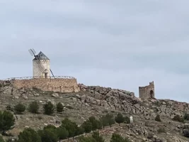
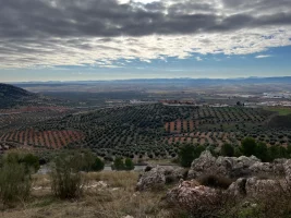
I had a fantastic view back to yesterday's route, but today the plain was under a thick blanket of cloud, so I could really feel the cold. The Camino led first along a dirt track, then along a Roman road-style paved path (the worst surface for me) up into the Montes de Toledo. I passed ruins and two windmills and reached the ridge relatively quickly. Now I could see the plain to the north and could see both Orgaz, lying in the sunshine, and the stage destination of Sonseca. I searched the horizon for Toledo, but found no clear trace.

I now had to cross a country road. A glance at Buen Camino told me that the route continued on the other side. There was no arrow and I passed a house, continuing uphill with beautiful views. After ten minutes, I wondered whether I should be going downhill to the north, but instead I was practically walking eastwards along the crest of the hill. The app showed me that I wasn't walking on the Camino, but I would soon meet up with my old friend, the N-401 leading to Toledo (and Orgaz). No problem, I thought, then the path must inevitably lead downwards.

But when I finally reached the N-401 on the map, there was no road and I was still on the mountain. The road was deep below me in a tunnel! And I was clearly travelling the wrong way and had to turn back. Back at the house, I turned right and found an arrow after 50 metres. So this time it wasn't Buen Camino's fault but my own, I thought I saw the path ahead of me but didn't check after a few minutes whether I was really walking on the Camino. It wasn't the first time this had happened to me. Result: two unnecessary extra kilometres on the mountain!

But now I descended quickly down the mountainside and met a country road at the bottom that led to the N-401. Thankfully, the Camino immediately turned left into an open grassy area between olive trees. Unlike yesterday, there were no fences, no ‘Toros Bravos’ warning signs and the surface was part grass, part gravel. I took my first break and then continued northwards with Orgaz in sight. I crossed the N-401, on the other side I continued along a dirt track into the village, which I reached shortly before 1pm.

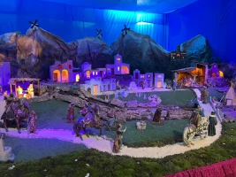
In Orgaz I got a stamp from the town hall, took a look at the open church with an impressively kitschy nativity scene (with a rushing stream and washing on the line!). Then it was time for lunch. After the half venison for dinner yesterday, I was in the mood for something vegetarian. Google Maps showed a Japanese restaurant near the castillo. But I only found an asador there. Just as well, I entered and was greeted by Adele over the loudspeakers, the waitress also looked like musical star Lea Michele. The menu was short and expensive, I opted for a salad, which turned out to be a large portion of antipasti (strips of peppers and anchovies swimming in oil). Quite tasty, but not enough, so I had a cheesecake afterwards. The restaurant didn't have a stamp for me, but Lea Michele brought me scissors and sellotape so I could cut out the logo from the bill and stick it on my credentials. What a great idea! I'll have to remember that, because contrary to what I've been told time and again, not all bars and restaurants on remote caminos have stamps!

Refreshed, I left Orgaz in a westerly direction, now in the sunshine. I was walking through the fields again, the sky now looked dramatically cloudy and I was worried that I might have to run the final stage the next day in the rain. A jogger in very short trousers overtook me. I could hear the muffled noise from the N-401 running parallel at a pleasant distance. I reached a hilltop and could then see Sonseca, dominated by a huge white building (a warehouse?). I would spray "Bienvenidos" or something equally uplifting on it.

IMG_6504.webp

The jogger now came back panting loudly. At 3pm I took another break and was pulled out of my Camino mood by a job-related call. Slightly annoyed, I continued on my way, my mind now occupied with a job problem. However, this made me walk much faster and the last few kilometres just flew by. At 4pm I was in the centre of the village and was delighted to see an autolavanderia (not a car wash, but a launderette).

I seized the opportunity and threw all the clothes from my rucksack (I usually hike with three sets) into the washing drum and thought about it. Nobody was in the launderette, so I undressed like in the famous Levis advert from the 80s and also put my worn clothes in the washing machine. I only kept my hiking trousers and jacket on. After ten minutes, the cold crept into my bones, as the launderette had no door and it was just as cold inside as it was outside (8 degrees). So I wrapped myself in my rain poncho and made a rather bizarre impression. And I wrote an e-mail to solve the job problem.

Three minutes before the dryer finished, people actually came into the launderette and I realised that I couldn't just put my clothes back on. My accommodation was inconveniently located at the other end of the city, 20 minutes away. I ducked behind a pillar, got rid of my rain poncho and at least put my T-shirt and hoodie back on. Unusually, I would be walking the last section without underpants (a small aside: Germany's hiking goddess Christine Thürmer, who spends months at a time in a tent on long-distance hiking trails and doesn't have a good opinion of the Caminos, never hikes with underwear).

As I already knew that I wouldn't be walking 2km back into the centre for dinner, I bought dinner (salad, arroz con leche and drinks) in the Mercadona opposite. Then I marched briskly out of town to the Hostal New York (40 euros with breakfast) and at 5.30am stood stunned in front of a tacky Statue of Liberty. At least the door was open and someone was there, even if it took another 5 minutes before I could check in. Because the card machine wasn't working, I had to pay in cash, which I just about managed to do with 45 euros in my wallet.

Conclusion: Once again an unnecessary diversion, but one that gave me some beautiful views. Fortunately, I was sensible enough to turn back instead of fighting my way down the mountain freestyle. Otherwise it could have ended badly. Apart from that, I really enjoyed this shorter stage without any time pressure. Tomorrow is the finale (25 completely flat kilometres) to Toledo. I'm hoping for sunshine and I'm already sad that this camino is coming to an end.

To be continued....

IMG_6377.webpIMG_6390.webp
IMG_6405.webpIMG_6412.webpIMG_6449.webpIMG_6468.webpIMG_6494.webpIMG_6502.webp
 
3rd Edition. Vital content training & pack guides avoid common mistakes, bed bugs etc
Day 5: Sonseca - Toledo (25km officially, 24km for me)

IMG_6583.webp


When I arrived at 8.45am in the breakfast room, which was only slightly heated, the hotel employee said it was very cold outside. I looked out of the window and saw hoarfrost on the parked cars, it was zero degrees! Fortunately, the sun was already shining. My credential was signed again because there was no stamp available. And then I marched into town through the frost.

I didn't have to return to the centre, which was almost 2km away, and was able to take a shortcut through an industrial estate. For the first time, I didn't have anything to drink with me, but I knew that the first town on the Camino was just four kilometres away. Despite the icy cold, I met early birds, people with dogs and a group of briskly marching female pensioners. I made my way to Ajofrin on a little-used old tarred road. At the entrance to the village, a jogger suddenly stopped and asked if I was on my way to Santiago.

It turned out that he had already walked the Camino Frances and the Norte and was happy to see a pilgrim here in his home town. Of course he knew the Camino Manchego and explained to me where I should turn off at the village exit and that an ermita (small chapel) and a fountain would be waiting for me later on the way to Cobisa. So I did meet a pilgrim after all, albeit not a currently active one.

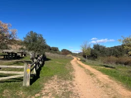
In Ajofrin, I treated myself to a freshly squeezed orange juice in a bar and a stamp from the town hall (by the way, the staff in the town halls were always very friendly to me). Then I bought a bottle of water from a small supermarket and off I went into the fields. The ground was a firm gravel path with only a few small stones, the sun was shining on my back and there was hardly a cloud in the sky. I made good progress and actually found the small ermita (closed) and the fountain next to a picnic area.

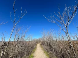
The path was deserted, no cyclists, no farmers, just me on my last stage. It was perfect! Olive trees alternated again and again with harvested and dug up fields. And not a noisy road in sight for miles. Heavenly! Then suddenly an arrow to the right, while Buen Camino wanted to send me straight ahead. After all the events of the last few days, I decided to ignore the app and trust the yellow arrow instead. The route now continued slightly downhill through the fields, with Cobisa, the last town on the way to Toledo, already visible on the horizon.

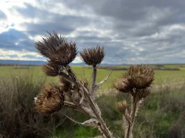
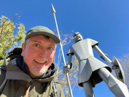
I took another break and sat down in a thistle. Ouch! The path was now heavily rutted by rain and agricultural vehicles, so I continued walking at quite an angle. But the sun and the prospect of lunch in Cobisa kept my spirits high. I reached the first houses in Cobisa around 1pm and was soon in the centre of the village. There I took a picture with a tin statue of Don Quixote, got another stamp from the town hall and looked for an open bar.

There were only bocadillos, but they were warm. I opted for “lomo con tomate” and chewed my frugal meal with relish. Looking at the map, I realised that I only had a single-digit number of kilometres to go and was well on time. The route was now on quiet tarmac roads out of Cobisa and soon crossed a motorway. I would not see my old friend, the N-401, again. It was now slightly hilly and downhill.

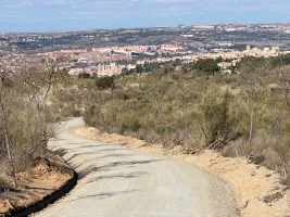
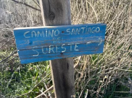
Once again I walked through olive groves and cultivated land, but now individual farms and villas kept appearing to the left and right of the path. And I saw a signpost for the Camino Sureste for the first time! Since Cobisa, I had not only been walking on the Manchego, but also on the Sureste (and probably Levante too?), which was also approaching Toledo from the south. It was now a really brisk descent and the kilometres just flew by.

The road was now tarmac and I occasionally came across cars and motorbikes. I remembered the old rule of always walking on the left-hand side of oncoming traffic, unless there was a left-hand bend ahead. There were a lot of left turns, so I always ran in the centre and then switched to the left or right depending on which direction a car was coming from.

IMG_6674.webp

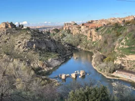
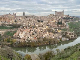
Toledo, which I had in view at the beginning of the slope, had disappeared again some time ago. After a hairpin bend, however, I had my first sweeping view of the dramatic location of the capital of Castilla-La Mancha. Surrounded by the River Tagus, the old town lies on a plateau. I was already on the ring road on the opposite bank and walked to a mirador with benches to take a few pictures.

I had already seen the turn-off to my hotel, so I had to walk back a little, then the last kilometre was quite a climb. I like to treat myself to a special reward at the end of a Camino. In this case, an overnight stay in the Parador, which is located directly opposite the old town on a hill and offers fantastic views.

I arrived there at 3.40pm and was given a room with a view of the swimming pool, which is closed in winter, and at least a side view of Toledo. I had stayed at this hotel 14 years ago but could hardly remember anything about it. Tomorrow I still have some time to visit the cathedral and run a few important errands before my flight home from Madrid in the evening.

To summarise the last day: a flat and quiet stage without any difficulties. For the first time since the first stage, there were two refreshment stops along the way. And I loved that I met a pilgrim after all. I will now let my impressions sink in a little and publish an overall summary of the Camino Manchego later. Thank you very much for all the motivating feedback during this week.

To be continued...
IMG_6561.webpIMG_6566.webpIMG_6574.webpIMG_6603.webpIMG_6620.webpIMG_6651.webpIMG_6655.webpIMG_6670.webp
 
Last edited:
I enjoyed reading your blog. I felt like I was walking along with you. Thank you! Enjoy your well-earned stay at the Parador and those delicious egg tarts.
@Caminogoat: Thank you very much. That means a lot to me. And that's exactly what I like about some other blogs. That you don't just find out the technical and infrastructure details, but can also read how the pilgrim felt. And if there's a bit of humour thrown in, all the better. My role model here is @Magwood, who is able to write a fantastic daily blog for 6 to 7 weeks.
 
The one from Galicia (the round) and the one from Castilla & Leon. Individually numbered and made by the same people that make the ones you see on your walk.
Thanks so much for your daily postings. They were fun, informative and very nice to read. Please do so again while you are on one of your future travels.

Best regards! 🍀
 
Thanks so much for your daily postings. They were fun, informative and very nice to read. Please do so again while you are on one of your future travels.
@RobinK*: Thank you very much. When I hiked my first casinos, I was mostly concerned with survival and couldn't have imagined a live journal. Then I once wrote a detailed report afterwards about Via Serrana and it took me a very long time. I have now found a system that works, at least for short caminos. I don't know if I could manage to summarise every day like this for a four-week or even longer walk. But I would try!
 
Conclusion of my Camino Manchego

IMG_6017.webp


I decided in favour of this Camino at very short notice, having actually wanted to walk the Camino del Sur (where it would have been much warmer). I was expecting meseta-like endless deserted expanses. After all, Castilla-La Mancha is the size of Czechia, but only has 2 million inhabitants. And I wanted to get a feel for Don Quixote, who kept popping up in one form or another along the entire route. Unfortunately, I have not yet read the masterpiece of Spanish literary history. Taking it with me on the Camino as a tactile book wouldn't be a good idea either – after all, it has more than 1,000 pages.

My expectations were exceeded! There were definitely long, flat and somewhat monotonous stretches, but there was also plenty of variety. The wetlands at the beginning, the crossing of the Montes de Toledo with beautiful views, hiking on old cattle tracks and along deserted-looking country roads, the occasional windmill and small towns with friendly people. Yes, the N-401 runs quite close to the Camino from time to time, but they have clearly made an effort to avoid walking on the road for the most part. Walking next to or on the road didn't bother me – unlike on the Via Augusta, where you walk more than a third of the way right next to motorways, busy railway tracks or an artificial canal with dog cadavers floating in it. I like remote caminos that give me the feeling of discovering something new. And I like challenges, of which there were a few, mostly because of my Buen Camino app, which was imprecise in parts.

There are no pilgrim albergues on the Camino Manchego, but there are small hotels and guesthouses in all the stage towns, but in December the choice was very limited, I couldn't book everything online and in one case (Malagon) I had to call in advance. The Camino is therefore naturally more expensive than a Camino with a good pilgrim infrastructure. I walked the Camino Manchego in 5 days, but it is also possible to do it in four, but then you have three consecutive stages of considerably more than 30 kilometres. In winter, with less than 10 hours of daylight, this can be difficult. I only just managed the 35 kilometres from Malagon to Urda by sunset.

IMG_6764.webp

Toledo as a destination is nothing short of spectacular; apart from Santiago, I can't remember ever having seen such a fantastic panorama at the end of a Camino. However, it can be a shock to suddenly encounter hordes of tourists after days of solitude. Incidentally, entry to the cathedral (the final destination of the Camino Manchego), which is well worth seeing, is no longer free as it used to be; even pilgrims now have to pay 12 euros. However, there is a loophole. There is a special free entrance on the north side for people who want to pray. Separated from the rest of the cathedral by a grille, you then have access to a side chapel and the opportunity to light candles. And you get an impression of the magnificent interior of the cathedral.

I can recommend this Camino to pilgrims who like to walk alone, already have some Camino experience and at least a basic knowledge of Spanish. I only heard English once (when I was walking past a bar in Malagon, two teenagers made fun of my olive green pilgrim outfit. A young woman then said in English that I shouldn't listen to these immature idiots and told me where I could find a nice restaurant for dinner).

Although it didn't look like it at first I was happy with the weather in December. I was expecting temperatures of 10 to 15 degrees, but due to a drop in temperature directly after my arrival in Ciudad Real, I ended up walking in temperatures between zero degrees in the morning and a maximum of 10 degrees in the afternoon, sometimes with wind. It was vital that I bought a pair of long sports trousers to wear underneath at the Decathlon in Ciudad Real. My Camino in December was bearable because the sun shone throughout. I only froze at the end in Toledo, when the sky was covered in thick cloud.

I really want to come back and see more of central Spain. The Camino Sureste (Alicante – Zamora), the Camino de San Juan de la Cruz (Granada – Ciudad Real) and the Camino Complutense (Alcala de Henares – Segovia) seem interesting to me. However, I probably won't have time again until late summer 2025 and will then probably look around in the north, as my absolute favourite region in Spain is Asturias. Thank you very much for the friendly and motivating comments, I really enjoyed reporting on my winter Camino here.

IMG_6342.webp
 
Last edited:
3rd Edition. Vital content training & pack guides avoid common mistakes, bed bugs etc

❓How to ask a question

How to post a new question on the Camino Forum.

Featured threads

❓How to ask a question

How to post a new question on the Camino Forum.

Forum Rules

Forum Rules

Camino Updates on YouTube

Camino Conversations

Most downloaded Resources

Featured threads

This site is run by Ivar at

in Santiago de Compostela.
This site participates in the Amazon Affiliate program, designed to provide a means for Ivar to earn fees by linking to Amazon
Official Camino Passport (Credential) | 2024 Camino Guides
Back
Top