• ⚠️ Emergency contact in Spain - Dial 112 and AlertCops app. More on this here.
  • Remove ads on the forum by becoming a donating member. More here.

Search 74,075 Camino Questions

Sheffield James on the Camino Viejo -- LOTS of good info!

Time of past OR future Camino
2013, 2014, 2015, 2016, 2017,2018, (2019)
Hi, I’m approaching Puente la Reine on the Aragonés + my wish is to continue to SdC without going the Francés route. I am aware there is an old route through the mountains that starts in Pamplona. Can anyone: i) confirm I am correct in this belief; ii) give me an indication of the main towns and villages along the early sections; and iii) offer an opinion about the likelihood of waymarking (GR or fleches).


My need is imminent, so any speedy info that can help me decide the feasibility of this venture will be gratefully received.

I hope to buy a map of the area when the shops open in Pamplona on Monday morning.

Thanks, James.
 
€2,-/day will present your project to thousands of visitors each day. All interested in the Camino de Santiago.
James, yes, you're right, and it's not the Baztanes, but the Viejo.
I can help a little maybe, because it's on my radar - but unfortunately not with specifics.
But here are some links that may be useful:
http://xacopedia.com/Viejo_Camino_de_Santiago
http://elreynodelospalabros.blogspot.nl/

I had a bunch of bookmarks to posts here on the forum but they vanished in the 'upgrade.':mad:
Hang on, I'll have a look and post anything I find.

Edit: Bingo. Here it is: https://www.caminodesantiago.me/community/threads/viejo-camino-de-santiago.7585/#post-138545
and:
https://docs.google.com/file/d/0B8FAqCOf35zAZHYxTzZMaHNhSjg/edit
 
Last edited:
Ideal sleeping bag liner whether we want to add a thermal plus to our bag, or if we want to use it alone to sleep in shelters or hostels. Thanks to its mummy shape, it adapts perfectly to our body.

€46,-
Hey James, I heard of the Camino Viejo, the "Old Way" before. It apparently connects Pamplona to Vitoria and further on Aguilar de Campoo and La Robla. Check out gronze.com for more details. It should allow you to dodge the Frances by opting for Del Norte, de San Salvador and Primitivo. Can't make any predictions about albergues though.. Buen Camino!
 
Get a spanish phone number with Airalo. eSim, so no physical SIM card. Easy to use app to add more funds if needed.
As I have said many a time and here again this Forum never ceases to amaze me. In the space of less than one or two hours a request has not only been answered but detail information provided. Now whilst this camino is not currently on my horizon it does have an interest. So thanks to VN; SY (I trust you are well!!) and our OP for raising the matter. Cheers to all;)
 
Fail to prepare? reduce your risk by buying this book full of practical info.
2nd ed.
Hey James, I heard of the Camino Viejo, the "Old Way" before. It apparently connects Pamplona to Vitoria and further on Aguilar de Campoo and La Robla. Check out gronze.com for more details. It should allow you to dodge the Frances by opting for Del Norte, de San Salvador and Primitivo. Can't make any predictions about albergues though.. Buen Camino!
This may help as its my ‘planning folder’ for this camino. https://www.dropbox.com/sh/mdwd90tntrgra3w/AACcd8AdKw7lG4tT1IIoFwT7a?dl=0
 
Well, to say I’m overwhelmed by the speed, quantity and quality of your responses would be something of an understatement, so I can only offer my sincerest thanks for rallying to the call.

I’m going to study your contributions in detail over dinner tonight in Muruzábel (between Pamplona and Puente la Reina) and I trust you’ll be available to lend further assistance if the materials prompt further questions.

For now, gracias a todos!
James

ps- I found it strange to be the only pilgrim in this 20+ bed albergue on the Francés route tonight. Maybe, the pull is to Puente la Reina after Pamplona, or are the numbers falling...or do the others know something I don’t !?!
 
Puente is Reina is certainly a hotspot to stay in. But don’t worry, you’ll meet plenty of friendly faces again soon enough ;) Let is know what your route will be like!
 
Before the Camino: Your Pocket Guide to Prepare Your Body and Mind for the Camino
I bought a road map today in Pamplona + my first night’s accommodation is booked 2 miles further on from Irurtzun. I’d be more precise but for the fact the map used by the booking site uses the Basque names, whereas my road map doesn’t.

I hope to do some ‘Live from the Camino’ posting over the coming weeks, if only to serve as a case study in why not to undertake a camino without proper planning.
 
The one from Galicia (the round) and the one from Castilla & Leon. Individually numbered and made by the same people that make the ones you see on your walk.
James, yes, you're right, and it's not the Baztanes, but the Viejo.
I can help a little maybe, because it's on my radar - but unfortunately not with specifics.
But here are some links that may be useful:
http://xacopedia.com/Viejo_Camino_de_Santiago
http://elreynodelospalabros.blogspot.nl/

I had a bunch of bookmarks to posts here on the forum but they vanished in the 'upgrade.':mad:
Hang on, I'll have a look and post anything I find.

Edit: Bingo. Here it is: https://www.caminodesantiago.me/community/threads/viejo-camino-de-santiago.7585/#post-138545
and:
https://docs.google.com/file/d/0B8FAqCOf35zAZHYxTzZMaHNhSjg/edit
@VNwalking, you’ve certainly uncovered some gems for me. I’d really like to save the google docs for reading offline, but my iPhone won’t allow me to do this because (I think) it is a pdf file. Do you or any other clever folk on the forum know if/how it can be done?
 
The one from Galicia (the round) and the one from Castilla & Leon. Individually numbered and made by the same people that make the ones you see on your walk.
@SYates got there before me.
For a pdf, if you have Adobe on your phone, it should be openable.
(Oh, wait. You have an Iphone and I don't know if that supports Adobe. You may need a third-party program, and sorry - I'm clueless about that.)
I hope to do some ‘Live from the Camino’ posting over the coming weeks, if only to serve as a case study in why not to undertake a camino without proper planning.
That sounds like lots more planning than many people do, James. May you go with ease, and please do let us know how it goes. And if you drop into one of those camino rabbit holes where everything begins to look or act strange, maybe send a PM to the several people here who have done this!
 
Hi MikeJS, this dropbox info looks very comprehensive, but I must confess I’m still trying to get to grips with it. Am I correct in thinking the information will be of use to me when the Bilbao and Pamplona routes join at some point?
It the accommodation and gps info that covers the route from Bilbao to Ponferrada on the Camino Olvidado. See the routes here - http://www.rayyrosa.com/loscaminos
 
Get a spanish phone number with Airalo. eSim, so no physical SIM card. Easy to use app to add more funds if needed.
Hola, soy Ender.
De momento no esta señalizado el camino Olvidado desde Pamplona y no tengo pensado señalizarlo.
Si lo esta desde Bilbao.
Hace 2 semanas terminé la señalización por Burgos.
El año pasado termine la señalización de toda la parte de León con sus variantes.
Puedo dejaros una pequeña guía que estoy elaborando pero que aún no esta finalizada.
Seguro que os a servir para hacer este precioso camino.

https://drive.google.com/open?id=1WOYKMhxISI9TOBUhuJAhS4uWTob7N161

Esto es de la parte Leonesa.

https://drive.google.com/open?id=1Tgoqwis3kTsT-nsB-75qVqieu5lfzkx4

Desde Boñar hay dos variantes una por el valle que nos lleva a La Robla y otra por la montaña que pasa por Vegacervera, el bosque del faedo, los calderones en piedrasechas, lugares especialmente bonitos.
Recomiendo encarecidamente la variante de Vegacervera.
Un saludo a todos y buen camino
 
Hola, soy Ender.
Hace 2 semanas terminé la señalización por Burgos.
El año pasado termine la señalización de toda la parte de León con sus variantes.
Puedo dejaros una pequeña guía que estoy elaborando pero que aún no esta finalizada.
Seguro que os a servir para hacer este precioso camino.
More likes than there are words for, Ender!!! Muchas, muchas, gracias!
 
@VNwalking, you’ve certainly uncovered some gems for me. I’d really like to save the google docs for reading offline, but my iPhone won’t allow me to do this because (I think) it is a pdf file. Do you or any other clever folk on the forum know if/how it can be done?

I am so glad there are people wanting to walk this beautiful route!

for a bit more info (from 2012) you can take a look here https://www.caminodesantiago.me/community/threads/viejo-camino-de-santiago.7585/post-108731 and here https://www.caminodesantiago.me/community/threads/viejo-camino-de-santiago.7585/post-138545.

if you have problems with downloading pdf files from the forum, send me a pm and we can arrange an email exchange.
 
Last edited:
Give back to the Camino. Join us from Logroño to Burgos May 30 to June 8.
Hi, I’m approaching Puente la Reine on the Aragonés + my wish is to continue to SdC without going the Francés route.

Note that the footbridge crossing the river Ebro (on GR99) into Banos de Sobron has been destroyed sometime in 2016 or 2017. Ask in Miranda de Ebro or in a hostal in Banos if a new bridge has been built. Otherwise, the only alternative is the road along the north bank of the river Ebro.
 
As promised, here is my first report ‘Live from the Camino Viejo’. I know I’ve expressed gratitude for the sage advice and guidance you’ve all given me recently, and I now hope you’ll be similarly forgiving if it seems as if I’ve not taken much of it on board.

I arrived in Pamplona on Sunday last, after completing a journey from Lourdes, along stretches of the Piémont and Arlés routes + the Camino Aragonés. My first task in town was to purchase a road map covering the Camino Viejo towns and villages, and the only one for sale in Caminoteka (?sp) is OK as far as it goes, but is lacking any detail for off-road walking. For info, the map scale is 1:400 000.

My second task was to ask the hospitalero at the Jesus y Maria albergue how I might leave the city in the direction of Vitoria-Gesteiz the following morning. He supplied a town map that showed a quick and easy exit route, which basically involves walking down by the side of the tourist office and Ayuntemiento, following the curve of the river past the “cable” bike-lift, then crossing the Puente Cuatrovientos and straight out of town in the direction of the Berriozer suburb, and Vitoria-Gestiez. The road of town is so straight and straightforward you’d struggle to take a wrong turn.

I looked constantly for possible options to leave the main national road but saw none until the 12km marker post. I have to admit I don’t mind road-walking. I can enjoy the scenery in the distance while making steady progress; the best of both worlds. True, there was some fast moving traffic on the road, but the safety margins were wide and I felt satisfied that my high-vis jacket offered me extra protection against the speeding trucks.
The 12km marker post came close to the exit for a roadside village on the right-side called Salsuzi (?sp). I could see a wide gravel path leading out of the village in the direction I was heading. I took the path and soon after it started to diverge away from the national road whilst still heading in the same general direction. I asked a local if the path continued to Irutzun, my lunchtime destination, and he said it did. He made it clear that the path would soon rise to the right, before a series of minor switchbacks on the other side. When reaching the bottom, he said it was important to ignore the left and right paths and, instead, to take the narrow path directly ahead. It was short and steep, which resulted in me struggling to keep my balance while making the brief ascent. The path to Irutzun was generally fine thereafter, but for the fact I encountered a series of signs blocking access due to ‘works in progress’. The first time coincided with there being an exit to the national road via a corrugated iron tunnel and, fortuitously, it meant I came across a fuel station with a restaurant attached, at which I could take my first stop of the day. At a convenient point, I rejoined the path and circumnavigated another diversion due to a damaged viaduct I was meant to cross. The third and final obstacle appeared just outside Irutzun, where I think the works were being done to upgrade the path itself. So, a good deal of road-walking in a beautiful landscape in the early part of the day, with the opportunity to get off the asphalt surface more and more as the morning turned to early afternoon.
Irutzun was a good place to stop for lunch. It sits at the opening of a wide valley flanked by high sierras. On a beautiful sunny day that it was, the first impressions were quite breathtaking. The town was clearly a Basque town, as evidenced by an almost complete absence of Castilian Spanish on shop fronts and signage.

I had reserved a bed in a Casa rural (Casa Irigoien) in a place called Heriberri / Villanueva de Arakil. It was a pretty random choice beyond me thinking Irutzun would be too short a distance for me on Day 1.

After lunch, I followed the national road to Vitoria-Gestiez until I arrived at a village called Etxarren. I could have continued the 6-8kms to my destination, but I saw a sign for Hiriberri that looked as if it would take me on a back-route, which would be a more agreeable finish to the day than simply continuing further on the asphalt. What a disaster!! Initially, I crossed the railway track and the river, ending up at a lovely, old chapel dedicated to our good friend Santiago. However, the only way to get to Heriberri / Villanueva de Arakil was to follow a GR route up the mountainside to then drop down into the village (a bit like climbing the roof of the house and entering via the chimney rather than walking up the path and through the front door!). I got awfully lost several times, and at one point I took a fateful decision that led me on a mountain road almost all the way back to Irurtzun! I got to my end of day destination at 7.45pm, almost 3hours longer than it should have taken.

Today (Tuesday) was a cool, misty day with very little of yesterday’s beautiful scenery in evidence. All the walking was done on the road, beginning with quite pleasant secondary and tertiary roads, but increasingly it involved the national road (NA 2410) which weaved alongside the Autovia. I made little effort to seek alternative routes, partly because of yesterday’s fiasco, partly due to the drabness of the day and partly because I think the great wilderness awaits me after leaving the Pamplona to Vitoria-Gesteiz transport corridor.

I ended up this evening at a truck-stop at Olaza /Olazagutia, 2kms from the biggish-looking town of Altsasu-Alsasua. It’s not The Savoy, but it has comfortable rooms and on-site food and drink options. Unfortunately, my phone app says I’m 45kms from my next ‘albergue’ accommodation booked at the private albergue nr the cathedral in Vitoria-Gasteiz, which indicates I have a long and punishing day ahead of me. An appropriate time to sign-off for the evening, methinks!


n.b. As you can see, I’ve forgotten how to make this an official ‘Live from the Camino’ report. Will someone please remind me? Thanks!
 
Does anyone have a view about whether Pobes or La Puebla de Arganzón is the end of day destination on the Camino Viejo after leaving Vitoria-Gasteiz? I’ve seen both mentioned, but don’t know which is more authentic. ¡Gracias!
 
...and ship it to Santiago for storage. You pick it up once in Santiago. Service offered by Casa Ivar (we use DHL for transportation).
thank for a detailed description of your adventures on camino viejo, james! I see the old GR21 to irurtzun is still somewhat functioning, baring the tunnel and the viaduct.
I loved staying in the casa rural in hirriberi.

I am sorry you had to stick to the big roads so much. I guess the pdf files still don't work for you. :(
I can post further description here if that will help you? for after miranda de ebro, perhaps?

Does anyone have a view about whether Pobes or La Puebla de Arganzón is the end of day destination on the Camino Viejo after leaving Vitoria-Gasteiz? I’ve seen both mentioned, but don’t know which is more authentic. ¡Gracias!

from salvatierra onwards you should be on a well-waymarked ruta del tunel / camino vasco interior which is off main roads and leads to puebla de arganzon with an albergue.

after puebla, I would advise you to follow ruta del tunel to miranda de ebro, taking care not to go left after estavillo in the direction of santo domingo de la calzada. after that, the route now approaches miranda from the east via some dolmens and passes by the albergue juvenil. call ahead as they have two two-week periods of closure per year. they have a microwave with plates and cutlery but no stove, if you are inclined to cook.

and don't forget to enquire about that footbridge across river ebro into banos de sobron for the next day or you will have to backtrack all the way to larrazubi.

my wikiloc tracks from 2012. note that I don't stick reverently to waymarked routes if there is something interesting just over there. I also happily change from one to another, if I feel so inclined. they will get you there, though.

miranda de ebro - banos de sobron (the broken footbridge is here!)
https://www.wikiloc.com/hiking-trails/camino2012-122-miranda-de-ebro-banos-de-sobron-21019390

banos de sobron - quintana de martin galindez
https://www.wikiloc.com/hiking-trai...s-de-sobron-quintana-martin-galindez-21020131
has an albergue.

quintana de martin galindez - trespaderne
https://www.wikiloc.com/hiking-trails/camino2012-124-quintana-martin-galindez-trespaderne-21024273
frias is spectacular, sleep here if you can.

trespaderne - quintana de valdevieso
https://www.wikiloc.com/hiking-trails/camino2012-125-trespaderne-quintana-de-valdevieso-21102426
has two albergues, one juvenil usually filled with groups and one private. insist on a dorm room (they wanted to sell me the most expensive double first).

quintana de valdevieso - pesquera del ebro
https://www.wikiloc.com/hiking-trai...tana-de-valdevieso-pesquera-del-ebro-21103048
I ditched GR 99 del ebro here and short-cutted on a beautiful old stone road directly to pesquera to join the ebro again.

pesquera del ebro - orbaneja del castillo
https://www.wikiloc.com/hiking-trai...quera-del-ebro-orbaneja-del-castillo-21433123
spectacular day. very nice casa rural abuelo with a kitchen in a spectacular setting.

orbaneja del castillo - polientes
https://www.wikiloc.com/hiking-trails/camino2012-128-orbaneja-del-castillo-polientes-21434689

polientes - villanueva de la nia
https://www.wikiloc.com/hiking-trails/camino2012-129-polientes-villanueva-de-la-nia-21435429

villanueva de la nia - aguilar de campoo
https://www.wikiloc.com/hiking-trails/camino2012-130-villanueva-de-la-nia-aguilar-de-campoo-21436186
a surprisingly straightforward route from the ebro to aguilar, but with a dangerous crossing of a major road.

after that, you are on camino olvidado which should be well waymarked.
 
Last edited:
Buen Camino, James it sounds like quite the adventure!
And those wikiloc links are another wonderful gift - thank you, Caminka! Bookmarked.

Only one (sorry to be pedantic:oops:) quibble, but to avoid confusion:
ruta del tunel / camino de baztan / vasco interior
The Baztan is roughly parallel to the VI, but well to the East; it starts in Bayonne and ends in Pamplona.
 
As promised, here is my first report ‘Live from the Camino Viejo’. I know I’ve expressed gratitude for the sage advice and guidance you’ve all given me recently, and I now hope you’ll be similarly forgiving if it seems as if I’ve not taken much of it on board.

I arrived in Pamplona on Sunday last, after completing a journey from Lourdes, along stretches of the Piémont and Arlés routes + the Camino Aragonés. My first task in town was to purchase a road map covering the Camino Viejo towns and villages, and the only one for sale in Caminoteka (?sp) is OK as far as it goes, but is lacking any detail for off-road walking. For info, the map scale is 1:400 000.

My second task was to ask the hospitalero at the Jesus y Maria albergue how I might leave the city in the direction of Vitoria-Gesteiz the following morning. He supplied a town map that showed a quick and easy exit route, which basically involves walking down by the side of the tourist office and Ayuntemiento, following the curve of the river past the “cable” bike-lift, then crossing the Puente Cuatrovientos and straight out of town in the direction of the Berriozer suburb, and Vitoria-Gestiez. The road of town is so straight and straightforward you’d struggle to take a wrong turn.

I looked constantly for possible options to leave the main national road but saw none until the 12km marker post. I have to admit I don’t mind road-walking. I can enjoy the scenery in the distance while making steady progress; the best of both worlds. True, there was some fast moving traffic on the road, but the safety margins were wide and I felt satisfied that my high-vis jacket offered me extra protection against the speeding trucks.
The 12km marker post came close to the exit for a roadside village on the right-side called Salsuzi (?sp). I could see a wide gravel path leading out of the village in the direction I was heading. I took the path and soon after it started to diverge away from the national road whilst still heading in the same general direction. I asked a local if the path continued to Irutzun, my lunchtime destination, and he said it did. He made it clear that the path would soon rise to the right, before a series of minor switchbacks on the other side. When reaching the bottom, he said it was important to ignore the left and right paths and, instead, to take the narrow path directly ahead. It was short and steep, which resulted in me struggling to keep my balance while making the brief ascent. The path to Irutzun was generally fine thereafter, but for the fact I encountered a series of signs blocking access due to ‘works in progress’. The first time coincided with there being an exit to the national road via a corrugated iron tunnel and, fortuitously, it meant I came across a fuel station with a restaurant attached, at which I could take my first stop of the day. At a convenient point, I rejoined the path and circumnavigated another diversion due to a damaged viaduct I was meant to cross. The third and final obstacle appeared just outside Irutzun, where I think the works were being done to upgrade the path itself. So, a good deal of road-walking in a beautiful landscape in the early part of the day, with the opportunity to get off the asphalt surface more and more as the morning turned to early afternoon.
Irutzun was a good place to stop for lunch. It sits at the opening of a wide valley flanked by high sierras. On a beautiful sunny day that it was, the first impressions were quite breathtaking. The town was clearly a Basque town, as evidenced by an almost complete absence of Castilian Spanish on shop fronts and signage.

I had reserved a bed in a Casa rural (Casa Irigoien) in a place called Heriberri / Villanueva de Arakil. It was a pretty random choice beyond me thinking Irutzun would be too short a distance for me on Day 1.

After lunch, I followed the national road to Vitoria-Gestiez until I arrived at a village called Etxarren. I could have continued the 6-8kms to my destination, but I saw a sign for Hiriberri that looked as if it would take me on a back-route, which would be a more agreeable finish to the day than simply continuing further on the asphalt. What a disaster!! Initially, I crossed the railway track and the river, ending up at a lovely, old chapel dedicated to our good friend Santiago. However, the only way to get to Heriberri / Villanueva de Arakil was to follow a GR route up the mountainside to then drop down into the village (a bit like climbing the roof of the house and entering via the chimney rather than walking up the path and through the front door!). I got awfully lost several times, and at one point I took a fateful decision that led me on a mountain road almost all the way back to Irurtzun! I got to my end of day destination at 7.45pm, almost 3hours longer than it should have taken.

Today (Tuesday) was a cool, misty day with very little of yesterday’s beautiful scenery in evidence. All the walking was done on the road, beginning with quite pleasant secondary and tertiary roads, but increasingly it involved the national road (NA 2410) which weaved alongside the Autovia. I made little effort to seek alternative routes, partly because of yesterday’s fiasco, partly due to the drabness of the day and partly because I think the great wilderness awaits me after leaving the Pamplona to Vitoria-Gesteiz transport corridor.

I ended up this evening at a truck-stop at Olaza /Olazagutia, 2kms from the biggish-looking town of Altsasu-Alsasua. It’s not The Savoy, but it has comfortable rooms and on-site food and drink options. Unfortunately, my phone app says I’m 45kms from my next ‘albergue’ accommodation booked at the private albergue nr the cathedral in Vitoria-Gasteiz, which indicates I have a long and punishing day ahead of me. An appropriate time to sign-off for the evening, methinks!


n.b. As you can see, I’ve forgotten how to make this an official ‘Live from the Camino’ report. Will someone please remind me? Thanks!

You will be forever Santa. What a picture, with your knapsack on your back! I wish I had the freedom to do what you are doing, but it is ok to follow and enjoy from a distance. Buen camino.
 
Before the Camino: Your Pocket Guide to Prepare Your Body and Mind for the Camino
Buen Camino, James it sounds like quite the adventure!
And those wikiloc links are another wonderful gift - thank you, Caminka! Bookmarked.
Only one (sorry to be pedantic:oops:) quibble, but to avoid confusion:
The Baztan is roughly parallel to the VI, but well to the East; it starts in Bayonne and ends in Pamplona.

thanks for the correction, @VNwalking - I edited my post accordingly.
 
My Day 3 (Wed) involved an 06.45 start from the Olazti /Olazagutia truck-stop. A local who passed me in the car park intimated it was about 50kms to Vitoria-Gesteiz, which meant already I had 5kms further to go than I thought I had when I left the hotel 50 metres before. Not the best start to the day!
My plan was simple. I’d walk the national road by the Autovia to Salvatierra / Ugurain, take a break there, then continue walking the same way to my end -of-day destination. It took almost 4hrs at a moderately-fast pace to reach my break-stop at 11am. The only surprise of note was the sudden termination of the two national roads I’d been walking on, although there was an alternative path to follow in both cases. Refreshments could be found at a fuel station mid-way along the route.
Everything changed at Salvatierra / Urgain. The town is on the route of an established camino route from Bayonne (called, variously, the Via Bayonne/The Tunnel Route/ Camino Vasco del Interiór) and has an albergue and official waymarkers to show for it. I would have liked to explore the town a bit, but time was not on my side, so I moved on. As I was leaving town, another local man appeared to think I was a late departer from the municipal albergue - which, incidentally, doesn’t have any external information about horarios, hospitalero contact, etc., - and I think he tried to tell me there would be another albergue 11-12kms further on. He mentioned a place name, but I couldn’t make it out.
Faced with the dilemma of continuing along the highway route, with its known distance, or following the yellow arrows and way-markers along a more meandering and potentially longer path, I did what any good pilgrim would do: I chose the official camino trail.

The afternoon walk between Salvatierra and Vitoria was a real delight. The weather was sunny and the scenery was very pleasing on the eye, especially after so much road-walking in the preceding days. This section is extremely well signposted, with most signs indicating the distance between places. I’d advise pilgrims to make sure they take enough water for the journey as I saw only 1 functioning fuente all afternoon. There is an opportunity, perhaps, to take a slight detour of 1.1kms to the relatively sizeable Algeria-Dulantzi when 15kms from Vitoria-G, should the need arise.

Victoria-Gesteiz surprised me. The first impression was of a Manhattan-like skyline emerging in the far distance, very different to rural northern-Spanish towns and cities familiar to me. I was surprised too how long it would take me to finally arrive in the historic centre, and to my accommodation near to the cathedral. The day’s journey took 11.5 hours to complete and definitely took its toll on my troublesome back.

I had pre-booked a dorm bed in El Albergue de la Catedral on a well known internet booking site. Centrally located, the modern backpacker-style albergue provided clean + comfortable rooms, and shared spaces, at a reasonable price (€18.50). I was tempted to stay a second night to allow time for my back to recover, but equally importantly, I still had to figure out where I’d be heading next. As it turned out, I had an extremely inconsiderate roommate this particular evening, whose behaviour made it easy for me to decide to move on the next day.

My Day 4 destination was La Puebla de la Arganzón, 18kms further down the previously mentioned camino, leading to St Domingo or Burgos. A shorter day would provide more physical recovery time, a bit of sightseeing in the city, the guarantee of a marked route / albergue accommodation for the day, and would also buy me a bit more time to formulate my C. Viejo plan.
 
A great book to listen to while training for the Camino or to relive the experience!
The stage from Vitoria to La Puebla de Arganzón is 18kms, so I had my relaxed morning in the city before heading out of town in the direction of Armentia. I had a map from the albergue to guide me, so it was pretty straightforward. My path took me down a street with several museums and fancy houses, which were well-deserving of a photo or two.

The suburbs end abruptly and with the exception of a few kilometres initially on the road, the stage is first along country paths, then followed by a hillside climb and descent among scrubland and forestry. The signposts are excellent; the fuentes tend to be unmarked or say they’ve not been chlorinated.

La Puebla de Aranzón is a smallish village, but with a couple of bar-restaurants, an ATM, tienda and a Panderia. The albergue is basic, but has almost all the essential bits and pieces. Payment is on a donativo basis.

My intention to use this evening to sort out my Viejo route once-and-for-all was thwarted somewhat by the presence of two other occupants in the property. One was a young Slovenian woman staying an extra day or two to recover from a heel injury, while the second was an American-Catalan who was walking a few days as a break from work. The Slovenian became engrossed in my plan and tried to work out a route for me using my inadequate road map and the Google Maps app, but we were forced to give it up due to a lack of low-level map information. Instead, the three of us ate an ‘all-in’ salad, which had been prepared and served in a washing-up bowl.
 
On Day5 out of Pamplona, I decided I needed just one more day on an established camino, so I walked another 18kms to the city of Miranda de Ebro, where there was sure to be a tourist office to assist me with my Viejo planning.

I’m not sure that I took the correct path out of La Puebla de Argazón in the morning, as I had to cross some railway lines 500ms after leaving the Panaderia in order to reach the carretera. Turning left at the first roundabout, there is a short climb before the path turns into the countryside Not much later, I dropped down under the Autovia in the direction of Armiñon. Soon after, there are two options for Miranda, with one shortly longer than the other. I chose the shorter option + was happy with my choice until the final approach to the city. This route ended in an industrial park, at what appeared to be the far end of the town, with no onward signage.

To get to the pilgrim albergue, I needed to go to the main road, turn left and follow the traffic signs to the Centro Urbano. In 15mins or so, there’s a junction with a sign to the historic centre. Out of nowhere, the yellow arrows re-appear here (maybe linked to the longer of the two alternative routes) and you are quickly directed through a small Cervantes plaza to the albergue. If you cross the river bridge towards the castle, you’ve gone too far.
The albergue is excellent. It has a modern, renovated look and provides WiFi and a washing machine (with detergent) you can use without charge. There is a very attentive hospitalero, who comes once you’ve phoned the telephone number on the front gate. All for the princely sum of €6!!

I spent a chunk of the afternoon at the tourist office. I was given excellent service by the guy on the desk, who searched assiduously a range of brochures and the internet to plot a walking route - from Miranda to Aguilar de Campo - as close as possible to the general direction I’d outlined to him (from forum contributions). The only thing he struggled with was lists of accommodation options along the route. That would be my job!
So, tomorrow (Saturday) I’ll be striking out on the next phase of the Camino Viejo. Given the fact most of it will be travelled on roads rather than country lanes and paths (having no detailed maps, an aversion to tech apps, etc), perhaps it should be known as the Camino Viejo Asfaltado!!
 
thank for a detailed description of your adventures on camino viejo, james! I see the old GR21 to irurtzun is still somewhat functioning, baring the tunnel and the viaduct.
I loved staying in the casa rural in hirriberi.

I am sorry you had to stick to the big roads so much. I guess the pdf files still don't work for you. :(
I can post further description here if that will help you? for after miranda de ebro, perhaps?


from salvatierra onwards you should be on a well-waymarked ruta del tunel / camino vasco interior which is off main roads and leads to puebla de arganzon with an albergue.

after puebla, I would advise you to follow ruta del tunel to miranda de ebro, taking care not to go left after estavillo in the direction of santo domingo de la calzada. after that, the route now approaches miranda from the east via some dolmens and passes by the albergue juvenil. call ahead as they have two two-week periods of closure per year. they have a microwave with plates and cutlery but no stove, if you are inclined to cook.

and don't forget to enquire about that footbridge across river ebro into banos de sobron for the next day or you will have to backtrack all the way to larrazubi.

my wikiloc tracks from 2012. note that I don't stick reverently to waymarked routes if there is something interesting just over there. I also happily change from one to another, if I feel so inclined. they will get you there, though.

miranda de ebro - banos de sobron (the broken footbridge is here!)
https://www.wikiloc.com/hiking-trails/camino2012-122-miranda-de-ebro-banos-de-sobron-21019390

banos de sobron - quintana de martin galindez
https://www.wikiloc.com/hiking-trai...s-de-sobron-quintana-martin-galindez-21020131
has an albergue.

quintana de martin galindez - trespaderne
https://www.wikiloc.com/hiking-trails/camino2012-124-quintana-martin-galindez-trespaderne-21024273
frias is spectacular, sleep here if you can.

trespaderne - quintana de valdevieso
https://www.wikiloc.com/hiking-trails/camino2012-125-trespaderne-quintana-de-valdevieso-21102426
has two albergues, one juvenil usually filled with groups and one private. insist on a dorm room (they wanted to sell me the most expensive double first).

quintana de valdevieso - pesquera del ebro
https://www.wikiloc.com/hiking-trai...tana-de-valdevieso-pesquera-del-ebro-21103048
I ditched GR 99 del ebro here and short-cutted on a beautiful old stone road directly to pesquera to join the ebro again.

pesquera del ebro - orbaneja del castillo
https://www.wikiloc.com/hiking-trai...quera-del-ebro-orbaneja-del-castillo-21433123
spectacular day. very nice casa rural abuelo with a kitchen in a spectacular setting.

orbaneja del castillo - polientes
https://www.wikiloc.com/hiking-trails/camino2012-128-orbaneja-del-castillo-polientes-21434689

polientes - villanueva de la nia
https://www.wikiloc.com/hiking-trails/camino2012-129-polientes-villanueva-de-la-nia-21435429

villanueva de la nia - aguilar de campoo
https://www.wikiloc.com/hiking-trails/camino2012-130-villanueva-de-la-nia-aguilar-de-campoo-21436186
a surprisingly straightforward route from the ebro to aguilar, but with a dangerous crossing of a major road.

after that, you are on camino olvidado which should be well waymarked.

@caminka, I am finding your route details extremely helpful in guiding my own, so thank-you once again. You will be interested to know that the footbridge over the Ebro is still down. The guy in the tourist office told me that the Burgos and Basque authorities still need to come to a shared view about what to do with their shared bridge. He went as far as to show me a YouTube video clip that shows its actual collapse. Have you seen it?
 
The one from Galicia (the round) and the one from Castilla & Leon. Individually numbered and made by the same people that make the ones you see on your walk.
@caminka, I am finding your route details extremely helpful in guiding my own, so thank-you once again.

that makes me really happy :). you can access pdfs now?
I am guessing you are now about to enter canon del ebro?

but just in case - the most tricky part, the climb to aguilar - here in a description:

The shortest way is from VILLANUEVA DE LA NÍA along CA273 past ~10km/2h30 SANTA MARÍA DE VALVERDE (860m; up L is preromanesque +0.2km igl. rupestre s María w/ necrópolis rupestre (Nov-Feb T-Su 9.30-15.30, Mar-Oct T-Su 9.30-14.30+15.30+19.30, w/ Centro de Interpretación €3)), and when spotting a small building ahead to the R of CA273 (it's humilladero Las Ánimas), turn L up a 0.6km/15min a gravel road with a 10t road sign. After a SA stretch bend L then turn R up a well-driven orange dirt track that soon swings L and is joined by a grassy track then a dirt track (from San Martín de Valdelomar). In an intersection turn R up for a good but short climb to a plateau above (915m), go SA in an intersection, join a good dirt track then PP6301 to s Cruz in 3.7km POMAR DE VALDIVIA (963m; s Cruz (worn romanesque portada & corbels)). Continue on PP6301 out of the village, cross río Rupión (925m) and before a R bend turn L to a straight gravel road leading to the main plaza of 2km BÁSCONES DE VALDIVIA (F, 915m; 15C iglesia (portada)). Go L down the main road, pass F, and cross and turn R on very busy N627. Cross arroyo s María and another stream then turn L up a dirt track, immediately passing under electricity lines, leading to a tarmac road at the start of 2km REBOLLEDO DE LA INERA (922m; s Miguel (window)). Cross it for a gravel road that descends to s María in 1.3km RENEDO DE LA INERA (F L past iglesia, 880m; s María (worn steps from rock, necrópolis rupestre)). Immediately fork R then L to a gravel road, it becomes a dirt road, cross a bridge, fork R up a dirt track that then ascends and follows a tranquil valley to PP6201. Turn R and follow it to the start of 3.5km VILLALLANO (F; probably of roman origins, gothic s María el Mayor (romanesque pila)). Veer R down Calle Mayor, at the end pass F, join PP6201 R, cross one branch of río Lucio. After a R curve veer R to an old overgrown tarmac road, at the end a path leads towards a bridge and up to PP6201. Cross río Camesa (858m), go over railway and A67 motorway, SA past an industrial zone (R, HsR Olmos), and when it ends go SA across a roundabout to a bridge with iron railings across río Cuérnago. Go under N611 (F after), past tiny s Andrés (R), across medieval puente de Portazgo over río Pisuerga, through 18C Puerta del Hospital (next to 15C hospital founded by Francisco de Soto), turn L and reach arcaded Plaza España with s Miguel in 4km Aguilar.

You will be interested to know that the footbridge over the Ebro is still down. The guy in the tourist office told me that the Burgos and Basque authorities still need to come to a shared view about what to do with their shared bridge. He went as far as to show me a YouTube video clip that shows its actual collapse. Have you seen it?

I haven't. ... I went to look and found a video of the river all the way up to and even a bit over the footbridge (I am guessing that was the day the bridge went down) and another video of the already collapsed footbridge covered in snow.
 
Day 6 (Sat): Miranda de Ebro - Quintana Martin Galindez (36kms, by road)

I followed the road out of town suggested by the tourist office. I walked towards Fontecha on a road with no safety margins, so I looked constantly for an alternative path I could take. I got to walk approx 3km on GR99 at Fontecha, but then had to make sure I turned right at main junction in the next village to work myself back to the national road. If walking this route, turn left on the A-2122, signposted Sobrón (5) and Trespaderne (32). At the 18km half-way point, close to Sobrón, there is an activity centre that provided the first establishment I’d encountered thus far where I could buy something to eat and drink. Moreover, I was able to purchase a postales of the infamous Sobrón footbridge (pre-collapse). If you’d like it Caminka, it’s yours! Soon after, I got to photograph the bridge myself.
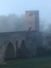
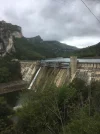
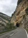
The second half of the day firstly involved walking alongside the Sobrón dam in the shadow of towering cliffs and a handful of short road tunnels, where care had to be taken to be visible to the occasional speeding car. The final approach to my destination was through open countryside.

There is a large albergue on the road into Quintana Martin Galindez, but it was closed. I rang the number on the door (+34 656711857) but got no reply. Thankfully, there was a room in the 16-room Hostal Valle de Tobaline on the main Calle, for which I was charged 30€, including breakfast. The place, which is also a bar-restaurant, was very welcoming + my room even had a full-length bath. As I was leaving before breakfast time, I was given a fruit drink and a couple of packaged cakes to take with me.


Day 7 (Sun): Quintana Martin Galindez - Poza de la Sal (approx 32kms)

This was a day when I diverted from Caminka’s general GR route to visit three tourist jewels of the area, known as the Raices de Castillo (Roots of Castilla). The first, Frias, is as Caminka has reported, a most spectacular place to see. It is reported to be the smallest city in Spain and it sits high on the edge of the valley of Tobalina. I had the extreme good fortune to see it emerge from the early morning mist to reveal its castle ruins, narrow streets, church and panoramic viewing points. It is a really small place, but it certainly packs a big punch!

I crossed a hill and a mountain - using local walkers’ waymarks - to get to the second jewel, Oña. This place is most famous for its monastery and magnificent church, dedicated to San Salvador. There is also the monastery garden to be explored.

I tried to book a bed in the town’s municipal albergue because time had marched on, but sadly it was completo due to a group booking that night. I took the list of accommodation given me by the tourist office, but I still had 8-10kms to walk to jewel #3, Paza de la Sal, and it was now 4.30pm.

I admit now that Paza de la Sal has charm and some interesting castle ruins, but that was not my priority at the end of a long slog to reach it. I needed a bed for the night and I had presumed there’d be a few options in what was clearly a tourist destination. I was wrong! There was just one tourist albergue and one hotel in town, but both were closed. I slept outside that night for only the second time in my 6-year’s walking the caminos. Ironically, it was under a canopy alongside a wall of the hotel where I wished I could have stayed

Day 8 (Mon): Poza de la Sal - Quintana de Valdivieiso (approx 30kms)

A good thing about sleeping outside is your budget looks a little healthier than it would have done otherwise. Another benefit is you get an early start to the next day. After a quick tour of the pueblo I was on my way, which meant trying to return to the route Caminka has documented so well.

I thought I’d aim for Pesquera de Ebro, so plotted a N-W course that would take me towards Dobro, at which point I’d review my options. I travelled through a valley and steep mountain pass, via Hozabejas and Escobados, before reaching the CL-629 highway that connects Burgos and Villercayo.

It was now mid-afternoon, so I stopped for something to drink at a roadside bar at Pesadas de Burgos. As it happens, it was the very first place I could have bought supplies over the past 24hours. While there, I realised that it would be unrealistic to continue on to Pesquera de Ebro, so I decided on the more sensible option of heading slightly north-east to Quintana. My decision was validated further when the bar owner told me about a signposted short-cut 4-5kms along the highway that would reduce my journey-time by an hour or two.

The Caldaza de El Aminé is a remarkably well-preserved Roman road that leads down steeply - and painfully in my case - to the hamlet of El Aminé, and then on to Quintana. The tourist albergue at Quintana is excellent, both in terms of its location in yet another valley, but also the quality of service and decor in a substantially-sized former palace. The fact I was the only guest that night may have had something to do with the attentiveness of the staff, but I think I deserved a bit of pampering after the previous night’s fiasco. I paid €35.50 for a dorm bed, a delicious three course dinner with wine, and a tasty breakfast. Guests can pay for the bed alone, or they can add the meal +/or breakfast options, as they prefer. There is a bar-restaurant in the next village 1km away, too.
 
Day 9 (Tues): Quintana de Valdivieso - Orbanejo del Castillo (approx 35kms)

Today was largely one of major ‘ups’ and ‘downs’. It took 2.5 hours to negotiate eight kms of switchbacks to rise out of the valley, with a gradient of 8-10%. It might have been quicker to retrace my steps via the cobbled Roman road, but my sore feet probably wouldn’t have liked it.

After that, I walked for a few hours along the high mountain plateau (~1000m) before dropping down to the pretty village of Pesquera de Ebro, nestled in another deep valley. On a bright, sunny afternoon, it was very tempting to try to find a room for the night there, but I resolved to carry on the extra 12kms to Orbanejo.

There wasn’t a single road sign for Orbanejo, so I relied heavily on Google Maps GPS to deliver me to my destination. At one point, I questioned the accuracy of the gps as it said I was about 2kms away, yet I could see no sign of any human habitation in the vast wilderness stretching out ahead of me. I was then directed to take a minor track in the middle of nowhere, that led me through scrubland and a deserted village until there I was looking down on Orbanejo, built into one-side of a deep, river gorge. On the opposite side of the gorge was a massive cliff face, with a weather-sculpted ridge top. All three villages mentioned today were memorable in their own way, but this last one had a real Wow! factor when it first came into view.

My accommodation was booked over the internet. I stayed in La Puebla, a modern and comfortable place. I was charged €42 room only. The bars and restaurants in the village were all closed when I arrived, so the proprietor’s son kindly offered to make me a sandwich if I wanted one. It was possible to buy drinks in the bar on-site, too, although it looked as if the bar was not staffed on quieter days.

Postscript: after all I’d read about dolmens along the Viejo route, I saw my first one while passing by Porquera del Butron, en-route to Pesquera. Called Dolmen La Cotorrita, it looked in very impressive condition, especially when the accompanying sign dated it as being constructed 5,500 years ago. Apparently, 15 remains were found in foetal positions along with ceramic artefacts.


Day 10 (Wed): Orbanejo del Castillo - Aguilar de Campoo (51kms)

I wasn’t exactly sure where I’d break my journey today. I was aware Caminka had stopped at Villanueva de la Nia, so I’d review my options a little later on.

It took a while to leave the valley gorge, but gradually the mountains receded and the valley opened into farm country. I had lunch at Polientes at 12.30pm. I liked the place as it seemed much more alive than others I’d walked through lately and there was an attractive bar-hostel that I knew had rooms. Unfortunately, it was far too early in the day to stop walking, so I moved on. The countryside was flat and lush in the spring sunshine.

I reached Villanueva late afternoon and thought now was a good time to find a bed for the night. The bar-keeper directed me to an Alojamiento Rural, but they said they had none. When asked where I might find a room I was told to try Polientes! When I said I’d already walked from there, I was made aware of a Casa Rural 6-8kms further on, in Castrilla de Valdelomar. I arrived at 7.30pm, but was unsuccessful once again. I experienced an unwelcome touch of déjà-vu when I was directed back in the direction of Villanueva by the person with whom I spoke.

I was still 13kms from Aguilar de Campoo, so either I looked for another outdoor sleeping place or I had to bite the bullet and strike out fast and hard for Aguilar. It had gone 10pm when I finally arrived in town in the dark. I saw Hotel Valentin on the booking website, so made my way there. I paid €46 for a room with breakfast. It’s a large hotel adorned with flags and neon signs, close the centre (on Avenida Ronda). It felt like heaven when I entered my room at 22.45.
 
The one from Galicia (the round) and the one from Castilla & Leon. Individually numbered and made by the same people that make the ones you see on your walk.
Day 11 (Thurs): Aguilar de Campoo (2kms max)

I don’t know if staying a second night counts as a rest day, or simply being credited for some of the excessive kms undertaken yesterday, but I think I needed it. The town has a lovely, busy feel to it and plenty of character, plus a castle I couldn’t bring myself to climb up to for a look around. The day was also great for doing very little out of respect for my suffering feet and a still improving back strain.

I booked a hotel room in Cevera de Pisuerga tomorrow evening, so maybe I can try to find an off-road route to enjoy more leisurely.
Thanks for your posts. I am enjoying reading them, while
I will not be following in your footsteps as I am far from having your stamina!
 
you pack some really long days, @Sheffield James!
a second days definitely counts as a rest day, and much appreciated by all the muscles, bones and other organs, I am sure. :)

I am a bit jealous you went through oña! I saw pictures, had a detour planned, but then opted out of it.

oh man, I would love that postacard. :D

you are now definitely on camino olvidado which should be at least adequately waymarked, so that you can reduce main road walking to a minimum.

the albergue in guardo is close to where camino leaves the town, up the hill. you turn left at a roundabout with a little wooden booth which is supposed to be the turismo (was closed in 2012). buy your provisions in the centre.
I couldn't got the albergue on the phone when I was there. these are the phones from their web new site: 979 043 008 || 693 448 184 || 664 495 334.

the friendly couple I stayed at in guardo advised me against sleeping in the cheapest pension/hostal in the centre.

are you thinking of taking the mountain route after boñar? I would be most interested in your comments (for this guide: https://www.caminodesantiago.me/community/threads/guide-to-olvidado.52042/).

buen camino!
 
Ideal sleeping bag liner whether we want to add a thermal plus to our bag, or if we want to use it alone to sleep in shelters or hostels. Thanks to its mummy shape, it adapts perfectly to our body.

€46,-
Hi James, when you enter guardo the albergue is on the other side of town. In the distance you can see a a blue "building" and a smaller red "building. This is approximately in the direction of the albergue. Go down the hill.The Main Street is extremely straight.Follow it up to the other side, then ask for directions. It's easy to find from there. As Caminka said buy your food in the supermarket in the center. It's 12 euros and if you want breakfast it is an extra 5 euros.

In Puente Almuhey within a few hundred yards of entering the village the albergue is together with the Correos and the Town Hall. They are new small buildings set back on the right hand side. The key is in the town hall or in the bar El Duende De Carricuende. The bar is a long way down the Main Street on the right hand side. No price was mentioned. It was a Sunday.
 
Train for your next Camino on California's Santa Catalina Island March 30 to April 2
Day 12 (Fri): Aguilar de Campoo - Cervera de Pisuerga (~31kms)

I couldn’t move but for bumping into pilgrims today. After weeks of solitary walking, I met Xavier, a middle-aged Madrileños, at the big dam on the road out of Aguilar. It was his first day on the camino and he planned to walk to La Robla. Despite the language differences between us, we just began walking together.

At the ~18km mark, we stopped for coffee in Salinas de Pisuerga and met a French and a Spanish duo in the cafe-bar. The Frenchman has been walking 5weeks from his home in Nantes, whereas his Spanish friend and companion had joined him in Bilbao.

Shortly afterward, we met a Dutch couple who had cycled through Portugal to Santiago de Compostela and were now cycling home to The Netherlands. We had an enjoyable short conversation - well, I did because they spoke English - before we caught up again with the other two pilgrims.

I did not allow these social contacts to distract me totally from the fact that the route is now the CAMINO OLVIDADO (Si?), is now marked with the beloved ‘flechas amarillas’, and I now had the prospect of a day of ‘off-road’ walking at long last. I was not disappointed!

The route was quite benign. The early part had a few undulations, but it was mostly quite flat. The snow-capped Picos de Europa mountains in the distance provided excellent photo opportunities, as did the necropolis and Romanesque church of St John the Baptist we passed early on.

Moreover, for me, the rio Pisuerga had now replaced the Ebro - and, even earlier, the Aragonés - as a guide along my route. I’m not sure how long it will last!

When we reached Barcenilla, not that long after Salinas, the arrows appeared to direct us towards the carretera. As we were on a decent track with local way-marking, we continued as we were and entered Cervera via the nearby village of Valdo.

I had booked into the Hostal Pineda on the internet, but there appeared to be lots of other accommodation options in this small town. I paid €30 for my room and breakfast - though a sign says it isn’t served until 9am - and, for the second time in recent days, it had my favourite amenity in the form of a full-length bath. Coincidentally, Xavier had booked a room here, too.

It is unusual for me to reach my end of day destination by mid-afternoon, so I took advantage of the situation by having a tasty €12 ‘Menu del Dia’ at the unfortunately named Meson Gasolina (just past the tourist office on the Calle from the Ayuntamiento into the Plaza Mayor).

I also retraced my steps a mere 800m in the direction of Valdo to visit the impressive Ermitorio Rupestre de San Vicente, which is a cave-like structure in a large boulder, with what looks like a series of burial slots in the rocks around it.
 
you pack some really long days, @Sheffield James!
a second days definitely counts as a rest day, and much appreciated by all the muscles, bones and other organs, I am sure. :)

I am a bit jealous you went through oña! I saw pictures, had a detour planned, but then opted out of it.

oh man, I would love that postacard. :D

you are now definitely on camino olvidado which should be at least adequately waymarked, so that you can reduce main road walking to a minimum.

the albergue in guardo is close to where camino leaves the town, up the hill. you turn left at a roundabout with a little wooden booth which is supposed to be the turismo (was closed in 2012). buy your provisions in the centre.
I couldn't got the albergue on the phone when I was there. these are the phones from their web new site: 979 043 008 || 693 448 184 || 664 495 334.

the friendly couple I stayed at in guardo advised me against sleeping in the cheapest pension/hostal in the centre.

are you thinking of taking the mountain route after boñar? I would be most interested in your comments (for this guide: https://www.caminodesantiago.me/community/threads/guide-to-olvidado.52042/).

buen camino!

@caminka, send me a PM with your address and I’ll post it to you with the greatest of pleasure.

Thanks for the advice re Guardo: noted!

It should be obvious by now that I don’t plan far ahead. If you can give me brief reasons for taking and not taking the mountain route, then I’ll let you know what path I’ll be taking.
 
The 2024 Camino guides will be coming out little by little. Here is a collection of the ones that are out so far.
Hi James, when you enter guardo the albergue is on the other side of town. In the distance you can see a a blue "building" and a smaller red "building. This is approximately in the direction of the albergue. Go down the hill.The Main Street is extremely straight.Follow it up to the other side, then ask for directions. It's easy to find from there. As Caminka said buy your food in the supermarket in the center. It's 12 euros and if you want breakfast it is an extra 5 euros.

In Puente Almuhey within a few hundred yards of entering the village the albergue is together with the Correos and the Town Hall. They are new small buildings set back on the right hand side. The key is in the town hall or in the bar El Duende De Carricuende. The bar is a long way down the Main Street on the right hand side. No price was mentioned. It was a Sunday.

@omicko, advice of this nature is so welcomed. Thanks very much!
 
Hi James, when you enter guardo the albergue is on the other side of town. In the distance you can see a a blue "building" and a smaller red "building. This is approximately in the direction of the albergue. Go down the hill.The Main Street is extremely straight.Follow it up to the other side, then ask for directions. It's easy to find from there. As Caminka said buy your food in the supermarket in the center. It's 12 euros and if you want breakfast it is an extra 5 euros.

In Puente Almuhey within a few hundred yards of entering the village the albergue is together with the Correos and the Town Hall. They are new small buildings set back on the right hand side. The key is in the town hall or in the bar El Duende De Carricuende. The bar is a long way down the Main Street on the right hand side. No price was mentioned. It was a Sunday.

@omicko, I appear to have thanked you in the wrong place, so let me thank-you a second time for your most helpful advice:
 
How great to get home to find that I can pick up with your Olvidado posts right at Aguilar de Campoo. You know, I thought that Bilbao to Aguilar was not the very best of the Olvidado. Lots of asphalt, etc. But from Aguilar on, wow! Have you seen the little guide that Susanna and I wrote up after our 2014 walk? Lots of it may be out of date by now, but I have gotten emails from a couple of people who found it on the Spanish Olvidado web site and said it was helpful. https://www.caminodesantiago.me/community/resources/camino-olvidado-from-bilbao-to-ponferrada.254/

Looking forward to following you! Buen camino, Laurie
 
Perfect memento/gift in a presentation box. Engraving available, 25 character max.
Thank you all. This thread is a gold mine of helpful information - @omicko, you come bearing gifts, on top of what James and @caminka have shared.
And James, your loooooong days are amazing. Buen camino! (May you have more bathtubs in your near future...you'll need a soak after more of those kind of days.)
 
A selection of Camino Jewellery
I am loving your diary. My current Camino is a mix of shorter days. The Norte for a while, Boadilla today which I am sure you will remember from the Pig Dig, then the Canal de Castille to link up with the Camino Madrid to see Oliver inPuente Duero and a visit to Reb and Paddy. You are following a lot of the route in her recent translation The Geat Walk Westward. Ultreya
 
I am loving your diary. My current Camino is a mix of shorter days. The Norte for a while, Boadilla today which I am sure you will remember from the Pig Dig, then the Canal de Castille to link up with the Camino Madrid to see Oliver inPuente Duero and a visit to Reb and Paddy. You are following a lot of the route in her recent translation The Geat Walk Westward. Ultreya
That is what I thought, too, about El Gran Caminante's route. Reminds me to finish it...
 
@omicko, I appear to have thanked you in the wrong place, so let me thank-you a second time for your most helpful advice:
James, I don't know where you are now but here is now some brief information I think will help you. In Bonar there is NO Albergue Juvenil.2 hotels 25 Euros including breakfast.
In Vegacervera there is Camping El Chalten.10 Euros plus 2 Euros for Breakfast. Recommended.Call Pablo on 686045743.Bars and a Tienda
In Buiza there is an albergue 5 or 6Euros. One bar probably only open in the afternoon.Call 987597031
In La Magdalena- Call Guadalupe on 685920895.Albergue for Peregrinos. It's being reformed.Tiendas and Bars. There is a Churreria opens at 6:30 in the morning. ( Probably 7 is more accurate).
 
Last edited:
The one from Galicia (the round) and the one from Castilla & Leon. Individually numbered and made by the same people that make the ones you see on your walk.
In Riello there are Bars.
In Vegarienza there is in Albergue para Peregrinos.Donativo.Call Estella on 680799927. One Bar with basic food.
In Fasgar there is a Albergue para Peregrinos.8 Euros. One Bar .NO FOOD.
Call Rosi on 607027949
 
In Riello there are Bars.
In Vegarienza there is in Albergue para Peregrinos.Donativo.Call Estella on 680799927. One Bar with basic food.
In Fasgar there is a Albergue para Peregrinos.8 Euros. One Bar .NO FOOD.
Call Rosi on 607027949
 
Day 13 (Sat): Cervera de Pisuerga- Guardo (~37kms)

Xavier and I breakfasted at 8am before setting out on the carretera - past the Valdo junction - for the day’s walk. After a km or two the yellow arrows signalled an exit to the right, and shortly after we had to decide whether to take the steep track on the left or the easier one to the right. We should have chosen the steep one! With a bit of head-scratching and scrambling up a shale bank, we returned to the marked route that took us through an old mining site, with a few ruins still there to be seen.

The track took us through some woodland and a bit more guesswork was required as the yellow arrows were not always as visible or obvious as they’d been the previous day. We climbed for a while before emerging into open, flat farmland, and thankful that we weren’t expected to negotiate the sombre-grey, largely tree-bereft mountains immediately to our right.

It was close to mid-day when we started to pass through a series of villages that might provide an opportunity for a coffee-break. Unfortunately, either they had no bar or they weren’t yet open. The sections of track and carretera were becoming increasingly long and straight, which, in the hot sun, served to exacerbate the feelings of caffeine deprivation. The only saving grace was that the mid-afternoon slog would have felt even more tiring and tedious but for the dramatic sight of the mountain range dominating the horizon ahead.

We had our first proper break when we’d almost given up all hope. The small village of Tarilonte had a bar serving coffee and warm nibbles. The ‘pork scratchings’ were to die for, which is probably what would have happened had I taken more than the two I did.

When leaving the bar, Xavier reported painful knees and he decided to find somewhere to stay before we’d reach our planned end-of-day destination. If anyone else thinks this 37kms stage too excessive, then there are rooms to be had in Santibañez de la Peña (@€25.50). After sitting-out a heavy, unexpected cloudburst in the town, I completed the final 10kms to Guardo along country tracks under a clear blue sky.

As others have reported, Guardo has a very long main thoroughfare. There were no arrows or markers I could see in the town, but there were street signs indicating how to get to its albergue. One sign directs you to the right and leads to a road bridge over the river. There’s a bar and a supermarket - and a church with a Saturday evening vigil Mass - before you cross the bridge and you then follow the road as it bends to the left, go under a little bridge, and then up a hill to a rail bridge and the final albergue sign directing you to the left (with the tourist office on the right). Keep following the road round to the left and the albergue is at the end of the street.

I was the only person staying at the albergue that night. There was a manager on site, but had he not been there when I arrived I don’t know if calling the telephone numbers on the front door (664495334/693448184) would be enough for him to come and let me in. The private albergue is in a residential area 15 minutes from the centre, so as a convenience I paid €5 for breakfast on top of the €12 bed rate.

I was relieved to see the town’s first camino marker (for me) directly outside the albergue, which saved me the headache of trying to figure out how to leave Guardo the following morning. I slept well.

Day 14 (Sun): Guardo - Puente Almuhey (11.9kms or 30.9kms)

Ordinarily, I’d have walked past this town as part of a ~32kms stage from Guardo to Cistierna. The fact I didn’t was for two good reasons: first, I half-agreed to stay here to enable Xavier to catch-up with me; and secondly, I might still get to see “camino busybody” Rebekah and husband Paddy, who live an hour away in Peaceable Kingdom, Moratinos.

I completed the 11.9kms route option by noon. To have chosen the longer route may have been more interesting, but would take up so much of the day that rendezvousing with R&P would have been impractical. That said, when I followed the first arrows of the day I had no idea on which of the two alternatives they would take me.

In terms of my walk, after a brief climb through some woodland I ended up on the carretera. I think this was the official route as there were yellow arrows on the crash barriers. The road rose gradually, affording a pleasant view of the forested hillsides around me. At La Espina, the route took me through the village but then back to the carretera. Some time later, there were multiple arrows directing me to a woodland track. The track was blocked by barbed wire, so I decided to keep to the road. Shortly after, more arrows directed me to cross a cattle grid and follow the road on a slightly elevated position. I thought this must be a sanctioned path and within minutes I’d reached Cegoñal, the second of just two villages on the route. However, in order to enter the village I needed to scramble under an electrified fence that blocked the track exit. The last few kms involved an woodland path and an ever so slightly awkward drop-down into the town.

Rebekah and Paddy met me in Puente Almuhey and took me in the car back to Guardo where they knew of a good Pizzeria, at which we could have lunch. A walk that had taken me 3hours to complete on foot took a mere 20 minutes in reverse! It was great to see them to catch up on their news, and both appeared very well.

They brought me back to Puente Almuhey and helped me to identify the bar holding the key for the albergue, which is at the near end of the town, next to the Ayuntamiento. They made a quick inspection of the facility and seemed to approve of what they saw. I was particularly impressed with the zero charge for the night’s accommodation.

I met Xavier in the early evening. He’d decided to stay at the Hotel Rio Cea for €30, including breakfast. He said he was happy with the place. Over drinks, he told me he had taken the blocked route after La Espina, but regretted it due to the fact it was very muddy in parts and the initial arrow sent him on a circuitous trek that eventually returned him close to his original starting point at the barbed wire fence.

All in all, a very relaxing and social day, with a bit of morning exercise thrown in for good measure!
 
...and ship it to Santiago for storage. You pick it up once in Santiago. Service offered by Casa Ivar (we use DHL for transportation).
How great to get home to find that I can pick up with your Olvidado posts right at Aguilar de Campoo. You know, I thought that Bilbao to Aguilar was not the very best of the Olvidado. Lots of asphalt, etc. But from Aguilar on, wow! Have you seen the little guide that Susanna and I wrote up after our 2014 walk? Lots of it may be out of date by now, but I have gotten emails from a couple of people who found it on the Spanish Olvidado web site and said it was helpful. https://www.caminodesantiago.me/community/resources/camino-olvidado-from-bilbao-to-ponferrada.254/

Looking forward to following you! Buen camino, Laurie

I’m not sure what I have and haven’t seen to be quite honest @peregrina2000, but I’ll check the link included in your post. Thanks v much.
 
I am loving your diary. My current Camino is a mix of shorter days. The Norte for a while, Boadilla today which I am sure you will remember from the Pig Dig, then the Canal de Castille to link up with the Camino Madrid to see Oliver inPuente Duero and a visit to Reb and Paddy. You are following a lot of the route in her recent translation The Geat Walk Westward. Ultreya

Great to hear from you @biarritzdon! Your adventure sounds very interesting too, and I especially love the Canal de Castillo. As you may have noticed in my most recent post, I got to enjoy a lovely afternoon with Rebekah and Paddy today. You’ve also given me an added incentive to read The Great Walk Westward, which a fellow forum member kindly gave me. Buen Camino!
 
James, I don't know where you are now but here is now some brief information I think will help you. In Bonar that is no Albergue Juvenil.2 hotels 25 Euros including breakfast.
In Vegacervera there is Camping El Chalten.10 Euros plus 2 Euros for Breakfast. Recommended.Call Pablo on 686045743.Bars and a Tienda
In Buiza there is an albergue 5 or 6Euros. One bar probably only open in the afternoon.Call 987597031
In La Magdalena- Call Guadalupe on 685920895.Albergue for Peregrinos. It's being reformed.Tiendas and Bars. There is a Churreria opens at 6:30 in the morning. ( Probably 7 is more accurate).
Noted and much appreciated, @omicko!
 
Before the Camino: Your Pocket Guide to Prepare Your Body and Mind for the Camino
In Riello there are Bars.
In Vegarienza there is in Albergue para Peregrinos.Donativo.Call Estella on 680799927. One Bar with basic food.
In Fasgar there is a Albergue para Peregrinos.8 Euros. One Bar .NO FOOD.
Call Rosi on 607027949
Ditto! When did you walk the route?
 
James, there is now a municipal thermal spa in Guardo, and there´s a fine pizzeria in town, too, run by genuine Italians! Send me a ping when you get close, I will try to get up there and we can have a bite and a natter!
Great to see you and Paddy, today! You’re mentioned in dispatches, ie., in my latest post. Hasta September!!
 
Hiya Caminka, I did the Mountain Route from Bonar. I started in Bilbao. When I return home and get some time I will update the Forum with my information.Cheers Mick.

that would be most appreciated, @omicko, thank you!

It should be obvious by now that I don’t plan far ahead. If you can give me brief reasons for taking and not taking the mountain route, then I’ll let you know what path I’ll be taking.

the road route is, well, the road route. lots of main road walking beside the side roads. few off road sections. this is in grey in the guide for the olvidado for which I posted the link above. also laurie's guide from 2014 follows this route.

I haven't (yet) walked the mountain route, but I have seen the pictures and read the posts of the folks that have walked it. it looks spectacular! there are still road sections, but no main road walking, if I remember correctly from writing the guide. there are albergues for each day. you probably need to alert them you are coming. I believe it takes a day (?) longer then the road route.
 
3rd Edition. Vital content training & pack guides avoid common mistakes, bed bugs etc
@caminka, send me a PM with your address and I’ll post it to you with the greatest of pleasure.

Thanks for the advice re Guardo: noted!

It should be obvious by now that I don’t plan far ahead. If you can give me brief reasons for taking and not taking the mountain route, then I’ll let you know what path I’ll be taking.
James the Mountain Route is fantastic ,in my opinion not easy, but the effort is well worth the views.Suerte,Mick.
 
Day 15 (Mon): Puente Almuhey- Cistierna (21kms)

The first hour of the day was spent largely on country tracks, with the highlight being the passing of a small, perfectly-still lake, that made for great photographs of the reflections in the surface of the water. This was followed by carretera all the way to the Santuario de la Virgen de la Vellila, an imposing church, with what appeared to be a mix of architectural styles added over the centuries. A sign nearby indicated EU monies have been secured to fund a restoration of the building.

The path behind the Sanctuary then rose steeply and steadily for a good few kilometres as it worked its way up and around the mountainside. The reward for all this effort was the absolutely magnificent mountain vista that opened up before our eyes when Xavier and I reached its highest point. A definite highlight - literally and metaphorically - of the Olvidado thus far!

A slightly less-steep descent allowed the breathtaking views to be enjoyed for some considerable time, although there were a couple of occasions when we almost missed flechas that we needed to follow to ensure we took the path to Cistierna and not to some other village visible in the valley below.

The glorious weather changed abruptly as we entered Cistierna. We had to take shelter from a fierce hailstorm and all the heat of the day quickly dissipated. I had contemplated pushing on an extra 10kms to the albergue at La Ercina, but I couldn’t get an answer from my telephone call and soon all my momentum was lost by this and the change in the weather. So, I decided I’d stay the night + give Xavier a proper send-off at the end of his week’s holiday on the camino trail.

I stayed in the municipal albergue at the start of the town for €5. A number of contact numbers were listed on the front door and they responded quickly. The exterior looked a bit shabby, but inside it was clean and spacious and the hospitalero was very friendly. The French and Spanish walkers stayed there, too, as did another couple who were walking the Camino Vadiniense that passes through the town. Xavier reserved a room for €20 at nearby Hostel Moderno, where we enjoyed a €9 farewell evening menu and swapped pleasantries with members a local camino association who were also dining there.

Tomorrow, I’d be walking solo again!

Day 16 (Tues): Cistierna- Boñar (~28kms)

Today will be remembered mostly for the kindness of strangers, but my first consideration of the day was to make sure I exited town on the right path.

The Amigo hospitalero had explained I should take the carretera and then turn right on reaching the first camino marker. I followed his advice but could see no path close to the marker, and so I gave-up (too hastily perhaps), retraced my steps a short distance and took the road marked La Ercina (7kms). I didn’t want to walk the carretera, but I thought it wouldn’t be for long, and at least I’d be sure to head in the right direction.

After 5kms, I saw yellow arrows in the village of Yugueros. They couldn’t have been linked to the Amigo’s advice, but it didn’t matter as I was now following an approved route. In La Ercina, it looked as if some re-routing had been undertaken on the lampposts, which made me uncertain about the direction I was now being asked to take.

I asked a guy about the signs and his wife was called as she spoke English. Not only did she show great interest in this route unfamiliar to her, but I was invited into their home for some refreshments. Lala is a news journalist based in Madrid and Lasa is a retired French teacher. We talked about a wide-range of camino and non-camino subjects, drank several cups of coffee and easily lost track of how much time had passed since I’d arrived. On leaving, I was given a packet of biscuits and their contact details for when I’m next in Madrid.

The yellow arrows that lead left after the first (only?) bar in La Ercina takes you down a curved street to what appears to be a dead-end. By turning into the field to the right of the garden of the very last house, it is just possible to make out a track that is the one follow. Soon, more arrows are visible.

Seeing the French and Spanish pilgrims ahead gave me added confidence I was heading the right way. The track rose and fell alongside a newly installed gas pipeline and, increasingly, yellow and purple shrubs bordered the path.

Initially, the three of us missed the turning for Acisa, which is surprising as it is the first obvious junction on this long stretch and the roofs of some of the houses can be made out in the valley below. Our arrival coincided with the arrival of the fish- and panaderia-vans, each competing with the other for the residents’ attention with their blaring horns.

After Acisa, the route mixed a bit of on-road and off-road walking, with a handful of small villages evenly-spaced out that made the final section to Boñar seem surprisingly shorter than I expected.

In La Devesa, I was approached by an ex-pat from Belgium who invited me to join her and her husband in the one open bar of the day. She insisted on buying me a few beers while we talked about the camino and her 35 years living in Spain. At one point, she enlisted half-a-dozen locals to offer their views on Boñar-La Robla-La Magdalena direct vs the Boñar-La Magdalena mountain route. Based on their volubly incredulous responses, it was clear the mountain route should be undertaken only... in a motor car!! As I left, she gave me her phone number in case I got into trouble in the mountains and she offered to drive me to Boñar to make up for the time I’d spent talking in the bar. For information, the generous offer of the lift was kindly declined.

In the absence of an albergue in Boñar, I booked into Hotal Nisi, simply the first I saw of the two in town. I paid €25 for my room (with bath) and could have ordered dinner for an extra €10.

The proprietor was very helpful with queries about accommodation on the mountain route, even going to the trouble of phoning an English-speaking friend to act as an intermediary. The consequence of all this is I’ve decided to take the mountain route tomorrow. I’m booked into a chalet in English-speaking Pablo’s campsite at Vegacervera for €10 + €2 for breakfast for the first night. I got no response from the Buiza, so fingers-crossed it will be open.

Wish me suerte!
 
The 2024 Camino guides will be coming out little by little. Here is a collection of the ones that are out so far.
James the Mountain Route is fantastic ,in my opinion not easy, but the effort is well worth the views.Suerte,Mick.
What exactly do you mean “not easy”? I don’t mind the physicality so much as the likelihood of getting lost and/or dangerous terrain.
 
Not easy in the sense of what I had done already from Bilbao and that it would not be for all Peregrinos.Ups ,downs, up to 1700 metres altitude etc.No problem for you. Do it,enjoy.
 
@omicko, thanks v much for the reassurance. All I need do now is find the way out of Boñar; I don’t want to follow the La Robla arrows by mistake!!
 
Ideal sleeping bag liner whether we want to add a thermal plus to our bag, or if we want to use it alone to sleep in shelters or hostels. Thanks to its mummy shape, it adapts perfectly to our body.

€46,-
Well Caminka, the simplest way for me to say this is, enter the village and In the Cafe Bar Velez ask for directions.The Camp is only a few hundred metres away and very easy to find.The Camp is very well known as is Pablo.Phone him on the number I gave in this forum. (In the Asociacion Leonesa Guide from Guardo his number has a wrong digit). I do not have a mobile with internet access so it's very difficult to write information.So when I get home and have time I can, ojala, remember some helpful information for the forum.Suerte Mick.
 
Last edited:
Day 17 (Wed): Boñar - Vegacervera (~27kms)

There was no breakfast -nor any sign of life - in evidence at Hostal Nisi at 07.30, so instead I headed for Café Azteca, where I’d enjoyed the most delicious hamburger and patatas fritas the evening before.

Today’s stage involved leaving town with a common set of yellow arrows as those for pilgrims heading for La Robla. A short stroll by the river to the first village was followed with an hour or so on a track largely through open countryside. The two routes diverged at the junction for Otero de Curueño and Ranedo de Curueño, with me taking the latter track.

The day’s serious climb began at La Mata de la Berbula, 10kms from Boñar. It was a narrow, earth, stone and rocky track that was reasonably easy to navigate apart from a fair bit of encroaching vegetation that had to be pushed through. Reaching the top felt like quite an achievement, and the high, barren mountain and deep forested canyon that now came into full view was simply stunning.

The descent proceeded very gently in a large arc, at the end of which was a short section of path curving around a cliff face with a sheer drop below. It was no more than 30-40 metres in length, but it caused me - as a self-diagnosed Acrophobic - quite a few anxious moments, especially as I saw it a long time before actually reaching it. Thankfully, the anticipation was worse than the actuality, and I’m thankful too that no-one was around to see my unconventional technique for overcoming the obstacle.

The main ascent was more tiring than I think I appreciated, so I was pleased that workmen on the next upland section were busy cutting-back the undergrowth. The resulting, wider path made walking so much easier and enjoyable. Let’s hope they do the same soon on the lower slope!

The descent into Carracillas took about 45minutes, followed by a further 6-8kms on the carretera into Villalfeide, where I enjoyed a glass or two as I reflected on the day’s sustos and vistas hermosas.

A half-hour later saw me into Vegacervera, a picturesque tourist hotspot, no doubt, in the summer months. Las Hoches adventure campsite is 500metres from the main road out of town, and is well-signposted. I was allocated a bed in a 10-dorm chalet, with a separate building next door for carrying out one’s ablutions. As previously reported, it cost 12€ for bed and breakfast. There didn’t appear to be any food options at the centre at this time of the year, so I was glad I had some with me. After changing, I wandered down to the local bar, which was open and was doing a lively trade.

Day 18 (Thurs): Vegacervera - La Pola de Gordón (21kms)

I left the campsite after a good breakfast and a handwritten ‘sello’ for my Credencial. The first ~7kms were on the road, which started flat but then rose steadily to reveal stunning mountain vistas until it reached the village of Villarreal del Puerto. Here, I took the marked track to my left and was very surprised to be passed by 30 or more Spanish military personnel coming the other way.

This section of the route involves descending to the very bottom of a narrow river gorge. I found it very tricky to navigate the final 30-40 metres of a hazardous, rocky drop, so my approach was very slow and hesitant. I suppose I was fortunate it was a dry day, as the rock could have been much more slippy under rainy conditions. Once over the anxious moments, I could appreciate my surroundings, which included crossing through the narrowest point on a wooden walkway over the fast-flowing waters.

The path from there to Ciñera was most notable in that it crossed an old mine, where a lovely grotto with mining artefacts has been built into the opening of the mine entrance. Also, I was passed by an ‘army’ for the second time in a matter of hours; this time, however, it was an army of school children on a school nature trip!

I liked Ciñera. It had a lively feel to it. One of the bar owners showed me a photograph on Facebook of a UK rock-legend, who he said had passed through on the Olvidado camino a few days previously. Discretion prevents me from saying ‘Who’ he was!

The path to Buiza was steep in the ascent and descent. The yellow arrows seemed to have disappeared at the top, where the enclosed track suddenly opened up into a wide open mountainside. With a mix of luck and judgement, it was possible to piece together a network of barely visible tracks and gradually home in on the target village.

I decided not to stay at the albergue in Buiza. I’d passed through on the San Salvador route a couple of years before, though I had no recollection of the place. A lorry driver gave me a banana from a box he had in his cab + one of the locals told me La Pola de Gordón was 5kms away on the carretera.

Buiza had lots of flechas I took to be directions for pilgrims on the San Salvador route. Similarly, the road up to Buiza from La Pola de Gordón was marked by arrows, too. My question is whether/where the Olvidado flechas exist/can be identifiable?

I booked myself into the Pension Bar 15 de Mayo in La Pola de Gordón, a few metres on from the Ayuntamiento and across the road from a supermarket. It cost €20 room only and I was very satisfied with my choice.

It has rained this evening. It has threatened for a few days now, so maybe an overnight downpour will clear the skies for my third a final day on the recent alternative Boñar-La Magdalena mountain route.
 
The 2024 Camino guides will be coming out little by little. Here is a collection of the ones that are out so far.
everything duly noted and corrected in the guide, @omicko and @Sheffield James. where is camping el chaltén in vegacervera?
Hi @caminka, I’m not familiar with the name camping El Chaltén. I think @omicko and I are talking about Camping Las Hoces de Vegacervera. It is located on a side road opposite the bar he has mentioned in his response to you. A quick check of the internet shows the address at Calle La Ranera S/N, C.P. 24836, Vegacervera. Two telephone numbers are listed as: 987591598 + 616409678
 
Well Caminka, the simplest way for me to say this is, enter the village and In the Cafe Bar Velez ask for directions.The Camp is only a few hundred metres away and very easy to find.The Camp is very well known as is Pablo.Phone him on the number I gave in this forum. (In the Asociacion Leonesa Guide from Guardo his number has a wrong digit). I do not have a mobile with internet access so it's very difficult to write information.So when I get home and have time I can, ojala, remember some helpful information for the forum.Suerte Mick.
Agreed! BTW, Cafe Bar Velez was a nice place to have an end-of-day drink. I’m sorry if it was closed when you were in town. Are you still on the road?
 
Well Caminka, the simplest way for me to say this is, enter the village and In the Cafe Bar Velez ask for directions.The Camp is only a few hundred metres away and very easy to find.The Camp is very well known as is Pablo.Phone him on the number I gave in this forum. (In the Asociacion Leonesa Guide from Guardo his number has a wrong digit). I do not have a mobile with internet access so it's very difficult to write information.So when I get home and have time I can, ojala, remember some helpful information for the forum.Suerte Mick.
Hi @caminka, I’m not familiar with the name camping El Chaltén. I think @omicko and I are talking about Camping Las Hoces de Vegacervera. It is located on a side road opposite the bar he has mentioned in his response to you. A quick check of the internet shows the address at Calle La Ranera S/N, C.P. 24836, Vegacervera. Two telephone numbers are listed as: 987591598 + 616409678

I thought it may be las hoces campsite. I was confused because on google there is a collection of huts at the start of vegacervera which may have been another campsite and @omicko said above that it's called el chalten. las hoces is correct as it's on endar's lists for olvidado accommodation. noted.

I will wait for your notes, @omicko, before 'publishing' the corrected guide on the forum. any commets on the path sections and accommodations are especially welcome.
 
Fail to prepare? reduce your risk by buying this book full of practical info.
2nd ed.
Day 19 (Fri): La Pola de Gordón - La Magdalena (~23kms)

The day began with breakfast in a bar in town, before I crossed the river and the railway track in the direction of Los Barrios de Gordón, a few kilometres away. There were no arrows for the Olvidado en-route and it appeared -to me- that there weren’t any either in the village. Eventually, I found one! To reach it, take the left fork into the village (Calle Real), cross the little footbridge, pass two fountains and exit along the ‘main’ street. This is where the first only arrow is painted.

The mountain climb started on a farm track through woodland. It continued round and up past a Refugio, and soon joined a wide, sandy access road used to service the tree plantations on the higher ground. The 360 degree views were magnificent, even if the storm clouds obscured some of the highest peaks in the far distance.

The walking was very safe and generally easy. I felt little concern when the mist and rain descended on my stretch of the mountain, but it may serve as a warning that the conditions can change suddenly and dramatically during periods of unsettled weather.

Following a relatively gentle descent, the path entered an extremely dramatic geological feature called Los Calderones. It is a really massive gorge where the rocks have been sculpted, scoured and fractured by the forces of nature over many hundreds of thousands of years. It starts wide and high, but gets increasingly narrow as it twists and turns it’s way through the mountain. The little stream at the bottom of the towering rocks was swollen by the overnight rain and it made quite a noise until suddenly it changed course and disappeared into the rock face. The silence was deafening, and lent an even more eerie quality to the surroundings.

It took quite while to exit the gorge, partly because of its sheer scale, but more so due the need to pick a way over and around the hundreds of small, medium and large boulders strewn along the length of the now-dry water channel.

A short stroll then took me to Piedresecha, a small village whose only bar was closed. Once again, I could see no arrows to guide me, so I took the quiet carretera the 4kms south to Viñayo (with a nice bar/restaurant). The arrows reappeared at the next village to lead me the 2kms to La Magdalena.

Tonight, I’m booked into El Crucero Hostal-Cafeteria-Bar (Avda Florentino Augustin Diez 36 - La Magdalena 24120, Spain) on the main road just before it enters town. Booked via the internet, I’m paying €24 for my own room and shared bathroom facilities. It’s a bit dated in terms of bedroom decor, but is clean and the English-speaking owner is very friendly. There’s even a Camino Viejo sticker in the front window.
 
Hi @caminka, I’m not familiar with the name camping El Chaltén. I think @omicko and I are talking about Camping Las Hoces de Vegacervera. It is located on a side road opposite the bar he has mentioned in his response to you. A quick check of the internet shows the address at Calle La Ranera S/N, C.P. 24836, Vegacervera. Two telephone numbers are listed as: 987591598 + 616409678

Ender asked me to clarify about the campgrounds. In Vegacervera there is a “Camping de Vegacervera” and a youth hostel (Albergue Juvenil) named “El Chalten”, which takes pilgrims. Pablo runs the albergue, and his phone is 686 045 743.

The camping is expensive because you have to take the whole bungalow for 75 €. The Albergue has a wooden bungalow with 2 or 3 bunks and the pilgrim price is 10 € and 2 € for breakfast.

Hoping to walk this again next year, this time with the new mountain routes, so I am paying careful attention!
 
Day 20 (Sat): La Magdalena - Fascar (~46kms)

My accommodation was approximately 1km before La Magdalena, so after breakfast of the dreaded Churros, I walked to the town and then the short distance on to Canales. I must have missed an arrow directing me left once there because I was soon out of town and on the carretera towards Riello. When I realised this, I decided not to retrace my steps as I thought I’d make quicker progress this way, especially with the long day ahead of me. Even though I did manage to re-join the camino track shortly before Riello -at Oterico-, I think I saved a couple of kms and up to an hour in time compared to following the official path. Let’s put it down to serendipity!

From Riello onward, the rest of the day was spent alternating between road and country tracks over largely flat terrain. The amount of road-walking was probably greater than that of the off-road sections, and this was exacerbated on two occasions when the tracks where impassable due to flooding.

The day’s walk was characterised also by the number of villages on the route, often with just a few kms between them. Many had at least one bar, so it was easy to find refreshments when required.

The final 15kms to Fascar passed through a lovely valley that seemed, to me, to go on forever. The village is so remote, I’d seriously consider it as a hideaway should I ever find myself on Interpol’s most wanted list! At one point, I lost sight of the arrows and found myself crossing fields close to the riverbank. While I knew that heading West would lead ultimately to my destination, I did get trapped - literally, on one occasion - by lots of barbed wire and electric fences. Sticking closer to the carretera would have been a safer course to follow.

I’d arranged to stay at Rosi’s albergue (tel: 607027949), but she wasn’t around when I arrived. The French and Spanish pilgrims I’ve mentioned before were insIde with the only key, but they dIdn’t hear my knocking, and so quite a few of the locals in the bar next door mobilised themselves to help me gain entry. The excitement of that 15-20 minutes far exceeded anything served up later in the Real Madrid vs Liverpool Champions League Final.

The albergue is modern with 10 beds and proper cotton sheets. There’s a kitchen with a microwave and coffeemaker(coffee supplied), but note there is nowhere to buy food in the village. Rosi lives elsewhere in the village, yet she’ll come and fInd you for the €8 charge and to stamp your credencial.


Day 21 (Sun): Fascar -Igūeña (18.5kms)

With no prospect of any food for almost 12kms, breakfast comprised Rosi’s coffee, some bread left by the aforementioned departed pilgrims, a carton of orange and a cereal bar. Come to think of it, it was a more satisfying desayuno than I’ve had on many previous mornings!

The day’s walk began with a stiff -for me- mountain climb for an hour or so. The view at the highest point was truly spectacular, however: a panoramic view of the lush Campo de Santiago/Campo de Martin Moro valley with snow-fringed high mountains as its extensive backdrop.

After dropping into the valley, the track worked its way through another long, steeply-sided, wooded valley with the fast-flowing Rio Boeza showing the way. The ground underfoot was very rocky, which slowed progress and, taken together with the earlier ascent, may well account for the comparatively short day in terms of kilometre distance.

The path became more flat and even on the approach to Colinas del Campo, where sadly the only bar was closed. This meant another 7kms without a refreshment stop to complete the day’s stage. Once again, the woodland path tracked the valley bottom until it reached the small town of Igūeña.

I paid for a bed in the modern Albergue del Catoute, situated just over the bridge after entering the town. The owners also run the Restaurante La Playa (tel: 987519517; 636968047; 629251182) directly across the road, from which the albergue is managed. My room had four beds and cost only €6 per person. Bed linen is provided, along with the expected bath and shower facilities. There is nowhere to hang clothes to dry, nor is there a kitchen or sitting room. The assumption must be that all rest and relaxation will be done in the bar.

All in all, a muy bonito stage, made more so by the partial success of the sun’s efforts to shine on the route!
 
Train for your next Camino on California's Santa Catalina Island March 30 to April 2
Day 20 (Sat): La Magdalena - Fascar (~46kms)

My accommodation was approximately 1km before La Magdalena, so after breakfast of the dreaded Churros, I walked to the town and then the short distance on to Canales. I must have missed an arrow directing me left once there because I was soon out of town and on the carretera towards Riello. When I realised this, I decided not to retrace my steps as I thought I’d make quicker progress this way, especially with the long day ahead of me. Even though I did manage to re-join the camino track shortly before Riello -at Oterico-, I think I saved a couple of kms and up to an hour in time compared to following the official path. Let’s put it down to serendipity!

From Riello onward, the rest of the day was spent alternating between road and country tracks over largely flat terrain. The amount of road-walking was probably greater than that of the off-road sections, and this was exacerbated on two occasions when the tracks where impassable due to flooding.

The day’s walk was characterised also by the number of villages on the route, often with just a few kms between them. Many had at least one bar, so it was easy to find refreshments when required.

The final 15kms to Fascar passed through a lovely valley that seemed, to me, to go on forever. The village is so remote, I’d seriously consider it as a hideaway should I ever find myself on Interpol’s most wanted list! At one point, I lost sight of the arrows and found myself crossing fields close to the riverbank. While I knew that heading West would lead ultimately to my destination, I did get trapped - literally, on one occasion - by lots of barbed wire and electric fences. Sticking closer to the carretera would have been a safer course to follow.

I’d arranged to stay at Rosi’s albergue (tel: 607027949), but she wasn’t around when I arrived. The French and Spanish pilgrims I’ve mentioned before were insIde with the only key, but they dIdn’t hear my knocking, and so quite a few of the locals in the bar next door mobilised themselves to help me gain entry. The excitement of that 15-20 minutes far exceeded anything served up later in the Real Madrid vs Liverpool Champions League Final.

The albergue is modern with 10 beds and proper cotton sheets. There’s a kitchen with a microwave and coffeemaker(coffee supplied), but note there is nowhere to buy food in the village. Rosi lives elsewhere in the village, yet she’ll come and fInd you for the €8 charge and to stamp your credencial.


Day 21 (Sun): Fascar -Igūeña (18.5kms)

With no prospect of any food for almost 12kms, breakfast comprised Rosi’s coffee, some bread left by the aforementioned departed pilgrims, a carton of orange and a cereal bar. Come to think of it, it was a more satisfying desayuno than I’ve had on many previous mornings!

The day’s walk began with a stiff -for me- mountain climb for an hour or so. The view at the highest point was truly spectacular, however: a panoramic view of the lush Campo de Santiago/Campo de Martin Moro valley with snow-fringed high mountains as its extensive backdrop.

After dropping into the valley, the track worked its way through another long, steeply-sided, wooded valley with the fast-flowing Rio Boeza showing the way. The ground underfoot was very rocky, which slowed progress and, taken together with the earlier ascent, may well account for the comparatively short day in terms of kilometre distance.

The path became more flat and even on the approach to Colinas del Campo, where sadly the only bar was closed. This meant another 7kms without a refreshment stop to complete the day’s stage. Once again, the woodland path tracked the valley bottom until it reached the small town of Igūeña.

I paid for a bed in the modern Albergue del Catoute, situated just over the bridge after entering the town. The owners also run the Restaurante La Playa (tel: 987519517; 636968047; 629251182) directly across the road, from which the albergue is managed. My room had four beds and cost only €6 per person. Bed linen is provided, along with the expected bath and shower facilities. There is nowhere to hang clothes to dry, nor is there a kitchen or sitting room. The assumption must be that all rest and relaxation will be done in the bar.

All in all, a muy bonito stage, made more so by the partial success of the sun’s efforts to shine on the route!
Hi Sheffield James
Just found this thread this morning
Fascinating reading
Everyone has just mucked in with help and information
Responses came quicker than google when help was needed!
Just love your sense of adventure
Now you must write the book and we'll all be off and running!
Best wishes and thanks for a great thread
Annette
 
Day 22 (Mon): Igüeña - Losada (~23kms)

The day began with breakfast in the restaurant-bar La Playa at 07.00. I stayed on after the French and Spanish pilgrims left, but I was then asked to leave just before 8am as the bar was closing again. The young owner kindly gave me a cup of molten chocolate as a parting gift, which was very nice of him even if it wasn’t ideal for a Type 2 diabetic.

The day was mostly damp and misty, so there was no landscape to be enjoyed during the morning stretch. That said, the track was quite agreeable through woodland, scrubland and pastures.

Not long before Quintana de Fuseros, I passed an unusual cruciform structure with a plaque referring to it as the Cruz Cercenada. My Spanish is extremely limited, but I thought it said something about replacing an earlier cross and honouring King Alphonso II who had been a pilgrim on the Camino Jacabeo de la Paz, Pristino Camino. I saw a second reference to this camino on a poster later in the day, but I’ve not been in a position to find out more about it on the listed website; www.cruzcercenada.es.
The bar at Quintana was closed. Apparently, it opens at 11am and I wasn’t going to wait an hour to obtain some refreshments. So, it would have to be another 12kms before I’d get some in Labaniego.

The path climbed into a forest and featured a series of gradual ascents and long flat stretches. The tracks widened considerably as if a network of new roads was being established in the mountain for logging trucks, etc., and the yellow flechas appeared to have been largely replaced by big white arrows sprayed directly on the earth that formed the track. I couldn’t quite grasp whether this was a temporary or permanent measure, but I doubted they would remain intact for long if it rained, or if they got driven over. Nonetheless, they delivered me practically to the first house in Labaniego without me getting lost in the vast wilderness of the forest.

Things then went slightly awry. These same white arrows directed me onto woodland paths that bypassed Labaniego altogether. They then disappeared, leaving me either to retrace my steps to the village or to see where the paths would eventually lead. With a mixture of luck and judgement, I emerged at the village of Arlanza, just over 3kms from the old mining town of Losada, my end-of-day destination.

I paid €15 for a bed in a twin room above the very welcoming Bar Losada on Calle La Era (tel: 680350708). You can’t miss it as it is the last building on the road out of town. The bar seems to be the community hub and forms part of the sports and swimming complex. The substantial lunch and dinner menus cost €10 each. There are no alternative options in the locality.

I was pleased to have chosen this place for my end-stage for the day. 23kms was a decent distance to walk and the extra ~4kms from Arlanza led me through pleasant countryside that provided a welcome contrast to much of the forest walking I’d done.
 
Day 23 (Tues): Losada - Cubillos del Sil (27kms)

As in Igüena, the bar owner opened up early just for the benefit of the three peregrinos - I’d become quite friendly with Jaomi the Spaniard (sorry, Catalunian!) and Jean-Paul the French man (from Nantes) by now. Breakfast cost €3 or €4 depending on one’s preference for jam or jamon on the morning tostadas.

The rain didn’t dampen our spirits too much as we departed our lodgings. A camino sign across the road indicated a couple of kilometres to the first village of the day, and.....220kms á Santiago!

The terrain for the first few hours was similar to recent days: lots of ups and downs on woodland tracks as we worked our way towards the Embalse de Bercena, a big lake and dam that would be the dominant geographical feature of the day. I followed the yellow arrows all the way to Congosto, a lakeside town, while the other two took the carretera because of a health issue. That said, the arrows started to lead me away from the town I could see directly below me, possibly with the intent to first send me on a detour to a church high on the hillside overlooking the town and lake. It wasn’t on my programme of events for the day, so I made my own way down and into the nearest bar. Incidentally, the bar owner offered me a sello that must be among the smallest in existence.

There has been terrible weather in many parts of Spain, with ‘Tormentas’ reported in every TV news bulletin. We had escaped the worst of the storms before now, but we got caught in an absolute deluge shortly after leaving the bar. We were on a long country road without cover at this point and oh how I wished we’d still been in the forests of the past number of days!

You see little of the lake until you cross the dam and also when getting close to Cubillos del Sil. We’d done only road walking for the 14kms since Congosto, so we were relieved to arrive finally at our destination. For information, the town is dominated by a huge hydro-electric plant that gives it a real industrial feel.

Our accommodation tonight is at the albergue touristico ‘El Bosque de Los Sueños’, a rather grand chalet complex at the end of town (tel: 987457175; 661502582). The three of us were charged €12 each to share an eight-bed chalet, complete with kitchen and dining/relaxing space. There are a couple of bars, a restaurant and a little supermarket all within 5-10minutes walk. We enjoyed a tasty €9 lunch menu at the restaurant + stocked up with provisions at the shop for our evening meal.

To get to the accommodation, you simply follow the yellow arrows through the town, you pass what looks like the Ayuntamiento on your right and continue down the wide, tree-lined street until you cross a little bridge over a canal de agua. Turn right here and walk 50-100 metres until you see the entrance set back behind a big bushy hedge.

As it happens, we are the first peregrinos ever to stay at this albergue. The owner took our photograph to use for local marketing purposes, which can only do good for the profile of the camino Olvidado. Let’s just hope the sight of our rinsed-out clothing hanging over the fence-posts wasn’t considered to lower the tone of the establishment too much!

Tomorrow, I’ll join the Camino Francés at Villafranca de Bierzo. My memorable 24-day journey on the ‘Viejo Camino Olvidado’ from Pamplona will be at an end, as will these ‘Live from the Camino’ reports. Of course, I’ll let you know how I get on over the final 23kms.
 
€2,-/day will present your project to thousands of visitors each day. All interested in the Camino de Santiago.
James, it has been wonderful, reading your posts. Thank you!
At this point, can you not simply find your way down to Ponferrada and walk the Invierno? After your grand adventure in the back of beyond, the Frances will feel like a superhighway.
 
Thank you for all the detail. I had set up a spreadsheet for the Olvidado to show potential stopping places and albergues from the currently available info and your posts have added a great deal of detail. I was hoping to walk the Olvidado in Sept this year but have had to postpone it.
I think you may find the Frances like entering a crowded bar - in my mind the Invierno is a far better option if you like more solitude.
 
Ender asked me to clarify about the campgrounds. In Vegacervera there is a “Camping de Vegacervera” and a youth hostel (Albergue Juvenil) named “El Chalten”, which takes pilgrims. Pablo runs the albergue, and his phone is 686 045 743.The camping is expensive because you have to take the whole bungalow for 75 €. The Albergue has a bungalow with 2 or 3 bunks and the pilgrim price is 10 € and 2 € for breakfast.

HOLA "PEREGRINOS del CAMINO OLVIDADO", I'm now back home and have access to the internet. In Vegacervera a couple of the customers in the Cafe Bar Velez contacted Pablo for me. He is very well known. They told me he was in a meeting at the town hall. A few of the locals used the word "camping" and pointed in the direction of the site as the crow flies. 5 minutes later Louis, one of his employees,met me at the bar and took me to the site by crossing the little bridge in front of the bar and following the road as it bends to the left. Within a few minutes you see a large Barn on your right and just after the barn you can see the campground with all the wooden cabins. At the entrance there was a board listing all the outdoor pursuits you can do here. One of the names was espeleología which I didn't know (caving). I couldn't see any recognisable names at the entrance of the camp so I asked Luis what they call this place. He said El Chalten. Louis is one of the outdoor pursuits instructors and was very helpful to me. That day there was a group of children on a Outdoor Pursuits course combined with speaking English. English had to be spoken at meal times. " If they speak Spanish the teachers will take away a knife then a fork then a spoon etc." said one of the teachers of English. This teacher had a Received Pronunciation accent of the BBC from the 1950's. He was Spanish.:)
Pablo told me in Camping Hoces de Vegacervera you slept in tents or wooden cabins but you had to rent the whole thing. His place is Albergue El Chalten.The bottom line is phone him on 686045743 and sleep in a standard pine cabin for €10 per night and €2 for breakfast, which I arranged to have at 7:30 in the morning and enjoyed.
Don't worry you don't have to do any of the outdoor pursuits.;) Cheers Mick
 
Last edited:
3rd Edition. Vital content training & pack guides avoid common mistakes, bed bugs etc
Day 24 (Wed): Cubillos del Sil - Trabadelo, Camino Francés (~33kms)

I awoke at 05.30 this morning. I’m not sure if it was because of the excitement about completing my Olvidado camino in a few hours time, or whether it was a subconscious preparation for the waking times I’d have to get used to in the albergues I’d be sleeping in on the Francés route.

Breakfast was a simple affair, after which the Catalan pilgrim bade farewell and left for Ponferrada and his onward journey home. This left Jean-Paul, the French pilgrim, and I to head off in the direction of Cacabelos and Villafranca del Bierzo.

We got lost! What an ignominious way to finish this epic trail, I thought, just a dozen or so kilometres from the grand ‘finishing line’! We must have missed an arrow on leaving Cabañas Raras (after a long, tedious stretch of road walking from Cubillos), which resulted in us passing through the villages of Hervededo and La Valgoma sin flechas until we hit upon Camponaraya, a town we knew was on the CF because we could see a steady procession of pilgrims heading westward in front of us.

Jean-Paul’s immediate reaction to seeing so many pilgrims was to contemplate finding a way to cut across to the Invierno in search of continuing solitude. In contrast, I was surprised how well I coped with my new situation; perhaps I was more ready for some increased social contact, especially the English-speaking variety.

I really enjoyed my first day on the Francés. It was great to recognise towns and villages I’d walked through on my first camino back in 2013. Fond memories came flooding back to help while away the kilometres, and the pilgrim numbers weren’t nearly as high as I thought they’d be. Seeing albergues and café-bars every few metres was a novel sight too.

I headed for Trabadelo as I’d stayed there in 2013, to give me a head-start on the O Cebreiro climb tomorrow. This time, however, I chose the €5 Albergue Parroquial, which has lovely clean dorms, and offers a communal dinner and breakfast on a donativo basis. The hospitalero opened the church for us and was very friendly to all. Jean-Paul decided to stop at Paraje, the previous village, but we expect to meet up again tomorrow.

After a very social dinner, the Asturian hospitalero treated us to an after-supper drink that involved setting fire to a bowl of clear alcohol into which he added coffee, sugar and lemon rind. It burned for 5-10 minutes, then he switched off the lights and slowly poured some of the liquid back into the bowl (a bit like pouring cider into a glass from a height). The blazing liquid-fall made an impressive sight in the dark + the liquor tasted extremely good too. Unfortunately, the floorshow was so absorbing I forgot to ask the name of the drink.

I’ve realised my last day on the Olvidado hardly gets a mention in this final report. I’d anticipated making the comparison of ‘deaf club’ meets ‘nightclub’ when switching from one route to the other, and of hating the switch, but it really wasn’t like that at all. I think I’m going to need a few more days to reflect on the impact of my Olvidado journey once the immediate novelty of the Francés has died down.

So, I’ll keep the thread alive for at least another week + maybe I’ll recall how to post some of my favourite photos to the forum as a fitting tribute to the route itself and also for the abundant advice, interest and support from forum members that has sustained me over the past 4 weeks or so. Muchas gracias!!
 
Shefield James said "I liked Ciñera. It had a lively feel to it. One of the bar owners showed me a photograph on Facebook of a UK rock-legend, who he said had passed through on the Olvidado camino a few days previously. Discretion prevents me from saying ‘Who’ he was!"

Well James, in connection with your story about the "UK rock legend of the group The Who", since I've come home I have had an email from a Hospitalera telling me that some other Hospitaleras contacted her saying that Roger Daltrey from the group The Who was on the Camino, but since then they have checked my passport and found my real name. When I was much younger, once upon entering a pub a man told me I look like the man in the group The Who. I said to him "do you mean the good looking one (Roger Daltrey) or the one with the big nose (Pete Townshend)." He replied "the one with the big nose.:)." Ps I have never ever been a member of Facebook but I have a good idea how it got there. In 1970 The Who played a rock concert in Leeds, England which some people say is the greatest live rock album of all time.Suerte, Rodger D.:D
 
Last edited:
The one from Galicia (the round) and the one from Castilla & Leon. Individually numbered and made by the same people that make the ones you see on your walk.
Hola "Peregrinos del Camino Olvidado", I'm now back home and have access to the internet. In Vegacervera a couple of the customers in the Cafe Bar Velez contacted Pablo for me. He is very well known. They told me he was in a meeting at the town hall. A few of the locals used the word "camping" and pointed in the direction of the site as the crow flies. 5 minutes later Louis, one of his employees,met me at the bar and took me to the site by crossing the little bridge in front of the bar and following the road as it bends to the left. Within a few minutes you see a large Barn on your right and just after the barn you can see the campground with all the wooden cabins. At the entrance there was a board listing all the outdoor pursuits you can do here. One of the names was espeleología which I didn't know (caving). I couldn't see any recognisable names at the entrance of the camp so I asked Luis what they call this place. He said El Chalten. Louis is one of the outdoor pursuits instructors and was very helpful to me. That day there was a group of children on a Outdoor Pursuits course combined with speaking English. English had to be spoken at meal times. " If they speak Spanish the teachers will take away a knife then a fork then a spoon etc." said one of the teachers of English. This teacher had a Received Pronunciation accent of the BBC from the 1950's. He was Spanish.:)
Pablo told me in Camping Hoces de Vegacervera you slept in tents or wooden cabins but you had to rent the whole thing. His place is Albergue El Chalten.The bottom line is phone him on 686045743 and sleep in a standard pine cabin for €10 per night and €2 for breakfast, which I arranged to have at 7:30 in the morning and enjoyed.
Don't worry you don't have to do any of the outdoor pursuits.;) Cheers Mick

aha, ok. so it's the correct camping but inside this camping is a pilgrim cabin called albergue el chalten for which you need to call pablo (or stop in bar velez where they will make the call for you). four beds? does it have a kitchen?
 
l

Well James, in connection with your story about the "UK rock legend of the group The Who", since I've come home I have had an email from a Hospitalera telling me that some other Hospitaleras contacted her saying that Roger Daltrey from the group The Who was on the Camino, but since then they have checked my passport and found my real name. When I was much younger, once upon entering a pub a man told me I look like the man in the group The Who. I said to him "do you mean the good looking one (Roger Daltrey) or the one with the big nose (Pete Townshend)." He replied "the one with the big nose.:)." Ps I have never ever been a member of Facebook but I have a good idea how it got there. In 1970 The Who played a rock concert in Leeds, England which some people say is the greatest live rock album of all time.Suerte, Rodger D.:D

hehe, what a cool story!
 
aha, ok. so it's the correct camping but inside this camping is a pilgrim cabin called albergue el chalten for which you need to call pablo (or stop in bar velez where they will make the call for you). four beds? does it have a kitchen?

HIYA CAMINKA, the site is called ALBERGUE EL CHALTEN. It is also an OUTDOOR PURSUITS CENTRE where the people doing the outdoor pursuits will use the facilities of the ALBERGUE EL CHALTEN. Pilgrims can stay there (as I am sure anybody else can ) as long as they pay the €10 and the optional breakfast for €2. The owner of ALBERGUE EL CHALTEN is Pablo. The telephone number for Pablo in the "Association Leonesa del Camino Olvidado a Santiago" guide has one incorrect digit in his mobile telephone number. Therefore I could not contact him. That is why In the Bar Velez I asked two girls to help me. He is very well known.The two girls tried to contact him. Eventually they found out he was in a meeting in the town hall. 5 minutes later Louis came and took me to the site. I asked him what it is called. He said EL CHALTEN. Louis is one of the outdoor pursuits instructors, he also made my breakfast in the morning after I had arranged a time with him. There are many cabins and about 100 beds in this Albergue.There is a big dining room with toilets.The kitchen is for the staff to prepare the meals.
YOU DON'T NEED TO KNOW THIS but I'm led to believe that Camping Las Hoces de Vegacervera is something TOTALLY DIFFERENT. ( Open only at the weekend but In summer everyday. You have to rent all of the tent or cabin.). Hope this might have helped a little.Suerte,Mick.
 
Last edited:
Train for your next Camino on California's Santa Catalina Island March 30 to April 2
l

Well James, in connection with your story about the "UK rock legend of the group The Who", since I've come home I have had an email from a Hospitalera telling me that some other Hospitaleras contacted her saying that Roger Daltrey from the group The Who was on the Camino, but since then they have checked my passport and found my real name. When I was much younger, once upon entering a pub a man told me I look like the man in the group The Who. I said to him "do you mean the good looking one (Roger Daltrey) or the one with the big nose (Pete Townshend)." He replied "the one with the big nose.:)." Ps I have never ever been a member of Facebook but I have a good idea how it got there. In 1970 The Who played a rock concert in Leeds, England which some people say is the greatest live rock album of all time.Suerte, Rodger D.:D
@omicko, I nearly fell off my chair when I read about your ‘role’ in this hoax! The camino de santiago has had so many myths and legends over the centuries + RD on the Olvidado shall now surely take its place on the list.
 
aha, ok. so it's the correct camping but inside this camping is a pilgrim cabin called albergue el chalten for which you need to call pablo (or stop in bar velez where they will make the call for you). four beds? does it have a kitchen?
I am happy to go with @omicko’s explanation of the nomenclature of Pablo’s place. There is a sign saying Las Hoces as you cross the little bridge and that’s what I followed until arriving at the accommodation. The property has a big Albergue sign at the entrance but other than that I saw nothing. I was billeted in a 10-bed chalet, with a table and chairs. There were no kitchen facilities I could access independently in the chalet, although I think they gave me permission to use the microwave in the main building to make myself a hot drink.
 
The 2024 Camino guides will be coming out little by little. Here is a collection of the ones that are out so far.
The last photos were from one day’s walk from Miranda de Ebro to Quintana Martin Galindez + includes one of the infamous Sobron footbridge. These next photos were taken at Frias, Oña and Poza de la Sal on my ‘diversion’ day....

9B86738F-F44D-4DF3-A6CF-90B4580468DC.webp4DE20EC0-508C-4F5D-9D87-176F5FFD5D5E.webp
7AE0DDED-9403-4295-B58E-7689DE8F8856.webp
A7C2BBA0-A270-4C0A-96D6-1A77CF303B34.webp
50F385CE-723A-4D18-B664-B1FD1AC6483F.webp
53AB8F40-5065-4141-A3F8-415325CEDC05.webp7D0E28E2-F466-43D6-BB20-8447422E4C7A.webp54B3C253-2992-4869-B204-1B507B61229D.webp
4AB62F58-0AF5-4815-A3E5-5E9C4303EF24.webp
AEAFDF9A-264C-4401-B111-8488EFC925F1.webp
 
3rd Edition. Vital content training & pack guides avoid common mistakes, bed bugs etc
ok, so I will put in the guide albergue El Chalten (& camping las Hoces de Vegacervera) for easier orientation.
any other comments on any part of the route or accommodation I should add before posting the guide to the resources? especially on those parts that can't be viewed with google cameras.
 

❓How to ask a question

How to post a new question on the Camino Forum.

Forum Zoom Chats

Join our Camino Forum Zoom chats every Tuesday. See the next one here.

❓How to ask a question

How to post a new question on the Camino Forum.

Forum Rules

Forum Rules

Camino Updates on YouTube

Camino Conversations

Most downloaded Resources

This site is run by Ivar at

in Santiago de Compostela.
This site participates in the Amazon Affiliate program, designed to provide a means for Ivar to earn fees by linking to Amazon
Official Camino Passport (Credential) | 2024 Camino Guides
Back
Top