Search 74,075 Camino Questions

Following the coast from Santander to Boo

Dave

Veteran Member
Time of past OR future Camino
First: Camino Francés 2002; most recent: Norte/Primitivo 2019
Admittedly, the walk from Santander to Boo de Piélagos isn't the most exciting part of the Norte. It's inland and paved pretty much the whole way.

Well, there's an alternative. And it's really fun. There are no waymarks, but it's possible to follow the coast all the way around, following footpaths much of the way. Admittedly, it's much longer, spanning some ~31km between Santander and Boo (as opposed to the 13-14km via the direct route, but if you want coastal footpath, this delivers.

One of the immediate advantages of this approach is that it allows you to really see Santander. Many pilgrims arrive at the ferry dock, march to the cathedral and albergue, and see little more than the surrounding area. However, this route leads you east from the dock, following the bay and then passing the closest beach to the center, the Playa de Peligros. Cut inland just before the Península de la Magdalena (unless you have the time to make a quick loop, which is highly recommended!) and proceed past the bigger Playa del Sardinero. It's possible to follow the beach through this next stretch, or to follow first a coastal promenade and later the sidewalk. Near the end of the beach, there's a roundabout. Go straight north out of the roundabout, joining a staircase that will lead you up to a pedestrian walkway on the bluff, passing around public gardens, a golf course, and the Playa de Mataleñas. From there, you have a short stretch on a paved road, turning right onto it in front of some public restrooms, before forking right through a gate a short time later and crossing a field towards some steps leading up to the Faro de Cabo Mayor (lighthouse). At this point, you're 7.3km from the Santander ferry dock.

As you wrap around the lighthouse, fork right onto a footpath just before the parking lot for the adjacent cafe. From here, you're on a great coastal walkway. You'll briefly join pavement behind a soccer field, but then you'll fork offroad again, passing a small coastal shrine soon after. Roughly 4km from the lighthouse, you'll pass by the Instituto Español de Oceanografia, along with some other houses. The trail becomes less clear in this area, and quite rocky in places, but just hold to the coastline and the trail will return before too long, leading you past the Centro de Interpretación del Litoral La Maruca. After walking through a parking lot comes a trickier navigational stretch: turn left through a park, climbing steps uphill. You'll keep straight on a minor road, passing between two bars (they don't open early). Take the first right, and then fork right again soon after. This will descend to a pedestrian bridge over the river, after which you'll continue to follow this minor road uphill. Take the second right (the first paved option), and this will push you back out to the coast, wrapping around the Punta Pinquel.

Eventually, that trail comes to a T, where you have to scramble up an embankment onto a dirt road. Turning right leads you to a dead end (unless you're prepared for a bit of a scramble and some property rights violations), so turn left and fork right soon after, on a trail likely to be a bit overgrown. This leads you straight to a cemetery. You're road-bound for the next stretch, proceeding behind the cemetery, past a camping, and then out to the parking lot for the Ermita de la Virgen del Mar. The ermita is perched on a lovely spot, there's a beach, and there are a couple of bars, including the British Imperial-style Bambara Tavern. This is roughly 18.5km from Santander (distances are approximate because I need to tidy up my gps tracks before nailing them down with precision). Incidentally, in the summer a bus runs between here and the city center, so it would also be possible to do this as a day-trip.

Follow a dirt road out the northwest corner of the parking lot and after some initial wiggliness the route proceeds in roughly a straight line. It's a dirt road for a bit, then paved, then a dirt road again and finally a foot path. Just before you intersect a new housing community and a stone road, fork right onto another dirt road. Soon after you'll join a nice coastal walkway that will lead down to a pedestrian bridge and into Urbanización La Concha. Turn left through a park and then loop around a beach, passing by a couple of bars along a road, as well as Posada La Morena, where it would be possible to spend the night. Follow the road as it loops around the beach. Just before a fence begins on your left, turn left and climb straight up the hill, along a minor footpath and over a rock face. It's steep at first, but mellows out soon after when you're rewarded with great views--you can see all the way back to the lighthouse and much of what's ahead. You'll follow a good dirt road through this stretch. As you approach the striking Isla del Castro, though, fork right onto a smaller footpath.

This next stretch is tricky. Soon after passing by a beach access point, turn left uphill then immediately after fork right. Join a dirt road and then soon after fork right on a footpath following the cliff's edge. The next km is a fantastic walk along a cliff with fantastic views. As you approach Liencres and the Playa del Portio, you'll need to turn left off the trail and descend to a paved road, which you'll follow into town. After curving inland on the road, take the first right and then turn left at a T. At the next T, turn right, following signs for the Senda Ciclabe (the center of Liencres is to your left, with restaurants and hotels). Half a km later, fork left. You'll see a sign for Urbanización Somacueva, but that's the only marker of any kind. Fork right when this road splits and then KSO as it becomes a dirt road. A km later, the dirt road splits. Fork right and then fork right again onto a footpath if you want to remain near the coast. Alternately, fork left and then turn right on a paved road (restricted use--walkers/bikers) if you're tired and want something a little easier. Regardless of which approach you take, you'll emerge in the parking lot for the Playa de Liencres and the Parque Natural Dunas. There are a couple of bars here and a fountain at the parking lot entrance/exit (for cars).

To continue, proceed out the far side of the parking lot and join the minor highway. Fortunately, there's a pedestrian trail in the trees on the left side of the highway, so you can enjoy a pleasant walk there. 1.5km later, turn right onto a busier highway, which you'll follow for just under 2km into Boo. While it's a highway with some quick car traffic, it also offers great views of the dunes and the coast, so it's not so bad!

All in all, a thoroughly enjoyable walk! We'll have a gps track and map available later on, but I wanted to post this now for anyone who's passing through soon and wants an offroad alternative. (I was inspired by this track, which gets you part of the way, though I didn't follow it precisely.) I uploaded some pics of the route here.
 
The one from Galicia (the round) and the one from Castilla & Leon. Individually numbered and made by the same people that make the ones you see on your walk.
Cut inland just before the Península de la Magdalena (unless you have the time to make a quick loop, which is highly recommended!)

I too recommend to make a loop around the Península de la Magdalena. It would be a pity to miss it. Early risers should check beforehand the opening times though.
 
Admittedly, the walk from Santander to Boo de Piélagos isn't the most exciting part of the Norte. It's inland and paved pretty much the whole way.

Well, there's an alternative. And it's really fun. ...
.


Agree! Wholeheartedly! Maybe the most beautiful part of the coastline of Cantabria. Although I went inland to the albergue at Santa Cruz de Bezana (one of the best albergues on the del Norte) after having seen Virgen del Mar. The walk from the island to the albergue isn't much fun though. But please take notice of the small chapel at the end of the cliff - as I remember shortly after the Instituto del Oceanographia. BTW, I didn't meet one single pilgrim on that days walk (in May).
 
Give back to the Camino. Join us from Logroño to Burgos May 30 to June 8.
Just followed your directions on Google maps... It looks like an amazing part of the coastl. I think I will definitely try it when I return next Easter. Looks like much more interesting way of passing through Santander. Thanks.
My only dilemma is whether it is too big of an undertaking to start in Gnemes that morning.
 
Might be too much, but if that proves to be true there are some options. Near Posada La Morena, mentioned above, is Hotel Costa San Juan, which is the most budget-friendly option I've found along the way. Doubles in April are listed at 30 euros; they also offer bungalows, which might be cheaper. I'm still hunting around for other options along the route...
 
Might be too much, but if that proves to be true there are some options. Near Posada La Morena, mentioned above, is Hotel Costa San Juan, which is the most budget-friendly option I've found along the way. Doubles in April are listed at 30 euros; they also offer bungalows, which might be cheaper. I'm still hunting around for other options along the route...

So, it looks like Guemes-La Posada/other hotel would be about 28, and then the next day about 35 to Santillana (using the train/tracks)? For people who already know Santander (and who hate asphalt!) this seems like a great alternative.
 
Train for your next Camino on California's Santa Catalina Island March 30 to April 2
That would be a great approach, for those who can handle the distances. I'll know precisely once I clean up the gps, but I think the Santillana leg might actually be less than 30--it's certainly closer to 30 than 35 (for those taking the train/tracks). For me, one of the perqs of the coastal approach is that you actually get to see much more of Santander than most pilgrims ever do. There's a great coastal city out there!
 
Hi Dave, I have just been looking at the Kindle version of your Northern Caminos book and am wondering if you will be updating it? I see that you have reprinted the paper version recently.
 
Hi Lucy,

(Updated) -- and here's the answer: the kindle and ebook versions are up-to-date with the print edition. We submitted our most recent round of updates in June, shortly before we headed back to Spain. Keep in mind that all new info generated during our recent scouting trip is not yet in the book, but it's accessible on northerncaminos.com

Dave
 
Last edited:
The one from Galicia (the round) and the one from Castilla & Leon. Individually numbered and made by the same people that make the ones you see on your walk.
Might be too much, but if that proves to be true there are some options. Near Posada La Morena, mentioned above, is Hotel Costa San Juan, which is the most budget-friendly option I've found along the way. Doubles in April are listed at 30 euros; they also offer bungalows, which might be cheaper. I'm still hunting around for other options along the route...

Hi Dave.

I intend to take this route out of Santander and stay in Posada La Morena on April 20th next month. Its costing 60 euro for two of us in a twin room, and it looks like a really nice place to put your head down the night.

I will get back on the Camino route at Boo. I think it possible to avoid the road between Liencres and Boo by taking a path along the ridge the overlooks the estuary and Natural park below.
From the Playa del Portio head into the center of Liencres. From the center of Liencres, leave on the CA231 for Boo. When you get to the sign that informs you have left Liencres, ie. the sign with a red line through Liencres, there is a small rough lane on the Left hand side. Take this lane.
After 30metres there will be track suitable only for walkers or mountain bikers on the Right Hand Side. Take this track.
After another 10 metres there is a track on the Right Hand Side. Take this track and as far as I can see from Google maps you are now on a track that you can use to get all the way to Boo, with some absolutely wonderful views to enjoy.
Search google maps "La Picota Santander" to see the ridge I am talking about. Have a look at some of the images, it looks like it could be a real highlight of the journey.

I will report back with the GPS route at the end of April.

Have you noticed that the Gronze website are reporting that the Official Camino route has changed after Boo? More specifically there is a new route between the bridge at Oruna and Mar, that completey cuts Mogro out of the camino route. I guess they are fed up with pilgrims crossing the rail bridge. There is no reason to cross the rail bridge now.

Hi, Niall, Add my name to the list of people eager to hear your report (and see your GPS tracks). I also hope to walk the roundabout way from Santander to Boo, because all that asphalt from Santander almost all the way to Comillas has nearly killed my feet a couple of times in the past.

I had also thought about staying at the Posada La Morena, because I have been to Santander a number of times and the day from Güemes to Santander is so short. Is that what you are doing? Where will you walk to on the day from La Posada? I believe that the albergue in Boo is still open even though the camino has been re-routed. And I bet pilgrims will continue to go that way as well, but we'll see!

Buen camino, Laurie


No worries Laurie. I Will be happy to share my experiences (and GPS route) with you. All going well I will leave from the albergue in Güemes, and finish with a dip in the sea at Posada La Morena, having followed the coastal route that Dave outlined. The following day I'd like to make it to the albergue izarra caborredondo, having spent some time in Santillana as we pass through it. I think I will give the new route between Oruna and Mar a go.
 
Give back to the Camino. Join us from Logroño to Burgos May 30 to June 8.
No worries Laurie. I Will be happy to share my experiences (and GPS route) with you. All going well I will leave from the albergue in Güemes, and finish with a dip in the sea at Posada La Morena, having followed the coastal route that Dave outlined. The following day I'd like to make it to the albergue izarra caborredondo, having spent some time in Santillana as we pass through it. I think I will give the new route between Oruna and Mar a go.


Niall, as someone who always comes up with different distances every time I try to calculate stages, can you give me an idea of how many km in the Güemes - Posada and Posada- Caborredondo stages? I also very much want to stay in Alex's new place, having enjoyed his Primitivo hospitality several times! I know the new place is different, but he is a wonderful guy and it would be great to see him again.
 
Hi, Niall, Add my name to the list of people eager to hear your report (and see your GPS tracks). I also hope to walk the roundabout way from Santander to Boo, because all that asphalt from Santander almost all the way to Comillas has nearly killed my feet a couple of times in the past.

I had also thought about staying at the Posada La Morena, because I have been to Sntander a number of times and the day from Güemes to Santander is so short. Is that what you are doing? Where will you walk to on the day from La Posada? I believe that the albergue in Boo is still open even though the camino has been re-routed. And I bet pilgrims will continue to go that way as well, but we'll see!

Buen camino, Laurie

Dave/Laurie
Please find below a link showing the GPS tracks for the stage between the albergue in Guemes and Posada La Morena in Soto de la Marina.

http://www.movescount.com/moves/move152664402#.WP_H9TG6nzU.link

We followed the official camino route in to Santander. The official route now follows the coastal route between Galizano and Somo where you get the ferry into Santander.
The distance measured includes 5.0km on the ferry.
My watch died in Soto de la Marina about 500m before Posada La Morena. So the total distance actually walked was 35.3kms

Please find below a link showing the GPS track from Posada La Morena in Soto de la Marina to Santillana del Mar.

http://www.movescount.com/moves/move152777748#.WP_Q3jhUNCw.link

The coastal route between Soto de la Marina and Liencres was nothing short of amazing.
From Liencres we walked along the ridge that includes "La Picota" mountain. The ridge is only 235 high but the views over the surrounding are are fantastic.
From La Picota there are 2 paths that descend into Boo. The one we took is more direct, but steeper. There is another which is less steep which I would use if doing it again.
We also took the direct route over the railway line bridge between Boo and Mogro.
We also took the direct route between Mogro and Mar along the CA322.
The albergue in Caborredondo is 6 km further from Santillana.

Hope this helps. Thank you Dave for posting the alternative. We enjoyed it immensely.

Thanks so much, Niall. I am definitely going to take this route. I am still undecided, though, about whether to take a short day to Santander, next day to Boo, next day to Caborredondo, or do what you did. Looks like I will have to choose between a 2 day version or 35 a day or a 3 day version with one very short day. Hmmm.

What did you think of La Posada? Did you reserve ahead of time?

One last question. I thought that there had been a "crackdown" to stop people from walking over the RR bridge at Boo. Did you have any problems?

Sorry to have so many questions, buen camino, Laurie
 
Fail to prepare? reduce your risk by buying this book full of practical info.
2nd ed.
Thanks so much, Niall. I am definitely going to take this route. I am still undecided, though, about whether to take a short day to Santander, next day to Boo, next day to Caborredondo, or do what you did. Looks like I will have to choose between a 2 day version or 35 a day or a 3 day version with one very short day. Hmmm.

What did you think of La Posada? Did you reserve ahead of time?

One last question. I thought that there had been a "crackdown" to stop people from walking over the RR bridge at Boo. Did you have any problems?

Sorry to have so many questions, buen camino, Laurie

No worries, I will address your questions in reverse if thats okay?
We had no problems crossing the railway bridge. In fact we got a wave and a friendly toot from one of the train drivers as the train passed us going in the opposite direction. We stopped for a very enjoyable meal in the Restaurant just past Mogro station. While we were there I seen several other pilgrims going by having used the bridge.

Posada La Morena is indeed a very nice guest house. We reserved our room through booking.com at 60 euro for a twin room. The room (Number 3) was basic enough, but was comfortable and clean, with a fantastic view of the beach outside. The ensuite was very good with shower and bath. The beach is right outside. I went for a bit of swim after our walk and it was just great. It was similar to having an ice bath! The couple who run the guest house were very welcoming and friendly, and helpful telling us where we could eat that evening.
There is a restaurant/bar and cafe at the beach beside the guest house. These were closed however. I guess that will not be a problem later in the year. For us however, it meant we had to walk another 2km round trip to the nearest restaurant. There is no shop or supermarket near the guest house either. If you want to have food for that evening or the following morning you will need to take it with you from Santander.

If you would like to make it to the albergue in Caborredondo from Posada La Morena it would be asking alot of yourself. It was after 7pm when we made it to Santillana.
There were couple of reasons:
Breakfast was not served in Posada until 8.30 and we could not check out until then. I suppose an earlier start would be possible if you were prepared, but we were not.
The route itself has so many places you will want to stop and take it all in, or take a photo. So much so that your progress will be slower than normal.
We made it to the restaurant just past Mogro train station for 1pm and had a very nice menu del dia.... In fact it was so good, we lost more than 2 hours here. It meant however we had still some 17.5km of walking to Santillana after dinner and that would have been 23.5kms if we were going to Caborredondo.

I think if you want to make to Caborredondo you need to make it to Boo the night before. Santander to Boo along the coast would be one fantastic day, that is very doable. There are a couple of places to stop and eat for lunch in La Maruca which is just after the Centro de Interpretacion del Litoral. There is also the Bambara Tavern beside the Isla de la Virgen del Mar. That leaves you staying in Santander the night before. Most of us pilgrims made it to Santander around 1pm from Guemes with 15kns walked before we got on the ferry.

By the way it was pavement/road/sidewalk all the way from Mogro to San Vincente de la Barquera where we finished.
 
Thanks Dave. It is a beautiful walk.
 
Hard to find enough superlatives to describe this walk. But its a long day, 36.5 on my GPS, and with a fair amount of up and down. I left at 7, arrived at 3:30, with two half hour breaks. I left from a pension about 1kn further than the Albergue in Santander and am now here in the albergue in Boo

The casa rural is at about km 23-- good thing I didn't plan to stay there after walking from Guemes because I wrongly thought the casa rural was 10km outside Santander. :confused:

Even though it was cloudy and foggy, the views were amazing. I would love to do this on a cool sunny day. Maybe next time.
 
Give back to the Camino. Join us from Logroño to Burgos May 30 to June 8.
Thanks for that feedback, peregrina! I'll be using one of my extra days to make this detour possible, and I'm looking forward to it! Food for the soul rather than rest for the feet!
 
Dave/Laurie
Please find below a link showing the GPS tracks for the stage between the albergue in Guemes and Posada La Morena in Soto de la Marina.

http://www.movescount.com/moves/move152664402#.WP_H9TG6nzU.link

We followed the official camino route in to Santander. The official route now follows the coastal route between Galizano and Somo where you get the ferry into Santander.
The distance measured includes 5.0km on the ferry.
My watch died in Soto de la Marina about 500m before Posada La Morena. So the total distance actually walked was 35.3kms

Please find below a link showing the GPS track from Posada La Morena in Soto de la Marina to Santillana del Mar.

http://www.movescount.com/moves/move152777748#.WP_Q3jhUNCw.link

The coastal route between Soto de la Marina and Liencres was nothing short of amazing.
From Liencres we walked along the ridge that includes "La Picota" mountain. The ridge is only 235 high but the views over the surrounding are are fantastic.
From La Picota there are 2 paths that descend into Boo. The one we took is more direct, but steeper. There is another which is less steep which I would use if doing it again.
We also took the direct route over the railway line bridge between Boo and Mogro.
We also took the direct route between Mogro and Mar along the CA322.
The albergue in Caborredondo is 6 km further from Santillana.

Hope this helps. Thank you Dave for posting the alternative. We enjoyed it immensely.
Niall, this is great information - thanks for posting it and for including your tracks. We're in that Posada tonight and trying to figure out our options for tomorrow. I'm not sure if we'll make it all the way to Santillana, but it's really helpful to see the distances.
 
Niall, this is great information - thanks for posting it and for including your tracks. We're in that Posada tonight and trying to figure out our options for tomorrow. I'm not sure if we'll make it all the way to Santillana, but it's really helpful to see the distances.
Hi, Nuala, You've probably already seen this, but gronze does list some private options after Boo but before Santillana. Loving your findpenguins pictures!!!! https://www.gronze.com/etapa/santander/santillana-mar
 
The 2024 Camino guides will be coming out little by little. Here is a collection of the ones that are out so far.
Niall, this is great information - thanks for posting it and for including your tracks. We're in that Posada tonight and trying to figure out our options for tomorrow. I'm not sure if we'll make it all the way to Santillana, but it's really helpful to see the distances.

Glad you found my post useful. You brought me back to those wonderful days in April. If you are in Santillana tonight you have earned yourself a good rest!! Buen Camino
 
Perfect memento/gift in a presentation box. Engraving available, 25 character max.
IMG_3031.webp IMG_3033.webp IMG_3038.webp IMG_3043.webp IMG_3073.webp

Glad you found my post useful. You brought me back to those wonderful days in April. If you are in Santillana tonight you have earned yourself a good rest!! Buen Camino
Thanks Niall! It was a long walk to Santillana, but we got there in the end. Everything you said about the walk to Boo was true, especially the bit about wanting to stop to take lots of photos! We're so glad that we took this option.

PS. We followed in your footsteps again today and had a 2 hour menu del dia!
 
Last edited:
Admittedly, the walk from Santander to Boo de Piélagos isn't the most exciting part of the Norte. It's inland and paved pretty much the whole way.

Well, there's an alternative. And it's really fun.

All in all, a thoroughly enjoyable walk!

We're happily resting in Liencres, having done most of @Dave 's coastal route from Santander to Boo de Pielagos.
We stayed 2 nights in Santander, and we had time to do some sightseeing. So what we did this morning, we took the bus line 1 from downtown to the final stop called Arsenio Odriozola. It's very close to the golf course at Mataleñas, and the coastal path that takes you to the lighthouse. From there we pretty much followed Dave's instructions, as well as a GPX track that @peregrina2000 mentioned in a post earlier.
We stopped at Liencres, and we'll resume the walk to Boo and beyond tomorrow.
Totally agree: a thoroughly enjoyable walk.

Buen Camino !
 
Glad to hear it! What did you end up with for accommodation in Liencres?
 
Train for your next Camino on California's Santa Catalina Island March 30 to April 2
Dave, thank you for the alternative path to Boo. I completed it on the 25th September from Santander. The directions were excellent and very easy to follow. While this coastal path has plenty of highlights, the section to Isla del Castro and beyond was particularly beautiful. The weather was excellent and colour of the water was stunning. This is a long day but not to be missed. It beats the paved road any day.
 
Food for the soul rather than rest for the feet!

I just wanted to quickly feedback on this, as I never followed up. Thank you so much for the tracks and the idea @Dave! The walk around the 'peninsula' was stunning and the coast around there was much wilder and freer than what I'd seen up until then on the Norte. I'd definitely recommend it to anyone! I would also recommend people do it as you laid it out! I was loath to fall behind my camino family and so walked this 'detour' and then on to Santilliana in one day - almost 50km that started with a moody, cloudy morning that would have been fine but ended with an unexpected 30°C walk up that blasted, neverending hill at about 5pm. I then also didn't enjoy much of Santilliana, which is a pity.

I hope more people in future take the extra day to go around the city to Boo and then the shorter day to Santilliana. Point is, it's a beautiful detour.
 
A selection of Camino Jewellery
I hope more people in future take the extra day to go around the city to Boo and then the shorter day to Santilliana. Point is, it's a beautiful detour.

I totally agree. @Dave 's itinerary is a gem! And I strongly recommend breaking the Santander to Santillana stage into two. You need to have time for Santillana.
And what's more, if you have time, stay an extra night and go and see Altamira. It's a 45 minute leisurely walk to Altamira from Santillana.
Buen Camino
Andrew
 
Wow. These threads are great! So if I understand all this, it looks like the coastal option out of Santander is a must but it makes the walk to Boo long - around 30+ km. I see there is an option to break that up around 20 km on the coast at Soto de la Mariña. But what happens then for getting to Santillana? From the Casa Rural in Soto de la Marina it looks like a very long day to Santillana - 35+ km. Did anyone find a way to break this up? Failing that, if I push from Santander to Boo via the coast how did people overall find that day's walking?
 
Wow. These threads are great! So if I understand all this, it looks like the coastal option out of Santander is a must but it makes the walk to Boo long - around 30+ km. I see there is an option to break that up around 20 km on the coast at Soto de la Mariña. But what happens then for getting to Santillana? From the Casa Rural in Soto de la Marina it looks like a very long day to Santillana - 35+ km. Did anyone find a way to break this up? Failing that, if I push from Santander to Boo via the coast how did people overall find that day's walking?

Last year, we walked along the coast from Santander, and yes, @Elizabeth Cheung , it is a must :)
We broke up the distance as follows, bearing in mind that we did not use albergues:
Santander to Liencres, 19km, stayed at Hospedaje La Picota
Liencres to Polanco, 22km, stayed at Rolisas. Rolisas is a little haven of peace and we loved it.
Polanco to Santillana del Mar, 12km.
Buen Camino
Andrew
 
The one from Galicia (the round) and the one from Castilla & Leon. Individually numbered and made by the same people that make the ones you see on your walk.
Walking the coast from Santander, the best option to me gotta be the magnificent albergue in Santa Cruz de Bezana. It's definitely one of the best on del Norte, and it's right between Soto de la Mariña and Boo.
 
I did follow the coast and turned inland through Liencres. Admittedly, I caught a bus here to avoid the road to get to Santa Cruz de Bezana. Alternatively, you may walk to Santa Cruz from Soto de la Mariña. Great walk from Santander to Liencres for me.
 
I recall the walk from the Posada la Morena to Santillana as being quite long, but not totally awful. The walk to Boo was really nice, but the final leg to Santillana wasn't particularly inspiring (or maybe that was just our perception on a hot afternoon).

We took the train across the bridge at Boo and I remember thinking that if I were to do that again, I'd stay on the train for another stop or two. It would have cut out some road walking and made the day a lot less tiring.

Incidentally, some friends walked from Santader to Boo in one day, but shortened it by staying in Hotel Chiqui, which is at the end of Sardinero Beach. That worked well for them, but we really enjoyed our evening in Soto de Marina.

@Elizabeth Cheung - you'll figure all of this out as you go along! It won't seem as complicated when you're actually there.
 
Give back to the Camino. Join us from Logroño to Burgos May 30 to June 8.
Admittedly, the walk from Santander to Boo de Piélagos isn't the most exciting part of the Norte. It's inland and paved pretty much the whole way.

Well, there's an alternative. And it's really fun. There are no waymarks, but it's possible to follow the coast all the way around, following footpaths much of the way. Admittedly, it's much longer, spanning some ~31km between Santander and Boo (as opposed to the 13-14km via the direct route, but if you want coastal footpath, this delivers.

One of the immediate advantages of this approach is that it allows you to really see Santander. Many pilgrims arrive at the ferry dock, march to the cathedral and albergue, and see little more than the surrounding area. However, this route leads you east from the dock, following the bay and then passing the closest beach to the center, the Playa de Peligros. Cut inland just before the Península de la Magdalena (unless you have the time to make a quick loop, which is highly recommended!) and proceed past the bigger Playa del Sardinero. It's possible to follow the beach through this next stretch, or to follow first a coastal promenade and later the sidewalk. Near the end of the beach, there's a roundabout. Go straight north out of the roundabout, joining a staircase that will lead you up to a pedestrian walkway on the bluff, passing around public gardens, a golf course, and the Playa de Mataleñas. From there, you have a short stretch on a paved road, turning right onto it in front of some public restrooms, before forking right through a gate a short time later and crossing a field towards some steps leading up to the Faro de Cabo Mayor (lighthouse). At this point, you're 7.3km from the Santander ferry dock.

As you wrap around the lighthouse, fork right onto a footpath just before the parking lot for the adjacent cafe. From here, you're on a great coastal walkway. You'll briefly join pavement behind a soccer field, but then you'll fork offroad again, passing a small coastal shrine soon after. Roughly 4km from the lighthouse, you'll pass by the Instituto Español de Oceanografia, along with some other houses. The trail becomes less clear in this area, and quite rocky in places, but just hold to the coastline and the trail will return before too long, leading you past the Centro de Interpretación del Litoral La Maruca. After walking through a parking lot comes a trickier navigational stretch: turn left through a park, climbing steps uphill. You'll keep straight on a minor road, passing between two bars (they don't open early). Take the first right, and then fork right again soon after. This will descend to a pedestrian bridge over the river, after which you'll continue to follow this minor road uphill. Take the second right (the first paved option), and this will push you back out to the coast, wrapping around the Punta Pinquel.

Eventually, that trail comes to a T, where you have to scramble up an embankment onto a dirt road. Turning right leads you to a dead end (unless you're prepared for a bit of a scramble and some property rights violations), so turn left and fork right soon after, on a trail likely to be a bit overgrown. This leads you straight to a cemetery. You're road-bound for the next stretch, proceeding behind the cemetery, past a camping, and then out to the parking lot for the Ermita de la Virgen del Mar. The ermita is perched on a lovely spot, there's a beach, and there are a couple of bars, including the British Imperial-style Bambara Tavern. This is roughly 18.5km from Santander (distances are approximate because I need to tidy up my gps tracks before nailing them down with precision). Incidentally, in the summer a bus runs between here and the city center, so it would also be possible to do this as a day-trip.

Follow a dirt road out the northwest corner of the parking lot and after some initial wiggliness the route proceeds in roughly a straight line. It's a dirt road for a bit, then paved, then a dirt road again and finally a foot path. Just before you intersect a new housing community and a stone road, fork right onto another dirt road. Soon after you'll join a nice coastal walkway that will lead down to a pedestrian bridge and into Urbanización La Concha. Turn left through a park and then loop around a beach, passing by a couple of bars along a road, as well as Posada La Morena, where it would be possible to spend the night. Follow the road as it loops around the beach. Just before a fence begins on your left, turn left and climb straight up the hill, along a minor footpath and over a rock face. It's steep at first, but mellows out soon after when you're rewarded with great views--you can see all the way back to the lighthouse and much of what's ahead. You'll follow a good dirt road through this stretch. As you approach the striking Isla del Castro, though, fork right onto a smaller footpath.

This next stretch is tricky. Soon after passing by a beach access point, turn left uphill then immediately after fork right. Join a dirt road and then soon after fork right on a footpath following the cliff's edge. The next km is a fantastic walk along a cliff with fantastic views. As you approach Liencres and the Playa del Portio, you'll need to turn left off the trail and descend to a paved road, which you'll follow into town. After curving inland on the road, take the first right and then turn left at a T. At the next T, turn right, following signs for the Senda Ciclabe (the center of Liencres is to your left, with restaurants and hotels). Half a km later, fork left. You'll see a sign for Urbanización Somacueva, but that's the only marker of any kind. Fork right when this road splits and then KSO as it becomes a dirt road. A km later, the dirt road splits. Fork right and then fork right again onto a footpath if you want to remain near the coast. Alternately, fork left and then turn right on a paved road (restricted use--walkers/bikers) if you're tired and want something a little easier. Regardless of which approach you take, you'll emerge in the parking lot for the Playa de Liencres and the Parque Natural Dunas. There are a couple of bars here and a fountain at the parking lot entrance/exit (for cars).

To continue, proceed out the far side of the parking lot and join the minor highway. Fortunately, there's a pedestrian trail in the trees on the left side of the highway, so you can enjoy a pleasant walk there. 1.5km later, turn right onto a busier highway, which you'll follow for just under 2km into Boo. While it's a highway with some quick car traffic, it also offers great views of the dunes and the coast, so it's not so bad!

All in all, a thoroughly enjoyable walk! We'll have a gps track and map available later on, but I wanted to post this now for anyone who's passing through soon and wants an offroad alternative. (I was inspired by this track, which gets you part of the way, though I didn't follow it precisely.) I uploaded some pics of the route here.
On my favorite online map it is labeled as the Senda del Litoral Looks good.
 
1. If you take the bus from central Santander around the bump and to the last stop, you then can start walking by going up some stairs near the golf course and you are out of town. This will cut 3 or 4 asphalt kms off the Santander to Boo distance. I thnk this is what AJ did:
So what we did this morning, we took the bus line 1 from downtown to the final stop called Arsenio Odriozola.

2.

3. Walk from Santander to the Liencres and Hospedaje la Picota as AJ did. XXX km from Santander. That leaves you only 5 or 6 from Boo, and Boo is about 18 (???) from Santillana, which makes the day to Santillana very do-able and would give you some time in town.

The bus from downtown Santander to the final stop shaves about 3km (more if you're following the coast along Playa del Sandinero).

The distance we did from where the bus dropped us off near the golf course to Liencres is 19km.

May I also add that from Santillana, you can visit the Altamira cave.

Buen Camino
Andrew
 
Thanks to the contributions from others, I think this gives you a good enough idea of the options you have if you want to follow Dave's directions for the coastal route from Santander.

Santander to Boo on the coast is about 34 kms, it is a long but beautiful day. That puts you right back on the Norte. If you want to shorten or break it up, here are some suggestions.

1. If you take the bus from central Santander around the bump and to the last stop, you then can start walking by going up some stairs near the golf course and you are out of town. This will cut 3 asphalt kms off the Santander to Boo distance. Take the bus line 1 from downtown to the final stop called Arsenio Odriozola.

2. Walk from Santander to the casa rural at about km 20. Posada la Morena, in Soto de la Marina. Right on the camino. Next day to Santillana would be about 33 (13 to Boo, then another 20 to Santillana). If you haven't been to Santillana, that won´t give you very much time to see it, and it has a cloister that is on the “must see” list of romanesque cloisters if you are into that kind of thing. The town itself is VERY prettified and touristy, so aim for a weekday if possible.

3. Walk from Santander to the Liencres and Hospedaje la Picota as AJ did, about 27 km from Santander, less if you take the bus to the stairs to the lighthouse. That leaves you only 7 from Boo.

4. Walk from Santander to Boo (34-35) and then the next day continue on through Santillana to Caborredondo. This is what I did. Caborredondo is where Alex (formerly of Bodenaya) has his new albergue. It’s not the Bodenaya experience, but it is a nice albergue. That’s an option for those who only want a short time in Santillana or who have been there before. You could even continue on to Cobreces that day, but I wanted to see Caborredondo.

5. Walk to Liencres, take bus (or walk about 5 road km) back to Santa Cruz de Bezana (great albergue) and carry on from there. You could also stop the coastal walk in Soto de la Marina and go to Santa Cruz de Bezana from there.

Thanks to all.
 
Perfect memento/gift in a presentation box. Engraving available, 25 character max.
We walked the coastal route and stayed in Soto de la Marina. It indeed was a very nice walk. This year we will be back. Last year we walked together till Boo the Pielagos. I continued on my own. We will pick up our community trail again.In Boo the Pielagos we will take the train but perhaps will get out a few stops later than Mogro for instance in La Puente de San Miguel. From there we could walk to Santillana and in doing so will pass the caves of Altamira. We could visit them if my wife wants to , make a round in Santillana and walk to Caboredondo. The albergue there sounds very promising. (Allthough the albergue in the old convent in Santillana did look very nice also; I did not stay there last year)
 
I did follow the coast and turned inland through Liencres. Admittedly, I caught a bus here to avoid the road to get to Santa Cruz de Bezana. Alternatively, you may walk to Santa Cruz from Soto de la Mariña. Great walk from Santander to Liencres for me.
Hi I’ve been learning loads from this thread thanks so much. Getting a bus from liencres to Santillana del Mar or to join up with train / Camino would be great for my plans but the only bus option I can see from google maps is to go back to Santander and out again. Is there another?
 
A selection of Camino Jewellery
Admittedly, the walk from Santander to Boo de Piélagos isn't the most exciting part of the Norte. It's inland and paved pretty much the whole way.

Well, there's an alternative. And it's really fun. There are no waymarks, but it's possible to follow the coast all the way around, following footpaths much of the way. Admittedly, it's much longer, spanning some ~31km between Santander and Boo (as opposed to the 13-14km via the direct route, but if you want coastal footpath, this delivers.

One of the immediate advantages of this approach is that it allows you to really see Santander. Many pilgrims arrive at the ferry dock, march to the cathedral and albergue, and see little more than the surrounding area. However, this route leads you east from the dock, following the bay and then passing the closest beach to the center, the Playa de Peligros. Cut inland just before the Península de la Magdalena (unless you have the time to make a quick loop, which is highly recommended!) and proceed past the bigger Playa del Sardinero. It's possible to follow the beach through this next stretch, or to follow first a coastal promenade and later the sidewalk. Near the end of the beach, there's a roundabout. Go straight north out of the roundabout, joining a staircase that will lead you up to a pedestrian walkway on the bluff, passing around public gardens, a golf course, and the Playa de Mataleñas. From there, you have a short stretch on a paved road, turning right onto it in front of some public restrooms, before forking right through a gate a short time later and crossing a field towards some steps leading up to the Faro de Cabo Mayor (lighthouse). At this point, you're 7.3km from the Santander ferry dock.

As you wrap around the lighthouse, fork right onto a footpath just before the parking lot for the adjacent cafe. From here, you're on a great coastal walkway. You'll briefly join pavement behind a soccer field, but then you'll fork offroad again, passing a small coastal shrine soon after. Roughly 4km from the lighthouse, you'll pass by the Instituto Español de Oceanografia, along with some other houses. The trail becomes less clear in this area, and quite rocky in places, but just hold to the coastline and the trail will return before too long, leading you past the Centro de Interpretación del Litoral La Maruca. After walking through a parking lot comes a trickier navigational stretch: turn left through a park, climbing steps uphill. You'll keep straight on a minor road, passing between two bars (they don't open early). Take the first right, and then fork right again soon after. This will descend to a pedestrian bridge over the river, after which you'll continue to follow this minor road uphill. Take the second right (the first paved option), and this will push you back out to the coast, wrapping around the Punta Pinquel.

Eventually, that trail comes to a T, where you have to scramble up an embankment onto a dirt road. Turning right leads you to a dead end (unless you're prepared for a bit of a scramble and some property rights violations), so turn left and fork right soon after, on a trail likely to be a bit overgrown. This leads you straight to a cemetery. You're road-bound for the next stretch, proceeding behind the cemetery, past a camping, and then out to the parking lot for the Ermita de la Virgen del Mar. The ermita is perched on a lovely spot, there's a beach, and there are a couple of bars, including the British Imperial-style Bambara Tavern. This is roughly 18.5km from Santander (distances are approximate because I need to tidy up my gps tracks before nailing them down with precision). Incidentally, in the summer a bus runs between here and the city center, so it would also be possible to do this as a day-trip.

Follow a dirt road out the northwest corner of the parking lot and after some initial wiggliness the route proceeds in roughly a straight line. It's a dirt road for a bit, then paved, then a dirt road again and finally a foot path. Just before you intersect a new housing community and a stone road, fork right onto another dirt road. Soon after you'll join a nice coastal walkway that will lead down to a pedestrian bridge and into Urbanización La Concha. Turn left through a park and then loop around a beach, passing by a couple of bars along a road, as well as Posada La Morena, where it would be possible to spend the night. Follow the road as it loops around the beach. Just before a fence begins on your left, turn left and climb straight up the hill, along a minor footpath and over a rock face. It's steep at first, but mellows out soon after when you're rewarded with great views--you can see all the way back to the lighthouse and much of what's ahead. You'll follow a good dirt road through this stretch. As you approach the striking Isla del Castro, though, fork right onto a smaller footpath.

This next stretch is tricky. Soon after passing by a beach access point, turn left uphill then immediately after fork right. Join a dirt road and then soon after fork right on a footpath following the cliff's edge. The next km is a fantastic walk along a cliff with fantastic views. As you approach Liencres and the Playa del Portio, you'll need to turn left off the trail and descend to a paved road, which you'll follow into town. After curving inland on the road, take the first right and then turn left at a T. At the next T, turn right, following signs for the Senda Ciclabe (the center of Liencres is to your left, with restaurants and hotels). Half a km later, fork left. You'll see a sign for Urbanización Somacueva, but that's the only marker of any kind. Fork right when this road splits and then KSO as it becomes a dirt road. A km later, the dirt road splits. Fork right and then fork right again onto a footpath if you want to remain near the coast. Alternately, fork left and then turn right on a paved road (restricted use--walkers/bikers) if you're tired and want something a little easier. Regardless of which approach you take, you'll emerge in the parking lot for the Playa de Liencres and the Parque Natural Dunas. There are a couple of bars here and a fountain at the parking lot entrance/exit (for cars).

To continue, proceed out the far side of the parking lot and join the minor highway. Fortunately, there's a pedestrian trail in the trees on the left side of the highway, so you can enjoy a pleasant walk there. 1.5km later, turn right onto a busier highway, which you'll follow for just under 2km into Boo. While it's a highway with some quick car traffic, it also offers great views of the dunes and the coast, so it's not so bad!

All in all, a thoroughly enjoyable walk! We'll have a gps track and map available later on, but I wanted to post this now for anyone who's passing through soon and wants an offroad alternative. (I was inspired by this track, which gets you part of the way, though I didn't follow it precisely.) I uploaded some pics of the route here.
Great info and I have looked at your FB page.
Many thanks
 
is Hotel Costa San Juan, which is the most budget-friendly option I've found along the way. Doubles in April are listed at 30 euros; they also offer bungalows, which might be cheaper. I'm still hunting around for other options along the route...
Hi Dave, I am going to do this route in a few weeks and just wondering how far is Hotel Costa San Juan off the coastal route and would I have to back track the next day to get back on the coastal route? Me and maps again :-) Thank you :-)
 
Hi Dave, I am going to do this route in a few weeks and just wondering how far is Hotel Costa San Juan off the coastal route and would I have to back track the next day to get back on the coastal route? Me and maps again :) Thank you :)
I stayed in this hostal 3 years ago. It is, in my memory, about 1 - 2 km from the coast. To avoid backtracking we tried to take a shortcut by "strolling through the bushes" which was not easy. Perhaps there is a better way
 
Ideal sleeping bag liner whether we want to add a thermal plus to our bag, or if we want to use it alone to sleep in shelters or hostels. Thanks to its mummy shape, it adapts perfectly to our body.

€46,-
I stayed in this hostal 3 years ago. It is, in my memory, about 1 - 2 km from the coast. To avoid backtracking we tried to take a shortcut by "strolling through the bushes" which was not easy. Perhaps there is a better way
Thank you Antonius! I was thinking that you would have to back track but wasn't sure. Although I could visualize myself going through bushes lol. I think I might scrap that plan and just keep going to Liencres.
 
Hi Dave, I am going to do this route in a few weeks and just wondering how far is Hotel Costa San Juan off the coastal route and would I have to back track the next day to get back on the coastal route? Me and maps again :) Thank you :)
Looks like 700m off-route to me! When you arrive at the two bars on Playa de la Casuca, turn left onto the road, doubling back around El Mirador Cántabro. Just stick with that road and you'll get there.

There might be a slightly quicker approach, but that strikes me as short enough and simple.
 
Godgle and maps.me seem to show possible and practical routes from the Costa San Juan to reconnect with the Camino without backtracking. That said tracks in rural Spain tend to go where the locals want to go: most of the way up the mountain, nearly all the way to the next parish; the wants and needs of Pilgrims are of secondary importance to strimming or even metaling a route that no-one with any sense would undertake
 
Give back to the Camino. Join us from Logroño to Burgos May 30 to June 8.
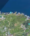
lighthouse
Hi I am at the lighthouse but if I fork right the only option at lighthouse this will take me back to Santander? Please directions from here anyone who has done it. I am here now. Thank you
 
Hi I am at the lighthouse but if I fork right the only option at lighthouse this will take me back to Santander? Please directions from here anyone who has done it. I am here now. Thank you
We just followed the coast
Screenshot_20210916-173538.webp
 
Follow the coastline. I did follow the coast to Isla Virgén del Mar, and then went straight south to Santa Bezana del Cruz. But I think, you may go even further along the coast - which is recommendable - and still heading south to Santa Bezana. In this town, there was one of the most amazing small albergues on the route. Wonderful private albergue hosted by the owner. A beautiful expereience following a beautiful walk. Even though it wasnøt that beautiful when you start going south from the coast. Buen Camino.
 
The one from Galicia (the round) and the one from Castilla & Leon. Individually numbered and made by the same people that make the ones you see on your walk.
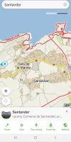
The Windy Maps app shows the trail along the coast. Download it and the maps to use offline. See the red "senda litoral" in this screen shot.

20210916_005732.jpg


Follow the coastline. I did follow the coast to Isla Virgén del Mar, and then went straight south to Santa Bezana del Cruz. But I think, you may go even further along the coast - which is recommendable - and still heading south to Santa Bezana. In this town, there was one of the most amazing small albergues on the route. Wonderful private albergue hosted by the owner. A beautiful expereience following a beautiful walk. Even though it wasnøt that beautiful when you start going south from the coast. Buen Camino.

We just followed the coast
View attachment 109234
Thank you for all kind responses. I figured it out with the help of a local jogger. I had walked around the area where the cafe n parking lot was and complely missed the gate to get me on coastal. I could see the shrine and couldnt get to it 😅 I am in Santillana del M now. Nice little quirky town but mainly for tourist. Very hot today 27 was not expecting that.
 
A great book to listen to while training for the Camino or to relive the experience!
Wow, loved it! I was mentally prepared for overgrown gorse, electric fences, dead end paths, bulls and farm dogs, but none of that. I actually got the idea that the Cantabrian government wants you to walk these coastal paths. And the views were stunning!

What a pity that the actual Camino de Santiago has so much asphalt...

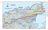
Here are my tracks:
PICTURES PLEASE!!! :p — oh I see it now, there are lots of pictures on the wikiloc tracks. They are just gorgeous.

I totally agree with your assessment, and I just can’t understand why people insist on walking the official asphalt route out of Santander and on past the chemical factory alongside the pipeline. I guess it must be because it is longer, but oh my goodness there is just no comparison.
 
I'm leaving Santander on the 30th - this is gonna be my route! In the past, on my previous caminos, I blew right through and didn't take this way. But now, having made it to Santiago many-a-time, I want to go slow, maybe even spend a few days enjoying this particular section.
<3
 
Ideal sleeping bag liner whether we want to add a thermal plus to our bag, or if we want to use it alone to sleep in shelters or hostels. Thanks to its mummy shape, it adapts perfectly to our body.

€46,-
PICTURES PLEASE!!! :p — oh I see it now, there are lots of pictures on the wikiloc tracks. They are just gorgeous.

I totally agree with your assessment, and I just can’t understand why people insist on walking the official asphalt route out of Santander and on past the chemical factory alongside the pipeline. I guess it must be because it is longer, but oh my goodness there is just no comparison.
Maybe it is a time issue? I know in the past I just blazed right through. I returning now with the sole intention to spend time in certain areas/towns simply to enjoy them, the people, the history. But the more I read, the more I realize how the direct path isn't always the best. :) <3
 
Maps.me is also a wonderful resource. Not sure if this was mentioned. Downloaded maps which can be used offline. I also have "wise pilgrim" app and guide book, but I think maps.me or google maps will be much better for this particular leg of the journey.
 
That would be a great approach, for those who can handle the distances. I'll know precisely once I clean up the gps, but I think the Santillana leg might actually be less than 30--it's certainly closer to 30 than 35 (for those taking the train/tracks). For me, one of the perqs of the coastal approach is that you actually get to see much more of Santander than most pilgrims ever do. There's a great coastal city out there!
Bumping this old thread to find out if this information is now in @Dave's book. I'm currently in Liencres - farther along than Soto de la Marina, and trying to decide what to do tomorrow.

Unfortunately, I'm here on a Saturday and it appeared that Hotel Costa San Juan had a two night minimum on the weekend. I'm staying at Hotel Calas de Liencres in Liencres, which I got on booking.com for 54€ for a double room. I booked it last minute, so that didn't seem too bad for a weekend price. And I was supposed to have a ground floor room, but they upgraded me to the 2nd floor.

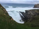
A few pics from today's walk.


20230603_204743.jpg
 
3rd Edition. Vital content training & pack guides avoid common mistakes, bed bugs etc
Bumping this old thread to find out if this information is now in @Dave's book. I'm currently in Liencres - farther along than Soto de la Marina, and trying to decide what to do tomorrow.
Yep, it's in there! Such a lovely walk--I'm looking forward to seeing it again next month.

Dave
 
Thanks, I've got the sample on Kindle, now I'll get the full version. I probably should have done that already. 😊
It's looking like you're just ~7.5km from Boo, based on the gpx. From there, it's another 21km to Santillana if you take the Boo-Mogro train, or 17km if you take the old route direct through Mar.
 
Ideal sleeping bag liner whether we want to add a thermal plus to our bag, or if we want to use it alone to sleep in shelters or hostels. Thanks to its mummy shape, it adapts perfectly to our body.

€46,-
It's looking like you're just ~7.5km from Boo, based on the gpx. From there, it's another 21km to Santillana if you take the Boo-Mogro train, or 17km if you take the old route direct through Mar.
I like the idea of the shorter old route!
 
I'm looking at the navigation on maps.cz and it's got me at 9.2 km to Boo on the Senda Litoral.

View attachment 148533
That's partially a function, I think, of the extra distance between where you're staying in Liencres and the trail. However, I also suggest breaking with the Senda in a couple places:

Screen Shot 2023-06-03 at 12.43.41 PM.png

The first sticks much closer to the coast, while the Senda Litoral veers inland for some reason. Then, when leaving the beach, I follow the road. It's shady, has footpaths running alongside it, and direct. The extra meters veering south on the Senda, just to return later to the road, seem unnecessary.
 
The one from Galicia (the round) and the one from Castilla & Leon. Individually numbered and made by the same people that make the ones you see on your walk.
I did this route in reverse when I stayed in Cudon for a few days at the Posada La Victoria (a small hotel I found my first Northern Camino and I have been to 4 times now.) It is an amazing walk and when I did it in 2017 I met 3 pilgrims along the route.
 
So, it looks like Guemes-La Posada/other hotel would be about 28, and then the next day about 35 to Santillana (using the train/tracks)? For people who already know Santander (and who hate asphalt!) this seems like a great alternative.
Plus I don’t think Santander was anything to write home about compared to Bilbao or San Sebastián.
 
Bumping this old thread to find out if this information is now in @Dave's book. I'm currently in Liencres - farther along than Soto de la Marina, and trying to decide what to do tomorrow.

Unfortunately, I'm here on a Saturday and it appeared that Hotel Costa San Juan had a two night minimum on the weekend. I'm staying at Hotel Calas de Liencres in Liencres, which I got on booking.com for 54€ for a double room. I booked it last minute, so that didn't seem too bad for a weekend price. And I was supposed to have a ground floor room, but they upgraded me to the 2nd floor.

A few pics from today's walk.


View attachment 148522
Absolutely LOVED this day! I rave about it to anyone who'll listen 😍 can't believe no one takes this path
 
Train for your next Camino on California's Santa Catalina Island March 30 to April 2
Re-upping this thread to say I walked this route 2 days ago from Santander to Liencres, and absolutely adored it. Utterly beautiful and spectacular. I took a tumble on a flat bit (careless trip on my part, it’s not that the route is tricky), and have bruised a rib or two, so elected to come off the track near Liencres to take the quicker but dull inland route to Boo.

My thanks to @Dave, @Luka and @peregrina2000 for their gps tracks on Wikiloc, comprehensive guide notes etc.
 
Last edited:
Re-upping this thread to say I walked this route 2 days ago from Santander to Liencres, and absolutely adored it. Utterly beautiful and spectacular. I took a tumble on a flat bit (careless trip on my part, it’s not that the route is tricky), and have bruised a rib or two, so elected to come off the track near Liencres to take the quicker but dull inland route to Boo.

My thanks to @Dave, @Luka and @peregrina2000 for their gps tracks on Wikiloc, comprehensive guide notes etc.
Its amazing 😍 might go out for a few days just to do those days again perfect for a weekend walking
 
I love the Posada la Victoria near Miengo, the address is in Cudon. I have stayed with them all 4 times I have been to Spain. You can walk the outer trail of Santander and then cut in to Cudon.
Calle Mies de Abajo, 40, 39318 Cudón, Cantabria, Spain
 
A great book to listen to while training for the Camino or to relive the experience!
I think this is the one alternative on the Norte I've never walked. Well, except the Ruta do Mar but that is in the current plan.

What a blast from the past this thread is! "Walk the train tracks from Boo!" Reminds me of the song... "back in the day when I was young I'm not a kid anymore, somedays I sit and wish I was a kid again."

I think this gives you a good enough idea of the options you have if you want to follow Dave's directions for the coastal route from Santander.

You still stand by that post?

I will be walking from Santona -> Santander... from there? I am willing to stop at Boo again if necessary. But I like to spend the night in Santillana too...

Excited about the new experience. About 44/45km is the longest I ever plan a stage in advance. (but ideal distance is like 37 km... Shorter days are cool too,)

Thoughts on a 2 day itinerary from Santander -> Santillana?
 
Last edited:
Thoughts on a 2 day itinerary from Santander -> Santillana?

I think if you want to do that in two days, Boo is the place to stop. But if I were to do it again, I might stop in one of the nice places along the coast that I passed.

I think this is the one alternative on the Norte I've never walked.
Have you walked all those wonderful coastal alternatives? Flysch, up from Soto de Luiña, etc etc? @Kosmos and @Luka put a couple on the alternatives thread some years ago that I have been hoping to try some year, have you seen those?
 
I love the Posada la Victoria near Miengo, the address is in Cudon. I have stayed with them all 4 times I have been to Spain. You can walk the outer trail of Santander and then cut in to Cudon.
Calle Mies de Abajo, 40, 39318 Cudón, Cantabria, Spain
How long of a day is that from Santander? Looks like it’d be even longer than stopping in Boo. Do you remember the actual route you walked after Liencres (where you pretty much have to turn inland or else really wind around, I think)? Thanks, sorry to bombard you with questions.
 
A great book to listen to while training for the Camino or to relive the experience!
Have you walked all those wonderful coastal alternatives? Flysch, up from Soto de Luiña, etc etc? @Kosmos and @Luka put a couple on the alternatives thread some years ago that I have been hoping to try some year, have you seen those?
Yes, I think. Well at least on the Norte... anytime I see the alternative RED dots on Wisepilgrim that involve a "right turn" I've taken them. Except for that one.

I personally wouldn't recommend the right turn out of Zumaia, but always take the right at Elorriaga? I mean, you've seen one Flysch...Note: that alternative GR? after Elorriaga on the way to Deba is a little hardcore.
 
Last edited:
I will be walking from Santona -> Santander... from there? I am willing to stop at Boo again if necessary. But I like to spend the night in Santillana too...

Excited about the new experience. About 44/45km is the longest I ever plan a stage in advance. (but ideal distance is like 37 km... Shorter days are cool too,)
I walked from Santander along the coast to Liencres, which was about 27 km, then the next day I walked (with the short train ride) to Santillana del Mar, which was also about 27 km walking.
 
The 2024 Camino guides will be coming out little by little. Here is a collection of the ones that are out so far.

❓How to ask a question

How to post a new question on the Camino Forum.

Most read last week in this forum

I'm planning on the Camino del Norte in June. Will I see many pilgrims? Is the Camino well marked? Thank you in advance.
So I do other treks in the USA that require permits. Well, sometimes they require "lotteries" to actually get a "permitted" start date. Once you hike there you know the permit system is just meant...
My two young daughters (ages 17 and 19 - will be 20) plan to walk the Camino del Norte together from Irun starting in June. I'm helping them organize it, and am getting very mixed advice about...

Forum Zoom Chats

Join our Camino Forum Zoom chats every Tuesday. See the next one here.

❓How to ask a question

How to post a new question on the Camino Forum.

Forum Rules

Forum Rules

Camino Updates on YouTube

Camino Conversations

Most downloaded Resources

This site is run by Ivar at

in Santiago de Compostela.
This site participates in the Amazon Affiliate program, designed to provide a means for Ivar to earn fees by linking to Amazon
Official Camino Passport (Credential) | 2024 Camino Guides
Back
Top