Search 74,075 Camino Questions

Coastal alternatives to the Norte's asphalt

amancio - you had me at cider! LOL Thank you for the great post with photos about the bridge. It does look dicey as far as uneven rock surfaces go but I can see that it is wide enough to gingerly peck my way over without getting vertigo. I had also posted about this to a FB group on the Norte and a couple of people also shared photos of the crossing. Also big thank you as well to peregrina2000 for putting all this info in one place and making sure no one has to do more pavement than necessary :-)
 
The 2024 Camino guides will be coming out little by little. Here is a collection of the ones that are out so far.
Yes, I think WisePilgrim has all or most these alternatives.

I WISH I had taken a picture of it. It is not so narrow, just extremely uneven. Like someone threw a bunch of stones together and then melded it all together. I think Amancio has been there, so I will contact him. I am bad with distance estimates, so I can’t give you a good sense of how high it was.

If you zoom in on the wikiloc tracks, you can clearly see it. It is the only spot on the tracks where you can see water on both sides. https://es.wikiloc.com/rutas-senderismo/senda-costera-la-franca-pendueles-por-la-costa-10189855

It looks like you would have to miss all of the coastal part from La Franca to Buelna if you didn’t want to cross it. But maybe Wise Pilgrim or Amancio can help here. I have PM-ed them. Buen camino, Laurie

P.s, if you look at my pictures in post number 7, this is exactly the kind of rock that it is. I would say the bridge itself is at least 3’ wide, but very uneven and jagged.

EUREKA, if you put puente natural buelna into google images, you will see it. None that I see are taken FROM the bridge, just of it. But you can see people walking on top. The best one I saw was picture number six on this website. https://mapio.net/pic/p-1043883/

Wise Pilgrim has those alternatives, indeed. We used the app on many occasions.
Unfortunately, I don't have a photo of the Salto del Caballo, as we stayed the night at Buelna. But we enjoyed the Cueva Cobijeru, which we recommend.

Buen Camino
Andrew
 
Ideal sleeping bag liner whether we want to add a thermal plus to our bag, or if we want to use it alone to sleep in shelters or hostels. Thanks to its mummy shape, it adapts perfectly to our body.

€46,-
6. La Franca to Llanes
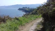
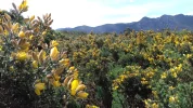
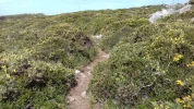
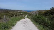
Just want to say that these pics are all from the coast before the camino comes to the coast in Pendueles.

GPS tracks from La Franca to Pendueles. At Pendueles, the coastal route merges right into the Camino.

https://es.wikiloc.com/wikiloc/view.do?id=10189855
If you don't mind my asking, how old are you? I turned 70 in February and am in good shape for my age. Do you have a list of hostels, alburgues that you stayed in along the way. I will be starting in San Sebastian.
 
If you don't mind my asking, how old are you? I turned 70 in February and am in good shape for my age. Do you have a list of hostels, alburgues that you stayed in along the way. I will be starting in San Sebastian.
Hi Andrea Lynn,welcome to the forum. I am almost 69. I am a good walker and try to walk a camino every year. I posted a list with my stages here:

https://www.caminodesantiago.me/community/threads/my-stages-on-the-norte-2017-one-year-late.55828/

And I think I gave some suggestions on places to stay when I was posting live.
https://www.caminodesantiago.me/community/threads/a-few-tips-from-the-camino-del-norte.48291/

Buen camino, Laurie
 
To explain -- I walked the Norte in 2007 and suffered mightily with all the pavement. In fact, I found my foot in a walking cast for about 4 months afterwards due to the pounding. Tarsal tunnel is what they called it.

I went back to the Norte this year and got a lot of forum help in finding coastal alternatives. For me one of the biggest Norte frustrations was that it is a Camino that is frequently within a few kms of beautiful coastlines but the arrows keep you pounding the pavement on the side of the national highway.

I'm attaching a document that contains descriptions of my "Camino detours" and a few other stretches where the standard route has an alternative. Most are coastal, but a couple are not and have been added just for the heck of it. Here is a list of what the document describes:

1. Ruta Alpinista (Irún to Pasajes)
2. Pasajes to San Sebastián
3. Zumaia to Deba
4. Castro Urdiales to Laredo
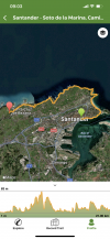
5. Santander to Boo via the coast
6. La Franca to Llanes
7. Llanes to Playa del Poo (and beyond)

8. After La Nueva to Ribadesella
9. Dipping down to Oviedo from Villaviciosa
10. A Detour to Cudillero
11. Soto to Cadavedo
12. La Caridad to Ribadeo
13. Mondoñedo to Gontán
14. Baamonde to Sobrado
15. Sobrado to Pedrouzo/Arca


And at the suggestion of another forum member, I am going to add posts with a few pictures to illustrate most of these alternatives -- I think that once people see what they are missing, these coastal options will become more popular!

Buen camino, Laurie
Thank you so much. I start walking on the 26th May from Irun and you have condensed all my notes for keeping to the coast. Very handy. Much appreciated. Robin
 
Ideal pocket guides for during & after your Camino. Each weighs only 1.4 oz (40g)!
8. After La Nueva to Ribadesella

GPS tracks showing the coastal alternative after La Nueva. https://es.wikiloc.com/wikiloc/view.do?id=9999603

GPS tracks for coastal alternative from La Nueva to the intersection with the coastal alternative above (I did not walk this part). With a night in the little hotel in La Nueva, the next day to Ribadesella could be all along the coast. BUT be sure to see that this track does not continue along the coast after Cuerres. Use the first tracks posted here for the "second half" of that coastal route, that is from Cuerres onward. Sorry if this is confusing, but someone with better tech skills should be able to combine the first half of the coastal route from Nueva to Cuerres (below) with the second half of the coastal route from Cuerres to Ribadesella (above).

https://es.wikiloc.com/wikiloc/view.do?id=8763164
Hi Laurie, my plan is to walk this wonderful looking Nueva - Ribadesella alternative somewhere in the coming weeks. I need to train a bit for a Camino of a week on the Francés the end of May and I am in the luxury position that I can do my training along the Asturian coast :-) Do you have any idea how long the combination of the two wikiloc tracks would be? My plan is to record my walk on wikiloc as well, so after that I will share the track here.

I am bit by bit discovering the Asturians coastal routes (as they are now more or less located in my backyard). It is such a pity that the Norte misses quite a few of them...
Hi, Luka,
You are one lucky holandesa! I found a GPS track from La Nueva all along the coast, looks like about 20 km. https://www.wikiloc.com/wikiloc/vie...-por-la-costa-junio-28-2014&id=21555506&rd=en

Would love to hear how it goes, and see some pictures, of course. The section that I walked, more or less after Cuerres, I think, had some gorgeous rocks very similar to As Catedrales, but you can’t walk on the beach around them. Buen camino, Laurie
 
WOW what a thread, @peregrina2000 and everyone else that added to it!
My thought exactly. And I'm not even walking the Norte. Gracias, Laurie!

There were kids on the Ruta del Flysch, and no scary narrow paths that I can remember. The path is on the strenuous side, but it is oh so worth it. You can see the profile here:https://www.wikiloc.com/hiking-trails/ruta-flysch-deba-zumaia-zarautz-2810918
And if you put “ruta del flysch” into google images, you will see lots of photos. Many focus on the crazy rock formations but there are some pictures of the actual trail. IMO, it is a trail that is accessible for people in good, but not necessarily great, shape. Three people from the albergue the night before came with me and they all survived (and were gobsmacked by the beauty) and were not very experienced.
One thing to add for any potential rockhounds out there: This is a blessed patch of geology which has the one of the longest exposed sequences of sedimentary layers in the whole world. Not to mention caves and neolithic paintings. There is much to pause at and marvel over.

From this:
"The coastal area contains a complete record of the important boundaries between geological ages such as the Cretaceous/Tertiary (K-T boundary) and the Palaeocene/Eocene, and likewise includes the official stratotypes (international references) for two internal boundaries within the Palaeocene (Danian-Selandian and Selandian-Thanetian)."
"The entire area contains excellent examples of tectonic deformation structures such as different types and scales of folds and faults, which were created during the opening of the Bay of Biscay and the compression and lifting of the Pyrenees.
Almost the entire stratigraphic record corresponds to marine environments. There is a great deal of palaeontological evidence: bioconstructions of rudist bivalves, Ammonoidea, trace fossils, calcareous plankton, etc."
"The municipalities of Deba and Mutriku have one of the greatest concentrations of caves with archaeological sites in the whole of Gipuzkoa. The cave paintings in Ekain cave (Deba), in particular the figures of horses, are one of the best examples of Franco-Cantabrian art. As a result, the Ekain cave was declared a World Heritage Site by UNESCO in 2008. "
 
Ideal sleeping bag liner whether we want to add a thermal plus to our bag, or if we want to use it alone to sleep in shelters or hostels. Thanks to its mummy shape, it adapts perfectly to our body.

€46,-
Hi, Luka,
You are one lucky holandesa! I found a GPS track from La Nueva all along the coast, looks like about 20 km. https://www.wikiloc.com/wikiloc/vie...-por-la-costa-junio-28-2014&id=21555506&rd=en

Would love to hear how it goes, and see some pictures, of course. The section that I walked, more or less after Cuerres, I think, had some gorgeous rocks very similar to As Catedrales, but you can’t walk on the beach around them. Buen camino, Laurie
I am! And thanks for the link, that one looks perfect. And yes, I will report afterwards!
 
My thought exactly. And I'm not even walking the Norte. Gracias, Laurie!


One thing to add for any potential rockhounds out there: This is a blessed patch of geology which has the one of the longest exposed sequences of sedimentary layers in the whole world. Not to mention caves and neolithic paintings. There is much to pause at and marvel over.

From this:

That reminds me of a conversation I had years ago in Villaviciosa in a hotel terrace. I met a geology professor who had just taken a group of students on a field trip/short course from the US to some European country. He and his wife were traveling through Northern Spain for a few weeks. I asked him why he didn’t just bring the students to Spain, and he said — oh, the geology here is way too complicated for beginning students. :-)
 
That reminds me of a conversation I had years ago in Villaviciosa in a hotel terrace. I met a geology professor who had just taken a group of students on a field trip/short course from the US to some European country. He and his wife were traveling through Northern Spain for a few weeks. I asked him why he didn’t just bring the students to Spain, and he said — oh, the geology here is way too complicated for beginning students. :)

My father was a geologist, and I would often think of him on the Norte, and how he would try to explain geology to us kids...
There is definitely some great geology on the Norte!
 
Get a spanish phone number with Airalo. eSim, so no physical SIM card. Easy to use app to add more funds if needed.
To explain -- I walked the Norte in 2007 and suffered mightily with all the pavement. In fact, I found my foot in a walking cast for about 4 months afterwards due to the pounding. Tarsal tunnel is what they called it.

I went back to the Norte this year and got a lot of forum help in finding coastal alternatives. For me one of the biggest Norte frustrations was that it is a Camino that is frequently within a few kms of beautiful coastlines but the arrows keep you pounding the pavement on the side of the national highway.

I'm attaching a document that contains descriptions of my "Camino detours" and a few other stretches where the standard route has an alternative. Most are coastal, but a couple are not and have been added just for the heck of it. Here is a list of what the document describes:

1. Ruta Alpinista (Irún to Pasajes)
2. Pasajes to San Sebastián
3. Zumaia to Deba
4. Castro Urdiales to Laredo
5. Santander to Boo via the coast
6. La Franca to Llanes
7. Llanes to Playa del Poo (and beyond)

8. After La Nueva to Ribadesella
9. Dipping down to Oviedo from Villaviciosa
10. A Detour to Cudillero
11. Soto to Cadavedo
12. La Caridad to Ribadeo
13. Mondoñedo to Gontán
14. Baamonde to Sobrado
15. Sobrado to Pedrouzo/Arca


And at the suggestion of another forum member, I am going to add posts with a few pictures to illustrate most of these alternatives -- I think that once people see what they are missing, these coastal options will become more popular!

Buen camino, Laurie
Since we're talking about alternate routes: Has anyone done or has any info on Subida al Monte Candina. It looks like a doable trail after crossing the river leaving Islares and heading to Laredo. It looks like it heads up to the coast but avoids the dangerous section. Also avoids a lot of asphalt. My husband and I will be on the CdN in June and we hate road walking and this looks like a viable alternative. Any info or advice on this would be greatly appreciated ;-)
 
Since we're talking about alternate routes: Has anyone done or has any info on Subida al Monte Candina. It looks like a doable trail after crossing the river leaving Islares and heading to Laredo. It looks like it heads up to the coast but avoids the dangerous section. Also avoids a lot of asphalt. My husband and I will be on the CdN in June and we hate road walking and this looks like a viable alternative. Any info or advice on this would be greatly appreciated ;-)
Hello @Kuuipo ,
We walked around Monte Candina. I wrote a post:
It's post #31 in the thread.
Hope this helps.
Buen Camino
 
Get a spanish phone number with Airalo. eSim, so no physical SIM card. Easy to use app to add more funds if needed.
I did a beautiful little circular today that might add an extra option for lovers of the Asturian coast. There is a wonderful coastal path between La Isla and La Griega (the beach of Colunga). I often see pilgrims taking a short cut on the road from La Isla to Colunga. Perfectly possible, because there is a side walk next to it. But extremely boring.

There are two better options instead:
- One is a little detour on little roads through meadows, which will take you to San Juan de Duz. From there Colunga is maybe half a kilometer away. It might even be the official Camino, but I hardly saw arrows today.
- One is a little bigger detour. Then you'll take the coastal path from the beach of La Isla to the beach of La Griega. From there you can take a path that goes to Colunga.

I combined the two and walked a circular which I uploaded on wikiloc (with more pictures) and had a lovely afternoon! Note, by the way, that I walked the coastal path in opposite direction.
https://www.wikiloc.com/hiking-trails/la-isla-la-griega-circular-35564275

55711
 
I did a beautiful little circular today that might add an extra option for lovers of the Asturian coast. There is a wonderful coastal path between La Isla and La Griega (the beach of Colunga). I often see pilgrims taking a short cut on the road from La Isla to Colunga. Perfectly possible, because there is a side walk next to it. But extremely boring.

There are two better options instead:
- One is a little detour on little roads through meadows, which will take you to San Juan de Duz. From there Colunga is maybe half a kilometer away. It might even be the official Camino, but I hardly saw arrows today.
- One is a little bigger detour. Then you'll take the coastal path from the beach of La Isla to the beach of La Griega. From there you can take a path that goes to Colunga.

I combined the two and walked a circular which I uploaded on wikiloc (with more pictures) and had a lovely afternoon! Note, by the way, that I walked the coastal path in opposite direction.
https://www.wikiloc.com/hiking-trails/la-isla-la-griega-circular-35564275

View attachment 55711
Thank you @Luka ! Brings back memories! :)
 
Hi, Luka,
You are one lucky holandesa! I found a GPS track from La Nueva all along the coast, looks like about 20 km. https://www.wikiloc.com/wikiloc/vie...-por-la-costa-junio-28-2014&id=21555506&rd=en

Would love to hear how it goes, and see some pictures, of course. The section that I walked, more or less after Cuerres, I think, had some gorgeous rocks very similar to As Catedrales, but you can’t walk on the beach around them. Buen camino, Laurie
Hi Laurie, tried that one today and I have to adjust it. The part after playa de Villanueva was totally unrecommendable. The path was completely overgrown, mostly with gorse. Later on also brambles. I had a hard time finding my path and unluckily I was wearing shorts. Got scratches all over my legs and arms. The gorse at some stretches grew as high as my shoulders.

56798

I had to crawl underneath barbed wire, press myself through bushes and got more or less lost. The path finally ended up in a meadow (I was still on the Wikiloc track) full of cows and calfs. I didn't bother looking if there was a bull around and started walking in the opposite direction. After quite a lot of roaming through fields and crossing a couple more fences I ended up on a road in the outskirts of Villanueva.

At that point I was just happy to be back in civilisation, my legs hurt and I was running out of water. I decided to walk to the little trainstation of Belmonte del Pría and call it a day. Now back on my own terrace with a beer and my legs covered in betadine.

I will probably give it another try on Friday, but then I'll stay on the E9. That will more or less be a combination of the other two Wikiloc tracks you added here. Maybe a bit less adventurous, but hopefully more pleasant ;-)
 
Train for your next Camino on California's Santa Catalina Island March 30 to April 2
Oh, dear, that is not such great news. The notes on the GPS tracks on wikiloc made it sound like a perfectly good and open trail. But they were from 2014 so maybe things have changed. I can tell you though that the part I walked had none of that, and it was really quite nice, so I hope your Friday is better than today was! Laurie
 
Ah well, that is the risk of trying an older Wikiloc route indeed. Luckily it was just a day trip and not a pilgrimage. I'll take care of my scratches, wait a couple of days and give it another try!

Which part did you walk?
 
Hi Laurie, tried that one today and I have to adjust it. The part after playa de Villanueva was totally unrecommendable. The path was completely overgrown, mostly with gorse. Later on also brambles. I had a hard time finding my path and unluckily I was wearing shorts. Got scratches all over my legs and arms. The gorse at some stretches grew as high as my shoulders.

View attachment 56798

I had to crawl underneath barbed wire, press myself through bushes and got more or less lost. The path finally ended up in a meadow (I was still on the Wikiloc track) full of cows and calfs. I didn't bother looking if there was a bull around and started walking in the opposite direction. After quite a lot of roaming through fields and crossing a couple more fences I ended up on a road in the outskirts of Villanueva.

At that point I was just happy to be back in civilisation, my legs hurt and I was running out of water. I decided to walk to the little trainstation of Belmonte del Pría and call it a day. Now back on my own terrace with a beer and my legs covered in betadine.

I will probably give it another try on Friday, but then I'll stay on the E9. That will more or less be a combination of the other two Wikiloc tracks you added here. Maybe a bit less adventurous, but hopefully more pleasant ;-)

It is a pity that the town council doesn't clean that area, in the west of Asturias the town councils are in charge of ensuring that all the coastal paths are clean and well conditioned.

Since you live in Ribadesella and you are 2 hours from Navia, I recommend the Travesia Costa Naviega that takes place on June 16, and gathers 2,000 hikers from all over Spain.

On the website of the association (Peña Furada) you have all the information

Photos COSTA NAVIEGA
 
Ideal sleeping bag liner whether we want to add a thermal plus to our bag, or if we want to use it alone to sleep in shelters or hostels. Thanks to its mummy shape, it adapts perfectly to our body.

€46,-
@Kosmos thanks for the tip! But I don't live in Ribadesella anymore (Navia is a little over a 2 hours drive) and I prefer solitary walks ;-)

Can't blame the ayuntamiento of Ribadesella for the overgrown path, I guess. The official E9 is in perfect condition. This is (or was) cleary a path used for cattle. This is what the first (still walkable) part looked like:

56813
 
8. After La Nueva to Ribadesella

GPS tracks showing the coastal alternative after La Nueva. https://es.wikiloc.com/wikiloc/view.do?id=9999603

GPS tracks for coastal alternative from La Nueva to the intersection with the coastal alternative above (I did not walk this part). With a night in the little hotel in La Nueva, the next day to Ribadesella could be all along the coast. BUT be sure to see that this track does not continue along the coast after Cuerres. Use the first tracks posted here for the "second half" of that coastal route, that is from Cuerres onward. Sorry if this is confusing, but someone with better tech skills should be able to combine the first half of the coastal route from Nueva to Cuerres (below) with the second half of the coastal route from Cuerres to Ribadesella (above).

https://es.wikiloc.com/wikiloc/view.do?id=8763164
I think I have sorted it out. This time I stayed on the E9 where I last time ended up in gorge bushes higher than my shoulders. About 2k later on there is another coastal option. Little dirt tracks but not overgrown that will take you to the Bufones del Pría and Playa de Guadamía. Absolutely recommendable!

At Playa de Guadamía it depends a bit on the tide. With low tide you could just cross the beach and climb to the area recreativa on the other side. I took a bigger loop around the beach, but still had to wade across a little stream. Another option is to follow a nice river path that brings you into Cuerres, where you can continue on the Norte.

From the area recreativa you can walk along the cliffs to the next area recreativa (called Area Recreativa del Infierno...). Stunning and recommendable. From there I would call it a day and follow the asphalt road which connnects with the Norte. I tried to stay on the coast, but got caught up in another wikilocs track covered by gorge...

Here is my track: https://www.wikiloc.com/hiking-trails/nueva-ribadesella-along-the-coast-36369779
 
Ah yes, how can I forget the pictures...

57123
57124
57125
571265712757128

I now realise that it is a little bizarre that I am walking my training rounds here to prepare for a week on the Meseta...
 

Attachments

  • 20190512_144412.webp
    20190512_144412.webp
    1 MB · Views: 39
Last edited:
...and ship it to Santiago for storage. You pick it up once in Santiago. Service offered by Casa Ivar (we use DHL for transportation).
We are on el norte now. Took the alpinista route from Irun- but it seems everyone else did so too The views were spectacular! took the other variations where possible as well. The best one was arriving in Santander, and walking in the opposite direction as everyone else to go by the lighthouse, along the top of the peninsula. The views were great and we were chased by some cows and horses. We did not know where to sty- we planned on Liencres but found a cabin in a camping site in San Juan del Canal, and continued on the next day to La Requejada. Will post pics later but thanks to all of you who make this so easy to do!
 
I am very much appreciative of the posts on this thread. Thank you all. I am concerned about hiking alone and am hopeful there are others hiking during July and August. Do you know?
 
I am very much appreciative of the posts on this thread. Thank you all. I am concerned about hiking alone and am hopeful there are others hiking during July and August. Do you know?
You definitely wont be alone. I just finished and there was already a fair number hiking. July August will be much busier. Enjoy. Its incredible.
 
Get a spanish phone number with Airalo. eSim, so no physical SIM card. Easy to use app to add more funds if needed.
I found an alternative out of Ribadesella, to avoid the suburbs and with a couple of coastal views as well. You will be back on track just before walking into La Vega. Actually there are two alternatives. There is also a way to just avoid the suburbs and join in again just before the last roundabout out of Ribadesella. See my wikiloc tracks.

 
To explain -- I walked the Norte in 2007 and suffered mightily with all the pavement. In fact, I found my foot in a walking cast for about 4 months afterwards due to the pounding. Tarsal tunnel is what they called it.

I went back to the Norte this year and got a lot of forum help in finding coastal alternatives. For me one of the biggest Norte frustrations was that it is a Camino that is frequently within a few kms of beautiful coastlines but the arrows keep you pounding the pavement on the side of the national highway.

I'm attaching a document that contains descriptions of my "Camino detours" and a few other stretches where the standard route has an alternative. Most are coastal, but a couple are not and have been added just for the heck of it. Here is a list of what the document describes:

1. Ruta Alpinista (Irún to Pasajes)
2. Pasajes to San Sebastián
3. Zumaia to Deba
4. Castro Urdiales to Laredo
5. Santander to Boo via the coast
6. La Franca to Llanes
7. Llanes to Playa del Poo (and beyond)

8. After La Nueva to Ribadesella
9. Dipping down to Oviedo from Villaviciosa
10. A Detour to Cudillero
11. Soto to Cadavedo
12. La Caridad to Ribadeo
13. Mondoñedo to Gontán
14. Baamonde to Sobrado
15. Sobrado to Pedrouzo/Arca


And at the suggestion of another forum member, I am going to add posts with a few pictures to illustrate most of these alternatives -- I think that once people see what they are missing, these coastal options will become more popular!

Buen camino, Laurie
I would love to have your opinion of highlights of the Norte as I am not sure my daughter and I can take enough days to be able to do the whole thing but could go for three weeks or so next May or June. I have been told that the last inland part is not as amazing as the part along the coast. If you have any advice on this I would love to hear it. We walked the Portuguese route this year and the Frances last year. It definitely gets into your psyche and you miss it when you aren't there walking. Thanks for any advice.
Holly
 
Train for your next Camino on California's Santa Catalina Island March 30 to April 2
I would love to have your opinion of highlights of the Norte as I am not sure my daughter and I can take enough days to be able to do the whole thing but could go for three weeks or so next May or June. I have been told that the last inland part is not as amazing as the part along the coast. If you have any advice on this I would love to hear it. We walked the Portuguese route this year and the Frances last year. It definitely gets into your psyche and you miss it when you aren't there walking. Thanks for any advice.
Holly
Hello Holly,
We walked the Norte last year.
There are too many highlights to point out, in my opinion, but if you're limited in time, start from Irun (or Hondarribia) and go as far as you have time for, following Laurie's alternatives.
Buen Camino!
Andrew
 
7. Llanes to Playa del Poo (and beyond)

There seem to be lots of paths between Llanes and Celorio that get you closer to the coast. Follow the E9, but my wikiloc searching brings up lots of different alternatives. Thanks to Tia Valeria for this description.

https://www.turismoasturias.es/en/descubre/naturaleza/rutas/sendas-costeras/llanes-celorio
I walked and uploaded this one today, from Poo de Llanes to Villahormes. Easy to expand on both sides.
 
Barayo - Navia (Travesia Costa Naviega)
https://es.wikiloc.com/wikiloc/view.do?id=1795893

http://www.jfcamina.es/caminoscosteros/AS-Z16-01-Navia/AS-Z16-01-Navia.htm

Luarca-Navia (GR E9 Coastal alternative)
https://www.wikiloc.com/hiking-trai...te-por-la-senda-costa-naviega-gr-e-9-26490483


Luarca - Ribadeo (GR E9 Coastal alternative)

View attachment 52984

View attachment 52983
[/QUO
 
A selection of Camino Jewellery
The scenery looks wonderful. Just one comment though. As someone who did the C. Frances in June 2018–I NEVER EVER saw even a fraction of the #of people in most of these photos! I take it these are tour groups travelling together in packs, as they don’t seem to be carrying anything? It’s a total turn-off. Please tell me this is not what I will see if I do C. del Norte next June!?
 
The scenery looks wonderful. Just one comment though. As someone who did the C. Frances in June 2018–I NEVER EVER saw even a fraction of the #of people in most of these photos! I take it these are tour groups travelling together in packs, as they don’t seem to be carrying anything? It’s a total turn-off. Please tell me this is not what I will see if I do C. del Norte next June!?

The videos @Kosmos has posted show group day walks on these routes. Lots of people vacation in the area, and there are also lots of local walking groups.

I walked all of the alternatives I described in the original post, and I never saw more than a handful of others. Many fewer people than on the official Camino del Norte. On the Ruta del Flysch, a very popular route between Zumaia and Deba, there were a few more, but no large groups.

I walk a lot of untraveled caminos and every now and then I have met a busload of people out walking a portion for a day hike. It’s usually a fun time — they are interested to meet the crazy old woman out walking for days alone, and if I happen to meet them when they are stopped, they inevitably have a feast they want to share. So I wouldn’t worry that this will ruin your camino, quite the opposite, even if you happen to run into an occasional group or two.
 
The scenery looks wonderful. Just one comment though. As someone who did the C. Frances in June 2018–I NEVER EVER saw even a fraction of the #of people in most of these photos! I take it these are tour groups travelling together in packs, as they don’t seem to be carrying anything? It’s a total turn-off. Please tell me this is not what I will see if I do C. del Norte next June!?
Don't worry about that, It is not so crowded, those photos are from a special day of hiking, that day more than 1500 hikers from all over Spain came to walk the route (Senda Costa Naviega) from Barayo to Navia.


@Walking Nature World has made some beautiful videos on that route (Senda Costa Naviega)


-

 
Last edited:
Join us from Logroño to Burgos in May 2025 or Astorga to OCebreiro in June.
Don't worry about that, It is not so crowded, those photos are from a special day of hiking, that day more than 1500 hikers from all over Spain came to walk the route (Senda Costa Naviega) from Barayo to Navia.


@Walking Nature World has made some beautiful videos on that route (Senda Costa Naviega)


-

Whew!
 
Thank you so much to everyone adding their wisdom to this thread. I'll be starting in Irun on April 12th and even though I'm notoriously good at getting lost, I will definitely try to find as many alternative routes as possible. I suppose you can't get lost too much as long as the beach is on your right? ;)
 
Thank you so much to everyone adding their wisdom to this thread. I'll be starting in Irun on April 12th and even though I'm notoriously good at getting lost, I will definitely try to find as many alternative routes as possible. I suppose you can't get lost too much as long as the beach is on your right? ;)

Hi, @hielinie,

Aside from some of the more well-traveled coastal options, like the Ruta del Flysch from Zumaia, you will need either a good map or a GPS to make the connection from the camino to the coast. The trails are usually a couple of kms away from the camino/road and those connection points are not marked. And once on the trails, though you are right that the ocean will guide you in the right westerly direction, I was frequently relieved to have the GPS — the coast is jagged and irregular and the paths not always obvious.

But you will absolutely love these alternatives, they are so spectacular.
 
€2,-/day will present your project to thousands of visitors each day. All interested in the Camino de Santiago.
Apologies if I have missed this but is there any advice on the coastal variant from El Bao (before Villapedre) to Navia? Looks like it would add around 6kms to the route from Luarca to La Caridad?
 
The 2024 Camino guides will be coming out little by little. Here is a collection of the ones that are out so far.
Thank you for this. I will be cycling from Biarritz to Santiago in September 2020. I will follow parts of Camino Norte but also wish to visit some lighthouses and beaches and make use of the coastal roads and paths. This resource will be very useful.
 
To explain -- I walked the Norte in 2007 and suffered mightily with all the pavement. In fact, I found my foot in a walking cast for about 4 months afterwards due to the pounding. Tarsal tunnel is what they called it.

I went back to the Norte this year and got a lot of forum help in finding coastal alternatives. For me one of the biggest Norte frustrations was that it is a Camino that is frequently within a few kms of beautiful coastlines but the arrows keep you pounding the pavement on the side of the national highway.

I'm attaching a document that contains descriptions of my "Camino detours" and a few other stretches where the standard route has an alternative. Most are coastal, but a couple are not and have been added just for the heck of it. Here is a list of what the document describes:

1. Ruta Alpinista (Irún to Pasajes)
2. Pasajes to San Sebastián
3. Zumaia to Deba
4. Castro Urdiales to Laredo
5. Santander to Boo via the coast
6. La Franca to Llanes
7. Llanes to Playa del Poo (and beyond)

8. After La Nueva to Ribadesella
9. Dipping down to Oviedo from Villaviciosa
10. A Detour to Cudillero
11. Soto to Cadavedo
12. La Caridad to Ribadeo
13. Mondoñedo to Gontán
14. Baamonde to Sobrado
15. Sobrado to Pedrouzo/Arca


And at the suggestion of another forum member, I am going to add posts with a few pictures to illustrate most of these alternatives -- I think that once people see what they are missing, these coastal options will become more popular!

Buen camino, Laurie
Thank you so much for posting that!! I have printed it off. My daughter and I are starting in Irún on May 9.
 
€2,-/day will present your project to thousands of visitors each day. All interested in the Camino de Santiago.
To explain -- I walked the Norte in 2007 and suffered mightily with all the pavement. In fact, I found my foot in a walking cast for about 4 months afterwards due to the pounding. Tarsal tunnel is what they called it.

I went back to the Norte this year and got a lot of forum help in finding coastal alternatives. For me one of the biggest Norte frustrations was that it is a Camino that is frequently within a few kms of beautiful coastlines but the arrows keep you pounding the pavement on the side of the national highway.

I'm attaching a document that contains descriptions of my "Camino detours" and a few other stretches where the standard route has an alternative. Most are coastal, but a couple are not and have been added just for the heck of it. Here is a list of what the document describes:

1. Ruta Alpinista (Irún to Pasajes)
2. Pasajes to San Sebastián
3. Zumaia to Deba
4. Castro Urdiales to Laredo
5. Santander to Boo via the coast
6. La Franca to Llanes
7. Llanes to Playa del Poo (and beyond)

8. After La Nueva to Ribadesella
9. Dipping down to Oviedo from Villaviciosa
10. A Detour to Cudillero
11. Soto to Cadavedo
12. La Caridad to Ribadeo
13. Mondoñedo to Gontán
14. Baamonde to Sobrado
15. Sobrado to Pedrouzo/Arca


And at the suggestion of another forum member, I am going to add posts with a few pictures to illustrate most of these alternatives -- I think that once people see what they are missing, these coastal options will become more popular!

Buen camino, Laurie
Hey Laurie
I happened upon your update to day and thank you so much. I'm walking from early September and will look at all your suggestions as am keen to walk as much as possible, along the coast line. looking forward to seeing the views from afar . x
 
Hi peregrina2000
I’ve moved to this thread because I was posting on a current photo-based thread and getting off-topic.
@Anne and Pat, and @peregrina2000 , I am especially interested in the eastern part of the Norte because I am a geology nut - (ask @VNwalking) - and you are obviously aware that the area has world famous exposures. I’m on a mountain bike but I am certainly NOT a mountain-biker, (I’m 75), and I have to be particularly aware that my bike is loaded.
I’ve looked closely at the maps you quote in your first post, and your comment about missing out on the experience of the coastal environment is very apparent. Even as a road camino, the Norte looks pretty daunting for me. I may look for a route post Zumaia to Pamplona.
 
I may look for a route post Zumaia to Pamplona.
Here's what I do in your shoes, Paul:
In Zumaia, make your way north to intersect the Vasco after Beasain. If you read the first section @Rebekah Scott's translation of the Great Westward Walk, you'll get a sense of what it's like.

From there, make your way to Zegama and from there to Alsasua. it looks like it would be relatively quiet road riding on the GI-2637. (There are albergues in Beasain and Alsasua, and a nice hotel in Zegama.)

Once you are in Alsaua, you can head backwards towards Pamplona on the Viejo. We had a virtual Viejo thread earlier in the summer — have a look and you will see what you're in for.

Edit — I've posted one of these before, and assume you have it. But in case not:


Last edited:
The 2024 Camino guides will be coming out little by little. Here is a collection of the ones that are out so far.
I walked quite a few loops at the Asturian coast that could be combined into a long, coastal alternative to the Norte (you would just have to connect the 'northern' parts of my loops). Here they are:

Llanes - Poo de Llanes: https://www.wikiloc.com/hiking-trails/a-little-stroll-from-llanes-47490036
Poo de Llanes - Playa de San Antolín: https://www.wikiloc.com/hiking-trails/poo-de-llanes-villahormes-along-the-coast-40631689
Playa de San Antolín - Picones (or on to Nueva): https://www.wikiloc.com/hiking-trai...ining-the-camino-and-the-e9-circular-66423154
Picones (or from Nueva) - Ribadesella: https://www.wikiloc.com/hiking-trails/nueva-ribadesella-along-the-coast-36369779
Ribadesella - Playa de Vega: https://www.wikiloc.com/hiking-trails/ribadesella-beach-la-vega-beach-circular-38053811
Playa de Vega - La Isla: https://es.wikiloc.com/rutas-senderismo/playa-de-vega-a-la-isla-11549361 (these are not my wikiloc tracks, this is the part I still have to check out myself)
La Isla - Colunga: https://www.wikiloc.com/hiking-trails/la-isla-beach-la-griega-beach-circular-35564275
 
To explain -- I walked the Norte in 2007 and suffered mightily with all the pavement. In fact, I found my foot in a walking cast for about 4 months afterwards due to the pounding. Tarsal tunnel is what they called it.

I went back to the Norte this year and got a lot of forum help in finding coastal alternatives. For me one of the biggest Norte frustrations was that it is a Camino that is frequently within a few kms of beautiful coastlines but the arrows keep you pounding the pavement on the side of the national highway.

I'm attaching a document that contains descriptions of my "Camino detours" and a few other stretches where the standard route has an alternative. Most are coastal, but a couple are not and have been added just for the heck of it. Here is a list of what the document describes:

1. Ruta Alpinista (Irún to Pasajes)
2. Pasajes to San Sebastián
3. Zumaia to Deba
4. Castro Urdiales to Laredo
5. Santander to Boo via the coast
6. La Franca to Llanes
7. Llanes to Playa del Poo (and beyond)

8. After La Nueva to Ribadesella
9. Dipping down to Oviedo from Villaviciosa
10. A Detour to Cudillero
11. Soto to Cadavedo
12. La Caridad to Ribadeo
13. Mondoñedo to Gontán
14. Baamonde to Sobrado
15. Sobrado to Pedrouzo/Arca


And at the suggestion of another forum member, I am going to add posts with a few pictures to illustrate most of these alternatives -- I think that once people see what they are missing, these coastal options will become more popular!

Buen camino, Laurie
This is fantastic! Thank you so much. This is exactly what I have been hoping to find.
You are a Camino angel.
 
Here is a (very recommendable) alternative for Unquera - Pendueles which I walked today:
 
Fail to prepare? reduce your risk by buying this book full of practical info.
2nd ed.
Hi, Luka,
If my map reading is right, what your suggestion does is add more coastal kms to my alternative 6, which goes from La Franca to Llanes (with the Pedueles to Llanes section being the “normal” Norte route). Starting at Unquera adds a few more coastal kms before Llanes, right?

BTW, did you walk over that rock bridge that is discussed earlier in the thread (pictures on post no. 99), the Salto del Caballo that Amancio described? I remembered being a bit freaked out, not because it was narrow, but because the rocks were so uneven.

Pretty soon you will have walked every possible step on the Asturian coast! Buen camino, Laurie
Hi Laurie, you are correct. I have added a few extra coastal kms to alternative 6. Worth it IMHO. Especially the area around the ruins of Iglesia Santa María de Tina is quite special and the walk from Pimiango to La Franca beach is pleasant. I also think it is worth it because the official stage from Unquera to Pendueles is hardly interesting (if I recall well). Good to realise that you are adding a couple of ascents and descents though.

That rock bridge is another story... I looked at it from a distance and with my vertigo and balance problems I decided to avoid it. So I walked around Playa de Cobijero to go round El Saltu 'l Caballu. That became an adventure. The path was totally overgrown and I have been fighting with brambles, climbing on hands and knees. It took forever and I ended up with a lot of scratches and I had to take off my pack a few times. I would have been a lot faster crossing the rock bridge on hands and knees...

And yes, I think I am almost there as regards the part between the border with Cantabria and Villaviciosa 😅
 
Hi All,
I got sick of the asphalt (and frankly the danger of walking on shoulders of fast roads) and took what to me seemed a less dangerous alternative which I am sure will garner me all sorts of scolding. But it was spectacular and I wish it could be developed into a genuine part of the camino.

Coming into Castro Urdiales:

Disclaimers: I wouldn't do this in the rain or poor visibility. I also do stupid things. This is tricky and potentially dangerous. But in this case I felt that the danger was in breaking a leg and having it be a nightmare for emergency services to get to me. I didn't feel like there was any risk of falling off a cliff. I also imagine this is private property.

at the easygas station in onton the camino goes off up a road and a hill. at the roundabout look for the old road with a no entry sign. it is to the right of the camino path on the roundabout. follow it to an old quarry or excavated area of some sort.

you'll see what I later worked out were the ruins of Cargadero de Saltacaballo below. Have a read about it. Very interesting story.

follow the quarry to the back right corner. say hi to the lonely horse and cow hanging out together. find the largest animal track you can - a little sketchy here - stream hopping and mud - may get wet feet. pushing through thorny gorse. just keep following animal tracks and don't go down.... stay up. when you hit meadows follow the heaviest animal tracks. You really can't get lost as you are wedged between very steep up to your left and very steep down to your right. at some point you'll see a keyhole cave entrance. on closer exam thousands of little eyes in there so I resisted the spelunking urge. here you begin a section which, with some pruning would be fine, but is now genuine bushwhacking. As in you have to whack bushes to get through. Just keep the overhanging cliff close to your left and head uphill. You'll eventually come out at a fence by a house and guess what - there in the middle of a place which you wouldn't access unless you did what I did, there is a yellow arrow. Have a drink at the restaurant and swear you'll kick my ass when you find me. this knocks of a couple of dangerous road pavement pounding miles in exchange for a half mile of knuckle biting fun.


To explain -- I walked the Norte in 2007 and suffered mightily with all the pavement. In fact, I found my foot in a walking cast for about 4 months afterwards due to the pounding. Tarsal tunnel is what they called it.

I went back to the Norte this year and got a lot of forum help in finding coastal alternatives. For me one of the biggest Norte frustrations was that it is a Camino that is frequently within a few kms of beautiful coastlines but the arrows keep you pounding the pavement on the side of the national highway.

I'm attaching a document that contains descriptions of my "Camino detours" and a few other stretches where the standard route has an alternative. Most are coastal, but a couple are not and have been added just for the heck of it. Here is a list of what the document describes:

1. Ruta Alpinista (Irún to Pasajes)
2. Pasajes to San Sebastián
3. Zumaia to Deba
4. Castro Urdiales to Laredo
5. Santander to Boo via the coast
6. La Franca to Llanes
7. Llanes to Playa del Poo (and beyond)

8. After La Nueva to Ribadesella
9. Dipping down to Oviedo from Villaviciosa
10. A Detour to Cudillero
11. Soto to Cadavedo
12. La Caridad to Ribadeo
13. Mondoñedo to Gontán
14. Baamonde to Sobrado
15. Sobrado to Pedrouzo/Arca


And at the suggestion of another forum member, I am going to add posts with a few pictures to illustrate most of these alternatives -- I think that once people see what they are missing, these coastal options will become more popular!

Buen camino, Laurie
 

Attachments

  • tempImageFr3SmT.webp
    tempImageFr3SmT.webp
    1.4 MB · Views: 39
  • tempImagebScNQw.webp
    tempImagebScNQw.webp
    991.2 KB · Views: 10
  • tempImageK3CIpP.webp
    tempImageK3CIpP.webp
    2.4 MB · Views: 10
  • tempImageKLRF1s.webp
    tempImageKLRF1s.webp
    1.3 MB · Views: 13
  • tempImageoChkOC.webp
    tempImageoChkOC.webp
    2.8 MB · Views: 13
  • tempImage1zHedG.webp
    tempImage1zHedG.webp
    1.3 MB · Views: 15
  • tempImageMAUKIF.webp
    tempImageMAUKIF.webp
    2.6 MB · Views: 21
  • tempImagebUchqu.webp
    tempImagebUchqu.webp
    904.2 KB · Views: 23
Join us from Logroño to Burgos in May 2025 or Astorga to OCebreiro in June.
Just my 2c on the river option from Deba into Gijon. There were some pretty sections in the beginning, and towards the end it was clearly nicer than what was around, but there was a middle section which took you away from the stream on winding, dangerous, unpleasant roads through a gated community and some other unpleasantness, and to add insult to injury a hill, which after the two substantial hills behind me on this 30k day was a kick to the teeth.

Although it is not a "Coastal" option it is worth mentioning the alternative route into Gijón from Deva. It is known locally as the Senda de Peña Francia and is akin to the river walk into Burgos; meaning less asphalt. It is well marked and delivers you to the eastern edge of the Playa San Lorenzo. From there it is easy to follow the coast until it rejoins the official camino near the harbor.

From the campsite at Deva turn left downhill past the campsite parking lot. Follow the road to the bottom of the hill and the trail is directly in front of you. Turn right to follow it into town.

Wikiloc link here, but I have not checked it for
 
Just my 2c on the river option from Deba into Gijon. There were some pretty sections in the beginning, and towards the end it was clearly nicer than what was around, but there was a middle section which took you away from the stream on winding, dangerous, unpleasant roads through a gated community and some other unpleasantness, and to add insult to injury a hill, which after the two substantial hills behind me on this 30k day was a kick to the teeth.
Thanks for that update. Good to have more opinions.

I have never walked into Gijón because I have dipped down to Oviedo from Villaviciosa. I can enthusiastically recommend that as an alternative to the walk from Gijón to Avilés. You get to visit the beautiful city of Oviedo, visit the gobsmacker pre-Romanesque church in the monastery at Valdediós on the way down to Oviedo, and then the route from Oviedo up to Avilés has none of the industry you see coming from the east.
 
Thanks to all for your input on this subject. I am continuing my Norte Camino from where I left it off last summer in Bilbao, then taking the Primitivo from Oviedo. I enjoyed the GR paths along the coast until Deba last July and these routes after Bilbao all give me hope to stay off the pavement as much as possible and to get to see sights and other towns I wouldn't otherwise.
 
...and ship it to Santiago for storage. You pick it up once in Santiago. Service offered by Casa Ivar (we use DHL for transportation).
Hi, I'm starting the Norte in Late August and I've started to look at some of these excellent coastal alternative suggestions as I'm a lover of great scenery.

I have a question on the first stage - Irun to Pasajes. If I interpret my Cicerone guide book correctly the coastal alternative would mean the stage to San Sebastian is around 25kms, so overall no real difference to the original route? I realise that a there will be more elevation involved.
 
Hi All,
My wife and I are on the Camino del Norte right now in Islares. I am reading ahead and noted the 31.7km coastal route option between Santander and Boo (#5 in Peregrina2000's originating post). We are slow walkers, and find that if there's a mountainous stretch we make very slow progress. Net, do you recall if this stretch has any significant steep inclines/declines? We reach Santander in 3 days time. Thanks in advance for your response.
I walked this stretch with my wife in 3018, it was very beautifull. You can break up this stage in two by staying in Soto de la Marina after 20 km. A room in a hotel was then 40 €. An advantage was that we could do it slow and take time to enjoy the nice views
 
The 2024 Camino guides will be coming out little by little. Here is a collection of the ones that are out so far.
Hi All,
My wife and I are on the Camino del Norte right now in Islares. I am reading ahead and noted the 31.7km coastal route option between Santander and Boo (#5 in Peregrina2000's originating post). We are slow walkers, and find that if there's a mountainous stretch we make very slow progress. Net, do you recall if this stretch has any significant steep inclines/declines? We reach Santander in 3 days time. Thanks in advance for your response.
I walked this a couple of weeks ago. From memory I don't think there any very steep or arduous sections. My GPS tracker recorded just over 350m of ascent for the whole day so one of the easier days.
 
I walked this stretch with my wife in 3018, it was very beautifull. You can break up this stage in two by staying in Soto de la Marina after 20 km. A room in a hotel was then 40 €. An advantage was that we could do it slow and take time to enjoy the nice views
@Vaughan Thanks for the specific data point from your GPS tracker. That's helpful information.

@Antonius Vaessen - Your response was ideal as my wife and I didn't really want to walk through some of this beautiful scenery in a rushed day. Thus, I have just booked a night at the Hotel Costa San Juan at the Soto de la Marina (it's still Euro 40!). I will work out myself, but from Soto de la Marina, it's like 10km to Boos de Pielagos. What was your next end point, given there's a train to catch at Boos to cross to Mogro station, and the distance to Santillana del Mar seems too much for a day?
We tried to avoid going back to the place where we left the beach and tried to take a shortcut through meadows and undergrowth. That turned out to be not a good decision. Finding the way into Boo de Pielagos was complicated ( for us, we were directed in the wrong drection by a passer- by)
We walked to Santillana. It was only 18 kms walking. We arrived there before noon, after taking the train at 7.15 and had more than enough time to walk up en down to the beautifull caves ( 2 x 2,5 kilometers) By the way the albergue in the old convent in Santillana should be very beautiful ( we did not stay there)
 
The one from Galicia (the round) and the one from Castilla & Leon. Individually numbered and made by the same people that make the ones you see on your walk.
I walked this a couple of weeks ago. From memory I don't think there any very steep or arduous sections. My GPS tracker recorded just over 350m of ascent for the whole day so one of the easier days.
Hi All,
My wife and I are on the Camino del Norte right now in Islares. I am reading ahead and noted the 31.7km coastal route option between Santander and Boo (#5 in Peregrina2000's originating post). We are slow walkers, and find that if there's a mountainous stretch we make very slow progress. Net, do you recall if this stretch has any significant steep inclines/declines? We reach Santander in 3 days time. Thanks in advance for your response.
Please note -the hostel in Boo is closed.
 
Train for your next Camino on California's Santa Catalina Island March 30 to April 2
To explain -- I walked the Norte in 2007 and suffered mightily with all the pavement. In fact, I found my foot in a walking cast for about 4 months afterwards due to the pounding. Tarsal tunnel is what they called it.

I went back to the Norte this year and got a lot of forum help in finding coastal alternatives. For me one of the biggest Norte frustrations was that it is a Camino that is frequently within a few kms of beautiful coastlines but the arrows keep you pounding the pavement on the side of the national highway.

I'm attaching a document that contains descriptions of my "Camino detours" and a few other stretches where the standard route has an alternative. Most are coastal, but a couple are not and have been added just for the heck of it. Here is a list of what the document describes:

1. Ruta Alpinista (Irún to Pasajes)
2. Pasajes to San Sebastián
3. Zumaia to Deba
4. Castro Urdiales to Laredo
5. Santander to Boo via the coast
6. La Franca to Llanes
7. Llanes to Playa del Poo (and beyond)

8. After La Nueva to Ribadesella
9. Dipping down to Oviedo from Villaviciosa
10. A Detour to Cudillero
11. Soto to Cadavedo
12. La Caridad to Ribadeo
13. Mondoñedo to Gontán
14. Baamonde to Sobrado
15. Sobrado to Pedrouzo/Arca


And at the suggestion of another forum member, I am going to add posts with a few pictures to illustrate most of these alternatives -- I think that once people see what they are missing, these coastal options will become more popular!

Buen camino, Laurie
🙏🏻
 
I hope this is in time to be useful. I walked this year. We stopped for the night at the campsite bungalows in Camping Costa San Juan (booking .com) at Soto de la Marina. Next day we jumped on the train after walking to Boo and stayed on board until reaching Barreda. I attach screenshots of my wiciloc track which show elevation profiles. You are welcome to take a look at my blog for a description of these stages. I followed other coastal options where possible.
 

Attachments

  • 861396EB-09E9-4059-8DCF-4F611A9DA4D5.png
    861396EB-09E9-4059-8DCF-4F611A9DA4D5.png
    8.3 MB · Views: 33
  • C5F01DB1-D21C-41DE-8278-EC662B084DF7.png
    C5F01DB1-D21C-41DE-8278-EC662B084DF7.png
    8.9 MB · Views: 39
I hope this is in time to be useful. I walked this year. We stopped for the night at the campsite bungalows in Camping Costa San Juan (booking .com) at Soto de la Marina. Next day we jumped on the train after walking to Boo and stayed on board until reaching Barreda. I attach screenshots of my wiciloc track which show elevation profiles. You are welcome to take a look at my blog for a description of these stages. I followed other coastal options where possible.
I did exactly the same this year too. Same walk, same accommodation, same train stop - Spooky - Great suggestion.
 
Train for your next Camino on California's Santa Catalina Island March 30 to April 2
I did exactly the same this year too. Same walk, same accommodation, same train stop - Spooky - Great suggestion.
Great minds!
The walk and accommodation were planned ahead, whereas the train stop was a spur of the moment decision. I really didn’t like the walk through Barreda - after all that glorious seascape I found the industrial area quite depressing - but at least there was beautiful Santillana to look forward to.
 
I hope this is in time to be useful. I walked this year. We stopped for the night at the campsite bungalows in Camping Costa San Juan (booking .com) at Soto de la Marina. Next day we jumped on the train after walking to Boo and stayed on board until reaching Barreda. I attach screenshots of my wiciloc track which show elevation profiles. You are welcome to take a look at my blog for a description of these stages. I followed other coastal options where possible.
Thanks Magwood. Love your approach to stay on the train till Barreda. Right now, I am leaning towards that. I will also check out your blog - thanks for the link! Since @David with new Kit! also seconded that! It gets us to Santilllana without more nights in between stages (Santander to Santilllana).

Thanks All for your timely responses.
 
Last edited:
@Magwood I enjoyed reading your blog entries for the two sections Santander - Soto de la Marina and Soto. de la Marina to Santillana. Gives me a good idea of what to expect for these stages. Your writing and pictures are great.
 
The one from Galicia (the round) and the one from Castilla & Leon. Individually numbered and made by the same people that make the ones you see on your walk.
This a timely post for me. Thank you.
I am hoping to do this next year and volunteer at Deba on the way. I look forward to any more thoughts on the Norte.and Romanesque churches.
 
To explain -- I walked the Norte in 2007 and suffered mightily with all the pavement. In fact, I found my foot in a walking cast for about 4 months afterwards due to the pounding. Tarsal tunnel is what they called it.

I went back to the Norte this year and got a lot of forum help in finding coastal alternatives. For me one of the biggest Norte frustrations was that it is a Camino that is frequently within a few kms of beautiful coastlines but the arrows keep you pounding the pavement on the side of the national highway.

I'm attaching a document that contains descriptions of my "Camino detours" and a few other stretches where the standard route has an alternative. Most are coastal, but a couple are not and have been added just for the heck of it. Here is a list of what the document describes:

1. Ruta Alpinista (Irún to Pasajes)
2. Pasajes to San Sebastián
3. Zumaia to Deba
4. Castro Urdiales to Laredo
5. Santander to Boo via the coast
6. La Franca to Llanes
7. Llanes to Playa del Poo (and beyond)

8. After La Nueva to Ribadesella
9. Dipping down to Oviedo from Villaviciosa
10. A Detour to Cudillero
11. Soto to Cadavedo
12. La Caridad to Ribadeo
13. Mondoñedo to Gontán
14. Baamonde to Sobrado
15. Sobrado to Pedrouzo/Arca


And at the suggestion of another forum member, I am going to add posts with a few pictures to illustrate most of these alternatives -- I think that once people see what they are missing, these coastal options will become more popular!

Buen camino, Laurie
Thank you so much for this. Having walked Frances and Portuguese (from Lisboa), I am looking to avoid as much asphalt as possible even if making the walk a bit longer. This is an excellent resource and very well explained. Thank you. Buen Camino.
 
To explain -- I walked the Norte in 2007 and suffered mightily with all the pavement. In fact, I found my foot in a walking cast for about 4 months afterwards due to the pounding. Tarsal tunnel is what they called it.

I went back to the Norte this year and got a lot of forum help in finding coastal alternatives. For me one of the biggest Norte frustrations was that it is a Camino that is frequently within a few kms of beautiful coastlines but the arrows keep you pounding the pavement on the side of the national highway.

I'm attaching a document that contains descriptions of my "Camino detours" and a few other stretches where the standard route has an alternative. Most are coastal, but a couple are not and have been added just for the heck of it. Here is a list of what the document describes:

1. Ruta Alpinista (Irún to Pasajes)
2. Pasajes to San Sebastián
3. Zumaia to Deba
4. Castro Urdiales to Laredo
5. Santander to Boo via the coast
6. La Franca to Llanes
7. Llanes to Playa del Poo (and beyond)

8. After La Nueva to Ribadesella
9. Dipping down to Oviedo from Villaviciosa
10. A Detour to Cudillero
11. Soto to Cadavedo
12. La Caridad to Ribadeo
13. Mondoñedo to Gontán
14. Baamonde to Sobrado
15. Sobrado to Pedrouzo/Arca


And at the suggestion of another forum member, I am going to add posts with a few pictures to illustrate most of these alternatives -- I think that once people see what they are missing, these coastal options will become more popular!

Buen camino, Laurie
HELP! LOL! I have now gone back to my computer 5 times trying to add your amazing recommendations for alternatives to the initial route I planned via Gronze. I am having a very difficult time finding the paths you highlight above with distance and routes and whether this adjusts my destination each day and therefore total plan or just adds distance.each day. Any helo you can provide is greatly appreciated. I plan on leaving Canada last week of April or first week of May.
 
The one from Galicia (the round) and the one from Castilla & Leon. Individually numbered and made by the same people that make the ones you see on your walk.
I’m hoping that Wise Pilgrim will chime in here, because I think his app shows all these coastal alternatives so you could do the calculations.

Except for the case of the alternative around the coast north of Santander, I just did those alternatives without changing the days, if that makes any sense. That is, on the day I walked the Ruta del Flysch (on the day from Zumaia to Deba), I just incorporated the detour/alternative into my day’s walk and walked from Zumaia to Deba. Same with all of the others — the listing shows which stage I did the detours in.

Not sure this is making much sense, but I understand that some people would want to recalibrate and recalculate with the coastal alternatives, because it is true that in some cases they added a big handful of kilometers to the day.

I walked those stages at age 67, but now 5 years later I have seen a drop in my endurance despite my best efforts, so I am betting I would have to do some recalculating too if I were to do it again.

As far as finding the paths, I have given my wikiloc tracks, which connect with the Camino routes. I am not able to give you much help with GPS other than with wikiloc,which I love and have used since I first walked the Olvidado in 2014.

Good luck and I hope you can find the way to do at least some of these alternatives because they just made this Norte so much more beautiful with so much less asphalt!
Thank you. This is very helpful. Is there an app specifically in need to use for wikiloc? Thank you and blessings.
 
3rd Edition. Vital content training & pack guides avoid common mistakes, bed bugs etc
HELP! LOL! I have now gone back to my computer 5 times trying to add your amazing recommendations for alternatives to the initial route I planned via Gronze. I am having a very difficult time finding the paths you highlight above with distance and routes and whether this adjusts my destination each day and therefore total plan or just adds distance.each day. Any helo you can provide is greatly appreciated. I plan on leaving Canada last week of April or first week of May.
I’ll also be walking del Norte same time!
Buen Camino!🤩
 
To explain -- I walked the Norte in 2007 and suffered mightily with all the pavement. In fact, I found my foot in a walking cast for about 4 months afterwards due to the pounding. Tarsal tunnel is what they called it.

I went back to the Norte this year and got a lot of forum help in finding coastal alternatives. For me one of the biggest Norte frustrations was that it is a Camino that is frequently within a few kms of beautiful coastlines but the arrows keep you pounding the pavement on the side of the national highway.

I'm attaching a document that contains descriptions of my "Camino detours" and a few other stretches where the standard route has an alternative. Most are coastal, but a couple are not and have been added just for the heck of it. Here is a list of what the document describes:

1. Ruta Alpinista (Irún to Pasajes)
2. Pasajes to San Sebastián
3. Zumaia to Deba
4. Castro Urdiales to Laredo
5. Santander to Boo via the coast
6. La Franca to Llanes
7. Llanes to Playa del Poo (and beyond)

8. After La Nueva to Ribadesella
9. Dipping down to Oviedo from Villaviciosa
10. A Detour to Cudillero
11. Soto to Cadavedo
12. La Caridad to Ribadeo
13. Mondoñedo to Gontán
14. Baamonde to Sobrado
15. Sobrado to Pedrouzo/Arca


And at the suggestion of another forum member, I am going to add posts with a few pictures to illustrate most of these alternatives -- I think that once people see what they are missing, these coastal options will become more popular!

Buen camino, Laurie
Thank you kindly! I hope to follow this during the fall.
 
Fail to prepare? reduce your risk by buying this book full of practical info.
2nd ed.
My husband and I walked the first half of the Norte last year. We found all the coastal alternatives on the Mapy.cz app. The alternatives between Zumaia and Deba are fabulous.
I did the same. I used Mapy.cz ALL the time. It was my go to map app as it had the official Camino route clearly marked on it and so any alternative I took I could see where I was in relation to the original.
I remember talking to people that didn’t come with me on certain alternates and they suffered on hot, ugly sections of asphalt with significant road traffic while my group and I walked breezy high headlands above the Atlantic Ocean
 
To explain -- I walked the Norte in 2007 and suffered mightily with all the pavement. In fact, I found my foot in a walking cast for about 4 months afterwards due to the pounding. Tarsal tunnel is what they called it.

I went back to the Norte this year and got a lot of forum help in finding coastal alternatives. For me one of the biggest Norte frustrations was that it is a Camino that is frequently within a few kms of beautiful coastlines but the arrows keep you pounding the pavement on the side of the national highway.

I'm attaching a document that contains descriptions of my "Camino detours" and a few other stretches where the standard route has an alternative. Most are coastal, but a couple are not and have been added just for the heck of it. Here is a list of what the document describes:

1. Ruta Alpinista (Irún to Pasajes)
2. Pasajes to San Sebastián
3. Zumaia to Deba
4. Castro Urdiales to Laredo
5. Santander to Boo via the coast
6. La Franca to Llanes
7. Llanes to Playa del Poo (and beyond)

8. After La Nueva to Ribadesella
9. Dipping down to Oviedo from Villaviciosa
10. A Detour to Cudillero
11. Soto to Cadavedo
12. La Caridad to Ribadeo
13. Mondoñedo to Gontán
14. Baamonde to Sobrado
15. Sobrado to Pedrouzo/Arca


And at the suggestion of another forum member, I am going to add posts with a few pictures to illustrate most of these alternatives -- I think that once people see what they are missing, these coastal options will become more popular!

Buen camino, Laurie
I would highly recommend these coastal alternatives. A couple of notes to add from my recent trip along the Norte.
1) Castro Urdiales to Loredo. Route 4B through Orinon as posted by Luka in 2017. After the bar in El Pontarron when you cross the bridge and take the path to the right under the A8 you will find a large sign in the woods advising you that the camino does not follow the route to Orinon. I threw caution to the wind and kept going. On reflection I would advise that this route should not be taken in wet, windy or misty conditions. The sign in Orinon indicating "Laredo 9km" has now been removed . This is a spectacular route for those who are used to mountain walking as it has a scramble through some steep rocky ground at the top of the asent and similarly on the decent. After the ascent the route goes quite close to the edge of cliffs with a sheer drop to your right. There is a wire rope to assist you along the path. So if you are not good with heights etc this route may not be for you. Otherwise for the more adventurous types it's has some amazing views

Santander to Boo. Rather than walking the 35kmish to Boo around the entire coastline from Santander I decided to take the No.18 bus from Plaza de Ayuntamiento directly north of the town centre to El Castillo. This is the last stop on the route and about 100m from the coast. The bus is signed for Monte(por El Castillo). If you decide to take the coastal route you are in for a great day. The route is quiet, the views incredible and it's really easy to follow. You will see the odd yellow arrow which may help your comfort factor. Bring some food with you as nearly all the bars were closed when I walked this route in early May. Highly recommended
 
Thank you. This is very helpful. Is there an app specifically in need to use for wikiloc? Thank you and blessings.
How did it go for you, Michael? Any input? If you have any documents with notes that you want to share, please do. I'm in planning mode! :)
 
Ideal pocket guides for during & after your Camino. Each weighs only 1.4 oz (40g)!
Check out the alternate trails on Buen Camino and Gronze. I have avoided a lot of roads and walked by a lot of coastal paths. Lots of options but kind of hard to plan. Just got to get over here and seek out the coastal routes.
 
Check out the alternate trails on Buen Camino and Gronze. I have avoided a lot of roads and walked by a lot of coastal paths. Lots of options but kind of hard to plan. Just got to get over here and seek out the coastal routes.
I'm on the Norte now, and the Wise Pilgrim Norte app shows more alternates than Buen Camino. I use both apps, and it's strange - when I walked the Norte five years ago it seemed that more pilgrims were using Wise Pilgrim. I couldn't get it to work well on my Android, so I relied on Buen Camino. This year is say that at least 90% of pilgrims are using Buen Camino, and I haven't met one who is using Wise Pilgrim.

As far as alternate coastal paths, the Cicerone guide coauthored by @Dave details many of them.

Screenshot_20230606_155714_Firefox.jpg
 
Zumaia to Deba
Fair warning here. Beautiful hike, but one of the scariest I’ve done from a steepness standpoint. There is a section that is steeper than any section I’ve ever done on the Fances or Portugues, where if I didn’t hold on to the fence I would have slid down the cliff.
 
Ideal pocket guides for during & after your Camino. Each weighs only 1.4 oz (40g)!
Zumaia to Deba
Fair warning here. Beautiful hike, but one of the scariest I’ve done from a steepness standpoint. There is a section that is steeper than any section I’ve ever done on the Fances or Portugues, where if I didn’t hold on to the fence I would have slid down the cliff.
Agree. I'd hate to do it in the rain!
 
To explain -- I walked the Norte in 2007 and suffered mightily with all the pavement. In fact, I found my foot in a walking cast for about 4 months afterwards due to the pounding. Tarsal tunnel is what they called it.

I went back to the Norte this year and got a lot of forum help in finding coastal alternatives. For me one of the biggest Norte frustrations was that it is a Camino that is frequently within a few kms of beautiful coastlines but the arrows keep you pounding the pavement on the side of the national highway.

I'm attaching a document that contains descriptions of my "Camino detours" and a few other stretches where the standard route has an alternative. Most are coastal, but a couple are not and have been added just for the heck of it. Here is a list of what the document describes:

1. Ruta Alpinista (Irún to Pasajes)
2. Pasajes to San Sebastián
3. Zumaia to Deba
4. Castro Urdiales to Laredo
5. Santander to Boo via the coast
6. La Franca to Llanes
7. Llanes to Playa del Poo (and beyond)

8. After La Nueva to Ribadesella
9. Dipping down to Oviedo from Villaviciosa
10. A Detour to Cudillero
11. Soto to Cadavedo
12. La Caridad to Ribadeo
13. Mondoñedo to Gontán
14. Baamonde to Sobrado
15. Sobrado to Pedrouzo/Arca


And at the suggestion of another forum member, I am going to add posts with a few pictures to illustrate most of these alternatives -- I think that once people see what they are missing, these coastal options will become more popular!

Buen camino, Laurie
Thanks. I'll read it carefully.
In your opinion, will these alternate routes make El Norte less pavement crazy? Thus, do you recommend it?
 
Get a spanish phone number with Airalo. eSim, so no physical SIM card. Easy to use app to add more funds if needed.
Thanks. I'll read it carefully.
In your opinion, will these alternate routes make El Norte less pavement crazy? Thus, do you recommend it?
Oh, absolutely. These alternatives are on dirt/rocky/grassy trails — much easier on the feet. And many more feasts for the eyes, because the coast is so beautiful. It’s been 7 years since I walked these trails, but updates from forum members in the interim make me think that they are still very much possible and very much to be encouraged! And to anyone planning these detours, pay careful attention to the additions of even more options by forum members — there have been a lot of suggestions in the subsequent posts that would add to the enjoyment!
 
Has anyone ever tried a coastal alternative from Villaviciosa to Gijón? I am looking at wikiloc now and it seems to be possible. I have never walked the official Norte stage (so I don't know how scenic it is), but a coastal alternative would make the walk into the city certainly a lot more pleasant.

This is what I found:

1. Villaviciosa - Tazones 11,5 km
It follows the Ruta de Carlos V (PR AS-302). According to this wikiloc user: 'Rural roads (some on asphalt), in between forests, meadows and farmland, which makes it a pleasant route.' Tazones is a beautiful (but touristy) fisherman's village.

2: Tazones - Playa de España (Quintes) 25,5 km
This one seems to start with following the Ruta de Azabache (to an old jet mine), then a couple of kilometers on rural roads (going inland) to connect to the Ruta de los Molinos del Río Merón: a forest path of about 7 km following the river Merón, ending at Playa de Merón. From there it is about 6 (inland) km more to Playa de España.

3: Playa de España . Playa de Ñora 9 km
Seems to be almost all on asphalt, but the only way to connect the 2 beaches.

4: Playa de Ñora - Playa de San Lorenzo (Gijón) 16,8 km (shorter options available)
This is a wellknown coastal path, part of the European long distance path E9. This way you'll follow the coastline all the way into Gijón. You'll end op at the far end of Playa de San Lorenzo. From there it is about 2 kms more along the beach to reach the old town.

All together a whopping 65 km, so more than double the official Camino. If I can find lodging in between I might try it out one day.
 
I walked the bit from Playa de Ñora to downtown Gijón today. It is beautiful and a much better entrance into the city, but it is all on asphalt or stony paths. Lots of people on a sunny Sunday afternoon. There are various options, so it can be a lot shorter than 16,8 kms.

IMG_20231119_140429.jpg
 
3rd Edition. Vital content training & pack guides avoid common mistakes, bed bugs etc
Oh wow! I am just so grateful @peregrina2000 to have found this post and to everyone who added to it. I know it is a few years since, but after walking the Olvidado this year and then travelling along the north coast in our Camper van, I thought, well, I could just retire from walking doing the famous Norte. However as we travelled along the coastal roads I did think "I think this will involve a lot of tarmac, but at least there is a LOT of signage!"
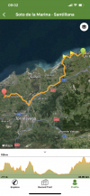
So, what a sheer delight to hear about the alternatives and also maybe use wikilocs again (after a great group online chat with Laurie and others, about said map app, I am now a total convert, especially for the Olvidado- and thank you Ender for your maps). So instead of thinking I would just walk a couple of weeks along the coast of Northern Spain from Irún, I can now plan a coastal walk to remember for the rest of my life. Thank you one and all, and Laurie, I hope you don´t mind but I might be posting a few more questions about this route.
 
Hi Laurie, thanks for providing the alternate coastal variant routes for the Norte in 2017. Has there been any route changes since then?

I’m doing my first Camino (Norte) on April 18 and I’d like to stay away from pavements and be by the coast as much as possible. I have the time to explore and I’m able to add a few kms in a day to enjoy 😉 Thanks again!
 
Hi Laurie, thanks for providing the alternate coastal variant routes for the Norte in 2017. Has there been any route changes since then?
Hi, @Rafael1214,

I think that the Wise Pilgrim app includes all or most of what I had posted about in 2017. I am pretty sure that the major alternatives, like the Ruta del Flysch, or the high route out of Soto de Luiña, or the coastal route from Santander, have remained the same. If you look through the many responses on this thread, you will see some who have added more alternatives to the ones that I posted years ago, but not too many (or maybe none?) who posted that they tried to take the alternative and were stymied. There was some discussion about the “rock bridge” after La Isla, but I haven’t gone back through the nearly 200 posts to find details.

I would recommend to anyone who is contemplating these alternatives that you should look at each one individually and see what other information you can get, either from Wise Pilgrim or wikiloc, which would be my go-to sources. It may be a little extra effort, but it is oh so worth it.
 
Ideal sleeping bag liner whether we want to add a thermal plus to our bag, or if we want to use it alone to sleep in shelters or hostels. Thanks to its mummy shape, it adapts perfectly to our body.

€46,-
3. Zumaia to Deba

GPS tracks for this route (called Ruta del Flysch or GR 121) here: https://www.wikiloc.com/wikiloc/view.do?id=14764882
This is one of the most beautiful coastal hikes I did, but beware, there are parts that are very steep and with loose terrain that is easy to slip going down. Anyone with a heavy backpack should reconsider, even with poles. But if you have a lighter (or no) backpack, and poles, and are in decent shape - this is a beautiful section.
 
Hi Laurie, thanks for providing the alternate coastal variant routes for the Norte in 2017. Has there been any route changes since then?

I’m doing my first Camino (Norte) on April 18 and I’d like to stay away from pavements and be by the coast as much as possible. I have the time to explore and I’m able to add a few kms in a day to enjoy 😉 Thanks again!
@Rafael1214, I do hope you have time to post your experience of walking the Norte, especially following some of the alternative coastal paths? I, for one, would be very grateful as my own Norte won't be until September
 
Ideal pocket guides for during & after your Camino. Each weighs only 1.4 oz (40g)!
Hi Laurie, thanks for providing the alternate coastal variant routes for the Norte in 2017. Has there been any route changes since then?

I’m doing my first Camino (Norte) on April 18 and I’d like to stay away from pavements and be by the coast as much as possible. I have the time to explore and I’m able to add a few kms in a day to enjoy 😉 Thanks again!
Our roads might just cross. I am starting from Bilbao April 25th :)

And I am so thankful to all you others that have contributed to this thread. I will be trying to avoid pavement when possible.
 

❓How to ask a question

How to post a new question on the Camino Forum.

Featured threads

❓How to ask a question

How to post a new question on the Camino Forum.

Forum Rules

Forum Rules

Camino Updates on YouTube

Camino Conversations

Most downloaded Resources

Featured threads

This site is run by Ivar at

in Santiago de Compostela.
This site participates in the Amazon Affiliate program, designed to provide a means for Ivar to earn fees by linking to Amazon
Official Camino Passport (Credential) | 2024 Camino Guides
Back
Top