• ⚠️ Emergency contact in Spain - Dial 112 and AlertCops app. More on this here.
  • Remove ads on the forum by becoming a donating member. More here.

Search 74,075 Camino Questions

My Camino Castellano-Aragonés (2016)

peregrina2000

Moderator
Staff member
I started this Camino in Riumar on the Ruta del Ebro and have a thread on my experience and the stages here. The Camino Castellano-Aragonés starts two days after Zaragoza on the Ebro in Gallur, and that’s what this thread details. I ended the Castellano Aragonés in Santo Domingo de Silos and from there walked on to Covarrubias to walk the San Olav in reverse to Burgos. It was a great “combo camino” as some forum members call these things!

I had a GPS and was very glad I did. I will point out the places where I would have been lost without it. I don't particularly like the GPS but have learned to use it and try to keep its presence to a minimum. As a result, I wind up getting "lost" more often than I would if I always had it on. But here's how I have made my peace with it. I have it in my pack side pocket. I rely on the arrows. But if at some point I haven't seen an arrow in a while, or if I'm at an intersection with no indication where to go, I pull it out and look at it. I just don't want to be that person with her head in the GPS as she walks a lovely camino.

The Camino Castellano-Aragonés starts in Gallur, breaking off from the Ruta del Ebro. In Gallur, the Ruta del Ebro heads northwest and the Castellano-Aragonés heads in a more westerly direction. According to mundicamino, it is 237 kms until its ending spot in Santo Domingo de Silos. It is a really fine camino. From Santo Domingo, you will go to Burgos. You can either take the Ruta de la Lana for two days, or take the Camino San Olav, which is a three day (HIGHLY recommended) alternative into Burgos.

Day 1 -- Gallur to Borja (28). (I had walked into Gallur the day before from the very nice albergue in Torres de Berrellén. Gallur has a nice albergue on the top floor of a building to the left of the train station. 10 €. You can contact the ayuntamiento via email and they will alert the hospitalera that you are coming. The lower floor is a bar/restaurant type place, and the woman in charge has to come down and open up for you in the morning. She doesn't mind coming down early. If you leave the elevator on the first floor and get out before she is there, alarms will go off so be sure to set the time with her carefully and not to come down until she has arrived and turned off the alarms. On Sabine's recommendation (I think), I had a delicious meal in the Hotel El Colono.)

Gallur to Borja was a great day, with two long agricultural track stretches, with the town of Magallón in the middle. Magallón has part of a mudejar church still standing, and a Renaissance church at the top of the town. Several cafés. Magallón to Borja is definitely not the straight line route, but rather a beautiful loop through vineyards, some fruit groves, some badlands type scenery. It is really really nice. I saw one guy on a tractor the whole time.

This is a stage that's easy on the feet, not too much elevation (mundicamino says it's about 400 m total ascent, all very gentle). There was one bad highway crossing, and a flooded underpass that I just had to get through. There was a brisk wind blowing at times, the locals told me it's from the Moncayo Mountains, and its name is the Cierzo (?). In late May it was cool and pleasant, but I'm sure that it's a killer in the summer.

In Borja I slept in the Pensión Peñas de Herrera, not in the old town, but in a residential area a bit outside. Actually, the pension is the second floor of a house, I think there are 3 or 4 rooms. 25€ with shared bath. Had a great 17€ menu in Bóveda del Mercado, on Alan's recommendation. I even wrote down what I ate because it was so good -- alcachofas con jamón, solomillo con salsa Roquefort, homemade cuajada cake and the local Borsao wine (kind of reminded me of Toro wine, but I'm no expert). Borja had a colegiata to visit, a nice square, nothing spectacular, but pleasant.

I am having trouble figuring out how to upload pictures but will ask for help on the forum and hope to add some soon. Buen camino, Laurie
 
The 2024 Camino guides will be coming out little by little. Here is a collection of the ones that are out so far.
Hi Laurie - what make of GPS are you using? I don't have one - but I have benefitted from other people's!
ml
 
Hi, Mary Louise,
I use a Garmin Dakota. I posted a few comments on how a dummy like me figured out how to use it without being overwhelmed by the many things it can do but that I don't want it to do. https://www.caminodesantiago.me/com...or-for-people-walking-solitary-caminos.41889/
This year's camino made me a true believer -- Day 2 on this Camino Castellano-Aragonés took me through a totally solitary slightly punishing and extremely poorly marked section. The GPS saved me hours and hours of endless wandering in search of someone to straighten me out. Are you planning a next Camino?
 
A selection of Camino Jewellery
Hi Laurie -

Thanks for the info. I figure if you can manage to make sense of it, so can I! :)
Next walk will probably be in the UK between the end of classes and exams in december, if all goes well. But I haven't decided what next summer's adventure will be. Next spanish camino will probably be the Norte/Primitivo - though I am also very tempted to do the Invierno while it is still quiet - and next summer I might have less time, so that might work. But then there are the camino routes through Germany and Austria, and the pilgrimages in Italy....In other words - there will be walking but I don't even know in which country!
Hope your re-entry has been okay. :)
ml
 
Day 2 -- Borja to Tarazona (30). WOW, what a beautiful day.

Soon after leaving Borja, you get on a nice dirt path/road through fields, and then ascend to the Santuario where the local painter's botched up "restoration" of an old Ecce Homo has become a tourist attraction. https://www.caminodesantiago.me/community/threads/borja-makes-lemonade-out-of-lemons.39072/
It was not open when I arrived. The camino then takes you up to the Calvario and dfrom there it's all along a ridge line for many beautiful kms. But I think I have never seen so many wind turbines in one place. At one spot, I started counting as I turned in a circle and got to 97. When you descend from the ridge, you have to get on the road for a few short kms to Buste, but you don't enter the village.

The first arrow right at the entrance to the village takes you off road. If that path is overgrown, you can safely stay on the road because the camino comes back down to the road in a few hundred meters. But the second arrow taking you off road (on the right) is one you must power through even if it's overgrown because this off road Camino takes you all the way to Tarazona. If you stay on the road I am not sure where you will wind up.

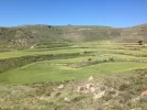
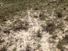
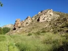
This is the section in which I was extremely and eternally grateful to my GPS. The arrows are there, but frequently hidden with overgrowth, or extremely faint. I found them only because I had my GPS. Some of the paths are totally invisible, by that I mean there is no obvious trail, you just walk up and down and around. Finally, when you emerge from what is essentially a "bowl" of undulating ridges (that may make no sense at all), you descend to a paved road that takes you into town (this paved part is 2 or 3 km, I estimate). I've got two pictures that help to explain. The first looks back into the section I had woven through. The second shows the camino as I ascended up the ridge.

into Tarazona.webp into Tarazona2.webp

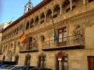
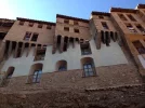
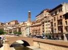
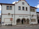
Tarazona is a VERY nice place to spend the afternoon, it has some nice old churches, a museum or two, and some "hanging houses" in the judería. Beautiful, ornate ayuntamiento, old bull ring, there's a lot to see. I stayed at Palecete de Arcedanios in central old town. 28 €, nothing fancy. The receptionist leaves for lunch, so if you are going to arrive late, you should arrange with her how and when you will get to your room. I got there at about 1:30 I think, and she was getting ready to leave. She communicates promptly via email and phone. I ate at the Galeón, a busy little place on the edge of downtown. The 10 € meal was not great, but there were a lot of people, and maybe I didn't get the best it had to offer.
 
The focus is on reducing the risk of failure through being well prepared. 2nd ed.
The first arrow right at the entrance to the village takes you off road. If that path is overgrown, you can safely stay on the road because the camino comes back down to the road in a few hundred meters. But the second arrow taking you off road (on the right) is one you must power through even if it's overgrown because this off road Camino takes you all the way to Tarazona. If you stay on the road I am not sure where you will wind up.

AFAIK, there is just one road on El Buste. It comes from Borja and ends in Cunchillos (roughly 3 kms away from Tarazona) where it meets other road heading to Tarazona on your left and Malón on your right (if there wasn't signage, any local in Cunchillos will tell you). Therefore if you take the road in El Buste, you won't have problems to reach Tarazona if you follow the road all the way; you just have to be sure that you aren't backtracking to Borja.
 
At one spot, I started counting as I turned in a circle and got to 97. When you descend from the ridge, you have to get on the road for a few short kms to Buste, but you don't enter the village.

The first arrow right at the entrance to the village takes you off road. If that path is overgrown, you can safely stay on the road because the camino comes back down to the road in a few hundred meters. But the second arrow taking you off road (on the right) is one you must power through even if it's overgrown because this off road Camino takes you all the way to Tarazona. If you stay on the road I am not sure where you will wind up.

I also got a bit lost on the way to Tarazona, and seemed to avoid El Buste altogether. After you get to the high ground, there are dozens of agricultural trails between Borja and Tarazona, and I must have just got lucky in finding a right path, especially as it was probably less overgrown in late autumn when I walked than when you were there, but clearly just as deserted of people to ask for directions.

My wikiloc trail (http://www.wikiloc.com/wikiloc/view.do?id=11164544) is different from mundicamino's, but got me there in about the same distance.

Glad you enjoyed Tarazona - it's a very fine place, isn't it?

Hi, Alan, I remember comparing your wikiloc tracks to the route I took. Essentially, you descended from the Calvario Ridge before I did. That meant I stayed up with the windmills longer until I was just above Buste. Then down to Buste, and then through that "bowl," where the twists and turns didn't make any sense to me so I was very glad I had the GPS. Then back up to another ridge, and then down -- which is where I intersected again with your tracks. I do have the GPS tracks and will probably try to get them up on wikiloc at some point.

Yes, Tarazona is quite a very fine place. Another one of those places you've never heard of and then it knocks your socks off.
 
Ideal sleeping bag liner whether we want to add a thermal plus to our bag, or if we want to use it alone to sleep in shelters or hostels. Thanks to its mummy shape, it adapts perfectly to our body.

€46,-
Day 3 -- Tarazona to Agreda (26). Another absolutely terrific day. As I go back thinking about the day by day, I am realizing that Alan is totally correct when he says this is one of the absolutely nicest caminos.

The first part of the day, 5.5 km to the small town of Fayos/Hayos was all off road (at least once you got to Tarazona's cemetery), all along a stream with lots of cottonwoods. At Los Hayos, there is a bar and lots of caves visible off in the distance that are obviously set up for visits with metal staircases and fencing. Then you're on the road a bit till you get up to the top where the dam is, and then it is probably about 8 km (I'm very bad with estimating distances) around the reservoir.

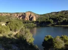
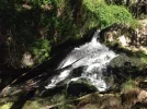
Next part involves a wildelife refuge named VAL (that's the name of the dammed up river). Very pleasant, shaded, a calming and comforting walk. This path leads you to the Cañon del Val, again very shady, green, quiet, very nice. Lots of water -- streams and a waterfall.

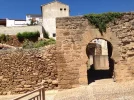
When you emerge from the cañon, there are about four kms through fields and some bare scrub hills. When you are near town, you'll see a sign that says Agreda 2 (km), but that's not the camino. You can stay off road by staying on the Camino, going through farms, and then up into town right by one of the two Moorish doors still standing, 7th century.

I saw only one other person from the reservoir to the end of the cañon, and it was a bit disconcerting. A scruffily dressed young guy was out with his dog, and it was kms and kms away from any town or road, somewhere in the preserve, I think. I just said Buenos días and kept walking. He then said something I didn't understand, and when I asked, he said, oh I was just talking to my dog. About five minutes further along, I saw what looked like an abandoned old caravan with no obvious way to have made the trek into the woods. I assume he lives there, but I can't imagine what he does.

Stayed at El Hayedo de Moncayo, small place in town, 25 € with breakfast you make yourself in the little kitchen. There is also a bigger place, the Hostal Doña Juana, on the road on the way out of town. I ate there, and the m enú was 11 €, nothing special. If I were to go back, I'd try the small in-town restaurant Sinagoga.

I spent the afternoon walking around, both to see the other ruins and to walk out through the many garden plots that are on the outskirts of town. Some have been cultivated (according to the plaque) since the times of the Moors. I also took a stroll along the long chestnut paseo, the Parque de la Dehesa, with its sulfur springs, sink holes, lovely shade, and an opportunity to chat with the many people out for a walk. The sign said it is the longest chestnut tree promenade in Europe. One woman told me she has walked the same path for more than 60 years, every day, rain or shine. It's probably a km or two out to where the trees end. It was hot, so I spent some time sitting in the shade and enjoyed seeing how so many people of all ages enjoyed some time there. Nice little place, kind of a sleepy town.

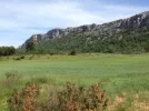
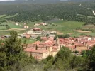
agreda1.webp agreda2.webp agreda3.webp agreda4.webp
 
Day 4 -- Ágreda to Pozalmuro (21 km)

Walking in the Parque de la Dehesa (the chestnut tree park) yesterday, I had seen a lot of yellow arrows taking you down the promenade. At some point, the arrows would have to take you to the right, and at the obvious spot where that would have happened, there was an industrial development. So my assumption was that the route was changed when the facility was built. I decided not to chance it for my departure from Ágreda, because I didn't want to get tangled up with fences, guard dogs, etc.

So I planned to follow the one arrow I had seen the day before, on the road near the hotel where I had eaten lunch. Unfortunately, the arrows soon stopped as I got near to the entrance to the autovía. Looking at my GPS, I saw that the track did indeed cross the entrances and exits from the autovía (very dangerous), and then turned left to be on a secondary highway (it may have been the National highway, but because of the autovía it carried very little traffic). After a few minutes along the side of that road, which was elevated at that point, I saw an underpass and an arrow pointing out of the underpass. It was easy enough to get to it -- continue on the highway till it went back to ground level, hop over the barrier, and backtrack a bit to the underpass. It wasn't too complicated and pretty obvious, but I think we could use some clarification from future pilgrims on this route. If I could go back to Ágreda, I would explore the arrows along the park (which pretty much parallel the road I wound up on with the overpass) and see where there's a possible turn to the right to get under the highway and on the camino.

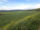
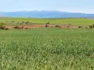
Once out of Ágreda, my walk was on agricultural tracks, more pretty fields,

pozalmuro1.webp
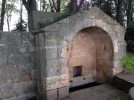
5 km to the town of Muro, a small village with not much going on but some residents. About 200 m off the camino there was a Roman fountain, which looks a lot like the one in the center of Oviedo on the end of the Gascona.

pozalmuro2.webp

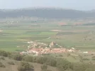
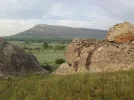
From Muro to Pozalmuro there were about 8 more kms of ag fields, then a slightly steep ascent began. When I got to the top, there was nothing below, just another hill in front of me. I could see the ribbony path going up, so I knew I was going to go down and up and down again. This part of the walk has been nicely improved by the Sorian government, and it is a Senda Natural de Soria, named Camino de Antonino. What would otherwise have been a rough walk over a very rocky terrain had been cleared (maybe the guys putting the crushed rock on the Primitivo should go take a look at how to make a path better for walking without ruining it). At the top of the second hill, there were beautiful views -- Moncayo to the left, the town of Pozalmuro to the right, down in the plains, amid all sorts of fields of different colors of green.

pozalmuro3.webp

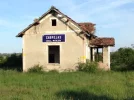
Pozalmuro has a year round population of 35. There are some well maintained, shuttered houses, and in summer there are several hundred here. The only bar still going (you'll see several that have closed) is the town social club. Run by a Brazilian woman and her husband. They used to run one of the bars in town, but when they closed it they were lucky to get the municipal concession for this club. Meals are served and that's where the key to the albergue can be obtained. I got there very early since it had been such a short day. The albergue is a back room in the building housing the doctor's office and boticario (pharmacy), both of which have limited hours of operation. The albergue room has a couple of bunks, and pilgrims can use the bathroom used by people who come to the doctor/pharmacy. No place to hang wash, but clean and a nice shower. No charge and no way to make a donation.

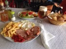
It was a long afternoon. I had a 10 € plato combindo that probably exceeded my non-Camino daily average caloric intake.
pozalmuro4.webp

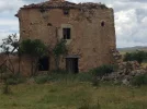
I did walk up and down all the streets and even ventured out of town a bit -- a home where the Spanish poet Bécquer had spent summers is a short way out of town, in ruins, but with a plaque explaining its significance. https://albertohernandezp.wordpress.com/2009/10/30/becquer-y-pozalmuro/ It was in such a bad state that I didn't dare poke my head in.
pozalmuro5.webp

Thanks to the wonders of wifi, I was able to facetime with my family and read the New York Times. At about 7 pm, I headed back to the albergue, and entered the room only to discover that the temperature was about 50 degrees (Fahrenheit). So I thought I'd spend a bit more time at the bar before bundling up in the albergue. The Brazilian woman was surprised to see me back, but I explained the temperature issue. She motioned for me to come with her and she took me back to the albergue and turned on the heat in the waiting room. She told me to just pull out a mattress and put it on the floor and to please turn off the heat when I left in the morning. Camino Angel!!! As I was setting up my new bedroom, the front door opened and in walked the pharmacist who was opening up shop for a few minutes. He told me not to move, not to worry, just pull the mattress over to the side a bit so others could get by. So for the next half hour, residents were coming and going getting their medicines, all of whom said a few words to me and expressed no surprise at all that an old white haired lady had plopped down her sleeping bag on a mattress dragged in from another room and was taking up most of the waiting room space. I slept like a baby and was very grateful for the wonderful hospitality I had gotten from the people here.
 
Day 5 -- Pozalmuro to Soria (38 kms)

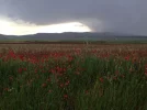
Long day, no doubt about it. When I woke up at 6, it was raining, and when I left the albergue about 30 minutes later it was still coming down. I decided to head out anyway, since my day would be long and thunderstorms were in the afternoon forecast. Lucky me, after passing through an abandoned town a few kms away, the rain magically stopped and actually held off till later that night when I was in my pensión in Soria. It was threatening for a while, and I did occasionally see lightening in the distance, but nothing more came down on my head.

pozalmuro6.webp

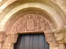
Aside from the horrible/terrible/very bad entrance into Soria, this was a spectacular day. At least three Romanesque churches, castles, watch towers. Glorious wide open spaces with the remnants of snow in the mountains beyond. It was really an exhilarating day.

pozalmuro7.webp pozalmuro8.webp pozalmuro9.webp pozalmuro10.webp

I try not to think that whoever is responsible for marking the way into Soria after you cross the N-234 after Casas de Cerro Gordo is a sadist, that can't possibly be true, but I can't think of any other explanation. I think Alan walked along the N-234, but silly me, I followed the arrows. They take you across the highway, through a field and then tell you to turn right to walk along the old railroad tracks. Under the best of circumstances, this is a hard job, because railbeds tend to be filled with good sized rocks. Under the worst of circumstances, which this was, there are rocks, overgrowth, broken ties. But I kept going, things got slightly worse when I got to the spot where new construction was building overpasses, new highways, etc and there was simply no way for me to get out. I was trapped by high walls. Finally, I got to a quarry and from there was able to find a way back to the highway. I then walked along on the small shoulder for the last few kms. Not nice either, but far preferable to the railroad.

But hey, the reward was Soria, a wonderful place with lots and lots to see. I took a rest day here and enjoyed every minute. With the 38 kms done, I found my perfectly adequate Hostal Albi up in the center. Small room, perfectly adequate, 31 € a night. After showering and washing clothes, I decided to head down to the train station to buy my Burgos-León train ticket that I would be using in a week or so. The train station is a km or two out of town, and when I got there I found that the ticket office was closed for the weekend. But the sign very nicely asked for my forgiveness. I decided I wasn't up for a big meal in a restaurant, so I went in to the LeClerq grocery store I passed on my way back to town. My opinion is that it's a bad grocery store, rotten fruit sold to unsuspecting people like me in wrapped up plastic packages. But hey, I did have some cheese and crackers, some gazpacho in a box, and some aquarius. Made for a perfectly fine little picnic in the lovely municipal park.

Late afternoon involved a visit to Santo Domingo (Romanesque church) and the cloisters at the Concatedral, both of which I returned to the next day in my Romanesque hoedown. After a nice vino tinto or two in the very very lively square, I was ready to hit the hay, knowing that tomorrow would be a totally relaxing rest day. Little did I know how spectacular it would be!
 
The one from Galicia (the round) and the one from Castilla & Leon. Individually numbered and made by the same people that make the ones you see on your walk.
@alansykes, I have just downloaded my tracks from Borja to Tarazona. http://www.wikiloc.com/wikiloc/spatialArtifacts.do?event=setCurrentSpatialArtifact&id=14144537

Do you know if there is a way to superimpose your track on my track, so we can see where we split?
I looked at them side by side and I must have lost the arrows fairly soon after the cylindrical chapel at the top. "My" way was a couple of km shorter than yours, with a bit less elevation as well, and I never felt really lost, as I could see Tarazona ahead from a good long way out. But perhaps you could get coffee in El Buste? - which I never got even close to.

PS. I had a look at your wikiloc walk into Soria as well. The last few km were grim, and I lost the arrows by the petrol station where the N roads join, and walked mostly on down an (empty on Saturday) N road. But I liked the last km or so, as I crossed the Duero on a footbridge about half way between San Juan de Duero and San Saturio, in a pleasant public park full of chestnuts and plane tees, and families out walking their dogs.

Looking forward to reading your impressions of "¡tan bella!" Soria.
 
A Rest Day in Soria

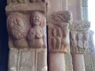
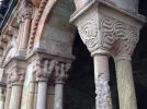
I was so very glad I had planned to stay an extra day in Soria, this city is amazing. It was Sunday, so I knew that I would have to do all my visiting during morning hours. I admit to being enamored of romanesque, but even if you don't find yourself spellbound by the cloisters, capitals, and tympanums, Soria still has a lot to see and do.

I got up early, had relaxing café con leche in one of the several pretty squares (this little city has a great ambiente in the squares) and then moved on to San Juan del Duero. I got there right as it was opening at 11 and had it all to myself for about a half hour. Then the bus loads started arriving. I highly recommend getting there as early as possible, because being able to enjoy it all alone was quite a joy. Both the church and the cloister are, IMO, just amazing.


soria9.webp soria5.webp

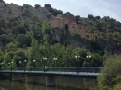
Then I walked along the river to the cave and Ermita of San Saturio. Saturio was a 6th century rich and noble Sorian who gave it all up and went to live in the cave. A baroque chapel was built on top of the cave and you can work your way up through the chambers. Till the 1950s there was a tradition that a local man would live in the cave (called the santero) and take care of it. He made regular visits to town, asking for donations and was a very important figure in Sorian life, at least according to the plaques in the cave.

soria6.webp
The river walk weaves on and off of an island in the middle of the river, goes up either side of the river, has many playgrounds, cafés, playgrounds, and just nice green space. I spent a long time there and had my second café con leche (what luxury these rest days are!).

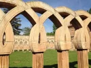
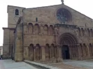
On the way back to the center, I stopped again at the Concatedral and wandered through the cloister, how can one city have so much beautiful romanesque?!

soria4.webp
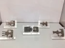
Next stop was the Museo Numantino, a regional museum focusing on pre-historic Soria, with a special emphasis on Numancia, that legendary town whose people bravely held out against the Romans' seige till the bitter end and are well known to every Spanish school child. I was interested to see that the informational plaques gently burst the bubble about the Numantinos powers, explaining that one of the main reasons they were able to hold on for so long was because the Romans had bigger fish to fry and weren't really paying attention to little Numancia. But the museum has a couple of floors with artifacts and interesting explanations of this pre-Roman settlement. The rest of the displays go through paleolithic, neolithic, bronze age, iron age, etc. I was touched by the "belt buckle display," which reminded me of the many cases of belt buckles I had seen in the Civil War museum in Gandesa. Belt buckles survive battles that many soldiers did not.
soria7.webp

For my late lunch, I decided to have a splurge. I went first to the Rincón de San Juan, which Alan had recommended. No tables available. I asked the very nice hostess if she could recommend the "next best restaurant in Soria" since I had only one day there and wanted a good meal. She quickly recommended the Chisterra, where I was luckily late enough to have avoided the rush and was able to snag a table a little after 3:30. My 18 € menu included celery with shrimp and mushrooms, merluza wrapped around asparagus, and a tiramisú cake. It was definitely worth the price.

Late afternoon was spent in the park, wandering around the town a bit more, back to Santo Domingo, a bit more time in a cafe, it was just such a wonderful day.

soria3.webp
Over and over again, I was impressed with how people of ALL ages partake of life in the public sphere in Spain, so different from where I live, where old people are just not out there much. My little city now prides itself on its outdoor venues, its street festivals, cafes and restaurants with outdoor seating, but I can't remember the last time I saw an older person with a walker, a cane, or some other mobility assistance strolling or enjoying a park, etc. That was definitely not the case in Soria, or in any other Spanish place I've enjoyed recently.

I'm sorry to have gone on for so long about the wonders of Soria, but if any of you walk the Castellano-Aragonés, think about taking a rest day here, and just make sure it's not a Monday!
 
Train for your next Camino on California's Santa Catalina Island March 16-19
I looked at them side by side and I must have lost the arrows fairly soon after the cylindrical chapel at the top. "My" way was a couple of km shorter than yours, with a bit less elevation as well, and I never felt really lost, as I could see Tarazona ahead from a good long way out. But perhaps you could get coffee in El Buste? - which I never got even close to.

PS. I had a look at your wikiloc walk into Soria as well. The last few km were grim, and I lost the arrows by the petrol station where the N roads join, and walked mostly on down an (empty on Saturday) N road. But I liked the last km or so, as I crossed the Duero on a footbridge about half way between San Juan de Duero and San Saturio, in a pleasant public park full of chestnuts and plane tees, and families out walking their dogs.

Looking forward to reading your impressions of "¡tan bella!" Soria.

Hi, Alan,

No coffee in El Buste, no nothing except a few houses as far as I could see.

And about the entrance into Soria, I just stayed alongside the national road the whole way and went over the bridge near San Juan. You must have crossed earlier, do you remember if it was anywhere near that huge bunch of howling dogs in cages? I was too tired to go take a look and see what it was, but they were visible from the road and howling pitifully. Luckily, I did get a nice long walk through that absolutely lovely park the next day when I went to San Saturio.
 
No coffee in El Buste, no nothing except a few houses as far as I could see.

So, if I understand that correctly, Alan's option is better because it's shorter, less elevation and also no coffee on the way :)
Nice to know. Thanks to both of you!
 
...and ship it to Santiago for storage. You pick it up once in Santiago. Service offered by Casa Ivar (we use DHL for transportation).
So, Kinky, is this route on your list?
Most of Spanish Caminos are on my bucket list :)
This one in combination with Girona/Catalan/Ebro and later Lana/CF/Invierno/Sanabres. I always want to end my Camino (holiday) in either Fisterra or Muxia but if that won't be possible in coming years it's nice Camino for a short hop to Spain. From the photos you are adding to your posts I can say I would like it.
 
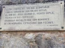
Before I get to day 6, I wanted to just mention that Soria was the university home of the Spanish poet, Antonio Machado. Though you may not be familiar with his name, you are probably familiar with the line of one of his poems -- caminante, no hay camino, se hace el camino al andar. There were many tributes to him and stanzas of poems reproduced all over town. I particularly liked a nice little statue of his head in a plaza, but my computer only displays this picture on its side and I can't flip it!). One of the nicest stanzas, I thought, had to do with carvings on cottonwood trees along the Duero:

machado.webp
Day 6 -- Soria to Abéjar (38 kms)

Another long day, but another relatively flat day (400 m up, 300 down), so it wasn't too tiring. Leaving Soria, I had to use the GPS because I didn't find arrows once I got to the outskirts. Once out of town, I got on a path used by locals for walking and cycling, and from then on it was mostly all off road for the rest of the day.

Beautiful sunrise

abejar1.webp

The camino led through a very large recreation area, with lots of dirt bike type paths, little hills, and some nice views off to the side:

abejar2.webp

This area had clearly gotten a lot of use the day before (Sunday), based on all the litter, banners, etc, but on this early Monday morning it was deserted. Once again, I had a long stage with no other human contact outside of the few little towns I passed through. Marking was good, though.

abejar3.webp

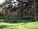
About 9 or 10 kms before Abéjar, after the town of Herreros, the camino detours out and around to go near a reservoir. This is a long loop, much of it alongside a road, nothing too beautiful. But better than walking alongside the national highway. Finally, after many kms with the reservoir in the distance, passing lots of unused and pretty much abandoned recreation areas, the camino goes into a pine forest, which is very welcome after all those kms in the sun. This pine forest takes you pretty much all the way into the back of Abéjar. Getting from the camino over to the road leading up into town, though, was a challenge. The GPS showed a trail, so I followed it and did find an arrow in the overgrowth. Staying with the GPS got me into a very marshy and overgrown place, but there was really no obvious alternative so I plunged through. In wet times this would be extremely difficult to navigate. Finally you get out and near the sewage plant on the left.

Then there's a hike up to the church at the top of this town, and then down again to the highway, turn R and you will come to the very nice municipal albergue. It's an old refinished building, very high quality. 17 € for bed, sheets and towels. Breakfast is 3 € but not served till 8, so I passed. I was the only one in the albergue. Had I been a day later, there would have been no bed for me because of a large school group coming. But there is a Hostal nearby (Fuente Fría) and a couple of hotels out on the highway. I ate a late lunch in the Hostal, 15 € (I think that was the special pilgrim price, I saw others paying 10 but hey it was decent food).

The next few days were going to be shorter, hurray, and I heard from Rebekah that she would be coming to meet me in Santo Domingo so that we could walk the San Olav into Burgos together. Double hurray!
 
...and ship it to Santiago for storage. You pick it up once in Santiago. Service offered by Casa Ivar (we use DHL for transportation).
Day 7 -- Abéjar to San Leonardo (31 km)

I had been expecting fewer kms, and I was totally unprepared for all the many kms on railbeds. This must be the same railroad line I was on coming into Soria, and it is just as awful after Abéjar as it was before Soria. But the first 7.5 km to Cabrejas del Pinar were lovely, through fields, up and down. It's a cute little town and I went to see the Roman fountain. Lots of nicely restored houses. Leaving town, it started out as more of the same on nice ag tracks. At some point, though, I realized I hadn't seen an arrow for a while, and when I checked my GPS I saw that sure enough I had missed a turn-off. I walked back till I was just about at the old abandoned railroad station, which is where the GPS took me across a field, past the station (and yes, there were arrows on the old station, but not very visible from the Camino).

San Leonardo5.jpg


After slogging through some marshy muddy squishy terrain, I walked alongside the road until I got to the Ermita de la Blanca,


and then I was taken, groan, to the old rail bed. It was so unpleasant. I have a picture but my computer puts thi At some point, the arrows took me off the railbed, but I wound up in a thicket, so I decided I should head back up to the RR. It was not fun, and it went on and on and on, till finally, there were some lovely kms through a pine forest, on soft cushy earth.

San Leonardo2.jpg

About 5 kms before San Leonardo, the little town of Navaleño has lots of cafés, a nice ayuntamiento, and a great little market on Tuesdays. I was close to San Leonardo, maybe about 8 kms, but it was early and it was getting hot so I thought a long boots-off rest was in order. I talked with several people in the café and bought some really great fruit in the market.

On the way out of town I passed a building identified with a word I didn't recognize, so I wrote it down and asked the next person I saw what it meant. Turns out this was a government office where people who are not experienced mushroom collectors bring in their mushrooms to have them checked for safety. Soria is SERIOUS about its mushrooms, I had already learned that from different people and different notices about festivals, etc. But this was something I had never heard of and thought it was a great idea.

On my way into San Leonardo from Navaleño, I was put back on the rocky RR tracks --- NOOOOOOOO! Fortunately, since the path was obviously used by a lot of local people, there was a well-defined dirt path off to the side. On the way into town, next to this track, there was a big poster announcing and picturing the filming of Dr. Zhivago. Turns out the movie was filmed in San Leonardo, and I was later told that the year they picked to film it was a freak year with no snow. And that most of the snow in the movie is fake. I'll have to watch the film again to see if I recognize the town.

I got into town, found my Hostal Torres. I wanted to make sure to get to the ayuntamiento before it closed to get a sello, so I could see whether the stamp still had the "de Yagüe" on it -- it didn't. This town, originally just named San Leonardo, had the Yagüe added during the Franco years to honor one of his top military guys. I knew of the controversy from @alansykes posts last year, and had actually read a long article about it back in Pozalmuro while I was trying to fill my long afternoon in a pueblo of 32. The ley de la memoria (Law of the Memory) has ordered that all towns, street names, etc, that were changed to honor Franco's people be changed back to their pre-Franco name. About 8 towns have not complied, San Leonardo being one of them. So a lawsuit has been filed, and the town is about to remove the Yagüe. There are strong opinions on both sides. The anti-Yagüe contingent is able to point to the law and says it's time to move on from fascism. The pro-Yagüe people say this isn't about fascism, this is about a man who brought a lot to the town -- electricity, movie theater, library, medical services, youth center, Guardia Civil office, carpentry business (the business is still going as Puertas Norma), and had 110 modern homes built, all no doubt made possible by his position in the regime. So it's complicated, and I have had a lot of discussions with Spaniards about this -- many think it's all well and good to remove offensive names, but that the law really needs to go further to get the Civil War out of the Spanish system, like a reconciliation commission or something. Not intending to wade into a political discussion, but I think people should be sensitive to the fact that there is still a lot of Civil War angst not too far below the surface, on both sides of the political spectrum.

Anyway, the theater still bears the founders' name.
San Leonardo3.jpg

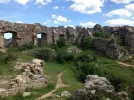
My afternoon in San Leonardo started out slow -- with a climb up to the castle, nearly a total ruin,

San Leonardo4.jpg

But then when I got back down and went for an agua con gas at my hostal's café, a woman came up to me and asked if I was Laurie. Turns out my pal @LTfit has a friend in Holland who was originally from this town and she still has friends here. And would you believe that a friend of a friend took it upon herself to show me the town and take me out after that? I saw some jota performances in the theater, went to the church where the priest let me ring the bell (some local women later told us they were worried when they heard the bell being rung at a time when it normally didn't ring), and then spent some time meeting her friends and family. These acts of kindness to a total stranger would alone qualify her for the title of Camino Angel, but there is more.

The Camino Castellano-Aragonés goes near, but not through, the Cañón de Rio Lobos. There is a way to start out on the camino, detour off a bit, and walk through part of the canyon. But my pre-Camino research showed me that if I went that way, I would miss the Romanesque church sitting in the middle of the canyon. It was 15 km to the place where a trail starts and goes through the entire canyon, and all 15 kms are along the road. I thought that the best thing to do would be to get a taxi to the trailhead, and then walk the 24 kms to the next day's end point, Hontoria del Pinar. All was fine and good until I called the taxi company (we had set this all up in May before I left the US) to firm up a time. The woman who answered the phone told me that her father-in-law had just died and there would be no taxi service tomorrow. My Camino Angel, of course knew of the death in the town, and promptly volunteered to drive me to the trailhead the next morning. Amazing, at least she let me treat her to a couple of vinos!

And I'll just add one bit of commentary for anyone else who might want to take this detour. First, if you want to see the spectacular part of the canyon, you must start at the trailhead -- walking from San Leonardo to the detour joins up with the canyon after the most glorious part. And second, though there are at least seasonal places to stay in Ucero, the town closest to the trailhead, the town is about 5 or 6 kms from the trailhead. So if you get a taxi to Ucero and spend the night there, you'll then either 5-6 more road kms to your day or have to get a ride. Hitching would probably not be too hard, but staying in San Leonardo (at least if your politics will allow you to do it) is definitely the most efficient.

Buen camino, Laurie
 
This must be the same railroad line I was on coming into Soria, and it is just as awful after Abéjar as it was before Soria.

Yes, it's the same one. A long ago closed part of the never finished Santander-Mediterráneo railroad.

The ley de la memoria (Law of the Memory) has ordered that all towns, street names, etc, that were changed to honor Franco's people be changed back to their pre-Franco name.

Just for people's info, the full text of the law can be found at: www.boe.es/boe/dias/2007/12/27/pdfs/A53410-53416.pdf
 
Day 8 -- start of the Cañón de Rio Lobos trail to Hontoria del Pinar (26 km)

Beautiful!!!! Exhilirating!!!!! What a glorious day. Definitely a 5 star.

My Camino angel dropped me right at the trail head, around 7:30 I think it was. So the sun was just rising up over the canyon as I walked through. The church is a few kms into the canyon, in an unlikely spot. The canyon has a small river running through it (at least the first half of the canyon does, it is a dry river bed well before you get to the Puente de los 7 Ojos (7-eye bridge).

The route is extremely well marked, I did not need my GPS till the very last part before emerging from the canyon, where several hiking routes converge, and it's not immediately clear which one of those routes will take you to Hontoria to get back on the Camino. As you are coming into town, you will see a road marker that points 2 km to Hontoria. Ignore it and stay on the path and you will avoid asphalt almost the whole way.

There is an albergue in Hontoria, along with a couple of cafes and grocery store. The woman in the ayuntamiento was a little unclear about its location, telling me it used to be one place (in or near the old school, I think) but had moved somewhere else. I hadn't seen the albergue in my walk through town. I had the contact info buried in my pack, but I decided that I'd just check in at the Hostal Chato around the corner. There were rooms for 24 € with private bath, and a decent menu del día at 10. Had a nice long chat with the owner of the hostal, who regaled me with mushroom stories. Many of these little towns have their own municipally owned "monte" near town. Used to be primarily for getting wood for the fireplaces, but is now an important source of mushrooms. You will see many signs about mushrooms on this Camino. Seems that bands of roaming thieves come to the monte when the town is in fiesta, rip out all the mushrooms and rush off to Madrid or another big city to sell them in the market. Sounds bizarre but I got confirmation of this from Reb and others. Looks like there is big money in those delicious setas!

This was a slow afternoon, not much going on here, but with the joys of wifi I could talk to my family and read the New York Times!

If you walk the Camino Castellano Aragonés, I believe you would be foolish to avoid the Cañón, and I'm happy to give more info if you have questions.

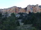
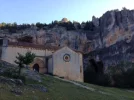
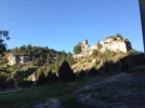
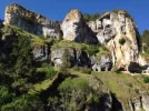
lobos1.webp lobos2.webp lobos4.webp lobos5.webp
 
Ideal sleeping bag liner whether we want to add a thermal plus to our bag, or if we want to use it alone to sleep in shelters or hostels. Thanks to its mummy shape, it adapts perfectly to our body.

€46,-
Day 9 -- Hontoria to Santo Domingo de Silos (about 30)

HOT day, so I left a little earlier than usual, about 6:15. First 3 km were on the road to the small town of Aldea del Pinar. Then, except for a few kms on the way into Peñacoba (last town before Silos), it was all through fields, grazing lands, etc. There were parts, especially the part through a very large grazing enclosure (several kms from one end to the other) that were not at all well marked. This was a very nice grazing area, at the top of the mountain, but no towns at all for kms. The arrows were there, but you had to know where to look for them, so I was very glad to have the GPS.


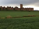
silos1.webp silos3.webp I was also lucky to run into a very nice man working with the herds -- I find that even a short conversation really re-energizes me when I'm on a long solitary section. He talked a little about his town (which was just down below at the bottom, Pinilla de los Barruecos -- he encouraged me to go visit, which I didn't do. But a google image search suggests that he was right when he told me it was a beautiful little place). There were some spectacular, almost Montserrat-like rock formations over to the right and the rest of the way to Peñacoba were fine. At Peñacoba I was tempted to stay on the road because of the huge hill looming in my future but in the end took the camino. And in the end, I was happy to see that I didn't have to climb up that entire hill as I had feared.
silos8.webp
This must be something having to do with being on the Lana. I knew I was going both to Santiago and to Silos, but I had to choose one over the other at that place.


The descent into Silos was rocky and uncomfortable, but the views were enough to make up for that. Really quite nice.

silos9.webp silos4.webp

I knew Reb was coming on the bus from Burgos, which is timed to arrive for vespers, so I had a big chunk of time in which to eat, visit the monastery, walk around the little fixed up touristy town, etc.

We had booked a last minute rate for Hotel 3 Coronas, right in the main square. Our 45 € room was not one of the beautiful ones shown on the web site (go figure), but it was fine. I decided to eat lunch in the hotel and learned that there is a 12€ menu but you have to ask for it. Wine is 1.5€ a glass in addition.
I had the menú. Vegetable menestra was great, the pollo was OK, and the homemade cheesecake quite yummy.

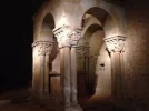
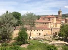
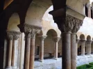
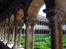
So I was able to spend a LONG time in the monastery (in the cloister and small museum only, the rest is closed off to visitors, though I did learn later on a walk around with Reb that we could go in the door on the side to visit the gardens). You have to go in with a guide, but he didn't care whether anyone stayed with him or not. And you are able to stay in the cloister once you are there for as long as you want. This cloister is really a jewel, I enjoyed it very much (but then I say that about almost every Romanesque cloister I visit).
silos6.webp silos7.webp

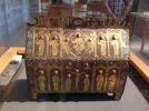
In the museum, I saw a small box that looks to me just like one I've seen in León in the museum associated with San Isidoro, enamel and jewels. So beautiful.

silos5.webp

Reb did indeed arrive for vespers. Some people but not too crowded. For me, the chants became a good contemplative backdrop as I was thinking about my mom who had recently died, and my soon-to-be born grandson. Nice and calming.

We had dinner at the place @mspath had recommended to @Viranani, I think. It was fine, nice people.

So ends my Castellano-Aragonés. The next day, Reb and I began a three day walk into Burgos on the Camino San Olav, which I will turn to next. But just let say that now that I have sort of relived this camino, I do encourage any of you looking for a not strenuous terrain, but with some long distances, and PLENTY of Romanesque, lovely open spaces, very friendly and helpful places -- consider the Castellanó-Aragonés.

Buen camino, Laurie
 
But just let say that now that I have sort of relived this camino, I do encourage any of you looking for a not strenuous terrain, but with some long distances, and PLENTY of Romanesque, lovely open spaces, very friendly and helpful places -- consider the Castellanó-Aragonés.

What a great and nice way to end your report!
 
Laurie,
These descriptions and photos will help so many pilgrims as they eventually follow along your path; thank you so much for sharing your steps and memories!

Margaret
 
Train for your next Camino on California's Santa Catalina Island March 16-19
Laurie, very inspiring, thank you for posting all this!
I had thought in March to start in Soria rather than SDdS and now I see that it's really worth considering for an encore someday.
There are direct bus and train connections between Madrid to Soria:
https://www.rome2rio.com/s/Madrid/Soria
Hmmmm. :)
Or .... You could start inZaragoza and walk two days to Gallur, and then the whole Camino Castellano Aragonés would unfold before you. (Or take Cercanias out of Zaragoza to get closer to the start in Gallur, I saw a station in Utebo I think). How much walking do you plan to do Viranani? I'd sure like to meet up sometime!!!
 
The focus is on reducing the risk of failure through being well prepared. 2nd ed.
AFAIK, there is just one road on El Buste. It comes from Borja and ends in Cunchillos (roughly 3 kms away from Tarazona) where it meets other road heading to Tarazona on your left and Malón on your right (if there wasn't signage, any local in Cunchillos will tell you). Therefore if you take the road in El Buste, you won't have problems to reach Tarazona if you follow the road all the way; you just have to be sure that you aren't backtracking to Borja.
what is AFAIK?
 
what is AFAIK?
As far as I know.

By the way (or BTW ;) for those who like to use shorthand) that last part of the walk into Tarazona was one I would not recommend without a GPS. Sure you can take the road as Castilian suggests but with a GPS you can weave through some pretty bleak yet also amazing landscape. There were lots of moments of feeling the enormity and beauty of the universe.
 
Ideal pocket guides for during & after your Camino. Each weighs only 1.4 oz (40g)!
But just let say that now that I have sort of relived this camino, I do encourage any of you looking for a not strenuous terrain, but with some long distances, and PLENTY of Romanesque, lovely open spaces, very friendly and helpful places -- consider the Castellanó-Aragonés.

Buen camino, Laurie

No....!

I'd never heard of this particular route before now -- and I very much enjoyed your reports -- and it does sound like a natural for a Romanesque fancier like myself.... But no! Any walk that requires the use of a GPS will be beyond me. Pax -- Fr J.
 
You can easily just walk along the road from Bulte (where there is a casa rural and meals can be obtained-- while Borja to Tarazona is only 24km, the walk up to the Sanctuario is uphill, and there are those who might take their time), thereby obviating the need for the cross-country stretch where a GPS is surely necessary. Another alternative in the region is to head west to Vera de Moncayo, then south for a few km to look at the 12c Real Monasterio de Santa María de Veruela, a Cistercian foundation. There are several places to stay in Vera de Moncayo, just to the north of the monastery, and the next day it is an easy 12km to Tarazona.
 
Last edited:
I have just discovered that there is accommodation in Magallon, the first pueblo west of Gallur. While the Chimenea, just south of the town over the carretera, has rooms, they were closed when I was there (although they kindly opened one for me, given my state having lost my way out of Gallur and walking about 8-10km extra in the campos), there is now a two-star on Calle Maria 21, just east of the ayuntamiento. The Hostal Loteta Experiences' number is +34 615 14 24 56. The only restaurant is still La Chimenea, but there are two bar-cafés in the town.
 
Get a spanish phone number with Airalo. eSim, so no physical SIM card. Easy to use app to add more funds if needed.
I am planning to write up a report on the first part of my 2016 camino, which started at the mouth of the Ebro River in the protected delta area (13 days from the mouth of the Ebro to Zaragoza and then two days to Gallur). But I'm not going to start with that because a forum member told me he is planning to walk the Castellano-Aragonés soon, -- there aren't too many people interested in these weird caminos I walk, so I might as well try to be helpful when someone is about to set out.
I had a GPS and was very glad I did. I will point out the places where I would have been lost without it. I don't particularly like the GPS but have learned to use it and try to keep its presence to a minimum. As a result, I wind up getting "lost" more often than I would if I always had it on. But here's how I have made my peace with it. I have it in my pack side pocket. I rely on the arrows. But if at some point I haven't seen an arrow in a while, or if I'm at an intersection with no indication where to go, I pull it out and look at it. I just don't want to be that person with her head in the GPS as she walks a lovely camino.
The Camino Castellano-Aragonés starts in Gallur, breaking off from the Ruta del Ebro. In Gallur, the Ruta del Ebro heads northwest and the Castellano-Aragonés heads in a more westerly direction. According to mundicamino, it is 237 kms until its ending spot in Santo Domingo de Silos. It is a really fine camino. From Santo Domingo, you will go to Burgos. You can either take the Ruta de la Lana for two days, or take the Camino San Olav, which is a three day (HIGHLY recommended) alternative into Burgos.
Day 1 -- Gallur to Borja (28). (I had walked into Gallur the day before from the very nice albergue in Torres de Berrellén. Gallur has a nice albergue on the top floor of a building to the left of the train station. 10 €. You can contact the ayuntamiento via email and they will alert the hospitalera that you are coming. The lower floor is a bar/restaurant type place, and the woman in charge has to come down and open up for you in the morning. She doesn't mind coming down early. If you leave the elevator on the first floor and get out before she is there, alarms will go off so be sure to set the time with her carefully and not to come down until she has arrived and turned off the alarms. On Sabine's recommendation (I think), I had a delicious meal in the Hotel El Colono.)
Gallur to Borja was a great day, with two long agricultural track stretches, with the town of Magallón in the middle. Magallón has part of a mudejar church still standing, and a Renaissance church at the top of the town. Several cafés. Magallón to Borja is definitely not the straight line route, but rather a beautiful loop through vineyards, some fruit groves, some badlands type scenery. It is really really nice. I saw one guy on a tractor the whole time.
This is a stage that's easy on the feet, not too much elevation (mundicamino says it's about 400 m total ascent, all very gentle). There was one bad highway crossing, and a flooded underpass that I just had to get through. There was a brisk wind blowing at times, the locals told me it's from the Moncayo Mountains, and its name is the Cierzo (?). In late May it was cool and pleasant, but I'm sure that it's a killer in the summer.
In Borja I slept in the Pensión Peñas de Herrera, not in the old town, but in a residential area a bit outside. Actually, the pension is the second floor of a house, I think there are 3 or 4 rooms. 25€ with shared bath. Had a great 17€ menu in Bóveda del Mercado, on Alan's recommendation. I even wrote down what I ate because it was so good -- alcachofas con jamón, solomillo con salsa Roquefort, homemade cuajada cake and the local Borsao wine (kind of reminded me of Toro wine, but I'm no expert). Borja had a colegiata to visit, a nice square, nothing spectacular, but pleasant.
I am having trouble figuring out how to upload pictures but will ask for help on the forum and hope to add some soon. Buen camino, Laurie
 
This camino looks amazing. I am trying to figure out if I can fit it into my spring plans next year. Even though it's ages away, I have a fixed number of days to be able to do it because of important bookended dates (long story, not worth explaining). So basically I would have only eight walking days at most from Gallur to Santo Domingo de Silos. Gronze has that as being exactly eight stages but I see you took nine including the canyon detour (which looks amazing), and 10 if you count the rest day in Soria. Gronze gives San Leonardo - Santo Domingo as being 38km but you give it as 56km over two stages. Does the canyon really add that much to it?
 
Wow Laurie, this looks wonderful. Thank you 🙏
P.S. ok, I’m commenting 5 years after your post but …
 
...and ship it to Santiago for storage. You pick it up once in Santiago. Service offered by Casa Ivar (we use DHL for transportation).
This camino looks amazing. I am trying to figure out if I can fit it into my spring plans next year. Even though it's ages away, I have a fixed number of days to be able to do it because of important bookended dates (long story, not worth explaining). So basically I would have only eight walking days at most from Gallur to Santo Domingo de Silos. Gronze has that as being exactly eight stages but I see you took nine including the canyon detour (which looks amazing), and 10 if you count the rest day in Soria. Gronze gives San Leonardo - Santo Domingo as being 38km but you give it as 56km over two stages. Does the canyon really add that much to it?
According to Google maps San Leonardo to Hontoria del Pinar is 9 km. My GPS recorded 26 from the start of the canyon trail (which is itself a taxi ride from San Leonardo) to Hontoria. So that does seem to add up to the difference you describe.
 
If I had an extra 2-3 days, it would be perfect, but it's too tight as it is. I have a plan B and C so I guess I'll revert to one of those. To be revealed at a later date!
Totally agree because I think it would be a pity to miss the cañon, and Soria is most definitely calling out for at least a full day. It was such a surprise to me, and truthfully I don’t think I knew anyone who had been to Soria!
 
...and ship it to Santiago for storage. You pick it up once in Santiago. Service offered by Casa Ivar (we use DHL for transportation).
If I had an extra 2-3 days, it would be perfect, but it's too tight as it is. I have a plan B and C so I guess I'll revert to one of those. To be revealed at a later date!
Just to make sure you have seen this guide. It’s old but I think there is still a lot of good info.


It was put together by the local association I think. https://caminosantiagosoria.jimdo.com/

And there’s this group.

(I just went through an old folder and thought some of this would be helpful).
 
Just to make sure you have seen this guide. It’s old but I think there is still a lot of good info.


It was put together by the local association I think. https://caminosantiagosoria.jimdo.com/


(I just went through an old folder and thought some of this would be helpful).
Did it... on your word, peregrina2000 ... I'll write more and post a photo video in a few days/weeks.
 
A selection of Camino Jewellery

❓How to ask a question

How to post a new question on the Camino Forum.

Featured threads

❓How to ask a question

How to post a new question on the Camino Forum.

Featured threads

Forum Rules

Forum Rules

Camino Updates on YouTube

Camino Conversations

Most downloaded Resources

This site is run by Ivar at

in Santiago de Compostela.
This site participates in the Amazon Affiliate program, designed to provide a means for Ivar to earn fees by linking to Amazon
Official Camino Passport (Credential) | 2024 Camino Guides
Back
Top