My first Camino, as mentioned above, was in 1989. I was living in Madrid at the time and started in Roncesvalles, which was a fairly common staring point for the Spanish. I did not walk the whole way. A little by bus. A fair amount of hitchhiking. And the rest walking. The first Camino I walked the whole way was my second, in 2016.
That was one of the differences. In the 1980s there were certainly pilgrims who were walking the Camino, but it wasn't as assumed as it is today. There were also plenty of people who were driving it. In preparing to write this post, I pulled out a couple of booklets on the Way to Santiago published by Spain's Tourism Secretariat, one from 1977 and one from 1987. (If people want, I can see about scanning these into PDFs and uploading them.) The one from 1977 clearly assumes that the reader is driving along the Way. Rather than saying where the paths and water fountains are, it says which roads one should take and where gas stations are. The one from 1987 is a little more ambiguous. It is mostly talking about the historic route and the villages and sights along it, but it does so in the context of the modern roads to be useful to drivers. When I was hitchhiking, I got several rides from people who were driving to Santiago, from Germany or Italy.
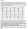
That said, there were still people walking to Santiago and something of an infrastructure for it, although much less of one. There were credencials. Mine, that I got in Roncesvalles, was from Los Amigos del
Camino de Santiago in Estella. They had created these for pilgrims leaving Roncesvalles and Jaca and intended, eventually, to have them for each point on the Camino. It was an 8.5x11" piece of card stock, folded in half. The front page was for the stamp from Roncesvalles. Inside were places for stamps from Viscarret, Pamplona, Puente la Reina, Estella, Logroño, Najera, Santo Domingo de la Calzada, San Juan de Ortega, Burgos, Fromista, Vilcazar de Sirga, Sahagun, Leon, Astorga, Rabanal del Camino, and Ponferrada. On the back, were more spaces for stamps from Villafranca del Bierzo, Centreiro, Triacastela, Sarria, Portomarin, and Palas de Rey. At the end, it exhorts:
HERRU SANCTIAGU, GOT SANCTIAGU, E ULTREYA E SUSEIA, DEUS ADIUVA NOS. ALELUYA!!!
There were guidebooks, but not many. The ubiquitous
Brierley wasn't around yet. I didn't have one when I started but somewhere along the way I picked up the tall paperback Everest guide (in Spanish) by Don Elias (who is known for having started the yellow arrows). I also picked up a smaller hardcover Everest guide (in English translation) by Eusebio Goicoechea Arrondo. The latter has an appendix listing the hotels, restaurants and service stations along the route. There were albergues, but not nearly as many of them and they tended to be in old schoolhouses, gyms, or religious institutions. The guidebooks didn't assume one was staying in these accommodations and tended to list the hotels/pensions/etc. ahead of them, I guess with the assumption that if one could afford a room in a hostal, that would be preferred tot he floor of a gym. I wasn't trying to stay in the albergues at the time. One accommodation story that has always stuck with me took place in O Cebreiro. There was no albergue then. Pilgrim accommodation in O Cebreiro was in one of the thatched-roof pallozas. There was a number to call, but I didn't have a phone. There was one inn (San Giraldo de Aurillac, a 2-star establishment). There were no rooms available, but as I was a pilgrim, the proprietor let me unroll my sleeping bag in front of the fireplace and sleep there. I never felt more like a medieval pilgrim.
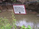
The route was fairly well marked. There were regular road signs all along identifying the road as the Camino and giving the distance to Santiago. I particularly noticed the one in Viana, which was 666 km from Santiago, which I took a picture of. They also already had pavement markings in towns to show the Camino. The one in Santo Domingo de la Calzada was particularly ornate.
There were a lot less pilgrims. In 1989 only about 5,000 Compostelas were handed out (I wasn't seeking one). Although I identified as a pilgrim, I wasn't really staying at the free pilgrim accommodations, so I wasn't meeting a lot of other walking pilgrims to comment knowledgeably on the pilgrim community at the time. I have a friend who walked from Arles via Saint Jean Pied de Port a year later in 1990. (Yes, I know that people walking from Arles traditionally walk along the Aragones through Somport, and so did he, but he wanted to pass through SJPP.) He reports that there were 4 or 5 other pilgrims he saw regularly. From his accounts, it sounds much like what one would expect to encounter on one of the much less travelled Caminos today.


