• Remove ads on the forum by becoming a donating member. More here.

Search 74,075 Camino Questions

What Garmin are you wearing?

Smash123

Member
Time of past OR future Camino
Figeac to Auvillar 2019
Podiensis/Rocamadour 2023
Hi All
Currently prepping for my Camino - Arles to . . . ? possibly to Compostella. The last time, I had a fitbit, and my phone for maps. I have since ditched the fitbit for an Apple watch, but there's no way I would do a Camino with a watch that needs such frequent charging. That said, it's really a gift to simply look at the watch to see a map, directions, a text or receive a phone call. I am thinking about going Garmin for my next Camino. Tell me what model you have used and why. The choice is overwhelming!
Thanks

- Edited to add - Don't tell me I don't need one, okay? Fine if you don't have one, maybe just let those who use one respond to this. Cheers!
 
Last edited:
The one from Galicia (the round) and the one from Castilla & Leon. Individually numbered and made by the same people that make the ones you see on your walk.
Hmm, I use my Fitbit to keep my cardiologist off my back and my iPhone for navigation when necessary. Mapy.cz is quite good for that but I find a general sense of direction and paying attention to waymarks works best. I’ve been impressed over the years by just how many times I’ve missed a waymark because I have been looking at some sodding gadget or another
 
It's pricey and overkill, but I love my Garmin Forerunner 965. I used a 935 before that and loved it too. My wife uses a 265S. We primarily use them for running, but they are very nice for the Camino as well - easily lasts a whole day or two without needing charging.

It's really cool to check out the tracks from years past and relive the memories.

That said, I almost never use the builtin map while on the Camino - that's what my phone is for. :)
 
The 2024 Camino guides will be coming out little by little. Here is a collection of the ones that are out so far.
Hmm, I use my Fitbit to keep my cardiologist off my back and my iPhone for navigation when necessary. Mapy.cz is quite good for that but I find a general sense of direction and paying attention to waymarks works best. I’ve been impressed over the years by just how many times I’ve missed a waymark because I have been looking at some sodding gadget or another
I will check out Mapy, but also have zero sense of direction, and waymarks work great, but you have to be near the Chemin/Camino to see them. I have a knack for getting really lost :)
 
I will check out Mapy, but also have zero sense of direction, and waymarks work great, but you have to be near the Chemin/Camino to see them. I have a knack for getting really lost :)
The Corporal who taught me dead-reckoning navigation and how to read a map gave me one really good piece of advice: “slow down, your target isn’t moving. Your job is to get there”.
 
The Chemin d'Arles is mainly (if not all) GR and the GR system of waymarking is infinitely superior to the yellow arrow system having been devised before GPS existed. Keep your eyes on the route and you should be fine. The only time you will really need GPS is in towns and cities where Google Maps would serve just as well.
 
The one from Galicia (the round) and the one from Castilla & Leon. Individually numbered and made by the same people that make the ones you see on your walk.
The Chemin d'Arles is mainly (if not all) GR and the GR system of waymarking is infinitely superior to the yellow arrow system having been devised before GPS existed. Keep your eyes on the route and you should be fine. The only time you will really need GPS is in towns and cities where Google Maps would serve just as well.
Yep, I did the Le Puy and managed to get very very lost. The way markers are great if you're anywhere near them. But the watch is not just for mapping.
 
I have used Garmin watches, fitness bands and handheld GPS units for nearly two decades. I don't think you are going to find anything significantly better than your current Apple watch if charging frequency is your main concern. My epix might last several days as a sports-watch tracking steps and heartrate, but as soon as it is used in GPS mode, battery life drops to around 8 hours. More modern watches will have improved on this, and you might get a couple of days life.

My preference these days is to use my phone with the OSMAnd+ app and Wise Pilgrim, carry an etrex32x with the route that I am walking loaded, and use an analogue watch. That combination has served me well and I expect it will continue to do so. I very occasionally use Google Maps in a town or city, but don't find it useful otherwise. If you are going to use your phone elsewhere for navigation, get a decent mapping app. As I said, I use OSMAnd+, but MapyCZ seems to get good reports, as do most other apps focussed on outdoors sports.
 
I went from Arles to Puente la Reina in 2022. With my GARMIN Instinct Solar but using the GPS to record the track, battery lasts approx. 20h. Otherwise I just following the GR markers and when I liked to know when I will get my next coffee I checked the map on the iPhone for the next town, restaurant or bar. I also used the map on intersections, when I had to select between the "original" way or a "variant" in order which way will be better for me, depending on the weather.
 
Fail to prepare? reduce your risk by buying this book full of practical info.
2nd ed.
@Smash123, I’ve got a Garmin inreach mini 2. Never used it on the Camino, although I would carry it if I was on one of the lesser walked trails - mainly just for the SOS function. Since I broke my ankle on trail I’ve become more aware of how often I walk though cellular blackspots ! At just 100g and €230, it’s good insurance. Using the 30-minute tracking send interval and standard activity recording, with moderate tree cover, I get at least 5 days out of my battery.

I use Mapy.cz on the trail here in Germany; whilst I’ve never used it on the Camino ( I’m one of the lucky ones for whom the arrows are sufficient) I have used it for research and it’s excellent. More functions when you open it on your laptop. Extremely accurate.
The advantage is that you can save your maps, access them before you leave town, then put your phone on airplane mode to save the battery but it keeps your current position.
 
Just to reiterate a couple of reasons why I'm a Mapy.cz fanboy...
- I like that you can move almost seemlessly between big screen computer and smartphone app - so I actually use it a lot more at home exploring routes than on the camino.
- Take a camino like the Madrid, where you might be in the middle of nowhere, walking dusty tracks between wind turbines, where the sky meets the flat empty horizon in all directions.. there's a vague fork in the road and no marker, you choose the one that looks most in line with the path you've arrived on, and walk on. After about 10-15 minutes of not seeing any other markers you get that gnawing feeling that this might not be the right path at all - do you go on or return and scout the other route? Or just pull out phone and check Mapy..
- GPS only seems to fire up when you open the app and shuts down after you close the phone, so negligible battery drain (at least on my Android Fairphone). You only need/use GPS, not data, if you have already downloaded the maps. I have downloaded several in Spain, France and here in the UK and have yet to be asked to pay for any.
- Mapy.cz in Outdoor layer doesn't just show you camino routes - but lots of other recognised paths, including the French GRs which dick bird mentions above. This gives you excellent additional information, particularly if you see a jumble of signs at a 5-way junction, or want to take a more scenic route/option (like the E9 coastal path on the Norte, or the GR109 on the Primitivo)
 
...and ship it to Santiago for storage. You pick it up once in Santiago. Service offered by Casa Ivar (we use DHL for transportation).
I've got an Instinct 2X which is solar. But the display is in black and white. But that makes it less obtrusive too. It has a little red light torch on it, a barometer and I can control my podcasts.
 
I have a Garmin Vivomove Sport that I have used on two Caminos and I am not that impressed with it. Even after several calibration walks over known distances it still well overestimates distance travelled. But it is very lightweight and tells the time, which is all I really need.
 
I use my phone for maps - OSMand is my app of choice. I really like it.
reasons why I'm a Mapy.cz fanboy...
OSMand does all of this too. Both are good. In OSMand I use tracks I've downloaded from various sources, and they all work.

No Garmin, though. Nor a smartwatch. So I can't help with recommendations.

but also have zero sense of direction
A sense for direction relies on paying attention: It's a skill that can be either developed or starved. Devices totally starve our natural wayfaring skills - these depend on external cues we miss when following a rout on a device: landmarks, vegetation, sun, sky, and shadow.

So I won't say you don't need a Garmin. If there's no developed sense of body in space you may very well need one. Just an encouragement to stretch yourself in that department a bit, to acquire your natural sense of direction. All of us have it.
 
€2,-/day will present your project to thousands of visitors each day. All interested in the Camino de Santiago.
Hi All
Currently prepping for my Camino - Arles to . . . ? possibly to Compostella. The last time, I had a fitbit, and my phone for maps. I have since ditched the fitbit for an Apple watch, but there's no way I would do a Camino with a watch that needs such frequent charging. That said, it's really a gift to simply look at the watch to see a map, directions, a text or receive a phone call. I am thinking about going Garmin for my next Camino. Tell me what model you have used and why. The choice is overwhelming!
Thanks

- Edited to add - Don't tell me I don't need one, okay? Fine if you don't have one, maybe just let those who use one respond to this. Cheers!
I have a Garmin Venu 2 Plus. I chose it b/c it has an altimeter to track elevation in addition to steps and distance for my caminos, hiking, walks and cycling (and calories, heart rate, sleep quality etc.). I am also a golfer so it also has a GPS. For me, it is a great all around watch and syncs with the pod I tend to use most often (Strava).
 
I always wear a Garmin Fenix 7 Solar. But much more for the data after walking. I am interested in all the performance data it provides, which most here probably aren’t. I don’t use it much while walking. Yellow arrows suffice and the occasional check on the map on Camino Ninja or wise Pilgrim if I think I have gone off track.
 
...and ship it to Santiago for storage. You pick it up once in Santiago. Service offered by Casa Ivar (we use DHL for transportation).
Hi All
Currently prepping for my Camino - Arles to . . . ? possibly to Compostella. The last time, I had a fitbit, and my phone for maps. I have since ditched the fitbit for an Apple watch, but there's no way I would do a Camino with a watch that needs such frequent charging. That said, it's really a gift to simply look at the watch to see a map, directions, a text or receive a phone call. I am thinking about going Garmin for my next Camino. Tell me what model you have used and why. The choice is overwhelming!
Thanks

- Edited to add - Don't tell me I don't need one, okay? Fine if you don't have one, maybe just let those who use one respond to this. Cheers!
I’ve used an older Instinct for years including 2 of 3 Camino’s and it worked fine. I’ve never used it as a navigation guide but I did use the GPS tracking on the Inglés and I had plenty of battery for 2 days usually. This past spring I walked the Aragonés starting in Oloron to Santiago using only the way markers. I kept track of distance, only for curiosity sake using my Peloton app, Outdoor Walking.

Personally, I don’t think you need any sort of GPS to navigate any Camino route but that’s my opinion only. I grew up backpacking truly in the wild and then it was map/compass and dead reckoning.

The part of the Instinct I did use this year was the elevation/barometer. The question was, how many more meters (up) to the Somport Pass???

Good luck.
 
Hi All
Currently prepping for my Camino - Arles to . . . ? possibly to Compostella. The last time, I had a fitbit, and my phone for maps. I have since ditched the fitbit for an Apple watch, but there's no way I would do a Camino with a watch that needs such frequent charging. That said, it's really a gift to simply look at the watch to see a map, directions, a text or receive a phone call. I am thinking about going Garmin for my next Camino. Tell me what model you have used and why. The choice is overwhelming!
Thanks

- Edited to add - Don't tell me I don't need one, okay? Fine if you don't have one, maybe just let those who use one respond to this. Cheers!
Hi, I used a fenix 7 x solar when I did the Norte 18 mnth back, I only had to top it up a few times, during the entire 33 days it took me.
Hope this helps
 
Just to reiterate a couple of reasons why I'm a Mapy.cz fanboy...
- I like that you can move almost seemlessly between big screen computer and smartphone app - so I actually use it a lot more at home exploring routes than on the camino.
- Take a camino like the Madrid, where you might be in the middle of nowhere, walking dusty tracks between wind turbines, where the sky meets the flat empty horizon in all directions.. there's a vague fork in the road and no marker, you choose the one that looks most in line with the path you've arrived on, and walk on. After about 10-15 minutes of not seeing any other markers you get that gnawing feeling that this might not be the right path at all - do you go on or return and scout the other route? Or just pull out phone and check Mapy..
- GPS only seems to fire up when you open the app and shuts down after you close the phone, so negligible battery drain (at least on my Android Fairphone). You only need/use GPS, not data, if you have already downloaded the maps. I have downloaded several in Spain, France and here in the UK and have yet to be asked to pay for any.
- Mapy.cz in Outdoor layer doesn't just show you camino routes - but lots of other recognised paths, including the French GRs which dick bird mentions above. This gives you excellent additional information, particularly if you see a jumble of signs at a 5-way junction, or want to take a more scenic route/option (like the E9 coastal path on the Norte, or the GR109 on the Primitivo)
I would like to try to use Mapy on Mozarabe next year, even though I have heard it is really well waymarked. With my vast knowledge of technology I just need someone to show me how it works!!!!
 
€2,-/day will present your project to thousands of visitors each day. All interested in the Camino de Santiago.
Fail to prepare? reduce your risk by buying this book full of practical info.
2nd ed.
Hi All
Currently prepping for my Camino - Arles to . . . ? possibly to Compostella. The last time, I had a fitbit, and my phone for maps. I have since ditched the fitbit for an Apple watch, but there's no way I would do a Camino with a watch that needs such frequent charging. That said, it's really a gift to simply look at the watch to see a map, directions, a text or receive a phone call. I am thinking about going Garmin for my next Camino. Tell me what model you have used and why. The choice is overwhelming!
Thanks

- Edited to add - Don't tell me I don't need one, okay? Fine if you don't have one, maybe just let those who use one respond to this. Cheers!
I am an off track hiker in Australia do multi day hikes in remote inaccessible areas so I have a Garmin Phoenix 7 pro for navigation it has various apps that you can use on your mobile to see it on a larger screen I found it useful in my Caminos, I have a Garmin ettrax 32 like Doug for navigation and something that you can't go out in the Australian bush without a Garmin inreach mini can also be used for navigation but it's main function is as a PLB personal location beacon those last two items I found them a bit of overkill on the Camino as well as maps and compass but to each their own and I might consider bringing them in March when I plan to walk from Tarifa southernmost point to Estaca de Bares northernmost point.
 
I used a Garmin Forerunner 945 (precursor to 965) on Camino Portuguese and on the Camino Del Norte. I used it for recording my walking as an activity every day, so the GPS was active during that. I didn’t use the maps on it. I used my iPhone for route finding. So I was not impacting battery life for map graphics. The 945 doesn’t have enough memory to hold both North Am and Europe maps.

If I remember correctly I needed to recharge it about every 3-4 days. I really like it. It is fairly light yet robust enough for Camino type adventures.

I have just replaced it with a Garmin Epix Pro 2. It is a little heavier and thicker but I’ve quickly gotten used to that. The main reasons to upgrade were it was heavily discounted due to release of new Fénix 8, it has enough memory for all maps, the screen is amoled and therefore easier to see in all conditions, and it has a flashlight. (I’ve been amazed at how useful the flashlight is.)

I use it in GPS mode about 3 hours a day and recharge about every 5 days or so.

I’m planning to use it on a Via Francigena this year and hoping to use the mapping on it for route finding. I use it for hiking and running courses around home and find it just less cumbersome to have the route guidance on my wrist rather than pulling out the phone. I’m sure that will have reduce battery life but from reviews I’m expecting to need to charge every 2-3 days.

If you really want long battery life, the new Enduro model is supposed to be for that.

945 and Epix recharge quite quickly. Full charge in hour-ish, and 10 minutes will give me plenty to get through a day. Also, they don’t draw a lot of power so you can easily charge them from a little portable power bank, and that of course can be done even while you’re walking — although not while on your wrist — if you forget to do it at the albergue.

I didn’t buy the new Fénix because it was $500 more and the benefits are ability to use it as a dive watch, it has a speaker (not just a beeper), and they have supposedly improved the menu organization. I decided I probably wasn’t going to use any of those things.
 
Map.cz is just an online map. Go look and see, pick a place where you know a camino is and zoom in, you will see the camino marker. Very easy and intuitive to use. For example - https://en.mapy.cz/turisticka?source=osm&id=1191857065&ds=1&x=-2.4405152&y=36.8780957&z=14
So I've only used Mapy.cz on Caminos that the dedicated apps, like Wise Pilgrim or Buen Camino, haven't gotten around to creating a guide yet (because they are like obscure / less popular walks I think). One feature that I think Mapy had, that a French guy showed me, was when you left the trail it would buzz / or ring a bit. I would likely not feel the buzz in my pants/shorts hiking, but I thought that was cool.

My biggest pet peeve with WP and BC is that, on an iPhone for me, there is no "Cone of direction" showing which way your phone is pointing when you come to an intersection or fork in the path. Numerous times, I'll have to be holding and looking at my phone, after taking my "best guess", walking about 20 meters, until I figure out if the blue dot is on the right path. If this quirk is because of some setting someone please tell me. I swear I saw an Android user who had the "cone of direction".
 
Last edited:
€2,-/day will present your project to thousands of visitors each day. All interested in the Camino de Santiago.
I note your comment “….. it's really a gift to simply look at the watch to see a map, directions, a text or receive a phone call.” Previously had fénix 6 but had an issue with the backlight and battery so upgraded to Fénix 7 solar (Garmin has great customer service in Australia) - hated the Apple Watch battery and returned the then model a couple of years ago as it wasn’t even going to remain charged for the trip from Australia. That said, I use the Garmin watch for tracking and set it up for various notifications - I use a phone app from Trekopedia whenever I’m feeling lost on the camino (sometimes there are multiple arrows pointing different directions) - the yellow arrow on the compass in the app always points the right way.
 
Garmin Vivosmart 5. Mostly just a watch to me, but it seems to track my walks and runs very accurately. I didn't want something too valuable or with too many features.

At some point I need to look into how well it goes with Relive.

I will have some .gps tracks downloaded on my phone for my Camino but will be using my eyes and brain first and foremost.
 
I bought an InReach Mini2 with a beacon possibility, as I am a lone walker, as I have always been and my home base would like a signal as to where I am. Have used for two years now..
Last November in ´23, I found the Ruta Catalan absolutely devoid of other walkers, and for the first time ever, I had two falls, but both times I succeded in landing myself on my backpack and my butt, and in this instance, it would have been handy, had I come to any harm. March ´24 I broke my knee and had to abort mission, but this time I were with friends. Being 70 brings home the issue of security on lone trails...
Other data are really not important to the experience of walking, so this security device is all I need....
 
Last edited:
The one from Galicia (the round) and the one from Castilla & Leon. Individually numbered and made by the same people that make the ones you see on your walk.
I bought an InReach Mini2 with a beacon possibility, as I am a lone walker, as I have always been and as home base would like a signal as to where I am. Have used for two years now..
Last November in ´23, I found the Ruta Catalan absolutely devoid of other walkers, and for the first time ever, I had two falls, but both times i succeded in landing me on my backpack and my butt, and in this instance, it would have been handy, had I come to any harm. March ´24 I broke my knee and has to abort mission, but this time were with friends. Being 70 brings home the issue of security on lone trails...
Other data are really not important to the experience of walking, so this security device is all I need....
Your comment is making me lean to perhaps taking my Garmin mini in reach as a lot of the time on that 2500 kms I will be on my own and as a soon to be 72 year old a fall or other issues may arise. The Garmin mini in reach allows you to send messages when you might not have internet connection
 
I wear a Garmin Instinct solar - lasts 28 days in normal mode and as Paul-CH noted above, approx 20 hours with full sampling and GPS logging. On a 5 day bushwalk I used it in full sampling mode while walking 2 of those days and normal for the rest of the time, it had about a third of battery left at end.

But I probably wouldn't take it on a multi-week camino, I don't need all the exercise stats it gives.

What I would look for is a watch that tells the time and day/date, easy to adjust to different time zones and with a light so I can see the time in the middle of the night, waterproof and preferably won't need to be charged. (Just my opinion).
 
I have used Garmin watches, fitness bands and handheld GPS units for nearly two decades. I don't think you are going to find anything significantly better than your current Apple watch if charging frequency is your main concern. My epix might last several days as a sports-watch tracking steps and heartrate, but as soon as it is used in GPS mode, battery life drops to around 8 hours. More modern watches will have improved on this, and you might get a couple of days life.

My preference these days is to use my phone with the OSMAnd+ app and Wise Pilgrim, carry an etrex32x with the route that I am walking loaded, and use an analogue watch. That combination has served me well and I expect it will continue to do so. I very occasionally use Google Maps in a town or city, but don't find it useful otherwise. If you are going to use your phone elsewhere for navigation, get a decent mapping app. As I said, I use OSMAnd+, but MapyCZ seems to get good reports, as do most other apps focussed on outdoors sports.
Uptick for using an etrex. For those with a Garmin GPS that want free OSM mapping take a look at OSM Map on Garmin for instructions on installing maps.

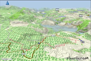
I use a British website "TalkyToaster" for my etrex. The map of Spain costs £13 ($26 CND, $18 US, €17) but they are beautiful!
1734778885871.webp
 
3rd Edition. Vital content training & pack guides avoid common mistakes, bed bugs etc

❓How to ask a question

How to post a new question on the Camino Forum.

Most read last week in this forum

From the Camino Francis 2023. The verdict is still out!
Need help with an Umbrella upgrade Pretty excited. Locked into The Francés (again) walking to Ponferrada and then connecting to the Invierno to SDC starting early April - so weather will be...
Hi All Currently prepping for my Camino - Arles to . . . ? possibly to Compostella. The last time, I had a fitbit, and my phone for maps. I have since ditched the fitbit for an Apple watch, but...
I need to call a company in the UK from the US regarding some travel arrangements for my next walk. Has anyone used and can recommend international calling cards which would be cheaper than my...
I wore Brooks Ghost on my camino last year. I loved them but they're worn out now so I bought a new pair. They're Ghost 16. I don't know what my old pair were but I bought them in 2023 so I guess...
Hi all. Apologies for another footwear question, but I'm interested in hearing what experiences people have had wearing waterproof socks for long periods on rainy days. I bought a pair of cheap...

Featured threads

❓How to ask a question

How to post a new question on the Camino Forum.

Forum Rules

Forum Rules

Camino Updates on YouTube

Camino Conversations

Most downloaded Resources

Featured threads

This site is run by Ivar at

in Santiago de Compostela.
This site participates in the Amazon Affiliate program, designed to provide a means for Ivar to earn fees by linking to Amazon
Official Camino Passport (Credential) | 2024 Camino Guides
Back
Top