• ⚠️ Emergency contact in Spain - Dial 112 and AlertCops app. More on this here.
  • Remove ads on the forum by becoming a donating member. More here.

Search 74,075 Camino Questions

Walking from Saint-Cirq-Lapopie to Cahors

Dave

Veteran Member
Time of past OR future Camino
First: Camino Francés 2002; most recent: Norte/Primitivo 2019
I've been lucky enough to walk the Célé Valley route a few times now, and I always struggle with the last chunk of it, between Saint-Cirq-Lapopie and Cahors. If you follow the "official" GR36 along the way, faithfully and completely, it'll run something like 35 to 39km, depending upon whether you take the riverside fork or the inland fork to the Mont Saint-Cyr viewpoint. The other thing about that "official" route is that, after Bouziès, there is zero food along the path (though the Arcambal bakery isn't a great hardship), nor many accommodation options (though Pasturat's gite is great). You can detour to Saint-Géry and Vers, but the latter in particular is a hassle, spanning 2km each way.

It's an awkward distance, especially given the lack of stuff along the way, and--certainly in my case--the likelihood of some shorter stages preceding it in the Célé Valley. I don't really want to do it in two days, but 35-39km with little food is a tough sell for most.

Over the years, I've poked around on this stage, finding a variety of different shortcuts and longcuts, but only on my most recent excursion last month did I put together what I suspect will be my preferred method moving forward, one I can enthusiastically recommend, with a couple of caveats.

In a nutshell, this route is 29.8km from Saint-Cirq-Lapopie to Cahors. It passes through Saint-Géry and Vers, both of which have bakeries and grocery stores. It's the shortest way you can make this walk and the route with the most food and facilities.

Main route-finding notes:
  • Follow the GR36 out of Bouziès, down to the riverside track. When the GR36 turns left, under a train trestle, keep going straight on the track
  • Note: if you aren't carrying trekking poles, you will find it helpful to have a sturdy stick for later on, and this is the best area to snag one
  • Just before passing under a train bridge that crosses the Lot, turn left and scramble uphill to join the bridge. This is one of two dicey issues to manage on this route
  • The other dicey issue kicks in on the other side of the bridge. This next stretch is chronically overgrown with brambles (this is where that stick comes in). My approach is generally to follow the bridge until it reaches the D662 (minor highway), whomping brambles out of the way as I go, and then to descend down the right side. This can be slow-going. Those who are less confident in their footing might want to employ the "butt scoot" method downhill. Once you've completed this, though, the worst of the walk is behind you
  • Follow the D662 into Saint-Géry, past the bakery, grocery, and then turning right immediately before the church. Note the sign for "site d'escalade." Near the end of this road, watch for a similar sign, calling for a turn onto a footpath. (This was the missing piece for me, the trail that "closed the gap" between Saint-Géry and Vers, and I was hooting with excitement when I found it to be workable this summer.)
  • A steep climb follows, onto the cliff overlooking Saint-Géry. This is the only genuinely strenuous part of the walk, and it will feel familiar to those who just finished the Célé Valley. You'll ascend first to the cliff face, then turn left and continue climbing to the top. When you emerge on a dirt road at the top, turn right. Epic views will start showing up to your right
  • Take the next left onto another dirt road. At this point, you'll spot yellow horizontal stripes. These waymarks, indicating a local pedestrian track, will lead you into Vers
  • Once in Vers, descend to the lovely park at the intersection of the Lot and Vers Rivers. Bask in the glory
  • Cross the pedestrian bridge and continue south along the west side of the Lot. Keep left around the Église Notre-Dame de Velles. Eventually, that dirt road will loop right and join the D653 highway. Turn left
  • When you intersect train tracks soon after, turn left onto the tracks. Continue straight onto a retired train bridge over the Lot
  • Continue straight after the bridge, ignoring a steep trail descending off the right side. Just keep going straight along the footpath. In time, you'll merge with the GR36, and from there it's smooth sailing
The downsides of this walk are the brambles on the train bridge, the tricky up-and-down to/from the bridge leading to Saint-Géry, and the chunk of highway walking (with limited shoulder) into Saint-Géry. I love getting to see the Lot from atop the cliffs over Saint-Géry, though, and I'm even more ecstatic about finding a way to fit Vers into a single-day walk from Saint-Cirq (or Cabrerets) to Cahors. It's such a beautiful village, and I think a lot of people miss out on it.

Anyway, this was already the most complicated stage in the book, with an abundance of route options. Why not make it more complicated? At the same time, though, if you're comfortable with the brambles and the tricky up-and-down, I can recommend this wholeheartedly.

Dave

The view from the cliffs above Saint-Géry:
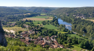
1659907751113.png

The bucolic riverside park in Vers:

1659907955888.png

The second train bridge crossing, after Vers:

1659907839717.png
 
3rd Edition. More content, training & pack guides avoid common mistakes, bed bugs etc
This is excellent, very helpful. I plan to make St. Cirq to Cahors in a full day next year and this is good information.
 
The 2024 Camino guides will be coming out little by little. Here is a collection of the ones that are out so far.
I've been lucky enough to walk the Célé Valley route a few times now, and I always struggle with the last chunk of it, between Saint-Cirq-Lapopie and Cahors. If you follow the "official" GR36 along the way, faithfully and completely, it'll run something like 35 to 39km, depending upon whether you take the riverside fork or the inland fork to the Mont Saint-Cyr viewpoint. The other thing about that "official" route is that, after Bouziès, there is zero food along the path (though the Arcambal bakery isn't a great hardship), nor many accommodation options (though Pasturat's gite is great). You can detour to Saint-Géry and Vers, but the latter in particular is a hassle, spanning 2km each way.

It's an awkward distance, especially given the lack of stuff along the way, and--certainly in my case--the likelihood of some shorter stages preceding it in the Célé Valley. I don't really want to do it in two days, but 35-39km with little food is a tough sell for most.

Over the years, I've poked around on this stage, finding a variety of different shortcuts and longcuts, but only on my most recent excursion last month did I put together what I suspect will be my preferred method moving forward, one I can enthusiastically recommend, with a couple of caveats.

In a nutshell, this route is 29.8km from Saint-Cirq-Lapopie to Cahors. It passes through Saint-Géry and Vers, both of which have bakeries and grocery stores. It's the shortest way you can make this walk and the route with the most food and facilities.

Main route-finding notes:
  • Follow the GR36 out of Bouziès, down to the riverside track. When the GR36 turns left, under a train trestle, keep going straight on the track
  • Note: if you aren't carrying trekking poles, you will find it helpful to have a sturdy stick for later on, and this is the best area to snag one
  • Just before passing under a train bridge that crosses the Lot, turn left and scramble uphill to join the bridge. This is one of two dicey issues to manage on this route
  • The other dicey issue kicks in on the other side of the bridge. This next stretch is chronically overgrown with brambles (this is where that stick comes in). My approach is generally to follow the bridge until it reaches the D662 (minor highway), whomping brambles out of the way as I go, and then to descend down the right side. This can be slow-going. Those who are less confident in their footing might want to employ the "butt scoot" method downhill. Once you've completed this, though, the worst of the walk is behind you
  • Follow the D662 into Saint-Géry, past the bakery, grocery, and then turning right immediately before the church. Note the sign for "site d'escalade." Near the end of this road, watch for a similar sign, calling for a turn onto a footpath. (This was the missing piece for me, the trail that "closed the gap" between Saint-Géry and Vers, and I was hooting with excitement when I found it to be workable this summer.)
  • A steep climb follows, onto the cliff overlooking Saint-Géry. This is the only genuinely strenuous part of the walk, and it will feel familiar to those who just finished the Célé Valley. You'll ascend first to the cliff face, then turn left and continue climbing to the top. When you emerge on a dirt road at the top, turn right. Epic views will start showing up to your right
  • Take the next left onto another dirt road. At this point, you'll spot yellow horizontal stripes. These waymarks, indicating a local pedestrian track, will lead you into Vers
  • Once in Vers, descend to the lovely park at the intersection of the Lot and Vers Rivers. Bask in the glory
  • Cross the pedestrian bridge and continue south along the west side of the Lot. Keep left around the Église Notre-Dame de Velles. Eventually, that dirt road will loop right and join the D653 highway. Turn left
  • When you intersect train tracks soon after, turn left onto the tracks. Continue straight onto a retired train bridge over the Lot
  • Continue straight after the bridge, ignoring a steep trail descending off the right side. Just keep going straight along the footpath. In time, you'll merge with the GR36, and from there it's smooth sailing
The downsides of this walk are the brambles on the train bridge, the tricky up-and-down to/from the bridge leading to Saint-Géry, and the chunk of highway walking (with limited shoulder) into Saint-Géry. I love getting to see the Lot from atop the cliffs over Saint-Géry, though, and I'm even more ecstatic about finding a way to fit Vers into a single-day walk from Saint-Cirq (or Cabrerets) to Cahors. It's such a beautiful village, and I think a lot of people miss out on it.

Anyway, this was already the most complicated stage in the book, with an abundance of route options. Why not make it more complicated? At the same time, though, if you're comfortable with the brambles and the tricky up-and-down, I can recommend this wholeheartedly.

Dave

The view from the cliffs above Saint-Géry:

View attachment 130718

The bucolic riverside park in Vers:

View attachment 130720

The second train bridge crossing, after Vers:

View attachment 130719
this is almost exactly the route I took in 2016, but in two stages: saint-cirq-lapopie - vers and vers - cahors. cool. :-) I was very excited about this route.

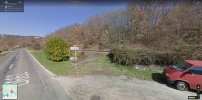
may I recommend a small improvement. where D10 meets D662 in Le Pont, there is a road sign St Gery 1km, Cahors 21km. right at this sign, there is a small path that climbs across the disused railway tracks to a lovely path in the forest above the tracks. to the left, this path leads to Rue Pere Cougnoux which ends on D662 at the start of Saint Gery. this way you can avoid at least some of the D662.

the little path by the road sign you can see here on google maps, it's in front of the ramp, and if you squint, you can even see the layout of the forest path above the train tracks:
D662-D10.jpg

I like the direct path to the cliffs from the church of Saint Gery. I found another lovely forest path with some views of Vers and its cliffs you can see on my wikiloc. you could go there by turning left on top of the cliffs. it was also marked with yellow splashes, if I remember correctly.
 
I'm trying to go from Espagnac to Cahors in 3 days and 4 nights. I'm thinking of these stages...

Espagnac
Saullic-Sur-Cele (23.5 km)
Saint-Cirq-Lapopie (19.6 km)
Cahors (29 km)

Does this look about right? Any concerns. I originally thought I could get to Cabrerets after Espagnac, but that will 33 km of tough terrain, so I thought I'd stop a little sooner.

The stage from Espagnac to Salic-Sur-Cele would be a Monday, and I know things close down then.

If it helps... I'm fit, and am planning on 24km (15 miles) average over my whole Camino.

Bill.
 
Last edited:
3rd Edition. More content, training & pack guides avoid common mistakes, bed bugs etc
I'm trying to go from Espagnac to Cahors in 3 days and 4 nights. I'm thinking of these stages...

Espagnac
Saullic-Sur-Cele (23.5 km)
Saint-Cirq-Lapopie (19.6 km)
Cahors (29 km)

Does this look about right? Any concerns. I originally thought I could get to Cabrerets after Espagnac, but that will 33 km of tough terrain, so I thought I'd stop a little sooner.

The stage from Espagnac to Salic-Sur-Cele would be a Monday, and I know things close down then.

If it helps... I'm fit, and am planning on 24km (15 miles) average over my whole Camino.

Bill.
Bonjour @BillW
To shorten the distance between St Cirq Lapopie and Cahors pilgrims often overnight at Cancot and Bach.

Attached is a 'Guide Practique' (PDF 2021) for pilgrims following trails in Le Lot et Dordogne. Pages 27-28 include services and overnighting posibilities from Cirq Lapopie to Cahor.

Happy planning!
Lovingkindness

Ps in 2004 I walked from Cabraret to Cancot (7 1/2 hours). I would have made it as far as Bach except I got lost. Cancot to Cahors took me 8 hours.

Pps near Vers on my way to Rocamadour in 2021, I stayed in a mobile home set aside for pilgrims at 'La Cheneraie'

Ppps...hhmmm...perhaps these suggestions don't exactly shorten the trail to Cahors... oh well :) . Bon chemin!

www.cheneraie.com

Screenshot_20220813-134950_Google.jpg
 

Attachments

Last edited:

❓How to ask a question

How to post a new question on the Camino Forum.

Most read last week in this forum

Hi there, I'm considering walking from Le Puy to St. Jean next spring if I can get my French up to par. I'm looking on advice on a few things: - Would it be too cool and rainy to start walking...

Featured threads

❓How to ask a question

How to post a new question on the Camino Forum.

Featured threads

Forum Rules

Forum Rules

Camino Updates on YouTube

Camino Conversations

Most downloaded Resources

This site is run by Ivar at

in Santiago de Compostela.
This site participates in the Amazon Affiliate program, designed to provide a means for Ivar to earn fees by linking to Amazon
Official Camino Passport (Credential) | 2024 Camino Guides
Back
Back
Top