As promised, here is my first report ‘Live from the Camino Viejo’. I know I’ve expressed gratitude for the sage advice and guidance you’ve all given me recently, and I now hope you’ll be similarly forgiving if it seems as if I’ve not taken much of it on board.
I arrived in Pamplona on Sunday last, after completing a journey from Lourdes, along stretches of the Piémont and Arlés routes + the Camino Aragonés. My first task in town was to purchase a road map covering the Camino Viejo towns and villages, and the only one for sale in Caminoteka (?sp) is OK as far as it goes, but is lacking any detail for off-road walking. For info, the map scale is 1:400 000.
My second task was to ask the hospitalero at the Jesus y Maria albergue how I might leave the city in the direction of Vitoria-Gesteiz the following morning. He supplied a town map that showed a quick and easy exit route, which basically involves walking down by the side of the tourist office and Ayuntemiento, following the curve of the river past the “cable” bike-lift, then crossing the Puente Cuatrovientos and straight out of town in the direction of the Berriozer suburb, and Vitoria-Gestiez. The road of town is so straight and straightforward you’d struggle to take a wrong turn.
I looked constantly for possible options to leave the main national road but saw none until the 12km marker post. I have to admit I don’t mind road-walking. I can enjoy the scenery in the distance while making steady progress; the best of both worlds. True, there was some fast moving traffic on the road, but the safety margins were wide and I felt satisfied that my high-vis jacket offered me extra protection against the speeding trucks.
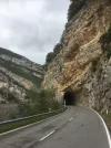
The 12km marker post came close to the exit for a roadside village on the right-side called Salsuzi (?sp). I could see a wide gravel path leading out of the village in the direction I was heading. I took the path and soon after it started to diverge away from the national road whilst still heading in the same general direction. I asked a local if the path continued to Irutzun, my lunchtime destination, and he said it did. He made it clear that the path would soon rise to the right, before a series of minor switchbacks on the other side. When reaching the bottom, he said it was important to ignore the left and right paths and, instead, to take the narrow path directly ahead. It was short and steep, which resulted in me struggling to keep my balance while making the brief ascent. The path to Irutzun was generally fine thereafter, but for the fact I encountered a series of signs blocking access due to ‘works in progress’. The first time coincided with there being an exit to the national road via a corrugated iron tunnel and, fortuitously, it meant I came across a fuel station with a restaurant attached, at which I could take my first stop of the day. At a convenient point, I rejoined the path and circumnavigated another diversion due to a damaged viaduct I was meant to cross. The third and final obstacle appeared just outside Irutzun, where I think the works were being done to upgrade the path itself. So, a good deal of road-walking in a beautiful landscape in the early part of the day, with the opportunity to get off the asphalt surface more and more as the morning turned to early afternoon.
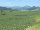
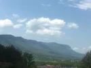
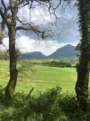
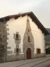
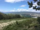
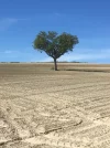
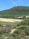
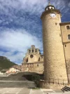
Irutzun was a good place to stop for lunch. It sits at the opening of a wide valley flanked by high sierras. On a beautiful sunny day that it was, the first impressions were quite breathtaking. The town was clearly a Basque town, as evidenced by an almost complete absence of Castilian Spanish on shop fronts and signage.
I had reserved a bed in a Casa rural (Casa Irigoien) in a place called Heriberri / Villanueva de Arakil. It was a pretty random choice beyond me thinking Irutzun would be too short a distance for me on Day 1.
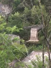
After lunch, I followed the national road to Vitoria-Gestiez until I arrived at a village called Etxarren. I could have continued the 6-8kms to my destination, but I saw a sign for Hiriberri that looked as if it would take me on a back-route, which would be a more agreeable finish to the day than simply continuing further on the asphalt. What a disaster!! Initially, I crossed the railway track and the river, ending up at a lovely, old chapel dedicated to our good friend Santiago. However, the only way to get to Heriberri / Villanueva de Arakil was to follow a GR route up the mountainside to then drop down into the village (a bit like climbing the roof of the house and entering via the chimney rather than walking up the path and through the front door!). I got awfully lost several times, and at one point I took a fateful decision that led me on a mountain road almost all the way back to Irurtzun! I got to my end of day destination at 7.45pm, almost 3hours longer than it should have taken.
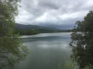
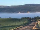
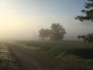
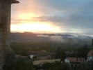
Today (Tuesday) was a cool, misty day with very little of yesterday’s beautiful scenery in evidence. All the walking was done on the road, beginning with quite pleasant secondary and tertiary roads, but increasingly it involved the national road (NA 2410) which weaved alongside the Autovia. I made little effort to seek alternative routes, partly because of yesterday’s fiasco, partly due to the drabness of the day and partly because I think the great wilderness awaits me after leaving the Pamplona to Vitoria-Gesteiz transport corridor.
I ended up this evening at a truck-stop at Olaza /Olazagutia, 2kms from the biggish-looking town of Altsasu-Alsasua. It’s not The Savoy, but it has comfortable rooms and on-site food and drink options. Unfortunately, my phone app says I’m 45kms from my next ‘albergue’ accommodation booked at the private albergue nr the cathedral in Vitoria-Gasteiz, which indicates I have a long and punishing day ahead of me. An appropriate time to sign-off for the evening, methinks!
n.b. As you can see, I’ve forgotten how to make this an official ‘Live from the Camino’ report. Will someone please remind me? Thanks!


