Dave
Veteran Member
- Time of past OR future Camino
- First: Camino Francés 2002; most recent: Norte/Primitivo 2019
For years, the coastal chunk of the Camino del Norte had the market cornered on alternative routes. Just see that long-running thread initiated and continually cultivated by Laurie above! The majority of this was driven by people branching off from the “official” route to get off-road or closer to the sea, particularly making use of the E-9. This was especially important a decade ago, when more of the Norte was pavement-bound.
Over the last few years, though, the interior Norte (mostly in Galicia, with a bit of Asturias mixed in) has assumed the mantle, and given that my most recent jaunt in Spain was a Norte-Primitivo combo, I haven’t had the chance to check out many of these. As such, while my main priority this summer was walking all of the different tracks associated with Le Puy – SJPDP, my secondary goal was to squeeze in as much as I could on the latter Norte. Here’s some of what I did and learned:
(Note: all distances come from my rough gpx tracks. Don’t take them as gospel—once tidied up, they tend to be a bit shorter, but usually not longer. I just don’t have the time right now to do all of that nitpicking.)
Alt 1: The Historical Route via Vegadeo
OK, so this variant is hardly new. It’s the original! Given the strong demand among pilgrims to deviate more to the coast, it was difficult for a long time to see the value in forking inland sooner and sacrificing that last, lovely walk on the sea. Locals have been dedicated to bringing this route back to the fore, though, and I was glad to finally have the time to check it out.
The variant to Vegadeo splits from the interior option between La Caridad and Ribadeo shortly after the albergue in Tol. It’s clearly signposted. From Tol to Vegadeo, the route spans roughly 13km. The first quarter passes through exposed fields, similar to the walk to Tol. Then, you move into more wooded areas, with the eucalyptus starting to kick in. Things get a bit hillier, but you never top 100m in this stretch, so the big exertion is climbing from 25 to 100 and then dropping back down to 20.
As would become a trend on this walk, the variant proposed a variant, as there’s a waymarked split at 1.7km from Tol, indicating the point at which one could deviate to Castropol. And that’s actually really intriguing, because in July – September, the Albatros V offers boat service between Castropol and Ribadeo, so that’s ANOTHER way one could cross through this section. (Or, alternately, one could walk into Ribadeo, maxing out that coastal time, and then ferry back to Castropol.)

Anyway, the last third of the approach to Vegadeo is lovely, as you can actually see Ribadeo and the mouth of the river in the distance, while the Ría de Ribadeo flows below to your right. The town itself is hidden until almost the last moment, and then you finally turn around the hill and see it beneath you. The biggest gem, though, is Albergue Mar y Montaña, under Lilian’s exceptional care (and ably supported by Lana the Samoyed). She made me a dinner of roasted vegetables, rice with peppers, and a mango salad, and had an equally impressive breakfast spread laid out the next morning. She noted that 4% of pilgrims on the Norte come through Vegadeo.
I’ve had my frustrations with Ribadeo’s waymarking and its tourism office in the past. By contrast, it felt like the entire town of Vegadeo was pro-Camino. The waymarking is borderline excessive. The municipal albergue is lavish. The town even has a t-shirt for pilgrims. And the location is quite nice, at the confluence of three rivers, with wooded hills pushing in from three sides. It’s a lovely little corner of the world.

From Vegadeo, you’re looking at another 38km to reconnect with the Norte in Mondoñedo. Facilities are fairly limited. I got a coffee 7km in, after crossing the Eo River into Galicia in the village of Pedrido. I saw a shiny new sign on a door in the village of Sante / A Igrexa for an albergue municipal, Albergue San Xiao, 3km later, but there’s next-to-nothing about it online. Seems like maybe it was about to open before the pandemic and then got frozen? Anyway, it’s awkwardly positioned, just 10km from Vegadeo, but it’s good to have beds. The main stop in this section is Trabada, 18.5km from Vegadeo, where there’s at least one pilgrim-friendly bar, a grocery store, and the opportunity to sleep in the polideportivo. From there, the only other town of any substance is San Tomé de Lourenzá, some 10km later (or 28.5 – 29km from Vegadeo), where you pass a small grocery, there’s a bar just off-route, and there’s a restaurant in the fortified Pazo de Tovar.
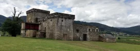
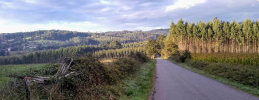
I really enjoyed this walk. It’s a bit of a rollercoaster, as you cross a series of ridgelines, with the two biggest coming in the second half of the walk (nothing too extreme—the highest points are between 400 and 470 meters—though a couple of the descents are pretty sharp). There’s a rhythm to the day, descending down into rich (and fully exposed) agricultural valleys, then transitioning back onto dirt tracks ascending (and dropping) through thick tree cover. Despite being little used, these tracks are carefully manicured by the Xunta. I passed a crew that was dutifully trimming down some grass in one area from three centimeters to one, while another fellow ran a leafblower over a mostly-clear trail.
From the moment I left the coast in Porcia to my arrival in Mondoñedo, I didn’t see another pilgrim.
Alt 2: The high-level option from Mondoñedo to Gontán-Abadín
I was surprised right out of the gates when I discovered that this newer approach is now labeled as the “principal” approach, while the longer-established (and just longer) one is “complementary.” Given that the formerly official route has a small albergue and a few tiny villages along the way, in comparison to the greater isolation of this new option, I figured it would maintain preeminence. Not the case.
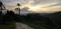
That said, I can see the logic in the decision. This new approach is shorter (12.9km instead of 15.8km), and it’s really not that much more strenuous. It climbs to a higher point than the other (around 680m), but it’s a pretty consistent ascent, most of it off-road.
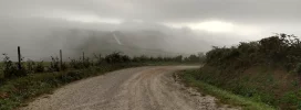
I wouldn’t be surprised if, once I have the chance to process the elevation details, there’s actually less elevation gain than the other route, as the old one is much more wiggly. I imagine the views are excellent. I had some nice glimpses of Mondoñedo in the rear-view mirror, but then the clouds and I had a head-on collision, and visibility was limited pretty much all the way from there to Gontán. If Maariz isn’t a draw for you, I’d opt for this approach quite gladly.
Alt 3: Leaving Baamonde
The old way out of Baamonde stinks: just follow the highway for 3km. Now, there’s a waymarked alternative, cutting back to the southeast, crossing the Río Parga, and then following a shady dirt road back through thick tree cover to reunite with the official route at the Capela do Santo Alberte. It’s 4.3km, so it’ll add like 1.3km to your walk, but it’s a no-brainer. It even passes a lovely riverside park after Baamonde, perfect for a picnic, and a stone refuge along the dirt road that would make a most convenient camping spot.

Alt 4: After Baamonde to Sobrado
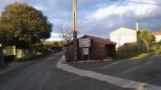
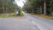
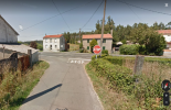
This is the other “big” new variant that has been developed in recent years. The Norte splits roughly 2km after the Santo Alberte chapel. The signage on the trail is not great:
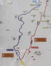
Originally, and as it’s still presented on Gronze, this was presented as two different ways of getting to Sobrado dos Monxes. The problem is that they subsequently added a variant to the variant, allowing pilgrims to bypass Sobrado completely and go straight onto Boimil/Boimorto. And as you can see on that sign, the connection to Sobrado from the northern short-cut has been removed completely. It’s still visible on the sign in As Cruces, but its omission was confusing the hell out of some of the pilgrims at the split.
Also: I mean, what the heck is the point of bypassing Sobrado? Out of all of the places on the interior Norte, THAT’S the place you’d miss? My goodness, are we going to have a scenic detour bypassing Santiago, too, just to avoid that urban jungle? Anyway, I didn’t try that variant.
Back to the main one: so, the long-standing approach from Baamonde to Sobrado spans just over 40km and passes through albergues in Carballedo, A Lagoa, Miraz, A Roxica, A Cabana. Lots of options. By contrast, this newer option is roughly 32km from Baamonde (or 33.3 if you do the nicer exit from Baamonde). Short-cut!
However, as it’s newer, the infrastructure is nowhere near the same. There’s a new private albergue, Parga Natura, some 7.5-9km from Baamonde, depending on which route you take. There’s also a fountain at the church there. After that, it’s another 7km to the village of Casanova, where there’s a new bar, Taberna de Modia, that also has a small mix of groceries inside. They’ll have an albergue here, too, at some point. The woman running the bar is endearing and she’ll whip up a fresh tortilla for you in no time.
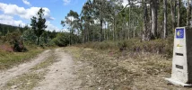
Buckle up, because from there you have no facilities until a restaurant and fountain in As Cruces, nearly 13km later. That includes the most significant ascent of the day, climbing to around 630m and a line of turbines. It’s a pretty walk, for sure. What surprised me the most about this variant, though, is just how much of it is paved. It’s quite a bit, including most of the second half. They’re hard at work, installing a new pedestrian walkway alongside the LU-P-8001, which is nice for the feet and ok for the safety, but adds little to the experience. That said, there’s not much car traffic up there—I just figured that a newer variant would be higher on the off-road percentage!
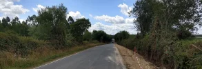
In any cast, the option to bypass Sobrado is signposted immediately after As Cruces. Once descending to Sobrado, you’ll soon be presented with ANOTHER split, either going directly into Sobrado on quiet paved roads or looping a bit wider to the north on unpaved tracks and adding a few hundred meters to your day.
What stood out to me the most on this walk was how confused many of the pilgrims were. I had a couple ask if I had any idea where we were. Pilgrims were hunched over outside the Taberna de Modia, marveling at how many kms they had to go to an albergue. If you look at the reviews of the bar on Google, you’ll see others commenting on how the host there helped them sort out accommodations. I started to worry by day’s end that the Xunta is getting a little too clever and a little too cute with all of these options, putting less attentive pilgrims in a potentially vulnerable position. If you end up on one of these variants without total clarity on the distance to your day’s accommodation—or the possible accommodations ahead—you could be setting yourself up for considerable discomfort. It’ll get better with time, but for now people should be quite careful in how they sort through these variants
Alt 5: Boimorto direct to Lavacolla
I was definitely intrigued when they added this waymarked approach, maximizing isolation time on the Norte before rejoining the Camino Francés in Lavacolla.
In preparing for it, I read that services were quite limited along the way. I found them to be sufficient. While the first bar I passed was closed (4.3km) and the fountain was broken at the Capilla de A Mota (7km), those didn’t proved to be much of a problem. I had some great—really, genuinely great—toast at Casa Rico de Medín, a lovely Casa Rural (12.9km), and then followed that up with another coffee at Bar Suarez in A Tarroeira (19.3km). They also have a small grocery inside. A bit further down the road, there’s Repsol station with a cafeteria and large shop (24.7km), followed by a couple of restaurants/pensiones in Santiso immediately after. You cross over and join the Francés at the 27.4km mark, and MY GOODNESS do you know it when that happens.

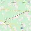
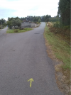
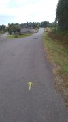
Here’s the thing about this walk, though: damn near the whole thing is paved. The first 10km are on the DP-0603. For the next 7km, you get a mix of some minor paved roads and some dirt tracks. And from there until you join the Francés, you’re right alongside the N-634. You’re not technically ON it most of the time, and also technically, you’re on unpaved surfaces for the majority of the time, as you’re walking on dirt tracks parallel to the highway. That’s nice for your feet, but your head has to reckon with the semi-regular auto traffic whipping past.
The biggest advantage of this approach, in my view, is that it makes a single-day walk from Boimorto to Lavacolla/Santiago (42km) possible for fit walkers, particularly those who have walked the full length of the Norte and are motivated to shave a day. That’s 7km less than the route through Arzúa.
Is it worth it, though? You avoid the noise of pilgrim crowds on the Francés, but replace it with the noise of auto traffic. And no offense to the Capilla de A Mota, but when that’s the scenic highlight on a 42km walk, you know you’re in for it. It’s Galicia, so it’s still pleasant enough, but it felt lacking to me.
I’m glad the option exists and I’m sure there are some who will find it appealing. To me, better to embrace the Chaos Parade and ride the collective wave of jubilance into Santiago.
Anyway, that’s what I have to share on the Norte! I’m grateful to have had the opportunity to squeeze in a bit of walking here after France. I didn’t find the experience to be reduced or compromised in any way by the COVID protections.
Dave
Over the last few years, though, the interior Norte (mostly in Galicia, with a bit of Asturias mixed in) has assumed the mantle, and given that my most recent jaunt in Spain was a Norte-Primitivo combo, I haven’t had the chance to check out many of these. As such, while my main priority this summer was walking all of the different tracks associated with Le Puy – SJPDP, my secondary goal was to squeeze in as much as I could on the latter Norte. Here’s some of what I did and learned:
(Note: all distances come from my rough gpx tracks. Don’t take them as gospel—once tidied up, they tend to be a bit shorter, but usually not longer. I just don’t have the time right now to do all of that nitpicking.)
Alt 1: The Historical Route via Vegadeo
OK, so this variant is hardly new. It’s the original! Given the strong demand among pilgrims to deviate more to the coast, it was difficult for a long time to see the value in forking inland sooner and sacrificing that last, lovely walk on the sea. Locals have been dedicated to bringing this route back to the fore, though, and I was glad to finally have the time to check it out.
The variant to Vegadeo splits from the interior option between La Caridad and Ribadeo shortly after the albergue in Tol. It’s clearly signposted. From Tol to Vegadeo, the route spans roughly 13km. The first quarter passes through exposed fields, similar to the walk to Tol. Then, you move into more wooded areas, with the eucalyptus starting to kick in. Things get a bit hillier, but you never top 100m in this stretch, so the big exertion is climbing from 25 to 100 and then dropping back down to 20.
As would become a trend on this walk, the variant proposed a variant, as there’s a waymarked split at 1.7km from Tol, indicating the point at which one could deviate to Castropol. And that’s actually really intriguing, because in July – September, the Albatros V offers boat service between Castropol and Ribadeo, so that’s ANOTHER way one could cross through this section. (Or, alternately, one could walk into Ribadeo, maxing out that coastal time, and then ferry back to Castropol.)

Anyway, the last third of the approach to Vegadeo is lovely, as you can actually see Ribadeo and the mouth of the river in the distance, while the Ría de Ribadeo flows below to your right. The town itself is hidden until almost the last moment, and then you finally turn around the hill and see it beneath you. The biggest gem, though, is Albergue Mar y Montaña, under Lilian’s exceptional care (and ably supported by Lana the Samoyed). She made me a dinner of roasted vegetables, rice with peppers, and a mango salad, and had an equally impressive breakfast spread laid out the next morning. She noted that 4% of pilgrims on the Norte come through Vegadeo.
I’ve had my frustrations with Ribadeo’s waymarking and its tourism office in the past. By contrast, it felt like the entire town of Vegadeo was pro-Camino. The waymarking is borderline excessive. The municipal albergue is lavish. The town even has a t-shirt for pilgrims. And the location is quite nice, at the confluence of three rivers, with wooded hills pushing in from three sides. It’s a lovely little corner of the world.

From Vegadeo, you’re looking at another 38km to reconnect with the Norte in Mondoñedo. Facilities are fairly limited. I got a coffee 7km in, after crossing the Eo River into Galicia in the village of Pedrido. I saw a shiny new sign on a door in the village of Sante / A Igrexa for an albergue municipal, Albergue San Xiao, 3km later, but there’s next-to-nothing about it online. Seems like maybe it was about to open before the pandemic and then got frozen? Anyway, it’s awkwardly positioned, just 10km from Vegadeo, but it’s good to have beds. The main stop in this section is Trabada, 18.5km from Vegadeo, where there’s at least one pilgrim-friendly bar, a grocery store, and the opportunity to sleep in the polideportivo. From there, the only other town of any substance is San Tomé de Lourenzá, some 10km later (or 28.5 – 29km from Vegadeo), where you pass a small grocery, there’s a bar just off-route, and there’s a restaurant in the fortified Pazo de Tovar.

I really enjoyed this walk. It’s a bit of a rollercoaster, as you cross a series of ridgelines, with the two biggest coming in the second half of the walk (nothing too extreme—the highest points are between 400 and 470 meters—though a couple of the descents are pretty sharp). There’s a rhythm to the day, descending down into rich (and fully exposed) agricultural valleys, then transitioning back onto dirt tracks ascending (and dropping) through thick tree cover. Despite being little used, these tracks are carefully manicured by the Xunta. I passed a crew that was dutifully trimming down some grass in one area from three centimeters to one, while another fellow ran a leafblower over a mostly-clear trail.
From the moment I left the coast in Porcia to my arrival in Mondoñedo, I didn’t see another pilgrim.
Alt 2: The high-level option from Mondoñedo to Gontán-Abadín
I was surprised right out of the gates when I discovered that this newer approach is now labeled as the “principal” approach, while the longer-established (and just longer) one is “complementary.” Given that the formerly official route has a small albergue and a few tiny villages along the way, in comparison to the greater isolation of this new option, I figured it would maintain preeminence. Not the case.

That said, I can see the logic in the decision. This new approach is shorter (12.9km instead of 15.8km), and it’s really not that much more strenuous. It climbs to a higher point than the other (around 680m), but it’s a pretty consistent ascent, most of it off-road.

I wouldn’t be surprised if, once I have the chance to process the elevation details, there’s actually less elevation gain than the other route, as the old one is much more wiggly. I imagine the views are excellent. I had some nice glimpses of Mondoñedo in the rear-view mirror, but then the clouds and I had a head-on collision, and visibility was limited pretty much all the way from there to Gontán. If Maariz isn’t a draw for you, I’d opt for this approach quite gladly.
Alt 3: Leaving Baamonde
The old way out of Baamonde stinks: just follow the highway for 3km. Now, there’s a waymarked alternative, cutting back to the southeast, crossing the Río Parga, and then following a shady dirt road back through thick tree cover to reunite with the official route at the Capela do Santo Alberte. It’s 4.3km, so it’ll add like 1.3km to your walk, but it’s a no-brainer. It even passes a lovely riverside park after Baamonde, perfect for a picnic, and a stone refuge along the dirt road that would make a most convenient camping spot.

Alt 4: After Baamonde to Sobrado
This is the other “big” new variant that has been developed in recent years. The Norte splits roughly 2km after the Santo Alberte chapel. The signage on the trail is not great:

Originally, and as it’s still presented on Gronze, this was presented as two different ways of getting to Sobrado dos Monxes. The problem is that they subsequently added a variant to the variant, allowing pilgrims to bypass Sobrado completely and go straight onto Boimil/Boimorto. And as you can see on that sign, the connection to Sobrado from the northern short-cut has been removed completely. It’s still visible on the sign in As Cruces, but its omission was confusing the hell out of some of the pilgrims at the split.
Also: I mean, what the heck is the point of bypassing Sobrado? Out of all of the places on the interior Norte, THAT’S the place you’d miss? My goodness, are we going to have a scenic detour bypassing Santiago, too, just to avoid that urban jungle? Anyway, I didn’t try that variant.
Back to the main one: so, the long-standing approach from Baamonde to Sobrado spans just over 40km and passes through albergues in Carballedo, A Lagoa, Miraz, A Roxica, A Cabana. Lots of options. By contrast, this newer option is roughly 32km from Baamonde (or 33.3 if you do the nicer exit from Baamonde). Short-cut!
However, as it’s newer, the infrastructure is nowhere near the same. There’s a new private albergue, Parga Natura, some 7.5-9km from Baamonde, depending on which route you take. There’s also a fountain at the church there. After that, it’s another 7km to the village of Casanova, where there’s a new bar, Taberna de Modia, that also has a small mix of groceries inside. They’ll have an albergue here, too, at some point. The woman running the bar is endearing and she’ll whip up a fresh tortilla for you in no time.

Buckle up, because from there you have no facilities until a restaurant and fountain in As Cruces, nearly 13km later. That includes the most significant ascent of the day, climbing to around 630m and a line of turbines. It’s a pretty walk, for sure. What surprised me the most about this variant, though, is just how much of it is paved. It’s quite a bit, including most of the second half. They’re hard at work, installing a new pedestrian walkway alongside the LU-P-8001, which is nice for the feet and ok for the safety, but adds little to the experience. That said, there’s not much car traffic up there—I just figured that a newer variant would be higher on the off-road percentage!

In any cast, the option to bypass Sobrado is signposted immediately after As Cruces. Once descending to Sobrado, you’ll soon be presented with ANOTHER split, either going directly into Sobrado on quiet paved roads or looping a bit wider to the north on unpaved tracks and adding a few hundred meters to your day.
What stood out to me the most on this walk was how confused many of the pilgrims were. I had a couple ask if I had any idea where we were. Pilgrims were hunched over outside the Taberna de Modia, marveling at how many kms they had to go to an albergue. If you look at the reviews of the bar on Google, you’ll see others commenting on how the host there helped them sort out accommodations. I started to worry by day’s end that the Xunta is getting a little too clever and a little too cute with all of these options, putting less attentive pilgrims in a potentially vulnerable position. If you end up on one of these variants without total clarity on the distance to your day’s accommodation—or the possible accommodations ahead—you could be setting yourself up for considerable discomfort. It’ll get better with time, but for now people should be quite careful in how they sort through these variants
Alt 5: Boimorto direct to Lavacolla
I was definitely intrigued when they added this waymarked approach, maximizing isolation time on the Norte before rejoining the Camino Francés in Lavacolla.
In preparing for it, I read that services were quite limited along the way. I found them to be sufficient. While the first bar I passed was closed (4.3km) and the fountain was broken at the Capilla de A Mota (7km), those didn’t proved to be much of a problem. I had some great—really, genuinely great—toast at Casa Rico de Medín, a lovely Casa Rural (12.9km), and then followed that up with another coffee at Bar Suarez in A Tarroeira (19.3km). They also have a small grocery inside. A bit further down the road, there’s Repsol station with a cafeteria and large shop (24.7km), followed by a couple of restaurants/pensiones in Santiso immediately after. You cross over and join the Francés at the 27.4km mark, and MY GOODNESS do you know it when that happens.

Here’s the thing about this walk, though: damn near the whole thing is paved. The first 10km are on the DP-0603. For the next 7km, you get a mix of some minor paved roads and some dirt tracks. And from there until you join the Francés, you’re right alongside the N-634. You’re not technically ON it most of the time, and also technically, you’re on unpaved surfaces for the majority of the time, as you’re walking on dirt tracks parallel to the highway. That’s nice for your feet, but your head has to reckon with the semi-regular auto traffic whipping past.
The biggest advantage of this approach, in my view, is that it makes a single-day walk from Boimorto to Lavacolla/Santiago (42km) possible for fit walkers, particularly those who have walked the full length of the Norte and are motivated to shave a day. That’s 7km less than the route through Arzúa.
Is it worth it, though? You avoid the noise of pilgrim crowds on the Francés, but replace it with the noise of auto traffic. And no offense to the Capilla de A Mota, but when that’s the scenic highlight on a 42km walk, you know you’re in for it. It’s Galicia, so it’s still pleasant enough, but it felt lacking to me.
I’m glad the option exists and I’m sure there are some who will find it appealing. To me, better to embrace the Chaos Parade and ride the collective wave of jubilance into Santiago.
Anyway, that’s what I have to share on the Norte! I’m grateful to have had the opportunity to squeeze in a bit of walking here after France. I didn’t find the experience to be reduced or compromised in any way by the COVID protections.
Dave
Last edited:


