Search 74,075 Camino Questions

N135 Puerto de Erro to Zubiri

MARSKA

CF 2023, 2024, 2025?
Time of past OR future Camino
Sept/Oct 2023
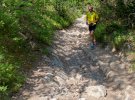
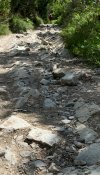
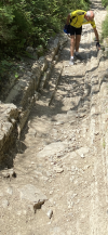
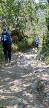
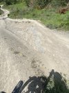
A month or two ago I asked about alternatives to walking the nasty dragon-tooth path from Puerto de Erro to Zubiri in case of rain or snow. A few people suggested walking on the side of the N135 from the food truck down to Zubiri.

Can anyone tell me the distance via the N135 vs walking on the camino path (Erro food truck to Zubiri)? How hair-raising is the walk along the N135 road?

Thanks all! Less than 2 weeks to go!
 
Perfect memento/gift in a presentation box. Engraving available, 25 character max.
One of the comments on Wise Pilgrim said it was about 4km extra. I've seen mixed messages about walking the road, some say okay, others like in Wise Pilgrim say don't. I guess a lot depends on the weather. This one is a concern for me too since it will be my first long day of walking. Only 4 days till I leave, but a couple to get over Jet lag before I hit the trail.
 
I have driven a car on this route many times and depending on the day of the week and the time of the day it can be heavily trafficked with many surreptitious trucks going across the border to avoid customs inspectors. I would avoid it at all costs if the weather is bad. The verge is almost non-existent on some curves due to the guardrail placement. One anecdote from many years ago, I was following posts from Robo on the Forum and he had mentioned he would be walking that stage on the same day I had to pick someone up at the Pamplona airport. I am reasonably sure I passed him walking down the road, it was a very wet and blustery day, if it was him then he looked like a drowned puppy and was probably soaked to the bone and I decided NADA to try to pick him up. I will do nothing to help a pilgrim who is trying to establish their cred.
 
Train for your next Camino on California's Santa Catalina Island March 16-19
Look, I'm a bicigrino, and the first time on the descent to Zubiri I took the road being aware of the track's reputation. Last year I walked down the trail with my loaded bike because I wanted to look at the geology. The track is fine for the most part except for relatively frequent short sections where the near-vertical limestone beds crop out along the track. If you take your time, and negotiate these sections with care, you should have no problem – but in snow I'd think twice.
IMG_4771.jpeg
 
Transport luggage-passengers.
From airports to SJPP
Luggage from SJPP to Roncevalles
Hi PP! I walked this stretch Oct 2023. I'm sure it was due to near exhaustion that the "relatively short frequent sections" seemed continuous and very, very long. How in the world did you manage to get a bicycle down that path???
 
One of the comments on Wise Pilgrim said it was about 4km extra. I've seen mixed messages about walking the road, some say okay, others like in Wise Pilgrim say don't. I guess a lot depends on the weather. This one is a concern for me too since it will be my first long day of walking. Only 4 days till I leave, but a couple to get over Jet lag before I hit the trail.
Buen Camino Robert! If you are willing and able, please report back and let us know about trail conditions!
 
3rd Edition. Vital content training & pack guides avoid common mistakes, bed bugs etc
Hi PP! I walked this stretch Oct 2023. I'm sure it was due to near exhaustion that the "relatively short frequent sections" seemed continuous and very, very long. How in the world did you manage to get a bicycle down that path???
With great patience, and on foot. For you, it would have come at the end of a long day, and that would definitely add to the stress. For me, I had plenty of time.
 
I did this section last week. I was kinda dreading it as I remember it as being tricky 9 years ago and all the guidance (WP, this forum) was dire. However it was fine in the end.

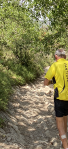
The day was dry and it hadn't rained for a few days so there were only a few damp spots. It was doable, slowly and with care and with walking poles. I imagine it would have been trickier if it had been raining/snowing or without sticks.

I think it has to be a suck-it-and-see situation, aim to do it but be open to adjust plans if the conditions are very poor.
 
I’ve often been tempted to give you all a geology lecture about the descent to Zubiri, but have held back for obvious reasons. I have however waxed lyrical about it in my almost-ready-to-go book about the geology of the camino. Zubiri gets a chapter of its own.

I’ll give you a brief rundown in the hope that you will realise that the choice to take the track is a no-brainer if you have the slightest interest in whats going on under your feet.


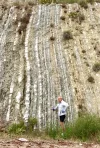
The rocky outcrops belong to a famous geological formation known as the Flysch. Those of you who have been through Zumaia on the Norte have already seen the spectacular exposures of the SAME rocks cropping out in the cliffs and the beach. The Flysch formation continues under the landscape more or less all the way from the coast, beyond what we see at Zubiri. Here’s a look-see.

IMG_6303.jpeg

The rock layers are ‘couplets’ of hard limestone and soft marl (that’s a muddy limestone which erodes away easily). The photo is looking straight down at the track. You can clearly see the hard and soft layers alternating. (There are a couple of thousand of them in the whole sequence. In the picture above, the layers are perfectly vertical. But the dip of the layers varies considerably as you progress (very slowly I hope) down the hill.

This was taken near the top.

IMG_6295.jpeg
Obviously a very different situation. The layers here are horizontal and you have to step down them. Notice that ‘risers’ are the eroded marl layers.

On most other occasions, the layers emerge at the surface either vertically or at an oblique angle - here at maybe 45 degrees.

IMG_6296.png
The individual layers often vary in thickness. If they are dipping at an angle and broken off : it ain’t pretty (unless you’re me).

IMG_6297.jpeg

Sometimes the channels are deeply eroded and wide like here.
IMG_6300.png Thicker layers at the edge can look like man-made stone walls.

But if you navigate with care I think it’s well worth the time.

IMG_6302.png

This last bit would be a problem when wet, but you’re almost there. You can see the broken surface of a bed dipping gently towards you.

IMG_4798.jpeg

There’s much more to say, but here endeth…
 
Last edited:
A selection of Camino Jewellery
I’ve often been tempted to give you all a geology lecture about the descent to Zubiri, but have held back for obvious reasons. I have however waxed lyrical about it in my almost-ready-to-go book about the geology of the camino. Zubiri gets a chapter of its own.

I’ll give you a brief rundown in the hope that you will realise that the choice to take the track is a no-brainer if you have the slightest interest in whats going on under your feet.


The rocky outcrops belong to a famous geological formation known as the Flysch. Those of you who have been through Zumaia on the Norte have already seen the spectacular exposures of the SAME rocks cropping out in the cliffs and the beach. The Flysch formation continues under the landscape more or less all the way from the coast, beyond what we see at Zubiri. Here’s a look-see.

View attachment 167038

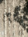
The rock layers are ‘couplets’ of hard limestone and soft marl (that’s a muddy limestone which erodes away easily). The photo is looking straight down at the track. You can clearly see the hard and soft layers alternating. (There are a couple of thousand of them in the whole sequence. In the picture above, the layers are perfectly vertical. But the dip of the layers varies considerably as you progress (very slowly I hope) down the hill.

This was taken near the top.

View attachment 167039
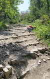
Obviously a very different situation. The layers here are horizontal and you have to step down them. Notice that ‘risers’ are the eroded marl layers.

On most other occasions, the layers emerge at the surface either vertically or at an oblique angle - here at maybe 45 degrees.

View attachment 167040
The individual layers often vary in thickness. If they are dipping at an angle and broken off : it ain’t pretty (unless you’re me).

View attachment 167041

Sometimes the channels are deeply eroded and wide like here.
View attachment 167042 Thicker layers at the edge can look like man-made stone walls.

But if you navigate with care I think it’s well worth the time.

View attachment 167043

This last bit would be a problem when wet, but you’re almost there. You can see the broken surface of a bed dipping gently towards you.

View attachment 167044

There’s much more to say, but here endeth…
I absolutely love geology. I have hiked the Canyonlands, Escalante, Zion, Grand Canyon, etc and those amazing rock layers always speak to me. Thank you for taking the time to explain the geology of this area in Spain.
 
Buen Camino Robert! If you are willing and able, please report back and let us know about trail conditions!
Marska, just came down today. Was dry and doable. Not fun, but just went slow and made it. Its suppose to rain later and tomorrow, but forecast are not always right.
 
Join the Camino cleanup. Logroño to Burgos May 2025 & Astorga to OCebreiro in June
I’ve often been tempted to give you all a geology lecture about the descent to Zubiri, but have held back for obvious reasons. I have however waxed lyrical about it in my almost-ready-to-go book about the geology of the camino. Zubiri gets a chapter of its own.

I’ll give you a brief rundown in the hope that you will realise that the choice to take the track is a no-brainer if you have the slightest interest in whats going on under your feet.


The rocky outcrops belong to a famous geological formation known as the Flysch. Those of you who have been through Zumaia on the Norte have already seen the spectacular exposures of the SAME rocks cropping out in the cliffs and the beach. The Flysch formation continues under the landscape more or less all the way from the coast, beyond what we see at Zubiri. Here’s a look-see.

View attachment 167038

The rock layers are ‘couplets’ of hard limestone and soft marl (that’s a muddy limestone which erodes away easily). The photo is looking straight down at the track. You can clearly see the hard and soft layers alternating. (There are a couple of thousand of them in the whole sequence. In the picture above, the layers are perfectly vertical. But the dip of the layers varies considerably as you progress (very slowly I hope) down the hill.

This was taken near the top.

View attachment 167039
Obviously a very different situation. The layers here are horizontal and you have to step down them. Notice that ‘risers’ are the eroded marl layers.

On most other occasions, the layers emerge at the surface either vertically or at an oblique angle - here at maybe 45 degrees.

View attachment 167040
The individual layers often vary in thickness. If they are dipping at an angle and broken off : it ain’t pretty (unless you’re me).

View attachment 167041

Sometimes the channels are deeply eroded and wide like here.
View attachment 167042 Thicker layers at the edge can look like man-made stone walls.

But if you navigate with care I think it’s well worth the time.

View attachment 167043

This last bit would be a problem when wet, but you’re almost there. You can see the broken surface of a bed dipping gently towards you.

View attachment 167044

There’s much more to say, but here endeth…
Paul. Having traversed the steps 3 days ago, thanks for the explanation. Currently in Los Arcos with exposures of folded bedding layers showing in the cliff above the village. Can you enlighten me on the local geology. Mike.
 
Paul. Having traversed the steps 3 days ago, thanks for the explanation. Currently in Los Arcos with exposures of folded bedding layers showing in the cliff above the village. Can you enlighten me on the local geology. Mike.
The sedimentary layers you're looking at are a sequence of evaporites, which occur extensively in the area particularly to the north of you.
Lakes were common in the whole Ebro basin, which was closed off from the sea until the Ebro River broke through to the Med about 8 million years ago. As the lakes intermittently dried up, evaporites precipitated out of the water, specifically salt and gypsum. The sediments exposed at Los Arcos are gypsum with interpolated layers of alabaster, which is a harder pure white variety of the same calcium sulphate.
When I was there last June, I made a point of checking out the road cutting for the autovia at the eastern end of the long ridge which you walked alongside on your way into Los Arcos. There the evaporite beds are spectacularly exposed, and vertical. The disturbance of the once perfectly horizontal sediments would have been caused by crustal movements associated with the rising Pyrenees.
Screenshot 2024-11-05 at 12.03.47 AM.webp White alabaster, and degraded gypsum. Near Los Arcos. June '24
 
Get a spanish phone number with Airalo. eSim, so no physical SIM card. Easy to use app to add more funds if needed.
The sedimentary layers you're looking at are a sequence of evaporites, which occur extensively in the area particularly to the north of you.
Lakes were common in the whole Ebro basin, which was closed off from the sea until the Ebro River broke through to the Med about 8 million years ago. As the lakes intermittently dried up, evaporites precipitated out of the water, specifically salt and gypsum. The sediments exposed at Los Arcos are gypsum with interpolated layers of alabaster, which is a harder pure white variety of the same calcium sulphate.
When I was there last June, I made a point of checking out the road cutting for the autovia at the eastern end of the long ridge which you walked alongside on your way into Los Arcos. There the evaporite beds are spectacularly exposed, and vertical. The disturbance of the once perfectly horizontal sediments would have been caused by crustal movements associated with the rising Pyrenees.
View attachment 180234 White alabaster, and degraded gypsum. Near Los Arcos. June '24
I can't wait to see this book. When, where, and how do I get a copy??
 

❓How to ask a question

How to post a new question on the Camino Forum.

Most read last week in this forum

My husband and I are walking the Camino next June. We are currently booked into guest houses/hostels from Sarria to Santiago. I feel if we miss doing the meseta, I think we will regret it. That...
I have not had time to read this yet, but my spy on the ground tells me it outlines what it says on the tin, including a comment on the issue of how to improve the descent around Zubiri. I have no...
I never tire of doing the Camino Francés (five times and counting!), but the overcrowding in the summer months has made the Brierley stages from Sarria a no-go for me. That's why today I'm...
Back in 2018, I found an interactive Excel spreadsheet in the resource section for the Camino Frances that listed every town on the route and allowed you to pick your stopping point for each day...
I'm a total newbie and could use some help finding this little site so I can take a pic for a friend. It's near Burgos. I've found "Approaching Hontanas (Province of Burgos, Castilla y León)...
Suzanne and I may be back at it in the Spring. The hardest part right now is getting our heads around committing to 5-6 weeks of being away. Assuming we get there...we've always wanted to walk...

Featured threads

❓How to ask a question

How to post a new question on the Camino Forum.

Featured threads

Forum Rules

Forum Rules

Camino Updates on YouTube

Camino Conversations

Most downloaded Resources

This site is run by Ivar at

in Santiago de Compostela.
This site participates in the Amazon Affiliate program, designed to provide a means for Ivar to earn fees by linking to Amazon
Official Camino Passport (Credential) | 2024 Camino Guides
Back
Back
Top