• Remove ads on the forum by becoming a donating member. More here.

Search 74,075 Camino Questions

MAPS.ME vs Google Maps vs competitor apps

Mark McCarthy

Active Member
Time of past OR future Camino
CF 2014 2015
Lourdes 2 SdC 2016
Sarria 2 SdC April&Oct 2016 & (April 2018)
Camino Baztan June 2017
My last few Caminos I have used MAPS.ME which worked well on the CF but not as well on the CP. I noticed a few other people using MAPS.ME rather than Google Maps. I was wondering what are people's thoughts are on MAPS.ME versus Google Maps and does anyone use other apps? I use MAPS.ME to estimate distances and to find facilities when in towns.
 
Holoholo automatically captures your footpaths, places, photos, and journals.
I've never heard of MAPS.ME, thanks for the hint. I had a look at it, but it required me to choose a country, a town and a facility when opening the front page. I seldom use a map app to find facilities, instead I want to find the way e.g. through a town or where directions are hard to find. Thus I need an app which could show me a GPS track, much like http://www.locusmap.eu/ . I'm not sure MAPS.ME can do that.

So it comes down to what you would need such an app for. Google Maps has nearly unbeatable advantages as it is preinstalled on many devices, shows travel information if you need it, shows traffic information in real time and has its own map database. My quick view at MAPS.ME showed me that it relies obviously on OpenStreetMap data, am I right? If yes, the data quality is sufficent for many hiking trails/Caminos but not for all. When I crossed France from north-east to south-west, I came across many rural areas where the OSM map data was old or inaccurate. No big deal, but Google Maps was more complete in that regard.
 
I have MAPS.ME on my smartphone but I normally use the GPS app called OSMand (IOS and Android) that works offline and uses maps from the Open Street Map project. Why OSMand? Because I got it first. The user interface drives me nuts at time though. I've been meaning to do a comparison between the two geared to Camino use but I have more prjects than time. Anyway they are similar and both use data from the Open Street Map project. OSMand is free for trial with a small number of downloadable maps and for a small cost you get unlimited maps.

There is a nice feature in OSMand useful for Caminos; it can be used to display Points Of Interest that are sites mentioned in Wikipedia. Like the OSM maps these Wikipedia POIs also can be downloaded so they can be read off line. Read more about these POIs and see a screenshot at this post on the forum: https://www.caminodesantiago.me/community/threads/ios-apps-for-history-guide.43625/#post-450256

You can view downloadable tracks in both apps although the method of getting them on is different and one uses gpx format and the other uses kml/kmz. At least one (I forget which, maybe both) offers to download the next set of data when it notices that you are no longer in a mapped area.

I prefer these two apps over Google Maps because they show trails (if OSM has the data) and I haven't seen Google do that.
 
€2,-/day will present your project to thousands of visitors each day. All interested in the Camino de Santiago.
What was it that didn't worked so well?


Maps.me can definitely show the KML tracks.
I think that the CF is well mapped in Openstreetmap as a international walk way and therefore when working out the best route by foot MAPS.ME by default route you along the CF. I suspect the CP is not similarly mapped in Openstreetmap.
 
I think that the CF is well mapped in Openstreetmap as a international walk way and therefore when working out the best route by foot MAPS.ME by default route you along the CF. I suspect the CP is not similarly mapped in Openstreetmap.
I don't understand what happens in the background, but I have found KML files (e.g. on wikiloc.com) for the entire Almeria-Merida camino Mozarabe, as well as a number of variations from there. I would be very surprised not to find the CP at least as well documented. Maybe (?) if you are trying to create your own new route in advance, it is more complicated.
 
Perfect memento/gift in a presentation box. Engraving available, 25 character max.
Mark, like I wrote earlier I want to do a comparison of OSMand and Maps.me (and I suppose I should throw in Google Maps too.) I decided to download Navarra into Maps.me (I already had that for OSMand) for a quickie compare with the three apps using Zabaldika as a target to show. Based on this it looks like Maps.me will come out the winner in a good test. Sorry but I don't want to do a writeup right now but I liked Maps.me for a number of reasons. I wish it had that Wikipedia database that OSMand has though.
 
Mark, like I wrote earlier I want to do a comparison of OSMand and Maps.me (and I suppose I should throw in Google Maps too.) I decided to download Navarra into Maps.me (I already had that for OSMand) for a quickie compare with the three apps using Zabaldika as a target to show. Based on this it looks like Maps.me will come out the winner in a good test. Sorry but I don't want to do a writeup right now but I liked Maps.me for a number of reasons. I wish it had that Wikipedia database that OSMand has though.
I am just installing OSMand to see what it is like.
 
Unless I am using these apps wrong, Google Maps was great in any place that had named streets. I relied on it to find my way from one point of interest to another, or to locate a specific address in any town or city.

However, when walking the Camino, in between incorporated places, I found Maps.me to be superior. It is better for following the Camino path out in the "boonies," and locating yourself relative to where you have been, and where you are heading.

To use maps.me correctly, you need to download a .kml / .kmz GPS track file file from the maps.me website. The app has a function to download maps to serve as a the background, on which the GPS track operates. You can download as little of a countries maps as you wish.

Use the search function above / right to look for .kmz files or .kml files. That is how I find mine. The Dutch Pilgrim Society has a lot of these files for free download. The text is in Dutch, but a map is a map.

Hope this helps.
 
Get a spanish phone number with Airalo. eSim, so no physical SIM card. Easy to use app to add more funds if needed.
I tried both OSM and Maps.me but found Maps much easier to use. It does everything I need, is free. Both use OpenStreetMap (OSM) which works great. Also, if you see something missing you can report it easily or you can became an 'openstreetmapper' yourself. And it is a nice change from using all this google stuff.

In both it is quit easy to load other kml (maps.me) or gpx (osmand) trackfiles into it, or kml files with accomodation.
Check the site of the Dutch confraternity regulary. Some more Spanish accomodation files might show up later this year...
 
I've never used on-line or even off-line maps on 3 caminos. Just follow the arrows! OK maybe if you are after seeking out off route antiquities/churches/points of interest etc then you might need it.

Ok. Yes, I got "lost" once for all of 20 minutes. It was liberating... :)

Usually I don't know what day it is so why would I need to know where I am?
 
Holoholo automatically captures your footpaths, places, photos, and journals.
I, too simply follow the arrows. However, when the weather deteriorates seriously, or my hips knees or ankles resonate in a chorus of "nada mas," it is nice to be able to know exactly where I am in relation to where I would like to be. It helps me plan forward.

Occasionally, I have to resort to taking a taxi or bus to finish the daily planned distance if my aging joints are simply too painful, even with pain relievers, anti-inflammatory medication and elastic braces. When I am presented with a challenge, I simply adapt and overcome.

I do not follow the GPS track. But I DO have it running in my pocket or belly bag. This way, when and if I need to refer to it, it is ready to tell me what I want to know.

Before I depart, I develop a MS Word table of my "walking plan." It has columns for date, day, destination, Km, elapsed Km, and Km remaining to Santiago. It also has columns for where I have reserved lodging for the night.

The table is orientated in landscape mode. I carry it in my cargo pocket, in the waterproof pouch with my credencial and national passport. I also leave a copy with my family so they know where I was expected to lay my head each night.

Where I do not have reservations already made, the lodging column also contains the phone numbers of several likely places TBD to stay that did not have online reservation capability. This way, I can ask an innkeeper to call the night before, or two nights out, to make a phone reservation on my behalf. My Spanish is improving, but is not yet fully conversational. In my experience, this always works.

Hope this helps.
 
t2andreo - Horses for courses as they say.

Sure, if you have health or safety issues then go for it. But for most average walkers without health issues and wanting to get the most out of the freedom the camino offers then I'd say plan the least ( you never know what will happen, which route you will take, where you might decide to go next and when).
 
OK maybe if you are after seeking out off route antiquities/churches/points of interest etc then you might need it.
A smartphone can insert GPS location information into pictures so you can later determine the location where the picture was taken. It takes awhile for the smartphone to get the location from satelites and this makes it a nuisance to turn the GPS feature on and then off for each photo. So if you leave the GPS feature always on you may as well run the map application too. If you use GPS bring a spare battery.
 
Last edited:
...and ship it to Santiago for storage. You pick it up once in Santiago. Service offered by Casa Ivar (we use DHL for transportation).
A smartphone can insert GPS location information into pictures so you can later determine the location where the picture was taken. It takes awhile for the smartphone to get the location from satelites and this makes it a nuisance to turn the GPS feature on and then off for each photo. So if you leave the GPS feature always on you may as well run the map application too. Bring a spare battery.
I love this feature, it means you look back via Google Maps to exactly where you took a photo.
 
My last few Caminos I have used MAPS.ME which worked well on the CF but not as well on the CP. I noticed a few other people using MAPS.ME rather than Google Maps. I was wondering what are people's thoughts are on MAPS.ME versus Google Maps and does anyone use other apps? I use MAPS.ME to estimate distances and to find facilities when in towns.
I guess I should really be on the Primitivo since I didn’t use any of them, just a silly little thing I grabbed in Saint Jean to sort of look at distances.
 
Ideal sleeping bag liner whether we want to add a thermal plus to our bag, or if we want to use it alone to sleep in shelters or hostels. Thanks to its mummy shape, it adapts perfectly to our body.

€46,-
... does anyone use other apps? I use MAPS.ME to estimate distances and to find facilities when in towns.

I used OsmAnd+ on an Android 8” tablet to help me along the entire CF and to/from Muxia & Fisterra in 2017. I found OsmAnd+ to be extremely economical. It satisfied all of my needs, and its ability to use downloadable maps with associated POIs, and downloadable contour lines, were particularly useful in finding lodgings, sustenance, museums, laundromats, etc.

The CF and numerous other long-distance hiking routes were clearly identified on the downloaded OpenStreetMap maps that I used.

Using maps en-route, i.e. offline, obviously necessitates that the host Android device has a GPS receiver. Not all do.

Another factor to consider is the memory-space-demand of the downloaded maps and contour lines.

The latest version of OsmAnd for Android includes a set of concentric circles around the user’s I-am-here dot. The circles are marked with the radius distances, and the user can easily toggle the circles on/off. There is another new feature whereby when the user touches a point on the map, it momentarily shows the straight-line distance to the touched location. For me, these two features will be of great help when planning each day’s stage length, and/or deciding whether or not to visit that intriguing POI that is a bit off to the side of the trail. These straight line distance features are in addition to OsmAnd’s calculated follow-the-route distances.

I was much less satisfied with OsmAnd for IOS because at the time it was several design versions behind their Android offering.

I am planning to walk the CP this year. The CP shows as a discontinuous line on the OpenStreetMap maps. I will learn more about its CP accuracy as I stumble forwards.
 
Last edited:
For the CF and a few other Caminos (can't remember which ones), WisePilgrim is a great app. It has a map with the Camino route clearly marked on it. You can watch your progress as you go, and this has been very helpful for me when walking through cities, where I am most likely to get lost. WisePilgrim also lists accommodations and connects you to Booking.com for those that take reservations.
 
Holoholo automatically captures your footpaths, places, photos, and journals.
For those unfamiliar with the site of the Dutch Pilgrim Society (Nederlands Genootschap van Sint Jacob), click here. Google translate is in the top left corner.
Be careful that you have up to date tracks. The Dutch site has routes dated 13 March 2018. Significant changes were made to the Camino Ingles in April/May: before and after Pontedeume; after Mino; before Betanzos; before Sigueiro; most of the route from Sigueiro to SdC.

I came upon this rubric (from an old map found in New England) many years ago:

WARNING: Roads are shifted, houses burn, are abandoned or rebuilt; a round world distorts a flat map; man’s memory is fallible; expect not exactness.

It has been my (mapping) guidance ever since.
 
Get a spanish phone number with Airalo. eSim, so no physical SIM card. Easy to use app to add more funds if needed.
Windy Maps has all the major Camino routes on it.


+1 for Windy Maps

Link to app in Apple App Store (apologies to users on other platforms):
 
+1 for Windy Maps

Link to app in Apple App Store (apologies to users on other platforms):
If you click on my link you should get links to the Apple App Store and Google Play, but if not here's the Google link


The only issue I have with Windy Maps is that I don't seem to be able to download new GPS tracks to it. Maybe someone else knows how?
 
I have been using maps.me for some years for direction finding in the countryside. Fairly recently, I discovered that I also need google maps, in particular to find in-town locations. I was busy planning to walk the Levante and could not find any locations which others had suggested for accommodation, restaurants, routes through towns, etc.. Eventually, I discovered that google maps could be very useful because of the many services which it helped me find in the towns, although it does not have gps. But my initial problem of not being able to find places in towns on maps.me was caused by the fact that it was using a different language for locations nearer Valencia, where the Levante begins and Castilian is not in use. I could search street names on maps.me, but I could not find them if they were not in Castilian. I don't know if there are places in Galicia where maps.me uses Gallego This is only a general warning. All on-line maps have their peculiarities: what they are good at and not so good at. I was glad to be able to switch to google maps for town locations, then back to maps.me for the countryside.
 
A selection of Camino Jewellery
What do you mean that Google Maps doesn't have GPS?
I use, maps.me and the downloaded maps from the Valencian pilgrim office to find my route and my current location, on the Levante, and also the Dutch confraternity maps on other pilgrim routes. I did not see any routes marked while using google maps. Maybe I missed something, but I think of gps as being available when I can see routes on maps, and I did not find that function on google maps. I think that there is more than one version of google maps, but the only one that I am familiar with will show me places, but not in the route finding method that I am used to. This is part of what I mean when I say that I can use various maps for different purposes, and teach myself as I go along.
 
I tend to prefer apps using open source maps when hiking or researching hiking trails, and really only use Google Maps for quick online map consultations in a web browser. And even there, I tend to prefer the Microsoft maps thingies for non-hiking navigation in urban environments.
 
The one from Galicia (the round) and the one from Castilla & Leon. Individually numbered and made by the same people that make the ones you see on your walk.
I think of gps as being available when I can see routes on maps, and I did not find that function on google maps.
The little blue dot on the map - whether Google or maps.me - is the indicator of your GPS location. It moves when you do. What you call a "route" (aka "track") is a line made up by connecting a collection of GPS location points. When you upload a track to your phone, maps.me shows that collection of GPS points as a line. Google maps does not have this feature. Google maps has a better database of business information, which is why you sometimes want to use it.

Edited to add: You can see your GPS location as a blue dot on Google maps, and see what street you are on. You just don't see where you want to go!
 
If you click on my link you should get links to the Apple App Store and Google Play, but if not here's the Google link


The only issue I have with Windy Maps is that I don't seem to be able to download new GPS tracks to it. Maybe someone else knows how?
I tried "Windy" a while ago but find it "buries" tracks under roads or is it just that I haven't set it up right?

1610721627079.webp

Found it easy to upload an existing .KML or .GPX file in Windows but couldn't see how to transfer it to my Android devices or to upload to them either.

Shame it seems like a good app, just can't muddle my way through it.
 
The little blue dot on the map - whether Google or maps.me - is the indicator of your GPS location. It moves when you do. What you call a "route" (aka "track") is a line made up by connecting a collection of GPS location points. When you upload a track to your phone, maps.me shows that collection of GPS points as a line. Google maps does not have this feature. Google maps has a better database of business information, which is why you sometimes want to use it.

Edited to add: You can see your GPS location as a blue dot on Google maps, and see what street you are on. You just don't see where you want to go!
Thanks, @C clearly
I wondered what those blue dots were. But my real confusion arose when I was typing in street names from the Levante virtual camino thread onto my phone to find the locations of accommodations and other facilities fairly close to Valencia. I found nothing. Eventually, I figured out that the street names on maps.me for this area were not in Castilian. I started to try to use Google Maps, where I found the locations I was looking for, on streets with names in Castilian. I also found a lot more accommodations, etc. on Google Maps, which is why I continue to use it. I would prefer to be able to use just one map, but present circumstances seem to make it unlikely.
 
The 2024 Camino guides will be coming out little by little. Here is a collection of the ones that are out so far.
The little blue dot on the map - whether Google or maps.me - is the indicator of your GPS location. It moves when you do. What you call a "route" (aka "track") is a line made up by connecting a collection of GPS location points. When you upload a track to your phone, maps.me shows that collection of GPS points as a line. Google maps does not have this feature. Google maps has a better database of business information, which is why you sometimes want to use it.

Edited to add: You can see your GPS location as a blue dot on Google maps, and see what street you are on. You just don't see where you want to go!
May I just say a "route" is where you plan to go while a "track" is a record of where you've already been.

Of course once you've recorded a track it can become a route if you plan to re-walk it!
 
I tried "Windy" a while ago but find it "buries" tracks under roads or is it just that I haven't set it up right?

View attachment 91267

Found it easy to upload an existing .KML or .GPX file in Windows but couldn't see how to transfer it to my Android devices or to upload to them either.

Shame it seems like a good app, just can't muddle my way through it.
You really need to zoom in to see the trails.
Screenshot_20210115-082701_Windy Maps.webp

I also found that I could upload KML and GPX files to the Windy website, and it is disappointing that there's no way to transfer it to the app. I'll stick with Maps.me for that I guess.
 
The little blue dot on the map - whether Google or maps.me - is the indicator of your GPS location. It moves when you do. What you call a "route" (aka "track") is a line made up by connecting a collection of GPS location points. When you upload a track to your phone, maps.me shows that collection of GPS points as a line. Google maps does not have this feature. Google maps has a better database of business information, which is why you sometimes want to use it.

Edited to add: You can see your GPS location as a blue dot on Google maps, and see what street you are on. You just don't see where you want to go!
You can use the My Maps functionality to upload GPS tracks to Google Maps. For example, here is a Google Maps map with tracks for many caminos in Spain: https://www.google.com/maps/d/edit?...&ll=39.05614635400748,-3.0533069999999984&z=5
 
Get a spanish phone number with Airalo. eSim, so no physical SIM card. Easy to use app to add more funds if needed.
The focus is on reducing the risk of failure through being well prepared. 2nd ed.
I was able to reinstall the old version, and have turned off updates, so I haven't looked at the new version lately.
Hello, I think I have the new version but I may have done what you did, can't remember. Pretty sure they did the work to bring it back to at least what it used to be, maybe better
 
Hello, I think I have the new version but I may have done what you did, can't remember. Pretty sure they did the work to bring it back to at least what it used to be, maybe better
I just checked out the Buen Camino app on the Google Play and they have reinstated the old (good) version!
I also noticed that they have more rotes than before. When I walked the Camino del Salvador in 2019 it wasn't in the app and now it is. 😊
 
€2,-/day will present your project to thousands of visitors each day. All interested in the Camino de Santiago.
Map place-name language:

FYI, the mapping and navigation app OsmAnd+ permits the user to set the map language to any of about 75 to 100 languages. Perhaps the free version (OsmAnd, no +) also permits that.

Configure Map / Map Language / <a lengthy pick list of languages>

To test this I centred my map on Barcelona and set the map language to "Spanish", which means Castilian in this app. About half of the place names changed from Catalan to Castilian and half stayed in Catalan. Then I set the map language to Russian, same results. I guess the linguistic tailor-ability of the place-names and feature-names depends upon how they were encoded in the open source maps that OsmAnd uses.

-

App user interface language:

One can also set the OsmAnd+ user interface and menus to other languages. I think this functions independently from the Map Language setting.

Settings / OsmAnd Settings / Display Language / <a lengthy pick list of languages>
 
The focus is on reducing the risk of failure through being well prepared. 2nd ed.
Displaying caminos and long-distance walking trails in mapping apps:

I have been comparing Maps.me with OsmAnd+, the app I normally use.

OsmAnd shows all of the caminos and long-distance trails that I think I would ever be interested in.

In the Maps.me map of Spain, I do not see any of the caminos or long-distance hiking trails, and I cannot find a Maps.me setting to enable that.

Can anyone offer any Maps.me hints to display the caminos?

Thanks.
 
Train for your next Camino on California's Santa Catalina Island March 16-19
You really need to zoom in to see the trails.
View attachment 91278

I also found that I could upload KML and GPX files to the Windy website, and it is disappointing that there's no way to transfer it to the app. I'll stick with Maps.me for that I guess.
Thanks for that @trecile I suppose we all hope for these apps to be the Swiss Army Knife of mapping when all we need is to cut a piece of string!
 
Displaying caminos and long-distance walking trails in mapping apps:

I have been comparing Maps.me with OsmAnd+, the app I normally use.

OsmAnd shows all of the caminos and long-distance trails that I think I would ever be interested in.

In the Maps.me map of Spain, I do not see any of the caminos or long-distance hiking trails, and I cannot find a Maps.me setting to enable that.

Can anyone offer any Maps.me hints to display the caminos?

Thanks.
Look at the top of this page, there is a manual also in English, how to put tracks in maps.me. On that downloadpage you can also find all the downloads you need:
 
Look at the top of this page, there is a manual also in English, how to put tracks in maps.me. On that downloadpage you can also find all the downloads you need:
That is just what I needed, thank you Thomas!
 
Perfect memento/gift in a presentation box. Engraving available, 25 character max.
Look at the top of this page, there is a manual also in English, how to put tracks in maps.me. On that downloadpage you can also find all the downloads you need:
That is one good source. Another source I found that might be of interest is the Centro Nacional de Información Geográfica (which seems to be affiliated with the Instituto Geografico Nacional of Spain - Ivar has been known to sell their paper map in his store).

You can download their routes at: http://centrodedescargas.cnig.es/CentroDescargas/loadCamSan.do#
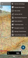
There is an amazing GPS app that, when you use the Directions icon gives you a pulldown to get and display tracks in various categories, including those for the Caminos. If you want them, the app brings you to the site that David mentioned above for you to pick and choose. The app is called Mapas de España. I haven't used it much as it can do everything and so it looks complicated. A PDF manual for basic use runs to 90+ pages in Spanish (although the app can display English). I mention this for die-hard GPS users who want great maps of Spain.
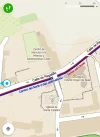
Screenshot_20210118-121159.webp Screenshot_20210118-122111.webp
 
There is an amazing GPS app that, when you use the Directions icon gives you a pulldown to get and display tracks in various categories, including those for the Caminos. If you want them, the app brings you to the site that David mentioned above for you to pick and choose. The app is called Mapas de España. I haven't used it much as it can do everything and so it looks complicated. A PDF manual for basic use runs to 90+ pages in Spanish (although the app can display English). I mention this for die-hard GPS users who want great maps of Spain.
View attachment 91431 View attachment 91432

Further to the post by Rick of Rick and Peg, the same organization (the Spanish Government IGN) offers a similar free app that has been especially tailored towards Camino Pilgrims. It offers free downloadable topographical route maps for many of the pilgrimage routes in Spain. The routes are highly visible. It is clear that the IGN has invested much effort in this app. Their topo maps are stunningly attractive IMO. Zooming out a bit makes the mountainous sections unmistakable.

It might be worth having a look.

Available on the app store, or here:


Look for the icon with the cockleshell:
 

Attachments

  • 4B565513-1441-4739-A879-6F4DF47AC3BB.webp
    4B565513-1441-4739-A879-6F4DF47AC3BB.webp
    4.8 KB · Views: 0
Last edited:
A selection of Camino Jewellery
It is clear that the IGN has invested much effort in this app... It might be worth having a look.
Yes, thanks - I downloaded the app and am playing around with it a bit. I'm not too keen on the commentary on the Camino (the Pilgrim Guide, including how one "should" prepare, etc.) and I also wonder how up-to-date their "available services" will be. I wish they had stuck with the maps.

I'm finding the app to be very buggy - now I can't delete one of the routes I downloaded. I will instead un-install the app. I'll stick with a combination of maps.me, google maps, and Gronze. Each one does its particular job quite well.
 

❓How to ask a question

How to post a new question on the Camino Forum.

Most read last week in this forum

I saw a video with a rather harsh criticism of a small, municipal albergue on one of the less traveled caminos. They paid 9€. I thought: What does it cost a small municipality to renovate and keep...
I was hoping to do a walk over ninety days so I researched a long stay visa. This walk would have gone through four countries but the majority of the time would have been in France. So I applied...
"A complete guide to the world's greatest pilgrimage"[sic] by Sarah Baxter. In a British newspaper, The Telegraph. A right wing daily that does print interesting articles and essays...
I've been trying to figure out how to use the Gronze app and as a first step I need to translate into English - I searched topics on the Forum, thought I found what I was looking for, and Yay! I...
My wife and I are planning to buy a house in the north-west of Spain for our retirement. Today, while scrolling through the ads, I noticed this: https://www.idealista.com/inmueble/106560131/...
Hi all - I have often wondered about the whole cutting grams, going as light as .. (I do it too!!) .. thinking about the "real" world with soldiers on the march and what they carry .. Roman...

Featured threads

❓How to ask a question

How to post a new question on the Camino Forum.

Featured threads

Forum Rules

Forum Rules

Camino Updates on YouTube

Camino Conversations

Most downloaded Resources

This site is run by Ivar at

in Santiago de Compostela.
This site participates in the Amazon Affiliate program, designed to provide a means for Ivar to earn fees by linking to Amazon
Official Camino Passport (Credential) | 2024 Camino Guides
Back
Back
Top