If you can download offline maps and use them to locate yourself without internet coverage that means you don't need Premium account. Or am I missing something?
I think there is some confusion here. The term
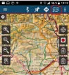
maps refers to a map of an area and contains objects such as roads, rivers, contour lines, houses and such. Displayed on top of that is a
track or a
route (usually a
track) that shows a way of getting from one place to another. On top of that is a cursor that shows a representation of where you are in the landscape/map. The cursor may have (or be) an arrow to show the direction you have your device pointed. Wikiloc's free app allows you to download
maps but is more restrictive about which
tracks you can download (see
@islandwalker's posts above).
Before going on let me state that I am experimenting with the
free app. After I find out what I can do with it I may pay for the premium version. Also, I'm using an Android phone.
I have just gotten back from a walk where I did more experimenting and I think I have found a way around the track download restrictions. Use a browser on your smartphone to visit wikiloc.com and download the track you want, even if it is not yours (use
file then
GPX or, for KML, use the
Google Earth option). I used the Firefox browser and downloaded a track (let's call the file
foo.gpx and the name of the track
Foo to Bar) and it ended up in the
Download folder. Using a file manager on your phone (I use
Total Commander) navigate to
.../Download/foo.gpx and open the file with Wikiloc. From that point on the track
Foo to Bar should appear as one of the tracks that you can display when you click the
Profile icon at the bottom of the Wikiloc app.
Now, as said before, you cannot use Wikiloc to follow this track and you cannot even see your current position displayed but what you do have shown is an electronic equivalent of a paper map with the way you want to take highlighted on it. You have to know your current location when you start (
e.g., the old bridge over the River Ebro at Puente de Reina) and from that point keep track of the distance and direction you travel. This is not great but workable. However with the free version of OSMand you can also download a map from its collection and open up the same
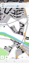
.../Download/foo.gpx file in the same manner and you get the map, track and a cursor with your up to the minute location. That makes following the track a lot easier with OSMand than with Wikiloc. I have used the free version of Wikiloc to follow my own recorded tracks, both forward and in reverse, and, if you can do this too, it has OSMand beat. I'm skipping this topic for now though.
Oh, yeah; if you want to follow someone else's track with the free Wikiloc app
try the following (I have not tried this myself but I think it would work). Do what I mentioned earlier about downloading
foo.gpx and then rename it to
bar.gpx. Open that and then upload to your Wikiloc account. Delete the
bar.gpx file on your phone and then download
bar.gpx from Wikiloc. Wikiloc
may see this as your file and allow to to start following it with its features (miles traveled on it, miles to go, warning you when off track, etc.)

 www.wikiloc.com


