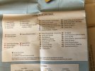
A friend just sent me a link to an official government site, run by the Instituto Nacional Geográfico. They are the wonderful people who produce the hard copy map that Ivar sells (which is indispensable for any serious camino planning outside the main routes, but is now unfortunately sold out).
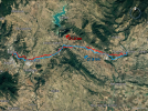
This link takes you to a site with a long list and from there you can get to individual camino tracks. My friend says to open it on Google Earth and it will show you stage by stage. All of this is outside my range of abilities, since I use only GPX tracks, but for those who use KML it looks like it should be an excellent resource.
This link takes you to a site with a long list and from there you can get to individual camino tracks. My friend says to open it on Google Earth and it will show you stage by stage. All of this is outside my range of abilities, since I use only GPX tracks, but for those who use KML it looks like it should be an excellent resource.


