russellg99
Member
- Time of past OR future Camino
- Camino Frances (starting May 20, 2013)
I'm looking for an iPhone app that can show my GPS position on a map of the area, and calculate the distance from me to a particular location I've selected -- all while offline.
Both the built-in Maps app and the Google Maps app can do most of that, but not the distance calculation without being online. They both allow you to pre-cache the map and then show your current GPS position without an internet connection, but I'd like to drop a pin at the town or albergue I'm headed to and have it update the distance to that location as I'm walking. I understand why generating a route might require internet access, but it seems like the app itself should be able to calculate the distance between two points.
What I'm basically looking for is something like the Geocaching app, where it shows a continually-updated direction and distance to a pre-defined point -- but I want to pick something like a town or a hostel, and so far I haven't found a way to point it to anything other than an officially listed geocache. (Does the full $10 version of the app allow you to do that?)
The Wise Pilgrim app contains a list of places to stay along the route, and even shows your distance to each albergue. But everything related to comments, photos, and maps are disabled while offline. That's a real shame, because it would be the perfect app for offline use.
What iPhone apps have you found useful on the Camino?
Thanks,
Russell
http://www.farofflands.com/camino/
UPDATE: here's a summary of what I found, for those that would like to skip reading all the posts below:
After trying several apps, it looks like GPS Kit is going to be the winner. It's $9.99 for the iPhone app, but so far I'm very impressed for what you get for the high price. It can display several different types of maps (Google Street, Google Satellite, Google Terrain, Google Cycling, Google Hybrid, and several other "open" maps), and most of them can be saved offline at one of three different resolutions.
You can also drop a waypoint by tapping on the map, and then bring up a screen that shows the distance to it along with a compass pointing to it, and both are constantly updated as you walk, even while offline. You can also add a name, photo, or comment to the waypoint, see its coordinates and elevation, re-position it, and even see a weather forecast for it.
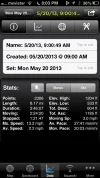
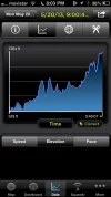
And it has a ton of other features as well, including tracking your progress, showing speed and pacing info, calculating the distance between two specific points (even if you're not at either of them), and more settings than you'll probably know what to do with. It also has a feature called Squawk that can be used between multiple GPS Kit users, allowing you to "track & chat with friends in real-time."
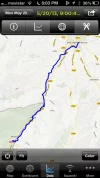
And best of all, it can import GPS data files (GPX, KML, & KMZ) and display the tracks on the map so you can see if you're still on course as you're walking. I loaded the GPX file from the web site for the new book "Hiking the Camino De Santiago" and it works great! (http://www.hikingthecamino.com/on-the-way/maps-gps)
MotionX GPS is a nice app too (note: not the same as MotionX GPS Drive), but the distance and direction to the waypoints are not updated on the screen unless you back out of the waypoint page and then go back into it again. That feature alone was a deal-breaker for me, but otherwise it has a lot of similar features to GPS Kit.


