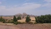
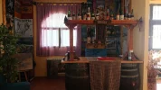
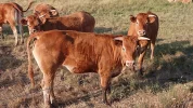
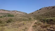
• ⚠️ Emergency contact in Spain - Dial 112 and AlertCops app. More on this here.
  • Remove ads on the forum by becoming a donating member. More here.

Search 74,075 Camino Questions

Forum Members virtually on the Lana, Part 2 (Cuenca to Burgos) — GREAT planning guide

A selection of Camino Jewellery
To clarify, the walk from Cifuentes to Mandayona is about 26 km, and the walk from Cifuentes to Aragosa is about 27 km if you turn right just after Mirabueno and follow this track.
I was going to share @Magwood 's and @alansykes ' tracks, to show the fork at Mirabueno. They both stayed in Masegoso de Tajuña, which is about 9.5 km from Cifuentes, and @alansykes stopped his track recording at Mirabueno.

For completeness, here they are. @Magwood walked to Mandayona:

and @alansykes walked to Aragosa, and you'll have to fill in the track from Mirabueno to Aragosa, which is about 4 km:
 
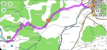
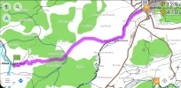
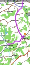
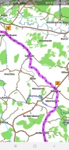
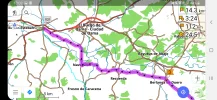
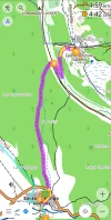
Because of internet challenges, accessing those wikiloc tracks isn't possible, but here are two options I found using OSMand, deviating from the Lana at Viana; the first meanders and is virtually all off-road, the second is more direct, with a bit of road walking at the very end (after Moratilla de Henares). It follows the river and rail easement as you approach Sigüenza, so there must be views. The difference between the two is a bit less than 3 km.
The meander:
Screenshot_20210214-130557_OsmAnd.jpg

More direct:
Screenshot_20210214-130436_OsmAnd.jpg
It's this, right?:
From Viana de Jadraque, there is a 'Camino de Viana de Jadraque a Sigüenza', which looks like a country road.
Without lookjng at wikiloc, I can't tell.
Both these options look very nice!
 
Last edited:
3rd Edition. More content, training & pack guides avoid common mistakes, bed bugs etc
the Sigüenza alternative in Aragosa. Weird because this is a town with 15 inhabitants, but the town is near the Parque Natural Barranco del Río Dulce. VN will appreciate its geological uniqueness.

Aragosa is stunning because of the backdrop with the mountains and cliffs all around. One thing I wonder though: the sun is blocked part of the day down in the gorge. How fun is that? :confused: Oh well, I guess the same goes for Alcalá del Júcar and the like.

Day 22a. Mandayona - Atienza. 35.8 km

Reading the Amigos' description of this stage in their guide, the slow walkers are bound to despair:
which is translated as:
The length of this stage is considerable and has a markedly uphill profile, making it one of the hardest of the entire route. The intermediate villages are very small and have few services, making it practically obligatory to reach Atienza.

There is a glimmer of hope: just after Huérmeces del Cerro, after about 16 km from Mandayona, there is the albergue rural El Molino, mostly focussed on outdoor activities. It could offer a mid-stage break.

The villages we will cross are small, indeed. Baides, Viana de Jadraque, Huérmeces del Cerro, Santiuste, Cardeñosa, everyone of these villages has a population of less than 100 inhabitants.

If one is used to walking 30 + kms, there is nothing special about this stage. I didn't notice the uphill profile, probably because the uphill gradually happens for 36 kms. I had coffee in two places: in Baides (I think) and in Huérmeces del Cerro. I was trainwrecked after walking through mud (after a heavy rainfall; it is not always muddy) and wanted to stay in El Molino, which had a spare room for me according to the lady in the cafetería where I stopped. It is possible to split this stage in two! But as soon as I heard that the place was invaded with shouting teenagers, I dropped my napolitana, threw my café con leche out the window and ran away as fast as my legs could carry me.

As this historical route falls into oblivion, in competition with Sigüenza, people will fail to notice that most of the difficulties are rumours: there are bars, it is not particularly uphill and it is not excessively long. With the bars and the possibility to stay half-way at El Molino, I don't understand how the Asociación can call this one of the hardest stage on the Lana...!

The only obstacles, literally, are the gates that you have to figure out how to open between Mandayona and Baides. I had to climb one or two of them, because I just didn't get through the locks. There are fences on both sides, like you are walking in a corridor, so you can only choose to walk forward - or admit defeat and return to Mandayona.

"Fence" and "corridor" doesn't sound very scenic, but this is a beautiful stage whith many wild animals: both on the right and the wrong side of the fence... All the way to Atienza is nice; not as nice as Sigüenza, but it would break my heart if this way would be totally abandoned by pilgrims...!

EDIT: I now remember that two spanish teenagers approached me when I was having my coffee; probably curious about my hiking outfit and about the Camino de Santiago in general. We had a chat about this and that and also about my home country that they had visited last year and that they had fond memories of. They were not shouting nor screaming! How is that possible?! Nice as they were, I decided to push on to Atienza...
 
Last edited:
Right. Looks like everybody is going to Sigüenza.

Oh no! My heart is shattered 😭💔💔💔

From Viana de Jadraque, there is a 'Camino de Viana de Jadraque a Sigüenza', which looks like a country road.

What!?! This is yet another reason for me to return to the Lana! Next time I will combine the historical route (Mandayona-Baides-Viana de Jadraque) and from Viana crossing over to the Sigüenza alternative! ♥️

I think the consensus is that it is a beautiful walk.

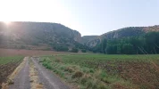
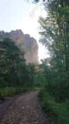
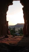
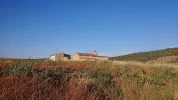
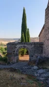
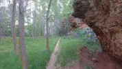
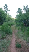
I have a few rehashed photos below...
 

Attachments

  • DSC_1501_copy_2752x1548.webp
    DSC_1501_copy_2752x1548.webp
    626 KB · Views: 18
  • DSC_1505_copy_1548x2752.webp
    DSC_1505_copy_1548x2752.webp
    1.1 MB · Views: 18
  • DSC_1518_copy_2752x1548.webp
    DSC_1518_copy_2752x1548.webp
    379.8 KB · Views: 18
  • DSC_1530_copy_2752x1548.webp
    DSC_1530_copy_2752x1548.webp
    487.6 KB · Views: 17
  • DSC_1545_copy_1548x2752.webp
    DSC_1545_copy_1548x2752.webp
    1.7 MB · Views: 15
  • DSC_1557_copy_2752x1548.webp
    DSC_1557_copy_2752x1548.webp
    759.6 KB · Views: 14
  • DSC_1561_copy_1548x2752.webp
    DSC_1561_copy_1548x2752.webp
    509.1 KB · Views: 15
  • DSC_1571_copy_2752x1548.webp
    DSC_1571_copy_2752x1548.webp
    552.4 KB · Views: 23
Last edited:
Ideal sleeping bag liner whether we want to add a thermal plus to our bag, or if we want to use it alone to sleep in shelters or hostels. Thanks to its mummy shape, it adapts perfectly to our body.

€46,-
If one is used to walking 30 + kms, there is nothing special about this stage.
That's the issue with us slow walkers... :rolleyes:
She can't really walk 30+ km stages.

It is possible to split this stage in two! But as soon as I heard that the place was invaded with shouting teenagers, I dropped my napolitana, threw my café con leche out the window and ran away as fast as my legs could carry me.
If there is a definite possibility to split the stage in two, then it would be attractive. The issue is that I have to guarantee to my darling that we can split the stage in two.
I guess that we wouldn't be too worried about shouting teenagers if they kept their shouting to daylight hours. I would definitely be turned away if their shouting was throughout the night...

Thank you for those photos, @Bad Pilgrim , they are fabulous!
 
This is yet another reason for me to return to the Lana! Next time I will combine the historical route (Mandayona-Baides-Viana de Jadraque) and from Viana crossing over to the Sigüenza alternative!
I think that would be my preference too.
This way is just getting more and more interesting.

Fanrastic photos, @Bad Pilgrim ! I like seeing them here from a perspective of deeper familiarity for where we are and where this is going.

(I have a very off-piste option floating around in my planning mind for after Sigüenza, but that's for later.)
 
Day 23. Sigüenza - Atienza. 31.4 km

When I look at the length of this stage, I immediately think of the slow walkers, and try to find where we could break this stage to make it shorter, or if there is a plan B we can look at.

Taking a taxi for a few km is a Plan B: Sigüenza is a large enough town to offer a taxi service. That could suit the non-purists, who could then walk whatever remainder of the stage to Atienza they choose.

Looking at where @Magwood and @alansykes walked led me to find another way of breaking this stage.

The published Camino takes the pilgrim through Palazuelos (5.9 km), where there is the Casa Rural La Carrasca Alta. A further 6.4 km leads us to La Olmeda de Jadraque, where there is a bar, but no place to sleep. Keep walking another 4.1 km to Santamera, and then 5.5 km you'll get to Riofrío del Llano. There is supposedly a bar in each of those villages, according to the Amigos' guide book. The final 9.5 km will get you to Atienza.

Palazuelos is a "stunningly beautiful walled village" as described by @Magwood. As for Santamera:
Then on to the almost equally ridiculously lovely village of Santamera, at the junction of three canyons, with its church perched on a cliff, and eagles circling overhead.
4 kms further on is another fabulously pretty village in a sun trap, in a gloriously position surrounded by cliffs. There were two water fountains here in Santamera.
the alp-like Santamera is the highlight of the day with the beautiful hills as a dramatic backdrop

@alansykes had a side trip in mind when he left Sigüenza:
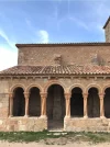
Rather than follow the Lana I decided to detour uphill to see the romanesque church at Carabias. It's an almost perfect small church, in the centre of a tiny village perched above the valley.
I think @Magwood must have followed his footsteps, not expecting to get to Carabias:
I am a little puzzled because this village does not appear on my list. It’s called Carabias and we are delighted to find a boutique 3* hotel which is not only open, but willing to serve a couple of scruffy pilgrims on their sunny terrace. I was presented with a whole jug of hot soy milk which was sufficient to fill two cups, and we had delicious toasted rustic bread with a dish of diced tomato. We were expecting the bill to be high, but it was less than most cafes would charge. Thank you Hotel Cardamomo.
It is approximately 9.5 km from Sigüenza to Carabias. In addition to Hotel Cardamomo, Google maps tells me that there are also two casas rurales, both appearing to be "Alquiler completo".
Following the tracks of our veterans of the Lana, it is then about 27.5 km to Atienza. Still a long stage for slow walkers, but just a little better than 31.4 km ;)😄
Now if you have done a bit of arithmetic, you would have noticed that if you stopped at Palazuelos after 5.9 km, you would only have 25.5 km left to Atienza... But then who wouldn't detour to see a Romanesque church? ;)😄

In Atienza, @Pilger Franz stayed at the Hostal rural El Mirador de Atienza, which is currently closed for Covid reasons, let's hope it opens when things get better. He had made what @Magwood called an "unfavourable assessment" of the Albergue. @alansykes stayed at the Albergue. @Undermanager also stayed at El Mirador. @Magwood and @Ninja as well as @Bad Pilgrim slept at the Hostal Santo Cristo:
It's on your right side just after having entered Atienza. Watch out, because there is no visible sign saying Santo Cristo? Just "Bar Restaurante Atienza" for the adjacent bar in the same building. It took me a while to understand I had arrived at the right place. 20 euros and the owner will also wash your clothes! Which made him my new best friend.
There are other places where we'll find a bed, such as Hotel Restaurante Antiguo Palacio De Atienza, and Hotel Rural Fonda Molinero.

And this, in Carabias, is for the aficionados of Romanesque:
 
Last edited:
Get a spanish phone number with Airalo. eSim, so no physical SIM card. Easy to use app to add more funds if needed.
Chatting to my lovely darling about today's walk, we came up with a plan for our real life walk on the Lana. We would have 3 nights in Sigüenza, one day's rest to discover the town, and on the second day, we would walk to Carabias (without backpacks) and return to Sigüenza. Then when we would leave Sigüenza, we would take a taxi to Palazuelos, and walk from there.
 
the Hostal rural El Mirador de Atienza, which is currently closed for Covid reasons,

The Hotel Convento Santa Ana, in an 18th C convent, has a note on its web page — “En estado de Alarma — Seguimos Abiertos.” So there is at least one place to stay, and I have to admit it looks like a nice option even if the other places are open! Same for the other hotel you mentioned, Palacio de Atienzas, which is in another historic building.

And here are Alan’s GPS tracks for that stage, for those who want to make sure about heading to Carabias. It looks like it follows the "regular" camino till Palazuelos and then detours off to take in Carabias, and then rejoins the regular route in Salinas de la Olmeda, which is not a town but a lake constructed in the middle ages for the production of salt. I had never heard the word "saltern." It's a few km before Olmeda de Jadraque.

I was pretty surprised to see that the Association guide describes leaving Palazuelos this way: "Km. 5,9 – Desde la plaza José Antonio salir por la calle Calvo Sotelo hasta la plaza Generalísimo." Jose Antonio Primo de Rivera was the founder of the fascist Falange party, Calvo Sotelo was a far right anti-Republic politician who was murdered in retaliation for the murder of a left wing leader in pre-civil war days and became a martyr in the Franco era, and the Generalísimo refers to Franco. So Palazuelos offers you a stroll down Franco's memory lane. The Ley de Memoria, which was passed in 2015 or thereabouts, has mandated renaming those places. I know Alan and others have reported occasionally on towns that have not complied, so here is one more.
 
The albergue is Atienza is a little basic and the more fastidious might be better off elsewhere (the convent sounds nice). But I was quite happy there, despite the dust and broken furniture, and lack of pillows (I carry my own inflatable one anyway, for occasions when there isn't one, or the ones on offer don't ... appeal). There was hot water, and it was free, and had a good view southwards and anyway after 38km I can sleep pretty well anywhere. It's a palace compared to the broken sofa that's on offer at Fresno de Caracena in a couple of days.

El Cid had passed near here on one of his excursions, avoided Atienza's still imposing castle as "una peña muy fuort."

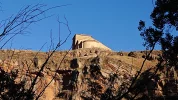
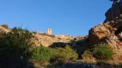
The pics are of Carabias, Santamera's clifftop Church, and Atienza's castle from the south, just as I was starting my race with the sun to get there in daylight.

DSC_0083.jpgDSC_0085.jpgDSC_0087.jpg
 
Ideal pocket guides for during & after your Camino. Each weighs only 1.4 oz (40g)!
I was hunting around to see if I could get some information on the interior of the portico-ed church in Carabias. Based on what I saw, the real beauty is outside. So I will probably not make the effort to find out opening times, find the señora with the key, etc. Unless there is someone with better information that suggests I am wrong?

I’m posting to this link, more than anything for my pal VN when she is (hopefully soon) once again able to freely access the internet. In my search about Carabias, I saw this website, with information on all the Romanesque in the province of Guadalajara.

 
Day 24. Atienza - Retortillo de Soria. 22 km

This is the next 'published' stage, as indicated by the Amigos' guide book.

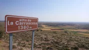
Crossing from the province of Guadalajara to Soria, during the day we'll reach the highest point on the Lana. Not an easy stage for slow walkers, judging from the profile, and the comments:
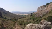
The next hour is a real hard slog up the side of gorge to a point 1380m high.
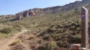
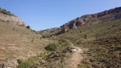
I had to walk up the steep, rocky trail that leads to Alto de la Carrascosa (1380 m altitude) on an empty stomach, which I had not planned. Once again I was huffing and puffing, probably scaring away all of God's living creatures in the wilderness.
and from @Magwood 's blog:
The track out of the village is steep and rocky on a goat track winding up the mountain side. Up and up we went 230 m in 3 km over very rough ground.

It might not be an easy stage for some, but it is a beautiful one by all accounts.
I think I'll give this one 5* and put it in my all time top 10 camino days. I know I've probably got 20 "top 10" days, but this was good. Atienza has some lovely buildings and I wish I'd got there earlier to explore. [...] You leave town via a romanesque church and a fine 2nd century Roman fuente. Then glorious rolling countryside, through pretty woods and across open country with majestic hills in the distance.

There are two villages, Romanillos de Atienza which is 9.5 km after Atienza, and Miedes de Atienza 6.4 km after that.
Miedes de Atienza, beautiful red stone houses, a little castle, church and more heavy new tractors than I've ever seen outside of an agricultural show. I popped onto the tiny bar hoping for a caña to fortify me before the climb, but stayed for lunch.

In Retortillo de Soria there is an albergue, in the "Local municipal", noting however "acogida no garantizada". There is also the private albergue, Hostal La Muralla, where all our veterans spent the night.

That steep trail to the Alto de Carrascosa is going to be really hard for my darling, so I looked at an alternative. In Miedes de Atienza, there is a casa rural, La Cueva del Gallo, where we might be able to have a room:
Tipo de alquiler: Por habitaciones
We would walk 15.9 km on that day, and stop just before the rise.
After a good night sleep, tackling the steep slope in the morning would be achievable for my wife. We would then possibly do what @Bad Pilgrim did, and walk on to Tarancueña:
I carried on to the very small village of Tarancueña (30 kms). The casa rural Los Arenes de Tarancueña (last picture below) is 40 euros, breakfast included. The nicest woman ever is in charge and it is a 5 star place, period. In the village, there is nothing though. I remember that I caught the bar in the Ayuntamiento being open when I was here last time, but no luck today. No tienda, nada. There are only 7 people living here, although a lot more during the summer vacations. Beautiful surroundings! The owner of the casa rural will cook for you in the evening if you want (not included). She is a good cook!
And that would give us a 13.8 km day.

However, for the purpose of this virtual Camino, we have stopped at Retortillo de Soria. Here's more information:

 
Retortillo de Soria is the most convenient point, I think, for jumping off the camino and going to visit San Baudelio de Berlanga. I have been wanting to visit this church for years and years. It was the frescoes of San Baudelio, some of which were transported back to the Prado in Madrid (others “wound up” in art museums in the US), that started my love of Romanesque. My Art History in the Prado course had a segment on Romanesque. We spent two hours a week in the museum, and I really came to love those frescoes. The church is from the early 11th century, and I have read that a few of the original frescoes remain in the church.

San Baudelio is about 28 km from Retortillo. It is then another 8 or 9 to the town of Berlanga de Duero, which is a destination in its own right.

So I came up with several options. The one I would most like to do would be to sleep in Retortillo, walk the next morning to the church, and then continue to Berlanga de Duero. Visit the Centro de Interpretación for the church, sleep there, and then head back to Retortillo the next day. Sleep in Retortillo and then carry on. That would add two days to the camino, maybe a problem.

Another option would be to take up the offer of the owner of the hotel/albergue in Retortillo to drive me out to see the church in the afternoon. That would add no days, but wouldn’t allow a visit to the town of Berlanga, which is a nice place. (Also, I have found that walking to these churches is far more magical than driving. I remember that on my first Francés, we got a taxi out and back from Pamplona to visit Eunate. The next several times I visited was on foot and it was just so so different).

A third option would be to get a ride to Berlanga de Duero the afternoon I arrive in Retortillo. Spend the night in Berlanga, and then the next day walk to San Baudelio and back to Retortillo to spend the night. This would add one day.

Visits are only Wed- Sat, morning and afternoon, and Sunday, morning. I remember last year at this time when I was planning my Lana 2020 (HA!) that I had to be very careful with days, because of another gem we will get to a week or so after Retortillo, in Quintanillas de la Viña, which also has a Wednesday-Sunday visiting schedule.

I’m sure there are other options. I think VN has been thinking about this as well, so we’ll see what she comes up with.
 
The focus is on reducing the risk of failure through being well prepared. 2nd ed.
I’m posting to this link, more than anything for my pal VN when she is (hopefully soon) once again able to freely access the internet.
May it be so. It takes forever for pages to load, and every night the internet is cut...which doesn't accomplish much, since everyone is sleeping. I think it's both spite and showing who's in charge. But I've gone off topic...

Laurie OMGomgOMG...you know what appeals, no doubt about it. Between Romanesque and what sounds like an amazing landscape, I'm in heaven! Remember flatflatflat? We've come a long way. (Sorry, @Bad Pilgrim , but I'll be starting in Cuenca if I manage to walk this Camino.)

But then who wouldn't detour to see a Romanesque church?
Retortillo de Soria is the most convenient point, I think, for jumping off the camino and going to visit San Baudelio de Berlanga
I’m sure there are other options. I think VN has been thinking about
Yes, AJ, I can imagine meandering all over Spain following my nose to the next Romanesque (or even Visigothic) Church.

So I looked at the map and came up with option 4, which is a long (3 days-worth) off-Lana meander that takes in both Sigüenza and San Baudelio de Berlanga, returning to the Lana at San Esteban. But after reading of these two last stages, I'm questioning whether it's worth it. There is a lot to miss, from the sound of it.

There are places to stay at the intermediate points on the map, but the stages are a bit long for slower walkers.

So here's the overview, followed by 3 sequential OSMand maps:
20210220_233636.webp
Screenshot_20210110-220241_OsmAnd.webpScreenshot_20210110-220249_OsmAnd.webpScreenshot_20210110-220400_OsmAnd.webp

There's more to be said, but they're about to cut the internet so I'm going to post this now.
Hasta pronto, amigos and amigas!
 
Last edited:
So here's the overview, followed by 3 sequential OSMand maps:
When I click on these links, I get an “OOPS! You do not have permission to view this page.”

Not to worry, though, because like you, I am pretty convinced that I want to walk from Retortillo onward on the Lana.

I was originally tempted by the idea that an off-camino detour to San Baudelio could be extended to include a meander to Burgo de Osma via Gormaz (not San Esteban de Gormaz) and then over to rejoin the Lana at San Esteban de Gormaz (12 km from Burgo de Osma).

This is how that would work.

Retortillo to San Baudelio to sleep in Berlanga de Duero. (35)
Berlanga de Duero to Gormaz (great castle, El Cid connection) to Burgo de Osma (30)
Burgo de Osma to San Esteban de Gormaz, back on the Lana (12) — and the first place I see to stop beyond San Esteban is Quintanarraya, another 30 km so that’s LONG. Maybe when AJ gets up to that point we can re-visit the question and do some sleuthing.

But I think that it would be a real shame to miss those canyons everyone describes after Retortillo, so I am probably going to limit my off-camino meander to a visit to San Baudelio.

I clearly have too much time on my hands, but am really enjoying all these deep dives. I had thought that at some point I would find it frustrating, but that hasn’t happened yet!
 
Day 24. Atienza - Retortillo de Soria. 22 km

This is the next 'published' stage, as indicated by the Amigos' guide book.

Crossing from the province of Guadalajara to Soria, during the day we'll reach the highest point on the Lana. Not an easy stage for slow walkers, judging from the profile, and the comments:


and from @Magwood 's blog:


It might not be an easy stage for some, but it is a beautiful one by all accounts.


There are two villages, Romanillos de Atienza which is 9.5 km after Atienza, and Miedes de Atienza 6.4 km after that.


In Retortillo de Soria there is an albergue, in the "Local municipal", noting however "acogida no garantizada". There is also the private albergue, Hostal La Muralla, where all our veterans spent the night.

That steep trail to the Alto de Carrascosa is going to be really hard for my darling, so I looked at an alternative. In Miedes de Atienza, there is a casa rural, La Cueva del Gallo, where we might be able to have a room:

We would walk 15.9 km on that day, and stop just before the rise.
After a good night sleep, tackling the steep slope in the morning would be achievable for my wife. We would then possibly do what @Bad Pilgrim did, and walk on to Tarancueña:

And that would give us a 13.8 km day.

However, for the purpose of this virtual Camino, we have stopped at Retortillo de Soria. Here's more information:

AJG Thank you for being the god of short distances.
 
Ideal sleeping bag liner whether we want to add a thermal plus to our bag, or if we want to use it alone to sleep in shelters or hostels. Thanks to its mummy shape, it adapts perfectly to our body.

€46,-
Sorry for lagging behind,

I hope a moderator can use her magic wand to put this post in the right place...

La Olmeda de Jadraque, where there is a bar

Are you sure? Nothing shows on Google Maps. I didn't see any when I walked through. I can't say I stayed to look for it either. This is a very small village.

Keep walking another 4.1 km to Santamera, and then 5.5 km you'll get to Riofrío del Llano. There is supposedly a bar in each of those villages, according to the Amigos' guide book.

Actually this was a stage where I found no bars at all until Atienza! (And people shame the historical route Mandayona-Atienza for a lack of bars, when there actually are a few...) So I found this stage quite hard. But no one would be happier than me to be proven wrong, so please enlighten me!

I see on Google maps that there is a bar in Palazuelos. But I must have arrived too early. The whole village looked empty to me at the break of dawn. I also see that there is a Centro Social in Santamera. I think I went there to take a look, but it was closed. Also in Riofrío del Llano, the bar was closed and looked like it had been so for a long time.

Then when we would leave Sigüenza, we would take a taxi to Palazuelos, and walk from there.

Good idea. The walk from Sigüenza to Palazuelos is quite dull and you wouldn't miss anything in my opinion. This stage has nothing to do with the previous one! I liked the flatlands right after Palazuelos where there were a lot of birds to see, and that I unfortunatley stirred up in the morning, and Santamera is impressive. But except that, the stage is a small disappointment after the walk in the canyon/nature park the day before.

Salinas de la Olmeda, which is not a town but a lake constructed in the middle ages for the production of salt. I had never heard the word "saltern." It's a few km before Olmeda de Jadraque.

Oh, that is what it was then. The camino goes right next to it. I didn't take any photos of the lake itself, but of the Ermita (?) that caught my eye in the field (2nd picture below). From this point there is an uphill walk to Olmeda de Jadraque; I guess one could turn around and have a view of the saltern. But I didn't: I was too focused on reaching the non-existant bars in Olmeda de Jadraque...!

The last kms of this stage join the historical route coming directly from Mandayona. When you see the skyline of Atienza and its castle, it is still one more hour before you get there, or even two if you are a slow walker like me!

Rehashed pictures coming up below!
 

Attachments

  • DSC_1572_copy_1548x2752.webp
    DSC_1572_copy_1548x2752.webp
    245.6 KB · Views: 30
  • DSC_1577_copy_2752x1548.webp
    DSC_1577_copy_2752x1548.webp
    918.5 KB · Views: 24
  • DSC_1578_copy_1548x2752.webp
    DSC_1578_copy_1548x2752.webp
    651.3 KB · Views: 17
  • DSC_1586_copy_2752x1548.webp
    DSC_1586_copy_2752x1548.webp
    781.7 KB · Views: 17
  • DSC_1590_copy_2752x1548.webp
    DSC_1590_copy_2752x1548.webp
    1.1 MB · Views: 17
  • DSC_1596_copy_2752x1548.webp
    DSC_1596_copy_2752x1548.webp
    379.7 KB · Views: 18
  • DSC_1603_copy_2752x1548.webp
    DSC_1603_copy_2752x1548.webp
    1 MB · Views: 17
  • DSC_1604_copy_2752x1548.webp
    DSC_1604_copy_2752x1548.webp
    505.9 KB · Views: 16
  • DSC_1608_copy_2752x1548.webp
    DSC_1608_copy_2752x1548.webp
    460.8 KB · Views: 16
  • DSC_1614_copy_2752x1548.webp
    DSC_1614_copy_2752x1548.webp
    407.7 KB · Views: 25
Last edited:
OK, I'm back on track now!

There are two villages, Romanillos de Atienza which is 9.5 km after Atienza, and Miedes de Atienza 6.4 km after that.
There are bars (in summer) but not if you come by too early in the morning!

In Retortillo de Soria there is an albergue, in the "Local municipal", noting however "acogida no garantizada". There is also the private albergue, Hostal La Muralla, where all our veterans spent the night.
Just to clarify: there is the Hostal La Muralla, and the private albergue (also called La Muralla?). I never went to the albergue; I would take the hostal any time... But it is true that Laners in general are impressed with the standard of the private albergue.

The hostal is also very nice! Your regular 25-30 euros, if I am not mistaken. Aurora knows everything there is to know about the Camino in the region. She hinted about the Asociación possibly re-routing the Camino in the future, making it go through the town of Gormaz. Would that affect your plans of visiting those other places in the area, @peregrina2000 and @VNwalking ?

Retortillo de Soria is the most convenient point, I think, for jumping off the camino and going to visit San Baudelio de Berlanga.
So I looked at the map and came up with option 4, which is a long (3 days-worth) off-Lana meander that takes in both Sigüenza and San Baudelio de Berlanga, returning to the Lana at San Esteban.
Stop!! You two are making never-ending suggestions that are pushing me to roam the Lana a third time!! :eek:

But I think that it would be a real shame to miss those canyons everyone describes after Retortillo,
YES. The canyon right after Tarancueñas is only for a few kms (long or short depending on how you feel) but it is ruggedly pretty... I guess we will get there in the next installment!
 

Attachments

  • DSC_1615_copy_2752x1548.webp
    DSC_1615_copy_2752x1548.webp
    211.3 KB · Views: 25
  • DSC_1618_copy_2752x1548.webp
    DSC_1618_copy_2752x1548.webp
    1.4 MB · Views: 21
  • DSC_1619_copy_2752x1548.webp
    DSC_1619_copy_2752x1548.webp
    1.2 MB · Views: 17
  • DSC_1627_copy_2752x1548.webp
    DSC_1627_copy_2752x1548.webp
    1.6 MB · Views: 14
  • DSC_1628_copy_2752x1548.webp
    DSC_1628_copy_2752x1548.webp
    1.3 MB · Views: 16
  • DSC_1632_copy_2752x1548.webp
    DSC_1632_copy_2752x1548.webp
    1.1 MB · Views: 16
  • DSC_1633_copy_2752x1548.webp
    DSC_1633_copy_2752x1548.webp
    883.4 KB · Views: 21
Last edited:
Actually this was a stage where I found no bars at all until Atienza! (And people shame the historical route Mandayona-Atienza for a lack of bars, when there actually are a few...) So I found this stage quite hard. But no one would be happier than me to be proven wrong, so please enlighten me!
I see on Google maps that there is a bar in Palazuelos. But I must have arrived too early. The whole village looked empty to me at the break of dawn. I also see that there is a Centro Social in Santamera. I think I went there to take a look, but it was closed. Also in Riofrío del Llano, the bar
As I haven't walked the Lana, @Bad Pilgrim , I would accept your information as the correct one. I was just quoting the Amigos' guide book. The have the little bar symbol for this villages, albeit without any other indication of location or opening times.

I think that for this stage and for my darling who loves her cup of manzanilla, I might get a heating coil like @peregrina2000 ☺️

Thank you for those fabulous photos, @Bad Pilgrim !
 
The focus is on reducing the risk of failure through being well prepared. 2nd ed.
Day 25. Retortillo de Soria - Fresno de Caracena. 23.9 km

Reading the introduction to this published stage in the Amigos' guide, there are a few points that I thought worth mentioning. The first one is that despite a large portion of the walk "por carretera o por caminos asfaltados", there is a highlight which is the canyon of the río Caracena. The second one is that the province of Soria has suffered the exodus of population to larger cities, leaving behind small villages, with little or no services. The Amigos conclude their introduction by this advice:
Es necesario viajar provisto de víveres e incluso prever la posibilidad de dormir en algún sitio en condiciones precarias.
It is necessary to travel with provisions and even to plan for the possibility of sleeping somewhere in precarious conditions.

Indeed, the note "acogida no garantizada" is entered in the guide next to the names of all the places we will go through in this stage.

As for any Camino stage, there are variations: @alansykes walked from Retortillo de Soria to Fresno de Caracena, @Magwood and @Ninja walked from Retortillo de Soria to Caracena including what looks like a diversion, @Bad Pilgrim had stopped in Tarancueña and walked to San Esteban de Gormaz, and @Undermanager walked from Retortillo de Soria to San Esteban De Gormaz, a 46 km effort which makes the slow walkers among us say "if only I could walk half of that!" 😲.

Now add to those options some extra homework in trying to figure out this route:
Retortillo to San Baudelio to sleep in Berlanga de Duero. (35)
Berlanga de Duero to Gormaz (great castle, El Cid connection) to Burgo de Osma (30)
Burgo de Osma to San Esteban de Gormaz, back on the Lana (12) — and the first place I see to stop beyond San Esteban is Quintanarraya, another 30 km so that’s LONG. Maybe when AJ gets up to that point we can re-visit the question and do some sleuthing.

We'll get to San Esteban de Gormaz later, in the next stage, one mustn't rush slow walkers ;). So before I look at @Magwood 's walk, I'll take some notes from @alansykes ' account to describe this stage, or at least, the bits that do not involve asphalt:
After Tarancueña it was amongst the most spectacular 3 hours of my life.

The camino follows the cañón of Caracena downhill until you reach Caracena itself. Total solitude; astonishing, sometimes jaw-dropping beauty, surrounded by high cliffs, circling eagles, autumn trees with leaves turning every colour from black red to pure gold, millions of wild rose hips (the valley must be even more spectacular when they are in flower), wild lavender, flowering thorns, juniper, thyme and more. Just amazing. Quite hard work, as the sometimes narrow path did not seem to be used much, and there were scrambles and stoney river crossings that would not be pleasant in rainy weather, but on a perfect autumn day it was too wonderful for words.

In her blog, @Magwood explains how she and @Ninja followed the GR86, a route which is totally off road. Her photos are fantastic. And this is what she writes:
One of the most stunning camino walks.

Note from the Mods: As of January, 2023, there is no longer any place to stay in either Caracena or Fresno de Caracena. Many have called a taxi from San Esteban de Gormaz for pick-up in either of those two places and spend the night in San Esteban.

If you're going to stop in Caracena, @Magwood shared the contact details of María Angeles, who runs the bar, and whose son provides basic but more than welcome accommodation for pilgrims.

If you're going to walk to Fresno de Caracena, then you'll stay:
where the acogida is, to put it politely, basic - no beds, no showers, no hot water: a store room above the medical centre.

I guess that one must make a choice between visiting the church of San Baudelio, or walking through the canyon of the río Caracena. Or we could always become recidivists of the Lana and experience both sights in successive Caminos. Should the Romanesque prime over nature, there's no way slow walkers would make it in one piece from Retortillo to Berlanga de Duero. Fortunately, if the information on Google maps is right, there is a place to sleep in Arenillas, the Casa del Curato. That would give us a 17 km day, followed by a 22 km day to San Baudelio and Berlanga de Duero.
Similarly, we would try to break the next portion of this escapade by stopping in Gormaz. The lodgings shown in Google maps in Gormaz might be for an entire house, so I am not sure we could stay in Gormaz. However, just off to the east of Gormaz is La Casa Grande de Gormaz, which offers rooms. That would be an 18 km day, which would still give us time to visit the castle in Gormaz. Then it is approximately 16 km to get to Burgo de Osma, where there is a choice of accommodation. The 12 km to get back to the Lana at San Esteban would complete this diversion.

After watching the video below, I think in a real life Camino, my darling and I would stop in Caracena:
 
Last edited by a moderator:
I guess that one must make a choice between visiting the church of San Baudelio, or walking through the canyon of the río Caracena.

Well, I am stubborn enough to want to do both when I finally make it to the Lana. As my list of Caminos grows longer, as I keep putting off camino 2020 till who knows what year, and as my legs are getting creakier, I can't indulge the dream that I will walk the Lana twice. :rolleyes:

If time is really short, that 22 km day from Atienza to Retortillo can provide the time to take a motorized visit covering the 28 kms to San Baudelio and back to Retortillo. That could be either with a taxi from Berlanga de Duero (not likely to be cheap, but cheaper than coming back and walking the Lana again!) or see if the lovely hospitalera offers to drive you over as she had offered to me as I was planning the Lana that never was.


The other thing I will keep in mind about the stage from Retortillo is that I would like to take the GR 86 through the canyon outside Retortillo, go through Valvenedizo and then head back to the Lana, rejoining it in Taracueña. Maggie did this, Alan did not, and I am not sure about BP or anyone else.

The GR86 goes from Retortillo to Tiermes (where there is an archeological excavation). Here are wikiloc tracks. But I don’t think most of us (maybe VN excluded) will want to walk the 16 km to Tiermes from Retortillo and then find our way back to the Lana. But the Tiermes site looks quite fascinating, even if calling it the Pompeii of Spain is an overstatement. It was both a celtiberian hill fort as well as a Roman city. (Having said that, though, for people who would like to visit Tiermes, you have an 11 km walk on minor roads to get you to Caracena for the night).

But I do think some of us would like to follow Maggie’s walk on the GR 86 and then make our way back to the Lana at Tarancueña.

So that requires a connector, since the GR86 doesn’t merge with the Lana. Here is one wikiloc possibility, from Valdeneviso to Losana on the GR86, and then getting off the GR 86 at Losana and heading to Tarancueña back on the Lana. Maggie did not go as far as Losana on the GR 86, which would save a few kms. Looks like there is a way to head for Tarancueña from Valdeneviso directly, without going through Losana. I’ve attached a screen shot.

81B39965-A66E-4DBE-9D24-7085A5969106.png

So that means that from Retortillo to Caracena, you have three options.

1. Retortillo to Valdenevizo on GR86, then using google maps shot to get to Tarancueña, and then on to Caracena. That’s about 17 km.

2. Retortillo to Valdeneviso to Losada on GR 86, and then Losada to Tarancueña (using the wikiloc tracks) and on to Caracena. That’s about 21 km.

3. Retortillo to Caracena on the Lana the whole time, about 15 km.

Like you, AJ, I would probably stop in Caracena, but if some great place pops up in the next day’s research, I wouldn’t mind adding on another 10 or so kms. But for now I’ll just happily climb around the Caracena castle and visit the Romanesque churches in town with y‘all.
 
€2,-/day will present your project to thousands of visitors each day. All interested in the Camino de Santiago.
So I looked at the map and came up with option 4, which is a long (3 days-worth) off-Lana meander that takes in both Sigüenza and San Baudelio de Berlanga, returning to the Lana at San Esteban. But after reading of these two last stages, I'm questioning whether it's worth it. There is a lot to miss, from the sound of it.

Thanks for fixing the maps so I could see them, VN. You may know this, but the interpretation center for San Baudelio is in Berlanga de Duero, but the church itself is about 9 kms out, not too far off the road you have marked, a few kms beyond Caltojar.

I guess your option gets you more quickly to Berlanga de Duero, but based on the little online searching I just did, it looks to me like staying on the Lana till Retortillo takes you through nicer places than going from Sigüenza to Baraona and then to Berlanga de Duero.

If you do eventually take this route, I see that you get oh so close to Burgo de Osma. Have you checked it out? Lots to see there, too.

But who am I kidding? Given the way things are going, I’ll consider myself lucky to walk the plain old detour-free Lana, but it is nice to dream!
 
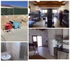
Can I go back a stage and say how fabulous is the private albergue in Retortillo de Soria - one of the nicest albergues I have had the pleasure to stay in. 18 or 20 places in bunks, paper sheets, cosy duvets and pillows. Really well thought out, separate bathrooms each with two basins, two showers and a loo, very good kitchen. Plenty of space for washing to dry in the sunny courtyard. 15 euros, 975 345 053.042480C1-BCBB-4CC9-A957-650D6D4D50D8.webp
 
Last edited:
When leaving Retortilla via the archway, I highly recommend that you turn left to follow the GR86 route instead of the official Camino route. It is one of the most stunning walks on the Lana! After about 16 km, the GR connects with the Camino in Tarancuena and it continuous to be a stunning walk.

I didn’t take many photos, but every time I blinked with my eyes I stored pictures on the hard disk…

ON_ROUTE_TO_CARACENA.webp
 
The one from Galicia (the round) and the one from Castilla & Leon. Individually numbered and made by the same people that make the ones you see on your walk.
I have three pictures from Caracena. It matches the number of inhabitants of Caracena.
I beg to differ @Ninja. I know for a fact that you have one more photo but perhaps you are too polite to share it 😂😉. I wrote in my blog ... we walked up to see the castle. It’s huge and open for exploration. Nina was outside waiting for me to exit and thought she would take a photo of my smiling face as I emerged through the low doorway. Little did she know that I had decided the best way to avoid bashing my head was to exit rear end first. Result, a rather unexpected and silly photo.

IMG_8450 2.webp
 
Last edited:
I beg to differ @Ninja. I know for a fact .....
Yes, you totally ruined my good intentions. 🤣🤣🤣 What fun we had! But Maggie, if you hadn’t told the story, it would instead just be a completely harmless photo of someone ENTERING the castle … 😁


Too much time on my hands, but I think that a gem like the GR86 from Retortillo would be easy to miss ...
Here is one of the GR86 markers on route to Caracena. When I revisit this photo I can’t help thinking of the recent photos from Mars!

GR86_LA_LANA.webp
 
The 2024 Camino guides will be coming out little by little. Here is a collection of the ones that are out so far.
small villages, with little or no services.
The services are kind of a hit and miss. There could be a bar open in Tarancueñas, especially in summer when the population rises with people from nearby cities visiting. And there is apparently a bar in Caracenas? I have never seen it. I have been to a bar in Olmillos (there are two bars according to Kevin O'Brien); that's 7 kms from reaching San Esteban de Gormaz.

@Bad Pilgrim had stopped in Tarancueña and walked to San Esteban de Gormaz
Yes: Atienza - Tarancueña - San Esteban de Gormaz is possible if one can do 30+ kms a day. But I understand that the hostal and the private albergue in Retortillo de Soria will attract 99 % of the pilgrims...

Then it is approximately 16 km to get to Burgo de Osma, where there is a choice of accommodation.
In spite of almost never doing any excursions while on a Camino, I have been to El Burgo de Osma! It's the closest bus station if you would need to go to Madrid from Retortillo de Soria. So I went there by bus to rest my foot (in a hostal in Madrid, in 2017). Then I got back to Retortillo de Soria the same way. El Burgo de Osma is charming: very nice and tidy à la Casas Ibáñez. I didn't walk around that much because of my foot, but yes, it should be large enough to have accomodation. Just sitting down on a bench in front of the large square and the beautiful Ayuntamiento was peaceful and just what I needed...! But this was in 2017 so no photos: I lost them all with my cellphone.

I would like to take the GR 86 through the canyon outside Retortillo, go through Valvenedizo and then head back to the Lana, rejoining it in Taracueña. Maggie did this, Alan did not, and I am not sure about BP or anyone else
I followed the official Camino dutifully. I was so happy the 2nd time when I walked through the canyon when my foot was fine again! I could finally appreciate the surroundings that Alan described above. That was not the case first time around when I hobbled like a one-legged goat up and down the trail...! 🐐 😭

When leaving Retortilla via the archway, I highly recommend that you turn left to follow the GR86 route instead of the official Camino route. It is one of the most stunning walks on the Lana! After about 16 km, the GR connects with the Camino in Tarancuena and it continuous to be a stunning walk.
Like the roaming youngsters write nowadays: THIS ☝️ It would be wonderful to walk a stage of 16 kms from Retortillo de Soria, to experience what Nina & Maggie did, and then stay at my favorite desolate village of Tarancueña. (The official camino, from the archway, is totally on tarmac for like 8 kms. I think most pilgrims would want to try Nina's alternative.) And I have said it before: In Tarancueña, there is a casa rural Los Arrenes, some 40-45 euros, but definitely worth it. Nice lady cooking for you, and breakfast. Staying in the quietness of the casa rural next to the pasture is a treat for the soul. So many reasons to go back to the Lana now...................

In case you wonder what the canyon on the official route looks like, some pictures coming up below! And the last picture is entering San Esteban de Gormaz. Not the best quality. It takes time for the sun to reach the bottom of the canyon...!
 

Attachments

  • DSC_1646_copy_2752x1548.webp
    DSC_1646_copy_2752x1548.webp
    615 KB · Views: 15
  • DSC_1651_copy_2752x1548.webp
    DSC_1651_copy_2752x1548.webp
    777 KB · Views: 17
  • DSC_1655_copy_2752x1548.webp
    DSC_1655_copy_2752x1548.webp
    381.2 KB · Views: 15
  • DSC_1660_copy_1548x2752.webp
    DSC_1660_copy_1548x2752.webp
    1.4 MB · Views: 16
  • DSC_1662_copy_2752x1548.webp
    DSC_1662_copy_2752x1548.webp
    1.5 MB · Views: 16
  • DSC_1664_copy_1548x2752.webp
    DSC_1664_copy_1548x2752.webp
    1.2 MB · Views: 15
  • DSC_1667_copy_2752x1548.webp
    DSC_1667_copy_2752x1548.webp
    721.8 KB · Views: 15
  • DSC_1671_copy_2752x1548.webp
    DSC_1671_copy_2752x1548.webp
    656.7 KB · Views: 13
  • DSC_1678_copy_2752x1548.webp
    DSC_1678_copy_2752x1548.webp
    1.2 MB · Views: 15
  • DSC_1680_copy_2752x1548.webp
    DSC_1680_copy_2752x1548.webp
    417.2 KB · Views: 19
Last edited:
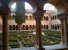
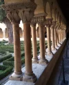
Do you happen to know why the pillar on the right is twisted? Just curious.
No. But there's another like it at the church of San Pedro de la Rua in Estella. The Royal Institute of British Architects has an article about it with absolutely no information about its meaning. Freudian architecture critics they are not. Sometimes a column is just a column.

And here's another at the abbey of Santo Domingo de Silos. Wikipedia's entry has some interesting tidbits about the sculptural iconography of the cloister but no mention of the column.

Well pilgrims - My challenge to you when you reach this point for real is to pose for a photo with one person bracing the top of the column and another person (or two), twisting it at the bottom. We could initiate a new craze like the folks who stage photographs of their significant others "holding up" the tower of Pisa.

Twisted, me?
 
Last edited by a moderator:
No. But there's another like it at the church of San Pedro de la Rua in Estella. The Royal Institute of British Architects has an article about it with absolutely no information about its meaning. Freudian architecture critics they are not. Sometimes a column is just a column.

And here's another at the abbey of Santo Domingo de Silos. Wikipedia's entry has some interesting tidbits about the sculptural iconography of the cloister but no mention of the column.

Well pilgrims - My challenge to you when you reach this point for real is to pose for a photo with one person bracing the top of the column and another person (or two), twisting it at the bottom. We could initiate a new craze like the folks who stage photographs of their significant others "holding up" the tower of Pisa.

Twisted, me?
Interesting but doesn't work for those of us who walk alone.
 
Ideal sleeping bag liner whether we want to add a thermal plus to our bag, or if we want to use it alone to sleep in shelters or hostels. Thanks to its mummy shape, it adapts perfectly to our body.

€46,-
Interesting but doesn't work for those of us who walk alone.
On the contrary. You might encounter some locals at the church and persuade them to join you in this jape. What an icebreaker that would be. You can then send the photos to your home paper with the caption "Local man assists the residents of Caracena in the annual wringing of the pillars."
 
On the contrary. You might encounter some locals at the church and persuade them to join you in this jape. What an icebreaker that would be. You can then send the photos to your home paper with the caption "Local man assists the residents of Caracena in the annual wringing of the pillars."
I am not sure if Google Translate is up to communicating something as interesting as wringing the pillars and I doubt that I can learn Spanish well enough to communicate that either.

Perhaps you could do a video in Spanish explaining what to do and giving an example 😁
 
turn left to follow the GR86 route instead of the official Camino route. It is one of the most stunning walks on the Lana! After about 16 km, the GR connects with the Camino in Tarancuena

I hope I am not being too mind-numbingly detailed as I pour through maps and GPS tracks.
I am glad you are doing it, to help me with my planning.

Do I have this straight?...
  1. Upon leaving Retortillo de Soria, go through the Puerta.
  2. After about 200 m, the Camino goes right - up to the SO-135 for a 8 km walk to Tarancuena. Instead, we should go left for a 16 km walk along the Arroyo de Carramonte, past Campamento Retortillo, maybe by Castro and/or Valvenedizo before going up to Tarancueña after a 16 km walk?
[Added after writing the above: I Just went to @Magwood 's blog, which was very clear in confirming that I've got it about right. The photos are great.]

Can you link me to a track of this part of the GR 86?

I am finding this second half of the Lana to be very tempting, but I am also feeling like maybe I'd rather have a walking partner for it.
 
The focus is on reducing the risk of failure through being well prepared. 2nd ed.
Can you link me to a track of this part of the GR 86?
From my blog...
We are informed by my notes that the first 12 km of this stage are on the road. But I am also informed that it is possible to follow the GR86 route to the same town and walk off road. We leave Retortilla via an archway and soon come to a small chapel.
At this point the yellow arrow directs a right turn onto the road, whereas we turned left for the GR route. I forgot to start recording on Wikiloc until we had covered around 1.5 km. Even on this route we are still on the road for around 3 km before following the red and white stripes to the right over barely discernible dirt tracks, through scrubby woodland, over great slabs of rock and past towering cliffs.
Link to my Wikiloc track for this stage:

But please note...
(again, from my blog) It’s an absolutely fabulous walk over all types of ground. But the red and white stripes indicating the way are not always easy to see and we do get a bit lost, but can see from maps.me that we are heading in the right direction. Eventually we cross a small crop field to reach the road and immediately see the stripes. We should have got onto the road some time sooner, but no harm done.
IMG_5797.jpg
 
Last edited:
Day 26. Fresno de Caracena - San Esteban de Gormaz. 19.5 km

From wherever we all started recently, we're all heading to the same place today: San Esteban de Gormaz. I must say I am attracted to the place just by the description in the Amigos' guide book:
Pero el destino final es la villa de San Esteban de Gormaz, declarada conjunto histórico-artístico, por la monumentalidad de su casco antiguo y de sus iglesias románicas. Situada a la orilla del Duero, es la localidad de mayor importancia del Camino de la Lana en la provincia de Soria, por lo que debe considerarse como parada obligatoria para poder disfrutar de su belleza, de su gastronomía y de sus gentes.
Declared a historic-artistic site, for the monumentality of its old town and its Romanesque churches. Oh, music to my ears!

Along the way we'll walk through Ines (8.4 km), and then Olmillos (4 km). These two places didn't stand out for our veterans, except for maybe @Magwood and @Ninja , who were both lucky in Olmillos to have a local open the bar for them. @alansykes sums up the walk today:
A quiet day, although with yet another small canyon shortly before Ines - not sure how many that is since leaving the Serpis 3 days from the coast.
And we'll cross the Duero as we come into town.

I'll refer to the "disfrutar de sus gentes" in the Amigos' description of San Esteban de Gormaz, and relate @Magwood 's experience there, when @Ninja needed the services of a pharmacist after hours:
the young man who worked there and was having an after-work drink in the bar next door, opened up for us and our friendly pharmacist dispensed the medication, charged the outrageous sum of 2 euros, chatted with us for ages and then gave us some free sample sizes of shampoo and toothpaste, and hugged and kissed us goodbye. I can’t imagine anywhere other than Spain giving such great service to a couple of out of town strangers. Thank you wonderful people of San Esteban de Gormaz.

I believe some of our veterans stayed at the Hostal Moreno, which is the alternative to sleeping at the polideportivo, the keys of which you will receive at the ayuntamiento. @alansykes hasn't named the hotel he stayed in, and @Bad Pilgrim stayed at the Hotel Rivera del Duero. The ayuntamiento's website lists a few other lodging options. There is also a good choice of restaurants.

In a real life Camino, we might stay an extra night and have a rest explore day:
 
Yes, @Magwood and I did stay at Hostal Moreno … for several days … for multiple reasons.

The hostal was not so charming, but a very friendly place including a bar and a restaurant. (The look of the bartender made us think of The Addams Family - or maybe we were just exhausted after the long walk and really needed the wine).

3_San_Esteban_bar_b.webp
1_San_Esteban_bar_a.webp
 
The one from Galicia (the round) and the one from Castilla & Leon. Individually numbered and made by the same people that make the ones you see on your walk.
Just a word about Hostal Moreno - it is at the very edge of the town and probably a 2-ish km walk back to the historic centre. It would be much more convenient to stay in the centre of town.

Oh yes. I desperately wanted to stay in the centric Hotel Rivera del Duero in 2019. But the nice bloke who gave me a discount two years earlier was not behind the counter so it was too expensive for me. Hostal Moreno is located too far away from the centre in my opinion. It was a bit frustrating to add kms just because I wanted to go into town, then go back again. Especially if you have already done those 30+ kms from Tarancueña, or even Retortillo de Soria, the same day! Next time I am saving up some money to spend on lodging in San Esteban de Gormaz so I can stay close to the center...
 
The 2024 Camino guides will be coming out little by little. Here is a collection of the ones that are out so far.
The ayuntamiento's website lists a few other lodging options
I like the looks of El Rincón de Elena, which specifically notes that they rent out individual rooms. Looks like a good location, too.

And a hotel with doubles at 45€ — about 100 m from the Plaza Mayor. Hotel Rural El Alquerque.

So many lodging options in a small place!

And I wanted to let the regulars on this thread know that VN is having trouble getting on the forum, even when the internet is “on”(in theory at least). There are regular nightly shut-offs, but now she is having problems during the day (I got an email from her, so maybe it has something to do with the size of the forum website).

Anyway, I told her we miss her and that everyone has fingers crossed for her well-being.
 
And we'll cross the Duero as we come into town.
For those of us who like to start our caminos in or near the Mediterranean, crossing the Duero is a significant milestone, meaning that you're somewhere between about half way to 2/3s of the way to Santiago, depending on how far upriver you make the crossing.

There's a fine bridge at San Esteban de Gormaz, 16 arches, partly mediaeval, built (and frequently rebuilt) on the remains of a Roman bridge. El Cid almost certainly crossed over here on his way south and described the place as "una buena ciudad", which seems very fair. The romanesque church of la Virgen del Rivero is well worth a look, especially for its impressive south facing portico looking back over where you've come.

Other crossings in Spain include further upriver at lovely Soria on the Castellano-Aragonés. Downriver you have Tordesillas on the Sureste, close to Rueda, home of the tasty fruity light verdejo grape. Toro on the Levante is better known for its much heavier strong red wines, most welcome after several days in dense freezing fog the only time I went that way. Zamora, on the Plata, has one of the loveliest riverscapes in Spain. One I'm saving up for the post-covid world is at Puente Duero-Asparragal, on the Camino de Madrid. I expect there are others, but that's most of the ones where an "official" camino crosses the river. In Portugal there are several more crossings (of the Douro, of course), the only one of which I've done was at Peso de Régua on the Camino Torres/Portugués del Interior, in the spectacular heart of port wine country.

DSC_0127.jpgDSC_0128.jpg
 
Last edited:
Ideal pocket guides for during & after your Camino. Each weighs only 1.4 oz (40g)!
Day 27. San Esteban de Gormaz - Quintanarraya. 30.4 km

I assume this stage is not one of happy memories for @Magwood , as her Camino was unexpectedly cut short, and she returned home. I hope your hip has recovered, @Magwood , and that you will soon be able to walk again on the Camino. I would like to take the opportunity to thank you for sharing your experience in your blog: I very much enjoyed it and I loved your great photos!

This stage is a long one by slow walker standards. @Bad Pilgrim had had a bad experience with the MWM in Quintanarraya, and decided to push an extra 6 km, making it a 37.1 km day 😲 !

From San Esteban de Gormaz, it is 7.3 km (according to the Amigos' guide book) to the first village, Matanza de Soria.
The walk to Matanza de Soria was uninspiring, about 8kms, including a missed dirt track turn and subsequent readjustment. The deer were out in force though, bolting in all directions. A further 3kms to Soria to Villálvaro was equally uninspiring, but there were drinking water fountains there.
At Villálvaro, @alansykes made a detour, which Romanesque lovers might also do:
More of the glut of romanesque. One of my favourites was the truncated chapel of the Virgen de las Lagunas, a few km from Villálvaro, standing entirely alone, the village it used to serve having vanished several centuries ago.
Another 5.7 km ...
and you will end up directly in Zayas de Bascones. This route is stunning for photos of long winding dirt tracks, big countryside, big sky, lonely trees and of course, a lonely church. You'll also pass what I think is a large ancient boundary marker stone. The track is well-developed, easy to follow and is clearly shown on maps.me as dotted lines.
Alcubilla de Avellaneda is a further 5.7 km, and this is where @Bad Pilgrim had a surprise:
a restaurant in Alcubilla de Avellaneda! You pass right in front of it on the road that runs through town, in a curve. The guides don't mention it, and I don't remember it from before, so it must be new (?). Very fancy in a castle-like, old building: I had to look around. A cafetería and restaurant, but also an outdoor area with a terrace, arcades, a lawn, and a swimming pool (!). In a village of 150 inhabitants, they opened what looks like a Parador. And it's open on Sundays!
This is where Tomas helped out @Magwood .

A further 6 km to Hinojar del Rey, where we leave the province of Soria to enter the province of Burgos, and then 2.5 km to Quintanarraya.

Quintanarraya is a small place, 145 inhabitants, and the only place to sleep in is the albergue municipal.
At Quintanarraya the albergue key is held at the bar/social centre, a lively friendly place that does simple meals. The albergue is in the former school, 5 beds, blankets and pillows, loo, shower, microwave, 5€.

There are a few options for slow walkers. The non-purists will notice that San Esteban de Gormaz is a decent sized town, and a quick search reveals that there are a few taxi drivers. A taxi ride could thus be taken to, say, Villálvaro, shaving off 10.5 km, and resulting in a 19.9 km walk to Quintanarraya. After all, we wouldn't be missing anything of the "uninspiring" first few km.

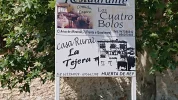
There is another option, which my darling and I would probably adopt when we get to walk in real life. We would walk 21.9 km to Alcubilla de Avellaneda, and then stay at the Hotel Rural Marquesa De Tavira. The next day, we would walk to Huerta de Rey, and stay at the Casa Rural La Tejera:
I found the casa rural La Tejera, which charges 20 euros. And this for a room in a house that is just as fine as, let's say, El Rincón de Sandra in Monteagudo. Once again, a ridiculously low price for a standard like that. I was flabbergasted. I asked Nice-Guy-In-Charge if this was a pilgrim deal, but he said it was the same price for everyone. Thank you Huerta de Rey! I also noticed a freshly painted Hostal El Cid (last photo below) in town, which the guides don't mention. Do they only accept Cider pilgrims or can Laners check in as well? I was too tired to investigate... I was so happy to be in a village with more than one half-empty bar and two goats, and with some action going on. With almost 1000 inhabitants, Huerta de Rey is a metropolis compared to Quintanarraya. That said, without a youth mob there is nothing wrong with the albergue in Quintanarraya. The people in the bar and the villagers are very helpful and kind to pilgrims! I'm just giving you some alternatives here.

However, we're walking a virtual Camino, and tonight, we're staying at the albergue municipal in Quintanarraya.
 
Thanks for the heads up about a nearby iglesia románica! Here is a bit of information and two pages of pictures showing how it was restored in 2005 after its roof collapsed. Quite an extensive undertaking. It is about 2.7 km from Villálvaro. I am pretty sure that @alansykes did not record his tracks from San Esteban de Gormaz to Quintanarraya, at least I cannot find them.

So, second best to having Alan’s tracks, here is a set of tracks to get you there. But these tracks will not take you back to the Lana, so to get from the ermita back to the Lana, I have just plugged it into google maps and it looks pretty straightforward. (screen shot below).

FA7EC4CB-E749-4FC1-82AC-B81CBB92817C.png

It may well be that this ermita is just a stone’s throw off the Lana, because the distance between Villálvaro and Zayas de Bascones (two towns I know are on the Lana) is 7.6 via the ermita, and about 7.9 on the GPS Lana tracks. Actually, now that I think about it, this ermita might be right on the Lana! Veterans, let us know.


But going back to Alcubilla de Avellaneda.

The restaurant BP describes in Alcubilla is actually in an old Palace, the Palacio de los Avellaneda.

NOTE FROM MODS — BOTH OF THESE ACCOMMODATIONS ARE APPARENTLY CLOSED AS OF MARCH 2023. FURTHER UPDATES WELCOME!

The Hotel Rural Marquesa de Tavira, also in Alcubilla, is described on its facebook page: A manor built in 1907, completely restored in 2011. 6 doubles with bath and single beds, and 2 rooms with double beds (one of those has a third bed). Terrace with BBQ and dining room with fireplace to enjoy the grilled meats prepared there.

C/REAL 47. ALCUBILLA DE AVELLANEDA
42351. SORIA (ESPAÑA)
Teléfonos: 975 357 681 | 615 826 895 | 615 826 900
E-mail: info@hotelruralmarquesadetavira.es


And look what I found about 4 km from Quintanarraya!


Not as spectacular as Mérida, no doubt, but it looks like a very nice place, well worth a visit. This is the type of afternoon jaunt that I would stick out my thumb for.
 
Last edited:
It may well be that this ermita is just a stone’s throw off the Lana, because the distance between Villálvaro and Zayas de Bascones (two towns I know are on the Lana) is 7.6 via the ermita, and about 7.9 on the GPS Lana tracks. Actually, now that I think about it, this ermita might be right on the Lana! Veterans, let us know.

I have the answer, at least to where the ermita is located. The camino, according to the Asociation's maps & directions, does not go past the ermita. It seems that pilgrims are clutched to the carretera all the way between Villálvaro and Zayas de Bascona, and that is far from the ermita.

However, an older version of the Camino must have existed, as I have always been guided by the arrows out of Villálvaro on a country road: first on Camino fuente and then on Camino de la Virgen. On this country road, you will eventally see the ermita in front of you! It is just that the Camino veers off to the right, to get you to the carretera, just a few hundred mtrs before reaching the ermita. So I have seen the ermita twice, from a distance, but actually never gone to see it up-close. So it is not right on the Lana, but one could easily walk over to it and then get back to the spot where you turn right. After a while, you reach the road that takes you to Zayas de Bascona on tarmac.

See picture below: I caught it on camera! As you said, Laurie: a stone's throw away! This is where you turn right. And look closely: there is also a Camino marker in the picture. Sooo... Is this the official Camino or not...? Alan-Maggie-Nina need to sort this out for us.

I am very curious if I am the only one who leaves Villálvaro this way? I have no idea where those other (new?) arrows are supposed to be in Villálvaro, that follow the Asociation's way!DSC_1685_copy_2752x1548.webp
 
Last edited:
Ideal sleeping bag liner whether we want to add a thermal plus to our bag, or if we want to use it alone to sleep in shelters or hostels. Thanks to its mummy shape, it adapts perfectly to our body.

€46,-
Ok, and a few photos of today's stage... Up until Quintanarraya.
 

Attachments

  • DSC_1682_copy_1548x2752.webp
    DSC_1682_copy_1548x2752.webp
    411.8 KB · Views: 25
  • DSC_1694_copy_2752x1548.webp
    DSC_1694_copy_2752x1548.webp
    985.4 KB · Views: 18
  • DSC_1697_copy_2752x1548.webp
    DSC_1697_copy_2752x1548.webp
    1.1 MB · Views: 16
  • DSC_1699_copy_2752x1548.webp
    DSC_1699_copy_2752x1548.webp
    786.7 KB · Views: 17
  • DSC_1702_copy_2752x1548.webp
    DSC_1702_copy_2752x1548.webp
    1.1 MB · Views: 17
  • DSC_1707_copy_2752x1548.webp
    DSC_1707_copy_2752x1548.webp
    862.2 KB · Views: 17
  • DSC_1711_copy_2752x1548.webp
    DSC_1711_copy_2752x1548.webp
    1.2 MB · Views: 19
  • DSC_1714_copy_2752x1548.webp
    DSC_1714_copy_2752x1548.webp
    575.5 KB · Views: 18
  • DSC_1721_copy_2752x1548.webp
    DSC_1721_copy_2752x1548.webp
    1 MB · Views: 17
  • DSC_1724_copy_2752x1548.webp
    DSC_1724_copy_2752x1548.webp
    624.8 KB · Views: 24
See picture below: I caught it on camera! As you said, Laurie: a stone's throw away! This is where you turn right. And look closely: there is also a Camino marker in the picture. Sooo... Is this the official Camino or not...? Alan-Maggie-Nina need to sort this out for us.
Oh my, do I love this forum!!!! Thank you so much, BP. The GPS tracks I have downloaded do go off-road at Villálvaro, but get back on the road well before Zayas de Bascones.

Here’s a screenshot of that part of the stage:

3AD028DA-D25E-4673-91F7-8EA3A5317931.webp

I wonder if there is any way to keep going past the ermita and stay off road for a longer part of the stage?
 
The GPS tracks I have downloaded do go off-road at Villálvaro, but get back on the road well before Zayas de Bascones.
Yes, this is the way I am talking about! It is the Association that has a whole other take on it: perhaps it is only them.

I wonder if there is any way to keep going past the ermita and stay off road for a longer part of the stage?
Well, you could walk past the Ermita and turn right later (Calle Rejas de San Esteban) to reach Zayas de Bascones... I never tried. Maybe there are Camino markers there as well. So strange to divert pilgrims away from the ermita, when you can almost reach out and touch it. The thing is that the camino marker in my photo is just placed at the junction: impossible to say if it means Turn right or Carry on. I turned right, and it has always taken me to Zayas... I guess I have to walk past the Ermita next time to see where it leads me...!
 
Last edited:
€2,-/day will present your project to thousands of visitors each day. All interested in the Camino de Santiago.
I only have one photo to show from this stage. It must be from somewhere before reaching Villálvaro. After Villálvaro everything is a bit of a blur … but now seeing your picture @Bad Pilgrim (post 211), I think that @Magwood and I went straight ahead, we didn’t turn right at this point.

Last_day_24_la_lana_2019.jpg
 
I only have one photo to show from this stage. It must be from somewhere before reaching Villálvaro. After Villálvaro everything is a bit of a blur … but now seeing your picture @Bad Pilgrim (post 211), I think that @Magwood and I went straight ahead, we didn’t turn right at this point.

View attachment 94719

And were there signs that guided you to Zayas? I suspect that you and Maggie followed the traditional way to Zayas, past the ermita. I still have no idea why the Association would divert people away from the Ermita and from the countryside!
 
My notes say we walked through Zayas de Báscones. I have a closer view of the ermita but it may be that I zoomed in from the corner. These are the last photos of my Camino de la Lana sadly. Until participating in this thread I thought I was happily 'done' with this route, but I'm now thinking I might like to return to Cuenca in more clement weather and walk again from there. Thanks to all for keeping me entertained throughout a dark and lonely British covid winter.

IMG_5909.webpIMG_5916.webpIMG_5917.webpIMG_8518.webp
 
Ideal sleeping bag liner whether we want to add a thermal plus to our bag, or if we want to use it alone to sleep in shelters or hostels. Thanks to its mummy shape, it adapts perfectly to our body.

€46,-
I just street viewed Zayas de Báscones and the visual helped me remember the walk from Villálvaro.

We must have turned right and thus NOT passed the ermita as I first thought. We were on a tarmac road for a very long time before reaching Zayas and we walked right through it without stopping, and continued on tarmac all the way to Alcubilla de Avellaneda.

Oh my, do I love this forum!!!! Thank you so much, BP. The GPS tracks I have downloaded do go off-road at Villálvaro, but get back on the road well before Zayas de Bascones.
The GPS tracks you downloaded @peregrina2000 I now see is the tracks we followed.


Well, you could walk past the Ermita and turn right later (Calle Rejas de San Esteban) to reach Zayas de Bascones... I never tried. Maybe there are Camino markers there as well. So strange to divert pilgrims away from the ermita, when you can almost reach out and touch it. The thing is that the camino marker in my photo is just placed at the junction: impossible to say if it means Turn right or Carry on. I turned right, and it has always taken me to Zayas... I guess I have to walk past the Ermita next time to see where it leads me...!
A good plan: we will follow the Camino de la Virgen that goes past the ermita. We follow it until it meets Calle Rejas de San Esteban where we take a right turn towards Zayas. Only the last 40 meters is on tarmac!
 
Last edited:
The Camino from Zayas to Alcubilla keeps you on tarmac road. Why? There is a dirt track through the fields. Maybe it adds 1,5 km, but I would prefer it to the asphalt, wouldn’t you?

Zayas_to_Alcubilla.webp
 
Get a spanish phone number with Airalo. eSim, so no physical SIM card. Easy to use app to add more funds if needed.
3rd Edition. More content, training & pack guides avoid common mistakes, bed bugs etc
Wringing and shaking, we're moving on! 😄

Day 28. Quintanarraya - Santo Domingo de Silos. 24.3 km

I was looking at the GPX tracks @alansykes recorded for this stage, and I noticed he walked just over 29 km. That includes a spur on the Camino de la Dehesa after Peñacoba: did you take a wrong turn, @alansykes ? ;).
Looking more into details, I can see that about 3 km after Huerta de Rey, near the Área Recreativa "Las Navas", he followed the Camino del Cid, which looks like a walking trail, instead of following the road.
I ALWAYS prefer a few extra kms if it means avoiding asphalt. I know there are some who aren’t bothered by asphalt, but it really does a number on my feet.
I agree, provided the stage doesn't become too long for my beloved. In our case, walking a real Camino, we would have stopped in Huerta de Rey, which means that the walk to Santo Domingo de Silos from there would only be about 20.7 km, instead of 17.8 km.

In 2019, @Bad Pilgrim walked from Huerta de Rey:
There are 14 kms to Peñacoba and the first ten or so of them are on the road. Luckily it is a road that runs through the woods so there are shadow and nature all around. But a road through the woods becomes so monotonous...
After that comment, we too, in a real life Camino, will follow the Camino del Cid.

Coming back to our virtual Camino, we have left Quintanarraya:
About 7kms after leaving Quintanarraya, you get to the town of Huerta de Ray along a pleasant dirt track. There are a fair number of bars and a few shops here but at 9.00am when I arrived, all but one, a restaurant called Meson La Herreria, was closed, pretty typical but you only need one open!
Following the road, after 6 km, we arrive at the Ermita de Nuestra Señora de Pinarejos.

From Huerta de Rey, @Undermanager also followed the Camino del Cid, rather than following the monotonous road through the woods:
When you follow the road out of town, just as you come to the sign for the town for drivers coming in, there's a small green bridge on the left. Cross it, turn right and follow it to it's exit 0.5kms away. It runs parallel to the road but also by a crystal clear stream. At the exit where the path rejoins the road is an ancient water fountain of sparklingly clear spring water, where you can have a slurp and refill bottles. This is also a picnic and BBQ area. You then turn left at the road 20 meters on uphill here to follow the Camino for about two kilometers, before turning left into the forest. It's very clearly marked, as is the forest path you are about to take. Someone has clearly been out with the marking paint recently! It's a lovely walk, through forest and glade, a fair amount of shade and at times, quite uphill and tiring. Bring a bit more water than usual if it's hot.

At 15.5kms, you'll come across a road and large park area, with drinking water, many tables, BBQ areas and generally, a nice place for a rest.

From the Ermita, there is an option to follow the road to Mamolar, which is the alternative for bicigrinos. There is no lodging in Mamolar.

At the Ermita, the Lana follows the Camino del Cid.
Again, the Lana Camino following the El Cid Camino is excellently marked. From here, it's mostly uphill all the way, sometimes steeply, until the 21kms mark at 1290 meters, with all kinds of track, from nice pine, dirt, stone and mountain goats only paths.
From the Ermita, it's 7.8 km to Peñacoba:
It's about 20 minutes downhill to Penacoba, where joy of joys there was an unexpected bar! I heard voices in a building next to the fountain in this tiny village that possibly looked like an Ayuntamiento, tentatively opened the door and behold, a vision of loveliness. It wasn't a mirage but a big, well-developed bar, with people, tables, drinks. Beer con Limon, a seat, peanuts, TV. What more does you need?

For the slow walkers hoping to maybe stop in Peñacoba: there is a Casa Rural Martínez. However I wouldn't count on it, as it appears one must book the whole house (Alquiler Integro). And let's face it, it's only 4 km to Santo Domingo de Silos.

In Santo Domingo de Silos, there are a few places where one can find a bed. The first one is the Albergue managed by the monastery:
Fray Alfredo, the genial brother hospitaler, showed me across the road to the albergue and quickly confirmed something that had been bugging me for the last few days - the capitals and twisted central column at San Pedro de Caracena were indeed done by the same sculptor as the early part of the cloister here. The albergue is luxurious. 2 bunks, microwave, fridge, washing machine and drier, loo and shower, donativo.

Vespers in the darkened church is always an experience, with the Abbot providing the only splash of colour, but I think Lauds at dawn next morning was even more memorable - totally monochrome, starting on the dark with the light gathering as the singing proceeded, only 4 of us in the congregation and a dusting of snow lying outside.
The abbey has a Hospedería, in case one wants to extend one's stay for spiritual reasons, and a minimum of 3 days is required. With one restriction: Sólo se acepta la estancia de varones.

The alternatives are the Hostal Santo Domingo de Silos, Hostal Silos 2000, Hotel Tres Coronas de Silos, Hotel Arco San Juan, Hotel Rural Villa de Silos, Hotel Mesón Casa de Guzmán.

There's plenty to see in Santo Domingo de Silos, and the slow walkers we are will probably stay two nights in a real life Camino.
 
Google Maps also shows a second "albergue de peregrinos" in town. I have no idea what that is about. As far as I know there is only one.
I suppose, this is Albergue municipal Pza Constitución1, New adress: Calle Escuelas 969270068 - (Ayuntam.)
Later: This post concerns #37 Villar de Domingo Garcia
 
Last edited:
The 2024 Camino guides will be coming out little by little. Here is a collection of the ones that are out so far.
I suppose, this is Albergue municipal Pza Constitución1, New adress: Calle Escuelas 969270068 - (Ayuntam.)
I could not find that street, any chance of posting a google maps link or a what3words link to the Albergue municipal?
 
Heads up to our fearless leader. In Covarrubias, which is 16 kms beyond Santo Domingo and is quite the little touristy jewel, there are two options - stay on the Lana, or take the San Olav. And there are criss-crossing permutations as well.

My suggestion would be that, to make this a perfectly symmetrical camino, since we started the Lana with two alternatives (Alicante and Villajoyosa), we should end the Lana with two alternatives (Lana and San Olav). What do the rest of you think?
Sounds good to me-eeh...! 🎵

Personally I prefer the good old Lana. I walked the San Olav already but it was backwards, as we will also do. It was tricky to go backwards through Alex Walker's otherwise excellent guide, and difficult to spot the markings in time.
 
Last edited:
€2,-/day will present your project to thousands of visitors each day. All interested in the Camino de Santiago.
  • #113 When I have time I can do an extensive overview of Alicante-Burgos regarding foodless villages. Right now, Alatoz comes to my mind. But there are at least 2 bars in Alatoz.
In Alatoz a grocery shop is just next door to the Bar OVI, and a bar-restaurant - as I found in Sept. 2019.
 
#173 Similarly, we would try to break the next portion of this escapade by stopping in Gormaz. The lodgings shown in Google maps in Gormaz might be for an entire house, so I am not sure we could stay in Gormaz.
I do not remember wether I posted this already: In Gormaz, about 25km from Retortillo, is a quite new albergue de peregrinos. The marked camino towards San Esteban is for El Cid, anyway.
Tel. 975 183 473, 8€ https://www.caminodelcid.org/servic...minos-a-santiago-el-cid-gormaz-soria-2241323/ gormazalbergue@gmail.com
 
Last edited:
The 2024 Camino guides will be coming out little by little. Here is a collection of the ones that are out so far.
.....
Day 28. Quintanarraya - Santo Domingo de Silos. 24.3 km

....... only 4 km to Santo Domingo de Silos.
......
The abbey has a Hospedería, in case one wants to extend one's stay for spiritual reasons, and a minimum of 3 days is required. With one restriction: Sólo se acepta la estancia de varones.
.....
There's plenty to see in Santo Domingo de Silos, and the slow walkers we are will probably stay two nights in a real life Camino.
Has anyone stayed at the Hospedería?

This sounds like a good place to take a week and contemplate life and how I live it.

Would they accept me with almost no Spanish language skills?
 
Heads up to our fearless leader. In Covarrubias, which is 16 kms beyond Santo Domingo and is quite the little touristy jewel, there are two options - stay on the Lana, or take the San Olav. And there are criss-crossing permutations as well.

My suggestion would be that, to make this a perfectly symmetrical camino, since we started the Lana with two alternatives (Alicante and Villajoyosa), we should end the Lana with two alternatives (Lana and San Olav). What do the rest of you think?
Fearless but slow walking 😄

I think it is a very good idea. I have been studying the way ahead, looking for short stages for my darling's sake, and I noted that our recent veterans, namely @Bad Pilgrim and @alansykes , both took the San Olav.

I have already downloaded @alexwalker 's excellent guide for the San Olav.
So, as for the start of the Lana, I'll complete the official two stages first, and then I'll walk the San Olav backwards virtually.
 
The year that Reb and I walked the San Olav, we met up in Santo Domingo de Silos. The bus from Burgos gets here just in time for vespers, and that is how Reb arrived. We stayed in the Hotel Santo Domingo de Silos, with a good last minute rate at booking.com. I will say that of the (embarrassingly many) times I have stayed in more “upscale” places on Caminos, this place stands out as one of the very few I remember where the staff was clearly thinking that pilgrims were not up to the hotel’s standards. I will chalk it up to the fact that we are near Burgos — I have strong memories of getting disapproving once-overs from the proper señoras walking down the river walk, but this was in the early 2000s when peregrinos were much less a part of the norm.

Even in mid June, the town was not at all crowded, the cloisters were peaceful and quiet, and Vespers were virtually empty. I’m sure weekends are an entirely different matter, though.

Has anyone stayed at the Hospedería?

This sounds like a good place to take a week and contemplate life and how I live it.

Would they accept me with almost no Spanish language skills?
I haven’t been in the hospedería, but I would be shocked if your lack of Spanish would be a problem. Their website describes an openness to anyone (at least those of the male persuasion) who is looking for serenity and a time to disconnect from the modern world. They make quite clear that you are not expected to be Christian or even religious — long way of saying that I bet you would be easily accepted. 45€ a day full room and board.
 
Ideal pocket guides for during & after your Camino. Each weighs only 1.4 oz (40g)!
#198 Oh yes. I desperately wanted to stay in the centric Hotel Rivera del Duero in 2019. But the nice bloke who gave me a discount two years earlier was not behind the counter so it was too expensive for me.
I found out in 2019 that booking.com offered a night in the Hotel Rivera del Duero for 59€. When I stepped in without a reservation the night was 45€ as noted at the reception desk. The experience: It is sometimes cheaper to phone or to step directly into the hotel than a reservation by a booking platform.
 
Last edited:
Does this route include what Kevin O'Brien called "into the forest for a somewhat strenuous walk to Penacoba"?
I guess it does. Looking at the profile, I would say that the strenuous walk would be after the Ermita de Nuestra Señora de Pinarejos. @Undermanager mentions "mountain goat only paths" after the Ermita.
 
3rd Edition. More content, training & pack guides avoid common mistakes, bed bugs etc
As I was looking for information on the Camino del Cid alternative into Santo Domingo de Silos, I learned about the Desfiladero de la Yecla. I thought maybe this was the trail Kevin had mentioned, but it turns out this is after Peñacoba, not before. Wikiloc route shown here. If you look at the wikiloc map, it’s a circle from Santo Domingo to the gorge to Peñacoba and back into Santo Domingo on the Camino del Cid. And it doesn’t look like it’s much longer to take the left hand side of the circle from Peñacoba than the Camino del Cid. The trail through the gorge is well built and safe. There are stairs down and up to get to the gorge itself. Some better pictures here.

Now back to the drawing board to get more info on the Camino del Cid alternatives. Am I right that the only place on this stage where the Cid deviates from the Lana is the part from Huerta del Rey to the Ermita de Nuestra Señora de Pinarejos?
 
Am I right that the only place on this stage where the Cid deviates from the Lana is the part from Huerta del Rey to the Ermita de Nuestra Señora de Pinarejos?
That's what it looks like from the various maps and the GPX tracks I have compared.
 
Here are VN's comments about Santo Domingo de Silos

SdDS is one of those 'special' places, so it's a very good idea to spend an extra night here! It gives plenty of time to visit the exquisite cloister — and do give yourself a lot of time here because it's not something to be rushed. I only had about a half an hour before they closed and it was way too little time.

And next time (being optimistic) I will stay for matins. The evening service was exquisite.

One thing to consider if you spend a rest day here would be to walk over the hill on the GR82 to the Sad Hill Cemetery. Even if you're not into spaghetti westerns, it's quite a beautiful walk. After a long gradual uphill from town, the way there turns right and drops into the next valley over. If at this point you go straight, about 5 minutes away is a stunning view point. I've posted this picture before on the Forum, but it was a gobsmacking view!
(It is also possible to go off-piste and pass by here the next day if you are willing to be a bit adventurous. More about this later.)

I stayed at Casa Guzman, and don't have much memory of it, other than basically being satisfied. It's got a very central location and I vaguely remember a busy bar. Word to the wise: if you want to get an early start see if they will give you a care package the night before. I did not do this, blithely thinking I would subsist on what I was carrying until I got to Covarrubias — so it was a very hungry day because I took a wrong turn and never got there!

I would love to stay for a retreat, but alas. (Actually in this case I totally understand the reason for that stipulation about gender and I'm not inclined to complain.)


VN has also sent some beautiful pictures, but it is much easier for me to get them from my email to the forum when I am on my ipad and not my computer. So I will do that later when I leave my office and get home.
 
A selection of Camino Jewellery
Here are VN's comments abaout Santo Domingo de Silos

SdDS is one of those 'special' places, so it's a very good idea to spend an extra night here! It gives plenty of time to visit the exquisite cloister — and do give yourself a lot of time here because it's not something to be rushed. I only had about a half an hour before they closed and it was way too little time.

And next time (being optimistic) I will stay for matins. The evening service was exquisite.

One thing to consider if you spend a rest day here would be to walk over the hill on the GR82 to the Sad Hill Cemetery. Even if you're not into spaghetti westerns, it's quite a beautiful walk. After a long gradual uphill from town, the way there turns right and drops into the next valley over. If at this point you go straight, about 5 minutes away is a stunning view point. I've posted this picture before on the Forum, but it was a gobsmacking view!
(It is also possible to go off-piste and pass by here the next day if you are willing to be a bit adventurous. More about this later.)

I stayed at Casa Guzman, and don't have much memory of it, other than basically being satisfied. It's got a very central location and I vaguely remember a busy bar. Word to the wise: if you want to get an early start see if they will give you a care package the night before. I did not do this, blithely thinking I would subsist on what I was carrying until I got to Covarrubias — so it was a very hungry day because I took a wrong turn and never got there!

I would love to stay for a retreat, but alas. (Actually in this case I totally understand the reason for that stipulation about gender and I'm not inclined to complain.)


VN has also sent some beautiful pictures, but it is much easier for me to get them from my email to the forum when I am on my ipad and not my computer. So I will do that later when I leave my office and get home.
..

So glad to learn that VN booked the Casa Guzman! Several years ago after I finished the CF early in December my husband drove down to SdC to join me and eventually we visited Santo Domingo de Silos staying at the Casa Guzman. It was a pleasant inexpensive hostal with good food, open fireplace and simple comfort. Best of all it is 1 minute from the visitors entrance to the monastery; perfect!

In Santo Domingo de los Silos the tourist bureau has a list of many small hotels and hostals. They also provide a good free map of additional walking paths in the area. If you are into 'ad hoc' camping, ie unorganized camping, follow the path towards the nearby Ermita de la Virgen de la Camino and you will see many inviting nooks for laying down your sleeping bag.
 
Last edited:
VN’s pictures of Santo Domingo and the walk into it. Sorry, I don’t know how to make them thumbnail using the method of transfer I did on my ipad.

I am pretty sure the last picture is from VN’s walk OUT of Santo Domingo, but I know it is one of her favorite all time walks (when she got on the “wrong path” and had a marelous walk). But more on that later!

What a cloister — right up there with San Juan de la Peña, San Juan de Duero, Santillana del Mar... oh the beauty.

1615232325556.jpeg

1615232362395.jpeg
1615232388593.jpeg

1615232423999.jpeg

1615232448818.jpeg
1615232491797.jpeg
 
When arriving in Peñacoba you will shortly after the pueblo have to cross the BU-V-9216 coming up from Pinarejos/Mamolar. Walkers cross the road and follow the marked camino towards Santo Domingo. The path is sometimes harsh - not at all suitable for cyclists.
There are also yellow arrows along the road showing to the left. They are meant for bicigrinos and for those who want to see the Yecla cañon. The road leads smoothly downhill in a great circle to Santo Domingo - fine for cyclists.
 
Get a spanish phone number with Airalo. eSim, so no physical SIM card. Easy to use app to add more funds if needed.
I'm back in business!!! Happy dance.
It's still slow but apparently almost everything works as it should, and I can reply (inserting quotes seems a step too far, though).

Yes, Laurie, that pic is the overlook above SDdS, on the way to the Sad Hill Cemetery, for those taking a rest day who wish to take a side trip with no weight on their backs.
 
Here’s a map to show the route to the Sad Hill Cemetery and the overlook (El Rodadero on this map).

It's about 4.5km, not including going to the overlook. I remember this side trip to the Overlook being only 5 or 10 minutes, but it may be a bit further than that from the look of the map. I don't know what the black line along that ridge means; it's not a road, although to go to the overlook you follow a two-track that's not marked on the map. Just go straight when you get to the saddle rather than taking the sharp right-hand turn downhill.
Screenshot_20210309-152147_OsmAnd.jpg
 
Last edited:
Here’s a map to show the route to the Sad Hill Cemetery
Well, maybe I’m the only uninformed member of this thread, but I confess I had to find out what the Sad Hill Cemetery was. Turns out it is an important scene in The Good, The Bad, and The Ugly:

Sad Hill Cemetery was the mocked-up military cemetery where the last moments of the film unfold with the most famous scene, the three-man duel between Clint Eastwood, Eli Wallach and Lee Van Cleef. ‘The Ecstasy of Gold’, the outstanding soundtrack by Ennio Morricone, keeping pace with Sergio Leone’s wonderful direction. Twenty magnificent minutes that had a tangible influence on so many later films, but where there are no extra shots left, nor any extra seconds.

Information about the Cultural Association trying to restore the site here. I confess I would not go up to visit the movie site, but the view VN posted is much more tempting.
 
€2,-/day will present your project to thousands of visitors each day. All interested in the Camino de Santiago.
Day 28. Santo Domingo de Silos - Covarrubias or Mecerreyes. 16.7 or 23.5 km

Heads up to our fearless leader. In Covarrubias, which is 16 kms beyond Santo Domingo and is quite the little touristy jewel, there are two options - stay on the Lana, or take the San Olav. And there are criss-crossing permutations as well.

My suggestion would be that, to make this a perfectly symmetrical camino, since we started the Lana with two alternatives (Alicante and Villajoyosa), we should end the Lana with two alternatives (Lana and San Olav). What do the rest of you think?
We'll follow the official Lana until Burgos, and then we'll come back. This is why I have two destinations, so that we can come back to the first when we look at the San Olav.

Actually, it probably doesn't really matter where we stop to start the San Olav. As @peregrina2000 wrote, there are criss-crossing permutations as well.

Looking at what our veterans have done in recent years, here is what I found.

@Undermanager walked to Covarrubias, and stopped there for a rest day.
Santo Domingo is on a valley floor so there are lots of uphills and downhills, mainly uphills, at the start of the day for the first two hours. Then it flattens out, all through light forest or scrubland.

As you see for the first time Retuerta 13 kms from Santo Domingo from the top of the valley, you can see an El Cid sign trying to take you sharp left away from the village. Just carry on towards the village, past the red and white cross and you'll pick up the El Cid markers again within 100m. [...] There were no other facilities, although I did see a one star Casa Rural, if you wanted somewhere super quiet to stay.

It's about 4kms on to Covarrubias, a 1.5 km slog uphill then a slow descent into this incredibly gorgious medieval village / small town. Set by a pretty river and bridge, there are endless fabulous old buildings here, plenty of bars, restaurants and hotels, some shops and bakeries and lots of tourists milling about, taking it all in.

@Bad Pilgrim had followed the Lana to Burgos previously, and in 2109, decided to try the San Olav after having walked from Huerta de Rey to Covarrubias.
And here ends my Camino de la Lana! Surprise. I'm still going to Burgos, but on the Camino de San Olav.

@alansykes walked past Covarrubias and stopped at Mecerreyes, where he then switched across to the San Olav.
From 1200m up you get the first distant glimpse of the menacing flat of the meseta. Then down towards lovely Covarrubias. Miraculously, the Colegiata, with its van Eyck, closes on Tuesdays, so was open when I rashly crossed the weir over the Arlanza, as Lorca puts it, "Sobre la plata azul lunar del río, se retratan los árboles, fundiendo sus verdes oscuros en el abismo enigmático de las aguas".

Next time I will stay in Covarrubias, as the tienda in Mecerreyes has closed in the three years since I last visited (3 years to the day, according to the visitors' book).

The options for sleeping at Covarrubias, as we will need this information when we follow the San Olav later, include the Casa Galín, where both @Undermanager and @Bad Pilgrim stayed, and the Hotel Doña Sancha, which was recommended to and by @alexwalker . Both are listed in the Amigos' guide. The ayuntamiento website gives us extra options, including the Hotel Rey Chindasvinto, and the Hotel rural Princesa Kristina (the name of which refers to the Norwegian princess), as well as three casas rurales and a camping ground.

I am not aware of an albergue in Covarrubias.

It definitely looks like a place where one could take a rest day, even with Burgos so close. The Colegiata de San Cosme y San Damián is worth a visit, and it appears that it is now closed on Mondays.

It is only 6.8 km to Mecerreyes. There, we will find the albergue de peregrinos La Corneja.
The albergue is the biggest on the Lana, with 20+ beds and bunks, as well as its proper kitchen, 5€.
We will also have the option of sleeping at the Pensión Las Rejas.

And for the purpose of this virtual Camino, we're staying in the albergue. And even if you have brought your own food (the tienda has closed), you might still have a nice meal:
the mayor clearly didn't believe me when I told him I had enough to eat, and returned 30 minutes after checking me in with a bottle of wine from his brother's vines, 3 eggs from his hens and some pimientos de Padrón, so what would have been a nasty meal turned into a very nice one.
 
Looking at what our veterans have done in recent years, here is what I found.
I unintentionally did something completely different. And should there be a next time I'll do something different again. But I'll hang fire until we come back. As you quote Laurie, there ard lots of criss-crossing options.

My only exposure to Covarrubias was from a bus gojng to SDdS from Burgos, and it looked pretty - but touristy.


I'm sorry for lagging behind but I'm only now catching up:

More of the glut of romanesque. One of my favourites was the truncated chapel of the Virgen de las Lagunas, a few km from Villálvaro, standing entirely alone, the village it used to serve having vanished several centuries ago.
And look what I found about 4 km from Quintanarraya!

Not as spectacular as Mérida, no doubt, but it looks like a very nice place, well worth a visit.
This is the type of afternoon jaunt that I would stick out my thumb for.
OMG me too. Both.

This is more amazing than the disappearing orujo!
Don't forget the amazing disappearing sow! Oh so long ago...

then I'll walk the San Olav backwards virtually.
I vote we walk it in the direction that we would be walking it were we on the Lana— in other words, from Santo Domingo de Silos toward Burgos. Is this what you mean, AJ? (I'm assuming so).

glad to learn that VN booked the Casa Guzman
Just so you know, @mspath, the reason I booked there was your recommendation here on the Forum! Full circle. I'd certainly stay there again, and hope to pay more attention next time without the jet lag.
 
Last edited:
Perfect memento/gift in a presentation box. Engraving available, 25 character max.
Archeology, pilgrimage, passion ...

Waking up to a rainy day and not much going on, I decided to take a look at the videos @Raggy posted. So interesting. Pardon my pop psychology —

The homemade youtube documents the trip of three friends to re-create the shootout scene. It was so touching — complete with tears breaking down at being overwhelmed by actually being there! I can relate — Sad Hill is kind of like the cathedral in Santiago for these guys.

And to carry the analogy further was a line or two in the trailer of the documentary, which suggests that the site has been restored — “People going to visit the sets and locations of movies they love is a kind of pilgrimage. And the journey to that place is almost more important than getting there.”

The crazy universality of our need to connect with something bigger than ourselves — and the medium can be a movie set or a cathedral, or surely many other things.

So, VN, what state is the cemetery in now? Has it been “renovated”?

Thanks for posting them, Raggy!
 
So, VN, what state is the cemetery in now? Has it been “renovated”?
There is a documentary that describes the restoration. It was after we walked, but if you're lucky and get to walk through there again, stop in Contreras and talk to the locals — it sounds like they have a ton of stories to tell. After I passed the site of the cemetery without checking it out I met an older gentleman who was out for his daily walk. He talked a blue streak and I understood one word in ten, and now I am wondering if he was somehow involved in either the restoration or the actual filming.

As @mspath says the restoration made the Guardian:
For an update re the volunteer restoration of the Sad Hill cemetery see this Guardian article.

Rick's post in the thread about this place has enough information to keep the most ardent spaghetti western fan busy for a very long time:
Look at this website for locations, maps, before and after pictures, etc.: http://www.fistfuloflocations.com/

This page may be useful in finding other places of interest on your way to the cemetery: https://www.tripadvisor.com/ShowTop...707-Day_trip_to_Sad_Hill_Cemetery-Madrid.html

[Edit. GPS location was originally given by me as 40.010787,-3.735352]
And the cemetery is at GPS coordinates 41.990517,-3.408511. Try it at https://mappingsupport.com/p/gmap4.php?ll=41.990517,-3.408511&z=16&t=h

Another website to visit: http://thebadnet.blogspot.com/2014/03/location-sad-hill-entrance-to-cemetery.html

Documentary about Sad Hill Cemetery:

Also type in "sad hill unearthed" in youtube's search bar to get the trailer and other short videos.

Still more:
http://rutabfm.blogspot.com/
https://2.bp.blogspot.com/-6dZWpYLqbJQ/V74yD7EnThI/AAAAAAAAAxI/AnpS4gUPp0I6jxjQVyUvV4ju-ck5RtCogCLcB/s1600/RUTA+BFM+2016.jpg
https://drive.google.com/file/d/0B57wzAYzxBzAdjhnSXRrSGZCcVU/view?usp=sharing
https://asociacionculturalsadhillen.wordpress.com/
http://www.fistful-of-leone.com/
 
Last edited:
It is only 6.8 km to Mecerreyes. There, we will find the albergue de peregrinos La Corneja
And even if you have brought your own food (the tienda has closed), you might still have a nice meal:

Looking at google maps, I see that Mecerreyes also has a bar and a mesón (temporarily closed), So maybe no need to bring food? (or rely on the kindness of the mayor).

What I found a bit incongruous was the identification the location of “AfterPunk Mecerreyes — los primos de Sheila.” With the indication that it is a “night club.”

For those with lots of time on their hands, or for whom a visit to Sad Hill is appealing, these wikiloc tracks take in Sad Hill on the way to Covarrubias.

That would make it a 23 km day to Covarrubias, or about 30 if you go on to Mecerreyes.
 
Ideal pocket guides for during & after your Camino. Each weighs only 1.4 oz (40g)!
That would make it a 23 km day to Covarrubias, or about 30 if you go on to Mecerreyes.
I ended up on the road towards Covarrubias from the bridge over the Arlanza. So if you elect to do this be careful not to miss the fork that you take that will lead you Retuerta (at the blue dot on this screenshot). I hesitated there but played it safe, because I had no map and didn't want to take the wrong turn again so soon. I ended up walking a long way on the side of that road and elected not to go all the way into Covarrubias but turned off to the San Olav at the horrid chapel.
20210311_222709.jpg
 
The one from Galicia (the round) and the one from Castilla & Leon. Individually numbered and made by the same people that make the ones you see on your walk.
Here’s a map to show the route to the Sad Hill Cemetery and the overlook (El Rodadero on this map).
On one of my three trips this way I went via the cemetery and liked it very much. I've never actually seen El malo, el feo y el bueno, the order the Spanish use for the film, so the cemetery itself wasn't exactly a thrill, but the countryside is glorious, especially on a crisp autumn day. And the atrociously bad silhouette sculpture of Clint Eastwood was worth a laugh. After the cemetery I found myself for a time on a lovely wooded path near the Arlanza, at one point with imposing cliffs and a huge kettle of vultures.
Looking at google maps, I see that Mecerreyes also has a bar and a mesón (temporarily closed), So maybe no need to bring food? (or rely on the kindness of the mayor).
The only time I needed to eat in the albergue in Mecerreyes was when I was there on a Monday, the day the (very friendly) village bar shuts, otherwise I'd eat in the bar. The Meson is a bit posh and I think only open at weekends - I got the impression mostly for people driving out from Burgos.

Next time I think I'll try to stay in Covarrubias, which I like very much indeed. Not only for the treasures in the Colegiata, but also for the Michelin "bib gormande" restaurant El Galo, in which I've had three excellent lunches, and which I think is where the teenage Lorca stayed when he visited. The locals seem to have cheered up a bit since he commented on the "amargo sello del aburrimiento trágico del la población."

The pic is looking down towards the cemetery

DSC_0872-2.jpg
 
Coming back to our virtual Camino, we have left Quintanarraya:
Beware: There is scarse waymarking between Quintanarraya and Huerta de Rey IMO. The blind spots begin right after leaving Quintanarraya. Keep close to the highway, which is always visible on your left where the cars are swooshing by in the distance (you will be on dirt tracks anyway). I documented the difficult spots, just as I did with the Ermita outside Villálvaro, but I don't think my haphazard photos are any help this time.

the Camino del Cid, rather than following the monotonous road through the woods:
After the large camping/resting area that Undermanager describes, even those of us who walked the several kms on tarmac are invited to join the goat path in the forest. Excellent waymarking on El Cid sounds good, because the waymarking at some places where I went was terrible. There is a mish-mash of colors and signs, often superposed, on poles or on trunks next to the trail. I wish I had taken some pictures. In this area, the Cid is constantly merging with the Lana and sometimes the signs are unintelligible. Luckily there is only one way to go most of the time. But see picture nr 4 below: It felt as if the goat paths almost dissolved into the forest..!

And may I add that during the steep descent into Santo Domingo de Silos (last picture below) there is a good chance of having vultures above you, or swarming all around. I thought they would come nibbling at my ears a few times! 😅
 

Attachments

  • DSC_1728_copy_2752x1548.webp
    DSC_1728_copy_2752x1548.webp
    1.4 MB · Views: 20
  • DSC_1732_copy_2752x1548.webp
    DSC_1732_copy_2752x1548.webp
    508.6 KB · Views: 17
  • DSC_1735_copy_2752x1548.webp
    DSC_1735_copy_2752x1548.webp
    722.7 KB · Views: 24
  • DSC_1737_copy_2752x1548.webp
    DSC_1737_copy_2752x1548.webp
    1.7 MB · Views: 22
  • DSC_1739_copy_2752x1548.webp
    DSC_1739_copy_2752x1548.webp
    1 MB · Views: 21
  • DSC_1741_copy_2752x1548.webp
    DSC_1741_copy_2752x1548.webp
    793.5 KB · Views: 19
  • DSC_1745_copy_2752x1548.webp
    DSC_1745_copy_2752x1548.webp
    1.1 MB · Views: 17
  • DSC_1748_copy_2752x1548.webp
    DSC_1748_copy_2752x1548.webp
    1.6 MB · Views: 17
  • DSC_1749_copy_2752x1548.webp
    DSC_1749_copy_2752x1548.webp
    1.7 MB · Views: 22
  • DSC_1757_copy_2752x1548.webp
    DSC_1757_copy_2752x1548.webp
    959.5 KB · Views: 20
Last edited:
Day 29. Mecerreyes - Burgos. 34.8 km

This is the last stage of the Ruta de la Lana.

It is a long stage for slow walkers... Our veteran pilgrim @Undermanager walked, after a rest day, from Covarrubias to Burgos. 41.6 km according to the Amigos' guide book, 46 km according to his report on this forum. :eek: :eek: It looks like he walked a path to the east of the Lana, through Cubillo del Campo, Los Ausines and Modúbar de la Cuesta.

Following the Amigos' guide book, from Mecerreyes, we'll get to Hontoria de la Cantera after 12.8 km. The villages of Revillarruz and Cojóbar appear after 6 km and 2.6 km respectively. A further 6.4 km takes us to Cardeñadijo, and the last 7 km to Burgos. None of the villages or towns we cross on our way have any albergues or places to spend the night.

The only way to reduce the stage is to take a taxi. I have never been to Burgos, so I'll quote @Undermanager as he walked the last 7 km from Cardeñadijo:
On my way in and out of this village, I looked for any yellow arrows or any other signs but didn't see any. As I was getting tired, I decided to road hike it in to Burgos. Easy peasy and an hour later you are at the outskirts. Unfortunately, you have another two kilometers to go to get to the Albergue Casa de Perigrinos de Emaus, about 1.5kms from the cathedral, and it's a bit of a grim walk, like many through the suburb of a city.
So it might not be such a bad idea for slow walkers to take a taxi into town.

There's not much more I can add to this last stage. There are many places where a pilgrim can sleep in Burgos, and guides such as Gronze and others will provide a list.

However, before we return to Covarrubias to follow the San Olav, I'll thank @Bad Pilgrim for his excellent summary of the Lana:
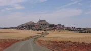
And how do I perceive el Camino de la Lana in its totality?

Other pilgrims: very few. This is still a solitary route, especially in summer. You are unlikely to run into other Lana pilgrims while walking or in the albergues. I met only two between Alicante and Burgos. Perhaps there are more people walking in spring and autumn (the registers I saw in the albergues suggest this). You will sometimes meet people walking El Camino del Cid, mostly Spaniards. The Lana and the Cid often overlap, especially between Cuenca and Burgos. But the people who follow the Cid all walk in the opposite direction...!
Waymarking: Good. But the fact that the GR-routes, the Cid and the Lana overlap may create confusion. The last week was full of scribbles on rocks and trees that I couldn't interpret. Guides are helpful.
Guides: Asociación de Amigos del Camino de Santiago en Alicante (google it) and Kevin O'Brien (on this forum). But prices in hostales and casas rurales were all over the place. Even albergue prices can differ. Call ahead to confirm price?

Hardest stage: In my opinion it's Salmerón - Trillo (27 kms). But I doubt other pilgrims will agree. Up and down a hill/a mountainside not one time, but two times. That's murder. 21 kms on this stage have no water, food or villages. Still it's only the second most isolated stretch: from Monteagudo de las Salinas to Fuentes are 23 kms without civilization.

Best albergue municipal: and the award goes to... Mecerreyes (as of 2017). But I have heard that the albergue in Retortillo de Soria is a strong contender.

Worst albergue: Villar de Domingo García. But I find it hard to see an alternative. Antonio in Villaconejos told me that he and Pepe have spoken to the mayor about the condition of the albergue, without success. They have even traveled there themselves to clean it up!

Season: Summer pilgrims must beware of heatwaves. I usually set the alarm at 4.30 a.m to start walking at 5. But I am slow. Other pilgrims may sleep longer and still avoid the heat. Around noon, and certainly after 1 or 2 pm, things got difficult if I hadn't reached my destination. Find out beforehand how much water you need to carry. Spring and autumn are cooler. But there are a lot of dirt roads and rural tracks that will become muddy in rain.
 
Perfect memento/gift in a presentation box. Engraving available, 25 character max.
the last 7 km from Cardeñadijo:
My memory of this stretch was that much of it was on a Via Verde, very pleasant and full of people walking, jogging, and hanging out with family. It didn't go through Cardeñadijo, but skirted it to the west. So you'd need to divert to get a taxi there. And it was flatflatflat. So easy walking. And an extremely pleasent entry into Burgos.

@Bad Pilgrim said, and I concur:
But the fact that the GR-routes, the Cid and the Lana overlap may create confusion
From SDdS I inadvertently took the GR82, which leaves town in a slightly different direction than the Lana. Slightly different over 15 km makes a huge difference.:oops:
 
Last edited:
@Bad Pilgrim had followed the Lana to Burgos previously, and in 2019, decided to try the San Olav after having walked from Huerta de Rey to Covarrubias

Sorry for lagging behind. This pertains to the previous stage between Santo Domingo de Silos and Mecerreyes. :rolleyes:

The walk between SdDS and Retuerta is pleasant; as tranquil as, for example, the hilly forest between Salmerón and Viana de Mondéjar. There are information panels about this and that along the trail. Mostly about the remains of wooden huts where people burnt coal: charcoal piles? And heaps of stones (one? many?) à la Cruz de Ferro that appear out of nowhere next to the trail. Oh well, there are information panels about the stones as well but I don't remember what I read 😄.

I only took pictures in Covarrubias; I include them in this post.

The 7 kms from Covarrubias to Mecerreyes are all on tarmac. It could turn into a horrible slog depending on where you started earlier in the morning! An enormous statue of El Cid salutes you before entering Mecerreyes. The albergue is mega-cosy, several floors and spotlessly clean. There is a restaurant in town with nice people who are interested in the Camino and in those of us who come by. But I don't know if it will be open due to the pandemic and so forth.DSC_1783-2752x1548.JPGDSC_1780-2752x1548.JPG
 
Last edited:
My memory of this stretch was that much of it was on a Via Verde, very pleasant and full of people walking, jogging, and hanging out with family. It didn't go through Cardeñadijo, but skirted it to the west. So you'd need to divert to get a taxi there. And it was flatflatflat. So easy walking. And an extremely pleasent entry into Burgos.
VN, so you took the Via Verde along the former railway tracks, mainly for cyclists, leading you smoothly to the city.

Shortly before Cardeñadijo you can choose a) the Via Verde, no marking needed, 4,4 km, the pink line, b) the Ruta for walkers over the hills, up and down, not too well marked, 6,8 km, the blue line. Both routes meet near the city center.

A Bus goes twice daily from Covarrubias to Burgos bus station. May avoid a taxi.
BC
Franz

1615745600364.png
Map taken from www.encaminodesdealicante.org
 
Get a spanish phone number with Airalo. eSim, so no physical SIM card. Easy to use app to add more funds if needed.
Following the Amigos' guide book, from Mecerreyes, we'll get to Hontoria de la Cantera after 12.8 km. The villages of Revillarruz and Cojóbar appear after 6 km and 2.6 km respectively. A further 6.4 km takes us to Cardeñadijo, and the last 7 km to Burgos. None of the villages or towns we cross on our way have any albergues or places to spend the night.
Baaad marking. This was my worst day on the Lana. They must have run out of paint right before reaching Burgos. Most of the morning I kept walking, not knowing if I was lost or not. It is important to know that the first town, Hontoria de la Cantera, is hidden from view right until you reach it. So you can't aim for it from a distance, and there are few arrows that take you there.

After leaving Hontoria, I got lost for real. I had to walk straight across a field to get to the next town, Revillarruz, that I did see from a distance. I probably ruined the crops for half the population in the area, but I had no choice but to plow through the fields: I just couldn't find the right way. In Revillarruz there is a bar close to the Ayuntamiento.

My memory of this stretch was that much of it was on a Via Verde, very pleasant and full of people walking, jogging, and hanging out with family.

Shortly before Cardeñadijo you can choose a) the Via Verde, no marking needed, 4,4 km, the pink line, b) the Ruta for walkers over the hills, up and down, not too well marked, 6,8 km, the blue line. Both routes meet near the city center.

The alternative Vía Verde Santander-Mediterráneo starts already from Cojóbar, and the blue and the purple lines on the map are intertwined from here all the way to Burgos. I tend to jump from one line to the other; whatever gets me as fast as possible to Burgos... On the Vía Verde, a few kms after Cojóbar, there is a tunnel of 600 mtrs (!) to walk through. The only source of light comes from both ends of the tunnel, and the light slowly fades the further you go into it... When you are right in the middle of the tunnel, it is chilly and almost completely dark, as both the entrance and the exit are reduced to small dots in the distance... one's imagination runs wild... Not for the faint-hearted...! But what a relief to exit, and to be out in the open, fresh air again...! That tunnel is an experience, I say! 👻

Even on the Vía Verde, it is easy to sneak off to Cardeñadijo where there is at least one bar; probably more. Also in Cardeñadijo, the San Olav joins the Lana, coming from Covarrubias. More on that later, I suppose!

We all know what Burgos looks like, but why not celebrate our arrival with a few pictures... Here you are...
 

Attachments

  • DSC_1817_copy_2752x1548.webp
    DSC_1817_copy_2752x1548.webp
    762.4 KB · Views: 14
  • DSC_1833_copy_2752x1548.webp
    DSC_1833_copy_2752x1548.webp
    615.8 KB · Views: 10
  • DSC_1822_copy_2752x1548_1.webp
    DSC_1822_copy_2752x1548_1.webp
    816.6 KB · Views: 10
  • DSC_1827_copy_2752x1548.webp
    DSC_1827_copy_2752x1548.webp
    684.1 KB · Views: 10
  • DSC_1832_copy_1548x2752.webp
    DSC_1832_copy_1548x2752.webp
    256.3 KB · Views: 9
  • DSC_1839_copy_2752x1548.webp
    DSC_1839_copy_2752x1548.webp
    699.8 KB · Views: 9
  • DSC_1821_copy_1548x2752.webp
    DSC_1821_copy_1548x2752.webp
    602.4 KB · Views: 9
  • DSC_1824_copy_2752x1548.webp
    DSC_1824_copy_2752x1548.webp
    857 KB · Views: 21
Last edited:

❓How to ask a question

How to post a new question on the Camino Forum.

Featured threads

❓How to ask a question

How to post a new question on the Camino Forum.

Featured threads

Forum Rules

Forum Rules

Camino Updates on YouTube

Camino Conversations

Most downloaded Resources

This site is run by Ivar at

in Santiago de Compostela.
This site participates in the Amazon Affiliate program, designed to provide a means for Ivar to earn fees by linking to Amazon
Official Camino Passport (Credential) | 2024 Camino Guides
Back
Top