Search 74,075 Camino Questions

Detailed planning thread for the Camino Olvidado

Ah, the intricacies of language. I had not known this and will try to remember in the future. I guess I should not be surprised, though, because I remember when I first read on the forum about people walking on tarmac, I wondered — how do they get out on the runways? Don’t the airport authorities stop them? 😁

So, if I can’t say tarmac, because Americans will immediately think of airports, and I can’t say pavement, because Brits et al. will think of sidewalks, can I say asphalt? Road walking is another option.

Thanks for pointing this out, @dick bird! I do like to be precise with language and avoid misunderstandings.
Thanks for that. In spite of actually having been an English teacher for most of my working life, I actually hate commenting on people's use (and usage) of English (at least to their face). Maybe just 'road' or 'hard road surface' should be clear enough. Hopefully this doesn't generate another linguistic rabbit hole for us all to disappear down. Or maybe, why not?
 
Holoholo automatically captures your footpaths, places, photos, and journals.
In Villasana, Luisa operates a donative in her house. Unlike Adolfo's. it is licensed, but she is a gem and does it out of the goodness of her heart. She fed us but there is also a social/community centre where you can have a drink and get a meal in the village on the other side of the main road. We stayed in the youth hostel in Espinosa. It is before the town making a short day even shorter but it is a peasant little town. The people running the youth hostel let us have a cabin in the grounds so we had a good night's sleep and cooked for ourselves. For some unexplained reason the camino in Espinosa routes you along a back street a block away yet parallel to the main street, thus carefully avoiding any bars, cafés or other retail outlets that would be glad of your custom. It meets up with the main street just before the bridge.
Villasante
 
Adolfo’s place in Nava de Ordunte sounds like a good place to go. But it would mean passing up on the opportunity to see two great little Romanesque churches a few kms away from Villasana de Mena. I have to admit that I am finally accepting the fact that not everyone is as enamored of Romanesque churches as I am (and I will dare to put VN and AJ in that category as well). 😁


Just checking to make sure — I think you mean Villasante, not Villasana de Mena.

Villasante is about 26 from Nava de Ordunte and if you walk directly from Villasana de Mena (rather than return to Nava de Ordunte), it would be a 21 km walk.

I have to thank you, @dick bird, for highlighting all of the albergues — there really are quite a few! I will make sure to make up a list and have them all in one place. I think that often people shy away from Caminos because of the lack of albergues, but your posts have suggested that there are actually a lot.

So far I have — Bilbao, Balmaseda, Nava de Ordunte, Villasante, Espinosa (youth hostel), Santelices
Am I jumping ahead to mention Cistierna?
 
Join the Camino cleanup. Logroño to Burgos May 2025 & Astorga to OCebreiro in June
North or South of the reservoir, anyone?
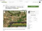
Sorry, I got caught up on the pavement issue. 😁 The only wikiloc walking trail that passes through both Pedrosa and Reinosa goes on the south side of the reservoir. You say it goes off-road, and that would be a real plus. But I don‘t see anything but the road on google maps, which is not a definitive source. I vote for the south, tedious as those 18 kms may be. But then I am not a birder, which might be the deciding factor for others who want to visit the center.
 
Day 7. Olea to Aguilar de Campoó (24 km)

Very good walking day, very pretty countryside and villages. It looks like even the last chunk of kms from Nestar into Aguilar have been taken off road. Or at least off the side of the national road going into town.

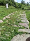
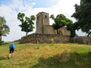
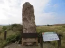
This is a day for which I would recommend GPS. There used to be several alternative routes, and they varied depending on which of the ancient sites you passed. The possibilities include Roman road, medieval bridge, Romanesque church, and menhirs.
A5D8430C-8153-4BFF-AB6C-D8CB02367095.jpeg69380F52-8CB4-4BF3-A2B7-71D38C2504F9.jpeg69E6F035-CB2B-4883-B9B7-1026FDD36281.jpeg6A32A9B6-2152-4D0C-8235-FFFD0B1277CB.jpegF9B9D674-26C3-4459-BBDC-C8F8E20A1D3A.jpeg
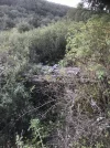
I believe that the markings now all take you through Reinosilla and then on to Casasola. I think that our problem was that we asked a man in the fields if we were on the way to Casasola. There was no obvious route to follow. He pointed us in one direction, even though Susanna’s GPS was clearly pointing the other way. Had we followed the GPS, I believe we would have taken a more circular route but would have gotten there without having to go down a steep hill and cross a nasty little arroyo with high embankments. Lesson learned — follow the GPS. There is a mesón at Casasola, closed when we passed, but we enjoyed a nice rest at their picnic table outside.

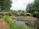
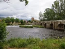
Crossing a Roman bridge into the town of Nestar, the Camino leaves Cantabria and enters Palencia.

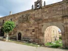
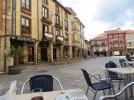
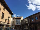
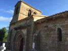
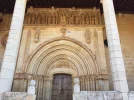
Aguilar is a big town. It was walled in medieval times, and there are a few vestiges left, along with lots of houses with those big coats of arms. The Pisuerga River runs along one side of the center, and there is a nice paseo. The town square (very lively and friendly) and the Colegiata de San Miguel are interesting. The church has visigothic origins, but what is there now is mainly late romanesque, gothic, and even some later touches thrown in. The inside has lofty gothic arches dividing the naves, and I really liked the choir stalls and baptismal font. But I did not spent much time there, because it was only a stop on the way to my real goal — to get the keys to the Romanesque Santa Cecilia church, on the edge of town, up a hill and a short distance below the castle.

52F113FB-1ABA-4EDB-8C58-3CAF361E0310.jpegB5F7A4BD-CB48-4E71-97D5-7470314281DF.jpeg
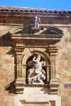
The Casa del Cura is across from the church. Ring the bell, give the priest your passport, and you will get the keys. It’s about a 10 minute walk to the Santa Cecilia church. And oh, wow. The only thing missing to add to the wonder would have been a ring of those huge old medieval keys. Today, the locks have been modernized, but the sensation of unlocking the doors of a romanesque church, which you will have all to yourself, was really something. One or two keys for the door itself, then another key gives you entrance to room with the electric box so you can illuminate the interior. The showpiece is the capital of the Slaughter of the Innocents, which is exquisite. Other capitals are nice as well. But sitting all alone is good balm for the soul, very restorative and calming. After the visit, I went up to the castle ruins and walked around a bit. No entry gates, you can walk freely.

DA8B6B8F-0FB6-4B70-9797-2880073FF651.jpeg5CBF16E8-1044-488E-9F56-AD3DB62B71B5.jpeg

In Aguilar, I have stayed twice at Hotel Valentín. Room price includes breakfast, which was available in the bar below at an early hour. Not cheap, and there are a number of other options in Ender’s guide. The splurge would be staying at the Posada Santa María La Real (I think @SabineP has stayed there). It is located at the edge of town right on the camino, at the end of a pretty promenade. No rooms were available when I was last there, but maybe the third time’s a charm if I ever get there again! A website with nice pictures of the monastery, its cloister, and the Santa Cecilia church.

Aguilar has a big Romanesque institute, which has a museum, but it hasn’t been open when I was there. Another thing to put on my “to do” list when I return.

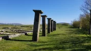
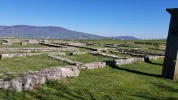
To cut a few kms off the day, you could stay in Nestar, where there is an outdoor exposition on the Roman Road, a millario and an ancient (Roman??) bridge.

There are several options for staying in Nestar. The owner of Villa Esperanza,
whom we met while walking through, told us (in 2014) that she would be happy to help pilgrims find lodging even if she had no room. Things may have changed, so contact in advance. Email: info@villaesperanza.es. Tel: 979 123 942 or 638 049 738 or 697 318 329.

A taxi into Aguilar would also be easy to arrange from Nestar. In fact, when I walked with Susanna in 2014, she had to stop walking in Nestar. I waved to a car (first one passing by stopped), and the driver kindly took Susanna into town to our hotel. So the old “stick out the thumb” option might work as well.
 
Olea to Aguilar de Campoó (24 km) My notes from the day state - A short day for me. Tried to have a later start but woke up at 0645. Miguel had left the makings for breakfast so I decided to have a bun and marmalade with tea. However, it was green tea that smelt like boiled grass so I reverted to coffee. I delayed leaving until just before 0800 and got here at just before 1300. It was a fairly uneventful day with the exception of three large ‘hunting ‘ dogs just after leaving. Had to resort to throwing a large rock at the more aggressive of the 3. In fact there were a few enthusiastic dogs today and that’s not really been a problem on this camino so far. The way was simple and fairly uninspiring with the exception of a couple of wonderful roman bridges. It was mostly well marked although there were a few places where Ender’s app, Wikiloc track and the metal Camino Olvidado signs disagreed. However, I’m sure they would all end up here. In Aguilar I stayed in a room I booked on Air BnB that was close to the river and the centre of town.
 
Join the Camino cleanup. Logroño to Burgos May 2025 & Astorga to OCebreiro in June
But I don‘t see anything but the road on google maps,
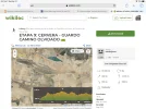
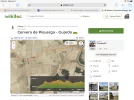
Check out those wikiloc tracks that I took screenshots of, Laurie. It looks nice:
that alternative Camino de Las Asturias route:

Hmmm. Birds? Roman ruins? Gaaah! How to choose? Time to flip a coin.

This last stage before Aguillar looks lovely. Given all the Romanesque and the museum, it looks like a good place for a rest day. I don't tend to do that, but this looks special.
 
Check out those wikiloc tracks that I took screenshots of, Laurie. It looks nice:
I see what I did wrong. I picked Pedrosa and Reinosa as two “passing areas” to search, but of course that search method won’t pick up trails that start in Pedrosa and end halfway to Reinosa, or that start in Corconte and end in Reinosa. Yes, there is a good off-road chunk. Maybe it would be a good alternative to the long, slightly tedious stretch along the south of the reservoir.

The pictures on this wikiloc track show very nice terrain on the way from Pedrosa to Corconte. And the second stage from Corconte to Reinosa also looks great. See this wikiloc track — these are both by the same author and there is a lot of description and a lot of pictures. But some of the text is negative, describing locked gates, overgrown trails, etc. All things to weigh in the mix.

The spa in Corconte looks interesting — some grand common rooms with gilded capitals and ornate ceilings.

The only other issue would be whether to go straight from Reinosa to Olea, as this track shows (13 km). This would NOT take you to the Roman ruins and nice Romanesque church, however. But it does go through Baños de Cervatos with its Romanesque church.

A better option, IMO, is going from Reinosa to Retortillo on a minor road, where Julióbriga ruins and the church are. Then you join up with the “normal” Olvidado and continue on to Cervatos. That’s what I suggested for those who wanted to stay on the south side of the reservoir to break up the stae from Arija to Olea (post 75 if this is getting confusing), but of course it works for anyone wanting to take the northern route as well.

So, to compare — (but I may have the distances wrong, so please correct me)

Southern route — Pedrosa/Santelices to Arija (26); Arija to Olea (32)
Northern route — Pedrosa/Santelices to Corconte (20); Corconte to Reinosa (29); Reinosa to Olea (15-16)

Now it seems less clear to me which way to go! Time constraints are likely to be the deciding factor.
 
Day 7. Olea to Aguilar de Campoó (24 km)

Very good walking day, very pretty countryside and villages. It looks like even the last chunk of kms from Nestar into Aguilar have been taken off road. Or at least off the side of the national road going into town.

This is a day for which I would recommend GPS. There used to be several alternative routes, and they varied depending on which of the ancient sites you passed. The possibilities include Roman road, medieval bridge, Romanesque church, and menhirs.
View attachment 97529View attachment 97531View attachment 97532View attachment 97535View attachment 97534
I believe that the markings now all take you through Reinosilla and then on to Casasola. I think that our problem was that we asked a man in the fields if we were on the way to Casasola. There was no obvious route to follow. He pointed us in one direction, even though Susanna’s GPS was clearly pointing the other way. Had we followed the GPS, I believe we would have taken a more circular route but would have gotten there without having to go down a steep hill and cross a nasty little arroyo with high embankments. Lesson learned — follow the GPS. There is a mesón at Casasola, closed when we passed, but we enjoyed a nice rest at their picnic table outside.

Crossing a Roman bridge into the town of Nestar, the Camino leaves Cantabria and enters Palencia.

Aguilar is a big town. It was walled in medieval times, and there are a few vestiges left, along with lots of houses with those big coats of arms. The Pisuerga River runs along one side of the center, and there is a nice paseo. The town square (very lively and friendly) and the Colegiata de San Miguel are interesting. The church has visigothic origins, but what is there now is mainly late romanesque, gothic, and even some later touches thrown in. The inside has lofty gothic arches dividing the naves, and I really liked the choir stalls and baptismal font. But I did not spent much time there, because it was only a stop on the way to my real goal — to get the keys to the Romanesque Santa Cecilia church, on the edge of town, up a hill and a short distance below the castle.

View attachment 97539View attachment 97540
The Casa del Cura is across from the church. Ring the bell, give the priest your passport, and you will get the keys. It’s about a 10 minute walk to the Santa Cecilia church. And oh, wow. The only thing missing to add to the wonder would have been a ring of those huge old medieval keys. Today, the locks have been modernized, but the sensation of unlocking the doors of a romanesque church, which you will have all to yourself, was really something. One or two keys for the door itself, then another key gives you entrance to room with the electric box so you can illuminate the interior. The showpiece is the capital of the Slaughter of the Innocents, which is exquisite. Other capitals are nice as well. But sitting all alone is good balm for the soul, very restorative and calming. After the visit, I went up to the castle ruins and walked around a bit. No entry gates, you can walk freely.

View attachment 97537View attachment 97538

In Aguilar, I have stayed twice at Hotel Valentín. Room price includes breakfast, which was available in the bar below at an early hour. Not cheap, and there are a number of other options in Ender’s guide. The splurge would be staying at the Posada Santa María La Real (I think @SabineP has stayed there). It is located at the edge of town right on the camino, at the end of a pretty promenade. No rooms were available when I was last there, but maybe the third time’s a charm if I ever get there again! A website with nice pictures of the monastery, its cloister, and the Santa Cecilia church.

Aguilar has a big Romanesque institute, which has a museum, but it hasn’t been open when I was there. Another thing to put on my “to do” list when I return.

To cut a few kms off the day, you could stay in Nestar, where there is an outdoor exposition on the Roman Road, a millario and an ancient (Roman??) bridge.

There are several options for staying in Nestar. The owner of Villa Esperanza,
whom we met while walking through, told us (in 2014) that she would be happy to help pilgrims find lodging even if she had no room. Things may have changed, so contact in advance. Email: info@villaesperanza.es. Tel: 979 123 942 or 638 049 738 or 697 318 329.

A taxi into Aguilar would also be easy to arrange from Nestar. In fact, when I walked with Susanna in 2014, she had to stop walking in Nestar. I waved to a car (first one passing by stopped), and the driver kindly took Susanna into town to our hotel. So the old “stick out the thumb” option might work as well.
I can't add anything to this, except that (from memory) the Olvidado overlaps the Camino Lebaniego for parts of the next two days - we met a Spanish pilgrim walking towards us who was completely gobsmacked to discover that not only was there another camino, but that he was actually on it. Also, I don't recall any big issues with navigation, and at times we used the Lebaniego waymarks which are big and prominent but be careful for when they diverge. Does anyone have more detail about this? We found a couple of shops (and the very odd community run café in Nestar) open along the way.
 
Perfect memento/gift in a presentation box. Engraving available, 25 character max.
Many thanks for all the replies regarding food, accommodation and what to do while in Bilbao. My next question would have to be - do people head to the supermarket before starting their walk to stock up on supplies and if so what is their favouvrite food item to buy and where do they go to buy supplies?
Provisions can be a problem on the Olvidado, especially midday - rural Spain has become depopulated and shops and bars are few and far between. Especially frustrating is to arrive at a bar and discover it doesn't open until 1 o'clock. My advice is to carry a packed lunch or snacks to keep you going if you don't find anything. We also got into the habit of always having an emergency evening meal, e.g. 2 minute noodles and a packet of soup, just in case. And plenty of water, of course
 
A better option, IMO, is going from Reinosa to Retortillo on a minor road, where Julióbriga ruins and the church are.
Yes, this does look best. (The Camino de las Asturias misses AdC altogether, going from Reynosa directly to Cervera de Pisuerga via first Olea then Brañosera. This is definitely a part of the world where Caminos cross each other in confusing ways!)
Now it seems less clear to me which way to go! Time constraints are likely to be the deciding factor.
Presumably one could walk from Reinosa direct to AdC, if 39 kms is within the realm of the possible. Doing that, the two ways are equivalent in terms of days taken.

Southern route — Pedrosa/Santelices to Arija (26); Arija to Olea (32); Olea to AdC (24).
Northern route — Pedrosa/Santelices to Corconte (20); Corconte to Reinosa (29); Reinosa to AdC (39)
 
The slow walkers got all excited when they noticed that the Camino Olvidado website listed a Vivienda Palacio de la Correlada in Las Henestrosas, which would have so conveniently allowed a stop half way. But that might not be an option: it is listed on AirBnB, might require a minimum number of nights, and requires booking all four rooms... 🤔

To cut a few kms off the day, you could stay in Nestar, where there is an outdoor exposition on the Roman Road, a millario and an ancient (Roman??) bridge.
Nestar would thus be a 17.4 km day's walk from Olea. There, we'll find the Hotel Rural Amontes Rural, Villa Esperanza mentioned by @peregrina2000 , and the Casa Rural La Galana (currently closed for repairs).

A taxi into Aguilar would also be easy to arrange from Nestar. In fact, when I walked with Susanna in 2014, she had to stop walking in Nestar. I waved to a car (first one passing by stopped), and the driver kindly took Susanna into town to our hotel. So the old “stick out the thumb” option might work as well.
From Nestar to Aguilar de Campoo, it is a short 6.9 km. A short day that slow walkers would enjoy. That would give them plenty of time to explore Aguilar.

Or should we stay an extra night and have a rest day?
 
Ideal pocket guides for during & after your Camino. Each weighs only 1.4 oz (40g)!
Nestar would thus be a 17.4 km day's walk from Olea.

Good idea! Nestar is a very small place. This website indicates there is a restaurant, but I don’t see it anywhere else. The Hotel (looks very nice by the way) indicates that it offers breakfast, so my negative inference is that other meals are not available. People planning to stay there should probably have some food, though the owner of Villa Esperanza seemed like the type who would not let anyone go hungry. 😁
 
Nestar is a very small place. This website indicates there is a restaurant, but I don’t see it anywhere else.
I don't think it is a restaurant, but both OpenStreetMap and maps.me show a symbol for a café or bar next to the church.
Screenshot_20210414-231002.webp

It doesn't appear on Google maps, but if you use the street view, you can see the logo of an ice cream company in the window. So I am assuming that we can at least get an ice cream 😄
 
Ideal pocket guides for during & after your Camino. Each weighs only 1.4 oz (40g)!
the Olvidado overlaps the Camino Lebaniego for parts of the next two days...Does anyone have more detail about this?
This is the Camino Lebañiego Castellano. There are a couple of threads discussing it.


This camino doesn’t have its own subforum (all posts about this camino are in the Vadiniense section) but a search with Lebaniego and Castellano is likely to bring up all the posts that are on the forum.
 
Yup. I would
Sorry, I was posting in a hurry. Now I'm back and can I explain myself. A short day from Nestar might be enough of a rest, would give plenty of time to see AdC.

For anyone walking from Bilbao, an extra day also potentially offers a chance to explore not only local Romanesque but also some of the area to the east that the Viejo traverses. It's an area full of treasures; access is the only problem, because a car would be ideal. Yesterday I found a website of a place that looks like it offered day trips? It's not clear:

And...More about birding on the Ebro Reservoir; it's a place of some importance for wetland birds:
 
Last edited:
Join the Camino cleanup. Logroño to Burgos May 2025 & Astorga to OCebreiro in June
We didn't stay in Balmaseda, but I have heard good things about the Youth Hostel, which seems to be permanently open.
I have stayed in the youth hostel. It is a ‘high rise’ and my dorm of six, in bunk beds, gave on to the exit of the freeway/motorway tunnel heading northwards. It was blisteringly hot so open windows meant a noisy night. I guess rooms on the other side would be quiet. Great views. Near the hospital. Super clean, well-organised and ability to stay more than one night. Sheets, pillow case and towel as I recall.basic cafeteria.
 
I don't think it is a restaurant, but both OpenStreetMap and maps.me show a symbol for a café or bar next to the church.
View attachment 97604

It doesn't appear on Google maps, but if you use the street view, you can see the logo of an ice cream company in the window. So I am assuming that we can at least get an ice cream 😄
There was a kind of café next to the church, as you get to the main road. A rather strange place, run by the local community association (rather than as a business) and the coffee machine wasn't working, but it was open and if they still haven't fixed the coffee machine, they'll have soft drinks and packet snacks.

I think they had ice cream too, but don't bank on it.
 
Perfect memento/gift in a presentation box. Engraving available, 25 character max.
This is the Camino Lebañiego Castellano. There are a couple of threads discussing it.


This camino doesn’t have its own subforum (all posts about this camino are in the Vadiniense section) but a search with Lebaniego and Castellano is likely to bring up all the posts that are on the forum.
Thanks for that. Our plan is for (who knows when, 2022?) to walk the Lana to Burgos, then along the Francés then up to Santo Toribio. The signs around Aguilar were quite elaborate and official-looking. The local authorities seem very keen to promote the Vadinense, which makes it all the stranger that they overlook the Olvidado.
 
Day 8. Aguilar de Campoó to Cervera de Pisuerga (29 km).

For me it seems like today marks the beginning of Olvidado, Part II. That may be because, when I walked from Bilbao in 2014, my companion Susanna stopped walking here, or because in 2019, I got here from the Vasco Interior to start the Olvidado with my pal Alun. But I think it’s also because there is a definite break as the mountains start here!

Having gone back day by day over the first week from Bilbao for purposes of this thread, though, I have to say I wouldn’t at all object to another jaunt from Bilbao to Ponferrada! But Aguilar is a good starting place for those who want to concentrate on mountains or don’t have enough time.

Aguilar is on the edge of the Monte Palentino, the mountainous region at the top of the province of Palecia. The camino skirts the south side of it, and there are lots of nice views over the next few days. And then after Guardo you are right smack IN the mountains.

The day walking from Aguilar is really lovely. Lots of off-road, lots of river walking. Walk down the promenade in Aguilar to the convent, continue walking till you get to the Reservoir, and then go up and around on the right, do not cross the dam.

The first time I walked out of Aguilar, I was alone, having lost my companion Susanna to blisters. This meant that not only did I lose her companionship, I lost her GPS expertise. Thankfully, @Gunnar called me from Belgium and walked me through the basics as I ascended towards the reservoir. Such forum kindness.

3B5C8D31-DFF1-40FC-9C0C-2E1D8A33F357.jpeg

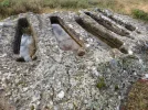
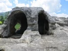
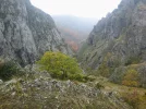
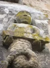
The first surprise is the anthromorphic tombs right after Corvío. Probably from around the 10th C. I learned that the tombs were made so that bodies always had their feet facing east.

16A8D795-9A1A-4C3C-A32A-0640DE5ABFE5.jpeg

Lots of walking through fields, and then in Salinas de Pisuerga, you cross the Pisuerga River and walk alongside for 12 kms, all the way into Cervera de Pisuerga. It is very pleasant. About a km or two outside of Cervera, you’ll see a sign pointing you towards the Ermita Rupestre de San Vicente (Rock hermitage of Saint Vincent). It’s about a half km off camino, and highly recommended. Another medieval construction, with more anthropomorphic tombs.
3E38B88A-139D-456C-AD56-0E557AD16595.jpeg

DE8D1A03-71AF-427F-8FC8-0BC290A14DA6.jpegB2B1DF65-AB38-4C00-8626-384373B30C58.jpeg

Cervera de Pisuerga is a nice little town, good restaurants, cafés on the square, a supermarket or two. Unfortunately, the Albergue Turístico Rivera del Pisuerga has closed permanently. I enjoyed my stay there in 2019, and the hospitalera Blanca was one of those joyously positive people. On my first time through, in 2014, I stayed in Hostal El Resbalón, and it was fine, if a bit dated.

E78158EB-7E0E-4147-9B08-482FC8839C9F.jpeg9B93D4F0-6B5B-4DA6-A538-1031F0C5BD54.jpeg
Shorter stage.
Salinas de Pisuerga looks like the best stopping point, about about 17 km from Aguilar. There is a nice looking Hotel Rural, Casa de las Campanas. Barcenilla de Pisuerga, another 3 km further on, has a Casa Rural but it seems to be rented on a whole-house basis.
 
Aguilar is on the edge of the Monte Palentino, the mountainous region at the top of the province of Palecia. The camino skirts the south side of it, and there are lots of nice views over the next few days. And then after Guardo you are right smack IN the mountains.
As I found out when walking the Camino del Norte in 2018 with my darling, ascents in the morning, fresh from a good night's rest, are fine. As the day progresses, however, mountainous stages can be a challenge, and short stages become important.

Shorter stage.
Salinas de Pisuerga looks like the best stopping point, about about 17 km from Aguilar. There is a nice looking Hotel Rural, Casa de las Campanas. Barcenilla de Pisuerga, another 3 km further on, has a Casa Rural but it seems to be rented on a whole-house basis.
That is indeed the plan I have considered. There is no point continuing beyond the 17 km between Aguilar de Campoo and Salinas de Pisuerga, as the remaining distance from Salinas to Cervera de Pisuerga is 11.7 km , a comfortable walking day. That gives us a fairly balanced two days to walk this stage.
 
The one from Galicia (the round) and the one from Castilla & Leon. Individually numbered and made by the same people that make the ones you see on your walk.
Day 8. Aguilar de Campoó to Cervera de Pisuerga (29 km).

For me it seems like today marks the beginning of Olvidado, Part II. That may be because, when I walked from Bilbao in 2014, my companion Susanna stopped walking here, or because in 2019, I got here from the Vasco Interior to start the Olvidado with my pal Alun. But I think it’s also because there is a definite break as the mountains start here!

Having gone back day by day over the first week from Bilbao for purposes of this thread, though, I have to say I wouldn’t at all object to another jaunt from Bilbao to Ponferrada! But Aguilar is a good starting place for those who want to concentrate on mountains or don’t have enough time.

Aguilar is on the edge of the Monte Palentino, the mountainous region at the top of the province of Palecia. The camino skirts the south side of it, and there are lots of nice views over the next few days. And then after Guardo you are right smack IN the mountains.

The day walking from Aguilar is really lovely. Lots of off-road, lots of river walking. Walk down the promenade in Aguilar to the convent, continue walking till you get to the Reservoir, and then go up and around on the right, do not cross the dam.

The first time I walked out of Aguilar, I was alone, having lost my companion Susanna to blisters. This meant that not only did I lose her companionship, I lost her GPS expertise. Thankfully, @Gunnar called me from Belgium and walked me through the basics as I ascended towards the reservoir. Such forum kindness.

View attachment 97864

The first surprise is the anthromorphic tombs right after Corvío. Probably from around the 10th C. I learned that the tombs were made so that bodies always had their feet facing east.

View attachment 97863

Lots of walking through fields, and then in Salinas de Pisuerga, you cross the Pisuerga River and walk alongside for 12 kms, all the way into Cervera de Pisuerga. It is very pleasant. About a km or two outside of Cervera, you’ll see a sign pointing you towards the Ermita Rupestre de San Vicente (Rock hermitage of Saint Vincent). It’s about a half km off camino, and highly recommended. Another medieval construction, with more anthropomorphic tombs.
View attachment 97868

View attachment 97862View attachment 97861

Cervera de Pisuerga is a nice little town, good restaurants, cafés on the square, a supermarket or two. Unfortunately, the Albergue Turístico Rivera del Pisuerga has closed permanently. I enjoyed my stay there in 2019, and the hospitalera Blanca was one of those joyously positive people. On my first time through, in 2014, I stayed in Hostal El Resbalón, and it was fine, if a bit dated.

View attachment 97860View attachment 97867
Shorter stage.
Salinas de Pisuerga looks like the best stopping point, about about 17 km from Aguilar. There is a nice looking Hotel Rural, Casa de las Campanas. Barcenilla de Pisuerga, another 3 km further on, has a Casa Rural but it seems to be rented on a whole-house basis.
Can't add much to this, except to say it was one of the pleasanter days on the Olvidado, lovely scenery. Although long by some standards, It was not a demanding stage, no steep climbs (with one or two shops and cafés along the way open) so worth considering doing it in one day. Shame about the albergue (which was very nice) but the town has nice bars and cafés in town, families in the street at night and supermarkets to stock up on snacks etc.P1000194 (2).webpP1000199.webpP1000201.JPGP1000207.webp
 
We are planning to stay at Hotel El Molino de Salinas in Salinas during the stage from Aguilar to Cervera. It is right on the Camino and is located by the river in Salinas. The price was £69 for a double room with breakfast. This means we have a nice 12km or so meander the next day into Cervera. If our Camino happens in September I will give an update afterwards on food, accommodation and anything else we discover.
 
My mouth is watering...it looks wonderful!
This sounds very like the last stages leading towards AdC via the Viejo, minus the reservoir: romanesque, ermitas rupestres, rock tombs, and what looks like very pleasant walking.

The Iglesia de Santa Juliana in Corvio (3.25kms from Aguillar de Campoo) definitely looks worth pausing to have a look:

20210417_190045.jpg

As does San Juan Bautista about 7kms farther along in Matamorisca (egad, what a place name! :eek:):
Screenshot_20210417-190754_Google.jpg
 
The 2024 Camino guides will be coming out little by little. Here is a collection of the ones that are out so far.
In Cervera is La Cascarita, one of the best old-style cantinas left in Spain. At the bar you can get the usual beverages, as well as flour by the kilo, local blue cheese cut off the round, olives and pickled fish dipped out of the barrel, all of it served up on a chipped plate for you to eat at one of the oilcloth-covered tables you share with everyone else. (a lot of the food is sold by weight!) They make their own wine, and it's not bad when served cold. It's a community place, with kids doing their homework and guys in dirty gumboots and overalls, and TV game shows blathering in the background. We ordered some fresh avellanas for dessert, and were given a big bowl of hazelnuts and a block of wood to open the shells, right on the tabletop. It's right downtown, I recommend it highly.
 
The Iglesia de Santa Juliana in Corvio .... and San Juan Bautista about 7kms farther along in Matamorisca

Both of those churches were closed both times I walked by. I remember Reb talking about how the Palencia tourism officials were instituting some schedules to open up the churches in Northern Palencia on a regular basis. I found the schedule for 2019 here. But it is unlikely to be of much help to pilgrims. Maybe a car trip from Aguilar if and when things open up again.

Of the two, IMO, Matamorisca looks more interesting. It has some 16th century frescoes that are well preserved. And I read about a romanesque baptismal font. But I wouldn’t pass by an open door at either place.

Matamorisca (egad, what a place name! :eek:

I remember wondering about the name of the town when I passed through. For those who don’t speak Spanish, “Matamorisca means kill the moorish woman.” Morisco is the term given to those Muslims who stayed in Spain after the Reconquest and ostensibly converted to Christianity. I know Spain has decreed the renaming of towns named after leading fascists during Franco’s time, but am not sure about names from many centuries ago.

I remember a controversy over a town named “Matajudíos” . In 2015 they changed their name to Castrillo Mota de Judíos. I would love to hear from someone who knows what “mota” means in this context.
 
Holoholo automatically captures your footpaths, places, photos, and journals.
In Cervera is La Cascarita, one of the best old-style cantinas left in Spain. At the bar you can get the usual beverages, as well as flour by the kilo, local blue cheese cut off the round, olives and pickled fish dipped out of the barrel, all of it served up on a chipped plate for you to eat at one of the oilcloth-covered tables you share with everyone else.
Well, I’ve been there twice and have never known about it, but if I get back a third time, it’s on my list! When you say “local blue cheese” — is this the really stinky stuff like Cabrales, or more soft and creamy like La Peral?

And I just wanted to add that there is no shortage of places to stay in Cervera de Pisuerga, something for most budgets. Even a parador — though it is 2 km out of town, and not especially atmospheric, IMO.
 
In Cervera is La Cascarita, one of the best old-style cantinas left in Spain. At the bar you can get the usual beverages, as well as flour by the kilo, local blue cheese cut off the round, olives and pickled fish dipped out of the barrel, all of it served up on a chipped plate for you to eat at one of the oilcloth-covered tables you share with everyone else. (a lot of the food is sold by weight!) They make their own wine, and it's not bad when served cold. It's a community place, with kids doing their homework and guys in dirty gumboots and overalls, and TV game shows blathering in the background. We ordered some fresh avellanas for dessert, and were given a big bowl of hazelnuts and a block of wood to open the shells, right on the tabletop. It's right downtown, I recommend it highly.
wow, that sounds like a great place to visit and I have realised we are less then a 10 minute walk from here to our accommodation. hopefully it will be open in September and if we are allowed to travel then. thanks @Rebekah Scott
 
The focus is on reducing the risk of failure through being well prepared. 2nd ed.
ordered some fresh avellanas for dessert, and were given a big bowl of hazelnuts and a block of wood to open the shells, right on the tabletop.
The hospitalera at the albergue recommended La Cascarita and I spent a very convivial evening there. They made me try the wine out of a porrón, and cheered when I was able to drink at arm's length without spilling (much) over my face. The sharp blue picón cheese was a treat, a mixture of milks from goats, sheep and cows, named after the Picos de Europa over the next range of mountains. The hazelnuts came free the evening I was there (in November, during the nut harvest) and I was told the heavy cylindrical wooden implement used to smash them open on the tabletop is called a cascarita, hence the bar's name. It was also the place I had my first cecina de chivo (goat), a speciality of Vegacervera - which the Olvidado passes in 3-4 days.
 
It depends what I expect the over the following day(s). If I don't expect to pass any open businesses and I'm planning to stay overnight in a place with no services, I'll buy a day's worth of bread, cheese, and something to cook for dinner. If I know that I'll be passing through towns or villages with cafes or shops, I might buy a snack for second breakfast and something for emergencies. I like nuts for snacks. Energy bars are good for emergencies. I imagine that the Olvidado takes us through towns and villages ... but we shall see.
On my caminos I try to buy ingredients to make a trail mix: nuts, chocolate, and raisens. If the stage is long and without a bar/restaurant my favorite is to buy a Tortilla de Patata Bocadillo to go. (Potatoe Omelette Sandwich) and eat it in a nice spot on the way. Yum!!
 

Attachments

  • 20190408_132852.webp
    20190408_132852.webp
    214.2 KB · Views: 4
Ideal sleeping bag liner whether we want to add a thermal plus to our bag, or if we want to use it alone to sleep in shelters or hostels. Thanks to its mummy shape, it adapts perfectly to our body.

€46,-
Ok, to celebrate the return of VN, here we go with Day 1!

Day 1. Bilbao to Güeñes, 25 km.

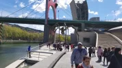
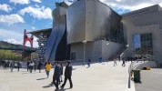
The departure from Bilbao has changed since I walked the Olvidado from Bilbao in 2014. It now continues along the river past the Guggenheim and splits from the Norte when crossing a small tributary at Puente del Diablo. Comparing some wikiloc tracks, I am virtually certain that the new Olvidado route no longer passes in front of the municipal albergue. If you choose to stay in the albergue, though, the old route will get you on the camino within a few kms.

View attachment 96724

The first day, no matter how many kms you walk, you will be on pavement virtually all day. Pavement extends pretty much the whole way into Balmaseda (about 37 km from Bilbao). It isn’t unpleasant, though, and the camino goes through some very large parks. The path is usually on a bidegorri, the Basque word for a bike/walking path. It is pleasant, flat, nothing too strenuous. Lots of big old stone homes with flower boxes filled with red and pink blooms. No shortage of places for coffee/food.

View attachment 96723 View attachment 96726
Ender’s tracks. https://www.wikiloc.com/hiking-trails/etapa-1-bilbao-guenes-camino-olvidado-18087804

Güeñes
The 25 km option takes you to Güeñes, where there is a hotel. Hotel Erreka. https://hotelguenes.com/. It is a good sized town, with all services.

Report of a single room in 2018 — 38.5€ with breakfast. Yes, prices are higher in País Vasco. Recommended restaurant — Katay. 100 m from hotel, to the left in front of a furniture factory. Menú was 10€ in 2018.

There is an albergue on the outskirts of town, but it is only open to groups, not individual pilgrims. So, just ignore anything you see about it. Albergue Sanxtolo.

The camino passes in front of Güeñes’ very pretty late gothic Santa María church, and it figures in most people’s pictures of the first day’s walk.

View attachment 96725

Alonsotegui/Alonsotegi (latter is Vasco I think)
For those who like shorter stages, Alonsotegui is 11 km out of Bilbao. It has an Agro-Tourism place that looks nice, Agroturismo Ordaola, http://www.ordaola.es/

And if that’s too short a total distance for your first day, it’s easy to add a few kms with some walks in the area after lunch. In fact, some kind person gathered a whole bunch of paseos (strolls, not hikes) near Alonsotegi and you have a lot to choose from.

Pintxos here are excellent, according to Ender and he is a pretty good judge of food.

Balmaseda
For those who like longer stages, Balmaseda is about 12 km beyond Güeñes for a total of 37 km. Hotel Convento San Roque. https://hotelsanroque.es/.

Susana and I stayed there in 2014 so I have no idea on current prices. Susana had a big GPS problem and spent about three hours on the internet in the library and also with Gunnar on the phone, while I did some errands for the two of us and generally enjoyed the town, which is very pleasant. This was my first year carrying a GPS but I kept it buried in my pack and let Susanna take charge with hers. This turned out to have been a mistake a week later when Susanna had to stop walking because of bad blisters. o_O

There is also an albergue juvenil in Balmaseda, info in Ender’s guide.

So that’s Day 1. What do you think?
I walked part of the Olvidado in April 2019 before the trip was cut short. This post is copied from my Facebook post at the time.

Camino Olvidado Day 1 Bilbao to Guenes. We have walked 17.2 miles today and still have 0.2 miles to get back to our hotel. The route was mainly paved bike path today. Our legs and feet are sore. We were able to keep getting lost to a minimum. The route is not as well marked as my last two caminos (Frances, Norte - Finnesterre). We didn't wake up until 9:40 and started our walk at the crack of noon. We have set an alarm for the rest of the mornings. The entire day we walked next to rivers. Some pictures from today:
Ok, to celebrate the return of VN, here we go with Day 1!

Day 1. Bilbao to Güeñes, 25 km.

The departure from Bilbao has changed since I walked the Olvidado from Bilbao in 2014. It now continues along the river past the Guggenheim and splits from the Norte when crossing a small tributary at Puente del Diablo. Comparing some wikiloc tracks, I am virtually certain that the new Olvidado route no longer passes in front of the municipal albergue. If you choose to stay in the albergue, though, the old route will get you on the camino within a few kms.

View attachment 96724

The first day, no matter how many kms you walk, you will be on pavement virtually all day. Pavement extends pretty much the whole way into Balmaseda (about 37 km from Bilbao). It isn’t unpleasant, though, and the camino goes through some very large parks. The path is usually on a bidegorri, the Basque word for a bike/walking path. It is pleasant, flat, nothing too strenuous. Lots of big old stone homes with flower boxes filled with red and pink blooms. No shortage of places for coffee/food.

View attachment 96723 View attachment 96726
Ender’s tracks. https://www.wikiloc.com/hiking-trails/etapa-1-bilbao-guenes-camino-olvidado-18087804

Güeñes
The 25 km option takes you to Güeñes, where there is a hotel. Hotel Erreka. https://hotelguenes.com/. It is a good sized town, with all services.

Report of a single room in 2018 — 38.5€ with breakfast. Yes, prices are higher in País Vasco. Recommended restaurant — Katay. 100 m from hotel, to the left in front of a furniture factory. Menú was 10€ in 2018.

There is an albergue on the outskirts of town, but it is only open to groups, not individual pilgrims. So, just ignore anything you see about it. Albergue Sanxtolo.

The camino passes in front of Güeñes’ very pretty late gothic Santa María church, and it figures in most people’s pictures of the first day’s walk.

View attachment 96725

Alonsotegui/Alonsotegi (latter is Vasco I think)
For those who like shorter stages, Alonsotegui is 11 km out of Bilbao. It has an Agro-Tourism place that looks nice, Agroturismo Ordaola, http://www.ordaola.es/

And if that’s too short a total distance for your first day, it’s easy to add a few kms with some walks in the area after lunch. In fact, some kind person gathered a whole bunch of paseos (strolls, not hikes) near Alonsotegi and you have a lot to choose from.

Pintxos here are excellent, according to Ender and he is a pretty good judge of food.

Balmaseda
For those who like longer stages, Balmaseda is about 12 km beyond Güeñes for a total of 37 km. Hotel Convento San Roque. https://hotelsanroque.es/.

Susana and I stayed there in 2014 so I have no idea on current prices. Susana had a big GPS problem and spent about three hours on the internet in the library and also with Gunnar on the phone, while I did some errands for the two of us and generally enjoyed the town, which is very pleasant. This was my first year carrying a GPS but I kept it buried in my pack and let Susanna take charge with hers. This turned out to have been a mistake a week later when Susanna had to stop walking because of bad blisters. o_O

There is also an albergue juvenil in Balmaseda, info in Ender’s guide.

So that’s Day 1. What do you think?
My entries are from my Facebook posts of the Olvidado in April 2019.

Camino Olvidado Day 1 Bilbao to Guenes. We have walked 17.2 miles today and still have 0.2 miles to get back to our hotel. The route was mainly paved bike path today. Our legs and feet are sore. We were able to keep getting lost to a minimum. The route is not as well marked as my last two caminos. We didn't wake up until 9:40 and started our walk at the crack of noon. We have set an alarm for the rest of the mornings. The entire day we walked next to rivers. Some pictures from today:
 

Attachments

  • 20190406_121309.webp
    20190406_121309.webp
    499.8 KB · Views: 3
  • 20190406_123440.webp
    20190406_123440.webp
    496.1 KB · Views: 1
  • 20190406_123736.webp
    20190406_123736.webp
    303.1 KB · Views: 1
  • 20190406_123745.webp
    20190406_123745.webp
    385.2 KB · Views: 1
  • 20190406_123745.webp
    20190406_123745.webp
    385.2 KB · Views: 1
  • 20190406_123751.webp
    20190406_123751.webp
    410.6 KB · Views: 0
  • 20190406_144315.webp
    20190406_144315.webp
    1 MB · Views: 0
  • 20190406_151738.webp
    20190406_151738.webp
    542.4 KB · Views: 0
  • 20190406_181755.webp
    20190406_181755.webp
    641.3 KB · Views: 0
Day 2. Güeñes to Nava de Ordunte (22.5) or Villasana de Mena (27.5)

If you’ve slept in Güeñes, you will go through several good sized towns. Zalla at 4 km, (nice looking rural hotel) and Balmaseda is 5 km beyond that. Balmaseda has a very pretty old bridge with tower. In addition to the hotel I mentioned in the last post, it also has an albergue that takes pilgrims. After Balmaseda, believe it or not, the País Vasco ends and the province of Burgos begins. The landscape becomes much less urban, lots of forests, nice dirt paths, and streams. This is not a stage of exceptional scenery, but it is very pleasant. Still not much elevation.

View attachment 96889View attachment 96891View attachment 96890

Nava de Ordunte is small, but it has a bar and restaurant, at least it did pre-Covid. More importantly it is where Adolfo lives. Adolfo has been promoting the Camino Olvidado for years, and was extremely helpful to us when we walked. I called him several times when I was in a pinch, hundreds of kms away, and he was always happy to help. Adolfo’s garage has been converted into an “informal” albergue. It is not listed in Ender’s guide because it is not officially licensed, but if you look at @dick bird ‘s recent Olvidado video, it is shown at about the 10 second mark. Give a big contribution so he can get the licenses he needs to “regularize” it.

Adolfo’s option was not available when we walked, so we walked on to Villasana de Mena, which is about 7 km further, for a total of almost 30 km. These days there is actually a shorter (and marked) way to get to Villasana without going through Nava de Ordunte. (This is all in Ender’s guide).

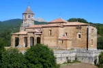
I give the Villasana de Mena option a 5 ***** rating. Not because the Hotel Foramonteros is so great, though it is fine. But because from Villasana, there is a marked off-road path, frequently alongside a pretty stream, to visit two wonderful Romanesque churches — San Lorenzo (in Vallejo) and Santa María (in Siones). The first is in a little hamlet, and the second stands alone, with a house nearby. Neighbors have the keys — best to call so they know you are coming. These are the phone numbers that worked for me in 2014!

San Lorenzo de Vallejo: Miguel Ángel: 947 126 427 OR 660 23 37 98
Santa María de Siones: Angelines, 947 126 132

Both churches have extremely beautiful apses, capitals, arches, doorways, they are really special. It would have been about a 10 km walk in total, but after visiting the second church in Siones, the skies opened and it began to pour. The “señora with the keys” called a neighbor and he drove me back into town, so I cut the kms in half. However you do it (there are local taxis), it is a real treat.

View attachment 96883View attachment 96884View attachment 96885View attachment 96887View attachment 96886View attachment 96888
From my 2019 Facebook post of this section

Camino Olvidado Day 2 (4/7)
Guenes to Nava de Ordunte 16.1 miles. We followed rivers most of the way today. I mentally did some fly fishing, but never did see a fish. Some of the trail was on an old Roman road so lots of uneven stone. A lot of concrete pathway as well. It looked like it would rain this morning, but wearing our raincoats prevented it from actually happening. There was no accommodation in our ending town today, so we taxied to a nearby hotel and we will taxi back to where we left off tomorrow morning. The restaurant was closed so they provided a couple of pinxtos (tiny sandwiches). We could have walked to a restaurant and back, but were to hammered to put in any more distance today. Hopefully we will get food for the long day tomorrow before we start out! Some pictures from today.
 

Attachments

  • 20190407_112009.webp
    20190407_112009.webp
    817.7 KB · Views: 1
  • 20190407_113945.webp
    20190407_113945.webp
    987.4 KB · Views: 1
  • 20190407_114210.webp
    20190407_114210.webp
    1.5 MB · Views: 1
  • 20190407_114439.webp
    20190407_114439.webp
    1.2 MB · Views: 1
  • 20190407_122016.webp
    20190407_122016.webp
    966.2 KB · Views: 1
  • 20190407_125131.webp
    20190407_125131.webp
    336 KB · Views: 1
  • 20190407_125250.webp
    20190407_125250.webp
    397.8 KB · Views: 1
  • 20190407_125500.webp
    20190407_125500.webp
    286.5 KB · Views: 2
  • 20190407_142515.webp
    20190407_142515.webp
    1.3 MB · Views: 2
Day 3. Villasana de Mena to Espinosa de los Monteros (28 km) OR Nava de Ordunte to Espinosa (33 km).

From Nava de Ordunte (aka, Adolfo’s garage), it is 33 km to Espinosa de los Monteros. From Villasana de Mena, it is 28. The two “branches” join up at the Taranco chapel right outside Ordejón de Mena. If you leave directly from Villasana de Mena, you will miss the reservoir, which is pretty and shaded, but not something to re-work your schedule around.

In 2014, the option from Villasana de Mena direct to the Taranco Chapel was not shown, so we took a taxi back to Nava, where we met Adolfo. He walked with us to Bercedo, which was quite a treat. But as always happens when someone else is leading the way, my memory of the trail specifics are much foggier than my memory of the conversation and carmaraderie we enjoyed. In Bercedo there is a panadería whose troncos (bread stuffed with chorizo) have regional fame. Adolfo insisted we have some, but I remember thinking that the empanadas and some of the sweets looked just as appealing. Adolfo left us in Bercedo, and we continued on to the pretty town of Espinosa de los Monteros. From Bercedo to Espinosa is flat and sunny, and off road, but that’s about all I remember.


View attachment 96982View attachment 96985View attachment 96986View attachment 96987View attachment 96988View attachment 96989 View attachment 96990


Espinosa de los Monteros
We stayed in the very nice Hostal Sancho García, which is the place recommended by Adolfo. We had a room facing onto the plaza mayor with a balcony, so we had a nice front row seat for the band playing and folkloric dancing going on that night. Also a nice spot to eat our troncos. Ender’s guide lists several other places to stay, including an albergue juvenil.

View attachment 96983View attachment 96984

Staying near Bercedo
For those who like shorter distances, about 3 km from Bercedo is a Hotel Rural Valtarranz . It is in a town called Noceco. That would give you about a 18 km day from Villasana de Mena to Bercedo, and about 23 from Nava de Ordunte. I have received a note from the owners, who say they are happy to pick peregrinos up in Bercedo or any other reasonable place. But even without that pick-up option, it would leave the day’s total from Villasana at 21.

Also, if you have slept in Villasana, taking a taxi out to one of the several towns along the way is an option. You have towns at 2, 4, 6, 7, 9, 12, and 18 km out from Villasana. Or you could also walk to Bercedo and call a taxi in Espinosa, which would reduce the total to about 18.
From my Facebook post in April 2019

Camino Olvidado Day 3
OMG! I am hammered. We walked 17.2 miles today and gained 2,441'. It rained off and on all day today. I laid awake between 1:30 and 4am listening to the wind howling outside. We overslept until 7:30 and had breakfast, bought lunch to go and taxied back to Nava de Ordunte. We started a little after 10am. Parts of this section were magical today. At about 4pm it was raining and we were hiking a particularly difficult section and I slipped on the wet rock snd fell on my side. I am bruised but not beaten. We stayed at a little albergue called Casa Isabel tonight. A lovely place and we are alone here. Ed drank beer and I drank wine with Isabel and she made us rabbit and rice, vegetables and salmon. It was delicious. Then she massaged my feet and calves. I am in heaven. Having a great time! Some pictures from today:20190408_104154.webp20190408_113929.webp
 

Attachments

  • 20190408_122348.webp
    20190408_122348.webp
    913 KB · Views: 0
  • 20190408_122350.webp
    20190408_122350.webp
    1.2 MB · Views: 0
  • 20190408_142244.webp
    20190408_142244.webp
    1.5 MB · Views: 0
  • 20190408_142824.webp
    20190408_142824.webp
    1.4 MB · Views: 0
  • 20190408_160118.webp
    20190408_160118.webp
    839.7 KB · Views: 0
  • 20190408_163601.webp
    20190408_163601.webp
    758.2 KB · Views: 0
The one from Galicia (the round) and the one from Castilla & Leon. Individually numbered and made by the same people that make the ones you see on your walk.
Day 4. Espinosa de los Monteros to Pedrosa de Valdeporres (25-26 km)

This day on the Camino is almost all off road, through a few small towns and a beautiful natural area. There is one ascent of about 200 m to a great view, with a stretch on the Via Verde made out of the now abandoned Santander-to-the-Meditrranean train line project. Begun in 1879, but never completed, the work was halted definitively in 1959. To tell the truth, the day seemed longer than 25-26, but I can’t point to any one specific difficulty. It is a very pretty walk. Ender’s guide notes that you can make the day a bit shorter by taking a forest route instead of the route on the abandoned railway. This split happes in the town of Entrambosríos and is marked.

View attachment 97110View attachment 97114View attachment 97115View attachment 97116View attachment 97111View attachment 97112
We spent the night in Pedrosa de Valdeporres, about .8 km before Santelices with its albergue in a train station.

We stayed in Hotel Rural La Engaña, double room was 55€. Truth be told, it was not a great price/quality ratio, but hey. A Spanish woman and her British husband operate the facility and also provide English immersion courses.

Probably the highlight of the day was walking through the natural area called Ojo Güareña. If I were to walk this way again, this is where I would mix things up a bit. It is described as a “karst complex.” Wikipedia describes an area filled with tunnels carved out of soluble rocks by underground water, 90 km of tunnels no less. Archaeological research reveals that the caves were inhabited hundreds of thousands of years ago, dating back to middle Paleolithic times. It includes the largest cave in Spain, which has rock paintings dating back at least 13,000 years. The Camino goes through a very pretty and forested area, and past some of the medieval anthropomorphic tombs.

View attachment 97113
But what it doesn’t do is take you to the Ermite de San Bernabé, which is a mere 2.1 km off the camino from the village of Quisicedo. It is a 10-12 century ermita, adjacent to a huge cave that is also open for visits. The most recent info I saw reported that it had re-opened and that guided tours take 45 minutes and cost 4€. Its setting reminded me a bit of the romanesque church in the Cañon de Río Lobos on the Camino Castellano-Aragonés. And that was just stunning. This may be more heavily touristed, which can interrupt the vibe a bit, but I think it would be a very nice visit.

So I would be tempted to take a day here, to see the ermita and to enjoy more of the natural beauty. Hotel Prado Mayor is in Quintanilla del Rebolar, which is right on the camino, a few kms from Quisicedo.

A video about Ojo Güareña, focusing on the natural beauty and wildlife (particuarly birds).

Good pictures of the ermita and adjacent cave.
From my Facebook Post April 2019

Camino Olvidado Day 5. The night of day 4 we stayed at El Prado Mayor. Fabulous. We could have spent a week. Organic garden, marvelous food and one of the most peaceful and hospitable places we have ever been. We walked 12 miles to Pedrosa de Valeporres. No dinner. Restaurant didn't open until 9pm and we would have had to walk back and forth in the dark. We had double helpings of tortilla de patata and pork rind (bar food) with beer and wine. We were in bed by 8pm. Some pictures from Day 5:
 

Attachments

  • 20190409_102935.webp
    20190409_102935.webp
    632.8 KB · Views: 0
  • 20190409_113626.webp
    20190409_113626.webp
    837.6 KB · Views: 0
  • 20190409_115017.webp
    20190409_115017.webp
    592.7 KB · Views: 0
  • 20190409_125134.webp
    20190409_125134.webp
    858.8 KB · Views: 0
  • 20190409_131647.webp
    20190409_131647.webp
    1.2 MB · Views: 0
  • 20190409_135727.webp
    20190409_135727.webp
    886.1 KB · Views: 2
  • 20190409_174421.webp
    20190409_174421.webp
    375.7 KB · Views: 3
  • 20190409_200117.webp
    20190409_200117.webp
    231.1 KB · Views: 3
  • 20190410_095339.webp
    20190410_095339.webp
    496.8 KB · Views: 3
There are a number of options for slow walkers to break this stage. Yes, they do seem short walking days, with most peregrin@s putting a 25 km day into the short day category, but a darling slow walker I know appreciates even shorter days.

The first option was alluded to earlier:

In Quintanilla del Rebollar, we'll find the Posada El Prado Mayor. It's only 8.9 km from Espinosa de los Monteros, and it leaves us with a 16 km walk to Santelices.

Just 5.6 km further, at Villavascones, we can stay at the Casa Guareña, and the next day walk 10.4 km to Santelices.

What I like with these options is that we can indulge in the detour to the Ermita de San Bernabé, and we can spend as much time as we want enjoying the visit, as well as appreciate the natural beauty of the Ojo Güareña.

It's also nice to know we can choose to stop at Pedrosa de Valdeporres.

EDIT: looking through the Viejo Camino Olvidado website suggested by @peregrina2000 , I noticed that there is a third option, with the Casa Rural Goiko in Quisicedo. However, it looks like it is only available as Alojamiento entero.

When we finally walk in real life, we are definitely detouring to the Ermita de San Bernabé and the caves:
My biggest regret of my camino was not seeing this. Another time.
 
Day 5. Pedrosa/Santelices to Arija (27-28 km)

Another pleasant day, nice scenery (one ascent with about 200 m elevation, mostly through green tunnels) some nice open field walking. Nothing spectacular but very comfortable, and a bit of road walking thrown in.

View attachment 97198 View attachment 97195View attachment 97196View attachment 97197

Arija is probably my least favorite place on the Olvidado, but that’s just me. The original city was flooded to make the dam that created the reservoir of the Ebro. So what is there now is an “upper town,” newly created after the dam, and the “new lower town” created next to the water. A woman in the pharmacy in the upper town told me they flooded 400 houses, 8 churches, 2 chapels and a glass factory that made glass in the traditional artisanal way. Though the “upper town” is mostly newly built, I remember that the ayuntamiento seemed to be several centries old, so I am not sure whether they transported it up from below before the flooding or what the story is. The nucleus around the reservoir has the same feeling as the Embalse de Alcántara on the Vdlp, though it has more commerce.

There is/was an albergue in Arija (google maps tells me it is permanently closed), but we stayed in Hotel Rural la Piedra. My notes tell me it was 46€ for both with breakfast.

There is a little grocery store down by the water. Since the hotel dining room didn’t open till 9, we went to the store to buy some food. I asked if we could get an extra plastic bag so we would have two “plates” for our meal. The little girl whispered something to her mother, then came back a few minutes later with some birthday party plates left over from her 9th birthday party.

View attachment 97199
A very short stage of about 8 km could be had with a stop in Soncillo at the Hotel el Capricho de Clemente. MikeJS has good reports. (And for those who like long stages, it looks like about a 35 km day starting in Pedrosa).

6.5 km beyond Soncillo would take you to Cilleruelo de Bezana with two hostals, the Hostal Monica, or Hostal el Escudo. That’s hitting AJ’s goal of 15 almost right on the nose.

There may be other options, but these seemed most logical. And I think some might want to stage it so that they avoid Arija and go further on the next day, where there are other possibilities.
From my Facebook Post April 2019

Camino Olvidado Day 6
Pedrosa de Valdeporres to Cilleruelo de Bezana
We walked almost 10 miles today. Rained on most of the way today. It was 35° this morning and we started off cold. I hadn't set my map to "follow" so we were on our own. Fortunately the trail was pretty well marked. We walked on an old viaduct that had been built in the 1940s for a rail line that was never completed. Tough rocky walking. We climbed about 1,200 vertical today.
 

Attachments

  • 20190411_112612.webp
    20190411_112612.webp
    994.6 KB · Views: 2
  • 20190411_112616.webp
    20190411_112616.webp
    937.4 KB · Views: 2
  • 20190411_120057.webp
    20190411_120057.webp
    1 MB · Views: 1
  • 20190411_135917.webp
    20190411_135917.webp
    521.3 KB · Views: 1
A selection of Camino Jewellery
From my Facebook Post from April 2019

Camino Olvidado Day 7
Today was a hard day. 15.15 miles. Relentless pavement. We spent quite awhile being lost. The route today was not well marked. When we got to our destination I thought we were going to have to go nativity. It is Easter weekend and there was no room in the inn. I was ready to cry when the innkeeper suggested we taxi ahead. Found an adequate hotel with hot water in the shower. We nearly froze to death in our cold room last night. 100 meters from our room we found a nice pizza place and our bellies are full. Nice. All is well with the world. Some pictures from today:
 

Attachments

  • 20190412_111630.webp
    20190412_111630.webp
    841.8 KB · Views: 3
  • 20190412_113935.webp
    20190412_113935.webp
    905.5 KB · Views: 3
  • 20190412_143518.webp
    20190412_143518.webp
    553.2 KB · Views: 3
  • 20190412_164801.webp
    20190412_164801.webp
    942.8 KB · Views: 4
  • 20190412_172914.webp
    20190412_172914.webp
    589.5 KB · Views: 3
Camino Olvidado. Day 7

Today was a hard day. 15.15 miles. Relentless pavement. We spent quite awhile being lost. The route today was not well marked. When we got to our destination I thought we were going to have to go nativity. It is Easter weekend and there was no room in the inn.
So good to have more first hand reports. @Jeri, where was your intended destination on this day (Leaving from Cilleruelo de Bezana), and where did you end up taking a taxi to?
 
Day 6. Arija to Olea (32.5 km)

(I know this is a long stage, and I include my suggestions for breaking it up further down in the post).

Once you leave Arija, you have entered Cantabria and left Burgos behind. The approximately 18 kms to Villafría, which go along the reservoir, are all on the side o the road. For those who go to great lengths to avoid pavement, I was able to walk on the side on a dirt shoulder. The road is very untraveled but cars go fast between the pueblos. About 7 km along the reservoir edge, at Villanueva de las Rozas, you will see the tower of a church that was submerged to make the reservoir. There is a walkway out to the tower, and an opening that suggests you can climb the tower, but we didn’t go out. It was too forlorn looking for me.

View attachment 97394

After Villafría, I don’t think there’s any pavement at all, or very little. There were two highlights — the Roman ruins of Juliobriga, with a museum. We did not visit the museum, but enjoyed walking around and especially climbing the bell tower of the adjacent church overlooking the ruins.


View attachment 97392View attachment 97393View attachment 97385

From the ruins, the Camino goes up through a beech forest, about 200 m to the Peña Cutral. I remember some confusion on the top of a hill, and the GPS came to the rescue. And then there’s a descent to the spectaclar highlight of the day — the Romanesque church at Baños de Cervatos. Another Romanesque jewel, San Pedro. A good number of the capitals and corbels are erotic, though the purpose is still debated by art historians. For a sampling of the possible theories, see this article in El País. I only include G-rated pictures. ;)
View attachment 97406 View attachment 97409View attachment 97407View attachment 97408

From the church to Olea is pretty straightforward, and I remember walking through some nice orchards and fields, but nothing really jumps out at me.
View attachment 97390

We stayed, as many peregrinos do, at the Casa Miguel. It’s a vacation complex of sorts, with very nicely equipped apartments. We paid 15€ each and had a very relaxing evening. The owners are generous and friendly — they and their friends insisted we sit outside with them for a few tapas and drinks. They wanted us to stay for the barbeque, but that would have kept us up way past pilgrim bedtime. They have also assured me in a recent Whatsapp exchange that they are happy to pick people up “sea donde sea” (wherever that may be).

Shorter options
There are a couple of ways to break this stage up, but I will leave it to AJ for the final plan! There is one hotel in Arroyo, about 11 km from Arija. If you stopped short of Arija on the previous day, by staying in Cilleruelo de Bezana, the Hostal La Lobera in Arroyo might be a good choice. It would be a 21 km day from Cilleruelo to Arroyo. From Arroyo to Olea the next day would be about 20 km.

The other option would be to go off camino to Reinosa, which is a big town and has a lot of sleeping options, ranging from the basic Hostal Tajahierro to some nicer digs like a 3*** Hotel San Roque or the Apartamentos Ebro. Looks like it has a nice old core. Reinosa is 4.5 km from Villafría. If you started in Arija, that would put your day’s total at about 25 km. The next day, there is no need to return to Villafría. You can take a minor road directly to the Roman ruins at Juliobriga, and then continue to Olea, for a day of about 15 km. Reinosa has taxis, too!

Buen camino, Laurie
From my Facebook Post April 2019. I am all about shorter stages.

Camino Olvidado Day 8
Today was a much better day. A lot more off road. All in all I didn't mind too much stepping into leaf covered muck a couple of times. We visited the Roman site Juliobriga. Pretty cool. Lots of up and down today. A bit over 13 miles. Tonight we are in Olea at Casa Miguel apartamentos. Beautiful! Check out the photos from today!
 

Attachments

  • 20190413_104856.webp
    20190413_104856.webp
    292.3 KB · Views: 3
  • 20190413_111645.webp
    20190413_111645.webp
    736.6 KB · Views: 4
  • 20190413_111650.webp
    20190413_111650.webp
    887.3 KB · Views: 4
  • 20190413_113106.webp
    20190413_113106.webp
    908.3 KB · Views: 3
  • 20190413_124949.webp
    20190413_124949.webp
    989.1 KB · Views: 4
  • 20190413_135706.webp
    20190413_135706.webp
    1.2 MB · Views: 4
  • 20190413_145009.webp
    20190413_145009.webp
    1.4 MB · Views: 10
  • 20190413_175702.webp
    20190413_175702.webp
    267.7 KB · Views: 9
  • 20190413_175709.webp
    20190413_175709.webp
    269.9 KB · Views: 10
  • 20190413_175802.webp
    20190413_175802.webp
    503.4 KB · Views: 29
Perfect memento/gift in a presentation box. Engraving available, 25 character max.
I thought Aguilar de Campoo to Cervera de Pisuerga was a lovely stage with a straight walk to the dam in the outskirts of Aguilar where I saw the first camino sign. It was another one of the rustic (that is rusty!) ones. Personally, I far prefer a simple yellow arrow which is also easier to see. It was a very varied walk to day with a few gentle hills, plenty of time along a river and a few particularly interesting sites such as the necropolis and the rock carved hermitage. As always, I have seen lots of fungi and a few fungi harvesters, but strangely they don’t seem interested in the ones we in the UK call parasol mushrooms. I have seen hundreds of them and they make excellent eating. Also saw my first fly fisherman today who was after trout. Always been surprised how few fishermen I see on the camino given how many trout I see! In fact all of the water seems underused- I’ve yet to see a boat, canoe or craft of any sort in the water. I am staying at the Albergue Turistico Rivera del Pisuerga Cervera which is excellent. For 12 euros I even get a private room. As I arrived quite early again (1300). I decided to have menu del dia for lunch today to avoid having to eat after 2100 tonight. I had a wonderful bean and octopus broth to start with and then chicken cooked in cider. Yogurt and local honey to finish and with water, wine and coffee it was 15 euros. Off to Guardo next.
 
So good to have more first hand reports. @Jeri, where was your intended destination on this day (Leaving from Cilleruelo de Bezana), and where did you end up taking a taxi to?
Our intended destination was La Lobera in Arroyo. We were hopelessly lost in and around Arija on 2 different days. I can't figure out where we taxied to, but we taxied back the next morning.
 
Oh dear, a lot of responsibility for the slow walkers ;)

From Arija to Olea, I have listed the following places to sleep:
- in Llano, 3.6 km from Arija, there is the Hotel Araz
- near Villanueva de las Rozas, 7.5 km from Arija, Google maps shows a casa rural (?) El Mirador del Ebro
- in Arroyo, 11.4 km from Arija, there used to be an albergue (Albergue Rumbo Ebro), but it appears to be permanenty closed, and there is the Posada La Lobera
- near Retortillo, 19.6 km from Arija, and 16 km from Llano, about 700 m off the Camino on the way to Villafría, or about 700 m from Retortillo, there is the Posada Julióbriga. It is listed on the caminoolvidado.com website, but it appears to be available on an "alquiler integro" basis, but I assume that rooms might be available.

From Arija, Arroyo looks indeed like a good option, breaking the stage into two days, one of 11.4 km, the other 19.6 km.

If, like us, you may have stopped in Llano, then the first day is 7.8 km followed by 19.6 km. If we were able to get a room at the Posada Julióbriga in Retortillo, then the stage from Llano would be 16 km, followed by a walk of 11.4 km. Slightly more balanced.

Both Arroyo and Villanueva de Las Rozas are on the Feve line between Bilbao and Léon. That could also give an option for the non-purists to reduce the walk by about 9 km, leaving a 22 km day.


Reinosa becomes a real option for slow walkers if one stays in Llano, as the day's total is then 19.3 km.
And:

which is always an option towards the end of the day.


From Reinosa to Olea, it looks like we might have a day with many highlights. First the Roman ruins, then:

followed by:

Slow walkers who love Romanesque will not feel the distance!☺️


From my Facebook Post April 2019
As promised, today I am starting a planning thread for the Camino Olvidado.

There are many good sources for the Olvidado.

Ender’s guide in English.

The Camino Olvidado website with stages, tracks, and pictures.

This forum’s sub-forum on the Olvidado.

Another Olvidado website, in Spanish, which is connected somehow to Adolfo in Nava de Ordunte, I think (but am not sure). I noticed that Susanna‘s and my feeble attempt at a guide in 2014 is linked on the site, and I think that Adolfo must have been responsible for that.

Ray and Rosa have a section on their website, too.

So it’s pretty clear that this thread will not provide new information, but hopefully it will let individual forum members focus stage by stage to see if and how they can fit their walking preferences to this glorious camino.

And another disclaimer — The Olvidado/Invierno combination is my all time favorite camino. So don’t expect balanced and objective information from this peregrina!

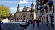
As always, the first task is to get yourself to Bilbao and get oriented. There’s a great airport bus, but of course that’s to be expected since you are in Spain. I don’t believe the tram goes to the airport, but the bus will drop you off at the station if you are going to a place served by the tram. But I just got off at the main stop and crossed the river to get to the old town where my pensión was.

Bilbao, in my mind, is kind of like the Pittsburgh of Spain. Back in the 1970s when I was studying in Spain, it was a place to be avoided — dirty, polluted, industrial. Then came the EU with its money for environmental cleanup, then came the Guggenheim, and voilà, Bilbao was reborn. Just like Pittsburgh! (minus the EU and the Guggenheim). I assume there will be lots of first hand recommendations of where to stay in Bilbao. I have stayed in a couple of places on different caminos.

My two favorites — I like the Pensión de la Fuente for its central location, family run and homey feel. Another very similar place where I’ve stayed a few times is the Iturrienea Ostatua. Both are well located in the old town in old buildings with ancient elevators, creaky wood floors, large clanging metal keys.

There is no shortage of things to do in Bilbao. Walking around the casco histórico, the cathedral, and the late 18th early 19th century gracious modernist neighborhoods (reminiscent of the Serrano area in Madrid, IMO) are all not to be missed. And you really should allow yourself the joy of having pintxos in the old town, as many times as possible. They are AMAZING!!!!!

The Guggenheim, well of course you have to see it, it is on the river and the promenade is one of those unmissible snapshots of Spanish life. Whether you want to go inside is up to you. I have been inside twice, and that’s more than enough for me. The room with a special “sunflowers” exhibit was a series of vases with sunflowers that had been dipped in lead, that pretty well sums it up for me, but then I am not a well educated contemporary art person. The Museo de Bellas Artes is much more my style. It is close to the Guggenheim, and spans a wide range of styles. The link I posted shows you some of the “obras maestras,” most famous works.

So for those of you who are new to this format, what we typically do is invite comments and questions about the post of the day. I will be back in three days to post the first walking stage, but for now we should focus on the beautiful city of Bilbao.

A few self-explanatory pictures. And can I suggest that people post thumbnails? You can click on the thumbnail to enlarge it, but that is a big help for people with slower internet.

Back in a few days with some actual camino walking going on. Buen camino, Laurie

View attachment 96475View attachment 96476View attachment 96477View attachment 96478View attachment 96479
This was my planning document from my trip in April 2019. Well used and worn. Probably the most valuable contribution I can make to this thread. The Olvidado is hard. Much harder than I anticipated.
 

Attachments

  • 20210418_103825.webp
    20210418_103825.webp
    287.5 KB · Views: 33
The 2024 Camino guides will be coming out little by little. Here is a collection of the ones that are out so far.
I thought Aguilar de Campoo to Cervera de Pisuerga was a lovely stage with a straight walk to the dam in the outskirts of Aguilar where I saw the first camino sign. It was another one of the rustic (that is rusty!) ones. Personally, I far prefer a simple yellow arrow which is also easier to see. It was a very varied walk to day with a few gentle hills, plenty of time along a river and a few particularly interesting sites such as the necropolis and the rock carved hermitage. As always, I have seen lots of fungi and a few fungi harvesters, but strangely they don’t seem interested in the ones we in the UK call parasol mushrooms. I have seen hundreds of them and they make excellent eating. Also saw my first fly fisherman today who was after trout. Always been surprised how few fishermen I see on the camino given how many trout I see! In fact all of the water seems underused- I’ve yet to see a boat, canoe or craft of any sort in the water. I am staying at the Albergue Turistico Rivera del Pisuerga Cervera which is excellent. For 12 euros I even get a private room. As I arrived quite early again (1300). I decided to have menu del dia for lunch today to avoid having to eat after 2100 tonight. I had a wonderful bean and octopus broth to start with and then chicken cooked in cider. Yogurt and local honey to finish and with water, wine and coffee it was 15 euros. Off to Guardo next.
Are you there now, or is this a post/journal entry from before?
 
Adolfo’s place in Nava de Ordunte sounds like a good place to go. But it would mean passing up on the opportunity to see two great little Romanesque churches a few kms away from Villasana de Mena. I have to admit that I am finally accepting the fact that not everyone is as enamored of Romanesque churches as I am (and I will dare to put VN and AJ in that category as well). 😁


Just checking to make sure — I think you mean Villasante, not Villasana de Mena.

Villasante is about 26 from Nava de Ordunte and if you walk directly from Villasana de Mena (rather than return to Nava de Ordunte), it would be a 21 km walk.

I have to thank you, @dick bird, for highlighting all of the albergues — there really are quite a few! I will make sure to make up a list and have them all in one place. I think that often people shy away from Caminos because of the lack of albergues, but your posts have suggested that there are actually a lot.

So far I have — Bilbao, Balmaseda, Nava de Ordunte, Villasante, Espinosa (youth hostel), Santelices
And Cistierna (unless that too has bitten the dust) - a bit run down but the local association were very friendly and doing their best.
 
Ideal pocket guides for during & after your Camino. Each weighs only 1.4 oz (40g)!
Sorry, should have completed the amendments. It was an extract from my blog in 2019. I was trying to catch up on this thread as I had been away from the machine for a few days.
That's OK. I just wanted to make sure. By the way, I think peregrina 2000 mentioned that the albergue had closed, which would be a real pity because we stayed there too and it was truly excellent.
 
Took me a while to find this thread again as the layout has changed on the main page! And not for the best IMHO!
 
Last edited:
Day 9. Cervera de Pisuerga to Guardo (39 km)

A. Cervera de Pisuerga to Tarilonte de la Peña (20 km).
B. Tarilonte de Pisuerga to Guardo (19)

The 39 to Guardo is obviously a very long day. It starts with a short ascent to an abandoned mine.
3E7FDF8D-AC18-4928-BD3A-FB1D44290BA5.jpeg
From the mine, I was glad to have my GPS. After you descend to the first town, there is a lot of flat, off-road walking with the very pretty Monte Palentina in your sights. It is really a very nice walk, lots of wide open spaces with mountains in the distance.

47FE3823-AC18-45D7-826C-583D464C0608.jpeg 59E535E0-7A5E-4933-B6A6-0509AF614F59.jpeg 24C689AB-1F8A-43C4-A323-FD5A3ADEC64E.jpeg

4D0251D9-4F8E-481A-BC16-F7407720A70F.jpeg
I know that some have just stayed on the road, the CL-626, but that would be much less pleasant IMO and not much shorter. The camino really takes you through some little villages that time has forgotten ... if only there were a café-bar or two! I remember a very welcome rest in Santibañez de la Peña, about 12 before Guardo, cold drink, nice people. @alansykes reports that the Bar Mylo in Santibañez has rooms, so that would be a 27 km day. I think a phone call ahead would be reasonable — 979 86 02 94

When I walked by myself in 2014 I stayed in Guardo in the Real Hotel. The second time, we stayed in the albergue, which is great. Wonderful hospitalero. The albergue takes in a lot of groups, but they are used to having Olvidado pilgrims. We coincided with a group of mountain bikers and enjoyed the interaction, but I imagine it could get noisy. Both the albergue and the Real Hotel are outside of the center and up a hill, at least 1.5 km away. So bring anything you need with you unless you fancy walking back down. If you are going to take the “old” route to Puente Almuhey, these places are right on the Camino. If you want to take the Caminayo mountain alternative, you will have to go back down and through the center of town to get on that route.

As I look back on my notes, I remember one of those very wonderful camino moments on my first trip through Guardo. I arrived alone dragging my feet. It was a weekend, late afternoon, and I wasn’t sure where I was going to sleep, because a small hotel on the outskirts was full. I saw the ayuntamiento door was open, which surprised me, but I went inside. I heard some voices far in the back and scared the two cleaning people out of their skins when I came upon them and said hola. They then took it upon themselves to find me a place to stay, surely not in their job description. It occurred to me that I got much better treatment from the cleaning staff in this Ayuntamiento than I have gotten in others from the officials in charge. They were so sweet.

E048C6B5-69C6-4304-A5D9-9D691166CF58.jpeg

For many 40 km is too long. You can pretty precisely cut it in half with a stop in Tarilonte de la Peña, where there is a small hotel rural, El Yunque. According to the website, the hotel may let you use their kitchen. It is a very small town/village, I remember a nice rest outside the pretty church. A bar is open only May-Sept, 1-3 and 7-10 (sounds like the summer hours when all the Spaniards go home to “their pueblos.” They also own the Casa Rural El Encinar. Stopping in Tarilonte gives you two 20 km days. I am not sure which churches are pictured below, though they are definitely on this day’s walk, but one of them is surely Tarilonte!

67C5395E-314B-4F9D-8C0E-B6B0B5038FF9.jpeg68A46DB3-ADDC-47C0-B233-1F246425D46A.jpegCFBA5205-4002-47ED-8D41-138B1AABA660.jpeg

Other places to stay along the way, according to @Omicko’s 2018 updates are Casa Tarabas, in Castrejón de la Peña, and a Casa Rural in Centoral de la Peña, call Montse, tel. 607 797 338, Rooms 20€ individual, 35€ double, breakfast included.

So it seems like there are multiple good ways to break up the 40 kms. Once again, we have busted the myth of unavoidably long stages on the Olvidado.
 
The focus is on reducing the risk of failure through being well prepared. 2nd ed.
We stayed in Santibañez as well. The town is a bit unprepossessing but Bar Mylo does indeed have quite nice rooms, reasonable price (30 euros for double?) and their menú was very good. In Tarilonte, the bar was open and the locals agog to hear about the camino.
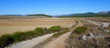
Next to the road was a Romanesque church, does anyone know its name? It was closed, of course, but if the exterior is anything to go by, the inside must be stunning. Above is the link to a youtube video (too large to attach as a file).
 
Last edited:
Hmm, I am now totally confused about which church is in which town.

In Tarilonte, the bar was open and the locals agog to hear about the camino.... Next to the road was a Romanesque church

@dick bird, are you sure that the video shows Tarilonte’s church? If you google Santa Marina Tarilonte de la Peña, you will get lots of pictures that show the church that is the third one I posted. But I am almost positive that the fancy facade (which you have a video of, and which is the second picture of my three) is a different church. The facade has different columns in front of it than the porch of the Tarilonte church.

Based on the time stamp, the mystery facade photo was taken a little less than two hours after the picture of the closed mine. It was also taken almost two hours before the third photo (which is the church of Santa Marina in Tarilonte), so that leads me to think that the mystery church is 8 or 10 km before Tarilonte.

But I can’t find pictures that show that facade in any of the churches in the small towns after Cervera and before Tarilonte. So I am really confused.
 
Hmm, I am now totally confused about which church is in which town.


@dick bird, are you sure that the video shows Tarilonte’s church? If you google Santa Marina Tarilonte de la Peña, you will get lots of pictures that show the church that is the third one I posted. But I am almost positive that the fancy facade (which you have a video of, and which is the second picture of my three) is a different church. The facade has different columns in front of it than the porch of the Tarilonte church.

Based on the time stamp, the mystery facade photo was taken a little less than two hours after the picture of the closed mine. It was also taken almost two hours before the third photo (which is the church of Santa Marina in Tarilonte), so that leads me to think that the mystery church is 8 or 10 km before Tarilonte.

But I can’t find pictures that show that facade in any of the churches in the small towns after Cervera and before Tarilonte. So I am really confused.
Sorry about the confusion, I should have been clearer; no it is absolutely not Tarilonte church. It was next to the road (i.e. highway) miles from anywhere (except the highway). My file information gives 11 am so it must have been before we got to Tarilonte which is where we had lunch that day. Looking at your photo of the second church (two hours after the old mine, two hours before Tarilonte) I agree they are the same one, and the times fit. I will try to locate it on Google maps ASAP and see if I can identify it.
 
The one from Galicia (the round) and the one from Castilla & Leon. Individually numbered and made by the same people that make the ones you see on your walk.
Brilliant. Some nice shots on the website, but unfortunately none of the inside. The building looked very well looked after so I suspect it is opened from time to time.

I share your interest, if not your passion, for Church architecture. Like Philip Larkin, I have a curiosity for old churches. But I grew up in the UK where Romanesque churches are incredibly rare and never intact. Church building in England didn't really happen on a big scale until after the Norman Conquest. The upside of this is that you can follow the development of Gothic architecture from the first tentative experiments with arched vaults and lancet windows to the magnificent, light-filled creations of the late perpendicular where the stone structure seems to almost disappear and the walls are almost entirely glass window. The downside is that most of the internal imagery - the wall painting and statuary, was ripped out during Cromwell's time. Anyway, thanks again for the detective work.
 
The 39 to Guardo is obviously a very long day.
I can just hear my darling sigh when I tell her how long the 'official' stage is. But then she trusts that we'll be able to find a way to break it up in shorter days...

For many 40 km is too long. You can pretty precisely cut it in half with a stop in Tarilonte de la Peña, where there is a small hotel rural, El Yunque. According to the website, the hotel may let you use their kitchen. It is a very small town/village, I remember a nice rest outside the pretty church. A bar is open only May-Sept, 1-3 and 7-10 (sounds like the summer hours when all the Spaniards go home to “their pueblos.” They also own the Casa Rural El Encinar. Stopping in Tarilonte gives you two 20 km days.
Tarilonte de la Peña is indeed where we would stop in a real life Camino, and obviously on this virtual Camino. It's so nice to have a place which balances out the two days ☺️

Other places to stay along the way, according to @Omicko’s 2018 updates are Casa Tarabas, in Castrejón de la Peña, and a Casa Rural in Centoral de la Peña, call Montse, tel. 607 797 338, Rooms 20€ individual, 35€ double, breakfast included.
I hadn't looked at Castrejón de la Peña, as it is off the Camino. Thank you for pointing this out. The viejocaminoolvidado.com website lists quite a few accommodation options.

From the caminoolvidado.com website, I had noted accommodation options in Cantoral de la Peña, Villanueva de la Peña, Tarilonte, and Villanueva de Arriba.

So it seems like there are multiple good ways to break up the 40 kms. Once again, we have busted the myth of unavoidably long stages on the Olvidado.
Indeed! Slow walkers are happy with the busted myth! 😀

I have mentioned previously that slow walkers look ahead to see what long stages they might expect.

Without jumping the gun too much, after Guardo, there are two options, one that suits slow walkers ideally, and the other which needs some attention, as it it double the length. So, when looking at the possibility of walking the longer option (10B) for the next 'official' stage, I came up with the option of stopping before Guardo, at Villanueva de Arriba, so that we could then walk to Velilla del Río Carrión, allowing us then to walk the remaining part of the longer option to Puente Almuhey in two days.

In Villanueva de Arriba, there is the Casa Rural La Majada Palentina. My only worry is that with this casa rural we might have to book a minimum of two nights, and that we might have to book the whole casa rural (Alojamiento Completo) and its 10 beds. 🤔 I guess only a phone call, when we do finally walk in real life, will reveal if stopping in Villanueva de Arriba is a possibility.
 
Ideal sleeping bag liner whether we want to add a thermal plus to our bag, or if we want to use it alone to sleep in shelters or hostels. Thanks to its mummy shape, it adapts perfectly to our body.

€46,-
I hadn't looked at Castrejón de la Peña, as it is off the Camino.
This is one part of the Olvidado where you are going to find a lot of different tracks. The first time I walked this, I somehow went through Castrejón de la Peña, staying on the road from Cubillo de Castrejón. But in 2019, I followed Ender’s tracks, which make for a much more pleasant off-road walk and do not go through Castrejón. But undoubtedly a few kms longer. And there are many other permutations. But to maximize off-road options, Ender’s tracks are always likely to be the best.

Here are a few screen shots, showing my 2014 tracks, another random walker‘s tracks, and Ender’s.

9569457D-1273-4365-A5C2-032EE1519EAB.png2B714F99-C64E-483D-99A7-4D26827F1DF2.png0C64D937-47E6-4B48-B356-C89DA488AAEB.png

The road, the CL-626, has very little traffic, but the off-road version is often dirt roads, which makes for lovely walking. (See the picture in post 154 with the blue shirted peregrino).


after Guardo, there are two options,
Yes, I have been pondering that as well, and think that the best way for shorter distance peregrinos to take the mountain alternative would be to carry on beyond Guardo to Velilla. Velilla is 4.4 km after Guardo, so that makes Cervera to Velilla about 44 km. If you stick with the plan of staying in Tarilonte, the stage from Tarilonte to Velilla would be about 23 km. Another idea, as you may be suggesting, would be to stay in Tarilonte, then stop in Villanueva (about 12 from Tarilonte) and then about 11 to Velilla the next day.

I’ll do two separate posts, one for the long stage, and one for the flat direct route.
 
My (edited!) notes from 2019 for the Cervera de Pisuerga to Guardo route say:
The first hour of the walk, as the path climbed higher,was a lovely stroll along a rural track. I met a couple of hunters on the way but was not sure what they were after. Once the main climb ended it was a delightful day walking through high tracks and pastures. Lots of cows, with their slightly off tune bells, and an amazing number of mouse holes! The route was sparsely marked for the first section today, but the final 20km or so was much better. Still a variety of routes marked so it still needs harmonising for clarity. I’ve included a photo of a bridge that I’m pleased was no longer in use. When entering one of the very small villages, I think it was the one just before Santibanez (Avinante de la Pena?), I saw an old lady struggling up the hill with two bags in her hand at a walking stick. She was very bent over and about half way up placed one bag on the floor. I assume to walk back and collect later! I could hardly go strolling past, so I picked up the dropped bag and offered to take the other one to help her home. Her house mush have been about 700m away and she had gone to her plot to get today’s vegetables. Needless to say, it took a while to get to her house and she nattered all the way, despite me saying how little Spanish I had. However, once we got to her house she gave me a wonderful tomato and then insisted on taking me to the church. It was next to her house and she wanted to show me the very old stone with the pilgrim symbols on it. Well worth the detour as it looks like it may come from the days of the original pilgrims. Hope to go to Puente-Almuhey tomorrow via the ‘mountain route, so let’s hope the weather is OK.
 

Attachments

  • IMG_5625.webp
    IMG_5625.webp
    2.5 MB · Views: 11
  • IMG_5630.webp
    IMG_5630.webp
    379.6 KB · Views: 13
  • IMG_5634.webp
    IMG_5634.webp
    2 MB · Views: 24
I can just hear my darling sigh when I tell her how long the 'official' stage is. But then she trusts that we'll be able to find a way to break it up in shorter days...


Tarilonte de la Peña is indeed where we would stop in a real life Camino, and obviously on this virtual Camino. It's so nice to have a place which balances out the two days ☺️


I hadn't looked at Castrejón de la Peña, as it is off the Camino. Thank you for pointing this out. The viejocaminoolvidado.com website lists quite a few accommodation options.

From the caminoolvidado.com website, I had noted accommodation options in Cantoral de la Peña, Villanueva de la Peña, Tarilonte, and Villanueva de Arriba.


Indeed! Slow walkers are happy with the busted myth! 😀

I have mentioned previously that slow walkers look ahead to see what long stages they might expect.

Without jumping the gun too much, after Guardo, there are two options, one that suits slow walkers ideally, and the other which needs some attention, as it it double the length. So, when looking at the possibility of walking the longer option (10B) for the next 'official' stage, I came up with the option of stopping before Guardo, at Villanueva de Arriba, so that we could then walk to Velilla del Río Carrión, allowing us then to walk the remaining part of the longer option to Puente Almuhey in two days.

In Villanueva de Arriba, there is the Casa Rural La Majada Palentina. My only worry is that with this casa rural we might have to book a minimum of two nights, and that we might have to book the whole casa rural (Alojamiento Completo) and its 10 beds. 🤔 I guess only a phone call, when we do finally walk in real life, will reveal if stopping in Villanueva de Arriba is a possibility.
I know it goes against the grain to skip a town with an albergue (and a very good one by all accounts), but there is another option that gives you two manageable stages - Cervera to Santibañez; Santibañez to Puente de Almuhuey. I'm not sure of the exact distances, but about 27 km each, and two of the peasantest days in spite of some road-walking. In Santibañez you can stay at Bar Mylo. They had rooms at 30 euros for a double. Their menú was good too. Puente de Almuhuey has the fabled albergue that the local council built then had to close but the bar El Duende Carriluende more than makes up for it. After that? After that a real treat - the walk to Cistierna.
 
Perfect memento/gift in a presentation box. Engraving available, 25 character max.
there is another option that gives you two manageable stages - Cervera to Santibañez; Santibañez to Puente de Almuhuey. I'm not sure of the exact distances, but about 27 km each, and two of the peasantest days in spite of some road-walking.
On my own I wouldn't have an issue with 27 km, and stopping in Santibañez de la Peña is a good idea. Thank you for suggesting Bar Mylo.

However, as I am walking with my darling wife, for whom 27 km is out of reach, the suggestion is good: should my darling have a 'bad' day, we can walk 15.7 km from Cervera de Pisuerga to Villanueva de la Peña, stay at the Albergue Peña Redonda, then walk 11.3 km to Santibañez de la Peña, and finally walk 12.3 km to Guardo. Or, should we want to walk the longer option to Puente de Almuhuey, we can walk 17.1 km to Velilla del Río Carrión.
It all sounds good. Guardo seemed a nice enough place as we passed through, but none of the places en route were stand out special (Guardo was the only one that qualifies as a town - it used to be a prosperous centre on a coal mining industry, now defunct). Be sure to have plenty of gas in the tank for the stretch into Cistierna. I can't see a way to cut it short but it is a special one. I am sure pelegrina2000 will have plenty to say about it.
 
Her house mush have been about 700m away and she had gone to her plot to get today’s vegetables. Needless to say, it took a while to get to her house and she nattered all the way, despite me saying how little Spanish I had. However, once we got to her house she gave me a wonderful tomato and then insisted on taking me to the church. It was next to her house and she wanted to show me the very old stone with the pilgrim symbols on it.
What a nice story. Even without much Spanish it’s usually pretty easy to communicate some of the basics. Your story reminds me of a recent post by @Theatregal on another thread, when someone asked what advice to give to a camino newbie. She said:

The camino is as much about the people of the camino as it is about the people who walk the camino. Be open and kind and engage with the local people along the way.... it will open them up to some wonderful rich encounters and experiences with the people who live in the communities they will pass through.


Do you (or does anyone) have any idea what that slab with pilgrim shells might be?
 
...and ship it to Santiago for storage. You pick it up once in Santiago. Service offered by Casa Ivar (we use DHL for transportation).
Day 10A. Guardo to Puente Almuhey 16 km
This route is flat and direct.

On my first Olvidado, the only way to Puente Almuhey was the first option, so I went about 12 km further on to a place that is no longer open. But when I went back in 2019, Ender had marked the 10B mountain alternative, which I’ll describe in my next post.

When I walked 10A, I thought it was pleasant, but it was pretty much alongside the CL-626.

I remember Ender told me he had made this alternative much nicer by taking it off road. Now that I am researching this a bit more, I can see that the “flat and direct” route between Guardo and Puente Almuhey has changed entirely from when I walked it, so I really can’t give any commentary! All the road walking I described has been deleted. If you look at Ender’s guide, you can see there is a lot of forest and field walking. So 10A seems to have been much improved.

Compare my route in 2014 with Ender’s new marked route.

Since I can offer no first hand knowledge, I did a little you-tube-surfing and found a short, well-produced video of this stage.

I think it is a very nice alternative!

In Puente Almuhey, there was a municipal albergue, but it was closed upon a complaint filed by the owner of the town’s hotel because of its lack of accessibility. Maybe I’m a cynic, but I’m betting she did not have the needs of disabled pilgrims in mind. Upon Ender’s recommendation, we went to El Duende de Carricuende. The owners are super, really trying to accommodate pilgrims. We had a fabulous 2 bedroom apartment for 15 or 20 € each. They also run a restaurant/bar next door, and it is a fairly big notch above your average camino restaurant, a bit of a foodie place in fact. We had a great meal here.

Later that night we went to the bar that is adjacent to the restaurant, where a very drunk resident was trying to start a conversation. I pretended not to understand and let my pal Alun, who enjoys practicing Spanish, deal with him. In response to several rude questions, Alun patiently explained that no, I was not his mother, and no, we had no romantic relationship, something the drunk guy could not understand. Finally the bar tender ushered him to the door and wouldn’t accept any money for our drinks because she was so embarrassed. 😁

If I remember correctly, an early morning breakfast in the bar was inclued in the price.

Since I’ve never walked this stage, I have no pictures to share, but here is one of me and my buddy in the restaurant. The wife is an artist and did all the painting and decoration. She keeps a record of pilgrims who stay there by taking their picture in the restaurant in front of one of her works. Don’t miss it!
4C598197-6749-4647-956A-EAED1F755CDC.jpeg
 
Day 10A. Guardo to Puente Almuhey 16 km
This route is flat and direct.

On my first Olvidado, the only way to Puente Almuhey was the first option, so I went about 12 km further on to a place that is no longer open. But when I went back in 2019, Ender had marked the 10B mountain alternative, which I’ll describe in my next post.

When I walked 10A, I thought it was pleasant, but it was pretty much alongside the CL-626.

I remember Ender told me he had made this alternative much nicer by taking it off road. Now that I am researching this a bit more, I can see that the “flat and direct” route between Guardo and Puente Almuhey has changed entirely from when I walked it, so I really can’t give any commentary! All the road walking I described has been deleted. If you look at Ender’s guide, you can see there is a lot of forest and field walking. So 10A seems to have been much improved.

Compare my route in 2014 with Ender’s new marked route.

Since I can offer no first hand knowledge, I did a little you-tube-surfing and found a short, well-produced video of this stage.

I think it is a very nice alternative!

In Puente Almuhey, there was a municipal albergue, but it was closed upon a complaint filed by the owner of the town’s hotel because of its lack of accessibility. Maybe I’m a cynic, but I’m betting she did not have the needs of disabled pilgrims in mind. Upon Ender’s recommendation, we went to El Duende de Carricuende. The owners are super, really trying to accommodate pilgrims. We had a fabulous 2 bedroom apartment for 15 or 20 € each. They also run a restaurant/bar next door, and it is a fairly big notch above your average camino restaurant, a bit of a foodie place in fact. We had a great meal here.

Later that night we went to the bar that is adjacent to the restaurant, where a very drunk resident was trying to start a conversation. I pretended not to understand and let my pal Alun, who enjoys practicing Spanish, deal with him. In response to several rude questions, Alun patiently explained that no, I was not his mother, and no, we had no romantic relationship, something the drunk guy could not understand. Finally the bar tender ushered him to the door and wouldn’t accept any money for our drinks because she was so embarrassed. 😁

If I remember correctly, an early morning breakfast in the bar was inclued in the price.

Since I’ve never walked this stage, I have no pictures to share, but here is one of me and my buddy in the restaurant. The wife is an artist and did all the painting and decoration. She keeps a record of pilgrims who stay there by taking their picture in the restaurant in front of one of her works. Don’t miss it!
View attachment 98344
Just so no one makes a terrible mistake, El Duende is on the right hand side, about halfway along. There is another hotel as you come in, on the left, opposite the closed municipal. It is not so friendly and is devoid of atmosphere. I will say no more except that we stayed at El Duende (in a self-contained apartment, would you believe, for normal room price) and I wish we could stay there again.
 
3rd Edition. More content, training & pack guides avoid common mistakes, bed bugs etc
Nothing to add, except to say boy am I hoping I can do this next year!
@VNwalking , we might not do the Olvidado next year, as we have credits we must use on the Portuguese, but boy are we also hoping we can walk next year!

On my first Olvidado, the only way to Puente Almuhey was the first option, so I went about 12 km further on to a place that is no longer open.
No wonder you went further than Puente Almuhey: you would have only had a 12 km day, compared to Ender's 16 km.

Day 10A. Guardo to Puente Almuhey 16 km
This route is flat and direct.
What can I say: ideal for slow walkers! ☺️

The question is: what differentiates 10A from 10B, apart from the length? Can they be compared? More Romanesque churches on one compared to the other?
 
Day 10B. Guardo to Puente Almuhey (32 km, 500-600m elevation gain)

As Ender’s passion is mountain walking (he lives near La Robla on the Salvador), he has taken it upon himself to provide some options to peregrinos who share that opinion. This one is beautiful.

The alternative mountain route goes down to the river in Guardo and then takes you through the abandoned mining town outside Velilla. Velilla itself has some places to stay, so if you wanted to do the alternative route, you could walk 24 from Tarilonte through Guardo and to Velilla. That would give you a 28 km day through Caminayo, which is what @omicko did. Omicko also gave some specific information. Hostal Stop. Also Casa Moura 979 861 098, 30 € with breakfast.

The rewards of this longer and harder walk are great. First in Velilla there are the ancient Támaricas Fountains. @alansykes reports that, according to Pliny the Elder, if the fountains are dry, you should be dead within a week. We had water, thankfully.

CA7A2399-B317-44EB-9223-78B5D0B295C4.jpegC924E09B-B46D-420E-A359-5FA229CE511F.jpeg

After the town, you enter an absolutely beautiful forest, with its very hard-to-follow path. Even with my GPS we got off piste and had to take some steep downhills to get back on the path. (My old GPS only takes 500 “points” per track, so at the micro level it is often hard to follow). But it was like a fairy tale forest. Then up and around one of several abandoned mines, and it is tricky. I remember warning @MikeJS about the confusion and he reported “Laurie’s advice about keeping high and left at the coal workings was invaluable. There are so many different tracks in this uphill section until you reach the coal workings it is extremely easy to take the wrong one... After that the way becomes more obvious and on a clear day the view is wonderful.” I felt like I had done a good deed. And that our 20-minute hunt for the trail had not been in vain. ;)

From the forest, out to the ridge, with just gorgeous views. Finally you see the little hamlet of Caminayo below you — it is nestled in the hills and about half of the way down to the level you started at. The walk down is just as pretty as the walk up. Caminayo is a tiny village, but looks to be on a path of revitalization. Some new construction, beautiful old buildings. Two women came and opened the social center to make us coffee, bringing tortilla, cheese and bread from their own homes for us.

A842B90F-E279-471B-851E-3C35A28B7285.jpegA3597FCF-384C-44F0-8992-408D6B48B10D.jpeg95136D88-2298-4BDB-8D35-75D844AAD45A.jpeg36820A49-731A-4740-ACD7-BEE433098595.jpeg

The walk down from Caminayo is very pleasant, extremely gentle slope, lots of shade, it is gorgeous. The last kms into Guardo are along the side of the road, but on a dirt track.

DDFC1A12-F789-4C86-A8A7-627CDB723A4A.jpegB3105364-F851-4993-A0FD-8A892DA054AC.jpeg

This is just one of those days where the views make you gasp, and the people shower you with kindness. No need for further explanation as to why in the world would anyone take a 32 km U-loop with some significant ascent when the straight shot is flat and 16 km. But don’t feel sorry for yourself if you decide not to do it — I think the newly marked direct route looks very pretty. And of course, the earlier you get to Puente Almuhey, the more you can enjoy the great restaurant and the lovely apartments in Duende de Carricuende!

For those who would like to go via Caminayo but don’t want a 32 km day, you can cut off some kilometers on one or both ends. First, sleep in Velilla the night before (cuts off 4.4 km) or get a taxi there from Guardo. Walk through the forest and up to the ridge, down to Caminayo, and then down to Morgovejo. It’s a nice little town with lots of weekend homes that have been renovated. That’s about 20 total. From Morgovejo, call Taxi Sabino in Puente Almuhey and see the last kms along the road from the taxi window.
 
Train for your next Camino on California's Santa Catalina Island March 16-19
My Guardo to Puente-Almuhey (via the High route) notes say - A fantastic start to the day as when I left at dawn the sky was crystal clear. That made the route decision easy. Could not miss the treats of the high route (having walked it, it would be wrong to call it a mountain route) on such a beautiful day, so happy to walk 32km to PA instead of 16km. It was about 1.5km from Albergue Norte to pick up the trail and then a simple although uninspiring stroll to Velilla. I used the Camino app for this hike. After crossing the bridge it goes uphill for about the next 15km through oak and then pine forests. This part of the hike needs a lot of attention as the markings seem non existent and although I had the Olviado camino app track the gps accuracy was surprisingly poor. I would be extremely wary of trying this route without gps. In addition, Laurie’s advice about keeping high and left at the coal workings was invaluable. There are so many different tracks in this uphill section until you reach the coal workings it is extremely easy to take the wrong one - I know! After that the way becomes more obvious and on a clear day as shown by the photos the view is wonderful. Unusually, I had lunch on the hike today and had a picnic sat on a lovely bench just above Caminayo. Interestingly, Caminayo was more prosperous than I expected- there are a few new houses and some being built. Also I saw three people younger than 30! The way out of there is very well marked and it’s a lovely route down to Valderrueda. From there the route is again clearly marked but the last 3 or 4km take you alongside the highway when there is an excellent alternative called Calle Mina that can be easily seen on google maps. Staying at Hotel Rio Cea which is good and friendly. Stuck with a short day tomorrow to Cistierna of only 23km owing to accommodation limitations so will use the time to plan my San Salvador trip.
I want to add a separate comment about the markings on this route - they are poor. Given the huge map in the centre of town promoting this high way I expected the markings to be very good. However, the first I noticed was after the bridge in Velilla then did not see another one until at the top of the hill. Thereafter, until Caminayo I saw a few of the rusty ones but in strange places such as along a straight section with no turn off options or my favourite which was on the edge of the track pointing straight into the wood. For such a route they really do need to be better and clearer.
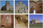
 
This is just one of those days where the views make you gasp, and the people shower you with kindness. No need for further explanation as to why in the world would anyone take a 32 km U-loop with some significant ascent when the straight shot is flat and 16 km. But don’t feel sorry for yourself if you decide not to do it — I think the newly marked direct route looks very pretty
The description of the 32 km alternative definitely makes it appealing.

For those who would like to go via Caminayo but don’t want a 32 km day, you can cut off some kilometers on one or both ends. First, sleep in Velilla the night before (cuts off 4.4 km) or get a taxi there from Guardo. Walk through the forest and up to the ridge, down to Caminayo, and then down to Morgovejo. It’s a nice little town with lots of weekend homes that have been renovated. That’s about 20 total. From Morgovejo, call Taxi Sabino in Puente Almuhey and see the last kms along the road from the taxi window.
Good suggestions for slow walkers.

For those who want to walk all the way, there are -very- short stages available to break up this stage. As I mentioned earlier, if we can find a room in Villanueva de Arriba, we would walk 12.1 km to Velilla del Río Carrión. The accommodation list for Velilla on the caminoolvidado.com website includes Casa Rural Anti, Casas Rurales Casán, Hostal Stop, and Hostal Casa Mauro.

Then we would walk 19.2 km to Morgovejo. There, we could sleep at Casa Rural La Mata. Once again, as with many casa rurales on this Camino, we will need to make a phone call to find out if we can book a room instead of the whole building.

Finally, we would have another short day, walking 7.7 km to Puente Almuhey.
 
The 2024 Camino guides will be coming out little by little. Here is a collection of the ones that are out so far.
The description of the 32 km alternative definitely makes it appealing.
It was utterly spectacular, even on a day spent half in a cloud. The views from the ridge at 1600m were amazing - up towards the Picos on one side, and down to the dead flat of the meseta to the south. There are wonderful days in store on the Olvidado, especially Los Calderones and the hike over from Fasgar, but this was the first of several great mountain days.

DSC_0170.webp
 
I would really like some feedback from others who have taken the Caminayo alternative. I have been googling around and reading other accounts, and was very surprised to come across a description in Spanish, and here is a rough translation:

There are complicated mountain crossings, lonely and unsafe places (risk of wild animals and problems with telephone coverage). Only advisable for mountaineers or very well prepared people and only on exceptionally good days. No signage.

I certainly don’t want to encourage others to go on a dangerous walk! But this is so far removed from what I experienced that I would almost describe it as fear-mongering. Do others agree or disagree?

Thanks, buen camino, Laurie
To be honest - I have not done this route at all - but I live close to Cuilagh mountain which several years ago had a boardwalk created up it and became a victim of social media as it became the "Stairway to heaven". The problem is watching people try and take on a walk on rough tracks and wood boardwalk when they are not prepared. The local mountain rescue group has had to go up to find lost people and recover those who have gotten injured (or died in fact). The Cuilagh route is not a difficult or technical hike in any sense but too often people underestimate it or make mistakes with the weather.

I am one of those in favour of serious warning signs! It makes people carefully consider the route - whether they are prepared or fit enough, if they know what to do in a remote spot if anything goes wrong, and what the weather is like. The Caminayo alternate probably isn't dangerous but unfortunately there are those who would try it unaware that it is a bit tougher and remoter, and without considering the weather conditions. I love the sound of the Caminayo alternate, but I would be careful in whether I felt it was a suitable route for me in general but also at the time I reached the option (weather, tiredness, injury)
 
€2,-/day will present your project to thousands of visitors each day. All interested in the Camino de Santiago.
I would really like some feedback from others who have taken the Caminayo alternative.
I haven't taken the Caminayo alternative, but if I may give my opinion...

I certainly don’t want to encourage others to go on a dangerous walk! But this is so far removed from what I experienced that I would almost describe it as fear-mongering.
I think it is a case of "forewarned is forearmed". If I consider your experience, @peregrina2000 , and that of @MikeJS :
After the town, you enter an absolutely beautiful forest, with its very hard-to-follow path. Even with my GPS we got off piste and had to take some steep downhills to get back on the path. (My old GPS only takes 500 “points” per track, so at the micro level it is often hard to follow). But it was like a fairy tale forest. Then up and around one of several abandoned mines, and it is tricky.
This part of the hike needs a lot of attention as the markings seem non existent and although I had the Olviado camino app track the gps accuracy was surprisingly poor. I would be extremely wary of trying this route without gps.
I would not follow this alternative if I was not well equipped with the appropriate tools, be they GPS, precise maps and compass, and I would ensure I have planned my walk. In our case, it would be walks, as the slow walkers we are would do this in three days. Which is probably good, as the longest distance we would walk is 19.2 km from Velilla del Río Carrión to Morgovejo. And we would not take this alternative if we could not get a room (one room as opposed to having to book the whole building) at the Casa Rural La Mata.

So I have already looked up GPX tracks, and I have the following three. The first one is by Ray y Rosa, who are veterans on the Camino, I believe:


The second one is by someone who started from Velilla del Río Carrión. This track includes photos, which look great:


and the last one is by Enders. I'll note his comment on wikiloc: "Etapa preciosa entre bosques de robles y hayedos interminables. Muy recomendable":

 
Totally agree on the real necessity for a GPS (especially for the forest after Velilla much more than for the rest of the walk), but that is not the danger that is described in that excerpt. It was the wild animals and mountaineering skills required that got me. In fact, the wide path on the ridge gets a bit of car traffic! We saw two cars up there when we walked, and that is the only part of the walk that qualifies as remote in any way.

So I guess what I am saying is that I favor honest disclosure. I don’t think it does anyone a service by exaggerating the dangers in the hopes that foolish unprepared people will not venture out. By taking a look at the elevation profile, the distances, and the first hand reports, people can make a much better decision than if they hear fabricated warnings about wild animals and mountaineering skills.


The first one is by Ray y Rosa, who are veterans on the Camino, I believe:

BTW, not that it matters, but Ray and Rosa use Ender’s tracks — I don’t believe they have walked this route. Ray and Rosa have a cabin in their back yard outside Manzanares el Real for pilgrimso on the Madrid. Everyone who stays there raves about it, but they hadn’t yet opened it when I walked the Camino de Madrid.
 
It was the wild animals and mountaineering skills required that got me.
Sorry, I didn't focus on those two issues.

Tongue in cheek, I would say it doesn't worry us: - I am scared of dogs and my darling has always protected me, so I think I'm safe from wild animals in her company
- we're both from Switzerland originally, used to mountaineering skills, and in fact, when my darling was younger, and in better health, I used to refer to her as my mountain goat 😄

Joking aside, the cynic in me might think that the scaremongering has an ultimate goal: to keep pilgrims on the 10A alternative so that it benefits from a financial point of view. But then I don't know who the authors of the viejocaminoolvidado.com website are, and whether they have any business or financial interest on the 10A alternative.
 
Holoholo automatically captures your footpaths, places, photos, and journals.
Only advisable for mountaineers or very well prepared people and only on exceptionally good days.
I think that's nonsense. I am not a mountaineer and have 0 mountaineering experience. It was snowing the (November) night before I went that way, and I thought that I would take the short route if snow was lying when I woke up. It wasn't, so I went ahead, and I'm so glad I did as it was a fantastically beautiful day, especially once the cloud lifted to over 2000m. The track is not that easy to follow and wasn't (then - 2018) very well marked, but with ender's wikiloc it was virtually impossible to get lost. Far from being a mountaineering trail, as far as I can remember I never even had to use my hands. Obviously, I could have slipped and broken my leg and, as virtually nobody was likely to pass in several days, might have died of exposure, but that would have been very bad luck, despite the Fuentes Tamáricas at Velilla del río Carrión being dry, so Pliny the Elder reckoning I should have died within the week.

DSC_0180.jpg

The only bit of the Olvidado where I felt seriously scared (and definitely had to use my hands) was the descent from Villar del Puerto to the Faedo de Ciñera after Vegacervera. Something like a cliff, and very slippery as it was pouring with rain when I went down there. Even that wasn't what I'd consider mountaineering, and is probably fine on a dry day. And very pretty once you get onto a flat bit and can enjoy it.

DSC_0226.jpg
 
The only bit of the Olvidado where I felt seriously scared (and definitely had to use my hands) was the descent from Villar del Puerto to the Faedo de Ciñera after Vegacervera.
Ahhh yes, I have been working on how to present that day. There are road options, and this is one where I totally concur about the difficulty. And I remember you walked it in the pouring rain. We had great weather and even then I struggled. My youngster companion (a mere 50) was cursing his way all the way down. Fortunately the views at the bottom and the forest adjacent calmed him down and made him decide it was worth it.
 
I think that's nonsense. I am not a mountaineer and have 0 mountaineering experience.

I think that these warnings are likely born of good intentions but lack of first hand knowledge. I am exactly like you — not a mountainer by any stretch of the imagination.

Thinking back on it, I have had similar experiences in other places. In the albergue in Ponferrada I was repeatedly warned about terrible dangers on the Invierno, but in fairness this was in 2012 when it was really unknown. Or the people in Laza telling me to stay on the road going up to Albergaría (nonsense — based on what people who took that advice told me, the road was the dangerous option with narrow roads and lots of traffic). Or how about what we used to hear about Hospitales on the Primitivo. I guess all we can do is offer the facts. It is true that there are lots of people who aren’t equipped to do these stages, but that’s for them to judge.

But then I don't know who the authors of the viejocaminoolvidado.com website are
Good question. I am pretty sure that this is Adolfo’s group. They are a well-meaning, dedicated organization but they may not ever have been anywhere near Caminayo or Guardo, since they are so close to Bilbao. I don’t think they have any financial interest.
 
Perfect memento/gift in a presentation box. Engraving available, 25 character max.
And a very timely heads up — Ender’s Camino Olvidado website and app is being revised to include a Resources section for each town on the route. The series of screen shots takes you through the clicking you need to do to get to the granular, pueblo level. Definitely a go-to resource.
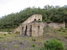
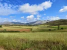
 

Attachments

  • C39788ED-C36B-4351-9E63-D555557043FE.webp
    C39788ED-C36B-4351-9E63-D555557043FE.webp
    191.7 KB · Views: 40
  • E579FE72-C7AF-4140-8A36-E84C851F4AEC.webp
    E579FE72-C7AF-4140-8A36-E84C851F4AEC.webp
    102.7 KB · Views: 36
  • 0FA2D67F-0668-4C91-BB12-D26BB0B6A594.webp
    0FA2D67F-0668-4C91-BB12-D26BB0B6A594.webp
    83.8 KB · Views: 36
  • CD0C0D94-D17D-4EA5-AE3D-DF987CE4CC4D.webp
    CD0C0D94-D17D-4EA5-AE3D-DF987CE4CC4D.webp
    110.9 KB · Views: 41
I would really like some feedback from others who have taken the Caminayo alternative. I have been googling around and reading other accounts, and was very surprised to come across a description in Spanish, and here is a rough translation:

There are complicated mountain crossings, lonely and unsafe places (risk of wild animals and problems with telephone coverage). Only advisable for mountaineers or very well prepared people and only on exceptionally good days. No signage.

I certainly don’t want to encourage others to go on a dangerous walk! But this is so far removed from what I experienced that I would almost describe it as fear-mongering. Do others agree or disagree?

Thanks, buen camino, Laurie
In my experience, less experienced walkers sometimes have different perspectives without necessarily having an agenda.

For example, I once came across a wikiloc track for the Tongariro Saddle that described this one day, spectacular, hike as technically "difficult". I pointed out that this track is one of the most popular day hikes in ANZ and is walked by thousands each year including myself and my own teenage children, wearing sneakers. The Wikiloc author disagreed.

While not "technically" difficult the 19.4klm track that climbs 800 metres to 1900 metres can be both exhausting (it starts with a vertical staircase climb) for the unfit and dangerous for the unwise as the weather can change rapidly and there have been deaths from hypothermia in this area.

Some people will describe a walk based on their own capabilities and experience which may not equate well with a more general description.
 
Ideal pocket guides for during & after your Camino. Each weighs only 1.4 oz (40g)!
Totally agree on the real necessity for a GPS (especially for the forest after Velilla much more than for the rest of the walk), but that is not the danger that is described in that excerpt. It was the wild animals and mountaineering skills required that got me. In fact, the wide path on the ridge gets a bit of car traffic! We saw two cars up there when we walked, and that is the only part of the walk that qualifies as remote in any way.

So I guess what I am saying is that I favor honest disclosure. I don’t think it does anyone a service by exaggerating the dangers in the hopes that foolish unprepared people will not venture out. By taking a look at the elevation profile, the distances, and the first hand reports, people can make a much better decision than if they hear fabricated warnings about wild animals and mountaineering skills.


BTW, not that it matters, but Ray and Rosa use Ender’s tracks — I don’t believe they have walked this route. Ray and Rosa have a cabin in their back yard outside Manzanares el Real for pilgrimso on the Madrid. Everyone who stays there raves about it, but they hadn’t yet opened it when I walked the Camino de Madrid.
Definitely no sign of wild animals when i was on the route and the tracks are easy enough so no need for mountaineering skills. The only difficulty was following the correct route. In 2019 the signage was poor and for some strange reason so was the GPS info. However, once you get to the old ‘coal workings’ it was much clearer and easy. The route is definitely worth doing.
 
Ahhh yes, I have been working on how to present that day. There are road options, and this is one where I totally concur about the difficulty. And I remember you walked it in the pouring rain. We had great weather and even then I struggled. My youngster companion (a mere 50) was cursing his way all the way down. Fortunately the views at the bottom and the forest adjacent calmed him down and made him decide it was worth it.
True, but it is such an outstanding section, for me one of the best of all my caminos, that it would be a travesty to miss it!
 
Day 11. Puente Almuhey to Cistierna (21 km)

This is a five star day.

Don’t miss the mermaids on the wall of the Romanesque church in San Martín de Valdetuéjar. Legend has it that several peregrinas on the way to Santiago seduced some of the monks (yeah, yeah, blame the women). The enraged abbot turned the peregrinas into mermaids and threw them into the river. He then ordered the monks to build the church of San Martín, adding the carved stone mermaids as a reminder of their sins.
292A4011-96B0-40B4-88BC-4D58F331C5B9.jpeg

The 17C Sanctuary of Our Lady of La Velilla (established as a pilgrimage site in honor of her many miracles) has never been open when I walked by but it is a nice spot and has a Santiago Matamoros on one end of the building.
9E461FB2-60BB-4C19-B5DB-E6ADDBD4EE9F.jpeg5E891365-B240-457F-B7FE-5E0612ECAA2A.jpeg

From there, a not-too-severe ascent begins and it is beautiful. Wild country at its best, with some well-known León mountain peaks in your sights. There is some road walking at the end, inevitable as you are entering what used to be a big mining town and is now a sad remnant of its former self.

FFF5B3AF-39D3-4F1D-A50C-C02EE9CE96F4.jpegC61A59EA-27EB-4445-9135-23C334328B54.jpeg850668A9-6289-467D-8677-48057B8E329A.jpegF73103D0-127C-40A9-86D6-9D694192F30E.jpeg05CBF413-2384-478D-8CD0-A48C63C22B6F.jpeg4B3890D9-C6DB-4077-9B15-B083835802BB.jpeg

@MikeJS summed it up beautifully: “In fact if I wanted to show someone the essence of a camino I would take them on this stage. It has everything — gentle stroll through pastures with the donging of cow bells, woods and forests. Good tracks, including a little bit of very quiet road, rural tracks, forest trails and the equivalent of goat trails! There are panoramic views, picturesque churches ad a sanctuary as well as pretty lakes.”

Since the Olvidado and the Vadiniense cross here, I have spent three nights in Cistierna — once in the albergue (which was fine) and twice in the Hostal Moderno (small basic hotel, wonderful staff, do not miss their restaurant’s menú del día). I’ve told this story before, but when I checked into the Moderno in 2019, the women at the desk, said — oh I remember you, I once pulled a tick out of your back! And she was right, but it was five years earlier.

People are very nice in this town, and there is a park/playground up the hill beyond the albergue where many gather in the afternoons. Lots of cafés along the main street. I remember one place coming into town on the right, next to a “tienda de chinos” where the owners served great little Chinese food tapas with the drinks. That is not a common occurrence in Spain!

As @dick bird has suggested, this is a hard day to break up. The online resources list Hotel la Velilla, in Mata de Monteagudo near the Velilla sanctuary. That would be a good way to cut the day almost in half, and leave the ascent for when people are fresh in the morning. But its website is no longer functioning. I will do some more research, and see if there are any other ideas out there.
 
A selection of Camino Jewellery
This is a five star day.

Don’t miss the mermaids on the wall of the Romanesque church in San Martín de Valdetuéjar.
Romanesque. Five star. Need I say more? ☺️

As @dick bird has suggested, this is a hard day to break up. I will do some more research, and see if there are any ideas out there.
A short stage for able bodied peregrin@s, and one that possibly could be done by slow walkers without the need to break it up. However, slow walkers have to be prepared, and I think there are not many ways of breaking this up, except in two short (very short for most pilgrims) days.

From Puente Almuhey, we would walk 10.2 km to La Mata de Monteagudo. There, we might find a room at the Hotel La Velilla. It is a little out of town, close to the Santuario de la Virgen de la Velilla. My only worry is that the hotel's website is no longer active...
If we were successful in finding a room, we would then walk the remaining 11 km to Cistierna.

The alternative is to walk as far as we can, and then call a taxi from Cistierna.
 
There, we might find a room at the Hotel La Velilla. It is a little out of town, close to the Santuario de la Virgen de la Velilla. My only worry is that the hotel's website is no longer active...
As I went back to my notes from my 2014 Olvidado, I saw that I had stayed in the Centro de Turismo Rural La Velilla. Looking at the pictures and reviews of Hotel La Velilla, and based on the location (just across from the monastery), I believe these two places are one and the same. It was run by a mother and daughter team from Madrid, and even then was not flourishing. I was the only one there, and it was a weekend. It was in a beautiful spot, and I enjoyed taking some walks over to the village Mata de Monteagudo (with nothing going on!) and up in the hills a bit. But the dinner was awful and the whole thing overpriced, and I wondered then if they were going to make it. So I would not bet on this being open when we head back to the camino.
 
Ender’s Camino Olvidado website and app is being revised to include a Resources section for each town on the route
God bless him. Seriously. What a guy!

when I checked into the Moderno in 2019, the women at the desk, said — oh I remember you, I once pulled a tick out of your back! And she was right, but it was five years earlier.
Only on the camino. 🤣
A funny story, but it gives me pause, since bedbugs don't come close to creeping me out like ticks do. Good to know they're up there so we check ourselves after a day of scrambling down cliff-faces.

Romanesque. Five star. Need I say more?
Nope. Nada.🙏
 
€2,-/day will present your project to thousands of visitors each day. All interested in the Camino de Santiago.
i have been using this guide to help with my planning -

Hi, @charlotte19675,

That is the “official” website, paid for by the municipal association that Ender put together. It is also the source of the rusty camino olvidado markings that you will find along the way—these markings have not been wildly praised, at least not here on the forum, but I don’t like to bite the hand that feeds me, so I try to stay silent on that issue. ;)

About a year before the official website was launched, Ender wrote a hard copy guide in Spanish, which I translated into English.


That is a less professional guide, but it is still, IMO, a very helpful document.

Just out of curiosity, what is your typical stage length? For instance, are you planning to walk from Puente Almuhey to Cistierna in one go?
 
Hi @peregrina2000

Thanks for your reply, my current walk length is about 10-12km as I have had chronic fatigue syndrome/post viral syndrome which I developed while travelling in 2014. Until about 6 months ago I was only able to do about 4-5 km per walk and then a week recovering from it. I am hoping to get to about 15 - 20km a day by September but if not then I will be following @AJGuillaume words of wisdom and also, obtaining taxi numbers to help me complete any stages that I can't. At the moment I would need to break this stage up but in a few months time I might be able to complete this stage but take a recovery day in Cistierna if needed.
 
Ideal sleeping bag liner whether we want to add a thermal plus to our bag, or if we want to use it alone to sleep in shelters or hostels. Thanks to its mummy shape, it adapts perfectly to our body.

€46,-
Thanks for your reply, my current walk length is about 10-12km
Good to know, and I hope that between AJ, myself, and the Olvidado website you are using, you are able to get stages sorted out for the proper length for you.

I have had chronic fatigue syndrome/post viral syndrome
I have a close friend who has also developed this syndrome, and like you she is fighting mightily to regain strength and energy. I had never heard of this till recently, but seeing the effects first hand was a wake-up for me.
 
Good to know, and I hope that between AJ, myself, and the Olvidado website you are using, you are able to get stages sorted out for the proper length for you.


I have a close friend who has also developed this syndrome, and like you she is fighting mightily to regain strength and energy. I had never heard of this till recently, but seeing the effects first hand was a wake-up for me.
from summer 2014 until late 2017 I was fairly housebound and didn't even have the energy to walk around the supermarkets with my husband. this was devasting as we are keen walkers and thought nothing of doing a 20 mile walk at the weekend but I am starting to recover slowly and hopefully a few more months will push the daily limit up a bit. I am aware of my limits and if I need to resort to public transport or a lift from some poor local then I will use them. I want to enjoy my Camino and if I can't complete it this time then I can always come back and continue from where I stopped. I am learning a lot from this thread and am looking forward to starting the Camino this year if possible.
 
For us, this was probably the best day on the Olvidado. The 17C Sanctuary of Our Lady of La Velilla is a gem, especially as a lot of the artwork has a primitive feel to it. By sheer luck, we had just had a rest and a snack when a car pulled up and out got the caretakers/curators of the church and attached pilgrimage museum, who opened up and, with immense and justified pride, showed us round. The church and museum are opened pretty regularly, but the time changes with day of the week and season. It would really be worthwhile checking in Puente de Almuhuey for the opening hours and delaying your start time to be there when they open (10, or 11 most days). Accommodation in Cistierna shouldn't be a problem, besides the local fraternity run albergue (let's hope it re-opens), there are lots of hotels. The rest of the walk is glorious so long as the weather is kind - over the mountains and down through the pine forest, but a small word of warning: it is a very popular area for walkers with a lot of marked trails so make sure you are on the camino, not side-tracked onto one of the others.P1000261 (2).webpP1000265 (2).webp
P1000262.webpP1000263.webpP1000264.webpP1000266.webpP1000267.webpP1000268.webpP1000255.webp
 
The focus is on reducing the risk of failure through being well prepared. 2nd ed.
@peregrina2000 thank you for the accommodation and some ideas of what to do in Bilbao.

My first question is any good tips on where to go to get some food after landing in Bilbao?
So I'm a bit late to this thread, but noticed that this question absolutely has an answer... at least for me. In the San Francisco barrio, a very colorful place for a stroll, is a restaurant called Peso Neto. It is small, but has never failed to impress me. Borderline hipster, but don't let that scare you away because the staff is gold.
 

❓How to ask a question

How to post a new question on the Camino Forum.

Featured threads

❓How to ask a question

How to post a new question on the Camino Forum.

Featured threads

Forum Rules

Forum Rules

Camino Updates on YouTube

Camino Conversations

Most downloaded Resources

This site is run by Ivar at

in Santiago de Compostela.
This site participates in the Amazon Affiliate program, designed to provide a means for Ivar to earn fees by linking to Amazon
Official Camino Passport (Credential) | 2024 Camino Guides
Back
Back
Top