• Remove ads on the forum by becoming a donating member. More here.

Search 69,459 Camino Questions

Camino Francés guide for cyclists

Kiwi-family

{Rachael, the Mama of the family}
Time of past OR future Camino
walking every day for the rest of my life
Is there a dedicated guide for cyclists that suggests alternatives to the rocky/steep parts of the trail? I found a link to a 2018 one on another thread, but it is no longer available.
 
Ideal pocket guides for during & after your Camino. Each weighs only 1.4 oz (40g)!
If you go to the app Mapy.cz you will not only find the CF and other Caminos as blue lines through Spain, but you’ll also find a pink dotted line with bicycle symbols. On some of those rocky/steep parts, you’ll see bicycle alternatives. Sometimes you’ll see that a road closely parallels the trail whereas on other parts, like the climb up O Cebreiro, the bike route is the road, but it doesn’t as closely follow the trail. I followed the Mapy.cz biking sections on several parts of the VDLP and found them most helpful.
 
We used to have the "Yellow " book by Raiman Joos which is a German author that had instruction for both walking and biking. Really liked it as it was very precise. Don't know if there is an updated English version, but I still have it on Kindle from 2016. It was called Outdoor: the way is the goal and we had the one for the CF.
 
Ideal pocket guides for during & after your Camino. Each weighs only 1.4 oz (40g)!
I used cycling the Camino de santiago by Mike Wells. For daily navigation, I used Google maps on my phone. I used a mixture of the cycle option, which takes you down some trails and the car option with no motorways selected. When I had chosen a route and started, I put my phone in my bag and listened to the verbal commands.
 
Is there a dedicated guide for cyclists that suggests alternatives to the rocky/steep parts of the trail? I found a link to a 2018 one on another thread, but it is no longer available.
You could look up thee peregrino online app for the Frances.
I found it quite useful with maps, geographical profiles and cyclist specific information
 
A selection of Camino Jewellery
Jakobs-Radweg from Bikeline at Esterbauer.

Text is in German but I found it worth buying for the excellent maps which show the walking route with cycle alternatives. Spiral-bound so handy to keep open on a handlebar-bag.
The 2023 edition seems to be available on Amazon.com (NZ section) and also on Amazon UK but could be purchased direct from Esterbauer.

PS : the 2014 edition still figures on some websites so worth checking that you are buying the latest version (2023).
PPS : you can see sample pages at https://www.dezwerver.nl/
 
Is there a dedicated guide for cyclists that suggests alternatives to the rocky/steep parts of the trail? I found a link to a 2018 one on another thread, but it is no longer available.

Buen Camino app does alternative routes for cyclists
 
3rd Edition. More content, training & pack guides avoid common mistakes, bed bugs etc
Is there a dedicated guide for cyclists that suggests alternatives to the rocky/steep parts of the trail? I found a link to a 2018 one on another thread, but it is no longer available.
Download the KOMOOT app. The free version is more than good enough. You can easily map every stage in a GPX file. Once you have mapped the stage, you can choose between the hiking route, gravel route, touring bike route or even the road bike route. I will be starting in Pamplona on the 28th of June and mapped all my stages. Plus it has many other features you can use.
 
If you go to the app Mapy.cz you will not only find the CF and other Caminos as blue lines through Spain, but you’ll also find a pink dotted line with bicycle symbols. On some of those rocky/steep parts, you’ll see bicycle alternatives. Sometimes you’ll see that a road closely parallels the trail whereas on other parts, like the climb up O Cebreiro, the bike route is the road, but it doesn’t as closely follow the trail. I followed the Mapy.cz biking sections on several parts of the VDLP and found them most helpful.
Mapy.cz is hands down the best navigation app.for trails. So clear compared to many others. I ve only used it for walking, but I may use it for bicycling in the future and that's a good piece of information about alternative routes.
 
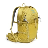
Technical backpack for day trips with backpack cover and internal compartment for the hydration bladder. Ideal daypack for excursions where we need a medium capacity backpack. The back with Air Flow System creates large air channels that will keep our back as cool as possible.

€83,-

Most read last week in this forum

Hi all, I'll be cycling Camino Frances in August/Sept 2024 over 14 days from St Jean Pied de Port to Santiago. My daily distances range from 47 to 72 km. I have booked all accommodation already...

❓How to ask a question

How to post a new question on the Camino Forum.

Similar threads

Forum Rules

Forum Rules

Camino Updates on YouTube

Camino Conversations

Most downloaded Resources

This site is run by Ivar at

in Santiago de Compostela.
This site participates in the Amazon Affiliate program, designed to provide a means for Ivar to earn fees by linking to Amazon
Official Camino Passport (Credential) | 2024 Camino Guides
Back
Top