HJDM
New Member
- Time of past OR future Camino
- Camino Frances and Norte on 2-way cycle Summer 2016
Camino de Gran Canaria Feb 2019
Walk a complete, genuine camino in a few winter days with little need for rain gear? - the Camino de Santiago de Gran Canaria is ideal.
This is some recent information to supplement a few other threads on this site; surely there should be a dedicated section to this Camino amongst the Other Routes in Spain section? I have added references and a few photos for anyone who would consider this walk, which differs from the two Caminos I experienced in 2016.
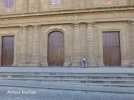
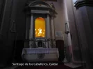
The Church of Santiago de los Caballeros in Gáldar was originally granted the privilege to celebrate the holy year in 1965 by Pope John XXIII. This was repeated in subsequent holy years and then in perpetuum by John Paul II in 1992. The building is now a museum (Museo de Arte Sacro) with limited opening hours and an entrance fee though it also appears to function as a church as there is a list of service times.
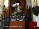
The pilgrimage links the other church dedicated to Santiago, confusingly called San Bartolomé. To add to the confusion, the town is known as San Bartolomé or, more commonly, Tunte. Both churches have depictions of Santiago Matamores in full detail, not politically corrected as in Santiago de Compostella cathedral.
Whilst a walk between the two churches could be completed in two days, most routes start in Maspalomas on the south coast. A journey from coast to coast is very attractive and in retrospect could have been from sea to sea. Whilst it is described as a three-day trip, two medium fit septuagenarians were not up to that challenge and took an extra day. I suspect most would feel the same, except possibly the very fit. Major differences with this camino are the pilgrim’s accommodation arrangements, the linked issue of transport and the weather at the time of year the journey is undertaken.
With my brother, I walked the route shown on Google Maps and publicly accessible at https://drive.google.com/open?id=1wbChe5_rsAmCvx95C7nMCZJ2AcDFHdCf&usp=sharing in February 2019. Pins mark starts/stops and I have added on some pins showing refreshment sites. We were blessed with very warm cloudless days in the mid 20s centigrade such that had it been any warmer, walking would have been difficult at midday or early afternoon though it appears to have been unseasonably good weather. The heat could be a major factor later in the year and could limit progress, especially if accommodation is off-piste, like ours.
An issue is that the majority of accommodation in Gran Canaria is on the coast with limited availability en route, especially on the southern section. There are hotels, even a parador at Cruz de Tijera though Hotel Rural El Refugio is more appropriate for the pilgrim. Not all appear on booking sites though the Google route map seems to display a better selection of nearby accommodation than the regular Google map. One option which we did not explore was Airbnb. More hostels may develop if the route becomes popular. Camping is an option but requires a permit and wild camping is officially forbidden. Water sources are rare which could mean carrying supplies for several days. We passed two camp sites beside the route; neither appeared to have toilet or washing facilities.
Staying in one location requires transport each day and the bus services (guaguas) which run on most roads are economic but impose limits on the journey undertaken as the last bus back may be mid-afternoon, though a taxi can usually be obtained at greater expense. My impression is that such a plan could be a problem in warmer weather, as we were obliged to walk between 1030 and 1530 each day. The early starts are not practical when staying off-piste.
Route Notes
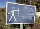
En route, the scenery and terrain are quite spectacular and the walking is challenging in some sections. Most is off-road on way-marked tracks; parts of the last 10 km are on minor roads which are not busy. There are recently erected route signs though the route designations vary along the journey. GPS and a digital map system are very useful; I used ViewRanger with a premium David Brawn map though the free ViewRanger Outdoors map is excellent especially for fine detail. Google Maps is excellent to locate bus stops and if online, the times of the next bus. There are some yellow arrows but signage seems to depend on the local council. Strangely, signage is sparse as Gáldar is approached. There were also some greetings of “Buen Camino”.
On the outskirts of Maspalomas at Lomo de Maspalomas, there is a large quarry complex and a choice of ascent route, either via Barranco de Vincentes or the lower level Barranco de Fataga. It appears that the lower route which we took is the more challenging with slow progress through a bamboo jungle in the depths of a ravine, though there is a higher level vehicle track with no such difficulty.
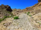
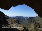
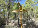
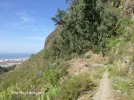
The ascent from Cruz Grande looks imposing from below but is quite straightforward on what others have described as a well-engineered path and I could not disagree. The reward is a walk through scented pine forests glimpsing views of the coast but the highlight is the view of Tenerife through Ventana del Nublo on a short side path. Great scenery abounds and more rest and refreshment opportunities arise as the journey progresses.
The descent becomes quite steep in places especially on the volcanic scree down from caldera-de-los-pinos-de-gáldar and particulary near Gáldar on the off road but considerably more direct route down from Hoya de Pineda to Anzofé. This was one of a few sections where overgrown shrubbery was somewhat of an obstacle, potentially more so later if not regularly trimmed.
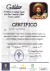
The Museo de Arte Sacro closes at 1330 during the week so, like us, if you arrive late in the day, you must return to pay respects to the Saint and collect a certificate. I could not find any credencial, even in Hostal Rural at Cruz de Tijera where others have indicated but none is requested at the museum. There are daily masses listed but I was unable to establish if a pilgrim could obtain a certificate then. The Museum/Church is well worth a visit and the building next door is being converted to a “Hotel Emblemático”; probably a very comfortable place to end the pilgrimage.
It is a fairly challenging 64km walk; there is about 3500m of ascent/descent. The greatest surprise was that there were only occasional walkers enjoying such spectacular scenery on such superb hiking terrain. This may reflect the package holiday/beach focus of the majority of visitors to the island though there are signs that the Cabildo de Gran Canaria is developing the infrastructure
Other resources:
https://espanafascinante.com/en/santiagos-road/the-camino-de-santiago-de-gran-canaria/
(Route description, in English)
https://www.cicerone.co.uk/a-winter-camino-on-gran-canaria
(February 2019 article by travel guide writer Paddy Dillon)
- http://www.grancanaria.com/turismo/es/naturaleza/deportes-de-montana/senderismo/
(in Spanish but translatable and the site has links to accommodation)
https://www.thetimes.co.uk/article/welcome-to-gran-canarias-mini-camino-de-santiago-bk2d6ff0n
(February 2018 article by Martin Symington, with pay wall)
http://www.wandermap.net/en/route/9...-canaria/#/z10/27.9161599,-15.5799866/terrain
(Map with GPS data for route via Ayaguares to San Bartolomé, in Spanish)
https://es.wikiloc.com/rutas-sender...a-camino-de-santiago-de-gran-canaria-15706161
(Describes two stages between the churches with maps and photos, in Spanish)
https://www.guaguasglobal.com/en/lineas-horarios/paradas/
(Details of all bus services on the island with route maps. Frustratingly, the only times given are from the starting point; clicking on a bus stop on Google maps brings up local times of services)


