• ⚠️ Emergency contact in Spain - Dial 112 and AlertCops app. More on this here.
  • Remove ads on the forum by becoming a donating member. More here.

Search 74,075 Camino Questions

Arles and Piemont - link-across options please?

Time of past OR future Camino
.
I'm looking at options for a camino starting in France for the first time. I have been interested in the Arles route for a while. Recently an excellent pilgrim I met a few years ago has said he'll walk the Arles route later this year. I've been invited to join him. I have plenty of good reasons why it's not the right time to do this, but nonetheless I've been sucked into the planning process...
I've heard good things about the Voie du Piemont and also fancy the hillier proximity to the Pyrenees. So far I've been able to find little useful practical information about crossing over from the Arles to the Piemont - so that's where you come in...
I can see that maps show a branch off the Arles/GR653 at Montpellier, but that seems unnecessarily early (unless you tell me it is the best option - but there's an absence of Piemont guidebooks in print). I have seen threads here that describe branching off at Toulouse. But that seems far too late to me, as by then the Arles route has moved further north and, by the time you hit the Piemont it will almost be finished.
The 'sweet spot' looks to be (on the map at least) the southernmost point of the Arles route at Montferrand/Labastide d'Anjou, just as it switches from going south west to north west. At this point it looks to be about 30km from the Piemont route further south (at Fanjeaux).
I'm particularly interested to hear from anyone who has done the switch-over. I'd also welcome links to guidebooks and maps that people have found useful, particularly for the Piemont, as I have the latest Miam Miam Dodo for Arles and am also now on the Via Tolosana facebook group.
Cheers, tom
 
The one from Galicia (the round) and the one from Castilla & Leon. Individually numbered and made by the same people that make the ones you see on your walk.
perigrino tom,

What wonderful plans you have for this difficult year!
Do try searching in the forum for the switch-over points such as Labastide which I vaguely remember from reading past posts.
Looking forward to following your research and, of course, your posts and photos when you do walk.

Stay safe and Carpe diem.
 
Hi Tom.

Not exactly on point as I don’t have any info on getting from Arles Way to the Piemonte. But a couple of comments:

We walked the Arles Way in 2016 starting from Arles on 1 April. Enjoyed this camino v much - fewer people than the Le Puy (also fabulous) and almost all French. Was ok for me, because my husband is French (in fact we met on the Camino Le Puy but that’s another story!)

Arles is a beautiful town with much to offer. If you start there I recommend giving yourself at least a day or two. See blog link below.

After about 800 kms, you cross over the Col du Somport into Spain and continue on the Camino Aragones to Obanos where it meets The Frances. The Aragones is a short but wonderful Camino. I walked it again in late 2019.

If you you end up on the Piémont you can join or re-join the Arles Way at Oloron Sainte Marie and make your way into Spain via the Somport pass and along the Aragones. This is my blog from Arles / Aragones


Bon chemin
Jenny
 
3rd Edition. More content, training & pack guides avoid common mistakes, bed bugs etc
I'm looking at options for a camino starting in France for the first time. I have been interested in the Arles route for a while. Recently an excellent pilgrim I met a few years ago has said he'll walk the Arles route later this year. I've been invited to join him. I have plenty of good reasons why it's not the right time to do this, but nonetheless I've been sucked into the planning process...
I've heard good things about the Voie du Piemont and also fancy the hillier proximity to the Pyrenees. So far I've been able to find little useful practical information about crossing over from the Arles to the Piemont - so that's where you come in...
I can see that maps show a branch off the Arles/GR653 at Montpellier, but that seems unnecessarily early (unless you tell me it is the best option - but there's an absence of Piemont guidebooks in print). I have seen threads here that describe branching off at Toulouse. But that seems far too late to me, as by then the Arles route has moved further north and, by the time you hit the Piemont it will almost be finished.
The 'sweet spot' looks to be (on the map at least) the southernmost point of the Arles route at Montferrand/Labastide d'Anjou, just as it switches from going south west to north west. At this point it looks to be about 30km from the Piemont route further south (at Fanjeaux).
I'm particularly interested to hear from anyone who has done the switch-over. I'd also welcome links to guidebooks and maps that people have found useful, particularly for the Piemont, as I have the latest Miam Miam Dodo for Arles and am also now on the Via Tolosana facebook group.
Cheers, tom
Tom,
Lived for years near Fanjeaux and now live between Villefranche- de - Lauragais and Castelnaudary.
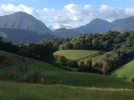
The Chemin du Piémont is wonderful - with relatively few walkers.
I agree with your logic - that the place to step off Chemin d’Arles is at or around Montferrand and then walk to Fanjeaux.
Note:
1) The Seuil de Naurouze is close to the step off point and is the engineering feat of Jean Paul Riquet in the 1660s - Canal du Midi - which joins Atlantic to Med. The parting of the waters is there. Worth a look if that sort of thing is of interest to you.
2) One can walk along the canal in any case to join the Piémont - either all the way (going a little backwards!) to Carcassonne -and then turn right onto the Piémont. Thé canal is very well maintained with a walking/cycling path, facilites etc etc.
3) Or one can leave the canal at Castelnaudary (home of cassoulet!) and walk the dead straight Roman road to Fanjeaux, cutting off Carcassonne
4) Thé Roman road is fairly busy for walking on but there are several alternate backroads through little villages on country roads and up through the hills running parallel to the Roman road.
5) Glimpses of the Pyrenees and great views of Black Mountain (Montagne Noir) are to be had on the higher routes from Castel to Fanjeaux.
Sorry - am starting to sound like a travel agent selling a package - love this area along the foot of the Pyrenees - am not French!
Currently am vacillating myself about taking the canal path north to Toulouse or going (yet again) on the south road to Fanjeaux and onwards come mid- September!
Bon Chemin
Joan
PS Church at Vals set into the rock (Église rupestre) worth stopping at. And Mirepoix church - one of the widest unsupported spans etc etc !
Great information Joan, thank you! I've popped this away for future reference as the Piemont is in our future. We almost walked that way a couple of times but ended up elsewhere! Spoilt for choices.
 
I can see that maps show a branch off the Arles/GR653 at Montpellier, but that seems unnecessarily early (unless you tell me it is the best option - but there's an absence of Piemont guidebooks in print). I have seen threads here that describe branching off at Toulouse. But that seems far too late to me, as by then the Arles route has moved further north and, by the time you hit the Piemont it will almost be finished.
The 'sweet spot' looks to be (on the map at least) the southernmost point of the Arles route at Montferrand/Labastide d'Anjou, just as it switches from going south west to north west. At this point it looks to be about 30km from the Piemont route further south (at Fanjeaux).
I'm particularly interested to hear from anyone who has done the switch-over.
On my 2005, I walked from Villefranche-de-Lauragais on the Arles Way to SJPP etc via Lourdes, reaching the Piémont Way somewhere near Barbazan - Saint-Bertrand-de-Commingues.

Nothing was waymarked back then, but there is now that waymarked route along the river from Toulouse, and I more or loss followed that, having gone via Villefranche-de-Lauragais > Gardouch > Nailloux > Auterive >Mauressac > Lézat-sur-Lèze > Carbonne ; though clearly from Auterive you could go via Beaumont-sur-Lèze or Saint-Sulpice-sur-Lèze instead of via Lézat.

Without the waymarks in question, the route after I reached the Garonne valley was necessarily DIY, so that I took a route in part of that - Roquefort-sur-Garonne > Mazères-sur-Salat > Salies-du-Salat (looking for somewhere to sleep) > Lestelle-de-Saint-Martory > Labarthe-Inard > Saint-Gaudens.

Even without that "detour" via Salies, the option via those villages between Boussens and Saint-Gaudens is well worth considering instead of the hiking route ; it's pleasant enough despite being on tarmac, as it's mostly off the main road.

Then there's a choice between good routes from Saint-Gaudens to Barbazan.

But certainly you could switch near Labastide-d'Anjou then > Saint-Michel-de-Lanès > Marquein > Gibel > Cintegabelle > Caujac > Esperce > Lézat-sur-Lèze > etc.

It was somewhat lonely after leaving the Arles Way, but the hiking itself was pleasant, especially after reaching the Garonne, even those parts of it that due to no waymarking I did on the main roads. Don't know how things will have changed in the 15+ years since, but the welcome in the villages along there was very good.

As for maps, I always recommend mapy.cz -- both the website version and the app with its free downloadable offline maps, for desktop, tablet, smartphone. The outdoor activities tab shows most hiking routes (worldwide), with special emphasis give to the Camino ones.
 
Last edited:
€2,-/day will present your project to thousands of visitors each day. All interested in the Camino de Santiago.
Ha! Well regardless of what I do this year, this thread has been of great value, particularly in drawing out Joan O. with her first ever post to the forum - and what a post!
Joan, there's some great ideas there, particularly 2 and 3. My immediate reaction is that I like the idea of backtracking a bit along the canal to Carcassone. Thank you - and do please keep posting!

mspath - thank you. Since you've hung up your long distance boots, I'm very much enjoying your new role as benign Flight Controller on the forum - checking all is in order before take-off and then monitoring the pilgrim blips on the long-distance radar ;-)

JabbaPapa - I was hoping you'd weigh in on this one (and @caminka too I hope...). Thanks for the suggestions. TBH I'm going to have to get the maps out over the weekend to fully understand the options you are setting out. But looking forward to that.

Jenny - thanks for your suggestions. I could of course just keep it simple and stick to the Arles route all the way, which would be the more practical option for a first pilgrimage in France... we'll see

Thanks, tom
 
Last edited:
Ha! Well regardless of what I do this year, this thread has been of great value, particularly in drawing out Joan O. with her first ever post to the forum - and what a post!
Joan, there's some great ideas there, particularly 2 and 3. My immediate reaction is that I like the idea of backtracking a bit along the canal to Carcassone. Thank you - and do please keep posting!

mspath - thank you. Since you've hung up your long distance boots, I'm very much enjoying your new role as benign Flight Controller on the forum - checking all is in order before take-off and then monitoring the pilgrim blips on the long-distance radar ;-)

JabbaPapa - I was hoping you'd weigh in on this one (and @caminka too I hope...). Thanks for the suggestions. TBH I'm going to have to get the maps out to over the weekend to fully understand the options you are setting out. But looking forward to that.

Jenny - thanks for your suggestions. I could of course just keep it simple and stick to the Arles route all the way, which would be the more practical option for a first pilgrimage in France... we'll see

Thanks, tom
🤣 great reply Tom. The great news is that whatever your choose you can’t go wrong! And I had a flashback of when we were walking along the Canal du MIDI section of the Arles Way. I seem to recall we saw Castelnaudry in the distance - Joan can probably confirm if that was likely or not?

And an added bonus your thread brought for me. Joan recognised me as a fellow Aussie and has been in touch with me separately. They don’t see too many aussies on the Arles or Piemonte routes. I’m sure we will look her up when we finally get back to France 🇫🇷

I hope you will let us know what you decide. You’ll have to get used to Bon Chemin rather than Buen Camino
Ooops - have just been outed as having lurked extensively on the forum for many years! Thanks Tom !! LoL
In my defense I will blame the fact that I really have had little extra to contribute to the conversations - am often impressed by the knowledge and Info posted by the ‘regulars’.

Anyway I was delighted at the opportunity to throw in my tuppence worth - simply living in this neck of the woods between two Caminos rendered me into a relative
🤣
great reply Tom. The great news is that whatever your choose you can’t go wrong! And I had a flashback of when we were walking along the Canal du MIDI section of the Arles Way. I seem to recall we saw Castelnaudry in the distance - Joan can probably confirm if that was likely or not?

And an added bonus your thread brought for me. Joan recognised me as a fellow Aussie and has been in touch with me separately. They don’t see too many aussies on the Arles or Piemonte routes. I’m sure we will look her up when we finally get back to France
🇫🇷


I hope you will let us know what you decide. You’ll have to get used to Bon Chemin rather t
 
The one from Galicia (the round) and the one from Castilla & Leon. Individually numbered and made by the same people that make the ones you see on your walk.
Don’t know what happened there! Too late at night.
Enjoyed the opportunity to share.
Thanks for your kind appreciation.
Jenny - Castelnaudary seems too far to glimpse from that hook on the Arles, but the church stands proud on a colline and there is not much else of significance looking south south- east.
Merci Joan. Maybe it was just the church!
 
Hello Tom
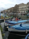
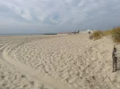
In September 2018 I left Arles and headed west. In Monpellier I met a fellow who suggested a "walk on the beach" and because of that remark the next morning I headed south to Sete (which is a very lovely city, by the way) and the next day set off for Agde following the beach. It was hot and almost surreal as there was rarely a soul walking. This was September 10 and as one of the municipal workers said to me "you're lucky because 2 weeks ago there were a million people here".
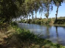
From Agde I followed the Canal du Midi to Carcassonne which was were I would have ended up had I stayed on the Chemin which on my map is marked as a red dashed line rather than the solid blue which is the main Chemin.
I had the FFRandonnee guide Le Chemin du piemont pyreneen which was indispensible.
It is a beautiful walk and if you enjoy being by yourself you will daily be rewarded. There were "clumps" of pilgrims in a few places such as Lourdes (30,000) and Oloron- Ste-Marie (19). Those were all headed for Col du Somport as they wanted to knock it off before winter set in.
There is another small guidebook put out by the regional Amis but I can't seem to put my finger on it at the moment.
bon chemin
 

Attachments

  • IMG_7529.webp
    IMG_7529.webp
    464.3 KB · Views: 17
  • IMG_7543.webp
    IMG_7543.webp
    433.5 KB · Views: 10
  • IMG_7563.webp
    IMG_7563.webp
    1.2 MB · Views: 8
  • IMG_8110.webp
    IMG_8110.webp
    235.1 KB · Views: 15
Ideal pocket guides for during & after your Camino. Each weighs only 1.4 oz (40g)!
Hello Tom
In September 2018 I left Arles and headed west. In Monpellier I met a fellow who suggested a "walk on the beach" and because of that remark the next morning I headed south to Sete (which is a very lovely city, by the way) and the next day set off for Agde following the beach. It was hot and almost surreal as there was rarely a soul walking. This was September 10 and as one of the municipal workers said to me "you're lucky because 2 weeks ago there were a million people here".
From Agde I followed the Canal du Midi to Carcassonne
That's one of the more important variants of the Arles Way, as following that canal eventually leads you to Toulouse. It's a good option for cyclists.

Though it's better (and more traditional on that route) to continue as far as Béziers from Agde. The city itself is a bit dodgy for its street denizens, but there's a great donativo Albergue there, and the hospitality from bars and restaurants is fine.

And it's a way to get onto the Piémont route as you suggest, by whichever variant you prefer.
 
Hi Richard - many thanks for describing your route - the Canal de Midi looks a viable option in the way you describe. And thanks to your prompting I had another look for guide books in print and found that GR78 Topo guide in stock - and in the UK! It starts from Carcassonne, so if I decide to use the MM Dodo guide for the Tolosana from Arles, I'm nearly all joined up...

As for maps, I always recommend mapy.cz -- both the website version and the app with its free downloadable offline maps, for desktop, tablet, smartphone. The outdoor activities tab shows most hiking routes (worldwide), with special emphasis give to the Camino ones.
JP, mapy.cz is a revelation! I'd always gone to OpenStreetMap when I've needed a map reference. It looks v similar but mapy has the caminos and other walking routes in the 'outdoors' overlay (that I hadn't been able to find in OSM). I've just 'walked' the cross-over options from Tolosana to Piemont. I can see good possibilities for going onto the Canal du Midi at Labastide d'Anjou, then SE 10k to Castelnaudary, further 10k to Villepint, then leave the canal going south on a path called 'Tour du Lauragais' for 12km right into Fanjeaux.

Joan - perhaps with your on-the-ground knowledge you can confirm whether 'Tour du Lauragais' is an actual way-marked path please?

Muchos Gracias /Merci Beaucoup to all of you! :):):)
 
Tom:
From Villepinte to Villasavary the path is the GR7. It will be marked (balisage) with the standard GR markings. But I will pop by shortly and have a look where it takes off from the canal and verify that it is actually marked - can’t envisage whether it is - though I remember there is a particularly nice example, well preserved, of a Lavoir (where the women used to come to do the laundry) at that Villepinte sector of the canal.
This link below:


has an excellent map (under GR7 in the yellow box - Carte des Randonnées pédestres.)
Gives places to stay etc etc

Anyway it’s a straightforward sector from Villepinte to Villasavary - which also according to the map is way marked with GR signs. Much less complicated than the route I was trying to send you on through the Collines du Vent (hills of wind). But less pretty too!

And once you get to Villasavary cross down to the football pitch (south side of « the main road» which bisects the village) There should still be the large map posted there of all the walking loops around the village - including the route up to Fanjeaux. Villa has a hugely active walking club and in recent years they have added loops to loops in the vicinity. A friend who lives in the village complains she now gets lost and takes wrong turns trawling through the loops!
But Fanjeaux is situated high up above Villasavary and the church is very visible from most-many places - only have to head upwards really with an eye to the church.
Another route is by the direct, steep (tarred) Roman road which goes almost straight up from the roundabout at Prouilhe (- fork right a few 100metres past the roundabout to avoid following the truck route to Andorra). Roundabout is a couple of kms on road out of Villa to Fanjeaux. (Longer walk as it is essentially 2 sides of a triangle)
St Dominique’s home in Fanjeaux is just by the 13C church which houses the miraculous burnt beam - from his time debating the Cathars (contrary to popular opinion/belief Dom had moved on to Rome when the pillaging and slaughter of the Cathars started, followed by the Inquisition etc - all tacked into the Albigensian crusades. (Obvious I am not a historian! Just sayin’!).
Check out also Seignadou lookout - over the Lauragais in Fanjeaux - Dom saw tongues of fire from here and established a nunnery at the spot at Prouilhe - Cathars saw women as equal and I guess it was canny to establish a Catholic counterpoint as soft power while the debates and philosophical duels took place).
Later, Catherine de Médicis had dibs on the Lauragais plain which you see from Seignadou and her «Albergue « - relatively modest indeed - is now privately owned in centre of village.
Two possible places to stay - (1) The Belvedere and (2) The Dominican nuns in centre of village ( 4/5 left in a fabulous old nunnery) at least they used to receive pilgrims, but perhaps no longer.
Outside the village leaving Fanjeaux (on the chemin a few km) is a well appointed campground with a lake - run by Luc and Nadine Vialaret. They also run a sheep dairy providing milk to ship to Roquefort - for the cheese caves. English spoken.
Also, if and when you are in the general region and you are so inclined - (and if I am home - am stepping out soonish I hope) - PM me for at least a bowl of cassoulet and a glass or two and a camino chat.

Anyway - after that ramble you are probably thinking - be careful what you wish for!
Bon chemin!
 
Join the Camino cleanup. Logroño to Burgos May 2025 & Astorga to OCebreiro in June
Hello @peregrino_tom
The GR 36 intersects with le Voie d'Arles roughly 12 kilometers after Anglés (one stage before Castres). From this point, the GR 36 will bring you to Mazamet, then over le Pic de Nore (splendid views) to Pradelles-Cabarde, after which one walks via Villegly to Carcassonne. I walked this way in August (2021).

On reflection, it would be best to stop over in Villegly rather than walk from Pradelles all the way to Carcassonne as I did.

Accommodation
*Anglés :
Gîte d'étape
Mairie d'Anglès sur Tarn
81260 Anglès sur Tarn
Tél : 05 63 70 97 19

*Mezamet
l'office de Tourisme: contacts

*Pradelles-Cabarde
Gîte d'étape (currently closed)
Camping and snack bar by the Lake
Chambre d'hôte
Epicerie van
[I enquired locally and was offered an empty apartement opposite chez Madame who sells apples and confiture.]

*Carcassonne
Auberge de Jeunesse
Couvent de ND (currently closed due to Covid)

The trail: https://www.gr-infos.com/gr36n.htm

gr36n-min.jpg
 
Last edited:
Joan, as we say in Australia (and maybe elsewhere) ‘you’re a legend!

Tom has eyes and ears on the ground with expert advice for his upcoming walk 😀
 
Well, wow, what can I say?
Actually, I'm blowing cold on this now, as, along with some doubts about COVID, and related reduced accommodation options and confusion about QR passports (as I am an infrequent smartphone user) I find now I can't get the ToPo guidebook. The shop here advertising it says you can buy it, but then further down says it is expected to arrive in December...
Some French sellers have copies of the previous edition, but that was published 2017, so will have info updated no later than 2016. I'm inclined to wait, even though cassoulet, vin and good conversation is out there, beckoning...But we'll see.

Either way, you/we have created a great resource here. And I think I can make the time to get to it next year.... that said:

Joan, thank you. Actually I'm about two posts behind you... since using mapy.cz I discovered the Collines du Vent path - and it does indeed look an excellent pastoral option - better than what I came up with, if it is decently waymarked.

LK - thank you! - great that you've just walked this. That hilly Noire region looks interesting. And I've never been to Carcassone, so cutting over earlier creates that opportunity. I've just had a skim of your input on the Vois Catalane thread.
Awesome.
While I obsess about the difficulties of walking at this time, you just pack a bedroll and get on with it! But I know my mental constitution at least, isn't tough enough to walk almost into the unknown each day, like you do. In my own very modest way I'd be Newby to your Thesiger (if you know A Short Walk in the Hindu Kush?)
Cheers, tom
 
A selection of Camino Jewellery
Well, wow, what can I say?
Actually, I'm blowing cold on this now, as, along with some doubts about COVID, and related reduced accommodation options and confusion about QR passports (as I am an infrequent smartphone user) I find now I can't get the ToPo guidebook. The shop here advertising it says you can buy it, but then further down says it is expected to arrive in December...
Some French sellers have copies of the previous edition, but that was published 2017, so will have info updated no later than 2016. I'm inclined to wait, even though cassoulet, vin and good conversation is out there, beckoning...But we'll see.

Either way, you/we have created a great resource here. And I think I can make the time to get to it next year.... that said:

Joan, thank you. Actually I'm about two posts behind you... since using mapy.cz I discovered the Collines du Vent path - and it does indeed look an excellent pastoral option - better than what I came up with, if it is decently waymarked.

LK - thank you! - great that you've just walked this. That hilly Noire region looks interesting. And I've never been to Carcassone, so cutting over earlier creates that opportunity. I've just had a skim of your input on the Vois Catalane thread.
Awesome.
While I obsess about the difficulties of walking at this time, you just pack a bedroll and get on with it! But I know my mental constitution at least, isn't tough enough to walk almost into the unknown each day, like you do. In my own very modest way I'd be Newby to your Thesiger (if you know A Short Walk in the Hindu Kush?)
Cheers, tom
Hi there, @peregrino_tom
No, I hadn't heard of Newby but I've just looked him up on Wikipedia. What an interesting fellow, what a crazy adventurer! He's definitely outside my league, though. I'm still following signed trails, ha ha!

'A Short Walk in the Hindu Kush' looks like a fun read. Thanks for mentioning it.

re the Topoguide for GR 78. I walked this route in May, 2017 without a Topoguide. I relied on the red + white GR signs, information gleaned at tourist offices along the way, and a pdf obtained from the ACIR office in Toulouse. Here's a link to the ACIR pdf of Voie de Piemont 2021. There were a couple of places where I missed the signs and went on a grand detour. [Edit: Sign confusion after Saint Bertrand de Cominges ; Sign confusion 10 minutes after Montserié. There are several trails in these two areas and I got bamboozled. An IGN map, guide book or Topoguide would have helped, Lol]


Most evenings I met up with pilgrims walking la Voie du Piémont which spends more time on asphalt and is a little less strenuous than the GR 78. We discussed and compared trails. I think there were two or three guide books available for la Voie du Piémont at that time. The others were using these. The two trails coincided at the end of most days.

*Here is another useful document for Voie du Piémont-Pyrénéen:
'Livret des Haltes-Saint-Jacques', edition 2021

*ACIR Compostelle: office hours


Cheers
Lovingkindness

GR 78, May 2017.
Gr 78 May 2017r.jpg
 
Last edited:
Hi LK,
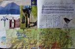
Firstly - thanks for all the info above - and that's a wonderful collage! I'd not heard of 'The Tall Blond Man with One Black Shoe' and it's hypnotic theme tune - do you whistle this as you walk? I see on youtube someone has commented 'Put this music on whenever you have to tell a long, convoluted story.'
Secondly, merci beaucoup for those links to the two guides - that's brilliant. Maybe one of them is the 'Amis' guide that Richard P mentioned above, that he couldn't lay his hands on.

The one thing that's confusing me is when you say you met up most evenings with people walking the Voie to Piemont as opposed to the GR78. This is the first time I've heard that there might be two paths running alongside each other. I can only see one path on mapy.cz - and that tallies with the Voie du Piemont Pyrenean. And, Pyrenean seems to feature in all the names of the guidebooks. Have I misunderstood something very basic here?
Many thanks, tom
 
Bonjour, @peregrino_tom

'Le Grand Blond avec une Chaussure Noir' is a classic French film, a must-see for any francophone. I was practicing the flûte-a-bec in a garden somewhere along le Voie du Piémont. The owner of the gîte insisted I learn the theme tune. He thought I'd make a hit with it on the streets!

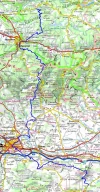
Here is a map of the GR 78.

Whilst the Chemin de Saint Jacques/Voie du Piémont often coincides with the GR 78, it sometimes takes a less demanding trail or side road to arrive at the same villages.

The maps in The LEPERE guide, for example, show alternative trails using blue or red dots.

Happy planning!
-Lovingkindness
 
The focus is on reducing the risk of failure through being well prepared. 2nd ed.
Tom- Just for the sake of completeness:
Had popped over yesterday to check the piece of the GR7 you mentioned earlier as being of interest to you - that is Villepinte to Fanjeaux.
Very well signed - every 3rd to sixth Telegraph pole is marked and there are also subsidiary local signs.
(For context - I mislay myself regularly - especially in French forests - but also can manage to do so anywhere and everywhere - eg having invited myself for a cup of tea to Rebekah and Paddy’s - I had first to be reflected back off the wrong road by a passing local in a car and then, later, was rescued by Rebekah, Paddy and dogs who were wondering what had become of me!!
But would have no problems on this part of the GR7 at least!
Yeah Jenny, legendary alright!!
 
This is the first time I've heard that there might be two paths running alongside each other. I can only see one path on mapy.cz - and that tallies with the Voie du Piemont Pyrenean.
mapy.cz is good, but it is still far from being an exhaustive catalogue of all waymarked and non-waymarked trails.
 
Had popped over yesterday to check the piece of the GR7 you mentioned earlier as being of interest to you
Hi Joan, thank you - that's very kind of you and good news too. I hoped you enjoyed the investigation!
You know, you are on a slippery slope now towards opening your own pilgrim Gîte... ;)

PS re finding the Peaceable Kingdom - although Moratinos is only a hamlet I don't recall any actual signage when I visited in 2015. By that point in the journey our brains have reprogrammed themselves to respond primarily to signs and arrows rather than instructions - so completely understandable!
 
€2,-/day will present your project to thousands of visitors each day. All interested in the Camino de Santiago.
Hi Joan, thank you - that's very kind of you and good news too. I hoped you enjoyed the investigation!
You know, you are on a slippery slope now towards opening your own pilgrim Gîte... ;)

PS re finding the Peaceable Kingdom - although Moratinos is only a hamlet I don't recall any actual signage when I visited in 2015. By that point in the journey our brains have reprogrammed themselves to respond primarily to signs and arrows rather than instructions - so completely understandable!
Yeah well maybe not - re gîte!
But please check am I ‘chez nous’ when/if you pass through my general neck of the woods - not too many forum pilgrims pass around here - and would like to walk a stretch with you.
Though PS am an old bat and walk slowly!
 
Hi Joan, well the odds are diminishing for a walk this season, but I'm looking forward to catching up with you on this at some point, hopefully next year...
Then when the Arles-Piemont link-across starts 'trending' you'll be inundated.. ;-)
 
OK, an update on the reason for my first post on this thread...
Recently an excellent pilgrim I met a few years ago has said he'll walk the Arles route later this year. I've been invited to join him. I have plenty of good reasons why it's not the right time to do this, but nonetheless I've been sucked into the planning process...
My camino friend actually started out from Arles yesterday. He (I think) has the right guide books now and also Mapy.cz on his phone - though some technical teething problems with that at the moment.
He plans to do the switchover we worked out above. So he'll move onto the Voie du Piemont when he reaches the Canal du Midi. And Joan is going to shepherd him through that :)
Cheers everyone for your earlier input.
 
Join the Camino cleanup. Logroño to Burgos May 2025 & Astorga to OCebreiro in June

❓How to ask a question

How to post a new question on the Camino Forum.

Featured threads

❓How to ask a question

How to post a new question on the Camino Forum.

Featured threads

Forum Rules

Forum Rules

Camino Updates on YouTube

Camino Conversations

Most downloaded Resources

This site is run by Ivar at

in Santiago de Compostela.
This site participates in the Amazon Affiliate program, designed to provide a means for Ivar to earn fees by linking to Amazon
Official Camino Passport (Credential) | 2024 Camino Guides
Back
Back
Top