Search 74,075 Camino Questions

New route from O Barco to A Rua

Glenshiro

Veteran Member
Time of past OR future Camino
Le Puy - SdC, Podiensis, Frances, Invierno 2012-23
Just idly checking the route on Mapy.cz and discover that the route from O Barco to A Rua has been moved south of the river Sil. When did this happen?
 

Attachments

  • 1732893782200.webp
    1732893782200.webp
    195.1 KB · Views: 711
Last edited:
Fail to prepare? reduce your risk by buying this book full of practical info.
2nd ed.
€2,-/day will present your project to thousands of visitors each day. All interested in the Camino de Santiago.
True (who is?) but I wonder who altered it in Mapy.cz (which I use a lot and usually find very reliable.)
That is an interesting question. Where does Mapy.CZ get its Trail information? Or all the other navigation apps?

I vaguely remember reading something about the Geo information coming from one or a few sources. Obviously, the people at the individual apps aren't going out with surveying and tools and mapping the entire planet…?
 
I walked this route in September. I followed the Brierley guide which took us to the left of the river which is the south side.
The guide book was the 2022 edition. Any change to the route must have been before 2022.
 
Well, thanks, that's interesting. I walked the (waymarked) route in June 2022 on the north side of the river. Anyone walk it later that year? Have the mojons on the north been removed, I wonder?
 
€2,-/day will present your project to thousands of visitors each day. All interested in the Camino de Santiago.
The 2024 Camino guides will be coming out little by little. Here is a collection of the ones that are out so far.
I walked on the south side of the river, but only because I wanted to go to the Pazo and the waterfalls. The arrows were pointing straight ahead along the river as I turned off to cross. I walked in spring 2024.

I described what I did on this thread.

@jungleboy did sort of the same thing, but cut a few kms off at the end. He described it here.
But if you’re going to cross the river anyway, it seems a shame to miss the waterfalls and the pazo, it was a really nice alternative.
 
Well, thanks, that's interesting. I walked the (waymarked) route in June 2022 on the north side of the river. Anyone walk it later that year? Have the mojons on the north been removed, I wonder?
Reading the guide book I now see that the left hand side of the river is an option. It was of course a no-brainer. The left side of the river was a beautiful walk and fully marked. The other side followed the N12 for most of the way.
 
Get a spanish phone number with Airalo. eSim, so no physical SIM card. Easy to use app to add more funds if needed.
There are offiicial mojones are on the North side, but I don't know about the South side.
There weren’t as of June 2024, but the south side trail is part of other walks so it is signed.

Edit: signed for those other walks, not specifically for the Invierno.
 
Last edited:
3rd Edition. Vital content training & pack guides avoid common mistakes, bed bugs etc
I guess that means that I'll have to repeat the Invierno. 😊
My thoughts exactly!

I see that Gronze still sticks to the north side, Wise Pilgrim shows the southern route but without comment. Haven't checked anyone else. Looks like a good choice, though.
 
Last edited:
Just idly checking the route on Mapy.cz and discover that the route from O Barco to A Rua has been moved south of the river Sil. When did this happen?
Maybe everybody here knows all about this, but it's new to me.
Thanks for the indulgence.


I was interested in your question and how something like that could be changed. It seems Mapy.cz uses data from OSM or Open Street Maps , which is a crowd sourced mapping.

There's quite a lengthy, Wikipaedia entry on it explaining how it works. So what happened, probably, is some user uploaded new data to change it.

I have no idea if this is better data or not, but the Wikipedia article points out that vandalism is a problem!
Most likely someone was just trying to improve the situation, but I could also quite easily see someone changing a hiking route so that it goes next to their café, for instance.

On the OSM website, it gives you an option to sign up, so you can use their software and start uploading data.

I also suspect, if you were interested enough, you could sign into OSM and find out which user changed it.
 
Last edited:
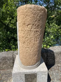
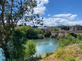
I have looked at about 12 wikiloc tracks for that stretch, all of which were recorded in the last 3 months, and all of them except for one stays on the north side of the river. The one that goes on the south side is entitled “alternativa sur.” It goes to the Pazo de Arnado but does not ascend to the waterfalls. It also stays on the south side of the river to Petín, a little town that is actually a bit to the west of A Rúa but has a Roman milario and an old bridge. That bridge takes you into what I would call “lower” A Rúa, very close to Pensión Fabio.

My sense is that the “official” Camino is still the one on the north side of the river, but for those who like alternatives and nicer walking, the south side would be the way to go. The options there would be

1. Stay low on the south side, as this wikiloc trail does, continue on to Petín and cross the river into A Rúa near the Pensión Fabio. 16.4 km, hardly no elevation.

2. Stay low on the south side until the dam over the river at Valencia de Sil, where you will rejoin the north side for the final stretch into A Rúa, including the off-road option recently signed. This would have virtually no elevation and would also be a few kms shorter, because you would come into A Rúa from the east side (on the official camino) rather than the west side.

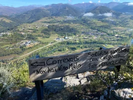
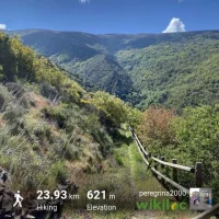
3. Take the longer alternative on the south side, past the Pazo de Arnado and then up to the fervenza (waterfalls). It is a lovely walk, with great views down to the river, and through a maze of small family vineyard plots. You will probably find people out there working who are happy to chat and describe how they provide their family with their yearly wine stash from these vines. At that point, when you get to the Village of Correxais (populated by only very nice people, it seemed to me!), you can either head down on an untraveled road to the dam at Valencia de Sil and continue on as in option 2, or do what I did and stay up high on a marked trail that winds around and eventually takes you into A Rúa over the bridge from Petín (on the south side). My wikiloc tracks show that was 24 kms and about 600 total m elevation gain. Going straight down to Valencia de Sil from Correxais would cut serveral kms off.

I know many people like to stay on the camino and will view these alternatives as unnecessary distractions, but especially for those who have already walked the Invierno before, these alternatives may make things more enjoyable.

And a quick p.s. - For anyone who wants to stay in either the albergue in Xagoaza or Vilamartín, you have to stay on the north side, on the official camino, or you will have a lot of backtracking!
 
Last edited:
3rd Edition. Vital content training & pack guides avoid common mistakes, bed bugs etc
a point that is actually past A Rúa but has a Roman milario and an old bridge.
Ooooo. And I missed that?! OK. That does it. I have to walk the Invierno again.

Edit. Your photos on wikiloc are very enticing, Laurie. That's a huge difference from the North side of the river!
 
Last edited:
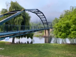
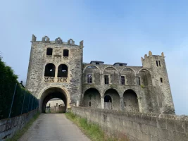
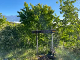
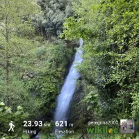
Some pictures from the south side alternative:

Take this pedestrian bridge over the river
IMG_2942.webp

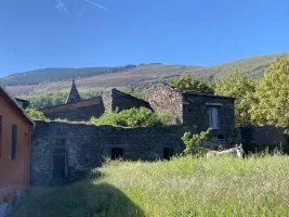
Through this abandoned pazo
IMG_2950.webp

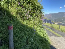
Follow signs to the waterfall
IMG_2969.webp

Enjoy the waterfall (you can get a lot closer, but I didn’t want my phone to get wet).

IMG_3042.webp

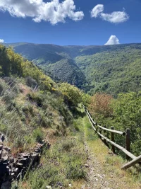
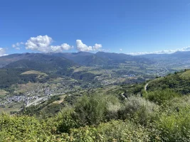
Continue along the ridge to Correxais with nice views down to the river and over the hills
IMG_2984.webp IMG_3045.webp

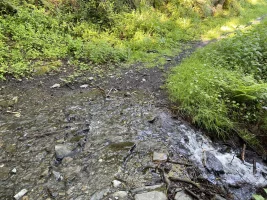
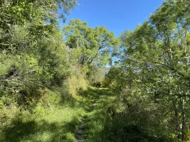
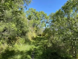
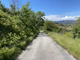
Along a nice wooded and grassy trail, which may be muddy.

IMG_1941.webpIMG_1932.webp

Through Correixas and onto a camino natural


IMG_1934.webp IMG_1935.webp

Since I have a 10-photo limit, this will be continued on another post.
 
A selection of Camino Jewellery
The Camino Natural winds around through the hills,
A big difference from the other way, with marvelous views! (Though I have to say one highlight of the Invierno for me happened along the train tracks before A Rua, when I waved at a train driver and got a train horn bast in return. No trains up there in the hills!)
 

❓How to ask a question

How to post a new question on the Camino Forum.

Most read last week in this forum

Hello fellow pilgrims, I am currently working on my Bachelor thesis, which focuses on the Camino de Invierno. To support my research, I need insights from other pilgrims about their experiences...

Featured threads

❓How to ask a question

How to post a new question on the Camino Forum.

Forum Rules

Forum Rules

Camino Updates on YouTube

Camino Conversations

Most downloaded Resources

Featured threads

This site is run by Ivar at

in Santiago de Compostela.
This site participates in the Amazon Affiliate program, designed to provide a means for Ivar to earn fees by linking to Amazon
Official Camino Passport (Credential) | 2024 Camino Guides
Back
Top