• ⚠️ Emergency contact in Spain - Dial 112 and AlertCops app. More on this here.
  • Remove ads on the forum by becoming a donating member. More here.

Search 74,075 Camino Questions

The Difficult Option - Report

Vilbol

New Member
Time of past OR future Camino
Primitivo, Finisterre, Muxia, San Salvador
Hello all, I have just recently returned from the Primitivo which I finished after doing the San Salvador.

I completed the Salvador in early September '24 so this information may well have changed somewhat especially given changes in weather over the last couple of weeks as we go into Autumn.

To the 'difficult option'! After the village of Llanos De Someron (I believe this is on the stage begining in Pajares) there is an option to take the right hand road down into the valley, the 'easy' way which I believe is all asphalt. You can also go left, taking a dirt track up onto the mountainside, the 'difficult option'. This is about how I found the difficult option.

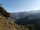
I am an experienced hiker, particularly in mountains and the weather was looking good. So I naturally took the 'difficult' option. I believe they are both the same distance but this option takes longer due to the terrain with lots of ascending and descending. The route at first is easy. Countouring along the mountainside through sub-alpine vegetation which is overgrown in places, but there is a clear path and spectacular views, at this point it is a steady incline.

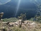
Eventually you come to a kind of 'turning' point with drastic steapening of the trail as you turn left, up and over some bluffs, crossing contours instead of following them, before descending into the forest below. At this point (distracted by the beauty) I lost the arrows which are not exactly numerous.

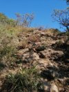
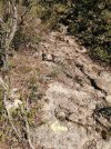
My problem was that a few nights before (I discovered later that evening from another pilgrim) heavy weather had come through and blown out much of this upper section of trail. I believe there was once a chain up here but there is none now, a few metal stairs instead but very worn, be prepared to get your hands on rock and do a little bit of scrambling. As well as the condition of the trail and the lack of arrows, mountain goats had made significant paths in the trees above the bluffs. One of these I followed for around 20 minutes, getting steeper and steeper through denser vegetation. I left my rucksack (very hard to move up there with it on) and proceeded without it to get the lay of the land ahead and found myself at the top looking right down to the valley floor. The Way it was not.... Descending again, using trees as anchors, I found the last recogniseable point and after some searching found a buried arrow pointing in the other direction.

Now the goat paths looked the same as the contour trail and with few arrows it made sense to use them. They also, to begin with, followed the true direction of the route according to my prior research. After discovering my mistake, and finding the arrow, I tried my best to block off the goat paths with branches and make new arrows with branches and rocks while also cleaning up the existing one.

Further on (towards the end of the diversion), near the bottom before you again join up with the village below and the road, there are only 1 or 2 arrows. Again here I took a wrong turn. The Way is not clear at all but I was lucky enough to run into a shepherd who I was able to ask for directions. In the village there is a fountain to freshen up in.

So, yes. The top section is difficult and if you're new to hiking, alone and not experienced, or just not feeling confident I would 100 percent take the 'easy' lower road. That being said, despite my mistake in losing the trail, the difficult option is absolutely beautiful and a real treat to walk on. I was alone and felt like I had the mountains all to myself, it remains my favourite day on the Salvador despite making it harder for myself. A great little adventure!

But my warning really is, ask the locals how they think the trail is going to be before heading up AND, really take your time (in the top section) in looking for arrows and the correct route. Don't trust the goats and don't let the beauty distract you from navigation. Otherwise I recommend the 'difficult' option very highly! It is truly a gem on the Salvador.

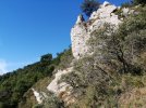
Some pictures attached of the top section for a bit of reference. It is steep but it is beautiful.
 

Attachments

  • dif 1.jpeg
    dif 1.jpeg
    657.4 KB · Views: 495
  • dif 2.jpeg
    dif 2.jpeg
    262.7 KB · Views: 117
  • dif 3.jpeg
    dif 3.jpeg
    803.2 KB · Views: 111
  • dif 4.jpeg
    dif 4.jpeg
    507.4 KB · Views: 114
  • dif 5.jpeg
    dif 5.jpeg
    669.1 KB · Views: 118
Get a spanish phone number with Airalo. eSim, so no physical SIM card. Easy to use app to add more funds if needed.
interesting. Sorry for all your troubles but this is now a good option for my future "first" Camino...
 
interesting. Sorry for all your troubles but this is now a good option for my future "first" Camino...
I highly recommend it! It really is a beautiful and quiet route and easily doable in 5 or 6 days. Another point; some places in the middle (when there is basically only one option for bed/food) require pre-orders for dinner the day before (something I found out too late). Don't be afraid to carry extra food or water.

Great to link into Primitivo too if you're thinking of it. Take a rest day in Oviedo and get used to being around humans again!
 
Holoholo automatically captures your footpaths, places, photos, and journals.
Thank you for taking the time and the trouble to do your best to block off the goat’s path and tidy up the existing marker. Always reassuring to come across a Pilgrim made arrow or two, especially when not sure of the way. ¡Muchas gracias!
 
The focus is on reducing the risk of failure through being well prepared. 2nd ed.
Also, many thanks for the detailed advice. Heading there next May, and will be taking the easy option!
Yes, everyone else I met on this last Camino took that 'easier' way. I was ahead of them in the morning, but saw them far ahead of me in the afternoon!

Hope you enjoy the Salvador, it is a really great walk!
 
WOW! What an ordeal. Thanks for the heads up. That is the Munisteriu route. I will forward your experience to Jose Antonio Cuñaro aka Ender who is the guy who recovered and keeps and loves this Camino.
Thanks for giving the actual name of that route! I think much of the ordeal was of my own making, the rest I can blame on goats and the weather. I think good preperation and some local knowledge is key for this detour. It is well worth the effort though.
 
Hello all, I have just recently returned from the Primitivo which I finished after doing the San Salvador.

I completed the Salvador in early September '24 so this information may well have changed somewhat especially given changes in weather over the last couple of weeks as we go into Autumn.

To the 'difficult option'! After the village of Llanos De Someron (I believe this is on the stage begining in Pajares) there is an option to take the right hand road down into the valley, the 'easy' way which I believe is all asphalt. You can also go left, taking a dirt track up onto the mountainside, the 'difficult option'. This is about how I found the difficult option.

I am an experienced hiker, particularly in mountains and the weather was looking good. So I naturally took the 'difficult' option. I believe they are both the same distance but this option takes longer due to the terrain with lots of ascending and descending. The route at first is easy. Countouring along the mountainside through sub-alpine vegetation which is overgrown in places, but there is a clear path and spectacular views, at this point it is a steady incline.

Eventually you come to a kind of 'turning' point with drastic steapening of the trail as you turn left, up and over some bluffs, crossing contours instead of following them, before descending into the forest below. At this point (distracted by the beauty) I lost the arrows which are not exactly numerous.

My problem was that a few nights before (I discovered later that evening from another pilgrim) heavy weather had come through and blown out much of this upper section of trail. I believe there was once a chain up here but there is none now, a few metal stairs instead but very worn, be prepared to get your hands on rock and do a little bit of scrambling. As well as the condition of the trail and the lack of arrows, mountain goats had made significant paths in the trees above the bluffs. One of these I followed for around 20 minutes, getting steeper and steeper through denser vegetation. I left my rucksack (very hard to move up there with it on) and proceeded without it to get the lay of the land ahead and found myself at the top looking right down to the valley floor. The Way it was not.... Descending again, using trees as anchors, I found the last recogniseable point and after some searching found a buried arrow pointing in the other direction.

Now the goat paths looked the same as the contour trail and with few arrows it made sense to use them. They also, to begin with, followed the true direction of the route according to my prior research. After discovering my mistake, and finding the arrow, I tried my best to block off the goat paths with branches and make new arrows with branches and rocks while also cleaning up the existing one.

Further on (towards the end of the diversion), near the bottom before you again join up with the village below and the road, there are only 1 or 2 arrows. Again here I took a wrong turn. The Way is not clear at all but I was lucky enough to run into a shepherd who I was able to ask for directions. In the village there is a fountain to freshen up in.

So, yes. The top section is difficult and if you're new to hiking, alone and not experienced, or just not feeling confident I would 100 percent take the 'easy' lower road. That being said, despite my mistake in losing the trail, the difficult option is absolutely beautiful and a real treat to walk on. I was alone and felt like I had the mountains all to myself, it remains my favourite day on the Salvador despite making it harder for myself. A great little adventure!

But my warning really is, ask the locals how they think the trail is going to be before heading up AND, really take your time (in the top section) in looking for arrows and the correct route. Don't trust the goats and don't let the beauty distract you from navigation. Otherwise I recommend the 'difficult' option very highly! It is truly a gem on the Salvador.

Some pictures attached of the top section for a bit of reference. It is steep but it is beautiful.
I should also add to this: When gaining the top and descending through the forest on the other side, there are some very steep rocky sections which I don't doubt will be slippy when wet, so take extra care in the rain.
 
A selection of Camino Jewellery
Hello all, I have just recently returned from the Primitivo which I finished after doing the San Salvador.

I completed the Salvador in early September '24 so this information may well have changed somewhat especially given changes in weather over the last couple of weeks as we go into Autumn.

To the 'difficult option'! After the village of Llanos De Someron (I believe this is on the stage begining in Pajares) there is an option to take the right hand road down into the valley, the 'easy' way which I believe is all asphalt. You can also go left, taking a dirt track up onto the mountainside, the 'difficult option'. This is about how I found the difficult option.

I am an experienced hiker, particularly in mountains and the weather was looking good. So I naturally took the 'difficult' option. I believe they are both the same distance but this option takes longer due to the terrain with lots of ascending and descending. The route at first is easy. Countouring along the mountainside through sub-alpine vegetation which is overgrown in places, but there is a clear path and spectacular views, at this point it is a steady incline.

Eventually you come to a kind of 'turning' point with drastic steapening of the trail as you turn left, up and over some bluffs, crossing contours instead of following them, before descending into the forest below. At this point (distracted by the beauty) I lost the arrows which are not exactly numerous.

My problem was that a few nights before (I discovered later that evening from another pilgrim) heavy weather had come through and blown out much of this upper section of trail. I believe there was once a chain up here but there is none now, a few metal stairs instead but very worn, be prepared to get your hands on rock and do a little bit of scrambling. As well as the condition of the trail and the lack of arrows, mountain goats had made significant paths in the trees above the bluffs. One of these I followed for around 20 minutes, getting steeper and steeper through denser vegetation. I left my rucksack (very hard to move up there with it on) and proceeded without it to get the lay of the land ahead and found myself at the top looking right down to the valley floor. The Way it was not.... Descending again, using trees as anchors, I found the last recogniseable point and after some searching found a buried arrow pointing in the other direction.

Now the goat paths looked the same as the contour trail and with few arrows it made sense to use them. They also, to begin with, followed the true direction of the route according to my prior research. After discovering my mistake, and finding the arrow, I tried my best to block off the goat paths with branches and make new arrows with branches and rocks while also cleaning up the existing one.

Further on (towards the end of the diversion), near the bottom before you again join up with the village below and the road, there are only 1 or 2 arrows. Again here I took a wrong turn. The Way is not clear at all but I was lucky enough to run into a shepherd who I was able to ask for directions. In the village there is a fountain to freshen up in.

So, yes. The top section is difficult and if you're new to hiking, alone and not experienced, or just not feeling confident I would 100 percent take the 'easy' lower road. That being said, despite my mistake in losing the trail, the difficult option is absolutely beautiful and a real treat to walk on. I was alone and felt like I had the mountains all to myself, it remains my favourite day on the Salvador despite making it harder for myself. A great little adventure!

But my warning really is, ask the locals how they think the trail is going to be before heading up AND, really take your time (in the top section) in looking for arrows and the correct route. Don't trust the goats and don't let the beauty distract you from navigation. Otherwise I recommend the 'difficult' option very highly! It is truly a gem on the Salvador.

Some pictures attached of the top section for a bit of reference. It is steep but it is beautiful.
Kudos for having the skills to get yourself out of a difficult situation(s) and also for letting panic take over. I, myself, I can guarantee you, would have gotten hopelessly lost as I have no sense of direction. Not to get dark here but I probably have had to be rescued. Glad everything worked out. It sounds like a great option for those that can persevere. Chuck
 
Kudos for having the skills to get yourself out of a difficult situation(s) and also for letting panic take over. I, myself, I can guarantee you, would have gotten hopelessly lost as I have no sense of direction. Not to get dark here but I probably have had to be rescued. Glad everything worked out. It sounds like a great option for those that can persevere. Chuck
Definitely worth the effort!
 
Thankyou for the stunning views which I missed when I took the easy route last year!!!
The Salvador was really beautiful crossing the axis of the Cantabrian mtns and standing under the Salvador cross ✝️👣
 
Ideal pocket guides for during & after your Camino. Each weighs only 1.4 oz (40g)!
Thanks so much @Vilbol for the report, I will be there in 3 days! Not sure if I want to attempt this as the weather looks interesting for the next several days.

Were you attempting to follow any GPS tracks?

Also, how did you find the route after Pola de Lena, where you have the forest option versus the paved option thru Villallana. Did you try this forest option?

Thanks again!
 
Thankyou for the stunning views which I missed when I took the easy route last year!!!
The Salvador was really beautiful crossing the axis of the Cantabrian mtns and standing under the Salvador cross ✝️👣
I concur, some stunning vistas to enjoy whether you took the easy way or not!
 
...and ship it to Santiago for storage. You pick it up once in Santiago. Service offered by Casa Ivar (we use DHL for transportation).
Thanks so much @Vilbol for the report, I will be there in 3 days! Not sure if I want to attempt this as the weather looks interesting for the next several days.

Were you attempting to follow any GPS tracks?

Also, how did you find the route after Pola de Lena, where you have the forest option versus the paved option thru Villallana. Did you try this forest option?

Thanks again!
Hi Elle. Great to hear you will be on the trail! With the 'difficult' option I would suggest making a choice on the day especially with an eye on the weather. Fuel up and hydrate well before you go and perhaps leave earlier in the morning than usual as it simply will take longer than the low 'easy' road. The whole day is a really nice walk regardless. Maybe time a visit to the UNESCO church further along as well (It was closed for siesta when I got there, so couldn't see inside). I was not using any GPS this day but it would certainly have proven useful to me. Yes, it IS difficult, but it is so worth it for the views, solitude and the beautiful trail.

Regarding the forest option after Pola. Yes, I did take it. The arrows will actually take you onto the forest trail automatically (turning under the highway to the right through an underpass, after the long towpath road between highway and zinc factory). It starts with a very steep climb. It was very overgrown and filled with spiderwebs and there are some steep sections within it too (I picked up a branch and used it for pushing through the vegetation) some areas have clearly been cleared with a strimmer though, mainly at the start and the end. You also end up by the highway anyway but you do get less highway. There are some interesting ruined buidlings along the way.

I made this last stage a long one and went straight to Oviedo from Pola (About 30-something KM). The rest of the route is mainly paved and you basically follow the river all the way to Mieres. After Mieres you will spend a couple of hours walking up the switchback road to the final highpoint before descending again through some forest sections. The last third is mixed paved, forest, rural and small villages before hitting the Oviedo outskirts. This last day was my least favourite due to the more urban settings and the extent of asphalt, plus, it rained for the entire day, but there are some really nice forested areas to walk through as well, which break up the highway/industrial sections. But that was just me! Other pilgrims really liked it, or stopped in Mieres after Pola to split it up.

Buen Camino and enjoy the mountains!
 

❓How to ask a question

How to post a new question on the Camino Forum.

Featured threads

❓How to ask a question

How to post a new question on the Camino Forum.

Featured threads

Forum Rules

Forum Rules

Camino Updates on YouTube

Camino Conversations

Most downloaded Resources

This site is run by Ivar at

in Santiago de Compostela.
This site participates in the Amazon Affiliate program, designed to provide a means for Ivar to earn fees by linking to Amazon
Official Camino Passport (Credential) | 2024 Camino Guides
Back
Back
Top