• ⚠️ Emergency contact in Spain - Dial 112 and AlertCops app. More on this here.
  • Remove ads on the forum by becoming a donating member. More here.

Search 74,075 Camino Questions

The Camino San Olav to Burgos -- 2016

peregrina2000

Moderator
Staff member
Now that Ivar has kindly set up a new sub-forum for the Camino San Olav, I am hoping it will get more attention. Reb and I walked it this past June, and I think that we would both issue full throated endorsements, but I will let her blog speak for her: http://moratinoslife.blogspot.com/2016/06/uphill-all-way.html

So, what is this Camino? It's about 60 km, and connects the little touristy town of Covarrubias to Burgos. There is a Spanish language brochure here that describes it: http://www.caminodesanolav.es/es/burgos/

I assume it originated as a way to increase visitors to this area and to cash in on the "camino" phenomenon, but its historical explanation is that it takes you to a church outside of the town of Covarrubias, where the government finally made good on a request made in 1258 by a dying princess from Norway who had been married to a brother of the king of Castilia. The lore surrounding it describes the cause of her death as homesickness, but in any event, 750 years later, the request was granted and a chapel dedicated to the Norwegian patron saint, San Olav, was created. The camino came soon after.

Before I get into details of stages, etc, you may be wondering why any pilgrims would ever head to Covarrubias. The answer is that pilgrims do go to Santo Domingo de Silos to see the monastery and attend vespers with the famous Gregorian chants. It's a short bus ride from Burgos, a detour from the Camino Francés. And Santo Domingo de Silos is about 13 km from Covarrubias, but I'll explain that later.

If you do visit Santo Domingo, which is well worth it, you have to decide how to get back to Burgos to continue on the Francés. There are three options. First, you can take the bus back, which is what the overwhelming majority of pilgrims do. Second, you can walk the last two stages of the Ruta de la Lana, which go to Mecerreyes and then into Burgos. But third, you can walk the three day Camino de San Olav, and you will be greatly rewarded!

The third option goes this way: Walk on the well marked Ruta de la Lana into Covarrubias. In Covarrubias, get off the Ruta de la Lana and start the San Olav. It's three days of mostly off road walking with some wonderful sights along the way and lots of natural beauty. Accommodation has to be planned in advance because there are not a lot of choices.

I got the idea from @alansykes, who walked a slightly different version of the route I will describe in another thread. @Viranani also has walked, and maybe there are others. But in any event, if this route appeals to you, I will be posting a day by day report of our experience, and I hope Alan and Vira will chime in with their experiences.

And if you are Norwegian, (I'm thinking of you, @alexwalker), you have an added incentive!

Buen camino, Laurie
 
...and ship it to Santiago for storage. You pick it up once in Santiago. Service offered by Casa Ivar (we use DHL for transportation).
In case that description tempts any of you, here's a day by day description of the walk I took with Reb in June 2016.

Day 0 -- In Santo Domingo de Silos

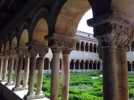
I had walked into Santo Domingo de Silos on the last leg of the Camino Castellano-Aragonés, which I have described here . I arrived well before Spanish lunch time, giving me a good leisurely afternoon to see the monastery and cloister,

silos7.webp


silos9.webp

If you are walking the Francés, though, and want to detour over to Santo Domingo, you will most likely be on the late afternoon bus that arrives in time for vespers. Since the cloister is only open for visits till 6:30 pm, you will not be able to visit the cloister if you take that 5:30 pm bus. Things are more complicated on Fridays, when the only bus is at 6:30 pm, because you won't get there in time for vespers either. And there is no bus on Sunday or Monday, so yes, this does require some pre-planning for those who want to take a bus out to Santo Domingo. You can see the full itinerary the bus makes here It's about a 55 km journey, which means that a taxi with four pilgrims would be in the 15 € per person range. For those who want to really have the time to visit the town, that's the best option, unless you want to spend two nights there.

There is an albergue for pilgrims walking and a number of hotels and hostales. Reb and I got a good last minute price on a hotel on booking, which put us in a hotel right across the plaza from the monastery. It was just fine.

In comparison to the difficulties and expense you may have getting into Santo Domingo, your way out is easy -- just walk.

Buen camino, Laurie
 
Last edited:
€2,-/day will present your project to thousands of visitors each day. All interested in the Camino de Santiago.
Thanks, Castilian, we saw many signs for the Camino del Cid, and though I haven't researched it, it seemed to me that the Camino del Cid was mostly an on-road version of the Camino San Olav. That may be harsh, but we frequently saw signs for the Camino del Cid that would just keep you on the road (though they were untraveled roads), whereas the San Olav took you off through agricultural fields that were lovely. I'll have to take more of a look at that option later. Buen camino, Laurie
 
If you are walking the Francés, though, and want to detour over to Santo Domingo, you will most likely be on the late afternoon bus that arrives in time for vespers. Since the cloister is only open for visits till 6:30 pm, you will not be able to visit the cloister if you take that 5:30 pm bus. Things are more complicated on Fridays, when the only bus is at 6:30 pm, because you won't get there in time for vespers either. And there is no bus on Sunday or Monday, so yes, this does require some pre-planning for those who want to take a bus out to Santo Domingo. You can see the full itinerary the bus makes here It's about a 55 km journey, which means that a taxi with four pilgrims would be in the 15 € per person range. For those who want to really have the time to visit the town, that's the best option, unless you want to spend two nights there.

An alternative to reach Santo Domingo de Silos is to take a bus from Burgos to Salas de los Infantes (several buses daily except on Saturdays when there isn't service). Salas de los Infantes is something like 20 kms away from Santo Domingo de Silos and you could take a taxi for that stretch. Buses from Burgos to Salas de los Infantes are operated by Therpasa: www.therpasa.es

Another alternative is to take a bus from Burgos to Lerma (with Alsa: www.alsa.es). They run daily and there are several buses per day (although service on weekends is more limited than the rest of the week). Once in Lerma, you could take a taxi to Santo Domingo de Silos (roughly 30 kms away).
 
The Camino del Cid have several routes. Most of the routes (as it the case with the stretch from Burgos to Santo Domingo) have a road option and an off-road option. In their web, they have detailed info for walkers, mountain bikers, road bikers and people making the route on a car or motorbike so you just have to click on your mode of transport to get all the relevant info.
 
Get a spanish phone number with Airalo. eSim, so no physical SIM card. Easy to use app to add more funds if needed.
Day 1 -- Santo Domingo to the intersection with the N-234. (30 km)

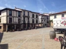
We followed the Camino del Cid to Retuerta, through the Monte. There is a bar there, open for business, and we had a café con leche AND a cold drink, such pampering. In Retuerta, we heard from locals that there were two options to get into Covarrubias, one was the "river route" and the other one went up through the vineyards. We decided to stay down by the Arlanza River. Even I, who am totally navigationally challenged, knew that since the river went into Covarrubias, we would not be lost. And we weren't. It was a nice walk, lots of shade an cottonwoods. In Covarrubias, we had another stop for cold drinks and got a glimpse of the squares, half-timbered houses, etc. Several small grocery stores so we got some snacks. There were several exuberant school groups there, which made things a bit more lively than the typical tourist. In the Tourist Office, we found a woman who knew absolutely NOTHING about the Camino San Olav, so you had better come prepared with your own route carved out. I had the gps tracks, which you can find here, here, and here. I would highly recommend having them, in fact, I think that without them we would have been tempted to turn back soon after the chapel to Saint Olav. But I know that @Viranani was just fine without them, so it depends on your cartographical instincts, I guess. Reb's are very good, mine are terrible.

Anyway, from Covarrubias we headed out on the Camino San Olav. If you look at my gps tracks for the first day, you will see that it would be very easy to cut over without going into Covarrubias. You would save a few kms, get more quickly to the church, but you would miss a nice stop.

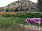
Opinions are varied on the design and feel of the Church to Saint Olav. You can see a picture here, because I didn't want to take one. It was closed. I noticed that on the turn-off from the road into the ermita, the sign indicating "Ermita de San Olav" had been modified to include the notation "Siglo XXI." My guess is that a lot of people took the turnoff expecting to see an old church and were not so thrilled.

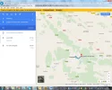
Anyway, from the church, it was actually hard for us to find the start of the trail (we had no problem going the 3 or so kms from Covarrubias to the church). The GPS took us over some plowed up fields, so maybe the route has changed since the track I had downloaded was made. But in any event it was a slightly difficult slog, but once we got on the trail we were ok. We got up to the top of a ridge and finally saw a marker, which indicated Quintanillas in one direction and Hortiguela (I THINK) in another direction. Again, if you look at the google map below while you're reading this, you can see what we did (though it isn't marked because that's above my pay grade) -- we took a steep downhill path (all cleared and fine for walking) which took us to the highway and the intersection of the N-234 with the white little road that goes into Quintanilla de las Viñas. The GPS tracks I had downloaded would have taken us to Mambrillas de Lara. In hindsight, looking at the map, it seems like it was not closer to go from the ridge to the highway the way we went, but we were starting to drag and guessed that it would be shorter. But in any event your first day will take you either to the highway spot or to Mambrillas de Lara.

Screenshot 2016-08-04 10.26.42.webp

So where to stay on that first night? I think you have at least three choices. In Mambrillas de Lara there is a casa rural run by a very kind woman, Ana, whose email is Ana Garcia a.garcialonso@hotmail.com. She will rent out to pilgrims if space is available in the Rincón del Alfoz. If not, she will put you in touch with a pension in Villaespasa, the Pensión Julia, whose phone number I believe @Viranani can supply.

We had a communication breakdown with Ana and only got through to her on the day before we were walking, and then it wasn't clear what she had in mind, whether she would be there, whether the casa was full, etc etc. So we moved to Plan B, which involved calling the Taberna Moruga in Hortigüela, which as you can see on that google map is a few kms down the road from Mambrillas de Lara. The owner came to pick us up.

It's a nice place run by a young couple, who opened up in the middle of the crisis and four years later are still there. I wouldn't say business is booming, but they had a respectable turnout and we had a really good dinner at about 9 pm -- cauliflower gratin, veal burger and ice cream. We had a few hours between shower and dinner, so we made the rounds in town and saw there is another bar where we had a drink, and a closed hotel.

The owner dropped us back off the next morning after breakfast, not till 8:30 since we wanted to visit the church at Quintanillas. So we had a leisurely sleep-in and a short ride in the van back to that place on the National highway where he had picked us up. This means that we did not ever go to Mambrillas de Lara, so for the purists out there, you could either walk on day 1 to Mambrillas or you could ask to be dropped off on day 2 in Mambrillas.

I can't comment on what we missed between Mambrillas and Quintanilla, but when @Viranani gets on, maybe she can help us out with that.

Anyway, if you think this day would be too long for you, you could easily stop in Covarrubias and enjoy the little town for the rest of the day. It is highly touristed and cutesy.

Buen camino, Laurie
 
The one from Galicia (the round) and the one from Castilla & Leon. Individually numbered and made by the same people that make the ones you see on your walk.
Don't know why but this Camino del Cid seems to me like going from Kamchatka to Tarifa (or any other distance for that matter) and you have plenty options to walk/ride it ;)
 
Don't know why but this Camino del Cid seems to me like going from Kamchatka to Tarifa (or any other distance for that matter)

It's not the same. There's history behind the Camino del Cid. You can get a salvoconducto to make it (similar to the Credencial of the ways to Santiago) and if you get the stamps required, an acreditative document (for more info about the salvoconducto and the acreditative document: www.caminodelcid.org/Camino_ElSALVOCONDUCTO.aspx).
 
...and ship it to Santiago for storage. You pick it up once in Santiago. Service offered by Casa Ivar (we use DHL for transportation).
Thanks, Laurie, for this thread--I cannot agree more with your recommendation!!
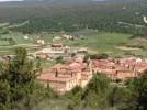
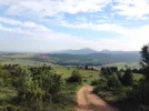
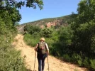
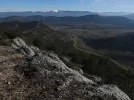
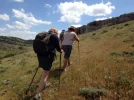
And I'll answer your rhetorical question by attaching a couple of pictures that say more than words could.

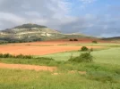
There's so much to recommend--patrimony, natural beauty, history, solitude--and I'm afraid the 3 days between SDsS and Burgos have spoiled me permanently. It was glorious, and a landsacpe that begs to be explored slowly and on foot...such a goldmine--going from deep prehistory (dinosaur footprints) to recent times (a set from a Hollywood western, for those who get off on such oddities).

There are various possibilities of one-way walks or out-and-back loops to SDdS from Burgos using the Lana/St Olav, the Camino del Cid, or the GR82.

The waymarking made for some interesting off-route wandering so I'd completely agree that a GPS or a good topo map would be very useful. It sounds like a GPS would also help to avoid all the road-walking that I did on day 2--I mostly failed to find the off-road route you did!

Look forward to reading your reflections, Laurie, and to perhaps wandering this way again. If I do have such good fortune, I'd probably pass on the 'hermitage' near Covarrubias (which looks a bit like a derelict mine) and instead visit San Pedro de Arlanza just up the road, perhaps stretching the journey out to 4 days by zig-zagging here and there off route.
 

Attachments

  • Santo Domingo de Silos to Covarubbias on GR82 (3).webp
    Santo Domingo de Silos to Covarubbias on GR82 (3).webp
    196 KB · Views: 30
  • On the Camino St Olav.webp
    On the Camino St Olav.webp
    90.6 KB · Views: 29
From Santo Domingo de Silos
There are at least 2 ways out of SDdS, both signposted to Covarrubias. One is the Lana/del Cid that Laurie took, and the other is the GR82. I took the latter by mistake--following a simple arrow with GR82 on it at the top of the main street that passes the Casa Guzman.

This is a glorious but longer alternative to the 18km on the Lana--and one that goes pretty close to the monastery at San Pedro de Arlanza if you wanted to visit there. It also goes right by (of all weird things) the reconstructed cemetery set from The Good the Bad and the Ugly. But: If you're not staying the night in Covarrubias, it's a loooong detour on top of an already long day. So the tracks that Laurie mentions are worth paying close attention to here!

From Covarrubias
From the hermitage, the route was not well marked, indeed! The trick is to back-track to a road that turns off to the left right before the hermitage; follow it along the sides of the fields, and as it swings to the right heading up the little ravine.
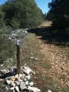
There are no waymarkings of any note until the top of the hill, where the path meets the 2-track coming directly up from Covarrubias. There were dedicated posts near this intersection. If you find yourself going up the hill past little piles of scree, you are on the right path.
A bit farther along from here the path from the hermitage meets the 2-track, there is the intersection that you mentioned, Laurie; to Quintanilla direct (your route) take the Left fork to GR82, to Mambrillas take the right one:

I dithered there a bit. The signposting was confusing--I knew I didn't want to go all the way to Hortiguela and there as no mention of Mambrillas, where I was headed. So I went left and ended up hoofing it down the road at the end of a long day...

[And long after it was any use to you, Laurie, I finally found the card for the place where I stayed in Villaespasa; it was a lovely pension, and the proprietors were incredibly helpful, picking me up at Mambrillas and taking me back there the next morning:
Casa Julita, C/. San Jose, 10 09650 Villaespasa.
674 69 19 04 and 673 35 75 30]
 
From Covarrubias
From the hermitage, the route was not well marked, indeed! The trick is to back-track to a road that turns off to the left right before the hermitage; follow it along the sides of the fields, and as it swings to the right heading up the little ravine.

Hi, Vira, your post has such good information, thanks so much. The notes will help fill in the many gaps in my account!

About leaving the hermitage at Covarrubias (this is the 21 C structure dedicated to San Olav, located a few km out of town and described earlier) -- how crazy is it to start the San Olav path at a point that is BEFORE the San Olav hermitage?! Maybe it reflects the fact that most people are coming from Burgos to Covarrubias, rather than walking TO Burgos as we did. But this is very helpful -- Reb and I just plowed our way through those fields till we coincided with the path.
 
Perfect memento/gift in a presentation box. Engraving available, 25 character max.
There are no waymarkings of any note until the top of the hill, where the path meets the 2-track coming directly up from Covarrubias. There were dedicated posts near this intersection. If you find yourself going up the hill past little piles of scree, you are on the right path.

So, and I think you've said this in another post, Vira, if you didn't want to visit the modern hermitage to San Olav, you could leave from Covarrubias and intersect with the trail at a point beyond the hermitage, right? Remind me again where that path leaves from in Covarrubias, if you remember! Thanks much, Laurie
 

A bit farther along from here the path from the hermitage meets the 2-track, there is the intersection that you mentioned, Laurie; to Quintanilla direct (your route) take the Left fork to GR82, to Mambrillas take the right one:

I dithered there a bit. The signposting was confusing--I knew I didn't want to go all the way to Hortiguela and there as no mention of Mambrillas, where I was headed. So I went left and ended up hoofing it down the road at the end of a long day...


Ok, this is really helpful. We were confused too, because there was no mention of Mambrillas, which we thought was our destination. We went left as you did, down the ridge, but then we stopped at the highway and called our ride. How did you walk to Mambrillas from the highway? Do you have any idea about how the path to Hortiguela goes to Mambrillas?
 
[And long after it was any use to you, Laurie, I finally found the card for the place where I stayed in Villaespasa; it was a lovely pension, and the proprietors were incredibly helpful, picking me up at Mambrillas and taking me back there the next morning:
Casa Julita, C/. San Jose, 10 09650 Villaespasa.
674 69 19 04 and 673 35 75 30]

Another very helpful tidbit. So it looks like people who want to walk the San Olav have three possible places to sleep in or near Mambrillas. The Rincon de Alfoz, the Casa Rural that may or may not be available, the Casa Julita in Villaespasa, or the Taberna Moruga in Hortiguela. The latter two will provide pick up and drop off.

Sorry for these minutia laden posts, but on the chance that someone may actually want to walk this route, these details would become very fuzzy for me in a few months, so I wanted to memorialize them now.

Here's hoping SOMEONE wants to take this little detour!!!!
 
€2,-/day will present your project to thousands of visitors each day. All interested in the Camino de Santiago.
Here's hoping SOMEONE wants to take this little detour!
Hey, all you Frances peregrinos...you'd be crazy NOT to consider this! It was quite special--I'd say a 9.75 out of 10. And that 0.25 off is more because perfection is impossible. ;)

you could leave from Covarrubias and intersect with the trail at a point beyond the hermitage, right? Remind me again where that path leaves from in Covarrubias, if you remember!
I have no idea from experience, because I came to Covarruubias from the BU-905 in the opposite direction as you, having gotten lost on the GR82. But once I got to the top of the hill above the town, (as you would have noticed too) I found that the main 2-track heads straight down into town, whereas the path that leads t0/from the hermitage heads off through the oak woodland in a roughly southeasterly direction.
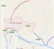
I looked at a map after the fact and found this:
Covarrubias.webp
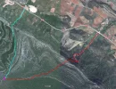
The red line is the direct path from the village, missing the scrapheap of a hermitage, and the blue one is the route up the BU-905 and to the hermitage.

Reb and I just plowed our way through those fields till we coincided with the path.
Yeah, I almost did too, but the road that I'd passed coming in looked more like Alan's
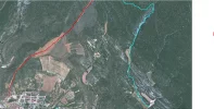
GPS track. I don't know what you guys did, but here's my route in turquoise, again with the red being the direct route from the village (they meet right off the screen--and the hermitage is that white patch in the lower right).
upload_2016-8-9_13-25-10.webp

How did you walk to Mambrillas from the highway?
Grf. Just hoofed it along the shoulder of the road! At that point I was on fumes, having walked over 35kms without either breakfast or lunch (long story...but it is amazing what the body can do)! So that part as definitely not fun, but I was just relieved to have more or less made it, without a GPS and only crummy screenshots of Alan's tracks. A sense of direction helped.

Do you have any idea about how the path to Hortiguela goes to Mambrillas?
Once you get to Mambrillas it's clear--going towards Covarrubias, the way goes from the village across the highway, directly up to the base of the scarp and then up it to meet the 2-track labelled 'Hortiguela' at the marked fork. So in the other direction (the way we were going), turn right at that Hortiguela sign, then take a left fork going down the scarp towards Mambrillas. It must be signposted, but who knows? It's confusing so here's another map (the pink dot is the signposted intersection, the turquoise is our route, the red is hat I intended to take...):
upload_2016-8-9_13-47-6.webp
I hope this isn't TMI, but on the ground this would have been very useful information. Perhaps we have a little guidebook in the making?o_O:D
 
Day 2 -- From the intersection on the N-234 to Mondúbar de San Cibrián (29 km).

No point in waking up and getting started early, at least not if you intend to visit the visigothic church at Quintanilla de las Viñas, which we most definitely did!

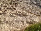
At about 8:30, after breakfast at the Taberna, the owner drove us back to the same place he had picked us up, about 3 km from Quintanilla. We just walked along the road (we were not on the Camino because we had not gone to Mambrillas). The first surprise was coming upon the 144 million years old (that's a hard number to compute) dinosaur footprints.

Mondubar1.jpg mondubar3.jpg
Then from there, to the town of Quintanilla, and then out on the road to the church, which is located off-Camino a few kms east of town. The sign told us that the church's opening time was 10:05, and sure enough, at exactly 10:05, the guy in charge rode in on his motorcycle, ready for a day alone out in Quintanilla.

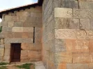
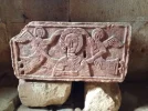
We spent a long time at the church (more than a half hour waiting for it to open, and then more than a half hour inside), so our day was a long one. The structure has beautiful carvings and arches, and its setting is pastoral and calm. A really terrific visit.
mondubar4.jpg mondubar11.jpg
From Quintanilla, there are off-road trails, while the Camino del Cid follows along the road -- it is a very lightly traveled road, but asphalt nonetheless. In Cubillejo de Lara, we were unsure about the off-road option, so we stayed along the road for the stretch between Cubillejo de Lara and Cubillejo de César. That was not necessary, we should have taken the off-road option, at least that´s what I think looking back at the map, gps, etc.

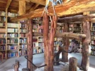
From Cubillejo de César to Quintanalara, it's a very nice off-road track. We arrived in Quintanalara as they were celebrating the opening of their crowd-funded library, built in an old agricultural building with the horse-shoeing contraption still standing. Very nice vibe in that little town.

mondubar5.jpg
Still on tracks, from Quintanalara, we made our way to Revilla de Campos. If you look closely at a map, or my gps tracks for that matter, you will see that it would be easy to avoid going into town by turning left on a farm road that the camino later rejoins after Revilla de Campos. This would have the advantage of avoiding a very muddy overgrown path along the stream. It would also mean that you wouldn't go through Revilla, and we did find a nice shady bench and fountain there, but if you don't need water, consider the shortcut.

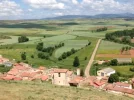
As we came into Ausines, we didn't take the arrow to the left because it just looked like it was going to take us on a long detour. Well, in fact, it would have taken us up the back of the hill that we eventually climbed from Ausines, but we didn't know that then. We climbed up to the church and then saw that our destination was at the top of a pretty steep hill and we were not sure what we would do. But then, out of nowhere came Dona Eugenia, a resident out for her afternoon walk. She took us up to the top of the ridge, accompanied us almost till our destination was in sight, and sent us on our way. There are less strenuous ways to get to the road that took us into Mondúbar de San Cibrian, but they would have involved a loop and also crossing a large herd of sheep with several dogs, not recommended by Dona Eugenia.
mondubar6.jpg mondubar7.jpg
In Mondúbar de San Cibrian, there's a very nice casa rural, Cerca de Doña Jimena. We had dinner, breakfast and a nice room for 41 € per person.

A truly 5***** day! Buen camino, Laurie
 

Attachments

  • mondubar2.webp
    mondubar2.webp
    26.9 KB · Views: 9
  • mondubar8.webp
    mondubar8.webp
    19.4 KB · Views: 8
  • mondubar10.webp
    mondubar10.webp
    24.3 KB · Views: 9
Day 3 Mondúbar to Burgos, 19 km

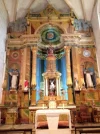
Short easy day, so we started out after a leisurely breakfast at 8. Good, filling breakfast, and the owner urged us to take the leftovers in our packs for snacks. She also offered to take us inside the 19th century church. I'm glad Reb said yes, because I would have probably passed on the opportunity, yet there inside was this brightly colored altarpiece that just sparkled. When you add this to the very interesting fountain made with three Roman sarcophagi, it adds up to a nice little stop.

burgos3.webp

The way into Burgos is really very straightforward, most of it on a biking/walking trail, so no need for walking details.
burgos1.webp

We were there early in the afternoon, went to the cathedral, had a hamburger (and a very good one at that, even for someone like me who eats very little meat), and then goodbye. Hopefully there will be another stellar short camino in my future with Reb, we've now had two three day jaunts (the first to Peñalba de Santiago from Ponferrada, another 5-star walk), and they are great pick-me-uppers after I've been walking alone for a couple of weeks. Thanks, Reb!

burgos2.webp

So, if you are tempted, let us know, because there are now four forum members (that I know of) who have walked and truly enjoyed this route. As @crackmrmac suggested, it would be a nice detour for those who want a little break from the crowds of the Francés -- solitary, beautiful, a bit of an individual challenge. And pretty risk-free, because you will never be too far from civilization, though some of the vistas make you feel like you are, in the words of the Illinois Tourism Council, "a million miles from Monday." Buen camino, Laurie
 
€2,-/day will present your project to thousands of visitors each day. All interested in the Camino de Santiago.
I had a very different experience of the 2nd day. It was very nice--but mostly walking on the road. And it was Good Friday so the Santa Maria as closed; wow...I'll have to go back.
Your day sounds so much more fun. I was really tempted to bush-whack over that hill at Los Aussines but it was raining and an ankle was whining, so I walked around it...missing that stellar view!! The road through the villages and past the stream was actually pretty nice, but you missed the lovely road past the quarry. ;)

Laurie, for some reason I can't find the maps/tracks you mention. Sorry to be a pest, but can you please re-post the links here?
 
Last edited:
I had a very different experience of the 2nd day. It was very nice--but mostly walking on the road. And it was Good Friday so the Santa Maria as closed; wow...I'll have to go back.
Your day sounds so much more fun. I was really tempted to bush-whack over that hill at Los Aussines but it was raining and an ankle was whining, so I walked around it...missing that stellar view!! The road through the villages and past the stream was actually pretty nice, but you missed the lovely road past the quarry. ;)

Laurie, for some reason I can't find the maps/tracks you mention. Sorry to be a pest, but can you please re-post the links here?
Hi,, Vira, do you mean my GPS tracks? I'm happy to get as much info up as I can, but I don't know exactly what you are referring to. Thanks!
 
Maybe I'm mistaken, but I thought you'd posted links to maps and tracks someplace?
And yes pretty please, Laurie...if you can put up yours that'd be great! I'm very interested to know how you avoided the road from Quintanalara past Revilla de Campos to Los Ausines--and how to avoid the road from Quintanilla to Cubillejo de César.
For me walking most of the day on the road made this a bit of a slog, and I knew it would have been stellar otherwise...as it was for you and Reb.
 
A selection of Camino Jewellery
Maybe I'm mistaken, but I thought you'd posted links to maps and tracks someplace?
And yes pretty please, Laurie...if you can put up yours that'd be great! I'm very interested to know how you avoided the road from Quintanalara past Revilla de Campos to Los Ausines--and how to avoid the road from Quintanilla to Cubillejo de César.
For me walking most of the day on the road made this a bit of a slog, and I knew it would have been stellar otherwise...as it was for you and Reb.

Vira, my GPS tracks are here, here, and here.
We went on the road from Cubillejo de Lara to Cubillejo de Cesar, but if you look at this wikiloc track, you can see that there's a track that parallels the road for that stretch, just like the rest of the way from Quintanillas. http://www.wikiloc.com/wikiloc/view.do?id=11388073

I think a little guide would be easy to do, but I'm going to wait and see if there's any interest, don't you think?
 
Triple like, Laurie, thank you!
Yes, I see now. I had noticed the dirt road after Quintanalara, wondering if it could be an alternative route, but was too chicken to try it. I think I would have been a bit less cautious if I had had a decent map, or (choke;)) a GPS. But I was concerned about dead-ends and didn't have it in me to do a bunch of extra Kms 2 days in a row!
As far as a guide is concerted, yes I think you're right: this thread will be plenty, and is here for people to use. But if there's more interest down the track, I'd definitely be into going out there again to document it all a bit more...and to learn more about the history of these places.
:DAny excuse.
 
And speaking of fountains made out of interesting things...did you see this at Cubillejo de Cesar?
Jaw-dropping, if you're into fossils! I'd love to know where these came from!
IMG_1353.webp
 
...and ship it to Santiago for storage. You pick it up once in Santiago. Service offered by Casa Ivar (we use DHL for transportation).
Anyway, from Covarrubias we headed out on the Camino San Olav. If you look at my gps tracks for the first day, you will see that it would be very easy to cut over without going into Covarrubias. You would save a few kms, get more quickly to the church, but you would miss a nice stop.

Can I put in a shout for Covarrubias? I thought it was a really great town, well worth the afternoon I spent there. The Colegiata de San Cosme y San Damián, in particular, is worth a proper visit. Its treasures include the oldest functioning organ in Spain, fine cloisters, a 13th century sculpture of Santiago, a wonderful 15th century triptych of the Adoration of the Three Kings, the sarcophagus of Fernán González (the first count of Castile) and of the Norwegian princess (who was apparently 5'6", so must have towered over most of her adopted countrymen at the time), and an alleged van Eyck as well. In order to see the paintings and cloisters, you have to go on a guided tour, which meant I had to wait until 4pm, as the previous one at noon had already set off when I arrived. But it was worth the wait, as I wandered round the very pretty town and then had a leisurely and first rate meal in De Galo (duck in ceps sauce lingers in the memory) where Lorca apparently stayed in 1918. I then carried on to Mecerreyes (on the Ruta de la Lana), where there is a large and well equipped albergue (5€, I think).
 
And if you are Norwegian, (I'm thinking of you, @alexwalker), you have an added incentive!

Buen camino, Laurie
Ha, ha, Thanks!!! :):):)
Yes, I am fully aware of this strange, ancient story, and Covarubbios has been on my bucket list for some years. Right now (last night, actually) I booked my flights and will end up in Burgos on sept.1. I was originally thinking of just start walking, but I am REALLY considering doing this first. Thanks for the reminder! And knowing that Reb has done it, I know I can call for help if I get lost! ;):)
 
The third option goes this way: Walk on the well marked Ruta de la Lana into Covarrubias. In Covarrubias, get off the Ruta de la Lana and start the San Olav. It's three days of mostly off road walking with some wonderful sights along the way and lots of natural beauty. Accommodation has to be planned in advance because there are not a lot of choices.

Hi Laurie,

I am catching up on the info about San Olav but the threads are lengthy and I have difficuties finding what I search...

I finally decided to walk the San Olav in the "wrong" direction, from Covarrubias to Burgos, which is not uncommon as I understand. But I will be coming from Santo Domingo de Silos (17 kms according to Undermanager), and I would like to continue on the San Olav the same day. Do you know of any albergue/casa rural that I would be able to reach the same day on the San Olav? That is, first 17 kms from Santo Domingo to Covarrubias, and then a chunk of the San Olav the same day?

Thanks!

/BP
 
The 2024 Camino guides will be coming out little by little. Here is a collection of the ones that are out so far.
@Bad Pilgrim , like I said in the other thread just make sure you're on the Camino when you leave SDdS. If you take the GR82, like I did, it's the long way to Covarrubias. That said...it's one of the vest walking days ever, and really worth considering.
 

❓How to ask a question

How to post a new question on the Camino Forum.

Featured threads

❓How to ask a question

How to post a new question on the Camino Forum.

Featured threads

Forum Rules

Forum Rules

Camino Updates on YouTube

Camino Conversations

Most downloaded Resources

This site is run by Ivar at

in Santiago de Compostela.
This site participates in the Amazon Affiliate program, designed to provide a means for Ivar to earn fees by linking to Amazon
Official Camino Passport (Credential) | 2024 Camino Guides
Back
Back
Top