• ⚠️ Emergency contact in Spain - Dial 112 and AlertCops app. More on this here.
  • Remove ads on the forum by becoming a donating member. More here.

Search 74,075 Camino Questions

From the Puerto de Pajares to the Pueblo de Pajares on the Salvador --- PART2

GunnarW

Active Member
Time of past OR future Camino
2011+ > Spain, Belgium, France
I open a new thread to check if there isn’t a fourth way to walk from the old parador till Pajares.
Please check http://www.caminodesantiago.me/community/threads/help-from-the-puerto-de-pajares-to-the-pueblo-de-pajares-on-the-salvador.19884/ to understand the history.
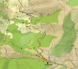
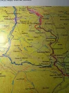
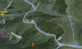
Yesterday I started editing the part between the old parador and Pajares and discovered some valuable information to prove that maybe there must be a fourth option. This option is dotted in orange on the map named "puerto-de-pajares-with-all-routes-2.jpg".
puerto-de-pajares-map-with-all-routes-2.webp

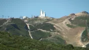
1) The shot below, I took from the balcony of the old parador. You see the tunnel of the railroad labeled "3". You see clearly a path a the right side of the railroad. Label "4" is normaly where all paths are joining. Label "p" is normally the place where I took the last picture of the parador (full zooom). I put red dots on the "dangerous" path that Stuart and Susanna tried to follow. Until now, we don't know where this path leads to, propably to point "4".
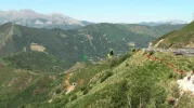
puerto-de-pajares-parador-orange-red-p3p4.webp
2) At label "p", I took a video of the old parador and you can see clearly a path going down labeled "2".
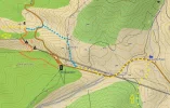
So the path that is visible on the Garmin Topo Map España v5 should exist. I think it starts below the balcony. Believing my pictures, it's possiblke that this path is more comfortable.
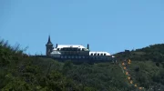
puerto-de-pajares-parador-orange-p2.webp

Who is the next to go there and make a report?
 
Last edited:
Ideal sleeping bag liner whether we want to add a thermal plus to our bag, or if we want to use it alone to sleep in shelters or hostels. Thanks to its mummy shape, it adapts perfectly to our body.

€46,-
Thank you very much for starting another thread in this fascinating subject of which we can never get enough!
I have loads of pics taken at this spot which I will post in a few minutes.:)Can't wait!
But! Must instantly correct you!
The red path (The School Kids Way), which I walked (please note, walked, not tried to walk ;)) doesn't look like that.
I actually walked it much longer, till approx between the spot where you have put a "3" on the map, and the point at the n-630 where the colour of the ground changes from beige to green.:)
More soon.
 
Ok. Fasten your seatbelts or something.
Here comes All my pics taken while walking The school kids way:
Approaching parador...
ImageUploadedByCamino de Santiago Forum1381394550.075385.webp
The uh oh moment when I realised there were cows there.
ImageUploadedByCamino de Santiago Forum1381394607.776164.webp
Standing in front of the first fence looking around the corner. More cows.
ImageUploadedByCamino de Santiago Forum1381394751.865534.webp
Here I've passed the first fence and I'm taking a pic of the suggested starting point of the orange path.ImageUploadedByCamino de Santiago Forum1381394882.732997.webp
 
Last edited:
The one from Galicia (the round) and the one from Castilla & Leon. Individually numbered and made by the same people that make the ones you see on your walk.
Don't worry, I have only just started.:)
More pics:

Here I'm standing at the point where the orange path was supposed to start. Please note, no path. And just terrain below, no path visible further down either.
ImageUploadedByCamino de Santiago Forum1381395132.182155.webp
Pic taken when outside the fence again, trying to figure out where to start.
ImageUploadedByCamino de Santiago Forum1381395285.087907.webp

Starting to walk on n-630 trying to figure out where to jump over the fence.
ImageUploadedByCamino de Santiago Forum1381395398.693483.webp

This is where I decided the coast was clear, and I'm ready to jump.
ImageUploadedByCamino de Santiago Forum1381395543.576855.webp
 
Ok from this point I'm on the school kids way and taking pics as I walk:
ImageUploadedByCamino de Santiago Forum1381395764.703368.webp
A bit steep ok, but the ground is soft and there's plenty of bushes down the slope to land in. :)
ImageUploadedByCamino de Santiago Forum1381395808.431574.webp
The parador is far away. I think I'm now in the same spot as where one of the school kids pics were taken. What a feeling! :)
ImageUploadedByCamino de Santiago Forum1381395918.311670.webp
And the view is fantastic.
ImageUploadedByCamino de Santiago Forum1381396052.880775.webp
 
I continue to walk. I can see that there's a road down the valley where the train comes out if the tunnel. But there are more cows there so I decided to continue waking.
ImageUploadedByCamino de Santiago Forum1381396535.849115.webp
ImageUploadedByCamino de Santiago Forum1381396610.133593.webp
ImageUploadedByCamino de Santiago Forum1381396737.243363.webp
ImageUploadedByCamino de Santiago Forum1381396791.750685.webp
It's a bit optimistic to think that these grey vertical lines can be a path one can walk. It's just the ground which has collapsed. :)
 

Attachments

  • ImageUploadedByCamino de Santiago Forum1381396274.720462.webp
    ImageUploadedByCamino de Santiago Forum1381396274.720462.webp
    241.8 KB · Views: 6
Fail to prepare? reduce your risk by buying this book full of practical info.
2nd ed.
Ok the last one is the cow on the trail pic. I'm posting it again here
ImageUploadedByCamino de Santiago Forum1381397092.394400.webp
...as you can see this is where the n-630 above me turns right. Here I climbed up to the road and walked the last 100-200 m on the road.

Ok this is a few 100 m after where I went back to the camino, and passed the gate. I then walked to Pajares. Not sure what happens if you turn left here. Perhaps you can walk to the road next to the train tunnel. :)
ImageUploadedByCamino de Santiago Forum1381397272.877073.webp
 
Hello Susanna,
Thank you for this interesting picture report.
If I understand well, on posted picture 3: you passed between the left cow and the second left cow, went a little bit up and took picture 5 and 6 close to where the first trees (start of the forrest) are situated on picture 3?
If yes, the gorge you took on pic 5&6 is the suggested orange path on the Garmin map.
There is a fuente on the map where I put label "2" (start of a blue line), so that must be where the forrest starts in the gorge on picture 6.
Hi Gunnar!
I'm glad you find the pics interesting. It was a pleasure to take them and to post them. :)
I passed all the cows while walking close to the parador wall. I stopped about where there is a pile of rubbish and took pic 5 with my back towards the parador.
Pic 6 I took, if I remember right, when I had walked out from the cows area again. Standing on the road. It's before pic 7.
As you can see the grass is much greener there, than on pic 5.
I could not see any trace of a path where the orange path was supposed to be. And it was very steep. Maybe one can do it with a toboggan in the winter.:)
 
Fail to prepare? reduce your risk by buying this book full of practical info.
2nd ed.
What a treat to wake up and find there are 8 posts about the Puerto de Pajares. :)

I have the definite answer to only one small question. The last picture you post, Susanna, shows the fork where you can go directly to San Miguel and by-pass Pajares. For anyone walking a stage from, say Poladura to Campomanes, this would be the way to go. (San Miguel is the first pretty little town at the bottom of the descent when you leave Pajares.)

But on the larger question -- Gunnar, your post makes me think that I haven't lost my mind. I always said that I took a path from right in front of the albergue, but I definitely didn't think I was walking a dangerous route. So I just don't see how its possible that I took the "red route" (aka school kids route?) because that looks scary and dangerous. So maybe I was on the orange route?

Rebekah is there now and I know she is going to check out the Pajares Pass closely, but she probably won't see this message.

I am pretty sure that I'm going back next May so we still have 7 months to theorize and hypothesize. Laurie
 
What a treat to wake up and find there are 8 posts about the Puerto de Pajares. :)

I have the definite answer to only one small question. The last picture you post, Susanna, shows the fork where you can go directly to San Miguel and by-pass Pajares. For anyone walking a stage from, say Poladura to Campomanes, this would be the way to go. (San Miguel is the first pretty little town at the bottom of the descent when you leave Pajares.)

Indeed, what can be better. :)

Ok, when walking there one does come to San Miguel, eventually.
But in the beginning of this path I noticed one walks back towards parador, for a little while. I think I was standing at the 4 on Gunnars map when I took the photo. And it looked like the path followed the orange path on Gunnars map, before it turned right and (I'm guessing now) continued along the black line on the map.
I'm curious about that. :)
There is a path/road there. I suspect it starts at this sign and continues along the railway. Where does it end?
 
Well, I am really stumped because I have no memory of a train track! Do trains still run on that track? My memory may be even worse than I thought it was, but I know I have gone from the Puerto de Pajares to the Pueblo of Pajares twice!

The next time I walk I will try to bring Ender with me. ;)
 
...and ship it to Santiago for storage. You pick it up once in Santiago. Service offered by Casa Ivar (we use DHL for transportation).
Laurie, you can see the railway and the tunnel on Gunnars second pic. After the map. There are orange dots along it and a "3".

Ok, that means you did not walk Gunnars orange path. Then you would have seen the railway.
Do take Ender with you and a webcam on your hat.:)
 
But I just realized that if I bring Ender with me, he will insist that we take the marked route on the right side of the highway, up to the barbed wire and livestock. So I may have to do this on my own. And since I usually don't make a decision about which camino I'm going to walk in May until the dark dreary days of winter, I suppose this could change, too. But right now I'm thinking Oloron Ste. Marie on the Aragones to Pamplona to Leon and then you know where.
 
Hello Laurie,
Trains are still riding on that track. When I left the N630 at the emergency track, a few hundred meters further close to the water fountain (the bath) on the left side, I noticed suddenly a horrible sound. It was a short train that came out of the tunnel and disappeared quickly. That's how I noticed the train track in the valley. I would never notice it without the presence of a train.

I suggest you spend three days between the old parador and Pajares. Every day a report of another track.
 
The 2024 Camino guides will be coming out little by little. Here is a collection of the ones that are out so far.
When I walked in April, I took the blue dotted line. As rainy and wet as it was, I doubt I could have safely walked the school children's route.
 
Hola, pongo un enlace de las fotos que realice el día 13 de Octubre del 2011 que fue el día que marque este sendero a Pajares, deciros que estuve marcando esos días el camino hasta Oviedo y que en cuanto llegue a Oviedo al volver a mi casa en coche, mande parar a mi mujer y escribí : PELIGROSO al lado de sendero a Pajares, sigo pensando que no se puede recomendar a todo el mundo y que el que tome la decisión de ir por él tiene que saber el peligro que corre.

Veréis que no está puesta la señal de madera que indica San Miguel - Pajares, esa señal no la puse hasta unos meses después que localice el camino por el bosque y lo fui marcando con ayuda de mi mujer y unos amigos


https://www.dropbox.com/sh/hce9pehthvlrf2f/--s8Anrrsh/sendero a pajares

El camino que se ve al lado del tunel y la via del tren es el oficial que va a San Miguel, unos kilómetros mas adelante se bifurca en dos, uno va a la autopista que esta en la otra montaña y el otro continua hasta San Miguel o hasta Pajares, según lo que quisieramos hacer.
Ahora no es necesario coger ese camino para ir a Pajares ya que se alarga 5 Km mas que por donde esta marcado a traves del pequeño bosque de hayas, pero es un camino precioso si lo haceis alguno seguro que os va a gustar mucho entre acebos.

Espero que se vea el enlace a dropbox (es la primera vez que lo utilizo)

Un saludo
 
Hola.

Deciros como curiosidad que el túnel que se ve en esas fotografías es el " túnel de La Perruca". Cuando se construyo era el más grande de España.

La obra de construcción del ferrocarril por el puerto de Pajares fue una obra faraónica para esos tiempos.


Pongo un enlace de tres páginas muy interesantes que explican esa obra ferroviaria (siento no poder traducirlas).

Mi amigo Josines me contó que el siempre lloraba cuando llegaba a ese túnel y cantaba una canción muy antigua que hacía referencia a ese túnel y su salida de Asturias para entrar en León, él estudiaba fuera y le entristecía dejar su Asturias del alma:


En pasando la Perruca,

y el Carrascal de la Legua,

adiós Asturias del alma,

cuando volveré a tus tierras.

adiós puertu de Payares,

que crucé muerta de pena,

porque he dejado a mi madre,

en el concejo de Lena.


http://www.telecable.es/personales/alfredov/nortePajConst.html


http://antiguosalumnosdominicos.blogia.com/2011/030201-los-tuneles-de-pajares.php


http://www.flickr.com/photos/navidiello/7217438680/


Un saludo
 
3rd Edition. Vital content training & pack guides avoid common mistakes, bed bugs etc
Interesting.
Now we talk about trains and tracks.
Is it possible that there is another train track under the ground at the other side of the N630 (so in the area where the blue path is situated) that makes a U-curve? I remember seeing a map with a track that turns back. It could be part of the coal mine situated behind the church of Arbas del Puerto .

Another remark is that the train track between León and Pola de Lena (or was it Mieres?) is only single track. I noticed it's a very, very busy line comparing to other RENFE railroad lines I remember seeing on the camino Frances. Passengers, coal and iron: it goes from León to Oviedo and from Oviedo to León almost every 10 minutes. But only on a single track for a big part.

Let the coal miners from La Robla/Asturia dig larger tunnels. An opportunity?
 
Hola, pongo un enlace de las fotos que realice el día 13 de Octubre del 2011 que fue el día que marque este sendero a Pajares, deciros que estuve marcando esos días el camino hasta Oviedo y que en cuanto llegue a Oviedo al volver a mi casa en coche, mande parar a mi mujer y escribí : PELIGROSO al lado de sendero a Pajares, sigo pensando que no se puede recomendar a todo el mundo y que el que tome la decisión de ir por él tiene que saber el peligro que corre.

Veréis que no está puesta la señal de madera que indica San Miguel - Pajares, esa señal no la puse hasta unos meses después que localice el camino por el bosque y lo fui marcando con ayuda de mi mujer y unos amigos


https://www.dropbox.com/sh/hce9pehthvlrf2f/--s8Anrrsh/sendero a pajares

El camino que se ve al lado del tunel y la via del tren es el oficial que va a San Miguel, unos kilómetros mas adelante se bifurca en dos, uno va a la autopista que esta en la otra montaña y el otro continua hasta San Miguel o hasta Pajares, según lo que quisieramos hacer.
Ahora no es necesario coger ese camino para ir a Pajares ya que se alarga 5 Km mas que por donde esta marcado a traves del pequeño bosque de hayas, pero es un camino precioso si lo haceis alguno seguro que os va a gustar mucho entre acebos.

Espero que se vea el enlace a dropbox (es la primera vez que lo utilizo)

Un saludo

Thank you, that was very nice photos.
(I'm having to ask Laurie for a translation. I got to improve my spanish. Sometimes I understand most things, sometimes very little).
Anyway I want to say I just loved to walk the school kids way. I did not think it was dangerous. It's just a grass slope. Like a hill you ski on in the winter. If you trip there is a soft landing, in the grass. There are much more dangerous parts to walk in the mountains, where one step wrong means a long fall and landing on a rock.
And I can see that I walked to pic 45, where I met cows. Otherwise I would have walked it all the way, easily.
I loved this part of the walk. Wish I was there now. :)
 
Interesting.
Now we talk about trains and tracks.
Is it possible that there is another train track under the ground at the other side of the N630 (so in the area where the blue path is situated) that makes a U-curve? I remember seeing a map with a track that turns back. It could be part of the coal mine situated behind the church of Arbas del Puerto .

Another remark is that the train track between León and Pola de Lena (or was it Mieres?) is only single track. I noticed it's a very, very busy line comparing to other RENFE railroad lines I remember seeing on the camino Frances. Passengers, coal and iron: it goes from León to Oviedo and from Oviedo to León almost every 10 minutes. But only on a single track for a big part.

Let the coal miners from La Robla/Asturia dig larger tunnels. An opportunity?

That sounds very interesting. That is wonderful knowledge.
I'm proud to be a member of the Puerto de Pajares fan club.
Or should we call it Puerto de Pajares Fanatics? :)
 
Get a spanish phone number with Airalo. eSim, so no physical SIM card. Easy to use app to add more funds if needed.
Dear Staff Members of PdPF,

I updated our knowledge on a screenshot of Bing Maps which offers more details than Google Maps in our dedicated sector.
I learnt that in fact between point 4 and the old parador, there are 2 railroad sections.
It seems that the School Kids Path stays parallel with the N630.

***UPDATE*** you can see on this map that there is also a path between the bar and the blue path, call it a shortcut. Just before the building of the bar, it's easy to reach this shortcut (check google streetview). But it's possible you have to go through a barbered wire, so it's better to go back to the silo.

puerto-de-pajares-bing-maps.webp
 
Last edited:
Thank you for this important contribution. That was indeed jaw dropping.
The railway which goes parallel to the orange path, I saw IRL when walking the School kids way (SKW).:)
The other one I did not notice.
And. There's a third one above the word "Pajares" on your map. I didn't see that one either! :(
I'm hoping I might be excused for that, as I in that moment was trying to make myself invisible when passing a bull.
 
Maybe one can do it with a toboggan in the winter.:)

Just after walking this section, in the woods on the way into Pajares, I met a man who had been Spanish ski champion in the 1980's (I think he said he was a cousin of Marisa who runs the albergue). He was telling me that he skiied on all the hills all around Pajares, no lifts, just goes out and climbs and skis down.

He told me he'd been the first person ever to ski down Naranjo de Bulnes. That's seriously impressive...

Naranjo-de-Bulnes-001.jpg


I bet he could manage Gunnar's mystery track! :D
 
A selection of Camino Jewellery
Susanna, looking to your pictures, the bull was blocking your road somewhere at the fifth last red dot?
 
Susanna, looking to your pictures, the bull was blocking your road somewhere at the fifth last red dot?

At the fifth last dot, there was a cow standing at the path, and there was two more laying below her.
The bull was waiting for me along the blue dotted line, approx at dot five (to the left of n-630).
After him, the blue path was sprinkled with cows until the path turned right. (And there was of course more cow clusters later on the blue path. Big cows. The farmer must be rich)
 
€2,-/day will present your project to thousands of visitors each day. All interested in the Camino de Santiago.
Hello Stuart,
Amazing you met a ski champion.
Did someone notice the ski resort? Between Arbas del Puerto and Puerto de Pajares, there was a road heading to a ski resort.
I noticed the top building already just before Ender's cross but I didn't know what it was.
Pictures:
peurto-de-pajares-estacion-invernal.webp
peurto-de-pajares-estacion-invernal-2.webp

full zoom:
peurto-de-pajares-ski-resort-full-zoom.webp
 
Yeah I saw it on the walk up to Puerto de Pajares. I never knew it was there.
 
Get a spanish phone number with Airalo. eSim, so no physical SIM card. Easy to use app to add more funds if needed.
Thanks for the most recent aerial view, Gunnar. I can see why I never saw the train tracks taking Ender's (blue) route.
 
Hola, pongo un enlace de las fotos que realice el día 13 de Octubre del 2011 que fue el día que marque este sendero a Pajares, deciros que estuve marcando esos días el camino hasta Oviedo y que en cuanto llegue a Oviedo al volver a mi casa en coche, mande parar a mi mujer y escribí : PELIGROSO al lado de sendero a Pajares, sigo pensando que no se puede recomendar a todo el mundo y que el que tome la decisión de ir por él tiene que saber el peligro que corre.

Veréis que no está puesta la señal de madera que indica San Miguel - Pajares, esa señal no la puse hasta unos meses después que localice el camino por el bosque y lo fui marcando con ayuda de mi mujer y unos amigos


https://www.dropbox.com/sh/hce9pehthvlrf2f/--s8Anrrsh/sendero a pajares

El camino que se ve al lado del tunel y la via del tren es el oficial que va a San Miguel, unos kilómetros mas adelante se bifurca en dos, uno va a la autopista que esta en la otra montaña y el otro continua hasta San Miguel o hasta Pajares, según lo que quisieramos hacer.
Ahora no es necesario coger ese camino para ir a Pajares ya que se alarga 5 Km mas que por donde esta marcado a traves del pequeño bosque de hayas, pero es un camino precioso si lo haceis alguno seguro que os va a gustar mucho entre acebos.

Espero que se vea el enlace a dropbox (es la primera vez que lo utilizo)

Un saludo


Some translation for Ender´s message: I am posting a link to the pictures I took on 13 Oct. 2011, which was the day I put arrows on this trail to the town of Pajares. I was painting arrows the whole way to Oviedo, and as soon as I arrived in Oviedo and my wife was driving me home in the car, I asked her to stop and I then wrote the word "dangerous" on the side of the path (in front of the parador). I still think that it´s not a good alternative for everyone, and anyone who decides to go on that path should know its danger.

You will see (in those photos) that the wooden marker that indicates a fork with indications to Pajares or San Miguel still hadn´t been put up when I took those pictures. I did that a few months later when I found the old path through the woods and we (my wife, friends, and I) marked it.

The path that you see at the side of the tunnel and the RR tracks is the official route to San Miguel. A few kms after that point, it splits into two, one goes to the highway that is on the other mountain and the other continues on to San Miguel or to Pajares.

It is no longer necessary to take this latter path to go to Pajares. It is 5 kms longer than going the way I marked in 2011 (that is, the first wooden pole splitting between San Miguel and Pajares). The way I marked takes you through a little chestnut grove and it is beautiful, I´m sure you will love it.

Thanks to Ender
 
Get a spanish phone number with Airalo. eSim, so no physical SIM card. Easy to use app to add more funds if needed.
Hola.

Deciros como curiosidad que el túnel que se ve en esas fotografías es el " túnel de La Perruca". Cuando se construyo era el más grande de España.

La obra de construcción del ferrocarril por el puerto de Pajares fue una obra faraónica para esos tiempos.


Pongo un enlace de tres páginas muy interesantes que explican esa obra ferroviaria (siento no poder traducirlas).

Mi amigo Josines me contó que el siempre lloraba cuando llegaba a ese túnel y cantaba una canción muy antigua que hacía referencia a ese túnel y su salida de Asturias para entrar en León, él estudiaba fuera y le entristecía dejar su Asturias del alma:


En pasando la Perruca,

y el Carrascal de la Legua,

adiós Asturias del alma,

cuando volveré a tus tierras.

adiós puertu de Payares,

que crucé muerta de pena,

porque he dejado a mi madre,

en el concejo de Lena.


http://www.telecable.es/personales/alfredov/nortePajConst.html


http://antiguosalumnosdominicos.blogia.com/2011/030201-los-tuneles-de-pajares.php


http://www.flickr.com/photos/navidiello/7217438680/


Un saludo

Another translation:
The tunnel that you see in the pictures is the tunnel of Perruca. When it was built, it was the longest tunnel in Spain. Building a tunnel through the Puerto de Pajares was an overambitious project for those times. (actually, there´s a great word I had never heard, faraónica, which comes from the Pharohs, probably a reference to the pyramids and their grandeur, but my online dictionary says "overambitious" is close enough).

I´ll put three links here that explain the construction of the tunnel (all in Spanish, sorry).

My friend Josines told me that he always used to cry as he went through the tunnel of Perruca and he used to sing a song that makes reference to the tunnel and how you go in in Asturias and come out in León. Josines studied outside of Asturias and it always pained him to leave.

Passing through Perruca
And Carrascal de la Lengua
Goodbye Asturias of my soul
When will I return to these lands
Goodbye Puerto de Pajares
Which I passed through dying inside
Because I left my mother
In the town of Lena

Note from translator: Nice song, I´d like to hear it sung.
 
This last post may be only for Gunnar and our other map whizzes. But there is more to this Puerto de Pajares puzzle, which Ender´s post explains.

The first time I walked, the split with Ender´s wooden marked split wasn´t there. The way went instead to a split between San Miguel and Pajares that was much further on, and added 5 kms to the walk to Pajares.

Ender´s split gave pilgrims an earlier turn-off for the town of Pajares. As Ender explained to me, this path is the path used by the townspeople of Pajares when they carried their dead up to the church in Santa María del Arbas del puerto.

If you didn´t take Ender´s turn off for Pajares, you would keep walking and come to another split to allow you to choose between San Miguel and Pajares:
Conch for San Miguel.webp

But this is a longer way to Pajares.

Either way, once you are in Pajares, you will pass through San Miguel, so if people aren´t going to sleep in Pajares, they really could just continue on to San Miguel. Though it´s all so beautiful that I don´t think anyone minds taking a few 5 km detours!
But what I don´t understand about what Ender said are these two sentences:

The path that you see at the side of the tunnel and the RR tracks is the official route to San Miguel. A few kms after that point, it splits into two, one goes to the highway that is on the other mountain and the other continues on to San Miguel or to Pajares.

I´m going to ask him and get back to you, or maybe Gunnar will figure it out first. buen camino, Laurie
 
How interesting! In Scotland we call these routes coffin roads and they had the same purpose. There are lots of traditions and superstitions about these old tracks. Strangely, many of the modern long distance hiking trails are made up of old coffin roads, even though the communities are long gone the routes survive.

I guess bagpipes are not the only things we share with with our fellow Celts in Asturias :)
 
Fail to prepare? reduce your risk by buying this book full of practical info.
2nd ed.
The lyrics that Ender wrote made me want to know more about this song. It is a very nostalgic song. I found the full lyrics on google. It seems that the asturianos have their own brand of yearning for home or saudade. It also reminded me that when I was walking the Camino Vadiniense and good for nothing but watching TV at night in a hotel in Fuente De, there was a show on about all of the Asturians who had emigrated to Argentina, how difficult it had been for them, and how they still carried Asturias in their hearts. I have to say that though I love Illinois I can't imagine writing a song about my pain if I ever left it.

Hoy de Asturias me despido
con el corazón deshecho
la Virgen de Covadonga
un altar lleva en mi pecho.

Voy en busca de fortuna,
para así poder comprarle,
un trono de plata pura,
a la pobre de mi madre.

En pasando la Perruca,
y el Carrascal de la Legua,

Adiós Asturias del alma,
cuándo volveré a tus tierras.

Adiós puertu de Payares,
que crucé muerta de pena,
porque he dejado a mi madre,
en el concejo de Lena.

Carretera, carretera,
no te duelen mis andares
con lo mucho que te quiero
hoy me marcho de tus lares.

Carretera, carretera,
cuando llegue ese día,
que yo te pise de vuelta,
buscando a la madre mía.

Adiós Asturias del alma,
cuando te volveré a ver,
me voy a tierras extrañas,
contigo yo soñaré.

And I also found a youtube with the music:

I will be happy to translate the lyrics if anyone is interested.

And one last thing -- if you've walked the Norte, when you go through Asturias, you see all the mansions that are called "Casas de Indianos." These were homes bought by rich emigrants who went to "the Indies" to make their fortune and then returned to Asturias. Emigration must be a very defining force in Asturias as well as in Galicia.
 
This last post may be only for Gunnar and our other map whizzes. But there is more to this Puerto de Pajares puzzle, which Ender´s post explains.

The first time I walked, the split with Ender´s wooden marked split wasn´t there. The way went instead to a split between San Miguel and Pajares that was much further on, and added 5 kms to the walk to Pajares.

Ender´s split gave pilgrims an earlier turn-off for the town of Pajares. As Ender explained to me, this path is the path used by the townspeople of Pajares when they carried their dead up to the church in Santa María del Arbas del puerto.

If you didn´t take Ender´s turn off for Pajares, you would keep walking and come to another split to allow you to choose between San Miguel and Pajares:
View attachment 6402

But this is a longer way to Pajares.

Either way, once you are in Pajares, you will pass through San Miguel, so if people aren´t going to sleep in Pajares, they really could just continue on to San Miguel. Though it´s all so beautiful that I don´t think anyone minds taking a few 5 km detours!
But what I don´t understand about what Ender said are these two sentences:

The path that you see at the side of the tunnel and the RR tracks is the official route to San Miguel. A few kms after that point, it splits into two, one goes to the highway that is on the other mountain and the other continues on to San Miguel or to Pajares.

I´m going to ask him and get back to you, or maybe Gunnar will figure it out first. buen camino, Laurie

Actually I've been wondering about the other way to Pajares.
The thing is, when I jumped over the fence to walk the school kids way, my walking companion Otto disappeared. As if he had been swallowed by the ground. I did not see him again until I came to the albergue in Pajares. He said he had walked the n-630 until the emergency track, and then the camino. Which I found strange, as I did not see a single trace of footsteps anywhere and it was very muddy in places (my companions boots looked mud-free)
And I felt like I was walking for ages. So I wonder if I got the wrong way and walked the old way to Pajares?
The path I walked was marked with yellow arrows and there were cows in lots of places until the end. And it did not seem to be that far away from n-630.
 
The path I walked was marked with yellow arrows and there were cows in lots of places until the end. And it did not seem to be that far away from n-630.

The way I went had the yellow metal markers, the ones with arrows and scallop shells which I assume must be the new way. When I got to the track opposite the emergency road I was a bit confused, there is a concrete scallop marker next to a gap in the rickety old wooden fence. I thought for a moment that that was the way on. It was one of the few places I had to get the map out. This is it on Street View:

https://maps.google.co.uk/maps?q=Pu...I58n8q7G_LWbJ_mhSd7iyA&cbp=12,320.56,,1,10.76

It didn't seem right so I turned back and went up the track. If I remember right you go over a metal gate, I think you follow a ridge for a bit until you come to the split and then the metal markers begin as you go off to the right and down a slope. I think that's how it went.
 
...and ship it to Santiago for storage. You pick it up once in Santiago. Service offered by Casa Ivar (we use DHL for transportation).
Stuart, that sounds like the path I walked too. In the beginning there was yellow metal markers. And further on there was yellow arrows. I did not take many photos here. But here is one:ImageUploadedByCamino de Santiago Forum1381578397.259196.webp
I'm not sure exactly where this was. At the Peter Robins maps, it looks like the old Pajares trail goes over a few mountains. I wonder if the mountains on this pic can be the ones you walk on the old trail.
I might have to go back and walk it to find out.;)
 
The lyrics that Ender wrote made me want to know more about this song. It is a very nostalgic song. I found the full lyrics on google. It seems that the asturianos have their own brand of yearning for home or saudade. It also reminded me that when I was walking the Camino Vadiniense and good for nothing but watching TV at night in a hotel in Fuente De, there was a show on about all of the Asturians who had emigrated to Argentina, how difficult it had been for them, and how they still carried Asturias in their hearts. I have to say that though I love Illinois I can't imagine writing a song about my pain if I ever left it.


Hay una palabra que define todo eso, Morriña.

Tal es el vínculo que se tiene con la tierra que dejas atrás, que en los países a donde más emigrantes llegaron, están salpicados de centros asturianos y gallegos.

http://www.fica.es/

Te cuento una anécdota de un amigo mío. Se fue a trabajar a Madrid. Un día, su jefe le preguntó de donde era, a lo que respondió, de Asturias. Entonces el jefe le dijo que iba a durar muy poco allí y la razón que le dio es que todos acabamos volviendo. Al año y medio estaba trabajando aquí.

Las casas de indianos son las casas que construían lo emigrantes que retornaban a Asturias con dinero. En mi pueblo hay alguna, pero donde las hay muy bonitas es en un pueblo muy cercano llamado Somao. Además de casas, en muchas ocasiones construían escuelas, iglesias y otros edificios para el pueblo...

http://ambiorviajerum.blogspot.com.es/2012/07/las-casonas-de-indianos-de-somao.html
 
The way I went had the yellow metal markers, the ones with arrows and scallop shells which I assume must be the new way. When I got to the track opposite the emergency road I was a bit confused, there is a concrete scallop marker next to a gap in the rickety old wooden fence. I thought for a moment that that was the way on. It was one of the few places I had to get the map out. This is it on Street View:

https://maps.google.co.uk/maps?q=Puerto de Pajares, Spain&hl=en&ie=UTF8&ll=42.997986,-5.763259&spn=0.00228,0.005284&sll=52.8382,-2.327815&sspn=7.660759,21.643066&oq=puerto de paja&t=h&hnear=Payares, Asturias, Principáu d'Asturies, Spain&z=18&layer=c&cbll=42.997986,-5.763259&panoid=I58n8q7G_LWbJ_mhSd7iyA&cbp=12,320.56,,1,10.76

It didn't seem right so I turned back and went up the track. If I remember right you go over a metal gate, I think you follow a ridge for a bit until you come to the split and then the metal markers begin as you go off to the right and down a slope. I think that's how it went.

Oh my goodness, this is getting so confusing again. Stuart's picture is where the trail goes off the N-630 near the emergency truck pull-off. Stuart, are you saying you didn't follow that scallop shell that we see on google streetview?

I thought that the spot that google street view shows is the spot where the "official" camino comes down from the hill (on the right side of the highway) and crosses the highway and continues on. I thought this was the route that Ender had marked, and that it is after a descent on this route that you meet the wooden marker split for Sao Miguel or Pajares.

This spot on street view is also the place where people who have decided to walk the 500 m alongside the N-630 turn off and re-join the Camino.

But I think Stuart and Susanna are saying something else. So Stuart what did you do at the point of the car pull-off?

Looks like these paths offer us many more months of confusion so we can keep this thread going till next May when I check it out and undoubtedly add to the confusion!
 
3rd Edition. Vital content training & pack guides avoid common mistakes, bed bugs etc
Hi Laurie,

it's starting to sound like the old Abbott and Costello "Who's on first" sketch isn't it? :):):)

I bypassed the N630 by coming over the hill at the back of the bar at Puerto de Pajares and down the slope where the electricity pylons run (the bull & barbed wire route). This brings you out at the entrance to the emergency escape lane.

I crossed the N630 into the track that I posted from Google. Just behind the concrete scallop marker is a gap in the fence, my first thought was that the scallop shell was pointed at this but there didn't seem any obvious path so I turned back to the start of the track. I wasn't sure if the right way was to keep along the dirt track that left the N630 as there was a gate across it. I can't recall if there were any other markings but I remember sitting down for a minute with the map and compass. It looked like the way on was over the gate so I followed it for a few minutes and picked up markers on the other side.

I don't really remember too much about the terrain, I was too busy enjoying the scenery (and being grateful for still being alive after trying the schoolkid route, the side of the N630 and the bulls :) ). I vaguely recall following a ridge which I'd guess went westwards, I also vaguely recall looking down on the railway line but I might have imagined that after all the talk. I remember the wooden post where the path splits but I've got a feeling you reach that pretty quick, again I may be mistaken, and the route to Pajares I think may have started to descend after that.

Or maybe not! Like I said, I was too busy looking at the scenery and enjoying the walk. I remember glimpsing occasionally the N630 so I think I was probably on the same path as Susanna.

Cheers,

Stuart
 
Wow, what investigation on here...
Well, it is a long long time ago (a time without wooden markers nor yellow arrows ...;) ) - but I clearly remember there were 3 options at that time : follow the N630 (the quickest but more dangerous way), walking on the right side of the N630 (not recommended because of the bulls and the barbed wire fences) or leaving at the 'emergency exit turn' the N630 to the left.
This option I chose - at that time "bullfree", very fortunately - and I remember a clearly distinguishable very steep path descending nearly perpendicularly to the N630, before becoming "softer". (thus a path keeping all the time a much larger distance to the national road than the schoolkids path, if I understand well).
I remember as well that the concrete markers gave very precise indications and that I did not get lost on that way to the albergue of Pajares. (which I cannot say about the whole day: first nearly getting lost in the mountains after Poladura because of very sudden fog, then descending - or trying to descend - towards Arbas and/or the Puerta de Pajares, where the path and the very rare yellow 'flechas' disappeared...). It might be the 'coffin road'?!

Thus: indeed 4 possibilities?
Well, the camino is alive and living...
As Laurie says: I am too curious about Rebekahs remarks.
 
Hello dear camino friends,

I made a new map. This time it's larger and it contains digits and letters on important crosses.
For me, it's not possible to understand the description of the coffin path. So it would be nice to describe the path by mentioning the digits/letters it passes. (possible path = d>c>b>a>g>u>t>8>7>6>4>5>...]

About the latest picture that Susanna posted. Yes, the marker that indicates to go down (just after 4), I followed that road also.
To describe what was next: The path goes down (direction w), you walk in ferns, the path goes right into the forest (path still goes down).
After the forest: again down through a meadow. You arrive at a small swamp. From there, the path has two tracks used by farmer vehicles and arrives at a comfortable road at "t".
At "u", just before arriving the N630 ("9"), there is a arrow pointing down again on a small path (two pink dots). I followed the N630 (a>v>d). Does the path at "u" connects "s"? Or does it connect "m" close to San Miguel?

Puerto de Pajares to San Miguel skipping Pajares = [blue, red or N630 till emergency track "5"]>4>6>7>n>m>g

The day after Pajares-San Miguel: the camino = h>f>e>g>j>k
At "f" (iron rousty gate), I didn't see an arrow, so you could walk to "i".
At "k": Santa Marina: you have to open the blue gate.
puerto-de-pajares--pajares--san-miguel.webp
 
Last edited:
3rd Edition. Vital content training & pack guides avoid common mistakes, bed bugs etc
If this were a poker game, I would now fold. I continue to find this topic very interesting, but am afraid it has now gone way beyond my cartographic ability, and my aging memory is not helping either. I await enlightenment from the rest of you.

But Gunnar, I can tell you that the coffin path begins at the point of Susanna's last picture, that is at the wooden marker with a split for San Miguel or the Albergue de Pajares.
 
Last edited:
Gunnar:

I took the blue path as recommended by Ender's guide. That said, if it was as wet, rainy or snowing, I would walk along the n-630. A second point, It appears your map has the route connecting to the n-630 prior to Pajares. I do not recall the route connecting to the n-630 until after the Pajares Albergue for a very short time before heading down to San Miguel.

Ultreya,
Joe
 
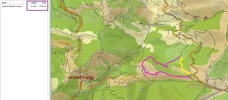
Yep, I'm similarly confused by the map. What I remember is coming out on a dirt track that went all the way to Pajares. After Puerto de Pajares I never went back on the N630 until I left Pajares the next day. I followed a gravel 4x4 track through the woods for a couple of km that took me all the way to the village, it came out on to a road which passed a cemetery (you can see the cemetery on the map below, pink rectangle with a crucifix in the middle just below Pajares). I don't really know how you would get from point "u" to that path or if I even reached point "u" but I'm sure I was going downhill when I reached it. I think there was a big right hand bend after I reached the path so I would guess it joins somewhere between "s" and "q". It was all way-marked, I can't remember what type of marker but it is definitely marked.


pajares map.webp
 
The one from Galicia (the round) and the one from Castilla & Leon. Individually numbered and made by the same people that make the ones you see on your walk.
Hello dear camino friends,

I made a new map. This time it's larger and it contains digits and letters on important crosses.
For me, it's not possible to understand the description of the coffin path. So it would be nice to describe the path by mentioning the digits/letters it passes. (possible path = d>c>b>a>g>u>t>8>7>6>4>5>...]

About the latest picture that Susanna posted. Yes, the marker that indicates to go down (just after 4), I followed that road also.
To describe what was next: The path goes down (direction w), you walk in ferns, the path goes right into the forest (path still goes down).
After the forest: again down through a meadow. You arrive at a small swamp. From there, the path has two tracks used by farmer vehicles and arrives at a comfortable road at "t".
At "u", just before arriving the N630 ("9"), there is a arrow pointing down again on a small path (two pink dots). I followed the N630 (a>v>d). Does the path at "u" connects "s"? Or does it connect "m" close to San Miguel?

Puerto de Pajares to San Miguel skipping Pajares = [blue, red or N630 till emergency track "5"]>4>6>7>n>m>g

The day after Pajares-San Miguel: the camino = h>f>e>g>j>k
At "f" (iron rousty gate), I didn't see an arrow, so you could walk to "i".
At "k": Santa Marina: you have to open the blue gate.
View attachment 6411

Hola Gunnar,
Yes, the yellow path is the one I walked (I think so) I remember close to Pajares I was suddenly standing on the n-630, and there was a sign/arrow telling me that I could go down the hill again, instead of going out on the n-630. I then said "no thanks" and walked the last part (a km? Or 500 meters something?) on n-630 and finally on pavement along it.
I still think it's funny as I thought the way to Pajares was so long. An hour or more. It looks like there's just a nice downhills twenty minutes or so. But I thought it was very long.
 
Am posting the last two pics I got of the Puerto de Pajares-Pajares trail.
One is from the muddy area. There's a yellow arrow on a tree. The other one is more at the end. Just when I was thinking Thank God no more cows. ;) There was a bunch of very large cows laying on the road. ImageUploadedByCamino de Santiago Forum1381673866.315740.webp
ImageUploadedByCamino de Santiago Forum1381673908.412072.webp
 
Hello all,

Here is a detail of point "t".
It shows also where point "u" is situated, now also called the "No thanks point".
Stuart, Joe, Fatma, maybe Laurie,
Can I conclude you all went down at point "u" and that "u" connects to "s" (Las Cotibinas on Stuart's map) and you entered Pajares by q>b>c>d?

The yellow circle on this picture is a painted marker on a rock.

Susanna, your picture in the wood is just after the fern walk after point "w", I recognize it.

pajares-no-thanks-section.webp
 
A selection of Camino Jewellery
And in fact, there seems to be another alternative to go from Puerto de Pajares till Pajares.
On my abcde-map, take the blue path to the North, leave it (where it goes North West down to the emergency track). Just continue to the North, zigzagging on the full black line (means possibility to drive on it with 4x4, farmer vehicle) to the top of the map
and come down on the white road arriving on the first "a" of the word Pajares.
héhé.

That looks very interesting. Wow, actually. :)
And fun as it means more mountain walking, instead of going down.
I wonder if there's a good satellite map/pic of this alternative path?
 
Having stared at that map for a while, I have figured one thing out. There is a connection missing somewhere. Bear with me. When you get to the place of Susanna's last picrture, Ender's wooden marker for San Miguel of Pajares albergue, the new "coffin route" takes you to Pajares.

But if you continue on the route marked San Miguel, you are on the "old Camino" and come to another bifurcation, which is the conch shell mojon I posted a picture of, which gives you the same option as the Ender's original split. This is the old Camino, and it's a few extra kms to stay on the road to San Miguel until you get to this second turnoff.

What I dont see is where the coffin route merges with the old Camino. And I also don't see where the Old Camino splits for San Miguel or Pajares. That is, the purple and yellow route hooks up with the new yellow route way before point g, because point G is where the route down from the albergue in Pajares arrives in San Miguel.

I am sure Ender could enlighten us in a snap, but this is much more fun. :)
 
...and ship it to Santiago for storage. You pick it up once in Santiago. Service offered by Casa Ivar (we use DHL for transportation).
Gunnar:

As I recall, I followed the blue trial across n-630. From that point I followed the markers to the Pajares/San Miguel sign post. Then the path went down hill through a grove of trees across an open area with a stream (Probably there because of the snow melt) and back through some woods. The mud was ankle deep. Somewhat further on I came to a 4x4 trail (described by Stuart) and then close to town the trail became more hard pan. Past a cemetery and and some farms then into Pajares. At no time did I cross or go on n-630. That said, there were times the road was in sight. It could very well have been the u>s>q>b>c>d?

Stuart:

I think you and I (possibly FatmaG) took the same route, Laurie I believe might have taken a slightly different route.

Ultreya,
Joe
 
I love this topic and I can't get enough of it either!
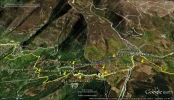
While walking I always have an GPS tracker in my pocket. I uploaded that in google earth which gave this picture.
I tried to make it clearer with all the extra marks in it, hope it still works works. This map shows the whole part between Arbas del Puerto and Pajaras village. Hope it doesn't make the whole discussion more confusing...

The way I walked is the yellow line. I walked from Arbas straight to Pajaras pass and didn't take the official camino which goes over the hill in the back of the bar.
After the bar I followed the N-630 till the emergency truck lane, I took a sharp left there back to the the camino. The signs there are very clear now. Ria (my wife) told me that it wasn't clear for her when she walked this part a few years ago, she walked to Pajares village on the N-630 all the way...
From the emergency lane I followed the camino signs, thanks to Ender, taking the Pajares sign, not the San Miguel route.. The path from there goes first through the cows (and a peaceful bull...), then the muddy part in the woods, the the bigger easy path (where vehicels can pass too). Then it goes the sharp left (point U at Gunnars map) where Suzanna decided to go straight back to the N-630. (might be a good desicion, much shorter and easier) The path we took and had caminosigns all the way, keeps going beneath the N-630, just before Pajares village it passes the cemetry, then we entered the village with the lovely albergue with the beautiful view.
After Pajares village (near the roadsigns of leaving the village) we took the path to the left to San Miguel, a path which is goes very steep down.

So back to the Pajares pass.
I think the official camino really should go to the bar-restaurant because there is no bar far before and far behind the place. (instead of going over the hill in the back)
Then we should forget about the school kids way, don't we? This because just before the bar we can take a right uphill, then a left to get straight to the emergency truck runway. It's safe.
I more people agree on that, we could ask Ender to mark the camino this way next time.

If someone still wants to continue on the N-630, please walk on the right side!!!!! On the left there is this double guardrail AND a double road, it's very very very dangerous. While walking left it might be that 2 trucks are coming up to you while passing each other. I have been a truck driver for many years and I know passing each other in such situations while the road is curving is very narrow with absolutely no place for walkers. You might be smashed between a truck and the double guardrail, there is no way you can quickly jump over the double guardrail :-( . If walking right you find more space.

So... what about a forum meeting soon at Pajares taking some yellow paint with us ;-)


Pajares ways.webp
 
Last edited:
It's becoming clearer! so, at the push-pin that says "Ender's wooden marker," that uncolored track to the left must be where the camino used to go. At some point on that path, there is another turn right to get back to the yellow path or to continue on to San Miguel. That spot is my picture of the concrete mojon with the two conch shells. But no one going on to Pajares will probably walk that way now, because they will take the first turn-off that Ender made.

I heard from someone who started the day in Poladura and was not stopping in Pajares but followed the path all the way to Pajares. they then went down to San Miguel and on to Campomanes. No wonder they were exhausted when they arrived!

Thomas, I agree that many people will not take the camino ender marked behind the bar if they know if will not stop at the bar (which would also mean missing the fabulous views from the parador look-out). So are you saying there is no way marked from the bar up to the Camino on the right?

I am hoping to be there next May and would be happy to have a painting party with this group.
 
Last edited:
3rd Edition. Vital content training & pack guides avoid common mistakes, bed bugs etc
I am sorry, I try to remember but all this remains too vague...
I cannot remember having seen the N630 nor having crossed any woods (it was in july 2010, woods and shadow should still be in my head if there had been any). I remember high vegetation (farns?), small paths as well as something which might have been a 4x4 way. I remember silence. And that it was a very long way after a very hard day.

If the wooden mark splitting San Miguel and Pajares comes before a second split at the concrete mark, I must indeed have followed that path, with a bigger distance to the N630.

Have to go back there, I guess - won't be able to sleep with these doubts... ;)
 
The way up behind the bar is definitely marked. There are yellow painted signs where it leaves the road (cant remember what or where but definitely marked) and there is at least one concrete scallop post, there is certainly one right at the top. It's not far, 10 min walk maybe? At the summit you can see the emergency lane below, there are no markings going down but you really can't miss it. I'm sure I've got some pics on my PC, I'll look in the morning.

I remember seeing the alternative track that Gunnar mentions at the summit and did consider staying high all the way to Pajares however the weather was turning and I didnt want to be at altitude if rain was coming. I hadn't decided whether or not to actually go to Pajares at this point either, I was still toying with Campomanes.

The "high" route from Arbas is marked too, a guy I leapfrogged for a couple of days went that way and missed the bar. He had a French-Canadian guide which recommended it.
 
The 2024 Camino guides will be coming out little by little. Here is a collection of the ones that are out so far.
It's becoming clearer! so, at the push-pin that says "Ender's wooden marker," that uncolored track to the left must be where the camino used to go. At some point on that path, there is another turn right to get back to the yellow path or to continue on to San Miguel. That spot is my picture of the concrete mojon with the two conch shells. But no one going on to Pajares will probably walk that way now, because they will take the first turn-off that Ender made.
I didn't go on that path but I think you're right. As you described things there must be a path to Pajares village that way too.

I am sorry, I try to remember but all this remains too vague...
I cannot remember having seen the N630 nor having crossed any woods (it was in july 2010, woods and shadow should still be in my head if there had been any). I remember high vegetation (farns?), small paths as well as something which might have been a 4x4 way. I remember silence. And that it was a very long way after a very hard day.
If the wooden mark splitting San Miguel and Pajares comes before a second split at the concrete mark, I must indeed have followed that path, with a bigger distance to the N630.
Have to go back there, I guess - won't be able to sleep with these doubts... ;)
If you didn't hear the N630 you probably walked the way mentioned by Laurie.


I heard from someone who started the day in Poladura and was not stopping in Pajares but followed the path all the way to Pajares. they then went down to San Miguel and on to Campomanes. No wonder they were exhausted when they arrived!
We did the same stretch in one day. It was a lovely day with very good temperature, it was hard but to do for us. Although the last part before Campomanes we decided not to go along the road, not the path through the woods. The road seemed more easy...

Thomas, I agree that many people will not take the camino ender marked behind the bar if they know if will not stop at the bar (which would also mean missing the fabulous views from the parador look-out). So are you saying there is no way marked from the bar up to the Camino on the right?
Also because of what Stuart said, I suppose there was this sign but I completely missed it, to much focused for the caffee and the boccadillo... Because I went of trail in Arbas, I think I wasn't on the camino anyway and had to find my own way. Sorry for that confusion.

It seems like there are (too) many ways with split ups without explanation (or did I miss something) on that part? Very confusing. Hope it is possible to improve that.

I am hoping to be there next May and would be happy to have a painting party with this group.
Yes, hope to be there too ;-)
 
I love this topic and I can't get enough of it either!
While walking I always have an GPS tracker in my pocket. I uploaded that in google earth which gave this picture.
I tried to make it clearer with all the extra marks in it, hope it still works works. This map shows the whole part between Arbas del Puerto and Pajaras village. Hope it doesn't make the whole discussion more confusing...

The way I walked is the yellow line. I walked from Arbas straight to Pajaras pass and didn't take the official camino which goes over the hill in the back of the bar.
After the bar I followed the N-630 till the emergency truck lane, I took a sharp left there back to the the camino. The signs there are very clear now. Ria (my wife) told me that it wasn't clear for her when she walked this part a few years ago, she walked to Pajares village on the N-630 all the way...
From the emergency lane I followed the camino signs, thanks to Ender, taking the Pajares sign, not the San Miguel route.. The path from there goes first through the cows (and a peaceful bull...), then the muddy part in the woods, the the bigger easy path (where vehicels can pass too). Then it goes the sharp left (point U at Gunnars map) where Suzanna decided to go straight back to the N-630. (might be a good desicion, much shorter and easier) The path we took and had caminosigns all the way, keeps going beneath the N-630, just before Pajares village it passes the cemetry, then we entered the village with the lovely albergue with the beautiful view.
After Pajares village (near the roadsigns of leaving the village) we took the path to the left to San Miguel, a path which is goes very steep down.

So back to the Pajares pass.
I think the official camino really should go to the bar-restaurant because there is no bar far before and far behind the place. (instead of going over the hill in the back)
Then we should forget about the school kids way, don't we? This because just before the bar we can take a right uphill, then a left to get straight to the emergency truck runway. It's safe.
I more people agree on that, we could ask Ender to mark the camino this way next time.

If someone still wants to continue on the N-630, please walk on the right side!!!!! On the left there is this double guardrail AND a double road, it's very very very dangerous. While walking left it might be that 2 trucks are coming up to you while passing each other. I have been a truck driver for many years and I know passing each other in such situations while the road is curving is very narrow with absolutely no place for walkers. You might be smashed between a truck and the double guardrail, there is no way you can quickly jump over the double guardrail :-( . If walking right you find more space.

So... what about a forum meeting soon at Pajares taking some yellow paint with us ;-)


View attachment 6420
Thank you Thomas for this voluminous and detailed post. Beautiful.:)
However, I'm not sure I'm with you when it comes to the path which you say should be marked with new painted yellow arrows. Err...what path? Do you mean the orange one on your map/photo?
Isn't that the same one as the blue dotted one on Gunnars map? :-/
If it is, isn't it marked already?
And. Isn't that the one Stuart walked?
I always thought that the blue dotted path was the boring path. Which made me think "meh" and/or "yawn".
And walking on the right side of n-630 just feels wrong.
 
The way up behind the bar is definitely marked. There are yellow painted signs where it leaves the road (cant remember what or where but definitely marked) and there is at least one concrete scallop post, there is certainly one right at the top. It's not far, 10 min walk maybe? At the summit you can see the emergency lane below, there are no markings going down but you really can't miss it. I'm sure I've got some pics on my PC, I'll look in the morning.

I remember seeing the alternative track that Gunnar mentions at the summit and did consider staying high all the way to Pajares however the weather was turning and I didnt want to be at altitude if rain was coming. I hadn't decided whether or not to actually go to Pajares at this point either, I was still toying with Campomanes.

The "high" route from Arbas is marked too, a guy I leapfrogged for a couple of days went that way and missed the bar. He had a French-Canadian guide which recommended it.

Ok, I'm trying to catch up and sort things out here. :) Am I right that a) the way that Thomas suggested should be marked (behind the bar) is already marked and b) you walked it?
Am looking forward to your pics. :)
 
3rd Edition. Vital content training & pack guides avoid common mistakes, bed bugs etc
Laurie, about a possible path behind the bar and the blue path: I put an ***update*** note on my post where I uploaded the satellite view.

About the picture Laurie posted with the double shell Pajares/San Miguel: the only place where this marker could make sense is point "7".

Susanna, about satellite view of a possible alternative path on the North side: You can explore the Bing maps (google on "bing maps" and enter Pajares, Spain, take selection 5 and explore. It's too large to screenshot and to post it on the forum.
The satellite view from Thomas is very interesting: you can see that you have to pass a big mountain.

And finally, it confirms that u>s>q>b is the camino to follow. In Bing maps, you can see clearly that "u" connects to "s".

To give a comment on Thomas's message about walking on the N630 till the emergency track: that's what we did. We knew it was only 300m and we walked quickly on the right side and calculated our steps that a we would never walk just after a "blind" curve when a truck was approaching the curve. When we took a break between 2 curves, we look to the behaviour of an incoming truck.

A reflexion an Fatma's message: I remember it's possible to miss the wood after the walk in the fern. We almost missed the walk in the wood because Ender's arrow was a little bit hidden in the fern. During winter and spring, there should be no problem because there is normally no fern.
If you would continue walking in the meadow with the fern and skip the wood, you would arrive on the trail between "8" and "t".
 
Last edited:
Laurie, about a possible path behind the bar and the blue path: I put an ***update*** note on my post where I uploaded the satellite view.

About the picture Laurie posted with the double shell Pajares/San Miguel: the only place where this marker could make sense is point "7".

But then where is the route from Point 7 to Pajares? That´s the "original" route that was in place before Ender put his post with the shortcut via the cemetery route.

I am still very confused, but I guess I don´t need to say that, it´s very obvious.
 
Here is one more bit of information that might help out the route detectives. That wide track that we all remember walking on at one point or another is a track that goes from the N -630 to the autovía (divided highway and toll road). But where is that on Gunnar´s map?

And that point (where the path gets close to the N-630, about 200 m before the pueblo of Pajares) is where both of the routes to Pajares (Ender´s coffin route and the original longer route) join.

I know this , not because of any cartographic or memory skills, but because little birdie named Ender just told me. :) But I don´t think he wants to give away all of his secrets just yet, he´s like the cat playing with the mouse, watching us confuse each other with every post.
 
3rd Edition. Vital content training & pack guides avoid common mistakes, bed bugs etc
But then where is the route from Point 7 to Pajares? That´s the "original" route that was in place before Ender put his post with the shortcut via the cemetery route.

I am still very confused, but I guess I don´t need to say that, it´s very obvious.

Okay. I'm confused, too. :)
You are saying that there are two paths missing at Gunnars first map (in post 1)?
A, the original route which was five km longer, the end of the part which goes to Pajares. Which means it does not go to San Miguel before it goes to Pajares? And that ones never had to climb up that awful, awful hill?
Right, if that's so, then I guess it also went up "the coffin road". Which ends at the No Thanks point, at n-630?
B, And Gunnar also forgot to put the blue dots from Arbas? As you can walk from Arbas on the Barbed Wired aka blue path all the way? And not only the short blue dotted path from the bar, called The Wimp Way ?
Or am I all wrong here?
 
If I thus walked the original path (the one Laurie walked thus also, without yellow arrows, without wood but with ferns), it definiteley did not descent till San Miguel, Susanna.
Except a very steep part, it stayed rather flat (in my memories).
and I don't remember of any hard ascent to Pajares neither.
I just wonder, Gunnar, might there be a possibility connecting point t to s, r or q without approaching the N630?
Because, definitely, before the "center" of Pajares, I really don't think having walked on it.
Unfortunately, my very few pictures don't tell anything...
(except, yes, the concrete marker "San Miguel - Pajares", and to the lefthand a small enclosure to count the flog)
 
I should start by clarifying that I have walked the Salvador twice. The first time was before Ender put in the wooden post with the bifurcation to the coffin route. The second time was afterwards.

So, yes, FatmaG and I may be the only two here (or maybe Thomas´s wife also) to have walked the original camino. When the wooden post wasn´t there yet, that meant that you kept going till the point where my photo shows the mojón with the two conch shells. At that point there was a turn-off for Pajares, with an option to continue descending to San Miguel. And as Fatma says, the route to Pajares didn´t go down to San Miguel -- it had an earlier turn-off. The problem is finding that camino on Gunnar´s map, but it must still be there.
 
...and ship it to Santiago for storage. You pick it up once in Santiago. Service offered by Casa Ivar (we use DHL for transportation).
Okay. I'm confused, too. :)
You are saying that there are two paths missing at Gunnars first map (in post 1)?
A, the original route which was five km longer, the end of the part which goes to Pajares. Which means it does not go to San Miguel before it goes to Pajares? And that ones never had to climb up that awful, awful hill?
Right, if that's so, then I guess it also went up "the coffin road". Which ends at the No Thanks point, at n-630?
B, And Gunnar also forgot to put the blue dots from Arbas? As you can walk from Arbas on the Barbed Wired aka blue path all the way? And not only the short blue dotted path from the bar, called The Wimp Way ?
Or am I all wrong here?


Susanna, yes I think this is right, there are two paths missing. The original route did not descend all the way to San Miguel, but it did descent quite a bit of the way in terms of elevation, so there was still a short steep ascent to get back up to the highway.

The best way to know if you went on the coffin road or not is to answer whether you turned towards Pajares albergue, which was your last picture posted. I´m assuming that the answer is yes, and if you did that, you went on the "new coffin route."

So maybe we need to split this into two separate posts -- one talking about where the coffin route goes, and the other talking about where the old "original Camino" goes. Which ought to be good for many more hours of our time. :)
 
Hello, I'm back again, don't be confused :-)
About the blue path
a) what I put in the update is in case you would come out the bar and try to go behind the bar and join the blue path.
b) yes, I had to put the original camino "Wimp way" starting from Arbas also on the map. But here I'm a bit confused because I saw the last brown, wooden marker (the one that starts in León) somewhere at the third last yellow dot to the right on the N630 (so somewhere close to the river on the left side of the N630 walking to the Puerto dP), so I thought following the N630 is/was the original track. But I agree, the original starts behind the church.

Laurie wrote: That wide track that we all remember walking on at one point or another is a track that goes from the N -630 to the autovía (divided highway and toll road).
(man man man miserie miserie miserie, sorry that's a bit of dutch :-)
OK
Here we go
Following my opinion, the 5km extra is painted in pink. Better, it's calculated by Garmin and it's 4,6km. The yellow path is the actual camino (ferns-wood-meadow). I missed some hundred meters because Garmin was not able to join the yellow line at the bottom.
At point "7", following my opinion, there is the double shell marker from Laurie and.... there is also a way to go to the autopista... dotted and painted in brown
pajares-versus-autopista.webp


Don't you think we will get a remark from Ivar because we post too much pictures, maps....
At your service,
Gunnar W.
 
Hello, I'm back again, don't be confused :)

At point "7", following my opinion, there is the double shell marker from Laurie and.... there is also a way to go to the autopista... dotted and painted in brown
View attachment 6437

Don't you think we will get a remark from Ivar because we post too much pictures, maps....
At your service,
Gunnar W.

I think the only way we'll get remarks from Ivar is if we start hurling instults at each other. Which we would obviously never do. I have to say I think the Puerto de Pajares club and the electric coil club are the two nicest sub-groups on the forum (and coincidentally Susanna and I belong to both). ;)

Gunnar, I just wrote a long paragraph explaining why you must be wrong about point 7 being the place where the old mojón is. But I erased it, because now that I look carefully at the map above, I see that what you must mean is that the split is between the pink and the unbroken black line (NOT the brown dotted line) that descends and then takes you into San Miguel. That is exactly how I remember it. The mojon was at the top of a hill, with the route to San Miguel going down and the route to Pajares continuing to the right on level ground. So I think you have solved that problem completely!

But I think (hope you will correct me here) you still don´t have a complete version of the coffin route. Or is it that black line that goes up to the highway after the pink and yellow join?

And if that is the case, then the wide track that connects the N-630 with the autovia is the following:

-- black line from highway to point where pink and yellow join
-- stay on pink to point 7
-- get on dotted brown
-- but is your single line brown showing a track or just showing us that you´ve gotten us pretty close to the autovia?

How do you know that all of this is a wide track? Can you see it on the map?
 
The one from Galicia (the round) and the one from Castilla & Leon. Individually numbered and made by the same people that make the ones you see on your walk.
I have to say I think the Puerto de Pajares club and the electric coil club are the two nicest sub-groups on the forum (and coincidentally Susanna and I belong to both). ;)

haha - makes me reconsider using my (never used) electric coil just for the pleasure of joining in...

By the way, just realised that Rebekah is back to the forum - she might help us further.
Else we should all of us consider walking in spring with you, Laurie, to find out in "real time".
 
Sorry I have missed out on all the fun over the past couple of weeks. I was out walking the Salvador!

Sadly, I have little to add to this map-making saga, as the days are growing so short and each day´s walk was a race to get to the next albergue before the sun vanished behind the mountains! I was at Pajares Pass late on Wednesday, a cool, clear day. We started at Buiza.

I saw the first arrows for the "over the peak past the bulls" route at the Puerto de Pajares, but a building project at the roadway maintenance garage had barricaded the big parking lot and prevented the only access I could see. It looked like I would have to climb a wooden fence and walk along a pasture full of horses, then head up a sheer hillside. I was just then in dire need of a cold beer, so I opted for the bar.

I soon had a look round the "front yard" of the old hotel, and could only see the impending sunset. Three years ago I hiked down the highway and followed the marked path from the runaway truck ramp downhill and back up to Pajares Pueblo. It had added many steps to a long day back then, and this day I did not savor that long, circuitous hike, or trying to find a much-contested new pathway in failing light.

My hiking partner decided for us. The two mountains had done her in, and traffic on the highway was light.
We put on our reflective vests and walked along the roadway to Pajares.

Appalling, I know. But it really was not so bad as all that. And we made it to town with only about five minutes of light left to see with.

(I want also to applaud the wonderful little refuge at Cabanillas, and the OTTER we saw playing in the rapids of the Bernesga River just south of La Robla! The Salvador really does have it all!)
 
Get a spanish phone number with Airalo. eSim, so no physical SIM card. Easy to use app to add more funds if needed.
Ha!
Conclusions till now:
- we are still lost in the bull besieged no man's land around Puerta de Pajares
- we keep a little Mystery for ourselves
- we possibly have a new member in the group
- the fun can go on!
Sounds good!
 
The 2024 Camino guides will be coming out little by little. Here is a collection of the ones that are out so far.
I think the only way we'll get remarks from Ivar is if we start hurling instults at each other. Which we would obviously never do. I have to say I think the Puerto de Pajares club and the electric coil club are the two nicest sub-groups on the forum (and coincidentally Susanna and I belong to both). ;)

I think that may be because all the participants are completely mad (I mean that in a good way :) ).
 
Ok, I'm trying to catch up and sort things out here. :) Am I right that a) the way that Thomas suggested should be marked (behind the bar) is already marked and b) you walked it?
Am looking forward to your pics. :)

Yep, the way was marked. Like I said, I can't really remember how it was marked but it was done somehow. I think it was yellow paint, there was a mark on the gate post just down from the bar, maybe and on boulders going up the track. I was going pretty quick up that path as I was trying to avoid the bull noticing me but he looked that he might have other things on his mind :D

Right... I've taken a look at my pictures, I don't have a shot of the concrete mojon like I thought but I am really confused now. This is a blow-up of a cheesy self-portrait I took at the top of the "Wimp Route" that goes up from the back of the bar. I might be remembering it wrong but I'm pretty sure I took this at the summit after I crossed the barbed wire fence. If I'm right then the way down is to the LEFT of the electricity pylon in the background. But... I never noticed this before, there is a yellow flecha on the concrete foundation block which points to the RIGHT. I'm wondering if this is the alternative route that Gunnar spoke about that went over the hills to Pajares.

I'm also wondering if Ender is quietly chuckling away as he reads this.

[EDIT: I'm looking at this now on Bing aerial view and I think I may be remembering it wrong, it's possible the pylon was on the left of the way down. I would have sworn it was on the other side though. I'm getting very confused now :D]

pylon.webp
 
Yes, we must be the most crazy group here at the forum:), and I love it:p. Sometimes little things are very important in life.


Just a short reply on Lauries question, because I think I know that answer:
But I think (hope you will correct me here) you still don´t have a complete version of the coffin route. Or is it that black line that goes up to the highway after the pink and yellow join?
And if that is the case, then the wide track that connects the N-630 with the autovia is the following:
-- black line from highway to point where pink and yellow join
-- stay on pink to point 7
-- get on dotted brown
-- but is your single line brown showing a track or just showing us that you´ve gotten us pretty close to the autovia?
How do you know that all of this is a wide track? Can you see it on the map?

Just before the wide track is getting to the autovia there is a sign to the left, down into a small path. I took it, I think that is the coffin route.
You can see it at the map I used, it is the yellow line. The path takes you around the mountain, has the same curve as the autovia but down from that. If you follow the wide path and continue on the autovia (like Suzanne did) it seems to be much shorter.

Stuart: it might very well be possible that there are clear arrows, I possible just missed all that while all my focus was on that caffee I was going to drink...
But, it might also be that this path is blocked now by the the roadway maintenance garage as described by Rebekah.
I checked my pictures. In the far end just left of the road you can see the garage and silo standing on the parking lot. (and see how busy this road was at that moment). But at the same picture I also can't see the electric lines like on your picture. Can that picture indeed being taken at another point?

IMAG0658 (640x374).webp

Here everyone can also see why to walk at the right side just after the bar. There is some space there and no space at all and the high guardrail on the left.
IMAG0659 (2) (800x602).webp
 
A selection of Camino Jewellery
Sorry I have missed out on all the fun over the past couple of weeks. I was out walking the Salvador!

Sadly, I have little to add to this map-making saga, as the days are growing so short and each day´s walk was a race to get to the next albergue before the sun vanished behind the mountains! I was at Pajares Pass late on Wednesday, a cool, clear day. We started at Buiza.

I saw the first arrows for the "over the peak past the bulls" route at the Puerto de Pajares, but a building project at the roadway maintenance garage had barricaded the big parking lot and prevented the only access I could see. It looked like I would have to climb a wooden fence and walk along a pasture full of horses, then head up a sheer hillside. I was just then in dire need of a cold beer, so I opted for the bar.

I soon had a look round the "front yard" of the old hotel, and could only see the impending sunset. Three years ago I hiked down the highway and followed the marked path from the runaway truck ramp downhill and back up to Pajares Pueblo. It had added many steps to a long day back then, and this day I did not savor that long, circuitous hike, or trying to find a much-contested new pathway in failing light.

My hiking partner decided for us. The two mountains had done her in, and traffic on the highway was light.
We put on our reflective vests and walked along the roadway to Pajares.

Appalling, I know. But it really was not so bad as all that. And we made it to town with only about five minutes of light left to see with.

(I want also to applaud the wonderful little refuge at Cabanillas, and the OTTER we saw playing in the rapids of the Bernesga River just south of La Robla! The Salvador really does have it all!)


Rebekah:

I agree that Cabanillas is a wonderful little refuge.

Joe
 
Yes, we must be the most crazy group here at the forum:), and I love it:p. Sometimes little things are very important in life.


Just a short reply on Lauries question, because I think I know that answer:


Just before the wide track is getting to the autovia there is a sign to the left, down into a small path. I took it, I think that is the coffin route.
You can see it at the map I used, it is the yellow line. The path takes you around the mountain, has the same curve as the autovia but down from that. If you follow the wide path and continue on the autovia (like Suzanne did) it seems to be much shorter.

Stuart: it might very well be possible that there are clear arrows, I possible just missed all that while all my focus was on that caffee I was going to drink...
But, it might also be that this path is blocked now by the the roadway maintenance garage as described by Rebekah.
I checked my pictures. In the far end just left of the road you can see the garage and silo standing on the parking lot. (and see how busy this road was at that moment). But at the same picture I also can't see the electric lines like on your picture. Can that picture indeed being taken at another point?

View attachment 6448

Here everyone can also see why to walk at the right side just after the bar. There is some space there and no space at all and the high guardrail on the left.
View attachment 6450

Thomas:

Your first picture has the parking lot on the right. At the very end of the lot on the right is a gate I climbed over and walked up a hill. Then at the electrical Tower, I climbed over a barb wire fence and down a hill to the n-630. I believe this is the dotted blue line and Ender's route. It appears from Thomas's GPS map, I could have walked out of the restaurant in Arbus and crossed the street and followed the blue line and not walked on the n-630 at all except to cross it twice. Once in Arbus and then again between the Parador and the truck run-off.

Joe
 
Yep, the way was marked. Like I said, I can't really remember how it was marked but it was done somehow. I think it was yellow paint, there was a mark on the gate post just down from the bar, maybe and on boulders going up the track. I was going pretty quick up that path as I was trying to avoid the bull noticing me but he looked that he might have other things on his mind :D

Right... I've taken a look at my pictures, I don't have a shot of the concrete mojon like I thought but I am really confused now. This is a blow-up of a cheesy self-portrait I took at the top of the "Wimp Route" that goes up from the back of the bar. I might be remembering it wrong but I'm pretty sure I took this at the summit after I crossed the barbed wire fence. If I'm right then the way down is to the LEFT of the electricity pylon in the background. But... I never noticed this before, there is a yellow flecha on the concrete foundation block which points to the RIGHT. I'm wondering if this is the alternative route that Gunnar spoke about that went over the hills to Pajares.

I'm also wondering if Ender is quietly chuckling away as he reads this.

[EDIT: I'm looking at this now on Bing aerial view and I think I may be remembering it wrong, it's possible the pylon was on the left of the way down. I would have sworn it was on the other side though. I'm getting very confused now :D]

View attachment 6444

Thank you Stuart for this honest report of what Actually went on behind the scene (or should I say bar) during your Puerto de Pajares Light. Amazing.
Well I can only guess what the bull was thinking when he saw a Scotsman come crawling under the fence, then starting to stroll around in the fields taking cheesy self portraits against the background of pylons. "Great. Another member of the Puerto de Pajares Fanatics. Totally bonkers, all of them". :)
Now, I've made a close study of your photo. And (am rather pleased with myself right now), there's not only one yellow arrow on the concrete foundation, as you suggested. There are two! :cool:
If they are pointing to the downhills or uphills, I can't tell, as it looks rather flat to me.
 
The one from Galicia (the round) and the one from Castilla & Leon. Individually numbered and made by the same people that make the ones you see on your walk.
Just before the wide track is getting to the autovia there is a sign to the left, down into a small path. I took it, I think that is the coffin route.
You can see it at the map I used, it is the yellow line. The path takes you around the mountain, has the same curve as the autovia but down from that. If you follow the wide path and continue on the autovia (like Suzanne did) it seems to be much shorter.
Huh? Now I'm getting confused here. And I mean really confused. :)
What autovia? What's that and where is it? And did I walk it?
 
I think one thing we agree and that's about the way of caminar to Pajares Pueblo
At Arbas you can go behind the church till the emergency track.
But you can also follow the N630 till the bar. Before the silo, there is the blue path till the emergency track.
After the bar, entering Asturias, you an opt for The School kids path, the N630 or go back to the silo.
At the emergency track: it's 5>4>w>t>u>s>q>b>c>d till Pajares. Note that on the abcd-map, there is no dotted connection between u and s.

It seems that Fatma and Laurie took a long time ago another way between 4 and d. We have to hypnotize them much more with unclear pictures, weird maps,... to bring the memory back.
I will read now the other posts and update this post.

Good news: powerlines are also visible on the abcd-map. Stuart can determine where he took his latest posted picture. Susanna also with one of her prvious pictures.
It's a grey thin line hardly visible.
Where is it?
It starts on the map where the N630 starts on the right side of the map (Arbas del Puerto)
It shortcuts the church/N630 Arbas del Puerto and joins again the N630
It bends to point 5 (the emergency track) and it goes parallel with the blue dotted path
It bends again and goes straight to the second "a" of Pajares...
 
About the post of Laurie,
Coffin path: I think the coffin path follows the 4,6km (5km if you want) stretch in pink till the emergency path (which is not in pink, it was not possible in the application). What happens next with the coffin, I don't know. N630 till Arbas?

On the abcd-map:
black thin lines are normally paths where 4x4, farmer vehicles can drive on it too.
back dotted lines (not the dots that I placed) are small paths
Important: Garmin maps are not holy. There are still errors on it like paths who don't exist (any longer?). Also some existing paths are (still) missing.

I enlarged the map and mentioned the autopista because you mentioned the autovia.
I think we have to use the correct Spanish terms.
Autopista = highway with toll (peaje) = at least 2 seperate lanes each way = 120km/h. In our case it's the AP66 between León and Oviedo. The Alsa bus I took from Oviedo till León took that way.
Autovia = free highway = at least 2 seperate lanes each way = 120km/h. In our case, the AP66 is free at Campomanes till Oviedo and becomes the A66. That's the reason the traffic disappeared on our camino between Pola de Lena and Ujo.
National roads (N-ways) like the N630 = 90km/h (sometimes 100km/h).
The N630 is not an autovia, not a highway.
 
Last edited:
€2,-/day will present your project to thousands of visitors each day. All interested in the Camino de Santiago.
About the post of Laurie,
Coffin path: I think the coffin path follows the 4,6km (5km if you want) stretch in pink till the emergency path (which is not in pink, it was not possible in the application). What happens next with the coffin, I don't know. N630 till Arbas?

I enlarged the map and mentioned the autopista because you mentioned the autovia.
I think we have to use the correct Spanish terms.
Autopista = highway with toll (peaje) = at least 2 seperate lanes each way = 120km/h. In our case it's the AP66 between León and Oviedo. The Alsa bus I took from Oviedo till León took that way.
Autovia = free highway = at least 2 seperate lanes each way = 120km/h. In our case, the AP66 is free at Campomanes till Oviedo and become the A66. That's the reason the traffic disappeared on our camino between Pola de Lena and Ujo.
National roads (N-ways) like the N630 = 90km/h (sometimes 100km/h).
The N630 is not an autovia, not a highway.

That was such a great post Gunnar. :)
 
Huh? Now I'm getting confused here. And I mean really confused. :)
What autovia? What's that and where is it? And did I walk it?

Sorry for the confusion Suzanne.
The autovia is in this case the N-630. I wrote this because I unserstood this from what you mentioned before:
Hola Gunnar,
Yes, the yellow path is the one I walked (I think so) I remember close to Pajares I was suddenly standing on the n-630, and there was a sign/arrow telling me that I could go down the hill again, instead of going out on the n-630. I then said "no thanks" and walked the last part (a km? Or 500 meters something?) on n-630 and finally on pavement along it.

About the powerlines:
on the bingmap you can see them quit good. If you look at:
http://www.bing.com/maps/?v=2&cp=r4z4yqghm5vn&lvl=18&dir=90&sty=b&q=pajares&form=LMLTCC
you can see at the right the bar and on top to the left bottom thin powerlines with clearly the three poles and on the left bottom a singel pole.

You're right about the autovia and autopista Gunnar. Let's call it the N630 or national road.
I also see very clear in your picture that there is a clear sign just before the bar and near the silo to the right. I missed that out completely. Sorry for the confusion I made.
 
Last edited:
Fail to prepare? reduce your risk by buying this book full of practical info.
2nd ed.
About the post of Laurie,
Coffin path: I think the coffin path follows the 4,6km (5km if you want) stretch in pink till the emergency path (which is not in pink, it was not possible in the application). What happens next with the coffin, I don't know. N630 till Arbas?

Just to clarify (ha, not that I have clarified much of anything in this discussion) -- Gunnar, I think you mean in the above sentence -- "N630 till Pajares, right?

If so, though I can't tell you where it does go, I can tell you that the coffin path never actually hits the N630 again on the way into Pajares. Leaving Pajares, we hit it again. I think we all remember turning left out of the albergue, walking through the village up to the N630 and then very shortly afterwards seeing the arrow pointing us down to San Miguel.

And exactly what do you mean by "stretch in pink till the emergency path," what emergency path? I think the only time we've used the term emergency is to refer to the pull-off for runaway trucks up on the N630 and I don't think that's what you are talking about.

But I think we are muddling through making progress, and I think there are only a few mysteries still unsolved:
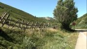
1. How do we get from the point where coffin path intersects old camino (that is where yellow and pink meet on the most recent Gunnar map) to the pueblo of Pajares?

2. Where is the wide unpaved track that connects N630 with autovia, and which we walk on at some point on pink trail and after yellow trail?

Here's what we have figured out, after only 30000 posts, many of which begin with "I'm confused."

1. We know how to walk on the camino from ARbas to the bar at the Puerto de Pajares, up to the right after the bar and eventually down to the N630 where the "official camino" crosses the N630 and descends.

2. We think we know how the original Camino gets from point 7 to San Miguel, bypassing the town of Pajares (must be on that black line to the right of the number 7, which continues up to San Miguel). (this is really relevant only for those who are bypassing Pajares)

But of course Gunnar started this thread asking about yet another route to Pajares, a fourth route from the Puerto de Pajares and we haven't really even scratched the surface of that one!

But we salvadoranos are nothing if not determined and we will get to the bottom of this! Let the map making continue! Laurie
 
Hello Laurie,
About the coffin path. I was thinking to transport first the body from Pajares to Arbas church. But we can think also reverse: from Arbas to Pajares. If the path never hit, crosses [well it needs to cross once] or is on the N630, then the part between Arbas and the emergencytrack seems no to be much comfortable (for a horse and a cart if we do it like that).
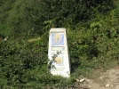
About point 2 (the question).
Autovia? The autovia A66 starts in Campomanes heading Oviedo... see my previous post admired by Susanna.

Aha, no we didn't start yet about other alternatives. Looking to the map with the brown dots heading to the Autopista. There are more alternatives. Much longer off course, for example Puerto de Pajares - point 7 - going more to the east and then to the North passing "El Nocedo" and then San Miguel del Rio.

And there is still the ferrocaril mystery. Meanwhile I found out where the fancy part is situated. But that's for later.
 
Sorry for the confusion Suzanne.
The autovia is in this case the N-630. I wrote this because I unserstood this from what you mentioned before:


About the powerlines:
on the bingmap you can see them quit good. If you look at:
http://www.bing.com/maps/?v=2&cp=r4z4yqghm5vn&lvl=18&dir=90&sty=b&q=pajares&form=LMLTCC
you can see at the right the bar and on top to the left bottom thin powerlines with clearly the three poles and on the left bottom a singel pole.

You're right about the autovia and autopista Gunnar. Let's call it the N630 or national road.
I also see very clear in your picture that there is a clear sign just before the bar and near the silo to the right. I missed that out completely. Sorry for the confusion I made.
Yes I agree, let's call n-630 n-630. :)
And. It's Susanna, not Suzanne. ;)

Thank you Thomas that was a very good pic of the power lines. :)
I'm impressed by Bing maps btw. I didn't know they were so good. Much better than google earth.
 
...and ship it to Santiago for storage. You pick it up once in Santiago. Service offered by Casa Ivar (we use DHL for transportation).
Hello Laurie,
About the coffin path. I was thinking to transport first the body from Pajares to Arbas church. But we can think also reverse: from Arbas to Pajares. If the path never hit, crosses [well it needs to cross once] or is on the N630, then the part between Arbas and the emergencytrack seems no to be much comfortable (for a horse and a cart if we do it like that).
About point 2 (the question).
Autovia? The autovia A66 starts in Campomanes heading Oviedo... see my previous post admired by Susanna.

Aha, no we didn't start yet about other alternatives. Looking to the map with the brown dots heading to the Autopista. There are more alternatives. Much longer off course, for example Puerto de Pajares - point 7 - going more to the east and then to the North passing "El Nocedo" and then San Miguel del Rio.

And there is still the ferrocaril mystery. Meanwhile I found out where the fancy part is situated. But that's for later.
Ok I've been out most of the day. It seems like I've missed something Big here. :(
(Now it's starting to look like a mystery novel IRL)
"...transport the body..."
What body? Maybe when should take this in pm?
 
Hello Laurie,
About the coffin path. I was thinking to transport first the body from Pajares to Arbas church. But we can think also reverse: from Arbas to Pajares. If the path never hit, crosses [well it needs to cross once] or is on the N630, then the part between Arbas and the emergencytrack seems no to be much comfortable (for a horse and a cart if we do it like that).

Sorry to be dense, but you'll have to explain it differently. If the body is going from the town of Pajares to Arbas church, we still have to find the trail from the town of Pajares up to the point where the pink meets the yellow trail. Isn't that where we are stuck?

What is the emergency track?

What I thought we were clear on was that from Arbas to the N630 intersection the official was the way Thomas and Joe have described. Once we do that crossing over the N630, there is no more crossing the N630 till we leave Pajares. I agree that it is unlikely that people carried coffins up that hill and back down to get to Arbas, but I think the "coffin route" that Ender marked is just from the beginning of the yellow track (where Ender's wooden marker is) to Pajares.

When I said this:
2. Where is the wide unpaved track that connects N630 with autovia, and which we walk on at some point on pink trail and after yellow trail?
I was talking about something Ender had told me, that such a track exists and that it begins on the N630 near a bar that is 200 m from the town of Pajares and extends to the autovia. AND that the Camino goes on that path before reaching Pajares. I remember walking on a wide track, seeing vehicles on it four years ago, I think, with picnickers.

on we go. Laurie
 
Sorry to be dense, but you'll have to explain it differently. If the body is going from the town of Pajares to Arbas church, we still have to find the trail from the town of Pajares up to the point where the pink meets the yellow trail. Isn't that where we are stuck?

Oh dear.
Laurie, what's happened?
Ok I guess you can be happy it's not +34 c anymore, considering the situation you are in.:rolleyes:
 
Get a spanish phone number with Airalo. eSim, so no physical SIM card. Easy to use app to add more funds if needed.
Just me again. :)
Here's a pic of a map I printed out from the map website Stuart wrote about before.
Ok. There is a mountain called "Muertos" something. Might be a good place to hide the body.
ImageUploadedByCamino de Santiago Forum1381851506.515200.webp
 
Ok I've been out most of the day. It seems like I've missed something Big here. :(
(Now it's starting to look like a mystery novel IRL)
"...transport the body..."
What body? Maybe when should take this in pm?
Oh dear.
Laurie, what's happened?
Ok I guess you can be happy it's not +34 c anymore, considering the situation you are in.:rolleyes:

I'm sure there is a very small number of readers who will have laughed out loud at this post like I did. And your "muertos" comment is even better.
Susanna you get the laugh award of the day. :)
 
I think one thing we agree and that's about the way of caminar to Pajares Pueblo

It seems that Fatma and Laurie took a long time ago another way between 4 and d. We have to hypnotize them much more with unclear pictures, weird maps,... to bring the memory back.

Impossible Gunnar!
My memories are far too vague (but, well I never really tried to be hypnotized - might it really work, pushing away dark clouds of different memories hiding the precious 'Puerta de Pajares' ones?)

Well, enough joking.
At least I am really seriously considering walking the Camino del Salvador another time.
It was in 2010, a long time ago, and such a beautiful camino deserves certainly a second time.
It might be the following combination:
Walking from Burgos to Leon - meseta is calling. And the Peacable Kingdom which I missed in 2009.
From Leon to Oviedo (and getting the "Salvadorana") - visiting Santa Cristina and all the other ancient churches or buildings I didn't stop at.
And then: "la Ruta de la Reconquista" and the Picos de Europa.
 
A selection of Camino Jewellery

❓How to ask a question

How to post a new question on the Camino Forum.

Most read last week in this forum

As you might imagine, Ender and the Salvador angels are spitting mad. Complaints have been filed, but the damage is done. It appears to have been a lumber company’s machinery. The exact spot...

Featured threads

❓How to ask a question

How to post a new question on the Camino Forum.

Forum Rules

Forum Rules

Camino Updates on YouTube

Camino Conversations

Most downloaded Resources

Featured threads

This site is run by Ivar at

in Santiago de Compostela.
This site participates in the Amazon Affiliate program, designed to provide a means for Ivar to earn fees by linking to Amazon
Official Camino Passport (Credential) | 2024 Camino Guides
Back
Top