Search 74,075 Camino Questions

Saint Jean Pied de Port to Roncesvalles, leaving in the afternoon

On my 1994, I was walking an average 42K/day, and had about a month of the Camino already in my legs.

I left SJPP at about 11AM, and just barely made it to the Albergue in Roncesvalles in time. I was averaging about 6kph on the flat.

But that was in July or August.

Sunset will be much earlier, and October weather in the Pyrenees is unpredictable. I was a very fast walker, and your plan is unrealistic. Start the next morning instead, as by October some Albergues will already be closed.
Hi JabbaPapa,

Thank you very much for your words, your experience is very important to me and will certainly help me.

I have no experience in mountain/hiking and I am not familiar with the term "speed on the flat". Do you remember the speed you were going on the trail when you refer to "6 km/h on the flat"?

In general, how did you manage your 42 km/day in terms of stops, food, schedules...?

I expected to find many people who had already walked this stretch in the afternoon, but I was completely wrong.
 
€2,-/day will present your project to thousands of visitors each day. All interested in the Camino de Santiago.
I may be misreading comments in this thread 🤔 but I think that we here on the forum are meant when @JonnyRosa refers to "colleagues".
Hello Kathar1na,
When I used the term "colleagues" it was to refer to the members of the forum as you said. I apologize in advance to anyone who did not understand or even liked the term I used.
 
That is a gut-wrenching ride 😁 (and expensive)
Never done it myself, but many do it seems......... :rolleyes:
I had booked a Pilgrim friendly taxi service online ahead of time from Pamplona to SJPdP in mid April 2017. No one arrived at the train station to pick up my family of four, although others were being whisked away. After several attempts we finally were able to get someone to take us; a young man in a very small car who drove like a maniac with three of us squished together in the back seat. I think he envisioned himself as a Nascar driver. I hung on to the seat in front of me for dear life and "nearly had a heart attack" as he snaked and swerved back and forth on the mountainy narrow roads through the trees and village pullouts.
 
Last edited:
Train for your next Camino on California's Santa Catalina Island March 16-19
There's a short catalogue of the dangers in the mountains on the website of the Pilgrim Association of SJPP. The area between SJPP and Roncesvalles is not really the high Pyrenees, i.e. it is more hills than mountains, but this catalogue applies, too. It is in French. It has been on their website since 2004 at least, i.e. for 20 years now. Translated into English, it goes like this [shortened extract]:

As any experienced pilgrim will tell you, hiking in the mountains is only slightly more difficult than hiking on the plains. Except that ...
  • except that when the weather is fine, the sun is both brighter and hotter than on the plains, so beware of sunburn and ophthalmia which give you the endearing look of a rabbit with myxomatosis;
  • except that when it is cold on the plains, it is 8 ºC colder at 1000 meters higher up;
  • except that the cool breeze you enjoy on the plains turns into a storm, blowing through your clothes, tearing off your hat, flipping over your umbrella and lifting your poncho over your head;
  • except that a bit rain on the plains turns into a violent downpour or into snow when it is cold. Hotter sun, more intense cold, stronger wind or heavier rain: there is still nothing to frighten the mountaineer in you;
As any experienced mountaineer will tell you, crossing the mountains is like crossing the plains. Except that ...
  • except that, in the mountains, a complication rarely happens on its own, and that the big difficulty starts when several small inconveniences occur at the same time and combine their effects.
Taking all precautions to minimise small inconveniences and allowing plenty of time to deal with them should they occur ought to be a no-brainer for everyone who starts from SJPP for Roncesvalles. Alas, it isn't.
 
Listen to people that say Don’t Do It. Trust the advice that you hear here over your own ability. You seem to have a very technical view of your ability but not the experience that others have. Weather is very unpredictable at that elevation and when I was there a bicycle pilgrim had to be rescued off the mountain for exposure. This can happen any time of the year. I walk your same pace and would never do this with only an hour window before sunset. The best advice I can give you is to be humble and listen. My first day my hospitalero insisted I download the 911 pilgrims app and stood there until I did it. She told me many many pilgrims get hurt or lost or need help on the Camino she also told me “keep your passport on your body not in your pack so that when they find you they know who you are.”It was very sobering. The people that live there and the pilgrims that have walked have seen and heard the stories. If 90% are saying don’t do it- don’t.
 
I haven't been on Camino yet, but i'm a regular runner on both paved surfaces and rough/no trails. I've done some jogging and running with my 7kg Osprey pack while on practice hikes in mountainous forest. The main thing is, in my experience, is you mentally get tired quicker when moving rapidly in dark, cross-country conditions. It's that constantly having to evaluate where you step - all those adjustments to avoid twisting ankles, etc. I never use a treadmill but I get the impression one often looks ahead. Cross-country running - my eyes tend to scan the ground. Bad visibility and unfamiliarity will make this harder and more dangerous. Only one misstep, hiking at home or on Camino, can lead to debilitating injury.

I'm planning on a few long stages for myself, but never planning that I will need to resort to jogging or running to match my schedule.

And besides, I want time to stop for coffee, access toilets, take photos and sightsee !
 
Last edited:
Fail to prepare? reduce your risk by buying this book full of practical info.
2nd ed.
@JonnyRosa I apologize for being slightly rude, but I think it's a poor idea and a really risky plan and I don't think you should do it. Too much can go wrong. You might ruin your Camino on the first day.

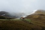
But there's always the mountain hut at about KM 20 at Col Lepoeder(I think). I met someone on my last Camino who ended up in the dark in the mountains and spent the night there. It was filled with garbage when I saw it this past April.

col-lepoeder-hut.jpg
Also if it's more important to you to get started on your first day, you could just skip this whole SJPP Napolean route thing and just start from Pamplona. It's still a big beautiful Camino.

Alternatively, if you're coming from Madrid, there is a way to skip Pamplona entirely and take a bus directly to Bayonne, and then a train to SJPP in one day. On a Blabla bus. Obviously, you'll have to search for your particular day.

 
Last edited:
This thread is incredibly entertaining.

Except that nobody mentioned that almost the entire climb, from the Nive river in SJPP, elevation 160 m, to Thibault Cross at 1227 m of elevation, is 15 km of STREETWALKING. Yes, you do the entire climb on tarmac road D428*. How does it relate to "hiking"?
Similarly, if one chooses the Ibañeta variant (I recommend it myself, the views are great), then the entire descent from the Lepoeder viewpoint to the Ibañeta Chapel is STREETWALKING again! On a hard surface, tarmac road. How does it relate to "hiking"?
The entire "hiking" part is 5.5 km long, between Thibault Cross and Lepoeder. And if the weather is good, it's really not difficult. If the weather is bad, you don't go to the mountains. Simple as that.


*There is a 850 m stretch between Honto and Orisson that is NOT on the road, but it's perfectly fine to stay on the D428. Many people stay on the road because the climb, although a bit longer, is more gradual. Following the yellow Camino arrows saves you a few hundred metres, but it doesn't save you time - on the road you walk much faster. The map below.
 
Last edited by a moderator:
There's a short catalogue of the dangers in the mountains on the website of the Pilgrim Association of SJPP. The area between SJPP and Roncesvalles is not really the high Pyrenees, i.e. it is more hills than mountains, but this catalogue applies, too. It is in French. It has been on their website since 2004 at least, i.e. for 20 years now. Translated into English, it goes like this [shortened extract]:

As any experienced pilgrim will tell you, hiking in the mountains is only slightly more difficult than hiking on the plains. Except that ...
  • except that when the weather is fine, the sun is both brighter and hotter than on the plains, so beware of sunburn and ophthalmia which give you the endearing look of a rabbit with myxomatosis;
  • except that when it is cold on the plains, it is 8 ºC colder at 1000 meters higher up;
  • except that the cool breeze you enjoy on the plains turns into a storm, blowing through your clothes, tearing off your hat, flipping over your umbrella and lifting your poncho over your head;
  • except that a bit rain on the plains turns into a violent downpour or into snow when it is cold. Hotter sun, more intense cold, stronger wind or heavier rain: there is still nothing to frighten the mountaineer in you;
As any experienced mountaineer will tell you, crossing the mountains is like crossing the plains. Except that ...
  • except that, in the mountains, a complication rarely happens on its own, and that the big difficulty starts when several small inconveniences occur at the same time and combine their effects.
Taking all precautions to minimise small inconveniences and allowing plenty of time to deal with them should they occur ought to be a no-brainer for everyone who starts from SJPP for Roncesvalles. Alas, it isn't.
Thank you very much Katar1na,
The weather conditions are one of the biggest obstacles in this section in my opinion. And as it says in the text, this can still be combined with other unforeseen events and increase the risk to a level that we do not want to face.
 
A selection of Camino Jewellery
This thread is incredibly entertaining.

Except that nobody mentioned that almost the entire climb, from the Nive river in SJPP, elevation 160 m, to Thibault Cross at 1227 m of elevation, is 15 km of STREETWALKING. Yes, you do the entire climb on tarmac road D428*. How does it relate to "hiking"?
Similarly, if one chooses the Ibañeta variant (I recommend it myself, the views are great), then the entire descent from the Lepoeder viewpoint to the Ibañeta Chapel is STREETWALKING again! On a hard surface, tarmac road. How does it relate to "hiking"?
The entire "hiking" part is 5.5 km long, between Thibault Cross and Lepoeder. And if the weather is good, it's really not difficult. If the weather is bad, you don't go to the mountains. Simple as that.


*There is a 850 m stretch between Honto and Orisson that is NOT on the road, but it's perfectly fine to stay on the D428. Many people stay on the road because the climb, although a bit longer, is more gradual. Following the yellow Camino arrows saves you a few hundred metres, but it doesn't save you time - on the road you walk much faster. The map below.
I had already noticed that the route leaves the road in this section, and I was always curious. I had never seen the map with the routes on the road and off the road. I agree with you that walking on solid ground is more productive.
 
@JonnyRosa I apologize for being slightly rude, but I think it's a poor idea and a really risky plan and I don't think you should do it. Too much can go wrong. You might ruin your Camino on the first day.

But there's always the mountain hut at about KM 20 at Col Lepoeder(I think). I met someone on my last Camino who ended up in the dark in the mountains and spent the night there. It was filled with garbage when I saw it this past April.

Also if it's more important to you to get started on your first day, you could just skip this whole SJPP Napolean route thing and just start from Pamplona. It's still a big beautiful Camino.

Alternatively, if you're coming from Madrid, there is a way to skip Pamplona entirely and take a bus directly to Bayonne, and then a train to SJPP in one day. On a Blabla bus. Obviously, you'll have to search for your particular day.


View attachment 177467
There's no need to apologize, Stephan. In fact, I'm the one who thanks you for your words.
My flight arrives in Madrid, and from there I'll take a flight to Pamplona. I studied the alternatives to get to SJPP, but unfortunately I only found out about the option you wrote about now. It will be useful for my next trip, thank you very much.
 
Fail to prepare? reduce your risk by buying this book full of practical info.
2nd ed.
Join the Camino cleanup. Logroño to Burgos May 2025 & Astorga to OCebreiro in June
@JonnyRosa - Can you share with us how much time you have planned to walk the Camino?
And what are you hoping to get out of the experience?
I don't know how the desire to do the Camino de Santiago grew in me.
There was a time when I was healthy, I wanted to, but I didn't have the money or the time.
There was a time when I was healthy, I wanted to, I had the money, but I didn't have the time.
I believe that the time has come when I have the ingredients.
I have been preparing for about 6 months, and in the last 3 months I have focused more on physical activity, with very complete training.
 
I had already noticed that the route leaves the road in this section, and I was always curious. I had never seen the map with the routes on the road and off the road. I agree with you that walking on solid ground is more productive.

I've done the descent from Lepoeder to Roncesvalles through the forest once and I won't do it again. All you see are trees and you have to be careful where you put your foot next all the time. It's not fun. The descent on an empty local road to Ibañeta is great, the views are spectacular. And from the Chapel of Ibañeta I walk the last 1.3 km to Roncesvalles on the N-135 (not a popular choice I imagine). On the right side of the road (the mountainside) there is a kind of "sidewalk", which is not really a sidewalk, but it is a safe place to walk on (it's for rainwater or sth?). It's only a little over 1 km to Roncesvalles, so not a big deal, and there is even a fuente (drinking water) on the way.

I wish you a Buen Camino!
 
Perfect memento/gift in a presentation box. Engraving available, 25 character max.
Thank you very much for your words, your experience is very important to me and will certainly help me.

I have no experience in mountain/hiking and I am not familiar with the term "speed on the flat". Do you remember the speed you were going on the trail when you refer to "6 km/h on the flat"?
1 Km every ten minutes, it was that simple. Well "simple", that was with a Camino the year previously plus about 6-8 months of intensive training during a period of paid unemployment.

YMMV

But then I was also 29 years old -- and the flat was, well, flat. Western France and the meseta.

You could probably make it to Valcarlos from a 2PM start.
In general, how did you manage your 42 km/day in terms of stops, food, schedules...?
When you're that fast, things basically just roll up as they come.
I expected to find many people who had already walked this stretch in the afternoon, but I was completely wrong.
I walked Roncesvalles > SJPP just over a month ago, and the people walking up in the afternoon were pretty much headed to Orisson or Borda. Not Roncesvalles, and very likely they had pre-booked.

This will not be possible in October as the Napoleon Route will be officially closed.
 
Fail to prepare? reduce your risk by buying this book full of practical info.
2nd ed.
But there's always the mountain hut at about KM 20 at Col Lepoeder(I think). I met someone on my last Camino who ended up in the dark in the mountains and spent the night there. It was filled with garbage when I saw it this past April.
In mid April on my first Camino Frances in 2015, I had a reservation for the night at Corazon Puro Pension before getting a ride to SJPdP the next morning. A Spanish couple at dinner that night told us they were caught out the night before going "up and over" in the dark and had to spend the night in that hut. Another couple talked about the slippery, slushy melting snow...it isn't always a "bowl of cherries".
 
How does it relate to "hiking"?
I am not sure whether you refer to my post where the English verb "hiking" does indeed appear. I did not pay much attention to it, being a non-native speaker of English.

I see now that the French original uses the word pérégriner and Deepl.com translated it as hiking. The French verb randonner is actually not used in the text.

I am always amused when the concept of "hiking" is being discussed on the forum in English. "It is not a hike but a pilgrimage", "don't hike but saunder" and all that. Other languages, at least in my personal humble opinion, don't make such a big deal about whether it is a walk or a hike when we move on our two feet on a trail in the Alps or in the Pyrenees (i.e. when we don't need our two hands in addition to our two feet to move forwards or upwards or downwards).

So yes, for us it is a hike when getting from one valley across a pass to the next valley, even when sections of the trail area on a broad comfortable track and even a road ... Buen Camino, in any case. :cool:
 
How does it relate to "hiking"?
I think I was the first to ask the OP if they had hiking experience. I would not refer to "hiking the Camino" as that is not how it see it. However, I asked the OP specifically if they did have hiking experience (elsewhere) because I think it is relevant to understanding whether they are familiar with variable and uneven terrain in dry and wet conditions, walking fairly steep uphill and downhill sections with a backpack, and general understanding of what it is like to walk in such conditions. Do they understand how weather can change in mountainous areas, and how to prepare for and cope with changing conditions? If they had answered that they have such experience, then I would have more confidence in their understanding of the risks.
 
Join the Camino cleanup. Logroño to Burgos May 2025 & Astorga to OCebreiro in June
There is plenty of hiking on the Camino if we want to look at it this way.

But I would like people planning the Napoleon Route to know that they will probably be walking 80% of the time on asphalt (I consider the Ibañeta route to be the default route for most pilgrims).
The weather in the mountains is a different issue, in the past I myself advised people against going to the mountains if the weather forecast was bad. In fact, I predict that OP will not be able to walk the Napoleon Route in October because it will be officially closed. Just like the Somport Way is already closed. Orisson Refuge is closing on October 17th for a reason. In fact, I think this year the pass will close much earlier than usual (just a feeling in the gut).
 
I see now that the French original uses the word pérégriner
An unfortunate neologism.

Well, perfectly fine as a bit of a joke-word sur les chemins, but you are in any case quite right that even then it doesn't mean randonner/hiking (and even randonner is dodgy, a noun awkwardly turned into a verb) ... but rather something more tongue-in-cheek like "Carry On Camino" !!

It's : Cheminer.
 
The 2024 Camino guides will be coming out little by little. Here is a collection of the ones that are out so far.
"It is not a hike but a pilgrimage"
That particular phrase doesn't have anything to do with the mode of travel. It states that one is a physical endeavor (hiking), and one is a spiritual endeavor (pilgrimage).

I think for some English speakers "hiking" belittles the Camino.

Not me.
You probably understand this, but just in case...


@Tortilla How does it relate to "hiking"?

If you look up the definition of hiking, it doesn't necessarily have to be on the trail. It can be a hike along a road. I think the Camino is a walk, hike, pilgrimage, saunter, waddle, jog, run, march, dance, tumble, etc., depending on the eye (or foot) of the beholder. There is no rule. Just preference.
 
Last edited:
Before you leave for the Camino I suggest that you set aside at least 4 consecutive days and walk 15 - 20 km each day with your backpack. This is a test to see how your feet and body handle the consecutive days of long distance walking. Do it outside, not on your treadmill. If you have time, walk at least 30 km on one of those days.
Also make sure that the road you take varies between smooth asphalt to very rocky, uneven and loose gravel. Add to that slippery dust, rain and mud. You are likely to have any, or all, of these as you cross the mountains. It is nothing like a treadmill.
 
Members occasional squabbles aside this thread is remarkably consistent in its response to the OP. Their proposition is a risky one. They are unlikely to fulfill their “plan” as constructed and may, in consequence, put others at risk as well as themselves. The alternatives: go via Valcarlos; overnight in St Jean and make a sensible morning start; start from Pamplona seem to have been ignored. The OP hasn’t responded yet to the question “how much time do you have?” They do seem to be in an awful hurry but we don’t know why.

My concern, since reading the first few posts has been that we have a “runner” who has trained on a machine in an indoor setting. That can offer, as many have said, no substitute for the mud; slick grass; broken cobbles; driving rain; intense sun; lethal vehicle traffic; slow pilgrim traffic; obscured direction signs and every other hazard and impediment that will occur. Sometimes all on the same day.

@JonnyRosa, I appreciate that you are wedded to your plan. As an experienced long distance hiker, ex-Outward Bound instructor and ex-Mountain Rescue volunteer I have to advise you that it is a very poor plan. You should reconfigure to allow for the hazards and risks that many members of this forum have tried to bring to your attention. At the very least you should be carrying a complete emergency shelter / bivouac kit and that will add considerably to the weight of your pack.
 
3rd Edition. Vital content training & pack guides avoid common mistakes, bed bugs etc
If you look up the definition of hiking, it doesn't necessarily have to be on the trail. It can be a hike along a road.
Yes! But then it's called hitch-hiking :D
I just wanted to add that the last bus from Pamplona to SJPP leaves on October 11, weather permitting.
Borda and Orisson close their doors on October 17.
Seize the day, pilgrims! The end is near!
 
I may be misreading comments in this thread 🤔 but I think that we here on the forum are meant when @JonnyRosa refers to "colleagues".
Well that goes to show he’s never met most of us.

Let’s stop trying to convince the man. People have done far more reckless things and got away with it.
 
Ideal pocket guides for during & after your Camino. Each weighs only 1.4 oz (40g)!
Well that goes to show he’s never met most of us.

Let’s stop trying to convince the man. People have done far more reckless things and got away with it.

Indeed.
And some didn't. :oops:

We have walked past their memorials, and read the news reports.

Still, some people need to try things and learn from the experience.
Hopefully the OP won't become another statistic.
 
Last edited:
...and ship it to Santiago for storage. You pick it up once in Santiago. Service offered by Casa Ivar (we use DHL for transportation).
our friend (and colleague;))
As this appears to cause much hilarity, I googled a bit.

As I had already expected, colleague is a word that is known as such in many languages and it can have not only the meaning of a person from work, it also can have the meaning of buddy, pal, friend with whom one shares interests, apparently so in Spanish and Portuguese where it is spelled colega. Just as with hiking, not everybody has the same associations connected with a specific word, especially speakers who are not monolingual or monocultural. :cool:
 
In early October, I plan to do the route from Sant Jean Pied de Port to Roncesvalles, leaving SJPP in the afternoon, around 2:30 p.m. I walk frequently and quickly, averaging 6 km/h. I would like to know if any of my colleagues have already done this route in the afternoon and what challenges I might be forgetting.
I left SJPP AT 1300, 1 OCTOBER 2018, after being up all day before, flying all night from USA, then to Biarritz, then bus and train to SJPP. It took me 6 hours to walk to Roncesvalles via Napoleon pass on that beautiful day. I was very well trained and only 58 at the time. It was still daylight when I arrived.

Challenges: I was very tired. I only met one other pilgrim on that route. I was able to buy dinner with the albergue people, but breakfast was sold out. The albergue still had a few beds left at 1900, but filled within the next hour. If you have rain or need to walk in the dark, it will slow you down.

It only takes 5.5 hours via Valcarlos, and that was with 2 coffee breaks. Consider that route, plus there is an albergue in Valcarlos.
 
Coming late to this, and have to agree with the cautious replies others have made.

Given weather, surface, and vagaries of bus schedules, it would be safer and more relaxed to walk part way if you need to start in the afternoon. Those are mountains, with mountain conditions - at the very least intense, and they kill people every year.

Thinking in terms of pacing -
Running on roads and treadmills is utterly different than what you'll be doing on the Camino. Apples and oranges. I've run 9 marathons, and done a handful of olympic-distance triathlons and one half-Ironman - as compared 8 Caminos, so have a sense of both. Perhaps if you were just doing one day on the Camino, the kind of speed you're able to do at home would be an accurate assessment of what you'll be doing on tbe camino. But it's not one day, it's plus or minus 30. So pacing yourself accordingly is important. You wouldn't run a 5K at the same pace as a marathon...same idea.

I get it that time is tight.
There's another option, though, that gets you well along, further than just Orrisson. If you walk via Valcarlos route and stay the night in Valcarlos, you'll have walked about 12.5 km - and since it's relatively flat, that would allow you time in SJPP to get your credential stamped before you hit the road. Then the next day you can continue past Roncesvalles (on the Valcarlos route, the steep part is after Valcarlos). As well as being the older and more 'authentic' way, it's gorgeous and seriously underrated.

Whatever you chose...buen camino!
Hello VNwalking,

Thank you very much for your contribution. You are not late, and there is always time to help!

Your vast experience is very important and I would like to hear your opinion on a few points.

First, I would like to remind you that we are aware that the plan has significant risks, and that we are not endorsing anything, just discussing a specific topic.

1) Some forum members stated that most of the stretch is asphalt.

2) A treadmill is completely different from outdoor terrain.

3) Common outdoor terrain is different from outdoor terrain in the mountains.

4) We have a planialtimetric survey, and we know the stretches and their most significant slopes.

5) We are aware that maintaining a pace on a treadmill is much easier than controlling the pace outdoors.

That said, what is your opinion on the preparation in relation to the execution of the plan?

Thank you in advance for your opinion
 
Ideal pocket guides for during & after your Camino. Each weighs only 1.4 oz (40g)!
I can't judge whether you can do it (I suppose it could be difficult). But - trudging through arguably the most beautiful part of the trail? Of course, it also depends on your motivation for walking. There is no way I would cross the Pyrenees this way. And not only because I wouldn't be able to do it, but because I think I would miss a lot. People are different. Slower walking also allows for a different "happening" in the head and soul - when we are not concerned with minutes. When you stop and admire the world in silence and peace, you allow yourself to be empty-headed and just experience the moment (or 10-15 minutes) - this is an essential part of the Camino for me. I have the feeling that with such a "race" you might lose a large part of the beauty of walking (along the Camino). But, of course - as I mentioned - it depends on your motive for walking the Camino.
Hello m108,
I know it may seem like I'll be running through the stretch, but that's not the case. I walk quickly, but very comfortably, I've always done this. Even when I'm walking or looking at shop windows, I walk quickly and it makes me feel good.
My purpose on the path is deeply religious, I have no plans to film, take photos, or share on social media, and in truth I don't miss any of that. I know I don't really fit in with today's world, but that's how I am, and I'm happy being that way.
 
He won't talk to anyone because no one else walks to Roncesvalles at that time. And that's actually the biggest advantage I see in his approach. Although for me, leaving at 2 pm would be too late. But I've done the Napoleon route several times and twice I started at 10-11 am walking straight from the train from Bayonne and those two times have been my favorites so far. Simply because I had entire Napoleon route (almost) to myself.

Added: So, if I were in his place, I wouldn't sleep the night before in Pamplona (and wait until noon for that one miserable Alsa bus) but would try to get to Bayonne on the day of my arrival to Pamplona. There are evening buses from Pamplona to Bayonne (you have to change in San Sebastian). After a night in Bayonne, I would take the first morning train to SJPP and head out on the trail.

Even sleeping in San Sebastian instead of Pamplona would be better, because there is a 6am Alsa bus from San Sebastian to Bayonne and you can take a 8-9 am train from Bayonne to SJPP and start walking at 10:30.
Hi Tortilla,

You always want to contribute in a positive way. Thank you very much for this.

I had already thought about traveling from Pamplona to San Sebastian, spending the night there and leaving early in the morning for Bayonne where I would catch the train to SJPP. Taking this route I would arrive around 10:00 am. Considering the tiring journey with the benefit of leaving 2 hours earlier, I didn't think it would be worth it.
 
If you reach 4km/h in average you will be lucky! In 2019, in almost perfect conditions (14-21°C, light wind, light rain) I reached Roncesvalles after 6:59h of constant walking and 30mins breakfast at Orrisson. I am fairly fit.

IMHO: don't try it! Get going before 8am or stay at SJPdP until the next morning. It's not worth the risk.
You may experience that the only option will be walking via Valcarlos.
 
A selection of Camino Jewellery
Hi Tortilla,

You always want to contribute in a positive way. Thank you very much for this.

I had already thought about traveling from Pamplona to San Sebastian, spending the night there and leaving early in the morning for Bayonne where I would catch the train to SJPP. Taking this route I would arrive around 10:00 am. Considering the tiring journey with the benefit of leaving 2 hours earlier, I didn't think it would be worth it.

Oh thanks @JonnyRosa ,

I'm probably the only person here who thinks that what you're planning will be a walk in the park for you. Especially if you take the Ibañeta variant and finish the walk on the road to Roncesvalles instead of tripping in the woods. The backpack of 3 kg, 16 km of steady uphill on tarmac, 5 km of steady downhill on tarmac - it's just what you trained for. Plus about 1 hour and 20 minutes of "hiking" in between (checking GPS is useful on this part so that you don't take a wrong turn). Getting to Roncesvalles after dark is not a problem. Check-in at the albergue is open until 10 pm. One condition necessary for your success: good weather and the trail still being open.
 
1) Some forum members stated that most of the stretch is asphalt
Did you watch the video that I posted above? It shows the terrain every step of the way.
I had already thought about traveling from Pamplona to San Sebastian, spending the night there and leaving early in the morning for Bayonne where I would catch the train to SJPP. Taking this route I would arrive around 10:00 am. Considering the tiring journey with the benefit of leaving 2 hours earlier, I didn't think it would be worth
Wouldn't 10 am be four hours earlier?
What about getting a taxi to SJPdP when you arrive in Pamplona instead of spending the night there?
Then you can spend the night in SJPdP and start in the morning.
 
Yes! But then it's called hitch-hiking :D
I just wanted to add that the last bus from Pamplona to SJPP leaves on October 11, weather permitting.
Borda and Orisson close their doors on October 17.
Seize the day, pilgrims! The end is near!
For those who are not native speakers and may not be aware, hiking along a road is not hitch-hiking unless one is also "hitching" (seeking to get a ride from passing vehicles). The actual hiking part is now optional in the usage of the word hitch-hiking (some will just wait at the entrance ramps to highways and hitch there and be considered hitchhikers), but the hitching part is not.
 
Perfect memento/gift in a presentation box. Engraving available, 25 character max.
That said, what is your opinion on the preparation in relation to the execution of the plan?
Your preparation takes care of fitness. What it doesn't do is prepare you for three things: surfaces, wayfinding, and weather.

Surfaces? To get a sense have a look at the video link @trecile posted above. It's a mix. If you take the road from the alto down to Ibañeta, that avoids the most treacherous part, but it's definitely not a treadmill. The Valcarlos way is more suitable for speed, but even that has uneven bits on the way up to Ibañeta.

You'll need to navigate. Sometimes that's very straightforward, but sometimes it can really slow you down, especially if there's fog. When you're walking fast it's easier to go past a turn and end up off the camino. So do take int account your skills etc there. Do you have a good sense of direction? Navigational skills without GPS? There are waymarks, but people do get lost up there...and the consequences of that are no joke.

The weather is really the kicker.
In the mountains, weather is more than a bit of wind and rain, but can be extreme, no matter what it's like in SJPP. At the very least it can significantly slow you down, and make finding your way a challenge.

In your shoes? Keep a keen eye on the forecast. And be prepared to go via Valcarlos if the forecast is even slightly iffy. Definitely bring raingear and have a headlamp, in case.
And buen camino!
 
You'll need to navigate. Sometimes that's very straightforward, but sometimes it can really slow you down, especially if there's fog.

In the mountains, weather is more than a bit of wind and rain, but can be extreme, no matter what it's like in SJPP. At the very least it can significantly slow you down, and make finding your way a challenge.
I took these just after noon at the Ibeneta pass a few years ago. It was sunny and clear when we left Valcarlos that morning. Sunny and clear when we arrived at Roncesvalles early afternoon. Up on the pass? Not so much... Never underestimate the weather.
 

Attachments

  • Screenshot_20240910_132144_Photos.jpg
    Screenshot_20240910_132144_Photos.jpg
    248.3 KB · Views: 34
  • Screenshot_20240910_132157_Photos.jpg
    Screenshot_20240910_132157_Photos.jpg
    214.6 KB · Views: 25
Did you watch the video that I posted above? It shows the terrain every step of the way.

Wouldn't 10 am be four hours earlier?
What about getting a taxi to SJPdP when you arrive in Pamplona instead of spending the night there?
Then you can spend the night in SJPdP and start in the morning.
Ops! It was my mistake, thanks. It is 4 hours earlier.
 
€2,-/day will present your project to thousands of visitors each day. All interested in the Camino de Santiago.
Good luck with your plan. Please check the weather conditions on the mountain at the Pilgrim Office in St Jean. It can be fine in the valley but brutal higher up. Fog, strong wind, heavy rain all commonly occur and you wouldn't know lower down. I think you can also find out the weather conditions at Orrison. At this point you'll be about 1/3 of your way so you'll be able to check your timing too. (At Orrison you can arrange a taxi back to St Jean if necessary.)
Hi Trecile,
You're right. I have a tight schedule. I'm already spending the night in Pamplona the day before, and I didn't want to spend the night in SJPP and only leave the next day. So I thought about leaving the same day I arrive in SJPP. Based on my planning, I think it's feasible, but I know there are risks. If the weather is bad, I'll definitely leave the next day.
Now, trying to answer your question as honestly as I can, I would say that the same impulse that is driving me to do the Camino de Santiago is what makes me do this stretch as soon as I arrive; I don't know the real reason.
Jonny, exactly how much time do you have to walk the CF? When do you arrive in Spain? Are you planning any rest days? How are you getting to Pamplona ? Do you need time to adjust to jet lag? Going down to Pamplona via Zubiri can also be stressful on the legs. Even if you are as fit as you project to be, I would suggest, that you give yourself the overnight in SJPdP, and then head out early the next day to Roncevalles. Most marathoners don’t fly overseas and then begin the race a day later. Don’t let your adrenaline get the best of your decision making process!

There is a very significant difference between hill walking on uneven surfaces, than with a backpack on a treadmill, if your using a full pack! Your rhythm will be different and may be more prone to blisters.


What is the downside to waiting till the next morning? If all goes well, you can likely make up the time…and if time is so tight, stretch your days on the Maseta sections.

Lastly, you are walking the Camino de Santiago, with other pilgrims. Many people bond at the beginning, it is a pilgrimage. The walk up via the Napoleon is quite lovely. Stay at an albergue and celebrate with other pilgrims. . It would a loss, IMO, not to take time, to pause and be still while jouneying and “tasting” the beauty, - appreciating the sacred path, and stopping along the way for a drink or snack with others as you are walking.

Wishing you a Buen Camino!
 
Last edited:
we are aware that
Are you walking alone or with someone else? Your biggest risks are the variability of weather, and being alone if you injure yourself on the route in bad weather.

Until your story, I was almost thinking I was an alien, or someone looking for a miracle.
I hope that this thread isn't suggesting that your plan will require heroic resolve and endurance, and a dramatic baptism on Day 1.

I first walked from SJPP to Roncesvalles in one day without difficulty as a jet-lagged moderately fit 66-year-old. If you have good weather and if you don't injure yourself, you will do fine. Even in bad weather and with mild injury, you will probably survive to stumble into Roncesvalles after dark. You will happily tell us how you persevered against our conservative advice.

As has been pointed out, it is not a wilderness hike. Many thousands of people have done it, only a few dozen or hundred (?) rescues have been required, and only a very few have died.
 
Get a spanish phone number with Airalo. eSim, so no physical SIM card. Easy to use app to add more funds if needed.
There is a great albe
hello jonnyrosa
I am a hospitalero in Roncesvalles and have considerable experience with pilgrims who start late in the afternoon.
my advice is don't do it!
you arrive in the dark and when it is raining it is extra dangerous.
my advice would be:
reserve 1 bed in Orison and then leave the next morning as soon as it is light, then walk to Espinal and then to Pamplona, you have not lost a day but you have had your rest
good luck with your hike
 
I support the guy, but there is a very small chance this will be a "walk in the park" for him. Any flatlander who has only merely tilted his treadmill up occasionally is going to find out real quick how different it will be in real life.
I agree. I think that SJPdP to Roncesvalles can be done in about 5.5 - 6 hours, but 4 hours is unrealistic.
And it won't be a "walk in the park".
 
I agree. I think that SJPdP to Roncesvalles can be done in about 5.5 - 6 hours, but 4 hours is unrealistic.
And it won't be a "walk in the park".
I, too, am not questioning ,how long it will take him, but rather, what the quality of the experience will be, and what it might physically cost him after that.
 
Fail to prepare? reduce your risk by buying this book full of practical info.
2nd ed.
I agree. I think that SJPdP to Roncesvalles can be done in about 5.5 - 6 hours, but 4 hours is unrealistic.
And it won't be a "walk in the park".

According to my log from 2019 it took me a "moving" time of 4h43m and a total time of 6h08m. And i did not really rush, took a break at Orisson, the van, the statue and again at the fountain. Also took the variant over Ibaneta. And did find the time for plenty of chats and fotos.
I would not go as far as to say doing it in 4h is impossible. The number of people able to pull something like that might be very small, but they exist. And they would have to "just walk", little to no stopping, no socializing, no enjoying the views.
Still would advise against it, as i already wrote, for reasons that have been discussed quite some in this thread.
 
I also think 4 hours is impossible.
But in 2021 when I started to walk from SJPP at 11am, I arrived to Roncesvalles after 9pm and still got a warm welcome from Dutch hospitaleros. Ok, it was summer, so I didn't have to use a headlight. But if needed, I would.
Today sunrise at SJPP was at 7:42 am, and probably almost everyone started to walk well before sunrise (that's not surprising, right?), what is wrong with arriving after sunset then?

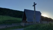
Below: the photo I took at Lepoeder (altitude 1400+ m, the peak point of the stage) at 8:04pm and at Ibañeta (1,5 km from Roncesvalles) at 8:53 pm.
 

Attachments

  • 20210705_200451.jpg
    20210705_200451.jpg
    852.9 KB · Views: 13
  • 20210705_205318.jpg
    20210705_205318.jpg
    447.9 KB · Views: 17
Last edited by a moderator:
"What is wrong with arriving after sunset" - that is such a good question to think about.

Although, nobody in the thread said anything about arriving at the Roncesvalles albergue around 8 pm being an issue because the albergue allows arrivals until 10 pm. Or did I miss such a comment?

I guess that walking away from sunrise and into the day, hopefully after a good night's rest, is not any different from walking into the sunset after having already walked a few dozen kilometers - at 6km/h I hasten to add. It is odd, somehow, that pilgrims on the Route Napoleon need bailing out of their troubles by the Burguete First Responders - I am not going to call it 'rescue' for fear of picking the wrong word - when it is afternoon, evening or nighttime and not early morning. Really odd ... 😶.

Are we going to keep this thread alive until the 2nd of October? 😎

BTW, I am not implying that there will be any trouble for the OP. Such things always happen to others.
 
Last edited:
A selection of Camino Jewellery
Does that make a difference to your perception of if it's worth it?
Yes, this completely changes my perception.

I would also like to add that all the information provided by the various messages is very enriching, and that here we are "talking about a topic", no one is responsible for anything. I truly believe that everyone wants the best, and that even those who predict catastrophes, deep down hope that everything will turn out well. And that it is never too late to thank everyone once again.
 
Jonny, exactly how much time do you have to walk the CF? When do you arrive in Spain? Are you planning any rest days? How are you getting to Pamplona ? Do you need time to adjust to jet lag? Going down to Pamplona via Zubiri can also be stressful on the legs. Even if you are as fit as you project to be, I would suggest, that you give yourself the overnight in SJPdP, and then head out early the next day to Roncevalles. Most marathoners don’t fly overseas and then begin the race a day later. Don’t let your adrenaline get the best of your decision making process!

There is a very significant difference between hill walking on uneven surfaces, than with a backpack on a treadmill, if your using a full pack! Your rhythm will be different and may be more prone to blisters.


What is the downside to waiting till the next morning? If all goes well, you can likely make up the time…and if time is so tight, stretch your days on the Maseta sections.

Lastly, you are walking the Camino de Santiago, with other pilgrims. Many people bond at the beginning, it is a pilgrimage. The walk up via the Napoleon is quite lovely. Stay at an albergue and celebrate with other pilgrims. . It would a loss, IMO, not to take time, to pause and be still while jouneying and “tasting” the beauty, - appreciating the sacred path, and stopping along the way for a drink or snack with others as you are walking.

Wishing you a Buen Camino!
Hello Marbe2,

I was putting off answering some questions to avoid further controversy, but everyone deserves the best I can offer.

My plan is to walk for 34 days from SJPP to Muxía.

I will arrive in Madrid on October 1st and then fly to Pamplona on the same day.

I don't need a jet lag, I've traveled long distances many times and I'm used to arriving and working.

The issue of walking on flat ground and on steep inclines with a heavy backpack changes the scenario completely, I've confirmed this in my training. Running on a treadmill is very different from running on the ground, and this is one of the risk factors I've taken into consideration, because when you're on a treadmill, it's the treadmill that sets the pace and you just walk; but outdoors, if you get distracted, you can get out of rhythm. In my case, after about 2 km, my body stabilizes its rhythm.

I don't see any problem in spending the night in SJPP. I'm not as stubborn as some people might think. I just made a plan and asked for help from the CF members who are more experienced than me. Which in fact must be the overwhelming majority, since I have zero experience!

I'll be walking alone, my pace is fast and walking slowly is boring to me; in the same way, forcing someone to walk quickly is unfair.

Regardless of whether I leave in the morning of the next day, or in the afternoon, I'm going to enjoy the trail a lot. I'm not going to take pictures, post anything, or record videos. I'm going to stop to get water at the few available points, and I don't plan on stopping to rest. I'll arrive tired but completely intact.
 
Now talking with 2nd October in mind and 34d to play with, why not stop at Orisson on the 2nd, then the 3rd you see how far you get? Having walked SJPDP-Orisson-Zubiri-Pamplona myself. Not sure i'd recommend it, but its an option and that way you avoid the situation of a rushed mountain crossing and still don't lose a day. 34d seems a tight, but doable timeframe for what you have planned. Again, personally i'd rather make my long days after i have a couple of days on trail behind me and know how everything is working out. On the flat Meseta, walking 40k days is quite a bit easier than doing so on day 2 with a sizable mountain in between...

edit: example schedule with 27d walking and 2 rest days attached
 

Attachments

Last edited:
A selection of Camino Jewellery
Are you walking alone or with someone else? Your biggest risks are the variability of weather, and being alone if you injure yourself on the route in bad weather.


I hope that this thread isn't suggesting that your plan will require heroic resolve and endurance, and a dramatic baptism on Day 1.

I first walked from SJPP to Roncesvalles in one day without difficulty as a jet-lagged moderately fit 66-year-old. If you have good weather and if you don't injure yourself, you will do fine. Even in bad weather and with mild injury, you will probably survive to stumble into Roncesvalles after dark. You will happily tell us how you persevered against our conservative advice.

As has been pointed out, it is not a wilderness hike. Many thousands of people have done it, only a few dozen or hundred (?) rescues have been required, and only a very few have died.
Hi C clearly,

I am in no way going against the advice I received, regardless of whether I decide to leave in the morning or in the afternoon. Whatever the choice, the journey will be made by a person who has grown and has been enriched by all the information he or she has received from the members of this forum.

As for the people who need rescue, I would like to remind you that this is what rescue teams are for, so if someone needs rescue, don't think twice, ask for rescue. This is not as embarrassing as the texts may sometimes make it seem.

As for the issue of deaths on the way, I also see it as very normal. We will all die, it is a fact. I do not wish death on anyone, nor do I expect anyone to die on the way, but I personally see death as natural.
 
I also think 4 hours is impossible.
But in 2021 when I started to walk from SJPP at 11am, I arrived to Roncesvalles after 9pm and still got a warm welcome from Dutch hospitaleros. Ok, it was summer, so I didn't have to use a headlight. But if needed, I would.
Today sunrise at SJPP was at 7:42 am, and probably almost everyone started to walk well before sunrise (that's not surprising, right?), what is wrong with arriving after sunset then?

Below: the photo I took at Lepoeder (altitude 1400+ m, the peak point of the stage) at 8:04pm and at Ibañeta (1,5 km from Roncesvalles) at 8:53 pm.
Hi Tortilla,

I liked your question about walking without sunlight in the morning and late afternoon, with artificial lighting.

Does anyone have experience with artificial lighting in wooded areas?

I once forgot about the time and the sun set in the middle of a forest where I often ran, and it was terrible (without artificial light). That's why when I made my plan I didn't even think about getting there close to sunset.
 
@JonnyRosa, in another thread a new pilgrim asked about the current weather conditions and trail conditions as she was concerned about the unusually heavy rainfalls that the area experienced last week. Including impressive mud slides, btw. You replied "It will be easy" and linked to https://caminoweather.com/frances/?...metric&startDate=2024-09-11&lengthType=stages

Maybe I am not looking carefully enough but that website appears to forecast the weather on the basis of the historical weather data of the past 15 years. It makes me wonder whether you registered the fact that the weather in Saint-Jean-Pied-de-Port is not the weather at the Collado de Bentarte and at the Collado Lepoeder and whether you registered that in particular temperature and felt temperature as well as wind speed and wind gust speed are not the same at 200 m sea level and at 1400 m sea level on an exposed trail.

Just to illustrate: I had a look on Meteoblue.com at the more detailed forecast for tomorrow Thursday 12th September. The predictability for the forecast at this point in time is medium. Current forecast for actual and felt temperature between 3 pm and 6 pm are:

For Saint-Jean-Pied-de-Port: 16 ºC and 15 ºC
For the Collado de Bentarte: 7 ºC and 3 ºC.

I am sure that you read earlier in the thread, unless you knew it anyway, about the usual difference of temperature between the location in a Pyrenees valley at 200 m sea level and the location on a Pyrenees trail at 1400 m sea level and will be prepared and equipped appropriately.
 
Last edited:
Ideal pocket guides for during & after your Camino. Each weighs only 1.4 oz (40g)!
Current forecast for actual and felt temperature between 3 pm and 6 pm are:
For Saint-Jean-Pied-de-Port: 16 ºC and 15 ºC
For the Collado de Bentarte: 7 ºC and 3 ºC.
And just because I like the detailed forecast on Meteoblue :cool:: After sunset the felt temperature on the Collado de Bentarte drops to 2 ºC on the day in question and according to the current forecast.

Everybody knows of course that it often does not start to feel noticeably more chilly when the sun sets in a mountainous area. It starts when the sun disappears behind the nearest hill.
 
Last edited:
@JonnyRosa, in another thread a new pilgrim asked about the current weather conditions and trail conditions as she was concerned about the unusually heavy rainfalls that the area experienced last week. Including impressive mud slides, btw. You replied "It will be easy" and linked to https://caminoweather.com/frances/?...metric&startDate=2024-09-11&lengthType=stages

Maybe I am not looking carefully enough but that website appears to forecast the weather on the basis of the historical weather data of the past 15 years. It makes me wonder whether you registered the fact that the weather in Saint-Jean-Pied-de-Port is not the weather at the Collado de Bentarte and at the Collado Lepoeder and whether you registered that in particular temperature and felt temperature as well as wind speed and wind gust speed are not the same at 200 m sea level and at 1400 m sea level on an exposed trail.

Just to illustrate: I had a look on Meteoblue.com at the more detailed forecast for tomorrow Thursday 12th September. The predictability for the forecast at this point in time is medium. Current forecast for actual and felt temperature between 3 pm and 6 pm are:

For Saint-Jean-Pied-de-Port: 16 ºC and 15 ºC
For the Collado de Bentarte: 7 ºC and 3 ºC.

I am sure that you read earlier in the thread, unless you knew it anyway, about the usual difference of temperature between the location in a Pyrenees valley at 200 m sea level and the location on a Pyrenees trail at 1400 m sea level and will be prepared and equipped appropriately.
Weather conditions are at the top of the list of risks.

I know this site that provides the average of the last 15 years (https://caminoweather.com). But weather conditions are only more reliable when we are closer to the day.

Forum members: Where do you look for weather information?
 
I know this site that provides the average of the last 15 years (https://caminoweather.com). But weather conditions are only more reliable when we are closer to the day.
In case the point got lost because the post was too long, here is the TL;DR:

The weather forecast for SJPP and the weather forecast for Roncesvalles is not the weather forecast for the Route Napoleon at altitude.
 
€2,-/day will present your project to thousands of visitors each day. All interested in the Camino de Santiago.
Does anyone have experience with artificial lighting in wooded areas?

I once forgot about the time and the sun set in the middle of a forest where I often ran, and it was terrible (without artificial light). That's why when I made my plan I didn't even think about getting there close to sunset.

Sometimes I think you are just trolling
But if you were trolling, it would be better to start by saying that you were planning to walk there in November, when the trail is closed. The fury of some forum members would be incredible 😄

Yes, you need a headlight. Or at least a flashlight. With fully charged batteries.
Do you know you need to take water? You will find water in only two places: at Orisson by the terrace and at the Fountain of Roland. Nowhere else. Don't count on Food Truck that you can see on Google. It won't be there so late in the day.
 
truly believe that everyone wants the best, and that even those who predict catastrophes, deep down hope that everything will turn out well.
I'm not sure that anyone is predicting catastrophes, but just pointing out that your plan could set you up to have problems instead of setting you up for success.
My plan is to walk for 34 days from SJPP to Muxía.
You have plenty of time without making a rushed start!
I walked from SJPdP to Finisterre in 35 days on my first Camino which was also my first ever backpacking experience - and I spent my first night at Orisson. You have plenty of time during your Camino to pick up speed and walk longer stages a little later!

Lots of people complete
SJPDP to Santiago in 30 days or less. I have a friend who did it in 28 days at age 76.

Here's a plan for 26 stages to Santiago from St Jean Pied de Port:
Add one day to stay at Orisson or Borda and three days to Muxía and you still have time to spare!

If you want to stop at Orisson or Borda you should make your reservation now, as they do get booked up.


A selection of Camino Jewellery
Sometimes I think you are just trolling
But if you were trolling, it would be better to start by saying that you were planning to walk there in November, when the trail is closed. The fury of some forum members would be incredible 😄

Yes, you need a headlight. Or at least a flashlight. With fully charged batteries.
Do you know you need to take water? You will find water in only two places: at Orisson by the terrace and at the Fountain of Roland. Nowhere else. Don't count on Food Truck that you can see on Google. It won't be there so late in the day.
Tortilla, I'm not trolling, I even thought your idea was funny.😄

As for the water sources along the way, I found 3 in my research:

Behicaro Spring at 6 km
Haya Spring at 6.7 km
Roldán Spring at 16.7 km

Is this list correct?

Do these springs have permanent water, or is there a risk that they will dry up?
 
"What is wrong with arriving after sunset" - that is such a good question to think about.

Although, nobody in the thread said anything about arriving at the Roncesvalles albergue around 8 pm being an issue because the albergue allows arrivals until 10 pm. Or did I miss such a comment?

I guess that walking away from sunrise and into the day, hopefully after a good night's rest, is not any different from walking into the sunset after having already walked a few dozen kilometers - at 6km/h I hasten to add. It is odd, somehow, that pilgrims on the Route Napoleon need bailing out of their troubles by the Burguete First Responders - I am not going to call it 'rescue' for fear of picking the wrong word - when it is afternoon, evening or nighttime and not early morning. Really odd ... 😶.

Are we going to keep this thread alive until the 2nd of October? 😎

BTW, I am not implying that there will be any trouble for the OP. Such things always happen to others.
From my perspective walking early in the morning for an hour or two vs. at night, is different! When walking the Napoleon early in the morning in the dark, one knows there will be lots of people coming after them, and a good chance of getting assistance. One starts fromSJPdP along the road, and can actually stay on it all the way to the top., In addition, if one gets lost, it will soon be light and easier to find their way. At night, you may not see anyone else till the morning and if bad weather, such as snow in Oct, or one is fogged in and can’t see two feet ahead of them it could be very problematic. It is an unnecessary risk to do the Napoleon route at night, especially, alone, when one is unfamiliar with the terrain and markers.

Accident’s happen, even to the fittest!
 
Last edited:
The one from Galicia (the round) and the one from Castilla & Leon. Individually numbered and made by the same people that make the ones you see on your walk.
I did meet a man once who ran the whole camino in 17 days - so anything is possible.
You didnt specify WHICH Camino.... Sarria to SdG - OK! ;)

We all know there are enough shall i say 'adventurous' folks out there. I know people ran Camino Inca in less than 4 hours and seems to run TMB takes roughly 4 days (vs 7-8 'normal' hiking)

All i can say is I am not one of those
 
... As for the people who need rescue, I would like to remind you that this is what rescue teams are for, so if someone needs rescue, don't think twice, ask for rescue. This is not as embarrassing as the texts may sometimes make it seem. ...

Of course if after careful thought someone determines that they genuinely need to be rescued, they should ask to be rescued. However, rescues are usually not a trivial matter.

When a rescue team is asked to perform a rescue, the process usually interrupts the team members' normal daily activities. At the least it is inconvenient for them, and in the case of volunteer rescue teams, causes the team members' to cease their normal paid employment for the duration of the rescue; i.e. it costs them money. It can also divert scarce resources from other competing rescues that might need to be performed, thus putting some other to-be-rescued person at risk.

During the rescue process, the team must expend considerable time, money, and wear-and-tear of their equipment, and in some cases put their own lives at risk.

My point is that everyone everywhere has a moral responsibility to plan and act in a way that will minimize the probability of needing to be rescued. This includes avoiding plans that *unnecessarily* expose the person to higher-than-normal risks.

Here is a question that I suggest you ask yourself: "After considering the factors identified by others above and by myself, does my plan unnecessarily expose me to higher-than-normal risks without creating any significant advantage, and might it set the stage for requiring a costly and possibly dangerous rescue that could have been avoided by better planning?"
 
Last edited:
As for the water sources along the way, I found 3 in my research:

Behicaro Spring at 6 km
Haya Spring at 6.7 km
Roldán Spring at 16.7 km

Is this list correct? Do these springs have permanent water, or is there a risk that they will dry up?
Nobody reacted to this question so far. I find it a bit of an unusual list. I am just curious to know where your research found it?
 
Get a spanish phone number with Airalo. eSim, so no physical SIM card. Easy to use app to add more funds if needed.
Roldán Spring at 16.7 km
Don't know the other two, and you likely won't need them, but this one is amazing !!

It's usually called the Fontaine de Roland, it's just past the border into Spain though it seems like you're still in France.

Cool, permanently flowing very good water.

qoVFPs3UcnkWZEp8__0325FEExnKlX-NvR9d3rHfYZnhujcrnYvMG5wvAUXzx6RWgDH-EIEPKgIl-UIgJZQx5FxofFIF8sgnw_5Wdt7hjfSLAyjJHREQ_HAjMm30kzY8CTtdIoDFBgjtKHnl5jEvaPBW
 
Holoholo automatically captures your footpaths, places, photos, and journals.
The Roldán (or Fountain of Roland) is the last valid source of water (IMHO drinkable) before Roncesvalles. The others I had no memory of.
Same here.

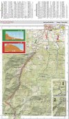
The Spanish Camino Pilgrim Association publishes a map of the SJPP to Roncesvalles region based on the official Spanish IGN maps but enriched with information for Camino Frances pilgrims including for example the location of the emergency phones and emergency WiFi points. It is fairly unknown to international Camino pilgrims. It is called Mapa SOS and it is in pdf form.

I had a look and saw that they updated it. Borda is not yet on it but the water points are marked. I could locate the Behicaro water point but no "Haya Spring".

Screenshot and link to this very useful topographical map for Camino pilgrims walking from SJPP to Roncesvalles:

SOS Pilgrim Map.jpg

https://www.caminosantiago.org/cpperegrino/enlaces/tecnologia.asp
 
Last edited:
I'll be walking alone, my pace is fast and walking slowly is boring to me
That is totally fine - we all have our own best pace.

Again, personally i'd rather make my long days after i have a couple of days on trail behind me and know how everything is working out.
This.
After some days on the road you'll have found your rhythm and will have time to work the kinks out, knowing how it feels to be carrying a pack day aftrr day over rough surfaces and varied terrain. After that, you can confidently pick up the pace.
 
Lets just close this thread. It seems to me as we covered everything and that there are no benefits to contiunue keeping the thread open.
Odd, these long threads, aren't they. One does not want to read a single word anymore about the thread's topic and yet one cannot help opening the thread again and again to see what has been posted since the last time one had a look ... :cool:
 
Join the Camino cleanup. Logroño to Burgos May 2025 & Astorga to OCebreiro in June
For the connoisseurs among us:

The "Roldán Spring" was remodelled in recent years and looks inviting. It does say "Fontaine de Roland" on the stele where the water tap is, and that's French. Because for a few hundred meters the pilgrim walks on no-man's land, i.e. exactly on the French-Spanish border. Look to the left and it's France, look to the right and it's Spain.

The OP, walking at 6 km/h, will be for 5 minutes on this short and special part of his Way to Santiago. He may not notice it nor be interested in it ... :cool:
 
Nobody reacted to this question so far. I find it a bit of an unusual list. I am just curious to know where your research found it?
I think the OP is refering to the water through at the top of the zigzag climb from Hunto and the water tap at the Orisson, judging by the short distance between them. although, shouldn't kms be more in the 8km bracket? the names are curious, though, I don't think I've ever seen them before.
 
Last edited:
Of course if after careful thought someone determines that they genuinely need to be rescued, they should ask to be rescued. However, rescues are usually not a trivial matter.

When a rescue team is asked to perform a rescue, the process usually interrupts the team members' normal daily activities. At the least it is inconvenient for them, and in the case of volunteer rescue teams, causes the team members' to cease their normal paid employment for the duration of the rescue; i.e. it costs them money. It can also divert scarce resources from other competing rescues that might need to be performed, thus putting some other to-be-rescued person at risk.

During the rescue process, the team must expend considerable time, money, and wear-and-tear of their equipment, and in some cases put their own lives at risk.

My point is that everyone everywhere has a moral responsibility to plan and act in a way that will minimize the probability of needing to be rescued. This includes avoiding plans that *unnecessarily* expose the person to higher-than-normal risks.

Here is a question that I suggest you ask yourself: "After considering the factors identified by others above and by yourself, does my plan unnecessarily expose me to higher-than-normal risks without creating any significant advantage, and might it set the stage for requiring a costly and possibly dangerous rescue that could have been avoided by better planning?"
I agree with you. You are completely correct Pilgrim9, we must take precautions and minimize risks as much as possible.
 
Get a spanish phone number with Airalo. eSim, so no physical SIM card. Easy to use app to add more funds if needed.
Nobody reacted to this question so far. I find it a bit of an unusual list. I am just curious to know where your research found it?
Hi Kathar1na,

Since I have never been to this region, I used maps from various sources. I don't remember the specific sources. I did some new research and, except for the Haya source, I believe these are the places where I found the information about the points where there would be water, including another option in Orisson:
Fointaine Behicaro https://www.visorando.com/randonnee-de-saint-jean-pied-de-port-a-roncevaux/


Fuente em Orisson : https://lh3.googleusercontent.com/p/AF1QipOHt0r7O2WUEaRBqoIHEnA25ThDZn6xniiXv7WL=s1360-w1360-h1020

Fuente de Roldán : https://maps.app.goo.gl/XzH8jUfgp5H7ATjN8
 
I think the sheer number of comments advising caution at such a late start from SJPDP show how people are concerned at your plan .
Advice to break up at Orrisson/Borda if bed availiable i agree 100 percent .
Ive been this way 3 times once in Sept and twice in Oct , i am also a ultra runner or was , even then id never do this setting off at that time of the year so late in the afternoon particuarly if youve never done the route before and without any other pilgrims to follow ahead of you or behind, in case of problems .
An extra day wont hurt, you can catch up or even do a longer first day .
Good luck whatever your decision . Buen Camino
 
A selection of Camino Jewellery
In early October, I plan to do the route from Sant Jean Pied de Port to Roncesvalles, leaving SJPP in the afternoon, around 2:30 p.m. I walk frequently and quickly, averaging 6 km/h. I would like to know if any of my colleagues have already done this route in the afternoon and what challenges I might be forgetting.
Leaving SJPP in the afternoon heading to Roncenvalles ... hmmm, I'd be very curious if you make it by dinner time, heck I'd be surprised if you make it by midnight. Buen Camino 🙋‍♀️
 
I'm with @lettinggo and would probably also vote for closure of this thread. Every possible advise has been offered; experiences have been shared; what JR does is what JR does.

I'd just like to be in StJdP in early October. The vision of an AI Bott sprinting the Napoleon with nothing but a powerbank in its 3kg (3kg?) backpack. Wow!

I would not enjoy watching anyone who really wanted to walk a Camino Frances, perhaps even make a pilgrimage to the shrine of Santiago break-down in their first week. I hope, and look forward to the OP reporting his happy progress, but I think this thread is done.
 
Ideal pocket guides for during & after your Camino. Each weighs only 1.4 oz (40g)!
I'm with @lettinggo and would probably also vote for closure of this thread. Every possible advise has been offered; experiences have been shared; what JR does is what JR does.

I'd just like to be in StJdP in early October. The vision of an AI Bott sprinting the Napoleon with nothing but a powerbank in its 3kg (3kg?) backpack. Wow!

I would not enjoy watching anyone who really wanted to walk a Camino Frances, perhaps even make a pilgrimage to the shrine of Santiago break-down in their first week. I hope, and look forward to the OP reporting his happy progress, but I think this thread is done.
I agree with Tincatinker but we want to know if he makes it 🙏
 
Reminder: You are not obligated to read this or any other thread. 😉
Lol so true I was just going to reply to the @Tincatinker post that I did a 🙏 to and then it dawned on me “well just don’t keep opening the thread” 🤣🤣 …but it’s like a good bag of chips/crisps…I can’t seem to stop dipping into the bag 😆
 
Join the Camino cleanup. Logroño to Burgos May 2025 & Astorga to OCebreiro in June
Lol so true I was just going to reply to the @Tincatinker post that I did a 🙏 to and then it dawned on me “well just don’t keep opening the thread” 🤣🤣 …but it’s like a good bag of chips/crisps…I can’t seem to stop dipping into the bag 😆
True Dani7, it's like a long and intriguing movie, where we want to know how it will end. I hope that at the end of this movie I'm not the villain of the story, and like everyone else, I'm rooting for a happy ending.
 
True Dani7, it's like a long and intriguing movie, where we want to know how it will end. I hope that at the end of this movie I'm not the villain of the story, and like everyone else, I'm rooting for a happy ending.
You can only be a villain to yourself if you ignore what both your heart and head tell you in the moment that make a difference. It only takes a moment to change everything. I believe you will have an awesome and incredible camino. 😁
 
Join the Camino cleanup. Logroño to Burgos May 2025 & Astorga to OCebreiro in June
Transport luggage-passengers.
From airports to SJPP
Luggage from SJPP to Roncevalles
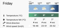
We are having a bit of a cold snap in a large part of Europe. I heard from people living in Brighton on the south coast of England that they had hail the other day. And on the top of Route Napoleon in the Pyrenees between SJPP and Roncesvalles it will feel cool on this September Friday afternoon, too. Some may even call it chilly. And a bit windy now and then. The occasional wind gust of 50 km/h has a tendency to get noticed.

You hail from Brazil, @JonnyRosa. I guess that this is the kind of summer weather that you are familiar with, too?

Of course it will already be autumn when you walk and we do sometimes have weather that we call "Golden October". And I don't know about the Pyrenees but the Alps are known for being a great time to walk in September and early October because the view can reach so incredibly far when you are high up and the air is dry.

Meteo Bentarte 13 Sep.jpg
Source: Meteoblue. Predictability is medium.
 
Last edited:
The downhill section through the forest in poor light at 6km/hr? Do you have a death wish?

You are an experienced runner, not a hiker, so you say. I met a young man in Sarria some years ago who was a very experienced runner, marathons.

With a smile on his face he told me this and went on to say that after 100km hiking with backpack, his feet were destroyed. Marathon running and long distance hiking are quite different.

Take care and good luck!!
 
I must admit that having received so many comments about why he should reconsider his proposed 1st day it reminds me of a conversation I had late on a New Year's Eve party when I said to someone I was considering running the London Marathon. A friend told me I couldn't do it, my wife replied don't ever tell him he couldn't do something! I did run (??) and completed it the following year.
Therefore, despite the advice, I would probably go ahead, thinking that I wouldn't hurt anyone else and was invincible. Whatever the outcome, if I survived, I would respond that it was a piece of cake ("easy" for non-English speakers) and I had time to shower, change and drink before the evening meal!
 
€2,-/day will present your project to thousands of visitors each day. All interested in the Camino de Santiago.
A friend told me I couldn't do it,
And was this a friend who had run the London Marathon earlier herself or himself? IOW, reasoned advice or just "thinking"?

And by "reason" I mean a bit more than the common logic of "I cannot do it so you can't either" and "I could do it so you can do". :cool:
 
Last edited:

❓How to ask a question

How to post a new question on the Camino Forum.

Most read last week in this forum

My husband and I are walking the Camino next June. We are currently booked into guest houses/hostels from Sarria to Santiago. I feel if we miss doing the meseta, I think we will regret it. That...
I never tire of doing the Camino Francés (five times and counting!), but the overcrowding in the summer months has made the Brierley stages from Sarria a no-go for me. That's why today I'm...
I have not had time to read this yet, but my spy on the ground tells me it outlines what it says on the tin, including a comment on the issue of how to improve the descent around Zubiri. I have no...
Back in 2018, I found an interactive Excel spreadsheet in the resource section for the Camino Frances that listed every town on the route and allowed you to pick your stopping point for each day...
I'm a total newbie and could use some help finding this little site so I can take a pic for a friend. It's near Burgos. I've found "Approaching Hontanas (Province of Burgos, Castilla y León)...
Suzanne and I may be back at it in the Spring. The hardest part right now is getting our heads around committing to 5-6 weeks of being away. Assuming we get there...we've always wanted to walk...

Featured threads

❓How to ask a question

How to post a new question on the Camino Forum.

Featured threads

Forum Rules

Forum Rules

Camino Updates on YouTube

Camino Conversations

Most downloaded Resources

This site is run by Ivar at

in Santiago de Compostela.
This site participates in the Amazon Affiliate program, designed to provide a means for Ivar to earn fees by linking to Amazon
Official Camino Passport (Credential) | 2024 Camino Guides
Back
Back
Top