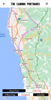
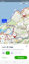
Searching the Bueno Camino app on my android, yellow arrow on blue background, the description of the stages along the central route, under Route in Detail, is negative. Author focuses on tarmac roads, walking next to N-roads, train tracks, does not sound like a pleasant experience. Is this just a peculiarity of the author's writing style, or is the central Camino that uninteresting?
-
 ⚠️ Emergency contact in Spain - Dial 112 and AlertCops app. More on this here.
 -
Get your Camino Portugues Guidebook here.
-
Remove ads on the forum by becoming a donating member. More here.
Search 74,075 Camino Questions
You are using an out of date browser. It may not display this or other websites correctly.
You should upgrade or use an alternative browser.
You should upgrade or use an alternative browser.
Buen Camino app, negative about central Portugal
- Thread starter bkkboy
- Start date
...and ship it to Santiago for storage. You pick it up once in Santiago. Service offered by Casa Ivar (we use DHL for transportation).
JabbaPapa
"True Pilgrim"
- Time of past OR future Camino
- 100 characters or fewer : see signature details
I understand that it's quite tough between Lisbon and Tomar, though there's a fair amount of tarmac north of there too.
Honestly, the route I'd suggest to Porto would be :
Lisbon > Santarém > (detour there to the Fátima route) > Minde > Fátima > Tomar > carry on as usual from there on. There's less infrastructure on the more direct route north out of Fátima, though no doubt that will change in future.
From Porto, the Coastal.
What I didn't do for my own needs and purposes is take the river route out of Porto, which most recommend, but instead I walked to the airport and from north of there made my way to the coast. It's not bad at all walking towards, around, and past the airport -- but the suburbia in and out of Porto is vast ; which can only really be helped by being a fast walker. Still, that does mean lots of watering holes along the way to forestall too much boredom ...
There are three principal routes out of Porto, really -- the Coastal, the Central (via Barcelos), and the route via Braga. The Coastal is the one with the least tarmac and cobblestones.
Oh, and for route planning do also use the mapy.cz app. It's also great on the go for finding parallel variants on some sections that you might dislike.
The one from Galicia (the round) and the one from Castilla & Leon. Individually numbered and made by the same people that make the ones you see on your walk.
klimmo
Active Member
- Time of past OR future Camino
- Mozarabe: nov ‘19
Português coastal: oct-nov ‘21
Walk out of Porto on the river to the coast! It's a lovely walk, you start at the cathedral, which makes for a nice starting point, and no suburbs or airport. In my opinion it would be a shame to miss it.
HumanistHiker
Active Member
- Time of past OR future Camino
- Camino Portugues September-October 2023
I did 2 days on the Littoral along the river out of Porto, up the coast through Matosinhos, and cut across to the Central from Vila do Conde to Rates. See https://stingynomads.com/vila-do-conde-to-rates-routes/This route is marked on mapy.cz The other main cut across is from Caminha further north, though the Matosinhos tourist info office lady said it is possible to cut across from Povoa de Varzim.
The 2024 Camino guides will be coming out little by little. Here is a collection of the ones that are out so far.
- Time of past OR future Camino
- Past: a few. Last: Gudbrandsdalsleden. Next: TBC
Perhaps more about what you have focussed on, at least if we have the same version of the Buen Camino app for the CP central route north of Porto. The author spends over sixty lines of description on the background of the route and a description of its characteristics, only six lines of which address the less positive aspects you have mentioned. It seems to me that much more is devoted to the virtues of the route than the less positive aspects of it. I think the description is well balanced. Perhaps you should read the positive bits of the description as well as the less positive!Author focuses on tarmac roads, walking next to N-roads, train tracks, does not sound like a pleasant experience. Is this just a peculiarity of the author's writing style, or is the central Camino that uninteresting?
Antonius Vaessen
Veteran Member
- Time of past OR future Camino
- 2015-2016 VdlPlata - Sanabres
2016.Primitivo
2017 Salvador
2018 Norte (to Sobrado)
2019 Norte again
I walked along the coast till Villa de Conde than switched over to the central route. It had beautifull parts but many kilometers were on tarmac or cobblestones and many times with very little space for walkers. Sometimes even dangerous when nearing a sharp bend in the road between walls and no idea if there were cars coming from the opposite direction.
After Pontevedra I would advise you to take the Variante Espiritual, which is very beautifull.
After Pontevedra I would advise you to take the Variante Espiritual, which is very beautifull.
Ideal sleeping bag liner whether we want to add a thermal plus to our bag, or if we want to use it alone to sleep in shelters or hostels. Thanks to its mummy shape, it adapts perfectly to our body.
€46,-
€46,-
- Time of past OR future Camino
- Various routes 2016 - 2024
If I were to leave Porto via the coastal route, what would be the best way to get back onto the central route a day or two later?
I would recommend using the Wise Pilgrim app. You can see all of the routes and how the connect. There's also a good description of how to leave Vila do Conde to connect with the Central route.

A Complete Guide to the Caminos to Santiago de Compostela
A complete guide to the Camino de Santiago, including accommodation on the Camino Francés, Camino del Norte, Camino Portugués, Camino Primtivo, Vía de la Plata, Camino de Invierno, Finisterre & Muxía, San Salvador, Camino Olvidado, Caminho Nascente, Camino da Geira, Camino Inglés, Vía Podiensis...
I did the same.I did 2 days on the Littoral along the river out of Porto, up the coast through Matosinhos, and cut across to the Central from Vila do Conde to Rates. See https://stingynomads.com/vila-do-conde-to-rates-routes/This route is marked on mapy.cz The other main cut across is from Caminha further north, though the Matosinhos tourist info office lady said it is possible to cut across from Povoa de Varzim.
Dick & Kitty
Member
- Time of past OR future Camino
- Camino Frances by stages from 2015 to 2021
We just finished walking from the northern suburbs of Porto (Vilar do Pineheiro) to Valenca, on the border with Spain. The first day of the walk (and part of the second day) was nothing short of terrifying. It wasn't along busy, curvy roads, but actually on the road, sometimes with nowhere to step off when cars came speeding by. Even when you could step off, it was more like a drainage ditch than a path. There were ways to detour around some of the worst places, but we found getting back to the main route to be confusing at times. Also, the detours added many kilometers to the path.Searching the Bueno Camino app on my android, yellow arrow on blue background, the description of the stages along the central route, under Route in Detail, is negative. Author focuses on tarmac roads, walking next to N-roads, train tracks, does not sound like a pleasant experience. Is this just a peculiarity of the author's writing style, or is the central Camino that uninteresting?
But after that, the camino became much, much better. Certainly from Barcelos to Valenca was very lovely indeed. It appears that Portugal is in the process of working hard to improve both the route and the signage. But quite frankly, the camino simply should not routed down the N306. It is too dangerous.
Kitty & Dick
A selection of Camino Jewellery
Vacajoe
Traded in my work boots for hiking ones
- Time of past OR future Camino
- Frances, Portuguese, Aragon, Norte, SJWayUK, Nive
First day out of Porto on the Central route is terrible. Oddly enough, you can find nice walking paths and quieter roads parallel to the signposted Camino route - I think they purposely route walkers past all of the businesses and hotels on a very busy roadway. If the Buen Camino stops short of saying “DON’T WALK THIS WAY,” then it is being more positive then that stage deserves
If you are going to spend a night or two in Porto, walk from the Cathedral to Matosinhos. Stop at the bridge. It is about 6 miles. Take the 500 bus back to the Cathedral/train station area dump your pack and do some site seeing. The next day take the 500 bus back to Matosinhos and walk to Vila do Conde about 14 miles. From Vila do Conde, we used the Wise Pilgrim to get to the Central. It was nice to take it easy the first two days.
kenwilltravel
Member
- Time of past OR future Camino
- Portuguese Coastal (2018)
Portuguese Coastal, with Spiritual Variant (2019)
I agree absolutely with what Dick & Kitty say about the N306. No fun at all, as you can see from our blog post: https://twoclinestraveling.wordpress.com/2023/09/02/porto-to-casa-mindela-6-6-km-too-much-traffic/We just finished walking from the northern suburbs of Porto (Vilar do Pineheiro) to Valenca, on the border with Spain. The first day of the walk (and part of the second day) was nothing short of terrifying. It wasn't along busy, curvy roads, but actually on the road, sometimes with nowhere to step off when cars came speeding by. Even when you could step off, it was more like a drainage ditch than a path. There were ways to detour around some of the worst places, but we found getting back to the main route to be confusing at times. Also, the detours added many kilometers to the path.
But after that, the camino became much, much better. Certainly from Barcelos to Valenca was very lovely indeed. It appears that Portugal is in the process of working hard to improve both the route and the signage. But quite frankly, the camino simply should not routed down the N306. It is too dangerous.
Kitty & Dick
€2,-/day will present your project to thousands of visitors each day. All interested in the Camino de Santiago.
Llew
Active Member
- Time of past OR future Camino
- Frances/Fin 2012, Norte/Ingles 2015, Port/Fin 2022
In my humble opinion the walk from Porto to Vila do Conde is lovely. Firstly by the river and then the coast. From there you can cut across to Barcelos to join the Central which I think is a great walk. Plenty of history and some lovely towns.
- Time of past OR future Camino
- 1989, 2016, 2018, 2023, 2024...
I walked out along the river and up the coast (technically on the Senda Litoral rather than the Coastal Route). A day and a bit later I got to Vila do Conde (where the "Coastal Route" finally makes it to the coast). Crossing the bridge heading north into Vila do Conde I immediately turned right (east) and walked along the north shore of the river. Soon there were yellow arrows and signage leading me to Arcos on the Central Route, and I continued along that route to Rates where I spent the night.If I were to leave Porto via the coastal route, what would be the best way to get back onto the central route a day or two later?
lovelyshell
Active Member
- Time of past OR future Camino
- October/November 2016
I highly recommend this but i would recommend starting in Vilar do Pinheiro which is just after the Maia industrial zone. The first part of the walk from Vilar do Pinheiro is really charming and one of my favorite walks on the Portuguese. It’s about 10 mile to Vilarinho from Vilar do Pinheiro so it makes for a nice short day (which you appreciate because the next walk from Vilarihno to Barcelos is lovely but long). I used Wise Pilgrim which I really needed. It was great!Thanks. Plan to start from Porto. May catch a train from Porto to Vilarinho to miss the suburbs and airport.
A selection of Camino Jewellery
- Time of past OR future Camino
- CF in spring and winter, Portugues, Sanabres: 2024
- Time of past OR future Camino
- Past: a few. Last: Gudbrandsdalsleden. Next: TBC
I have. I still think you're wrong to suggest that the author is negative about the route. The structure of the entries from Porto to Tui, with a section on 'Difficulties' for that section of the route, seem entirely appropriate. I think it is better that the app's users know what faces them described in a fairly dispassionate manner. The few words that might be described as emotive are both infrequent and mild. I cannot understand why you are interpreting this as anything but helpful.Six lines of which address the less positive aspects. I stopped counting at 70 lines. You need to dig deeper and read his comments on every stage.
Kirkie
member
- Time of past OR future Camino
- CF 2006, CP 2013, Salvador2017,
Inglés 2019
Oh dear. Uninteresting? Are you sure you are on the right forum?Searching the Bueno Camino app on my android, yellow arrow on blue background, the description of the stages along the central route, under Route in Detail, is negative. Author focuses on tarmac roads, walking next to N-roads, train tracks, does not sound like a pleasant experience. Is this just a peculiarity of the author's writing style, or is the central Camino that uninteresting?
A selection of Camino Jewellery
- Time of past OR future Camino
- CF in spring and winter, Portugues, Sanabres: 2024
I just did a cursory look at the mapy.cz app. How is it different from Google maps? Does it show walking paths?I did 2 days on the Littoral along the river out of Porto, up the coast through Matosinhos, and cut across to the Central from Vila do Conde to Rates. See https://stingynomads.com/vila-do-conde-to-rates-routes/This route is marked on mapy.cz The other main cut across is from Caminha further north, though the Matosinhos tourist info office lady said it is possible to cut across from Povoa de Varzim.
- Time of past OR future Camino
- Various routes 2016 - 2024
Yes, it shows the major and many minor Camino paths and other hiking and cycling trails all over the world. You have to zoom in to see them though. When you put in two locations to get directions you can choose driving or walking, like on Google Maps, but mapy.cz is much better at routing walkers to trails instead of roads.I just did a cursory look at the mapy.cz app. How is it different from Google maps? Does it show walking paths?
In the settings you can choose "outdoor" for your default map, though I'm not exactly sure of the differences between the maps.

Unlike other mapping apps you don't have to download tracks - they are already built in.
I used it for some coastal trails while I was on the Norte this year.
There was a thread about an alternative route into Molinaseca, and it's on mapy.
Here's my post on that thread.
The Mapy.cz app has this and many other hiking trails already built in - no need to download additional tracks.
This is what it looks like. Note the dark blue line is the Camino, and the Puente de Malpaso trail is gold.
Here's where it starts at Riego de Ambros
View attachment 146606
This shows the entire trail
View attachment 146607
And here's where it comes into Molinaseca
View attachment 146608
- Time of past OR future Camino
- CF in spring and winter, Portugues, Sanabres: 2024
So it shows the Camino route automatically (in Blue)?
Perfect memento/gift in a presentation box. Engraving available, 25 character max.
- Time of past OR future Camino
- Various routes 2016 - 2024
YesSo it shows the Camino route automatically (in Blue)?
- Time of past OR future Camino
- Various routes 2016 - 2024
JabbaPapa
"True Pilgrim"
- Time of past OR future Camino
- 100 characters or fewer : see signature details
Not all of them, but very, very many -- and most Camino routes, and all of the (current) major ones. There can be missing routes, such as currently a section of the Olvidado, until recently the Via Romea from Germany was missing, and last time I looked several sections of the Via Augusta from Cádiz to Rome on its Spanish portions are missing. When I walked the Provençal Way portion of my last Camino, in 2019, a long section of that was missing too, but it's there now.I just did a cursory look at the mapy.cz app. How is it different from Google maps? Does it show walking paths?
Some of the advantages of the mapy.cz app is that it works on all platforms (even on Windows Phone (!!) though that version is very out of date), that the offline maps are 100% free, and that it's very good with dirt trails and agricultural roads if you want to make a detour away from an "official" route for some reason, or if your Camino requires DIY, or you're roughly following a historic pilgrimage route that hasn't been waymarked yet.
The Windows desktop version of the app is great (I mean the app, not the website browser version), though you could only take it with you on a Windows higher-end tablet or a laptop ; great though for checking out the app at home, and planning, and so on.
Usually in blue -- but occasionally in red, if it's a secondary or less-travelled Camino route, or one that's been waymarked as something else than a Camino, even if it is one.So it shows the Camino route automatically (in Blue)?
Last edited:
The one from Galicia (the round) and the one from Castilla & Leon. Individually numbered and made by the same people that make the ones you see on your walk.
- Time of past OR future Camino
- Past: a few. Last: Gudbrandsdalsleden. Next: TBC
The mapping data for mapy.cz, OSMAand+ and a range of other products includes the open source data from the Open Street Maps (OSM) project. This project has been collecting trail information from users around the world for many years, including the Camino routes. I am not aware of Google providing this level of detailed information. I suspect that any mapping app that uses OSM sourced data will have data layers for walking, cycling and horse routes, ski slopes, etc that can be turned on or off as you wish.I just did a cursory look at the mapy.cz app. How is it different from Google maps? Does it show walking paths?
Other mapping apps, such as the IGN Mapas de Espana app, appear to need a downloaded route, which often is not as convenient for first time users.
eileeninhastings
New Member
- Time of past OR future Camino
- Frances 2009;
Ingles 2018;
Muxia-Fisterra-Santiago 2019
i have been struggling with the mapy app. I installed it and downloaded the north east Spain map as planning to walk from San Sebastian to Santander. i've been trying to familiarise myself with how it works by using it for local walks but I find it very difficult to switch between that and the downloaded map. Does anyone know any mapy tutorials as i can't find any help when I google it.
❓How to ask a question
How to post a new question on the Camino Forum.
Most read last week in this forum
Hi all - My name is Tihana and I started planning my first Camino.
It will be a short one on The Portuguese Way - Coastal route (Oia to Santiago).
Aiming to go last week of April and first week of...
My wife and I are planning to walk the Camino Portuguese starting in Lisbon around the 18th of March 2025.
Please can anyone advise on the availability of accommodation on the Lisbon - Porto...
Hi All!
My husband and I have been communicating with Follow the Camino, a travel agency that plans the route, books lodging, transfers luggage along the route, etc. I know we could easily book...
Note from the mods: Thanks to @Takahiwai for providing a translation to this post. Please carry on all discussion in English. Thank you.
Hola :-)
Estoy buscando ayuda o consejo :-)
Soy...
Similar threads
- Replies
- 13
- Views
- 2K
- Replies
- 8
- Views
- 2K
- Tags phones/apps/gps/maps
- Replies
- 13
- Views
- 973
- Tags phones/apps/gps/maps
- Replies
- 24
- Views
- 2K
Forum Zoom Chats
Join our Camino Forum Zoom chats every Tuesday. See the next one here.
❓How to ask a question
How to post a new question on the Camino Forum.
Most downloaded Resources
-
“All” Albergues on the Camino Frances in one pdf“All” Albergues on the Camino Frances in one pdf
- ivar
- Updated:
-
A selection of favorite albergues on the Camino FrancésFavorite Albergues along the Camino Frances
- Ton van Tilburg
- Updated:
-
Profile maps of all 34 stages of the Camino FrancesProfile maps of all 34 stages of the Camino Frances
- ivar
- Updated:


