• ⚠️ Emergency contact in Spain - Dial 112 and AlertCops app. More on this here.
  • Remove ads on the forum by becoming a donating member. More here.

Search 74,075 Camino Questions

Waymarking?

auburnfive

Veteran Member
Hello
One of the things I loves about the Frances and the Portuguese Central routes was how easy they were to navigate - just follow the yellow arrows! We are thinking about the Portuguese coastal or seaside - can anyone advise on how well those routes are marked? Is it necessary to frequently consult a map or GPS? Thank you
 
The 2024 Camino guides will be coming out little by little. Here is a collection of the ones that are out so far.
Mostly well marked, and I saw no intentional mismarkings. We had a slight problem finding the route leaving Vila de Conde, but asked someone and got pointed the right way - that was the second day out, so perhaps just a rookie error in spotting the waymarks. Once we were out of town it was very clear.
The only other caution I'd give is that a year ago, leaving Tui, a group of us were following waymarkers pre-dawn, and a motorist stopped and told us to go a different way; that they'd changed the route due to construction, and the route he pointed us too was well-marked. Presumably, that issue has been taken care of in the past year.
Bom caminho!
 
Some of the arrows were green (2015) - a slight problem for those of us who are colourblind.
Apart from that the only problem we had was where a carpark was being built across the camino and no attempt at a diversion had been made.
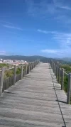
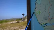
For what they're worth the attached is the path we followed.
 

Attachments

Perfect memento/gift in a presentation box. Engraving available, 25 character max.
I wouldn't say the Senda Litoral (seaside) in Portugal is as well marked as the Senda in Galicia From A Guarda. I too had a few difficulties from Vila do Conde to Esposende especially from a few kms short of Fao..so check the coast map carefully here if you want to stay on the coast senda here. Esposende via Marinhas to Viana waymarks took me adjacent to the coast but inland through Belinho and Antas...but I really enjoyed this stretch. I also found the seaside route from Viana to Caminha a bit tricky...leaving Viana I lost markers initially around the port area but found my own way to the coast within 30 40 mins. The boardwalks on this stretch south of Ancora are incomplete and it was tricky finding the work arounds. After Ancora is was much easier. I must add that maybe I missed some way markers (my first Camino!) but I kind of went with the flow which was part of the charm of this Caminho for me.
Some want to stay exactly on the seaside as much as possible throughout so that they are at times going 'off camino', ... i think you would need a map in that case. PS it can get windy on the atlantic coast esp the Portuguese bits.
 

Attachments

  • WP_20170611_024.webp
    WP_20170611_024.webp
    459.8 KB · Views: 18
  • WP_20170611_012.webp
    WP_20170611_012.webp
    222.9 KB · Views: 15
Thank you Jeff
I was only able to open the map in Google earth, and it looks very helpful. Would you happen to have it in a PDF?

Hi there, you can't print out a kmz file as a pdf - at least not in any intelligible sense.
Try http://www.caminador.es/?page_id=117Buen for various route maps in pdf form and you should certainly get hold of Johnnie Walker's guide.
The gpx file should open in apps such as Maps.Me and load onto most GPS handhelds.
I only logged the route because I like cartography - you probably don't need it (but they can be fun!)
 
The focus is on reducing the risk of failure through being well prepared. 2nd ed.
My experience last summer from Porto was that the Caminha da Costa was well marked with yellow arrows. This route weaves inland and back to the coast at various points. The Senda Litoral, which runs along the coastline, was not well marked. However, we wandered back and forth on the two routes, spending as much time near the coast as possible, but also following the yellow arrows where there did not seem to be a viable alternative. Both routes run through the same towns/villages, so it does not really matter, as long as the ocean is on your left. We did not have maps or GPS, but we dd not have too many difficulties. It's a great route. You will enjoy it.
 
Just home from the Portuguese seaside route and would say the markings are good in places. Out of Porto by the river to Matosinhos no markers. Matosinhos to Vila do Conde boardwalk and markers. To Esposende good markers but at end of boardwalk you go inland around a golf course. Esposende to Viana well marked via Marinhas. Viana to Caminha the seaside not marked well from town but one on the coast ok. Coastal and seaside join at Anchora and marked well from there. Lots of markings when you cross the Minho. We used The Johnney Walker notes which we bought from CSJ office and they were great, very detailed maybe too much at times but really helped us hug the coast by not following the arrows at times. Highly recommend it.
 
Train for your next Camino on California's Santa Catalina Island March 16-19

❓How to ask a question

How to post a new question on the Camino Forum.

Most read last week in this forum

Hi All - I'm a first time pilgrim planning an April 2025 walk starting in Porto via Senda Litoral via Spiritual Variant to Santiago. I'm looking for private rooms in aubergues or hostels. I'd be...

Featured threads

❓How to ask a question

How to post a new question on the Camino Forum.

Featured threads

Forum Rules

Forum Rules

Camino Updates on YouTube

Camino Conversations

Most downloaded Resources

This site is run by Ivar at

in Santiago de Compostela.
This site participates in the Amazon Affiliate program, designed to provide a means for Ivar to earn fees by linking to Amazon
Official Camino Passport (Credential) | 2024 Camino Guides
Back
Back
Top