Search 74,075 Camino Questions

Walking to Castro Urdiales--Confusing Section

Time of past OR future Camino
Camino de Santiago, Norte (2016)
Camino Portuguese, Coastal (2018)
The recent death of a pilgrim along the Norte prompted me to retrace my own walk this September from La Arena to Castro Urdiales. Initially I remember it being a beautiful walk along an old railway that had been turned into a paved walking path far above the sea. There was a fence along the cliff and many people, not just pilgrims, were walking the path that day. The path eventually ended and as we followed the Camino markers we found ourselves at a roundabout. We could find no arrows or other such markers. I believe there were a couple of different roads off of the circle, one being a dirt road. We were considering taking the dirt path as it appeared to go back towards the sea. While we were standing there, a cyclist came along and we asked him which way to pick up the Camino. He pointed us to the highway and told us that was the best way for us to go. That road, N-634, was a two lane curvy highway with many blind curves and what appeared to be a steep drop to the sea on the other side of the guardrail. We hugged the left shoulder the entire time and at least once during that long stretch had to press our bodies against the rock wall on our left to avoid being hit by a car.

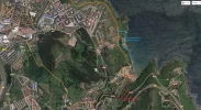
On another forum, and in response to the death of a pilgrim on that route, a person posted a google map picture of the Camino near Punta de Saltacaballos where the pilgrim's body was located. It appeared that a path actually ran along beside that highway just above the sea making me think that perhaps there was another option that we missed.

Did anyone else experience confusion at that same roundabout? Did anyone walk a trail parallel to N-634?

Thank you.
 
Last edited:
Perfect memento/gift in a presentation box. Engraving available, 25 character max.
Attached is a shorter and interesting alternative approach to Castro from Portuagalete that was posted on the forum a while back, saves quite a few kilometres. Took this route in 2015 and it is very easy to follow.
 

Attachments

Last edited:
The recent death of a pilgrim along the Norte prompted me to retrace my own walk this September from La Arena to Castro Urdiales. Initially I remember it being a beautiful walk along an old railway that had been turned into a paved walking path far above the sea. There was a fence along the cliff and many people, not just pilgrims, were walking the path that day. The path eventually ended and as we followed the Camino markers we found ourselves at a roundabout. We could find no arrows or other such markers. I believe there were a couple of different roads off of the circle, one being a dirt road. We were considering taking the dirt path as it appeared to go back towards the sea. While we were standing there, a cyclist came along and we asked him which way to pick up the Camino. He pointed us to the highway and told us that was the best way for us to go. That road, N-634, was a two lane curvy highway with many blind curves and what appeared to be a steep drop to the sea on the other side of the guardrail. We hugged the left shoulder the entire time and at least once during that long stretch had to press our bodies against the rock wall on our left to avoid being hit by a car.

On another forum, and in response to the death of a pilgrim on that route, a person posted a google map picture of the Camino near Punta de Saltacaballos where the pilgrim's body was located. It appeared that a path actually ran along beside that highway just above the sea making me think that perhaps there was another option that we missed.

Did anyone else experience confusion at that same roundabout? Did anyone walk a trail parallel to N-634?

Thank you.
I looked at the photo that showed where the pilgrim was found and saw that there was a train tunnel up the hill. Isn't this the area where before the tunnel, the trail comes to an area fenced off with a cyclone fence--with directions that say it is closed? We went ahead, as others had done, through an abandoned train tunnel. Some local people sort of led the way through a maze of concrete abutments, etc. As far as I recall, however, once through the maze and over the hill, the downhill section was easy to follow.
 
The 2024 Camino guides will be coming out little by little. Here is a collection of the ones that are out so far.
Attached is a shorter and interesting alternative approach to Castro from Portuagalete that was posted on the forum a while back, saves quite a few kilometres. Took this route in 2015 and it is very easy to follow.
Horler - this may provide a viable route into Castro Urdiales but the advice at Miono doesn't look right to me: 'As Mioño is in sight you'll see a small beach on your right. Then you see a yellow arrow which directs you to cross the road towards the right and take a path going down back which winds down to that beach. BEWARE - ignore that yellow arrow.'
In 2013 you could follow that yellow arrow and take the path down to the beach and then turn left at the end and climb up onto the grassy hills above the sea and walk from there all the way to CU without any roads or obstacles at all. There were some faint marks of yellow on path stones here and there. I thought this variant had been incorporated into later editions of the Cicerone guide, but I don't have it to check. Apologies if this has already been clarified by someone else on an earlier thread.
 
Tom, I stayed on the road into Miono and found the tunnel easily. I think the advice to ignore the arrow is to get you to proceed directly to Miono and not get diverted if you are going to use the tunnel route
 
In 2013 you could follow that yellow arrow and take the path down to the beach and then turn left at the end and climb up onto the grassy hills above the sea and walk from there all the way to CU without any roads or obstacles at all. There were some faint marks of yellow on path stones here and there. I thought this variant had been incorporated into later editions of the Cicerone guide, but I don't have it to check.

Hi, the dirt track down to the beach in Miono IS incorporated in the new Cicerone guide, and in fact is shown as the main route, not as the variant. (“Both routes work but the coastal approach is preferable”.) My two friends missed the yellow arrow pointing to the dirt track, so they ended up going through the long tunnel. I was looking for the turnoff, however, took it, and went down to the beach. I had a fabulous long lunch at the bar on the other side with a stunning view, and then ambled on late afternoon, up behind the bar and along the coast into Castro Urdiales. Jill
 
Holoholo automatically captures your footpaths, places, photos, and journals.
The recent death of a pilgrim along the Norte prompted me to retrace my own walk this September from La Arena to Castro Urdiales. Initially I remember it being a beautiful walk along an old railway that had been turned into a paved walking path far above the sea. There was a fence along the cliff and many people, not just pilgrims, were walking the path that day. The path eventually ended and as we followed the Camino markers we found ourselves at a roundabout. We could find no arrows or other such markers. I believe there were a couple of different roads off of the circle, one being a dirt road. We were considering taking the dirt path as it appeared to go back towards the sea. While we were standing there, a cyclist came along and we asked him which way to pick up the Camino. He pointed us to the highway and told us that was the best way for us to go. That road, N-634, was a two lane curvy highway with many blind curves and what appeared to be a steep drop to the sea on the other side of the guardrail. We hugged the left shoulder the entire time and at least once during that long stretch had to press our bodies against the rock wall on our left to avoid being hit by a car.

On another forum, and in response to the death of a pilgrim on that route, a person posted a google map picture of the Camino near Punta de Saltacaballos where the pilgrim's body was located. It appeared that a path actually ran along beside that highway just above the sea making me think that perhaps there was another option that we missed.

Did anyone else experience confusion at that same roundabout? Did anyone walk a trail parallel to N-634?

Thank you.


You walk through two tunnels on this section. First not far out of pobena on lovely path above sea. As you approach Miono you get choice to go to right towards beach and up a small mountain. This route now well marked. It's lovely but tough walk. Going straight in Miono where you have a few cafes/ bar and straight through to tunnel. 585 metres well lit now . You save 5 km!! Very little traffic on road and very safe
 
We did walk through Miono after walking the 634. Upon leaving Miono we did not find any arrows and asked a local to direct us to the Camino. We followed his directions (or at least we think we did) and passed through a second tunnel. We never saw the sea or beach again until we reached Castro Urdiales. As I recall, it was only about 3K from Miono to Castro Urdiales, much of it on a quiet, flat roadway.
 
Going straight in Miono where you have a few cafes/ bar and straight through to tunnel. 585 metres well lit now . You save 5 km!!

Hi, there is not much difference in the mileage between the two routes from Miono. I think you may be referring to the variant that branches off at Onton, which is 4kms before Miono. That route goes through Baltezana, Ontanes, Santullan and Samano, and is 5.3kms longer than staying on the coast via Miono. Jill
 
3rd Edition. More content, training & pack guides avoid common mistakes, bed bugs etc
I looked at the photo that showed where the pilgrim was found and saw that there was a train tunnel up the hill. Isn't this the area where before the tunnel, the trail comes to an area fenced off with a cyclone fence--with directions that say it is closed? We went ahead, as others had done, through an abandoned train tunnel. Some local people sort of led the way through a maze of concrete abutments, etc. As far as I recall, however, once through the maze and over the hill, the downhill section was easy to follow.

I looked at the photo but don't recall ever passing through that particular tunnel. We passed through a short one closer to Pobena along a well traveled path with split rail fencing beside the cliff. The other tunnel was after Miono and was not above a cliff. I suspect we heeded the "closed" sign and took a different route. It's hard to say. When you've traveled for 40 days, it's easy to confuse one section with another.
 
Last edited:
The recent death of a pilgrim along the Norte prompted me to retrace my own walk this September from La Arena to Castro Urdiales. Initially I remember it being a beautiful walk along an old railway that had been turned into a paved walking path far above the sea. There was a fence along the cliff and many people, not just pilgrims, were walking the path that day. The path eventually ended and as we followed the Camino markers we found ourselves at a roundabout. We could find no arrows or other such markers. I believe there were a couple of different roads off of the circle, one being a dirt road. We were considering taking the dirt path as it appeared to go back towards the sea. While we were standing there, a cyclist came along and we asked him which way to pick up the Camino. He pointed us to the highway and told us that was the best way for us to go. That road, N-634, was a two lane curvy highway with many blind curves and what appeared to be a steep drop to the sea on the other side of the guardrail. We hugged the left shoulder the entire time and at least once during that long stretch had to press our bodies against the rock wall on our left to avoid being hit by a car.

On another forum, and in response to the death of a pilgrim on that route, a person posted a google map picture of the Camino near Punta de Saltacaballos where the pilgrim's body was located. It appeared that a path actually ran along beside that highway just above the sea making me think that perhaps there was another option that we missed.

Did anyone else experience confusion at that same roundabout? Did anyone walk a trail parallel to N-634?

Thank you.
I am so sorry you missed the marker that takes you along the sea. It is there at the round about. Just needs a little searching but I've seen worse markers. If you ever have a chance to repeat, do so. It is a beautiful walk, yes along the dirt road. Buen camino.
 
I am so sorry you missed the marker that takes you along the sea. It is there at the round about. Just needs a little searching but I've seen worse markers. If you ever have a chance to repeat, do so. It is a beautiful walk, yes along the dirt road. Buen camino.

Thank you for letting me know. Perhaps I will get the opportunity to do that section sometime in the future. I'm curious though, how recently did you walk that section of the Camino?
 
3rd Edition. More content, training & pack guides avoid common mistakes, bed bugs etc
The recent death of a pilgrim along the Norte prompted me to retrace my own walk this September from La Arena to Castro Urdiales. Initially I remember it being a beautiful walk along an old railway that had been turned into a paved walking path far above the sea. There was a fence along the cliff and many people, not just pilgrims, were walking the path that day. The path eventually ended and as we followed the Camino markers we found ourselves at a roundabout. We could find no arrows or other such markers. I believe there were a couple of different roads off of the circle, one being a dirt road. We were considering taking the dirt path as it appeared to go back towards the sea. While we were standing there, a cyclist came along and we asked him which way to pick up the Camino. He pointed us to the highway and told us that was the best way for us to go. That road, N-634, was a two lane curvy highway with many blind curves and what appeared to be a steep drop to the sea on the other side of the guardrail. We hugged the left shoulder the entire time and at least once during that long stretch had to press our bodies against the rock wall on our left to avoid being hit by a car.

On another forum, and in response to the death of a pilgrim on that route, a person posted a google map picture of the Camino near Punta de Saltacaballos where the pilgrim's body was located. It appeared that a path actually ran along beside that highway just above the sea making me think that perhaps there was another option that we missed.

Did anyone else experience confusion at that same roundabout? Did anyone walk a trail parallel to N-634?

Thank you.
Hi Dragon Shadow (great name!) - I'm planning to go on that route next Spring, so thank you for the warnings and tips. Much appreciated,
Regards, Keith
 
Hello again. In answer to when I did this trail to Castro Urdiales it was late September 2016.
Orford Girl
 
Holoholo automatically captures your footpaths, places, photos, and journals.
Hi Dragon Shadow (great name!) - I'm planning to go on that route next Spring, so thank you for the warnings and tips. Much appreciated,
Regards, Keith

You're welcome, Keith. I'm sure you will enjoy the Norte. While certainly challenging, it's hard to beat the beauty. Buen Camino.
 
hi all! I took the coastal route from Miono to Castro in 8th Sep this year.

this is how I went. the route follows N-634 past Saltacaballos, above a small beach below (formerly a path branched off directly down to the beach but it was overgrown) and around a deeper valley. when it comes out of that valley, an arrow poins sharp right down a gravel road that descends to the beach. on the beach you turn left across the river then right, then left up after bar La Encina. this is all well marked. (from the bar a lane right along the sea leads through a former mine-railway tunnel to a cargadero then up some steep stairs to the top of the cliffs with the waymarked path.) the path then runs across meadows above cliffs (all safe) then in descend cuts the bends of a gravel lane/road to the right of an appartment complex. here on bottom was where things got confusing with little waymarks then a split arrow pointing left and right. I followed a faint path up to the overgrown cliff on the right, across it and steeply down (with loose stones, not recommended in wet conditions) to the start of the promenade leading into Castro.

I have seen on wikiloc description of a path that runs above the cliffs all the way from where Camino del Norte passes under the motorway before Onton. it goes through several former mine-railway tunnels and is probably not recommended.
there also seemed to be a path from the tip of Saltacaballo (with the restaurant) to the beach of Miono. this may be worth exploring to avoid part of the N-634.
 
Horler - this may provide a viable route into Castro Urdiales but the advice at Miono doesn't look right to me: 'As Mioño is in sight you'll see a small beach on your right. Then you see a yellow arrow which directs you to cross the road towards the right and take a path going down back which winds down to that beach. BEWARE - ignore that yellow arrow.'
In 2013 you could follow that yellow arrow and take the path down to the beach and then turn left at the end and climb up onto the grassy hills above the sea and walk from there all the way to CU without any roads or obstacles at all. There were some faint marks of yellow on path stones here and there. I thought this variant had been incorporated into later editions of the Cicerone guide, but I don't have it to check. Apologies if this has already been clarified by someone else on an earlier thread.
I believe that this wikiloc route shows the two alternatives that Horler and Tom are talking about.

Horler's tunnel route is the left side of the circle, I think, and Tom's beach walk is the right side of the circle.

http://www.wikiloc.com/wikiloc/view.do?id=9606788
 
Perfect memento/gift in a presentation box. Engraving available, 25 character max.
Hi Laurie
thanks for trying to clear this up. I'd also add to anyone about to walk this way and wondering what is going on - try and have a look at the map in the more recent editions of the Cicerone guide to the northern routes. I just caught a quick glimpse of it the other day and it looks as if it shows the route around the shore and the tunnel (in blue) as well. But either way, it's not something to lose sleep over - you'll be fine!
Cheers, tom
 
I walked along the N634, practically starting in Pobena. This is considered an alternativa to walking along the coast. Why I didn't take the coastal route, I have no idea, as the guidebook says it's beautiful.

In Onton one can again choose: the N634, the alternativa which also shaves off 9km, or the offical which is a big loop inland, and is the recommended route. If you take the official, long, inlamd route, you do not go through Miono. The N634 was tne recommended route.

From Miono there is a coastal alternative, but the guidebook suggests asking locals about amd does not give any details.

I never found the traffic on the N634 to be an issue, though I remember couting my footsteps on a hilly part of it to motivate me by giving me small goals. :confused: I also remember the ripe figs we had for breakfast, harvested off a tree not on private property.
 
I added to the map that Laure posted the waymarked route branching off the N634 (in red) and the route that goes from Miono along the sea to the cargadero and then climbs up the stairs to the waymarked route along the top of the cliffs (in blue) - this one is based on descriptions, I haven't walked it.
 

Attachments

  • Miono.webp
    Miono.webp
    434.2 KB · Views: 26
Train for your next Camino on California's Santa Catalina Island March 16-19

❓How to ask a question

How to post a new question on the Camino Forum.

Most read last week in this forum

Planning on walking Norte-Primitivo starting about June 10, 2025. Are the albergues very busy at that time and also what will the weather be? I did this the end of August and September of 2017 and...

Featured threads

❓How to ask a question

How to post a new question on the Camino Forum.

Featured threads

Forum Rules

Forum Rules

Camino Updates on YouTube

Camino Conversations

Most downloaded Resources

This site is run by Ivar at

in Santiago de Compostela.
This site participates in the Amazon Affiliate program, designed to provide a means for Ivar to earn fees by linking to Amazon
Official Camino Passport (Credential) | 2024 Camino Guides
Back
Back
Top