• ⚠️ Emergency contact in Spain - Dial 112 and AlertCops app. More on this here.
  • Remove ads on the forum by becoming a donating member. More here.

Search 74,075 Camino Questions

Detailed Planning for Viejo/Olvidado from Pamplona

Time of past OR future Camino
Various 2014-19
Via Monastica 2022
Primitivo 2024
Now that I have the hang of walking virtually after taking on the Invierno, I'm going to be more ambitous: next up is the combination of the Viejo and Olvidado from Pamplona to Ponferrada. I won't go any faster then I walk here everyday, so it will take a while (weeks? months?). As I go I'll post here, to pick the brains of everyone who's already walked.

First up is basic resources....
In addition to several bookmarked threads that I already have, here are my starting points as far as information goes:
Ender's guide:

@peregrina2000's guide from Bilbao:

@caminka's guide from Pamplona:

And of course:

I have a wikiloc track that gets me as far as Miranda de Ebro, but then the adventure begins in earnest. @caminka posted a link to hers somewhere here on the Forum, but I did not bookmark them, alas...so now cannot find them.

If anyone knows where they are, or has resources I've missed, please sing out ~ thank you!
 
...and ship it to Santiago for storage. You pick it up once in Santiago. Service offered by Casa Ivar (we use DHL for transportation).
Day -1 is actually about getting there. I'm coming from Santiago, and have the choice of a bus ride more or less on the Norte, A train to Irun following parts of the Invierno, Frances, and Via de Bayona - and then somehow getting across to Pamplona - or a train to Pamplona via Madrid. (Flying is also possible, but why fly? It's not as if time is an issue!)

I love that train journey to Irun, so am thinking that I might suck up the extra travel time and go for it. RometoRio tells me there are plenty of options:
 
So arriving in Pamplona and gathering my resources.
It looks like the first days, before metging with the Vasco in Salvatierta, might be 'intetesting.'
from Pamplona to Salvatierra there are no waymarks, although this part has most of the albergues
That was a while ago, so I am hoping the waymarking has improved quite a bit in the meantime.

At least @Sheffield James (who's walked this way more recently) is reassuring about the route leaving Pamplona.
a quick and easy exit route, which basically involves walking down by the side of the tourist office and Ayuntemiento, following the curve of the river past the “cable” bike-lift, then crossing the Puente Cuatrovientos and straight out of town in the direction of the Berriozer suburb, and Vitoria-Gestiez. The road of town is so straight and straightforward you’d struggle to take a wrong turn.

I have Wikiloc track to follow but prefer not to have my nose constantly in my phone. So I am wondering if anybody knows the state of the waymarking between Pamplona and Salvatierra now?

There is there is a lot of information now (thanks to Ender's guide and more pilgrim traffic and blogs here) about the Olvidado from Bilbao. But there's much less information about the arm of the Viejo that joins it coming from Pamplona. It's reassuring to know I'm not the only one trying to round up loose ends of information:
Now this is the third time I have tried to round up the loose details of this Viejo Camino from the Pamplona start.
With some luck I will take that route some fine day.


I'm tired after the long trip and the slog coming up from the train station, so I'm glad to have planned a free day tomorrow to poke around Pamplona. I look forward to revisiting the Navarre Museum, enjoying some Tapas at bar Gaucho and maybe a trip to Caminoteca. I got here late, so I had booked at a very nice little hotel that @NualaOC turned me onto after we walked the Baztan in 2017:

Anyone have recommendations for things you particularly like in Pamplona?
 
Join the Camino cleanup. Logroño to Burgos May 2025 & Astorga to OCebreiro in June
There are lovely river walks. The Mercado is fascinating, it is just off Carlos Tercero. I always love checking out the fish, and of course the fruit and veg...can’t you just see those Padrón Peppers?
If you need anything camino related, Decathlon is easy to get to by bus. Buen camino!
 
Day 1 Pamplona to Hiriberri
Well it's been quite a day.
I made it all the way to Hiriberri! :eek: (Seriously, I was so shocked to find that I had walked the 20K+ back and forth in my corridor.)

There's lots to digest in one day.
The exit from Pamplona is easy as can be, and the camino follows a major artery much of the way. In fact much of the first part of this camino follows the 'main drag' between Pamplona and Vitoria, going through the gap in the mountains that the trains follow between Vitoria and Irun. There was a Roman Road here, too, of course - it is a natural corridor. Sadly the link that I had bookmarked that would have said more no longer works...am I the only one? It's a pity if so - this was a fantastic and fascinating resource.

So I found a blog at the last minute that is extremely useful, almost as good as a guide, because it lists places to stay and eat; here's a sample page:
(His is the Wikiloc track I found.)

The way at first follows the autopista, but looks beautiful as it gets closer to Irurzun and Hiriberri (at least from Google Earth!). Anyone with interest in geology would love this landscape - the Basque Country is messy, complicated, and interesting! Lots of folded and crumpled rock layers to admire!

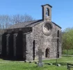
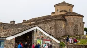
Between Irurzun and Hiriberri, there is the beautiful Romanesque Ermita Santiago de Itxasperri, which looks like a place worth some time:
And a photo:
Ermita de Santiago Itxasperri.PNG
 
Last edited:
The focus is on reducing the risk of failure through being well prepared. 2nd ed.
Great to have you here, Laurie! Once I get to the Olvidado proper I'll be happy to pick your brain.

Well, on hold or not— that new Camino de las Asturias going from Pamplona to Oveido follows the same route for much of the first part of this way. So someone is obviously doing some promotion.

I could be wrong but my understanding that the Viejo is the limb that comes from Pamplona, I would guess as far as Aguilar de Campoo.

Being somewhat cartographically challenged, is there any way to put up a map of these two routes?

You started talking about what Caminka calls the Camino Viejo, Pamplona to Aguilar de Campoo, where it joins the Camino Olvidado (whose route is Bilbao to Ponferrada).

But now you have seen info about the Camino de las Asturias from Pamplona to Oviedo. Based on the stages I see on the website you linked, that camino crosses the Camino Olvidado at Cervera de Pisuerga, which is one stage after Aguilar de Campoo. That leads me to think that the Camino de las Asturias goes a little north of the Camino Viejo, but I can't visualize it.

I wasn't totally sure, but I think that when you say the Camino de las Asturias "follows the same route", you mean it follows the same route as the Camino Viejo for the first part?

I tried to figure this out for myself, using the following data points.

Camino de las Asturias lists stage one as Pamplona to Irurtzun 22 km.

You have said your first stage was Pamplona to Hiriberri 20 km

But Hiriberri, according to googlemaps, is east of Zubiri (and 68 km from Irurtzun), so I am totally confused. Or maybe you are lost. Or both.

:oops:
 
But Hiriberri, according to googlemaps, is east of Zubiri (and 68 km from Irurtzun), so I am totally confused. Or maybe you are lost. Or both.
The latter is always a possibility! 🙃 But I don't think I am: There must be two of these strangely named villages.

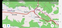
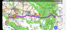
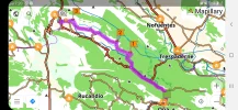
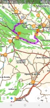
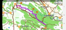
Here's a screenshot from my OsmAnd app; the place in question is on the purple wikiloc track, on the left side. When I have a moment later I will post an overview map:
Screenshot_20200504-120159_OsmAnd.jpg

I think that when you say the Camino de las Asturias "follows the same route", you mean it follows the same route as the Camino Viejo for the first part?

Yes, as far as I understand.

Camino de las Asturias lists stage one as Pamplona to Irurtzun 22 km.
Obviously, YMMV. I'm calculating distance with the direction function on my OsmAnd app.

There is some confusion in my mind too, about this route. @caminka's guide from 2012 seems extremely up and down, whereas this Wikiloc track from rocjumper is very much flat, down in the bottom of the valley. The Camino sounds like it has been recently marked, and perhaps they just took the easiest route, avoiding the ups and downs of the GR route. There look to be many mountain alternatives, which I know would totally delight you Laurie!

When I have a ticket to Madrid, I'll just post on the forum and ask "where should we meet?" and I'll show up, ready to walk.
🤣 Yeah, and can you imagine the delightful chaos if we all do that?
 
Last edited:
Between Irurzun and Hiriberri, there is the beautiful Romanesque Ermita Santiago de Itxasperri, which looks like a place worth some time:
Caminos Del Romanico And a photo:
Ermita de Santiago Itxasperri.PNG
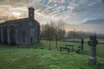
And to be sure that you want to visit here is another photograph of it.
Santiago-de-Itxasperri.jpg
 
Train for your next Camino on California's Santa Catalina Island March 16-19
Day 2. Hiriberri to Etxarri Aranatz 19.7 Km

The recently marked way follows the Sakana Valley, with dramatic karst landscapes all around. And I am astonished by the number of Ermitas along the way - eight in this stretch alone, a veritable smorgasbord of saints:
Ermita Nuestra Señora de Berastegui
Ermita de Santa Barbara
Ermita de San Gregorio
Ermita de San Miguel
Ermita de San Sebastien
Ermita de San Pedro
Ermita de San Antonio
Ermita de San Juango
Not to mention the Romanesque monastery of Zamarce which was built in the 12th C.

OsmAnd tells me that in the surrounding hills, there are many many dolmens and menhir, as well. If you wanted to pause here it would be easy to wander for many kilometers on tracks up in the mountains, like the circular Route of the Dolmens, which leaves near this campground where I stopped for the night (it even has a swimming pool!):
Etxarri is a good break in what could otherwise be a pretty long stage. There is not so much in the way of lodging in the towns in this valley, so if you want to do short stages it will take some planning. Again, rocjumper's blog lists accommodation options, but may not have everything. I found an albergue in Irañeta off Google Maps.

If there is a valley floor option, it puts it back on the possibilities list.
There definitely is, @Northern Light:

@Sheffield James says this of his walk in 2018 about the stretch after Hiriberri:
...very little of yesterday’s beautiful scenery in evidence. All the walking was done on the road, beginning with quite pleasant secondary and tertiary roads, but increasingly it involved the national road (NA 2410) which weaved alongside the Autovia. I made little effort to seek alternative routes, partly because of yesterday’s fiasco, partly due to the drabness of the day and partly because I think the great wilderness awaits me after leaving the Pamplona to Vitoria-Gesteiz transport corridor.

I ended up this evening at a truck-stop at Olaza /Olazagutia, 2kms from the biggish-looking town of Altsasu-Alsasua.

Here is how @caminka walked it, a very different experience - @peregrina2000, these are your 'mountain alternatives; she has links to her wikiloc tracks here, post #28:
pamplona - villanueva de arakil, 31km via irurtzun
a fairly long day on sometimes difficult former gr21 (waymarks removed). requires some orientation skills. casa rural irigoen with superb treatment, atmosphere, and food. HP for 27E. two houses with blasones with scallops in the village.

villanueva de arakil - monasterio zamartze, 8km
an unplanned stay, excavations in monasterio (roman waystation and medieval graves, some with scallops), and a car visit to santuario de aralar. but monasterio zamartze doesn't usually accommodate people - perhaps that might change in the future? otherwise, I would recommend going as far as alsasua (29km).

monasterio zamartze - puerto de lizarraga, 23km
a majestic day almost literally straight up from huarte arakil to beriain (1000m climb in less then 6km) with a superb view all around, fog permitting, then a solitary and somewhat longish descent to puerto lizarraga. the only water in huarte arakil! hostal in puerto lizarraga 50E per room.

puerto de lizarraga - alsasua, 20km
a walk on panoramic ridge then a descent through beautiful forest to alsasua. in albergue juvenil ring the right bell. 17E.

And to be sure that you want to visit here is another photograph of it.
Just yes.
So your Hiriberri is 2 km before Irurtzun, and both are located on both the Camino de las Asturias and the Camino Viejo? If the answer to that question is yes, I am no longer confused.
Weeeellll, sort of. Close but no cigar. Hiriberri is about 6kms after Irurtzun. But yes - both are on those caminos...which, like the Vasco and the Via de Bayona, follow the same route for a ways.
A nice way to avoid the crowds. Come in to Pamplona off the Aragones and off on this way.
And finish on the Invierno. Or the Camino de las Asturias....
 
Last edited:
is there any way to put up a map of these two routes?
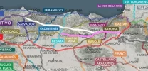
Here is a crummy map for you Laurie. Sorry it's not more than just giving the general idea.
From Pamplona to Aguilar de Campoo is what I am calling the Viejo.
From Salvatierra onwards, it, the Vasco, and the Camino de las Asturias are together as far as...Miranda de Ebro, I think but am not absolutely sure.
So viejo is pink
CdlA is white
(A very rough approximation of both).
map_LI.jpg
 
Last edited:
The 2024 Camino guides will be coming out little by little. Here is a collection of the ones that are out so far.
Two other points of interest that I am finding, well off the camino up in the mountains, but worth the walk especially if you like hills and have the time to pause in this area for an extra night:

Sanctuary of San Miguel de Aralar: http://sanmigueldearalar.info/
First constructed in the 12th C, it sits above the valley with a commanding view. So if you want to go, be prepared for a climb! You can get there from Arbizu (the town before Hiriberri, and there are places to stay there if you wanted to spend a few nights to allow you to explore the nearby hills.)
San Miguel.PNG

Cave of Mendukilo : https://mendukilo.com/en/
This looks a bit commercialized but still interesting. You would probably need transport...

Here is the link to a page with all sorts of walking options in the Urbasa-Andía Natural Park to the south of the valley, and the Sierra de Aralar Natural Park between the Sakana Valley and the valley of the river Oria to the Northwest, which the Vasco Interior traverses.
 
Last edited:
Beautiful!
Now, if you have some spare time, how about some photos of each of those Ermitas?
Pretty please?? ;)
Ermita Nuestra Señora de Berastegui
Ermita de Santa Barbara
Ermita de San Gregorio
Ermita de San Miguel
Ermita de San Sebastien
Ermita de San Pedro
Ermita de San Antonio
Ermita de San Juango
Not to mention the Romanesque monastery of Zamarce which was built in the 12th C.
I'm sorry. Much too difficult. I work with crippled systems (except my smartphone which isn't good for this type of a job). I really need a new desktop.
 
Beautiful!
Now, if you have some spare time, how about some photos of each of those Ermitas?
Pretty please?? ;)


I am not able to figure out how to transfer fotos from the web to the forum, but I have some time and love hunting for (Romanesque) churches. My comments after each one you have listed.

There is a Navarra tourism site dedicated to the Valle Sakana, http://turismo.navarra.com/item/el-valle-de-sakana/
but it is focused on food and geography, not churches!

Also a nice tourism video, which has some shots of churches, but no identification. My guess is that they are of San Miguel de Aralar and the Zamarce monastery, because those two seem to be the standouts in the valley. http://www.sakana.eus/en/

Ermita Nuestra Señora de Berastegui
Picture here — http://www.sebastianschutyser.com/engels/ermita-14.html

and here. https://s1.kaia.es/images/2020/02/18/Z1139_106.jpg

Ermita de Santa Barbara
Not sure if this is the right Santa Barbara ermita, but it is near Mañeru, which is on the Francés and roughly in the right vicinity. Knowing little about 19th century Spain, the web page describes the importance of this site in the Carlist Wars, so that may also be a geographical hint.

http://senderismonavarra.blogspot.com/2017/11/Ermita-de-santa-barbara-maneru-fuerte-carlista.html

Ermita de San Gregorio
Picture at the bottom of this website. http://www.etxarriaranatz.eus/index.asp?idi=ES&p1=edificios-religiosos

1588711368581.jpeg

Ermita de San Miguel
San Miguel de Aralar. Picture of the gorgeous enamel altarpiece from the XII Century. http://turismo.navarra.com/item/retablo-de-san-miguel-de-aralar/

1588711445319.jpeg
Church has its own website. http://sanmigueldearalar.info/


Ermita de San Sebastien
Can’t find this one, probably because of the common name and the proximity of the city of San Sebastián. (Are you sure about the spelling?)

Ermita de San Pedro
Description here — https://elpais.com/diario/2000/09/16/paisvasco/969133223_850215.html
The article explains that San Pedro Alsasua and San Donato Beriain are the two ermitas that stand at either end of the valley.

Picture here. https://www.clubrural.com/que-ver/navarra/alsasua/sitios-interes/ermita-san-pedro_8168

1588711676394.jpeg


Ermita de San Antonio
Referred to on the web as San Antonio Abad.

http://www.almonteparaque.com/blog/sakana-ermitas-de-berama-itxasperri-berastegi-despoblados-

Ermita de San Juango
I think this is San Juan de Itxasperri, as the above blog shows it in continuation after the visit to San Antonio Abad. This looks like one to visit — a romanesque ermita all alone in the valley.

http://www.almonteparaque.com/blog/sakana-ermitas-de-berama-itxasperri-berastegi-despoblados-
1588711588164.jpeg


Not to mention the Romanesque monastery of Zamarce which was built in the 12th C.
Definitely a place to visit. http://www.zamartze.info/
The monastery website explains some of the evolving interest in the Camino that passes through this valle. http://www.zamartze.info/camino-de-santiago-2


San Donato Beriain, which you didn’t include, is at one end of the valley and seems very interesting. It is the highest ermita in Navarra and looks like a beautiful walk up. A very long video here.

So, some of the websites I’ve seen do have wikiloc tracks, but I am not sure about your ideas about walking in this valley. Based on what I saw, I think San Miguel and the monastery are the two gems. San Donato would be a spectacular ascent.

So are these places Located in Day 2’s walk or is this a detour from Day 2? And do you have your lodging options sorted out so far?
 

Attachments

  • 1588711509285.webp
    1588711509285.webp
    321.3 KB · Views: 15
Last edited:
Ideal pocket guides for during & after your Camino. Each weighs only 1.4 oz (40g)!
I am not able to figure out how to transfer fotos from the web to the forum
Here is a easy way to do it (much easier on a PC than a phone). This works with the URL of the picture, not the webpage the picture is on. To get the URL of webpage's picture on a PC right click the picture and menu should allow you to copy the URL to the clipboard. Paste the URL into the forum's text input box and surround it with a starting and ending img tag (case imsensitive) as shown in the code box below. (That box allows markup code to be seen as written instead of being interpreted).
Code:
Picture of Ermita Nuestra Señora de Berastegui
[img]https://s1.kaia.es/images/2020/02/18/Z1139_106.jpg[/img]

The same text outside the code box results in:

Picture of Ermita Nuestra Señora de Berastegui
Z1139_106.jpg
 
Wow, I was just able to cut and paste the picture itself! I was going to try Rick’s instructions, but I am on an ipad and wasn’t sure how it would work.
Great. That doesn't work with my old Linux system or Android phone. It probably does work on Windows. I use that so seldom though I didn't think of it.
 
Ideal pocket guides for during & after your Camino. Each weighs only 1.4 oz (40g)!
Wow, Laurie, I give you a few breadcrumbs and a crummy map, go to sleep, and wake up to treasures!
It's amazing, what you could find.

And walking...from the 'campsite' (delux!) in Etxarri (see post above), you can access dolmens and probably San Miguel. I don't know about San Donato; I haven't got that far yet!

Ermita de San Juango
I think this is San Juan de Itxasperri
No, it's a different one that shows up on me OsmAnd map well after that.
This is San Juan de Itxasperri
Otherwise known as Ermita Santiago de Itxasperri, see post #13 above. So to clear up all the residual confusion, we'll just have to go and see for ourselves. 🙃

So are these places Located in Day 2’s walk or is this a detour from Day 2? And do you have your lodging options sorted out so far?
Ermita Santiago de Itxasperri is right on the Camino on day 1. The small hermitages are strung out along the valley Days 2 and 3.

As far as accommodation is as far as accommodation is concerned in this area, there are albergues, hotels, or CRs (in addition to that campsite at Etxarri) at: Irurtzun, Hiriberri, Egiarrela, Irañeta, Arbizu, and Alsasua. So there seem plenty of options.

And hang on...checking the distance to Hiriberri from Pamplona. I copied the 20km from somewhere without checking it.
Edit...Gaaah, confusing! OsmAnd and I are not getting along right now. I'll come back when I've figured it out.
 
Last edited:
that posts are bringing back so beautiful memories, thank you, @VNwalking!

You started talking about what Caminka calls the Camino Viejo, Pamplona to Aguilar de Campoo, where it joins the Camino Olvidado (whose route is Bilbao to Ponferrada).
But now you have seen info about the Camino de las Asturias from Pamplona to Oviedo. Based on the stages I see on the website you linked, that camino crosses the Camino Olvidado at Cervera de Pisuerga, which is one stage after Aguilar de Campoo. That leads me to think that the Camino de las Asturias goes a little north of the Camino Viejo, but I can't visualize it.
I wasn't totally sure, but I think that when you say the Camino de las Asturias "follows the same route", you mean it follows the same route as the Camino Viejo for the first part?

I think that at least in the general route direction both caminos follow the same route till la puebla de arganzon, along the wide valley of the river arakil. as far as the actual walking route, they probably differ. mainly because I really don't like asphalt and make my route/description via sites that I want to see.

somewhere I think I was writing about how camino viejo could be named after ther the route that that abbot(?) gundisalvo from the 9/10C took when he accompanied some nobles from pamplona to santiago.
I remember that they did go via frias.

I’ve had my eye on the Viejo for a while but all the hills previously referenced had me second guessing this route. If there is a valley floor option, it puts it back on the possibilities list. So I thank you for doing all this homework!

there absolutely is a floor option. that was my primary route, but I got a wonderful chance to sleep in the monastery in zamartze, scramble around the archaeological dig, got a car ride up to the panoramic monastery of aralar (and I got the privilege to press my nose to the glass protecting the famous altar and to touch the venerated statue of st miguel).

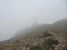
and then I decided to climb the beriain which I have been eyeing since I researched the route because it looked wonderful on the google maps from above. that was a day I absoultely wouldn't want to miss: the straight up climb into the cloud, the crawling on all fours over the top edge because the wind was so strong, losing my scallop, getting back my scallop, clouds lifting for amazing views, scenery.... oh my! :D
 
Last edited:
Wonderful to see you here, @caminka! I was hoping you'd chime in with your experiences. I have to say that the mountain options along either side of this valley are really impressive.

It sounds like one of the main differences between when you walked in 2012 and we're recently is that now there is decent waymarking. Of course the downside of that is that people tend to slavishly follow it. But here, for those who are fit there are so many other possibilities.

losing my scallop, getting back my scallop, clouds lifting for amazing views, scenery.... oh my!
Hmmmm...there is a story here. Do tell!
 
Perfect memento/gift in a presentation box. Engraving available, 25 character max.
Wonderful to see you here, @caminka! I was hoping you'd chime in with your experiences.

I have a bit limited useful access to internet because the libraries are closed and I've been mostly limited to read-only.

I have to say that the mountain options along either side of this valley are really impressive.

I had another detour planned around the dolmens below the monastery of aralar but then I bypassed this because of the beriain climb.

It sounds like one of the main differences between when you walked in 2012 and we're recently is that now there is decent waymarking. Of course the downside of that is that people tend to slavishly follow it. But here, for those who are fit there are so many other possibilities.

there were lots of local waymarked routes even before 2012 - the so-called PR routes - and quite well waymarked. also one or two GR routes (long-distance several-days long routes). I always use them if they are going in my direction.
what I particularly like about the camino routes (and other long-distance routes) is that they connect local routes to each other in a reliable and open way. (open meaning that anyone can pass regardless of the ownership of the land the route passes through.)

Hmmmm...there is a story here. Do tell!

I was admiring beriain from the other side of the valley, from the monastery of aralar on a sunny afternoon the day before. it was gleaming and presiding majestically above the valley. in the morning, the top was of course covered in thick cloud which was pouring down north into the valley. but I wasn't deterred. I stocked on water and slowly made my way up the (almost) vertical beech-covered slope.
below the edge the rocky pillars were starting to peer through the clouds. when I reached the edge, the wind was blowing so strongly over it that I couldn't just walk over. I had to crawl into the cloud covering the pastures. luckily I didn't see that there is another (short) climb to the lovely romanesque san donato on top of beriain or I might have decided against going there.
the albergue portion of the ermita was open and there were even some hikers inside. while I was taking pictures I noticed that something was wrong with my backpack. at first I couldn't quite put my finger on it, then it struck me. my beloved scallop shell was gone! it has been with me since my second camino and was given to me by a dear friend. you can imagine my shock. apparently the string with which it was attached has worn down so much that the strong wind on top of beriain tore it and it fell loose. I looked all around, searched the ground around the ermita, but didn't find it.
finally I decided to move on. there was no other option because there was not going to be any water for the remainder of the day and I had a long way to go still. but I did ask all hikers I came across if they have seen a big scallop shell lying around. someone did! I was so so happy. I tucked in a pocket and resolved to get a stronger string.
about at that point the cloud miraculously disappeared and the whole of beriain became clearly seen. it's like an enormous prow of a ship, with high rocky walls on three sides and pastures on top. the rest of the day was a beautiful wander under the scorching sun across pastures with horses and past various karst formations.
 
Last edited:
What a day! ☺ 👏
This means it's worth lingering for more than just a single day— one day to get up to the spectacular Hermitage on one side of the valley, and then the next day for the one on the other side of the valley. Oh wait! Make it three days— a third day to go up to the dolmens. That loop trail looks really interesting and not too intimidating.

San Donato Beriain, which you didn’t include, is at one end of the valley and seems very interesting. It is the highest ermita in Navarra and looks like a beautiful walk up. A very long video here.
So, some of the websites I’ve seen do have wikiloc tracks, but I am not sure about your ideas about walking in this valley. Based on what I saw, I think San Miguel and the monastery are the two gems. San Donato would be a spectacular ascent.
It obviously is! I didn't include it because although I had seen a photograph, I assumed it was further away — of course without checking. :oops:
This is why many Minds make wonderful planning.☺☺☺☺☺🙏

Edit: this is Beriain, which @caminka is talking about:
1280px-Dorrao_-_Beriain_02.jpg
 
Last edited:
This means it's worth lingering for more than just a single day.
absolutely. monastery of zamartze is perfectly positioned for exploring if you manage to stay there. otherwise you are mostly stuck with hostales along the main road and the albergues in the two camping sites.
perhaps you may convince the keepers of the monastery of aralar to let you sleep in the vast portico which is completely sheltered from the elements.
and if I remember correctly, there were some open-access shelters (aka bivouacs) mentioned on the route via the dolmens to aralar.
 
Last edited:
Train for your next Camino on California's Santa Catalina Island March 16-19
Sorry to be lagging behind. I hope you don’t progress to Day 3 until I can get more clarity about Day 2 (and maybe an add-on — or 2?). I think the route is this one:

Hiriberri to Alasua is 28 km. https://www.wikiloc.com/hiking-trails/camino-de-las-asturias-hiriberri-a-alsasua-45500721 I think this day needs to be split into two to allow for detours up, one up on one side of the valley (San Miguel), the other up on the other side (San Donato).

I have not included any more of the ermitas along the way, but I think we will pas some of them just by being on the camino route, and I think the main sites are San Miguel, monastery at zamartze, and San Donato/Beriain. Do you think we need to plan more detours for churches?

Day 2 — Hiriberri to Zamartze monastery to San Miguel and the Dolmen circle and back down and on camino to Arruazu (total of about 22, I THINK).
Hiriberri to Zamartze monastery, about 6
Zamartze monastery up to San Miguel, and back down to Zamartze, following the dolmen circle is about 13 from the monastery. Wikilocks show the circle as 14 km, but they start from Uharte, which is at least a km away from the monastery.


To sleep that day, I picked a hotel rural about 3 km away along the Camino (page 9 @caminka googledoc), just for orientation purposes. The town is Arruazu and I’ve picked it because it gets us well positioned for Day 2A.


Now, the ascent to San Donato — @caminka’s story has grabbed hold of my imagination and I cannot imagine walking through that valley without going up there.

Day 2A —Arruazu to Extarri-Aranatz 19 km. (via Beriain)

With a sleep in Arruazu, the climb to San Donato/Beriain is, according to google maps about 10 km. And about 500 m up. But oh the exhiliration of those views and the sensation of being on top of the world! Going back down and continuing on to Extarri-Aranatz would be 9 more km. (Page 10 @caminka google doc). CR Urmendi and a camping. Or add on the 10 km from Extarri to Alasua to make this a 29 km day and give us a shorter day into Salvatierra the next day.


I saw you were talking about another Dolmen circle, this one from Extarri. That is a 15 km loop. That could be added just as a day side trip to dolmens. Or doing the second dolmen loop and then adding on the 10 km from Extarri to Alasua would give us a 25 km day from Extarri to Alasua. I can’t tell if the campground has cabins, but even if it doesn’t there is that CR Urmendi. I am just thinking out loud here. I think I would probably be satisfied with the dolmens that we would visit on the San Miguel circle, but I defer to you on that!


The following comments jump ahead and show my reasoning for choosing Extarri as the end point. A night in Extarri-Aranatz would put us, for Day 3, 10 km from Alasua according to rocjumper’s camino Tracks. Then 22 more on to Salvatierra according to the Alava Camino de las Asturias website. Another option would be to go on beyond Extarri-Aranatz for some more kms on Day 2A to make Day 3 shorter, but I think having Salvatierra as an endpoint for Day 3, whether it comes after Day 2A or Day 2B, makes sense.

So, there are the options I see for the lovely valley of Sakana! Thanks for giving me plenty to dream about @VN. Buen camino, Laurie
 
Ok. So I promised myself I wouldn't do this. But looking at the map... I can't resist. From the campsite in Etxarri, if you take that Dolmen Circle, once you get up the hill, it's completely possible to find a way across and then down to the Vasco at Beasain, where there is one of the best albergues on the planet. The whole top of that mountain is littered with megalithic sites and ermitas.

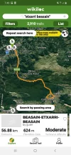
On the road it's about 25kms, and obviously popular with cyclists: there are many Wikiloc tracks to check out. I can't find any tracks for walking that distance, but there are clearly many trails that go in the same general direction, and with less distance. Here's a screenshot of one of the cycling tracks (I can't figure out how to copy the link):
Screenshot_20200507-074818_Wikiloc.jpg

You get the general picture; not to worry about the distance on the track, that's out and back rather than one way.

Were you to do that, you'd get the best of both worlds: this part of the Viejo, plus the wonderful Tunel San Adrian on the Vasco. Either way you ultimately end up in Salvatierra. Yes, you have to go over that mountain twice, but if you like mountains it's a whole lot better than following the main transport corridor from Pamplona into Alava.
 
Last edited:
...and ship it to Santiago for storage. You pick it up once in Santiago. Service offered by Casa Ivar (we use DHL for transportation).
Ay yay yay yay

Now it’s time for me to go to bed, can’t wait to see what havoc you bring tomorrow. But you know, I didn’t walk that part of the Vasco since I was on the Saiatz alternative, and what’s not to like about having more mountains. :)
 
Now, the ascent to San Donato — @caminka’s story has grabbed hold of my imagination and I cannot imagine walking through that valley without going up there.

a few pictures to wet your appetite :D.
I didn't have much (any) view from the top because I was already away from the cliffs when the clouds lifted.

my wikiloc track up to beriain. the climb is steep and stiff but nothing one cannot manage. the only problem is that the only water is at the last houses at the start of the climb.

I continued on top of the ridge westward after sleeping in the hostal on puerto de lizarra. (it's not an albergue in the sleeping sense although that was written on their page and I was told that in the turismo in pamplona. it's the albergue in the architectural/etnographical sense as a type of shelter for shepherds and sheep. it was not cheap but I thought I deserved it.)

12919840Master.jpg

12919845Master.jpg

12919860Master.jpg

12919894Master.jpg

12919869Master.jpg

12919898Master.webp
 
Last edited:
@caminka: Wonderfull! There will be others going up there, now, no doubt! It looks astonishing.

I have gotten no-where today, except down a rabbit hole of history. The Sakana Valley has a rich and old history, as shown by all the dolmens and ermitas, not to mention a main Roman Road. So I dug around for more information.
Here are a few snippets that caught my attention (my emphasis in bold font):

There's a overview of the pre-Roman history of the Basque Country here:
This being a quote about all those dolmens:
"The Basque Country has multitude of megaliths, described as dolmens or mounds, sometimes confusingly. They are in any case burials of collective nature, placed in spots of great visibility, often on top of mountain ridges. The materials used are always of local origin."

Once the Romans came, of course, everything changed (quotes from another Wikipedia article):
"Under Pompey in the 1st century BC, the Romans founded Pompaelo (modern Pamplona/Iruñea); conquest of the area further west followed a fierce Roman campaign against the Cantabri (the Cantabrian Wars). There are archaeological remains from this period of garrisons protecting commercial routes all along the Ebro river, and along a Roman road between Asturica and Burdigala. "

"Ab Asturica Burdigalam was a Roman road that linked the towns of Asturica Augusta (modern Astorga) in Gallaecia and Burdigala (modern Bordeaux)
in Aquitania. The Antonine Itinerary mentions that it ran through Pallantia (Palencia), the pass of Vindeleia, Veleia, Pompaelo (Pamplona), Iturissa (Aurizberri) and the Summo Pyreneo (Roncevaux pass), among other places."

Here is a link to an atlas of Roman roads, showing that this route follows the modern way through SJPP to Pamplona, and on to Vitoria up the Sakana Valley. It was the main route from what is now SW France to the interior of Hispania, and its gold mines and riches. The first part of this Camino Viejo, up the Sakana Valley, and on through Alava to Vitoria follows that route directly (zoom in with this interactive map):

A Wikipedia entry says this about the road through the valley:
"In medieval times it would be largely replaced by the Way of St. James that, while coincident in some parts with the Roman road, it goes further south between Pamplona and Astorga."


I entered this rabbit hole trying to clarify the relative importance of the route coming up from San Sebastian and through the Tunel San Adrian, but have no clarity. Some sources say that the Romans built the road coming up from Zegama, and tunel -while others say that it dates from a later time. Who knows?
"When Guipúzcoa and Álava became part of the Crown of Castile, San Adrián was the mandatory route connecting Europe and the Cantabrian Sea. There was even a castle that guarded the border to Navarra. San Adrián was the scene of many clashes and an area frequented by bandits. The citadel was abandoned when Castilla was annexed to Navarra in 1512. The stone path is popularly known as Calzada Romana (Roman Road), but it’s actually from the Middle Ages and it was the “Royal Path of Relay”."
But what is clear to me is that it would be worth an extra two or three days to link the Viejo with the Vasco!
Looking in Wikiloc, I only find bike tracks, but I don't have the premium version...so no luck there.

And information about all those ermitas?
I found nothing, except for a link to your guide, @caminka.😉

People and armies and roads come and go, religious observances come and go...and old ways still persist. I also found out that there is a wild and very old tradition of carnival in Alsasua during Lent, similar to the one in Lantz on the Camino Baztan. Walk through here in February, and you're in for something seriously different:
 
Last edited:
The one from Galicia (the round) and the one from Castilla & Leon. Individually numbered and made by the same people that make the ones you see on your walk.
this was my latest version of the introduction to viejo camino:

''Under the name Viejo Camino de la Montaña is scooped a vast number of secondary roman and medieval roads that run at the foothills of Cordillera Cantábrica, from Pamplona to Villafranca del Bierzo. The text of Historia Silensis (c1110), where there is the first mention of a pilgrim route in Spain per se, recounts that iter Sancti Iacobi has been secured from the barbarians by Navarrese king Sancho el Mayor from the Pyrenees to castrum Nazara (Nájera) so that peregrini won't have to make a detour via (the land of) Alava. Later Rodrigo Jiménez de Rada (born in Puente la Reina in c1170 – 1247 Jun 10), archbishop of Toledo, in De rebus Hispaniae (V, 25) gives the route in more detail: iter Sancti Iacobi quod propter insultus Arabum per Alauam et Asturiarum deuia frequentabant, ab Anagaro per Biruescam et Amaiam immutauit, et per confinia Carrionis donec ad Legionem et Astoricam veniatur (from the course Alava – Asturias to the course Nájera – Briviesca – Amaya – border of Carrión – León – Astorga). This is thought to represent the older route, before it was given the present course by Sancho el Mayor. It is, in fact, what is now known as Viejo Camino, and it followed the course of the roman road from Bordeaux to Astorga, passing Roncesvalles – Pamplona – in Alava the valleys of Araquil and Salvatierra – near Vitoria – across Ebro N of Miranda – Briviesca.

The first possible known traveller on this route was bishop of Oporto who in the 12C travelled from Olorón via Jaca or Estella across Guipúzcoa and Vizcaya per devia montium, vallium atque marium to reach Carrión where he finally encountered publicae viae.''

To which I can now add this:

''The historic significance and use of the camino has been handsomely backed up by the publication of two books by Julián González Prieto, Vexu Kamín and Pai Frolanus. The itinerary dates from 902 and in it abbot Gundisalvo from the Monastery of san Julián de Veseo in the valley of Valdecésar in the mountains of Curueño describes the journey taken by the retinue (of which he was part) of the sister of the Asturian king Alfonso III el Magno and the daughter of the Asturian king Ordoño I, doña Leodegundia, and one of her possible husbands, don García Íñiguez, king of Pamplona, or García Jiménez, lord of Navarra. Leodegundia pulcra Ordonii filia is more known as one of few female poets of Spanish literature some of whose work has been preserved. The party started in Pamplona and traversed Salvatierra, Alegría, Armentía, Trespuentes, Puentelarra, Tobalina, Frías, Oña, Sedano, Amaya, Nogales, Mave, Aguilar, Cervera, San Román de Entrepeñas, Velilla del río Carrión, Morra de Santiago (Caminayo), Morgovejo, Puente Almuhey, La Losilla, San Adrián, Boñar, La Mata (de la Riba), Valdepiélago, La Mata de Bérbula, Morquera, Valdecésar, Dotes, Correcillas, Crespas, San Feliz, Mataplana, Vegacervera, Coladilla, La Vid, Buiza, Beberino, Pola de Gordón, Santas Martas, Viñayo, río Luna, Riello, Pandorado, Urbicua, Guisatecha, Vegarienza, Fasgar, Colinas del Campo, Quintana de Fuseros(?), Losada, Virgen de la Peña, Bárcena, río Cúa, Cacabelos. A hundred years later the latin itinerary was translated into astur-leonés and a map of the route was made. However, the date of the pilgrimage is not certain, as queen Leodegundia is said to have entered monasterio de Boadilla in Samos in 882 and was there still in 912, when she wrote a poem titled Versi domna Leodegundia Regina. Perhaps Gundisalvo wrote the account when they were on the pilgrimage, but added the date when he presented it to someone, perhaps san Froilán. The narrative does suggest that it was written during the pilgrimage, not as a memoir years later. The document (902 or 1002?) is now in Oviedo? I tried to mentain the spirit of the text as much as possible, but did not follow the Spanish translation to the letter.''
 
I am not at all surprised that that territory is so littered with megalithic monuments. apart from being a major transport route the nature itselft is so magnificent that it must have evoked spiritual connotations.
 
another look at the beriain, from the plain to the north of salvatierra. the straight gravel road evokes to me roman roads cutting straight through almost any landscape. it points straight to beriain, the last ridge on the horizon.
one of may favourite pics.

12920726Master.jpg
 
Last edited:
Holoholo automatically captures your footpaths, places, photos, and journals.
Were you to do that, you'd get the best of both worlds: this part of the Viejo, plus the wonderful Tunel San Adrian on the Vasco. Either way you ultimately end up in Salvatierra. Yes, you have to go over that mountain twice, but if you like mountains it's a whole lot better than following the main transport corridor from Pamplona into Alava.

Ok, sign me up. But it does turn one day (Extarri to Salvatierra) into three (Extarri to Beasín to Zegama to Salvatierra). If I have the time I would jump at the chance, because the day from Zegama is one of those whose splendor you can recreate just by closing your eyes and remembering. If I’m keeping count correctly, that would make a six day trek from Pamplona to Salvatierra (cutting out your Extarri dolmen circle).

Day 1 Pamplona to Hiriberri
Day 2 Hiriberri to Arruazu or thereabouts (ascent to San Miguel)
Day 3 Arruazu to Extarri (ascent to Beriain and San Donato)
Day 4 Extarri to Beasín
Day 5 Beasín to Zegama
Day 6 Zegama to Salvatierra


I see there is also a cycling route that goes directly from Extarri to Zegama, which would cut out the backtracking to Beasín but still leave us with the tunnel after Zegama. Does that appeal? (See one half of the loop in this track)


Since all of the routes I have found for this cut-over to the Vasco from Extarri are for cycling, I am guessing they are all on low-travelled roads. I would prefer not to have to do that for two days in a row, my feet are just not enamored of asphalt. My Saiatz alternative of the Olvidado joined up with the “normal” Vasco in Zegama, so that would mean I wouldn’t get a glimpse of what you and @sabine enjoyed so much. But asphalt and time constraints are likely to be considerations if this ever goes from “virtual” to “real.”
 
@caminka...what to say?
Just thank you. What a font of information!
And your photo shows that ship's prow even from very far away. That long straight road...it wouldn't be much fun on a hot summer afternoon.

Now I have the bug in my ear to go up to the ermita in Beriain! I see what you mean. Look at this thing!
Beriain.PNG
And as you experienced, it is not entirely benign.
Here's what a local climbing website says:
Important: the normal routes are generally not complicated but in the last years the mountain had some deadly accidents. You must be careful with leave the normal paths (the falls are very impressives) specailly in winter. [June 26, 2005, Sunday: 2 new deaths in the mountain, Borja and Ruben R.I.P. ]
In winter it's a great experience for the magnificent views but it's a little dangerous, specially the summits of Iyurbain and Leziza. It's necessary the use of crampons and ice-axe and to have precaution with the avalanches if it has snowed recently since the slopes are important (2 victims in 2003 in route from Uharte-Arakil and 1 in the Morro).

And Laurie, if you really want to have some fun try THIS wikiloc track!
:eek::eek::eek:

Jumping ahead a little...maybe we can delve into this later...but the rest of your post is fascinating.
Alava – Asturias to the course Nájera – Briviesca – Amaya – border of Carrión – León – Astorga
The party started in Pamplona and traversed Salvatierra, Alegría, Armentía, Trespuentes, Puentelarra, Tobalina, Frías, Oña, Sedano, Amaya, Nogales, Mave, Aguilar, Cervera, San Román de Entrepeñas, Velilla del río Carrión, Morra de Santiago (Caminayo), Morgovejo, Puente Almuhey, La Losilla, San Adrián, Boñar, La Mata (de la Riba), Valdepiélago, La Mata de Bérbula, Morquera, Valdecésar, Dotes, Correcillas, Crespas, San Feliz, Mataplana, Vegacervera, Coladilla, La Vid, Buiza, Beberino, Pola de Gordón, Santas Martas, Viñayo, río Luna, Riello, Pandorado, Urbicua, Guisatecha, Vegarienza, Fasgar, Colinas del Campo, Quintana de Fuseros(?), Losada, Virgen de la Peña, Bárcena, río Cúa, Cacabelos.
This looks South of the modern Viejo/Olvidado route in places, right?

And Amaya...which is a prevalent place in both itineraries~
This Amaya? (The red pointer is on the parish church of San Juan Bautista there):
Amaya.PNG
If so, sic transit gloria mundi! It says that now there are 60-some people there (as of 2002, so probably many fewer now). But once it was a place! here is part of what this wikipedia entry says:
Amaya was one of the main villages of the Cantabri Celtic tribes, and played a key role in the Cantabrian wars during the Roman conquest of Hispania, and later, during the Visigothic Kingdom, as the capital of the Duchy of Cantabria. Amaya is mentioned in the Chronicle of John of Biclaro, as a town captured by the Visigothic king Liuvigild in 574.[5]

In the first stages of the Reconquista, the city was part of the repopulating efforts of the Kingdom of Asturias in the border region of Bardulia, the primitive territories of Castile. After the campaigns of Alfonso I of Asturias (739-757) against the Moors, the city lay an abandoned in the largely empty buffer zone between Moors and Christians known at the time as "The Desert of the Duero" and was part of the repopulation campaign carried out a century later, during the reign of Ordoño I of Asturias (850-866).

At that time it was an important and significant place, as a very old saying states: "Harto era Castilla pequeño rincón, cuando Amaya era la cabeza y Fitero el mojón" (A very small corner was Castile, when Amaya was the head and Fitero the boundary stone).

Amaya seems to have been a short-lived bishopric,[which, no longer being a residential diocese, is today listed by the Catholic Church as a titular see.

So their route, even in the 10th C, is south of the present Olvidado route, right? I guess at that time only fools would be headed to the mountains if there were a flatter, more civilized alternative.
 
Oh, boy, this thread is big fun.
So, Laurie...our posts crossed.
Does that appeal?
Yes, indeed.
I wouldn’t get a glimpse of what you and @sabine enjoyed so much.
Well, it was only really nice after Segura - before that it was very tamed. But we did not go to Idiazabal, with it's cheese...so I can't say what you'd miss there.
The nicest thing about Beasain was the food and the albergue, so going to Zegama would bypass those. But Zegama was plenty good, too.
Since all of the routes I have found for this cut-over to the Vasco from Extarri are for cycling
Looking at my OsmAnd map, there are plenty of off-road options at least on the way up. It may just be that people have not posted a track. Or maybe there's no-one crazy enough to walk that.

If I’m keeping count correctly, that would make a six day trek from Pamplona to Salvatierra (cutting out your Extarri dolmen circle).

Day 1 Pamplona to Hiriberri
Day 2 Hiriberri to Arruazu or thereabouts (ascent to San Miguel)
Day 3 Arruazu to Extarri (ascent to Beriain and San Donato)
Day 4 Extarri to Beasín
Day 5 Beasín to Zegama
Day 6 Zegama to Salvatierra
Yeah, that looks about right.

Of course, now that I've posted it, you might want to do that insane 3 Ermitas loop instead? ;)
 
Get a spanish phone number with Airalo. eSim, so no physical SIM card. Easy to use app to add more funds if needed.
I have now stepped back to try for a big picture look at this part, since we will soon be on the well-established Vasco for a few stages at least and won’t have much scouting work to do.

My sources have been mainly caminka, Sheffield James, and Rocjumper. Rocjumper’s blog from last year is pretty amazing (btw, VN, do you have a link that would send me squarely to the blog, I can only get one page at a time from a link on each one of his wikiloc tracks, if that makes any sense. I see he has tons of routes in his rocjumper site, but I can’t find a sub-forum just for this leg of the Olvidado/Viejo. I would love to be able to flip back and forth through his blog).

My take-aways —

@caminka was a trailblazer — when I read her description of the abandoned trail out of Pamplona, I started to reconsider. But Rocjumper’s more recent account suggests that yes indeed we can find a marked route. There seem to have been huge improvements.

Sheffield James‘ account makes me lean heavily towards the option of heading back up to the Vasco, either to Beasín or Zegama (probably the latter). There is going to be a straight path into Salvatierra no matter which direction we come from, but having walked through the Túnel de San Adrián on the way there would be sweeter, IMO.

And Caminka’s contributions on the monastery, San Miguel, and of course San Donato, just shout out that those are not to be missed.

As far as that Tres Ermitas hike goes, I think it’s above my pay grade. I did see that there are local hiking groups that do it in a day and seem to arrive unscathed, though. What I can’t figure out is where the third ermita is. I believe it’s called Trinidad, but I don’t see it. I think we have a much more enjoyable way to visit San Miguel and San Donato, and maybe Trinidad is along the way on one of those days we had sketched out, but I don’t know because I can’t find it!


Now all we need is the time and opportunity to walk!
 
As far as that Tres Ermitas hike goes, I think it’s above my pay grade.
What? Hey, Laurie, it only took them a little over 11 hours! Just imagine, if you didn't have to carry a pack you could be flying.

But more seriously, it doesn't sound like a lot of fun just to zoom around from Hermitage to Hermitage without being able to linger. San Miguel is further towards Pamplona in San Donato, so with extra time to linger one could take two days — it might be worth staying partway in between and doing one on one day and one on the other.

Once you get to once you get to Etxarri, a choice needs to be made as to whether to go directly to Salvatierra, or to go via Beasain and the tunnel.

The way across from Etxarri to Beasain is roughly 25 km. Then from Beasain to Zegama is an easy 14 or so — only about 11 if you do not go via Idiazabal. And yes Lori I think you're right it would be a much more pleasant entry into salvatierra. The other route follows the main drag for a lot the way, so it looks much less quiet. The decision as to which way to go really revolves around how much time one has. With three extra days it would be worth the detour, I think. That photo that @caminka just posted of the long straight road...it would also miss that! Which for me is only a good thing.

I had a link to rocjumper's blog, and may have even mentioned it in an earlier post. Hang on, I'll have a look.
 
Last edited:
Last edited:
Perfect memento/gift in a presentation box. Engraving available, 25 character max.
And not to bombard you with questions, but do you have tracks that show an off-road trail direct from Etxarri to Zegama (which is probably going to be my preferred option, in that lovely event that I actually have to make a choice).

Edit to say — I found one — 25 km, looks perfect. About 900 m up, 300 down.

 
do you have tracks that show an off-road trail direct from Extarri to Zegama (which is probably going to be my preferred option, in that lovely event that I actually have to make a choice).
Unfortunately, no I couldn't find any. But my OsmAnd map shows many foot paths. Haha - best go with somebody who has a good sense of direction. I would do it I would do it in a heartbeat!
 
Perfect memento/gift in a presentation box. Engraving available, 25 character max.
Hmmm. We seem to be living in different universes. Here's what I see on my phone:
Screenshot_20200508-215313_Firefox.jpg

And..
You found it! The wikiloc track, I mean.
 
Hmmm. We seem to be living in different universes. Here's what I see on my phone:
View attachment 74681

And..
You found it! The wikiloc track, I mean.
I have been hunting to find the location of those primitive drawings in your post (from rocjumper) but cannot. Based on where he placed them in his blog, I had assumed they were in the Ermita de Nuestra Señora de Ayala, but the several websites I have looked at do not include them, so they must not be there. The exterior does seem well-preserved and interesting, though. Any ideas about where they are? And yes, I know this means I am jumping ahead, but I didn’t want to lose the thought since you posted the picture.


Question for the day, before we move on to Salvatierra, is whether there might be a way to walk from Etxarri through the tunnel and then on to Salvatierra, without looping up even as far as Zegama.

I think, that in order to do that, we would have to add the Etxarri to Alsasua 10 km on to our previous day, which includes the ascent to San Donato. That would make the day from Arruazu to Etxarri to Alsasua (via San Donato) a 29 km day, with a 500 m ascent. OK for my aging body now, but not clear how long it will be till we get there. ;)

But doing that would mean that the next day we could walk Alsasua to the tunnel, which looks to be about 17.


Tunnel to Salvatierra 14

Just an option to keep in mind depending on weather, time and fitness levels. I do think a return visit to the tunnel of San Adrián should be a priority, though!
 
Perfect memento/gift in a presentation box. Engraving available, 25 character max.
I have been hunting to find the location of those primitive drawings in your post (from rocjumper) but cannot.
I think so. Have a look at this site. It should keep you busy for a while. (I sure wish I had seen this before I waltzed past all this last year!)

I will come back to reply in more detail later...There are 6 more kms to walk before today's destination comes over the horizon!
 
Day 3. Etxarri Aranatz to Alsasua 22 Km
Here is where you can play around with visiting ermitas, perhaps taking some extra full days to accomplish that. The distance to Alsasua is not very far, but walks to both San Miguel and (especially) San Donato are challenging. If it were me, I wouldn't even think of including either of these detours in a regular day's walk.

Day 4. Alsasua to Salvatierra 20.8 Km
If we follow the Viejo route proper, we eventually arrive at Alsasua which is where the Rio Burunda and the Alzania Ibaia Meet. What also meet here are the main transport corridors between Vitoria and either the Atlantic coast at San Sebastian or to Pamplona. There are a number of places to stay in the town, ranging from albergues to hotels.

From Alsasua onwards, especially after passing Ziordia, we leave the mountains and the Sakana Valley behind and enter the wide valley and plain of Alava — following it all the way to Vitoria. We leave Navarre and enter the province of Alava after Ziordia.

To summarize the various options here:
If you want a quieter walk into Salvatierra, you can ditch the highway and the railway by cutting across to the Vasco Interior. There are at least three ways of doing this, all entering Salvatierra via Vasco after the Tunel San Adrian. This involves either one or two serious climbs, but this is a stunning walk. So if you don't think you will have the opportunity to walk the Vasco, you can still experience one of its highlights:
1. Etxarri-Besain (25km) Beasain-Zegama (12 or 14km), Zegama-Salvatierra (~20km)
2. Etxarri-Zegama (25.4km), Zegama-Salvatierra (~20km)
3. Alsasua-Salvatierra the long way around (31.1 km) via the first part of this track, then leaving it to follow the Vasco after the tunnel:

If walking directly to Salvatierra on the Viejo via Alsasua, along the way we can see at the base of the hills to our left there is a string of small villages, each with its own church.

The first town of any the first town of any substance (and the only town of any substance) until we get to Vitoria is Salvatierra. There's a very nice albergue here: get the keys at the polideportivo. Look for the strange glass kiosk-like building on way out town, and take the stairs or lift to the basement where someone will help. And there's a nice bar at the main plaza.

It turns out the Alava Plain area has many interesting Romanesque churches - and you could easily spend time going off-piste between Salvatierra and Vitoria, exploring them...this is for the next stage...
 
I don’t mean to get ahead of you, but I have had a very lovely email exchange with ”Alava Medieval” and Isabel has pointed me to a part of their website that has digitalized visits and descriptions, in Spanish and English, to all of their sites. I know you have seen that webpage, but I wasn’t sure you had seen this section of it. There is also a part involving those QR codes, which I don’t really understand, but you can see everything easily online.


Isabel also told me that, yes indeed, the Estibaliz church is open from 8 am to 8 pm every single day. I am not at all sure how I missed that information last year when I walked without taking the detour. :( I assume I was using the schedule for the adjacent interpretation center and the guided tours, which has very limited hours. So that means that a detour from Salvatierra or even Alegría would be easy to factor in. Hooray! I will not walk this part a second time without a visit to Estíabliz.
 
A selection of Camino Jewellery
Day 5. Salvatierra to Vitoria-Gasteiz (26.8km)
Or...
Day 5A Salvatierra to either Alegria (or off piste to Parador de Argomaniz)(10.9km and 17.6km)
Day 5B Alegria or Agromaniz to Vitoria via Estibaliz (14.8 km or 13.4 km, respectively)

After looking at that delicious website that you just cited, Laurie (thank you!!!), it seems a pity to march straight to Vitoria. There are multiple wonders here, especially if you like Romanesque and Medieval. And some are right on the Camino San Martin de Tours is utterly astonishing, and we walked right past it, not knowing the wonders that are inside... :(
Check out the little videos that they have as well. The narration is way too fast for me to understand much, but just the visuals are gorgeous, very well done! https://alavamedieval.com/iglesia-de-san-martin-de-tours-de-gazeo/

It turns out that the Alava was a place of refuge for Christians from further south when the Moors invaded, and in 1072, The Bishop of Alava went to Rome to advocate in defense of the Mozarabic Rite, fruitlessly as it turned out.

There is an albergue in Alegria, and in Argomaniz (a bit off the Camino to the North) a Renaissance Palace has been turned into a Parador; it's only 4 km from Estibaliz, and the prices are astonishingly reasonable: https://www.paradores-spain.com/spain/pargomaniz.html
 
Last edited:
Day 5. Salvatierra to Vitoria-Gasteiz (26.8km)
Or...
Day 5A Salvatierra to either Alegria (or off piste to Parador de Argomaniz)(10.9km and 17.6km)
Day 5B Alegria or Agromaniz to Vitoria via Estibaliz (14.8 km or 13.4 km, respectively)

After looking at that delicious website that you just cited, Laurie (thank you!!!), it seems a pity to march straight to Vitoria. There are multiple wonders here, especially if you like Romanesque and Medieval. And some are right on the Camino San Martin de Tours is utterly astonishing, and we walked right past it, not knowing the wonders that are inside... :(
Check out the little videos that they have as well. The narration is way too fast for me to understand much, but just the visuals are gorgeous, very well done! https://alavamedieval.com/iglesia-de-san-martin-de-tours-de-gazeo/

It turns out that the Alava was a place of refuge for Christians from further south when the Moors invaded, and in 1072, The Bishop of Alava went to Rome to advocate in defense of the Mozarabic Rite, fruitlessly as it turned out.

There is an albergue in Alegria, and in Argomaniz (a bit off the Camino to the North) a Renaissance Palace has been turned into a Parador; it's only 4 km from Estibaliz, and the prices are astonishingly reasonable: https://www.paradores-spain.com/spain/pargomaniz.html

Well, it is a very good thing I didn’t know all of this last year or I never would have made it to the Invierno!

There will be some very hard choices. But I can confirm that the albergue in Alegría is very nice. And the town has a pretty nice ambiente, and decent places to eat as I remember. This is not one of the more scenic stages on this route, so some romanesque detours would be just what the doctor ordered.
 
It's especially not scenic when you compare it to what just happened. Coming over the mountain and through that tunnel is an 11 on a scale of 1 to 10.

(Calling on any Vasco alumni - like @C clearly, @SabineP, @KinkyOne, @peregrino_tom , @jpflavin1 ... ? - to chime in with your ideas about anything between here and Miranda de Ebro: accomodation, places to eat, etc, etc. And of course @caminka and @Sheffield James, you who've gon ahead of us into ehe unknown...)
 
Last edited:
The one from Galicia (the round) and the one from Castilla & Leon. Individually numbered and made by the same people that make the ones you see on your walk.
Looks like one 35 km day or two short days. Not much in the way of elevation and apparently not much to see!


https://www.gronze.com/etapa/puebla-arganzon/miranda-ebro

I know this is the part of the Vasco where @jpflavin saw that medieval tabernacle in Berantevilla, but that is after the split for the Burgos vs. Santo Domingo options, and he went left at Estavilla and headed to Haro and on to Santo Domingo.

Not sure about the other forum members who have walked.

I was hoping to walk through Pancorbo, but see that we will have to leave the Vasco at Miranda de Ebro to continue on the Olvidado to Aguilar! And that will be where it gets complicated, and very interesting! Collapsed bridges and all that, if I am remembering correctly. :)

Once again, Pancorbo is left for another time.
 
If you stayed in Alegria or the Parador at Argomaniz, you could blow through Vitoria, and go directly to Pueblo de Arlanzon. Horrors, I know — Victoria is not only the capital of this province, but also the largest city between Pamplona and Ponferrada. But if you have spent time there on previous Caminos, and or not the city type, doing this saves you a day.

Vitoria has restaurants and a beautiful cathedral and a wonderful Old City— but hey, there are Romanesque wonders and adventures ahead.
Just being contrarian...;)
 
I was hoping to walk through Pancorbo, but see that we will have to leave the Vasco at Miranda de Ebro to continue on the Olvidado to Aguilar! And that will be where it gets complicated, and very interesting! Collapsed bridges and all that, if I am remembering correctly. :)

Once again, Pancorbo is left for another time.
Not so fast there, pardner.
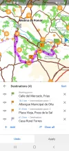
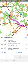
This is really jumping ahead, but I can't resist throwing another rock into your pond. It's only 34 km from Pancorbo to Oña. That's a day's walk for the likes of you, Laurie. From there you could rejoin @caminka's track either the way James did to Quintana de Valdevielso, or walk his route backwards to Trespanderne.Screenshot_20200513-041743_OsmAnd.webp
 
The 2024 Camino guides will be coming out little by little. Here is a collection of the ones that are out so far.
A selection of Camino Jewellery
Between Vitoria and Miranda de Ebro, there is not much that stands out. So lumping two days into one post.

Day 6 Vitoria - Puebla de Arlanzon 17.9
Day 6A Alegria or Argomaniz - Puebla de Arlanzon (32.7 or 31.3, respectively)

Before Laurie and I jump ahead, first we have to get to Miranda de Ebro. There are two options for these days, depending on whether you spent the night in Alegria/Argomaniz or Vitoria (5 or 5A from the post above) and are willing to pass through Vitoria as opposed to staying the night there. It is a city worth staying in and exploring if you have not been there before or have the time to linger. The Old City, with its beautiful cathedral and wonderful restaurants make lingering a pleasure. There is also a Decathlon if you need any equipment support. If you intend to stay, there are many options including an albergue.

Either way this first day gets us to Puebla de Arlanzon, where there is a good albergue and a bar and a restaurant on the other side of the railroad tracks were you can get a decent menu del dia - and a super place for breakfast on the way out of town.

Day 7. Puebla de Arlanzon - Miranda de Ebro 17.5
The main thing to pay attention to on this day is to make sure you take the correct Camino, in the direction of Miranda de Ebro, rather than heading in the direction of Haro and Santo Domingo de la Calzada. After Estavillo, do not turn left but follow the general direction you've been going, downhill and under the autovia towards Armiñon.

Armiñon has a lovely Bridge and seems that it should be a promising place for coffee but that may well be an empty promise. After you cross the bridge, you find yourself again on the route of the Roman road headed soon to Miranda de Ebro.

Miranda de Ebro is easy to underestimate. But there is actually a lot here worth exploring. Besides the old city on the other side of the river with its Castle, and the nearby Romanesque Eglisia del Spiritu Santo, there is one of the nicest restautrants on the Via de Bayona, a place called Tartan. Edited to add — Restaurant closed permanently in 2024. It's also a good place to restock your supply of snacks.
 
Last edited by a moderator:
sorry to be laging behind a bit, I am still on limited internet time. (but I am reading all posts! :))

@caminka
And your photo shows that ship's prow even from very far away. That long straight road...it wouldn't be much fun on a hot summer afternoon.
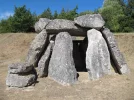
that straight road was not not that drastically long. I went this way because before that I wanted to see one of the best dolmens in the region - Dolmen de Aizkomendi. I think it was totally worth it. you can check its (unfavorable) location on my wikiloc track.
12920715Master.jpg

So that church is in Alaiza, which is a few km outside of Salvatierra.
the regime for visiting in 2012 was like this: you hired a guide and had to have your own transport. you met the guide at the church in gozeo at 10h to see the beautiful frescoes inside (camino passes by but it's locked), then you met the guide at alaiza at 14h to see those primitive frescoes inside the church. there are pilgrims on these fresceos, too. that was the reason I didn't went to see the frescoes (and I still regret it). hopefully this has changed since then.
there is another fine dolmen in the vicinity of alaiza, Dolmen de Sorginetxe. I think you met the guide there also.
 
Last edited:
Ideal sleeping bag liner whether we want to add a thermal plus to our bag, or if we want to use it alone to sleep in shelters or hostels. Thanks to its mummy shape, it adapts perfectly to our body.

€46,-
I quite like the idea of crossing the aralar mountains and incorporating tunel de san adrian into the viejo. 👌
 
I think that the tracing of camino de san adrian into miranda on the eastern side passes by a dolmen and a medieval castle.
 
Last edited:
I wanted to see one of the best dolmens in the region - Dolmen de Aizkomendi. I think it was totally worth it.
Oh! Definitely....

Day 8. Miranda de Ebro - Banos de Sobron. 18.76
Assuming the footbridge is still out at Banos, it's necessary to go across the Ebro at Puentelarra. The puente is a disappointing affair, as not all of the original arches are still intact. From the GoogleMap image it looks like the end is blocked off, so it may not even be possible for foot traffic.

This stage is short and mostly flat - and on the map it looks relatively uninspiring. I would love for this to be wrong! Unfortunately, unless you're willing to walk quite a long long way further, there do not look to be any other options for stopping nearby.
 
Last edited:
Join the Camino cleanup. Logroño to Burgos May 2025 & Astorga to OCebreiro in June
Oh! Definitely....

Day 8. Miranda de Ebro - Banos de Sobron. 18.76
Assuming the footbridge is still out at Banos, it's necessary to go across the Ebro at Puentelarra. The puente is a disappointing affair, as not all of the original arches are still intact. From the GoogleMap image it looks like the end is blocked off, so it may not even be possible for foot traffic.

This stage is short and mostly flat - and on the map it looks relatively uninspiring. I would love for this to be wrong! Unfortunately, unless you're willing to walk quite a long long way further, there do not look to be any other options for stopping nearby.


This 2019 track shows a crossing over the river right before Sobrón. So that might suggest the bridge is not out, or else the hiker was a good swimmer.


But this is very confusing, because this blog from 2018 shows something quite different. Looks like the safe thing will be to cross over to the Sobrón side when we get to Puentelarrá, about 5 km before Sobrón.
 
What caught my eye in that wikiloc page is the very nice photo of what looks like a dolmen. Maybe it is not such a bland stage after all.
 
Join the Camino cleanup. Logroño to Burgos May 2025 & Astorga to OCebreiro in June
Day 8. Miranda de Ebro - Banos de Sobron. 18.76
Assuming the footbridge is still out at Banos, it's necessary to go across the Ebro at Puentelarra. The puente is a disappointing affair, as not all of the original arches are still intact. From the GoogleMap image it looks like the end is blocked off, so it may not even be possible for foot traffic.
if you mean the bridge at puentellara, I think there are one or two arches still standing above the water. it's all fenced off.
 
Day 8. Miranda de Ebro - Banos de Sobron. 18.76
Assuming the footbridge is still out at Banos, it's necessary to go across the Ebro at Puentelarra. The puente is a disappointing affair, as not all of the original arches are still intact. From the GoogleMap image it looks like the end is blocked off, so it may not even be possible for foot traffic.

This stage is short and mostly flat - and on the map it looks relatively uninspiring. I would love for this to be wrong! Unfortunately, unless you're willing to walk quite a long long way further, there do not look to be any other options for stopping nearby.
if you opt for following the GR 1 part-way (as I did) you will pass close by dolmen de la lastra and walk on a part of an old road with cart tracks, see my wikiloc track. a bit north of dolmen de la lastra there are remains of another dolmen, dolmen de la mina.
 
What caught my eye in that wikiloc page is the very nice photo of what looks like a dolmen. Maybe it is not such a bland stage after all.
it's not a dolmen, it's an early christian (9-10C?) sanctuary cut out of the rock at the necropolis de santa maría de tejuela. it's also on my wikiloc track.
 
Holoholo automatically captures your footpaths, places, photos, and journals.
This 2019 track shows a crossing over the river right before Sobrón. So that might suggest the bridge is not out, or else the hiker was a good swimmer.

oh! that is very good news. the path along the south of the ebro beneath the cliffs to the bridge into banos de sobron was very lovely.
 
oh! that is very good news. the path along the south of the ebro beneath the cliffs to the bridge into banos de sobron was very lovely.


Sorry, @caminka, but I added a blog link from 2019 that shows a picture of the bridge with a huge section missing, so I am not sure what is goign on.


Looking at Googlemaps, though, it looks like we can continue on the “other” side of the Ebro until a few km past Sobrón and cross in the town of Durtzi and just double back. Since it‘s a short day, those extra kms wouldn’t matter, and I would hate to miss the walk by the cliffs that you describe. What do you think?

Did you sleep in Baños de Sobrón? Looks like there are also places to sleep in Durtzi.
 

Attachments

  • D89392EF-3864-4111-A90F-9DE1DCDE9F34.webp
    D89392EF-3864-4111-A90F-9DE1DCDE9F34.webp
    132.8 KB · Views: 19
Sorry, @caminka, but I added a blog link from 2019 that shows a picture of the bridge with a huge section missing, so I am not sure what is goign on.
It's wild. The Wikiloc track satellite photo shows a ruined bridge...with the track walking on water over the river in a dead-straight line. A peregrino with spiritual powers, I guess. Which is why I measured and 'walked' across the bridge at Puentelarra and followed the northern bank of the river. I don't (yet) have said powers.🤣

So from Banos onward it gets complicated with a bunch of different options, so I have had to make an Excel spreadsheet for myself to keep it all straight - here is an excerpt, with distances measured by the OsmAnd app, using tracks where they are available (please disregard errors, I have corrected mistaken totals after Banos since I posted this!)
: Viejo spreadsheet exerpt.PNG

Leaving Baños, the way switches gears - once again we are in forest, and in the river gorge.
A bit over 6kms past La Presa, there is a bridge over the river, offering a choice, North or South bank. As I am more interested to stay in Frias than Quintana Martin Galindez, I opted to 'walk' the southern route, taking me direct (past the - gaak - nuclear power plant! :eek:) to Montejo and from there to Frias, missing QMG altogether.

I have not gone back to read your guide, @caminka, and will, nor @Sheffield James's account. So I'm jut looking at the map, thinking it looks quieter and a bit more direct. Any feedback and opinions happily accepted.

On the map, Frias looks stunning! A quick Google search for images confirms the impression.
1589794233235.png

1589794451043.png

1589794338690.png
 
Last edited:
Ideal pocket guides for during & after your Camino. Each weighs only 1.4 oz (40g)!
Day 9. Banos de Sabron - Frias (via the South bank of the Ebro after Embalse de Sabron)
Here is a screenshot of my proposed route, which diverts from the Viejo that both @caminka and @Sheffield James walked, missing Quintana Martin Galindez altogether and following either the North or South banks of the river for the last few kilometers between Montejo de Cebas and Frias. Going directly to Frias from Sobron is about 21 kms, whereas going via QMG is about 28 kms as measured by my OsmAnd app.
Screenshot_20200519-165859_OsmAnd.jpg

There are a several Casa Rurales in Frias, and @caminka's guide mentions a campground, but I cannot confirm that it's still there looking at my maps.

The main event on this day is Frias itself - the walled city and its impressive bridge across the Ebro. So it looks worth heading there and enjoying its impressive offerings.
 
Is this still on the GR99 or are you striking out into uncharted territory?
I believe but am not absolutely certain that the GR99 is the route that goes through QMG. Does it go through Frias? I don't know, but it'd be really dumb if it didn't.

And that's a good link! Tobera really catches my eye...going now to see where it is...

Oh! It's only 2.3km from Frias, and directly along the way between Frias and Oña. The map says there is a CR there as well. You know, @peregrina2000 , this makes that option of going from Miranda de Ebro-Pancorbo-Oña-Frias even more attractive.
 
Last edited:
The one from Galicia (the round) and the one from Castilla & Leon. Individually numbered and made by the same people that make the ones you see on your walk.
Sorry, @caminka, but I added a blog link from 2019 that shows a picture of the bridge with a huge section missing, so I am not sure what is goign on.


Looking at Googlemaps, though, it looks like we can continue on the “other” side of the Ebro until a few km past Sobrón and cross in the town of Durtzi and just double back. Since it‘s a short day, those extra kms wouldn’t matter, and I would hate to miss the walk by the cliffs that you describe. What do you think?

Did you sleep in Baños de Sobrón? Looks like there are also places to sleep in Durtzi.
the route on the map that you posted is actually the camino that I walked and the footbridge is the one that is supposed to be torn down. there is a dam close by upstream where it may be possible to cross with a prior arrangement? the side towards the road had a gate (probably locked) in 2012 when I went by.

I slept in hostal durzti. an ok place, nothing special with a nice view to the cliffs above, I had a plato combinato for dinner.
 
It's wild. The Wikiloc track satellite photo shows a ruined bridge...with the track walking on water over the river in a dead-straight line. A peregrino with spiritual powers, I guess. Which is why I measured and 'walked' across the bridge at Puentelarra and followed the northern bank of the river. I don't (yet) have said powers.🤣

So from Banos onward it gets complicated with a bunch of different options, so I have had to make an Excel spreadsheet for myself to keep it all straight - here is an excerpt, with distances measured by the OsmAnd app, using tracks where they are available (please disregard errors, I have corrected mistaken totals after Banos since I posted this!)
: View attachment 75229

Leaving Baños, the way switches gears - once again we are in forest, and in the river gorge.
A bit over 6kms past La Presa, there is a bridge over the river, offering a choice, North or South bank. As I am more interested to stay in Frias than Quintana Martin Galindez, I opted to 'walk' the southern route, taking me direct (past the - gaak - nuclear power plant! :eek:) to Montejo and from there to Frias, missing QMG altogether.

I have not gone back to read your guide, @caminka, and will, nor @Sheffield James's account. So I'm jut looking at the map, thinking it looks quieter and a bit more direct. Any feedback and opinions happily accepted.

On the map, Frias looks stunning! A quick Google search for images confirms the impression.
View attachment 75230

View attachment 75232

View attachment 75231
I walked on the road through the gorge of sobrón because I wanted to see it up close and the mountains where the waymarked GR-99 is, were in the clouds.
then I walked the northern route, I suppose. there was an interesting group of menhirs(?) a small detour south of mijaralengua.
13162115Master.webp

frias is amazing!! the beautiful bridge, the amazing castle hanging over the houses, the views... I was so sorry I didn't (plan to) stay there. well worth an afternoon or a day of wandering around. on bottom of the old town was a very nice bakery which let me leave the backpack while I explored the town a bit. but I was too early for the castle to be open.
13165127Master.jpg
13165133Master.jpg
 
Wow. Beautiful photos of a beautiful place! They beg the question - how many people did it take to build that castle hanging in space? And how many people died in the process?
 
Ideal pocket guides for during & after your Camino. Each weighs only 1.4 oz (40g)!
Day 9. Banos de Sabron - Frias (via the South bank of the Ebro after Embalse de Sabron)
Here is a screenshot of my proposed route, which diverts from the Viejo that both @caminka and @Sheffield James walked, missing Quintana Martin Galindez altogether and following either the North or South banks of the river for the last few kilometers between Montejo de Cebas and Frias. Going directly to Frias from Sobron is about 21 kms, whereas going via QMG is about 28 kms as measured by my OsmAnd app.
View attachment 75282

There are a several Casa Rurales in Frias, and @caminka's guide mentions a campground, but I cannot confirm that it's still there looking at my maps.

The main event on this day is Frias itself - the walled city and its impressive bridge across the Ebro. So it looks worth heading there and enjoying its impressive offerings.
it looks like a lot of road walking on the southern route, though? that must have been one of the reasons I chose the northern route (and the menhirs(?) and probably cheaper accommodatoin in quintana).
I can't find any campground on google maps, only an autocaravan site.
 
A selection of Camino Jewellery
Wow. Beautiful photos of a beautiful place! They beg the question - how many people did it take to build that castle hanging in space? And how many people died in the process?
yes. the medieval architecture genius never ceases to amaze me.
 
Yet another amazing little town in Spain that I had never heard of. Looks just beautiful, VN.

And here is our guide to seeing the sights in Frias.

Is this still on the GR99 or are you striking out into uncharted territory?
frias is on the gr-99. but I took a local pr out of it because it climbed up to a rocky ridge with a supert view of frias.
 
and the menhirs
You bad person. So much for an easy decision.
🙃

And yes, road walking...but it's 7 km shorter and you can still cross back over so that it's possible to aporoach Frias on the gorgeous bridge.

The campground? Maybe I misread your guide?
 
A selection of Camino Jewellery
You bad person. So much for an easy decision.
🙃

And yes, road walking...but it's 7 km shorter and you can still cross back over so that it's possible to aporoach Frias on the gorgeous bridge.

The campground? Maybe I misread your guide?
;)
the path from montejo de san miguel to the bridge was lovely, I would be sad to miss it.
 
Oh! It's only 2.3km from Frias, and directly along the way between Frias and Oña. The map says there is a CR there as well. You know, @peregrina2000 , this makes that option of going from Miranda de Ebro-Pancorbo-Oña-Frias even more attractive.
this is a really nice idea. when I'll be there again...
 
I am head down in looking at the way ahead.
It. Looks. Mind. Blowing.
How come no-one comes this way???
Stay tuned for further posts...

the path from montejo de san miguel to the bridge was lovely, I would be sad to miss it.
You wouldn't have to, because the route up the Southern bank of the river comes almost to the bridge that links it to the path you took. I didn't measure it but am thinking I will cross over at that point. The added benefit is that you cross the beautiful bridge back across the river, headed into Frias.
 
Last edited:
Get a spanish phone number with Airalo. eSim, so no physical SIM card. Easy to use app to add more funds if needed.
So what is the map maker’s decision about whether to walk on the north or south of both sides of the Ebro on the way to Frias? I like the idea of the shorter route, unless it would miss out on the beautiful gorge, because then it would give plenty of time to take a 2 km stroll out and back to Santa María de la Hoz in Tobera. which is apparently on a pretty path with waterfalls.

It’s hard to find visiting hours for Tobera, but google said it was only open on Friday, 9-5 pm. That cannot be right. This website, with more gorgeous pictures, says it is only open in July during the romería, but the exterior looks pretty amazing. And this youtube video, if you go to 2 minutes 25 seconds, you’ll see the interior, which seems to have suffered a lot of re-doing and re-painting, so I wouldn’t be heartbroken to miss it.

I’m with you, is this really only day 9 if you include all those detours on the first days and the return to the tunnel San Adrian? Hard to imagine it could get better, but your comments suggest that it does!
 
So what I think is a good compromise is to cross to the South side of the river until Montejo de Cebas, then to cross back to the North bank for the last part. It's a little longer but not a whole lot.

So 9 days is direct, though including the possibility of Alsasua-Salvatierra via the Tunel San Adrian as a long day. It also includes a long day between Argomaniz or Estibaliz and Puebla de Arlanzon, walking through Vitoria but not staying there. It does not include a day extra for the the hermitage on Beriain (I would do that separately rather than lugging my stuff up there), nor the 2 extra days if you were to cross to Beasain and go to the Tunel from there.

So it's 9, 10, 11, or 13 days, depending how far afield you wander and how long you linger. I think at the end I'll tabulate it.

You know, Laurie, I am still thinking. I know you discounted it, but Puebla de Arlanzon-Pancorbo-Oña-Frias is a great option, blowing through Miranda de Ebro. It's only 32 km between PdA and Pancorbo, giving the same number of days as PdA-MdE-S-F. And you get three fabulous day ending destinations.

Hard to imagine it could get better, but your comments suggest that it does!
Just you wait. Surprises are in store. :cool:
 
Last edited:
This website, with more gorgeous pictures, says it is only open in July during the romería, but the exterior looks pretty amazing.
Oooooooooooooo.

OK.
So from the bridge in Montejo to Frias on the North bank it's 5.87 km, and from the same place on the South bank it's 3.73 km. More like 3.1, because if you were coming along the South bank you wouldn't need to go all the way to the bridge, which saves 600m or so. Both are measured to the Tourist office on the plaza in Frias, and those distances (and the difference between them) might be different depending on where you were staying.

(What did I do before OsmAnd? Measured painstakingly on a paper map, I guess....)
 
Last edited:
Join the Camino cleanup. Logroño to Burgos May 2025 & Astorga to OCebreiro in June
I am head down in looking at the way ahead.
It. Looks. Mind. Blowing.
How come no-one comes this way???
Stay tuned for further posts...

You wouldn't have to, because the route up the Southern bank of the river comes almost to the bridge that links it to the path you took. I didn't measure it but am thinking I will cross over at that point. The added benefit is that you cross the beautiful bridge back across the river, headed into Frias.
if you are referring to various gorges and natural scenery, yes, it is totally mind-bowing. but there are also amazing corbels, old stone-built roads and dolmens (some on short-cuts I took). ;)

I found this nice site about GR-99 with very nice maps indeed. this one, for example, is the section between sobron and montejo de san miguel, and this one is around frias. interestingly, it lists an albergue in banos in sobron and no albergue at quintana martin galindez.

here is the local route which I took from frias to trespaderne.

some routes around ona.

camping at frias has apparently closed down. :(

btw, how do you get that nice blue square for a link?
 
Last edited:
Wow, thank you, @caminka! I was looking for something about the first part of the walk from Banos onwards, so it's great to have your link. And no albergue in QMG? That decides it. I'm definitely taking the South bank of the Ebro, and Dolmens be darned.
btw, how do you get that nice blue square for a link?
I'm not sure what you mean?

Day 10. Frias - Trespaderne 12 or 20 km
There are 2 ways of going about getting yourself form one place to the next on this day.
One is to roughly follow the river, using @caminka's track, and the other is to zig-zag up and over the alto on the GR85 via Tobera and Villanueva de los Montes. Both ways converge at Cillaperlata, and follow the Ebro to Trespaderne. Nature is the main attraction of this day's walking. Just South of here is the Parque Natural Montes Obarenes-San Zadornal, and you dip into it taking the longer GR85 route.

The GR85 route is about 20 km, involving a climb of 325m, and a similar descent:
@caminka's route, following the GR99 is shorter and gentler, only 12km and looks mostly flat.

The shortness of this day (whichever way you get to Trespaderne) is an opportunity to spend a bit more time in Frias, or to go the 'long' way to Trespaderne via Tobera on the GR85. If you go this way , after stoping in Tobera, about half way to Cillaperlata, you pass through the hamlet of Villanueva de los Montes with it's Iglesia de San Roman. Dating from the 12th C, it hasn't been in use as a parish chirch for 30 years, and is in sad shape. It made the news this last February because part of the roof fell in:
It's a sad sight, and shows how stones follow gravity in very little time without maintenance or use - even after 800 years of standing there.
1590061651491.png

Once back down by the river there are also humble places that have seen better days. Cillaperlata, a bit past half way to Trespaderne, is a hamlet with less than 100 people right on the river.

Trespaderne is a bigger place with places to stay, a gorgeous 12th C bridge across the Ebro, and some ruined palaces and a priory house to explore.
1590069677269.webp
Above the town on the other side of the Rio Nela, near where it flows into the Ebro, a road brings you to the Fortaleza Tedaja, with its views over the town and the surrounding countryside. This fortress dates to late Roman times, guarding the mouth of the Horadada gorge. From an excellent webpage describing it:
Tedeja ocupa un saliente en el extremo oriental de la Sierra de la Tesla, en la desembocadura del río Nela en el Ebro. A sus pies está el desfiladero de la Horadada, que es uno de los pasos naturales entre Las Merindades y la llanura de La Bureba. Lugar este claramente estratégico por sus condiciones topográficas, por el dominio visual que llega hasta Medina de Pomar situada a unos 20 Km.
1590065489778.png

Near Trespaderne, on the other side of the river, there is another small hermitage, Ermita de Encinillas, which is much more humble than Toberna, and also down on its luck. It was the site of a pitched battle in the 8th C and until recently many graves were visible in the surrounding area. All that information is here.

There is a Hostal and a campsite with cabins in Trespaderne. If you want to keep walking you would have to go all the way to Quintana de Valdevielso, another 27kms, to find a place to sleep. Alternatively you could go off-piste to Oña (if you didn't come to Frias that way), 14 kms farther on. From Oña to Quintana de Valdevielso is about 24 kms. It is a trade off, though - the next day, if walked on the Viejo proper, takes you past some real jewels, which you would miss.
 
Well, as someone who is likely to be pushing against a time crunch, I wonder if there is any way to extend this day’s walk, either using the short route or the longer route.

And Vira, when you mentioned the “Viejo proper”, does that mean that there are two essentially parallel routes, one the GR99 Ruta del Ebro and the other the Viejo?
 
Get a spanish phone number with Airalo. eSim, so no physical SIM card. Easy to use app to add more funds if needed.
The best way I can imagine of extending that day is to just keep going to walk the 14 km from Trespaderne to Oña.
And Vira, when you mentioned the “Viejo proper”, does that mean that there are two essentially parallel routes, one the GR99 Ruta del Ebro and the other the Viejo?
I was referring by way of contrast to the alternative (if you wanted to extend the day) to go that extra 14 km from Trespadrrne to Oña. The 'Viejo proper' that I is essentially the same as the GR99 here.

The downside of that alternative of going to Oña fro. Trespaderne as I see it is that you miss some of the best parts of the walk the next day. Here's a screenshot of what it would look like to go from Oña to QdV; it's about 25 km. It involves some backtracking from the day before, but this way at least you do not miss San Pedro de Tejada.

@Sheffield James went another way that involved going down an old cobbled road right at the end. If it were me I wouldn't do that, because the day after leaving QdV, the Camino goes up that same cobbled road, which means you'll get to see it anyway, and going up such a road is much more comfortable than going down it .

Screenshot_20200523-072036_OsmAnd.jpg
(This route merges with the turquoise line of @caminka's track at waypoint 2. After that I could not get it to follow her track perfectly, but you get the picture.)
 
Last edited:
Day 11.
Trespaderne – Quintana de Valdivielso
After Trespaderne, the way enters La Horadada canyon and follows the gorge of the Ebro for a while before then climbing into the Sierra de la Tesla, and eventually descending into the Valdivielso Valley. Roughly 400m up, and not quite all the way back down that amount.

This website is (again, as it was between Salvatierra and Vitoria) extremely useful:
https://translate.google.com/translate?sl=auto&tl=en&u=http://baulitoadelrte.blogspot.com/2016/11/el-romanico-de-las-merindades-de-burgos.html
Specifically, there is a section of the Romanesque in the Valdivielso Valley and surrounding areas.

Romanesque churches, as well as many rock cave hermitages dating from the 6th to the 10th C. are all over the place in this valley. There is so much here, that it is a little overwhelming.
Together, these pages are a goldmine, with information about hermitages, and Romanesque churches along the way:
https://visitalasmerindades.es/eremitasdelasmerindades/
https://visitalasmerindades.es/romanico-merindades/

Directly along the camino are:
The ruins of Santa Maria de los Reys Godos (on the outskirts of Trespaderne)
Down in the gorge in the below the fortress of Tejada, some of the site has been destroyed by nearby highway construction, and now there is nothing here but ruins. You walk right past it, but there is little to see. This area had been the site of a basilica from roughly the 5th C., and was once the church belonging to the fortress where people were baptized, worshiped, and were buried.

The words of Yepes (in the General Chronicle of the Order of Saint Benedict, 1615) are evocative:
“In the municipality of Tedeja there is a hermitage, called Santa María de los Godos, where an ancient burial site is shown, which it is believed that they belonged to some of the leading knights of that nation. ”
Obviously, once, this not ‘no-where.’ Sic transit Gloria mundi.
https://lacantabriaburgalesa.wordpress.com/tag/santa-maria-de-los-reyes-godos/

Evetually the camino leaves the gorge, climbing steadily up to the alto, and next we encounter
Ermita Rupestre de San Pedro (Near Tartales de Cilla after Trespaderne)
https://turismoenburgos.blogspot.com/2014/12/ermita-rupestre-de-san-pedro-tartales.html
1590252613554.webp1590252628866.webp
This is a genuinely old-fashioned hermetic abode, from the 8th C!
It is not the only one around, as the blogpost points out:
“In the surroundings of Tartalés de Cilla, there are the Cuevas de los Portugueses (rock hermitages that are located at the foot of the road next to the crossing to Tartalés de Cilla) and the rock hermitage of San Pedro, which we will talk about in this entry. [...] The rock hermitage is an artificial cave from the VII-VIII centuries that had the function of being a small church.”
Nearby there are two graves.
Also: https://www.turismo-prerromanico.com/monumento/san-pedro-de-tartalcs-20130515022214/
This is only the first of more to come.

Alternative way: Yew Trees
Nearby but not on the camino there is a protected stand of ancient yews – 64 numbered and well-studied trees that are about 1000 years old. Here is an account of a loop track that takes in part of the camino as well as the trees:
http://tierrasdeburgos.blogspot.com/2011/09/ruta-de-senderismo-los-tejos-de.html

The track passes through Hoz de Valdivielso, so if you are super interested in seeing them, it would be easy to walk to the Valdivielso that way instead of using @caminka ’s track.

Waterfall at Tartales de los Montes
Below TdlM, a 35m-high waterfall emerges from between the cliffs, right next to the camino. Photos look spectacular:
1590252688154.webp
(This blog has a lot of other information, and is well worth a look)

San Pedro de Tejada
Once down from the mountain, the camino follows the length of the valley from East to West. Near QdV, the camino goes right past the Ermita San Pedro de Tejada, one of the highlights of the day:
https://es.wikipedia.org/wiki/Ermita_de_San_Pedro_de_Tejada

1590252740197.webp
This is said to be one of the most important Romanesque buildings in Burgos. There was a monastery there that was founded in 850, but that’s now gone. The present building dates from the XII C. and is famous for the quality of its corbels:
1590252780665.webp
Sadly the stunning altarpiece from here by “Maestro de Oña,” Fray Alonso de Zamora, is not in situ, but in the Burgos Museum.

QdV has an albergue and a couple of guest houses, and there is a CR near San Pedro in Tejada.
 
Last edited:
Join the Camino cleanup. Logroño to Burgos May 2025 & Astorga to OCebreiro in June
Oña Alternatives
Before going on I want to lay out options about getting to Oña together in one place, because it's confusing to have them scattered here and there.

Oña was a historically important place. And by all accounts it's a beautiful one, famous for the Benedictine monastery of San Salvador de Oña, which thrived as a monastic powerhouse between the 11th century and 16th centuries.

Basic information is here:

1590292598340.png 1590292691583.png
1590292795089.png 1590292840816.png

It's a good place to spend the night, and you can get there several ways - as a side trip from the Camino Viejo as it goes through the Ebro Valley, or to access the Viejo in a round-about way by first going to Pancorbo from Miranda de Ebro.

So here are options, all in one place; the main difference between A/B/C/D and E/F being whether you get to Oña from Frias or Pancorbo. The options I think are preferable have the asterisks; it would be a pity to miss the stage between Trespaderne and QdV. Really the main choice comes down to whether you will see Frias or Pancorbo; A and E below allow the highlights between Trespaderne and QdV regardless of which way you walk.

Via Frias
*A. Frias - Oña (via Tobera) - Trespaderne (29.7km),
Trespaderne - Quintana de Valdivielso (26.8 km) on Camino
B. Frias - Oña (via Tobera) (18.1 km),
Oña - Quintana de Valdivielso (28.2km)
(Through the Valdivielso valley, but bypassing Trespaderne, Ermita Rupestre de San Pedro, and the hermitage/waterfall at Tartales de los Montes)
C. Frias - Oña (via Tobera) (18.1 km), Oña - Poza de Sal (31.5 km),
Poza de Sal - Quintana de Valdivielso (29.8 km)(What @Sheffield James did)
D. Frias - Oña (via Trespaderne)(24.3 km),
Oña - Quintana de Valdivielso (28.2 km)(as B, above, but walking to Oña via Trespaderne, not Tobera)

Via Pancorbo
**E. Pancorbo - Oña, (32.7 km)
Oña - Trespaderne (12.3km)(onward on regular Viejo)
F. Pancorbo - Oña, (32.7 km)
Oña - Quintana de Valdivielso (28.2 km, as B and D above)

Edit - BTW, I just found this unsubstantiated statement about Tobera in a tourist website about Frias, Oña, and Poza de Sal:
This was an altar for pilgrims on the Camino de Santiago, as several branches of the Forgotten Camino de Santiago cross the Merindades de Burgos , taking advantage of the Roman road.
 
Last edited:
@VNwalking, what a wonderful thread you've created!

I'm trying to avoid going down those rabbit holes of Camino planning at the moment, so I've just browsed through the posts and bookmarked them for later.

The Viejo and Olvidado are definitely on my radar ..... if I were to go down that rabbit hole, I'd think about starting on the Baztan ... via a little route I plotted some time ago from Biarritz Airport to the river path leading to Ustaritz.

And if I had a lot more time than I usually have for a Camino, I'd end this epic walk with the Invierno....

I'll enjoy adding this to my wish-list of Camino plans when the time is right. N x
 
Join the Camino cleanup. Logroño to Burgos May 2025 & Astorga to OCebreiro in June
Here are some maps...mix and match to your heart's content!

1. Frias-Oña-Trespaderne (via Tobera, 'A' above):
Screenshot_20200524-132008_OsmAnd.jpg

2. Oña - Quintana de Valdivielso (28.2km)
(Second day of 'B' and 'D' above, through the Valdivielso valley, but bypassing Trespaderne, Ermita Rupestre de San Pedro, and the hermitage/waterfall at Tartales de los Montes)
Screenshot_20200523-072036_OsmAnd.jpg

3. Frias - Oña (via Tobera) (18.1 km), Oña - Poza de Sal (31.5 km), Poza de Sal - Quintana de Valdivielso (29.8 km)('C' above)
Screenshot_20200524-135037_OsmAnd.jpg

4. Pancorbo - Oña (First day of 'E' and 'F' above) :cool:

Screenshot_20200524-141818_OsmAnd.jpg
if I were to go down that rabbit hole, I'd think about starting on the Baztan ... via a little route I plotted some time ago from Biarritz Airport to the river path leading to Ustaritz.

And if I had a lot more time than I usually have for a Camino, I'd end this epic walk with the Invierno....
My thought exactly. Baztan-Viejo-Olvidado-Invierno
It would take some time, though.
 

❓How to ask a question

How to post a new question on the Camino Forum.

Featured threads

❓How to ask a question

How to post a new question on the Camino Forum.

Featured threads

Forum Rules

Forum Rules

Camino Updates on YouTube

Camino Conversations

Most downloaded Resources

This site is run by Ivar at

in Santiago de Compostela.
This site participates in the Amazon Affiliate program, designed to provide a means for Ivar to earn fees by linking to Amazon
Official Camino Passport (Credential) | 2024 Camino Guides
Back
Back
Top