Walking Notes from the CSJ Guide -
www.csj.org.uk PLEASE ADD ANY OTHER DETAILS
Variante Espiritual
Stage 1
Pontevedra – Poio – Combarro – Armenteira.
Approximately 24 kms.
Leaving Pontevedra
Leave Pontevedra from the Praza Peregrina into the neighbouring Praza Ourense. Keep to the Left along the Rúa Soportales and at the next small plaza head over Right to the Rúa Real. KSO towards the river and to cross turn Left, onto the Rúa da Ponte, and then immediately Right and cross the
Puente del Burgo.
At the end of the bridge cross straight over the road and shortly turn Left and then Right into the Rúa da Santiña. At the mini-roundabout veer Left then, later, Right onto the Rúa Gandara. From here the route is very straightforward moving through leafy paths and minor roads. Pass a
fuente on your Left then, further along, pass under the railway, to your Right.
2.7 kms
Here there is a sign for the “
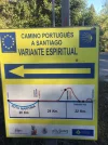
Variante Espiritual”, taking you Left. This is a modern detour based on the legend that the body of Saint James was brought in a stone boat to Galicia, it is claimed, by the estuary of Arousa and the river Ulla to Iria Flavia (now Padrón). Walking notes below. More info:
www.osalnes.com/descargas/web/traslatio.pdf.
The stage is well waymarked. First, follow the arrows on minor roads, then through fields and trees, to the Church of San Pedro de Campaño.
3 kms. Here there is a hotel and two restaurants. Continue, through houses and trees, and passing the
“Valoriza” factory, till you reach the main road and a large roundabout.
3 kms. On your Left is the Monastery of Poio. In addition to the Church and Monastery, there is accommodation and a cafeteria here.
The route continues on roads and paths through houses and trees, until you pass through a sports complex and head down to the Left, to walk alongside the seafront. Returning to a main road, ignore the arrows across the road in front of you. Instead, turn Left and follow the arrows along the side of this busy road. Just before the road bends Left, follow the waymark down to the Left, to the waterfront again, and continue into the centre of Combarro.
4 kms. In this delightful little seaside town, there are shops, bars and restaurants.
It is a good place in which to stop to eat. Before leaving Combarro, stock up on water, and perhaps an energy bar, for the climb ahead, which is steady mostly, but steep as well at times. Looking back as you climb you will be rewarded with excellent views.
To leave Combarro, cross over the main road and go up through the houses on the other side. Follow the direction of the arrows, climbing steadily, on the Camiño Rodondo, Esperón and Vilar, until you come to a Camino noticeboard.
6 kms. For the next
6 kms you continue to climb steadily, on country roads and wide forest pathways. Eventually, turn Right onto a main road then, after only 200 metres, turn Left off it again. The last
2 kms of this stage goes downhill, partly on a steep, narrow path. At the bottom of the path, follow the road down to the Right and into Armenteira, where there is an Albergue, the Monastery of Amenteira and two bar-restaurantes.
Albergue de Armenteira, Casa de la Cultura. 32 places.
Tel: 670 757 777 (Antonio).
Monasterio Cisterciense de Armenteira, Lugar de la Iglesia, s/n.
Tel: 627 097 696 (Hospedería - Hermana Lourdes).
Email: info@monasteriodearmenteira.es.
Pousada Armenteira is open in summer:
http://www.pousadadearmenteira.com/EN/hotel.html
Tele: +34 986 716 372
Email: info@pousadadearmenteira.com
Stage 2
Armenteira – Ruta de Piedra y Agua – Ruta del Rio Umia – Vilanova de Arousa.
Approximately 28 kms.
Leaving Armenteira, following the waymarks, the first part of this stage follows the well established
“Ruta da Pedra e da Agua” (the route of stones and water) – a lovely riverside walk. Care needs to be taken initially, as you are sometimes going downhill on stony paths. After
5 kms you come to a wayside Chapel and bar, which does not open early. However, a further
3 kms on, at the main road and roundabout, is the bar-restaurante “Os Castaños”.
Follow the arrows and waymarks across various roads here and, eventually, pass under a bridge to walk alongside the river on the
“Ruta del Rio Umia”, the second part of this stage. KSO this riverside path for
3 kms, until you reach a main road. Turn Left along the road, then Right to continue alongside the river for another
3 kms. Come out at the flyover and take the wooden footbridge, Right, over the river. KSO. At a roundabout, go Left, cross a bridge, and then go Left again. KSO at another roundabout then, at the next one, veer Right. Pass a
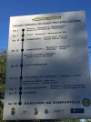
Variante Espiritual information board on your Left, before the road bends round to the Right. These last
2 kms, on roads, have taken you through Ponte Arnelas and Gombra, and towards Mouzas. The bars that you pass here are the last ones till Vilanova.
Shortly after the road bends round to the Right, follow the sign off Left, onto a path which goes round behind houses. Continue on this path. After
2.5 kms you begin to climb steadily, but not steeply, for about
2.5 kms, until you come out at more houses. Go down through the houses, and cross the main road into Cores. Continue on down through houses until you arrive at the seafront, where you turn Right to enter the start of Vilanova de Arousa.
4 kms.
To reach the Albergue and the departure point for the boat to Pontecesures the next day, pass under the bridge and continue walking along the seafront and beach, through trees, until you come to the footbridge.
3 kms. Cross the bridge. The departure point for the boat is on your Left, and the Albergue - which is housed in the Sports Centre - is round the road to the Right.
Albergue de Peregrinos Vilanova de Arousa, José Francisco González San Isidro, s/n (Pabellón de Deportes). 28 places.
Tel: 672 030 815 or 633 906 490.
In addition to the Albergue in Vilanova, there are several hotels, including:
Hotel Arco Iris*, Playa del Terrón, 12.
Tel: 986 555 444 or 986 555 319 or 669 847 643.
Email:
h_arcoiris@hotmail.com.
Stage 3
Vilanova – Pontecesures.
1 hour by boat; walking approx 28 kms.
The Albergue in Vilanova has information about the boat and sailing times, which vary according to the tide. You need to consult with the hospitalero there, and make a reservation for a place on the boat, the night before travelling.
The walking route is waymarked, however be aware that walking from Vilanova to Pontecesures involves long stretches alongside main, and at times busy, roads. The distances between the principal towns enroute are:
Vilanova de Arousa to Vilagarcia de Arousa: 8 kms.
Vilagarcia de Arousa to Catoira: 11 kms.
There are trains from Vilagarcia de Arousa to Padrón and, less frequently, from Catoira to Padrón.
Catoira to Pontecesures: 9 kms.
In Pontecesures the trail merges with the Camino Portugués into Padrón and on to Santiago.


