• Remove ads on the forum by becoming a donating member. More here.

Search 74,075 Camino Questions

Using smartphones in Camino emergencies

Status
Not open for further replies.

CJ Williams

Active Member
Time of past OR future Camino
Via Turonense (1995)
Camino Francés (1996; 1999; 2001; 2005; 2008; 2011)
Camino Aragonés (2000)
I posted this information as part of an answer to a question someone asked me on another thread, but I think it bears posting as a thread of its own because of its importance.

A smartphone with GPS and 3G coverage should be considered another piece of safety equipment that you bring along on the Camino, if you have one. If you do, you should definitely carry yours with you and have the GPS location mode switched on. Even if your battery dies and you lose call coverage, the Guardia Civil or other emergency rescue services can use the GPS to locate you in an emergency situation.

Additionally, install the WhatsApp application, or some other instant messaging application, that allows you to send photos and videos in instant messages. (WhatsApp is the most commonly used one in Spain.) If you are lost or become injured in a remote area, you can take photos of landmarks or the surrounding countryside, or a screenshot of your location on Google maps using the GPS, and send it to the dispatcher or the officer you are talking to on the phone, helping them to locate you more quickly.

The procedure is simple: first call 112, the emergency services number in Spain. If you are unsure of your location, explain that you are lost or injured and don't know where you are to the dispatcher. He or she will ask you to take note of the mobile telephone number of one of the members of the rescue unit and to add it to your address book to make conversation by Whatsapp possible.

Once contact is established with the rescuer, you will have to follow the same steps you normally would to send a picture. Make sure to allow the use of GPS by the WhatsApp so that the phone can "geolocate" you. Rescuers say that this normally works to within a margin of error of ten meters, more or less! Taking note of your coordinates by conversation often meant having to search within a radius of five kilometers or more before being able to successfully locate the person needing rescue.

Nevertheless, this system cannot take the place of EXPERIENCE and PRUDENCE. You still need to be prudent when walking the more remote or mountainous sections of the Camino. Pay close attention to weather forecasts, listen to the advice of locals and carry the proper equipment for the season in which you are travelling the Camino!
 
The one from Galicia (the round) and the one from Castilla & Leon. Individually numbered and made by the same people that make the ones you see on your walk.
Re: IMPORTANT: Using smartphones in Camino emergencies

Your advice is excellent even as the weather seems to be leaving blizzards behind. An emergency can happen anytime and anywhere. Thanks.
 
Perfect memento/gift in a presentation box. Engraving available, 25 character max.
Please be cautious. Smartphones are not necessarily very good GPS units, in addition to which, when used as a GPS, they have appallingly poor battery life. If you drain your battery using it as a GPS, you will not be in a position to make any calls - knowing exactly where you are is of little value if you cannot share that information with emergency personnel.

In addition, there have been some reports recently from both the UK and Australia about people needing rescue thinking they had given a good location, for the rescuers to find that they were several km away from their stated location.

Regards,
 
For some phones:
Fortunately, on some phone brands, such as Nokia, there is as function called "half rate codec." Enabling that function can give you up to 50 percent extra battery power on your phone.
Instructions:
1 Turn on your phone. Some phones shut off automatically when the battery gets low. If that happens, restart your phone and, as long as the battery is not completely dead, it should turn on long enough for you to access the half rate codec.
2 Dial *#4720#. That's the star sign, then pound sign, followed by 4720, followed by another pound sign.
3 Restart your phone. This should happen automatically after you key in the code. When the phone comes back on, it will tap into the battery's reserve and show a 50 percent increase in battery power.
Check to see your phone's capabilities.
 
Re: IMPORTANT: Using smartphones in Camino emergencies

falcon269 said:
Your advice is excellent even as the weather seems to be leaving blizzards behind. An emergency can happen anytime and anywhere. Thanks.

You're welcome!

dougfitz said:
Please be cautious. Smartphones are not necessarily very good GPS units, in addition to which, when used as a GPS, they have appallingly poor battery life. If you drain your battery using it as a GPS, you will not be in a position to make any calls - knowing exactly where you are is of little value if you cannot share that information with emergency personnel.

In addition, there have been some reports recently from both the UK and Australia about people needing rescue thinking they had given a good location, for the rescuers to find that they were several km away from their stated location.

Hi Doug! I am not advising anyone to use it as a GPS alone. The rescue services recommend using the WhatsApp instant messaging app to send a photo of the place where you are stranded or lost to help them locate you more quickly, i.e., some prominent feature of the surrounding countryside such as a mountain, or some other part of the physical landscape. That photo combined with the "geolocate" feature switched on when you send it can help them find you much faster than they might otherwise. Rescue services in the different autonomous communities in Spain have been using the technique with great success, which is why I passed along the information. If you are not in need of the GPS feature, then you should definitely switch it off on your phone as it does drain the battery quckly.
 
A selection of Camino Jewellery
dougfitz said:
Please be cautious. Smartphones are not necessarily very good GPS units, in addition to which, when used as a GPS, they have appallingly poor battery life. ,


I agree 100% with Doug about the battery life, but have not found poor GPS performance from phones.

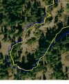
Here's three tracks, a cheap android phone, an iPhone, and a real Garmin GPS. Not much difference in quality.
 

Attachments

  • 3gps.webp
    3gps.webp
    57.6 KB · Views: 2,404
Plan to have my phone switched off when walking. If I need it in an emergency I would have a full battery. I have a cheap, light, small external battery which extends by battery life by recharging my phone or enabling a nearly discharged phone to be used directly from this batteryI have found my Iphone 4 GPS to be very accurate.
 
Im also in the market for something like this. Is the external power source also rechargeable, or does it run off disposable batteries?
 
3rd Edition. More content, training & pack guides avoid common mistakes, bed bugs etc
HermanTheGerman wrote

Is the external power source also rechargeable

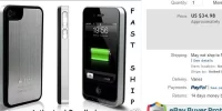
Smartphone on this forum generally means the Apple iPhones which do not have fixed batteries which you cannot change or charge out of the phone. It can have a clip on case which has a battery in its case thereby giving it an extra life once it piggybacks on to the phone. The external battery usually has to be charged with the phone.

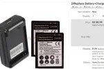
Increasing numbers of smartphone users use Androids, Google, Nokia and others which has a replaceable battery. And also interchangeable memory cards. You can carry as many of these light batteries as you like and charge them out of the phone.

These are available at ebay, attached pictures with prices. Note the Samsung battery comes with a charger.
 

Attachments

  • 1-Samsung battery and charger.webp
    1-Samsung battery and charger.webp
    32.5 KB · Views: 1,915
  • iPhone 4 battery case.webp
    iPhone 4 battery case.webp
    24.5 KB · Views: 1,897
HermanTheGerman said:
Im also in the market for something like this. Is the external power source also rechargeable, or does it run off disposable batteries?

I have an old external USB pack. Inside are four AA rechargeable batteries. If you plug it into the wall it recharges the batteries. If you plug it into an USB device it can charge smaller devices or keep power hungry devices running. Plus the batteries can be replaced. AA are pretty common so a person could throw a few extra sets into a pack if they really were worried.

Lately I've seen more modern devices along the same idea. A few even have solar panels. They look small and light enough that you could slip it inside a backpack with the small external panel outside. My guess with a Spanish summer you'd almost never end up with the internal battery running down.

Browse Amazon I bet you'll have plenty of different units to look at.
 
BTW I would say the GPS in my phone is more accurate then either of the Garmins I've owned.

But all GPS have tradeoffs.
 
...and ship it to Santiago for storage. You pick it up once in Santiago. Service offered by Casa Ivar (we use DHL for transportation).
Re: Re: Using smartphones in Camino emergencies

NicoZ said:
BTW I would say the GPS in my phone is more accurate then either of the Garmins I've owned.

But all GPS have tradeoffs.

Hey Nico, thanks for the info. Thats the answer I was hoping for. In the meantime that's exactly what I've been doing and have found a rechargeable cylinder on Amazon, but no solar panel as yet. And yes, I would definitely agree with you about the comment on Garmin. I'm running Alpine Quest on my Android HTC, which cost me about 5 euros (the program that is) and have saved out a contour map of the entire Camino Frances using MOBAC which is about 800MB on the SD card. Ever tried hiking through the Greek Islands with a Garmin? You can forget it. The maps don't exist and I refuse to contribute to the Garmin stranglehold on the market anymore. Why on earth should someone pay more money for the map than what the device itself cost, no thanks. 2 thumbs up to smart phone GPS:!:

The German
 
I didn't really mean the maps. I think the sensor in my phone is more accurate. You'll see it when driving. If you miss a turn it'll notice faster then the Garmins would.

Now there are tradeoffs. If I understand it right being more accurate means it takes longer to get a GPS lock.

The Google maps are more up to date. A few months ago I was driving and the road was closed for roadwork. The phone already had the detour on it's maps.
 
Re: Re: Using smartphones in Camino emergencies

NicoZ said:
I didn't really mean the maps. I think the sensor in my phone is more accurate. You'll see it when driving. If you miss a turn it'll notice faster then the Garmins would.

Now there are tradeoffs. If I understand it right being more accurate means it takes longer to get a GPS lock.

The Google maps are more up to date. A few months ago I was driving and the road was closed for roadwork. The phone already had the detour on it's maps.
My HTC google navigation is without a doubt more accurate than my Garmin motorbike navigation also. In fact, it does everything better for far less money.
 
...and ship it to Santiago for storage. You pick it up once in Santiago. Service offered by Casa Ivar (we use DHL for transportation).
If your battery starts to run low it is better to send text messages than to talk - uses a lot less energy - but if lost by all means turn off other apps and keep on so rescue teams can find your gps signal
 
I posted this information as part of an answer to a question someone asked me on another thread, but I think it bears posting as a thread of its own because of its importance.

A smartphone with GPS and 3G coverage should be considered another piece of safety equipment that you bring along on the Camino, if you have one. If you do, you should definitely carry yours with you and have the GPS location mode switched on. Even if your battery dies and you lose call coverage, the Guardia Civil or other emergency rescue services can use the GPS to locate you in an emergency situation.

Additionally, install the WhatsApp application, or some other instant messaging application, that allows you to send photos and videos in instant messages. (WhatsApp is the most commonly used one in Spain.) If you are lost or become injured in a remote area, you can take photos of landmarks or the surrounding countryside, or a screenshot of your location on Google maps using the GPS, and send it to the dispatcher or the officer you are talking to on the phone, helping them to locate you more quickly.

The procedure is simple: first call 112, the emergency services number in Spain. If you are unsure of your location, explain that you are lost or injured and don't know where you are to the dispatcher. He or she will ask you to take note of the mobile telephone number of one of the members of the rescue unit and to add it to your address book to make conversation by Whatsapp possible.

Once contact is established with the rescuer, you will have to follow the same steps you normally would to send a picture. Make sure to allow the use of GPS by the WhatsApp so that the phone can "geolocate" you. Rescuers say that this normally works to within a margin of error of ten meters, more or less! Taking note of your coordinates by conversation often meant having to search within a radius of five kilometers or more before being able to successfully locate the person needing rescue.

Nevertheless, this system cannot take the place of EXPERIENCE and PRUDENCE. You still need to be prudent when walking the more remote or mountainous sections of the Camino. Pay close attention to weather forecasts, listen to the advice of locals and carry the proper equipment for the season in which you are travelling the Camino!
Get info as I will take mine after last year being in hospital for 8 days my wife will glue mine to my forehead.
 
Holoholo automatically captures your footpaths, places, photos, and journals.
Also a good idea to put your phone on flight mode if not in use. Will add hours to the battery.

That's what I do. Then I can still use it to take pictures and if something were to happen, I would have almost instant access to the phone by taking it off Airplane Mode. Turning the phone on when it is off seems to take ages.
 
Please be cautious. Smartphones are not necessarily very good GPS units, in addition to which, when used as a GPS, they have appallingly poor battery life. If you drain your battery using it as a GPS, you will not be in a position to make any calls - knowing exactly where you are is of little value if you cannot share that information with emergency personnel.

In addition, there have been some reports recently from both the UK and Australia about people needing rescue thinking they had given a good location, for the rescuers to find that they were several km away from their stated location.

Regards,
My Samsung Galaxy Note 3 has brilliant GPS and always gets to within 5m. Also, the battery drainage on GPS is only bad when you're actually using the maps function. If you just leave GPS on, it's not. I leave GPS on all the time, as then when you take a photo, it geotags the picture, and later adds it to your maps. If you can't remember where you took the pic, just click on the function 'find on map' and it takes you right to where you were when you took the photo. Also, carrying an external battery charger is a great idea. You then charge that in public places rather than your expensive phone. When it's charged, it has enough power in it to charge your phone 3-5 times depending on the model.
 
Im also in the market for something like this. Is the external power source also rechargeable, or does it run off disposable batteries?

The one I have is a lithium rechargeable battery. It is about the size of a pack of cigarettes and I get a good 4 or 5 charges from it. It also means you can leave the battery pack charging and keep the phone with you. Not many people will steal a cheap battery and if they do then so what?

I got mine from Ebay. Didn't cost much.

My Samsung Galaxy Note 3 has brilliant GPS and always gets to within 5m. Also, the battery drainage on GPS is only bad when you're actually using the maps function. If you just leave GPS on, it's not.

I have a Galaxy S3 which is similar. I think when GPS is switched on it isn't actually running until you open an app that requires it. Open the app and it activates the GPS, close the app and the GPS turns off even though you've got the GPS function switched on. At least that's how it appears to work on mine. Hence it doesn't seem to drain the battery, it's not actually doing anything until an app wakes it up.
 
Join the Camino cleanup. Logroño to Burgos May 2025 & Astorga to OCebreiro in June
Hi, if you have your smart phone use whataspp app... You can send your exactly location to any contact that you have in that app... Just open the application, open a contact friend or family and put your cursor as you are going to write a message then click the up arrow at the bottom left (as when you want to send a photo or video) and select: SHARE LOCATION
And your location will be send to the contact you previously select.
You can use it, in case you are lost, or in an emergency.
 
What happens if you are in a remote area with no reception? A phone is useless unless it is within range of a mobile phone tower. Happens all the time in remote areas of Australia - for which you need a satellite phone. You might get GPS on a smartphone, but if you have no way of sending information it is useless to get you rescued.

Does Spain have complete coverage, everywhere?

There is a very funny scene in "St Jacque le Mecque" in which the pilgrims were vainly trying to get their phones to work in remote rural France.

But no laughing matter if you are up a mountain in bad conditions with a broken leg. If you go bush, let people know where you are going and when to expect to hear from you.
That's so right Kanga. Here in Australia we don't get coverage everywhere. I never take my phone just don't see the point. What I do have is an Epirb. So if I get into trouble in a remote place, like a broken leg, I can set it off.
 
€2,-/day will present your project to thousands of visitors each day. All interested in the Camino de Santiago.
That's so right Kanga. Here in Australia we don't get coverage everywhere. I never take my phone just don't see the point. What I do have is an Epirb. So if I get into trouble in a remote place, like a broken leg, I can set it off.

Yes, an Epirb makes sense for remote areas, or at sea. Expensive to buy for the occasional trip but they can be hired. Everyone travelling in outback Australia should carry one IMO. It's difficult to compare with Spain though, we have such vast areas of wilderness and isolation. Nothing in Spain is really remote in comparison. Even the mountains are comparatively well settled.
 
Yes, an Epirb makes sense for remote areas, or at sea. Expensive to buy for the occasional trip but they can be hired. Everyone travelling in outback Australia should carry one IMO. It's difficult to compare with Spain though, we have such vast areas of wilderness and isolation. Nothing in Spain is really remote in comparison. Even the mountains are comparatively well settled.
I use it for hiking out bush mostly. Didn't take it when I did the Del Norte route in Spain and I won't take it to do the Portuguese route in September. I don't think I will need it for that. Have you done the Portuguese way Kanga? I know you have done several.
 
I use it for hiking out bush mostly. Didn't take it when I did the Del Norte route in Spain and I won't take it to do the Portuguese route in September. I don't think I will need it for that. Have you done the Portuguese way Kanga? I know you have done several.

No, but one of my daughters is very keen. She was an exchange student in Brazil so speaks a bit of Portuguese. It sounds like a beautiful Camino but I do like a long walk. We've concentrated on the French chemins in recent years, mainly because my husband loves the food and wine - have to motivate him somehow!
 
The focus is on reducing the risk of failure through being well prepared. 2nd ed.
No, but one of my daughters is very keen. She was an exchange student in Brazil so speaks a bit of Portuguese. It sounds like a beautiful Camino but I do like a long walk. We've concentrated on the French chemins in recent years, mainly because my husband loves the food and wine - have to motivate him somehow!
Ha ha. Men and there stomachs. I'm not taking mine on this one but in May next year we are walking the second half of the Via Francigena through Italy. He is excited for the food.
 
My Samsung Galaxy Note 3 has brilliant GPS and always gets to within 5m. Also, the battery drainage on GPS is only bad when you're actually using the maps function. If you just leave GPS on, it's not. I leave GPS on all the time, as then when you take a photo, it geotags the picture, and later adds it to your maps. If you can't remember where you took the pic, just click on the function 'find on map' and it takes you right to where you were when you took the photo. Also, carrying an external battery charger is a great idea. You then charge that in public places rather than your expensive phone. When it's charged, it has enough power in it to charge your phone 3-5 times depending on the model.
I suspect smartphone battery life will improve as makers better integrate GPS chips into their products, and power consumption decreases generally.

On the matter of accuracy, I hate to be a wet blanket, but unless you are comparing the GPS readout with a well established reference point like a surveyed trig point, it is impossible to tell what accuracy is being achieved. Getting down to 5m other than in the US is technically difficult, if not impossible, given the nature of the GPS satellite stability and the variability of atmospheric effects on the signals.
 
Re: IMPORTANT: Using smartphones in Camino emergencies

Your advice is excellent even as the weather seems to be leaving blizzards behind. An emergency can happen anytime and anywhere. Thanks.
can you suggest buying an inexpensive phone for the Camino
 
Join the Camino cleanup. Logroño to Burgos May 2025 & Astorga to OCebreiro in June
Status
Not open for further replies.

❓How to ask a question

How to post a new question on the Camino Forum.

Most read last week in this forum

I saw a video with a rather harsh criticism of a small, municipal albergue on one of the less traveled caminos. They paid 9€. I thought: What does it cost a small municipality to renovate and keep...
On my last Camino (2023) I noticed that there were lots of tourists. It reminded me of a couple of quotes that I have read since my first Camino (2015) “A tourist demands, a pilgrim is grateful”...
"A complete guide to the world's greatest pilgrimage"[sic] by Sarah Baxter. In a British newspaper, The Telegraph. A right wing daily that does print interesting articles and essays...
Day 42 Week 6 460km walked (give or take) Today I had a revelation, an epiphany and a Divine Intervention... all in one day. Today the exreme pain in my soul is dissipating some... healed by the...
There was a recent thread about EST (Erhard Seminars Training) which I have to say I have never hear of, but it got me thinking. I undertook some rather 'left field' training about 10 years ago...
I've been trying to figure out how to use the Gronze app and as a first step I need to translate into English - I searched topics on the Forum, thought I found what I was looking for, and Yay! I...

Featured threads

❓How to ask a question

How to post a new question on the Camino Forum.

Featured threads

Forum Rules

Forum Rules

Camino Updates on YouTube

Camino Conversations

Most downloaded Resources

This site is run by Ivar at

in Santiago de Compostela.
This site participates in the Amazon Affiliate program, designed to provide a means for Ivar to earn fees by linking to Amazon
Official Camino Passport (Credential) | 2024 Camino Guides
Back
Back
Top