• Remove ads on the forum by becoming a donating member. More here.

Search 74,075 Camino Questions

Today's New Mexico Camino

JillGat

la tierra encantada
Time of past OR future Camino
CF in spring and winter, Portugues, Sanabres: 2024
April 24, 2020
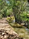
Today I riffed on the historical connections between Spain and New Mexico in all sorts of ways. Most of the day I hiked along one of the oldest acequias (water ditches) in Albuquerque, right next to the original, ancient route of the Camino Real; now Edith Blvd. NW

El Camino Real de Tierra Adentro (Royal Road of the Interior Land), was a 1600 mile trade route between Mexico City and Ohkay Owingeh pueblo north of Santa Fe, from 1598 – 1882. Up and down this route traveled Spanish, Mexican and American explorers, settlers, soldiers and missionaries. For a thousand or more years before that, indigenous people from what is now southern Mexico walked this same route, trading products such as turquoise, obsidian, salt and parrot feathers with northern tribes by the Rocky Mountains.

The rural, curvy section of north Edith Blvd. sits directly on this ancient path.

The Pueblo people of New Mexico revolted in 1680, killing 400 Spaniards and driving the remaining 2000 settlers out of the province, back down into what is now Mexico. Twelve years later, the Spanish reconquered the area and began to settle the Rio Grande valley in earnest (the amazing story is a lot longer than that, obviously).

One of the first things the Spanish settlers did was to dig agricultural ditches, “acequias” to channel water all through the Rio Grande valley to water their crops. Some of the oldest ditches here had already been built before the Spanish got here by indigenous people to water their crops, too. I believe the section of ditch I walked today pre-dates Spanish arrival, because of how it weaves around.

And today, the acequia was still doing its job; full of water, with gates channeling it into small pastures and farmlands.

The old acequias – from before the Anglos arrived – took advantage of physical features of the land (and gravity), so they were much curvier than the ones built much later in the 1920s-1940s.

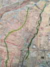
If you go to Google Maps and type in the coordinates: 35.195865, -106.603873, switch to satellite view, you can see the acequia I walked today. (the photos are from winter when it was dry and brown. Much greener right now). I started about two miles south of this point and walked until I got to the border of the Sandia Pueblo reservation border. I passed just below Vara Wines, whose name honors Spanish history connected to the Camino Real. I’ll talk more about them later. You can find Vara Wines here, just off Alameda and see the acequia I walked below, to the west: 35.187222, -106.604488

In the middle of a city of 915,000 people, I met one other person walking on the trail with her dog. And a few on horseback. Plenty of “social distancing,” and in many places it easily could have been 200 years ago. There were fruit orchards and alfalfa pastures, burros and sheep, huge old cottonwood trees, ducks, lizards, flowers, many quaint adobe haciendas built around the turn of the century and a spectacular view of the Sandia mountains.

I stopped to talk to an older lady working in her backyard. She told me that her family since before her grandparents have lived on this land. Her name was Chavez and she told me, “these are all old families along here. Most of them on either side of the road right by here are named Chavez, but none of us are related.” I asked if she knew that she lived right on the Camino Real that had been used since the late 1500s. She said, “Oh yes! There are lots of very old places here. That house across the way was built in 1912.” 😊

After my walk, I was famished, so I stopped at Federiquito’s on 4th St. for tacos. (It used to be Federico’s, but it closed and now it’s run by the little Federicos, I guess). These were real Mexican style tacos, not New Mexican style. Soft corn tortillas filled with grilled meat, pico de gallo red salsa and green tomatillo sauce. My sister-in-law from northern Spain was appalled to see, on some of the Mexican restaurant signs here, “Spanish Food.” We can thank the indigenous people of our region for our Mexican and New Mexican food. “Tortillas” in Spain are egg and potato omelets. You don't find much corn and hot salsa in Spanish food.

After getting home and resting my feet, I headed back up to Vara Wines to pick up our take-out paella, which they make in a big traditional pan every Friday (sadly, just take-out for the time being). This was REAL Spanish food, with saffron-infused rice, chorizo, chicken, mussels and shrimp. I highly recommend it.

Vara imports Spanish wines and also makes wine from local grapes in the Spanish style. “Vara” means “cane” in Spanish. They named the winery after the engraved canes historically presented to local tribes to acknowledge their sovereignty. The first was in 1620, an engraved cane presented to the Indian Pueblos in the Province of New Mexico by King Philip III of Spain (well before the Pueblo revolt). In 1863, President Abraham Lincoln issued engraved canes to each of the 19 pueblos as recognition of their property ownership and right to self-governance. Today these canes are still revered by the Pueblo people as physical and living reminders of their Pueblos’ natural authority. I believe Isleta Pueblo has the cane from 1620, but I’m not sure.

From Vara’s site: “In 1629, a Franciscan friar named García de Zúñiga and a Capuchin monk named Antonio de Arteaga planted the first European wine grapes in what is now the U.S. at a pueblo in the Rio Grande Valley of the Province of New Mexico (or Nuevo Espana). Viticulture took hold in the valley, and by the year 1880 the New Mexico territory was the fifth largest wine producer in America. The cuttings brought to the new world by missionaries from Spain were of a Vitis Vinifera grape variety known as Listan Prieto; the present day Mission grape. This variety has been continuously grown and is still harvested in New Mexico today.” Vara makes a local wine from this very grape called Vina Cardinal. You can see Doug talking about this history here: https://nmliving.com/…/vara-winery-distillery-doesnt-have-…/

When I told him, Doug acted like he already knew the winery sits just above the original Camino Real where monks carried their wines north through the territory four centuries ago. Maybe he did or maybe he didn’t, but I know he does now. :)

Full of tacos, paella, and wine, I flopped on the couch and read my book, a wonderful novel by Isabel Allende from Chile that takes place during the Spanish Civil War, "A Long Petal of the Sea."

In the picture below, the acequia I walked is in dark green on the right.
 

Attachments

  • ditch 1.webp
    ditch 1.webp
    1.3 MB · Views: 50
Last edited:
The focus is on reducing the risk of failure through being well prepared. 2nd ed.
...and ship it to Santiago for storage. You pick it up once in Santiago. Service offered by Casa Ivar (we use DHL for transportation).
Wonderful post!
Once I'm healed and back behind the wheel of my van, I'm going to check out this walk!
Hi @Anniesantiago
NM has a lot worth seeing. I’m from Australia but shared a road trip with relatives ( of roughly a week 2 years ago).
An artists paradise too. I just scrolled through my photos. So many photos and many places to walk ..

@JillGat
I even took the picture in Albuquerque with the Camino real sign.
 

Attachments

  • 3142E3CD-06C6-410D-8AF4-292A502DB1F3.webp
    3142E3CD-06C6-410D-8AF4-292A502DB1F3.webp
    391.6 KB · Views: 25
Thanks so much for this! I travel to Arizona each year and always find a way to stop over in NM, which I think is my very favorite state. I have a friend who once lived in ABQ and I have walked some of the acequias when I visited her.

Hopefully I can make the journey again next winter -- I will plan to do the walk you described if I don't get snowed out when I travel through (which has happened to me many times!)

Blessings!
 
Don’t mean to derail the thread, but I wondered — What? I don’t know this Isabel Allende novel! Turns out it was just published this year, and I have got it on my library e-book request list. Thanks so much for that, @JillGat!


This sounds like a wonderful walk, you are lucky to be there. Buen camino, Laurie
 
A selection of Camino Jewellery
Thank you, Jill! A wonderful sounding walk, and window into another world, and deep historical roots. It fascinates me how we can tend to take the way things look for granted, as just how they are, without having any understanding of what happened to create that landscape.
 
Wow! I live in southern CO, near the NM border and have tramped many grounds in NM. We used to walk along ditches in Socorro, where we had a friend who lived there (now deceased). Perhaps these are of historic significance as well?

I am a retired nurse, and I also did a travel assignment in ABQ in 2008 for about 3 month and was living at the Homewood Suites near the airport. My husband and I would walk the ditches in the south side of town! Fascinating! I wish I had know the history then. Gracias!
 
3rd Edition. More content, training & pack guides avoid common mistakes, bed bugs etc
There are remote stretches of the Camino in Southern New Mexico where you can still see wagon wheel ruts. Just recently some good maps have been posted online. I highly recommend the book, Following the Royal Road by Hal Jackson. He researched the route all through Mexico too, where some of the small villages are little changed
 
This is a wonderful post! Thank you. I have spent part of the last three winters in NM, staying in Santa Fe, but making frequent trips to Albuquerque (where I was always scouting out walking trails...) This year we stayed along the Acequia Madre, which I walked along every day. I felt a special connection to being near this historic "ditch" which brought life-giving water to the peoples of the Santa Fe area for centuries. I will now explore them in Albuquerque next time I visit that beautiful state. Very interested in the historical connections between Spain and New Mexico. Ultreia!
elle
 
Ideal sleeping bag liner whether we want to add a thermal plus to our bag, or if we want to use it alone to sleep in shelters or hostels. Thanks to its mummy shape, it adapts perfectly to our body.

€46,-
April 24, 2020
Today I riffed on the historical connections between Spain and New Mexico in all sorts of ways. Most of the day I hiked along one of the oldest acequias (water ditches) in Albuquerque, right next to the original, ancient route of the Camino Real; now Edith Blvd. NW

El Camino Real de Tierra Adentro (Royal Road of the Interior Land), was a 1600 mile trade route between Mexico City and Ohkay Owingeh pueblo north of Santa Fe, from 1598 – 1882. Up and down this route traveled Spanish, Mexican and American explorers, settlers, soldiers and missionaries. For a thousand or more years before that, indigenous people from what is now southern Mexico walked this same route, trading products such as turquoise, obsidian, salt and feathers with northern tribes by the Rocky Mountains.

The rural, curvy section of north Edith Blvd. sits directly on this path.

The Pueblo people of New Mexico revolted in 1680, killing 400 Spaniards and driving the remaining 2000 settlers out of the province, back down into Mexico. Twelve years later, the Spanish reconquered the area and began to settle the Rio Grande valley in earnest (the story is a lot longer than that, obviously).

One of the first things the Spanish did was to dig agricultural ditches, “acequias” to channel water all through the Rio Grande valley to water their crops. Some of the oldest ditches here had already been built before the Spanish got here by indigenous people to water their crops, too. I believe the section of ditch I walked today pre-dates Spanish arrival, because of how it weaves around.

And today, the acequia was still doing its job; full of water, with gates channeling it into small pastures and farmlands.
The old acequias – from before the Anglos arrived – took advantage of physical features of the land (and gravity), so they were much curvier than the ones built much later in the 1920s-1940s.

If you go to Google Maps and type in the coordinates: 35.195865, -106.603873, switch to satellite view, you can see the acequia I walked today. I started about two miles south of this point and walked until I got to the border of the Sandia Pueblo reservation border. I passed just below Vara Wines, whose name honors Spanish history connected to the Camino Real. I’ll talk more about them later. You can find Vara Wines here, just off Alameda and see the acequia I walked below, to the west: 35.187222, -106.604488

In the middle of a city of 915,000 people, I met one other person walking on the trail. And a few on horseback. Plenty of “social distancing,” and in places it easily could have been 200 years ago. There were orchards and alfalfa pastures, burros and sheep, huge old cottonwood trees, ducks, lizards, flowers, many quaint adobe haciendas from around the turn of the century and a spectacular view of the Sandia mountains.

I stopped to talk to an older lady working in her backyard. She told me that her family since before her grandparents have lived on this land. Her name was Chavez and she told me, “these are all old families along here. Most of them on either side of the road right by here are named Chavez, but none of us are related.” I asked if she knew that she lived right on the Camino Real that had been used since the late 1500s. She said, “Oh yes! There are lots of very old places here. That house across the way was built in 1912.” 😊

After my walk, I was famished, so I stopped at Federiquito’s on 4th St. for tacos. (It used to be Federico’s, but it closed and now it’s run by the little Federicos, I guess). These were real Mexican style tacos, not New Mexican style. Soft corn tortillas filled with grilled meat, pico de gallo red salsa and green tomatillo sauce. My sister-in-law from northern Spain was appalled to see, on some of the Mexican restaurant signs here, “Spanish Food.” What we have, of course, mostly originated with the indigenous people. “Tortillas” in Spain are egg and potato omelets. Corn and hot salsa are hardly featured in Spanish food.

After getting home and resting my feet, I headed back up to Vara Wines to pick up our take-out paella, which they make in a big traditional pan every Friday (sadly, just take-out for the time being). This was REAL Spanish food, with saffron rice, chorizo, chicken, mussels and shrimp. I highly recommend it.

Vara imports Spanish wines and also makes wine from local grapes in the Spanish style. “Vara” means “cane” in Spanish. They named the winery after the engraved canes historically presented to local tribes to acknowledge their sovereignty. The first was in 1620, an engraved cane presented to the Indian Pueblos in the Province of New Mexico by King Philip III of Spain (well before the Pueblo revolt). In 1863, President Abraham Lincoln issued engraved canes to each of the 19 pueblos as recognition of their property ownership and right to self-governance. Today these canes are still revered by the Pueblo people as physical and living reminders of their Pueblos’ natural authority. I believe Isleta Pueblo has the cane from 1620, but I’m not sure.

From Vara’s site: “In 1629, a Franciscan friar named García de Zúñiga and a Capuchin monk named Antonio de Arteaga planted the first European wine grapes in what is now the U.S. at a pueblo in the Rio Grande Valley of the Province of New Mexico (or Nuevo Espana). Viticulture took hold in the valley, and by the year 1880 the New Mexico territory was the fifth largest wine producer in America. The cuttings brought to the new world by missionaries from Spain were of a Vitis Vinifera grape variety known as Listan Prieto; the present day Mission grape. This variety has been continuously grown and is still harvested in New Mexico today.” Vara makes a local wine from this very grape called Vina Cardinal. You can see Doug talking about this history here: https://nmliving.com/…/vara-winery-distillery-doesnt-have-…/

When I told him, Doug acted like he knew the winery was sited just above the original Camino Real where monks carried their wines north through the territory four centuries ago. Maybe he did or maybe he didn’t, but I know he does now.

Full of tacos, paella, and wine, I flopped on the couch and read my book, a wonderful novel by Isabel Allende from Chile that takes place during the Spanish Civil War, "A Long Petal of the Sea."

In the picture below, the acequia I walked is in dark green on the right.
Great read! Thank you sooo much. Are you walking alone alone...I so miss being in nature. Very blessed to have my wonderful neighborhood with horse properties in the far NE of Albuquerque....but feeling a serious need for nature these days...

buen Camino XO stay healthy. 🙂👍🏼💪🏼 TG
 
@JillGat Thanks for posting about your local acequia trail walk. We have a similar trail in Denver that follows the High Line Canal, an irrigation ditch built in the early 1880s. It is one of Denver's most popular hiking trails, running a total of 71 miles from its origin at a diversion dam on the South Platte River in Waterton canyon to the plains (now suburbia) in Aurora, an eastern suburb of Denver. There are some sections of the trail which run through private property and are thus not accessible, but probably 65 or so miles are easily accessible. I hope this map link works -- you may have to register (free on TrailLink) to see it: https://www.traillink.com/trail-maps/high-line-canal-trail-(co)/

I should add that Waterton Canyon, where the High Line Canal begins, is the northern terminus of the Colorado Trail, a 480-mile high altitude trail between Durango and Denver. Parts of the Colorado Trail are shared with the Continental Divide Trail.

On a related note, I'm a native of San Antonio, which is on another Spanish colonial era Camino Real which ran up from Mexico City, entered Texas at Laredo, and terminated at a mission located in Natchitoches, Louisiana. The NPS is developing "El Camino Real de los Tejas National Historic Trail." I don't know much about it, but I don't think it's a walking trail, but rather just a route connecting several historic sites along the old Spanish road.

P.S. Just wondering -- did you ever walk the Camino de Chimayó? I know we had a PM exchange a while back.
 
Ideal sleeping bag liner whether we want to add a thermal plus to our bag, or if we want to use it alone to sleep in shelters or hostels. Thanks to its mummy shape, it adapts perfectly to our body.

€46,-
April 24, 2020
Today I riffed on the historical connections between Spain and New Mexico in all sorts of ways. Most of the day I hiked along one of the oldest acequias (water ditches) in Albuquerque,

@JillGat, this was fascinating to read! Thank you for taking the time to post so much information. It was especially interesting to me because two years ago, we spent three months exploring the acequias built during Muslim times that are still being used on the slopes of the Sierra Nevada in Andalucia.

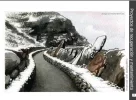
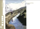
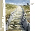
For those interested in acequias or who just want to see some gorgeous paintings of the area, take a look at the fascinating online book Manual del Acequiero. This (free) book is a joint project of the Sierra Nevada National Park and the government of Andalucía as part of their efforts to conserve and restore the acequias of the mountain area. It answered many of the questions we had about the acequias de careo: When were they built? How do they differ from the irrigation channels we’ve seen on earlier trips? How many of them are there? Why do some of them seem to end in the middle of nowhere?

Screen Shot 2020-04-26 at 10.35.26 AM.png Screen Shot 2020-04-26 at 10.35.58 AM.png Screen Shot 2020-04-26 at 10.36.57 AM.png Screen Shot 2020-04-26 at 10.38.43 AM.png Screen Shot 2020-04-26 at 10.52.19 AM.png Screen Shot 2020-04-26 at 10.52.58 AM.png

Many of these acequias de careo can be seen by taking a short side trip from the Camino Mozarabe. If you have time to explore only one, I highly recommend the Acequia Alta near the village of Capileira.
Screen Shot 2020-04-26 at 11.11.44 AM.png Screen Shot 2020-04-26 at 11.21.08 AM.png
 
Last edited:
If it’s ok to broaden the topic a bit, I just wanted to mention the levadas in Madeira, built by the Portuguese to bring water from the wet side of the island to the drier side. Lots of them are now used as hiking trails. I remember some absolutely gorgeous hikes a few years ago, so that is another option for you ditch-explorers! These channels are much younger than the other ones discussed here, mainly dating back to no earlier than the 16th century.
 
If it’s ok to broaden the topic a bit,
UNESCO World Heritage Site
The Aqueduct of Segovia
1280px-Aqueduct_of_Segovia_08.jpg
 
Perfect memento/gift in a presentation box. Engraving available, 25 character max.
I should add that Waterton Canyon, where the High Line Canal begins, is the northern terminus of the Colorado Trail, a 480-mile high altitude trail between Durango and Denver. Parts of the Colorado Trail are shared with the Continental Divide Trail.

I loved that tru-hike. Anytime I get down to Denver to visit my son, Caleb, we will do a round trip dayhike up Waterton Canyon to the dam near where the Colorado Trail continues on as a single track trail, and back down to the parking area. I did read that they had closed Waterton Canyon to hikers, recently. I hope it gets opened up again soon.
 
Thank you, Jill! A wonderful sounding walk, and window into another world, and deep historical roots. It fascinates me how we can tend to take the way things look for granted, as just how they are, without having any understanding of what happened to create that landscape.

Most people who live in Albuquerque are little aware of these ditches that lace the city and take you back a few centuries when you walk them.
 
Great read! Thank you sooo much. Are you walking alone alone...I so miss being in nature. Very blessed to have my wonderful neighborhood with horse properties in the far NE of Albuquerque....but feeling a serious need for nature these days...

buen Camino XO stay healthy. 🙂👍🏼💪🏼 TG

Hi neighbor!
 
€2,-/day will present your project to thousands of visitors each day. All interested in the Camino de Santiago.
@JillGat Thanks for posting about your local acequia trail walk. We have a similar trail in Denver that follows the High Line Canal, an irrigation ditch built in the early 1880s. It is one of Denver's most popular hiking trails, running a total of 71 miles from its origin at a diversion dam on the South Platte River in Waterton canyon to the plains (now suburbia) in Aurora, an eastern suburb of Denver. There are some sections of the trail which run through private property and are thus not accessible, but probably 65 or so miles are easily accessible. I hope this map link works -- you may have to register (free on TrailLink) to see it: https://www.traillink.com/trail-maps/high-line-canal-trail-(co)/

I should add that Waterton Canyon, where the High Line Canal begins, is the northern terminus of the Colorado Trail, a 480-mile high altitude trail between Durango and Denver. Parts of the Colorado Trail are shared with the Continental Divide Trail.

On a related note, I'm a native of San Antonio, which is on another Spanish colonial era Camino Real which ran up from Mexico City, entered Texas at Laredo, and terminated at a mission located in Natchitoches, Louisiana. The NPS is developing "El Camino Real de los Tejas National Historic Trail." I don't know much about it, but I don't think it's a walking trail, but rather just a route connecting several historic sites along the old Spanish road.

P.S. Just wondering -- did you ever walk the Camino de Chimayó? I know we had a PM exchange a while back.

I know people who have walked the Colorado Trail.. no small feat. Sounds wonderful, though. thanks for the info on the High Line Canal. That sounds very interesting. Some of my ditch walk was on private property too (with fences, even) pero eso no me preocupa. I climb over the fences because my taxes pay for these ditches.

I haven't walked the Chimayo pilgrimage. From Albuquerque it is all on pavement, but am still interested in the north to south route! Sadly, Chimayo has become a tourist destination.

Nice to hear from you!
 
The one from Galicia (the round) and the one from Castilla & Leon. Individually numbered and made by the same people that make the ones you see on your walk.
...and ship it to Santiago for storage. You pick it up once in Santiago. Service offered by Casa Ivar (we use DHL for transportation).

❓How to ask a question

How to post a new question on the Camino Forum.

Most read last week in this forum

Ok, so this group is young at heart! Love it. I am thinking it actually is a little more exciting to just wing it a little more on my hike. I guess one question I have is did you just have your...
Has anyone walked the Camino while "shy" or introverted? I (26 f, USA) am walking the Camino Frances in May 2025 mostly excited but also a bit nervous about the social aspect of the journey. I...
Greetings all While travelling from Camponaraya to Cacabelos I stumbled this nice little park area with benches and a BBQ area, right past the Wine factory and next to a Car Wash and Gas Station...
The Camino Planner As the click-clack of walking sticks fades here in Santiago, the tap-tap of my keyboard picks up with exciting changes planned for 2025. Earlier this summer, we published the...
Just curious. I'm sure we ran a poll somewhere. But I wonder in any given year, what the % of return Pilgrims might be? A large proportion of us here seem to 'repeat offenders' but we are only a...
Given the nature of this post, the Moderators ask that forum members contact @pablovergara directly, either via the direct message feature on the forum or via the other social media sites where he...

Featured threads

❓How to ask a question

How to post a new question on the Camino Forum.

Featured threads

Forum Rules

Forum Rules

Camino Updates on YouTube

Camino Conversations

Most downloaded Resources

This site is run by Ivar at

in Santiago de Compostela.
This site participates in the Amazon Affiliate program, designed to provide a means for Ivar to earn fees by linking to Amazon
Official Camino Passport (Credential) | 2024 Camino Guides
Back
Back
Top