• ⚠️ Emergency contact in Spain - Dial 112 and AlertCops app. More on this here.
  • Remove ads on the forum by becoming a donating member. More here.

Search 74,075 Camino Questions

Sundsvall to Trondheim - how high/steep?

Bradypus

Migratory hermit
Time of past OR future Camino
Too many and too often!
Hello all!

I am hoping to begin walking from Sundsvall to Trondheim next month (May 2016). I have found and downloaded some useful looking maps. It is difficult to get a clear idea of the terrain from the maps alone. Are there any altitude profiles for this route online? Or even a text description - in English if possible. If there are any serious challenges on the way it would be useful to be forewarned :-)
 
Perfect memento/gift in a presentation box. Engraving available, 25 character max.
I don't know of any profiles, although you might want to ask the question on Ivar's St Olav Ways forum (https://www.stolavways.me/).

Alternatively, if you can find a GPX track, you could import that into Google Earth, which can generate elevation profiles from track data.
 
Hello, Braypus.
From Sundsvall to Skalstugen at the Swedish/Norwegian border the terrain is mostly easy to moderate walking/cycling along forest tracks & trails and country lanes. Elevations increase gradually as one traverses the lake lands up into the mountains. From Skalstugen to Trondheim the scenery is dramatic and the trail physically demanding.

I walked In August-September 2015 when the wilderness and forests were carpeted in berries, the colors increasingly sumptuous. The experience was serene.

The PDF maps were adequate and signing excellent.

http://www.stolavsleden.com/uploads/kartor/Maps_walk+bike_Stolavsleden_.pdf
 
Last edited:
A selection of Camino Jewellery
ps...and don't forget to sing. There are bears in the woods....

pps...whoops, no need for a berry scoop in May. I'd carry mittens and woollies instead...
 
Last edited:
Thanks to @dougfitz for the suggestion of downloading a GPX track. A brief Google search led me to a very useful page with a GPX overview of the route and a built-in elevation viewer. Ideal! And many thanks also to larp123 who created and uploaded the GPX file. I'll post the page link here as others may find it useful:

http://www.gpsies.com/map.do?fileId=hycciuccnilftkur&language=en

@lovingkindness - Thanks for giving me some idea of what to expect. The maps you mention are the ones I have downloaded and printed. Good to know that they are OK. I did enjoy berry picking in northern Sweden (Abisko) in autumn two years ago. Too early in May :) A little worrying that I might have to fight the bears for the berries though! Especially as I am planning to wild camp most of the way. Partly because it makes things more flexible, partly because of the high cost of accommodation. Have you read Bill Bryson's "A Walk in the Woods" about walking the Appalachian Trail? Very funny in places especially when he becomes obsessed with the fear of bears. Like him I suspect I might die of terror-induced diarrhea if I ever come face to face with one on a trail. I am hoping that the many layers of clothing I may have to wear will be some defence. And given the weight I will be carrying the crash-crash-crash of my feet and my wheezing breath will probably let the bears know I'm around :)
 
Last edited:
3rd Edition. More content, training & pack guides avoid common mistakes, bed bugs etc
Here is the profile of the route generated by Google Earth from the GPX file link above. Thanks again to @dougfitz for the advice - much appreciated! Doesn't look too scary after all :)
I would be a bit cautious that the maximum slopes are as low as seems to be suggested. I would normally expect crossing a major mountain range to have somewhat steeper grades than those being reported here. To check, I have done a quick check in Google's Basecamp application, and it reports some parts being around 20%. Selection was done by eye, so there might be individual values higher than this for short stretches.
 
I would be a bit cautious that the maximum slopes are as low as seems to be suggested. I would normally expect crossing a major mountain range to have somewhat steeper grades than those being reported here. To check, I have done a quick check in Google'us Basecamp application, and it reports some parts being around 20%.

Thanks for the observation. I didn't completely believe the 2% figure either. I looked at spot heights along sections of the route and there are obviously some steeper sections but I saw nothing to give me serious worries. I walked the Camino Primitivo last year and this looks less challenging in terrain. Wildlife and pack weight may be another matter... :-)
 
...and ship it to Santiago for storage. You pick it up once in Santiago. Service offered by Casa Ivar (we use DHL for transportation).
Very envious Bradypus! :)
I wish you a good night and buen camino - only I don't know the Swedish for 'buen camino' :confused:
 
Ideal sleeping bag liner whether we want to add a thermal plus to our bag, or if we want to use it alone to sleep in shelters or hostels. Thanks to its mummy shape, it adapts perfectly to our body.

€46,-
The focus is on reducing the risk of failure through being well prepared. 2nd ed.
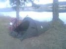
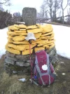
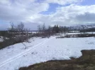
Another day of glorious weather and huge delight. 2km from my camping spot I saw bear tracks on the trail. They are out there somewhere! Several sets of moose tracks and droppings. One small lizard: must be hard work being a reptile at this latitude. Spring has recently arrived and I walked over several snow patches today - one knee deep. Mine were the only human tracks in the snow. Who knows when the last person walked this way?

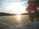
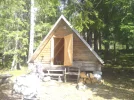
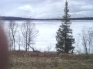
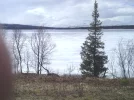
My room for the night is this beautiful cabin by Harrsjön lake, near Bräcke. The lake itself is still 95% covered in ice - moving slowly, groaning and creaking. The cabin is provided free for pilgrims about 3/4 of the way through a 40km section. I think the only one on the S:T Olavsleden. IMG_20160507_200949.webp IMG_20160507_133618.webp Such a lovely location that I stopped at 2pm today just to relax, wash, sunbathe and watch the sunset.
 
A selection of Camino Jewellery
@lovingkindness I did light a fire but a very small one. I am using a M-Kettle which is a 1/2 litre wood-fired water boiler.Burns small twigs and pine cones. My favourite toy :-)

I am in the chapel by St Olav's spring in Pilgrimstad. Great name for a village :-) Feeling good so no need for healing today. Spent last night at Revsunds Prästgård. Cannot recommend it highly enough for comfort and quality. Reuben is very involved in promoting and developing the Olavsleden and is a mine of information. Also a welcoming host. Breakfast was a banquet of local goodies - blueberry cheesecake one unlikely but delicious part!
 
Now in Östersund at the Boda Borg hostel right beside the trail at the south end of town. Conveniently less than 100m from a Lidl supermarket and with an excellent kitchen. This morning was cold and wet - the first poor weather so far. So I needed little excuse to stop at lunchtime for a half-day's rest, hot shower, warm bed, and the chance to resupply and stuff myself rigid on cheap fresh food. A 1.3 kg fresh chicken for 40SEK. Breasts fried for dinner tonight, legs and wings cooked for a gourmet picnic lunch somewhere tomorrow. Luxury :-)
 
Cold! For the second day the temperature has not reached double-figures and I have been walking head-on into a bitter NW wind. Today several short snow and hail showers added to the fun. I recommend the riding school at Wången for food and accommodation. Looking at its grand scale I'd assumed it would be expensive but it turned out to be quite modestly priced. 80 SEK for a substantial hot lunch, 350 SEK for a single room plus breakfast. All provided with quiet efficiency and a genuine warm welcome. Yesterday was the senior students' prom night and I chuckled a little at the incongruous scene as they gathered in the restaurant before their limos took them to Östersund: immaculately groomed and dressed Scandinavian youth in full ballroom finery while at the next table a dishevelled Scottish gnome gradually defrosted over salmon and mashed potatoes :-)

In a cafe in Mörsil, getting ready to head back out into the chill for a walk up the lake shore to Järpen.
 
Holoholo automatically captures your footpaths, places, photos, and journals.
...In a cafe in Mörsil, getting ready to head back out into the chill for a walk up the lake shore to Järpen.
Hi there, Bradypus. Any day now you will be arriving in Åre, a ski resort. I wonder if there will still be snow? If you find yourself in need of trail advice one of the priests at Åre gamla kyrka is familiar with the St Olaf's leden between Åre and Trondheim. [edited] I will PM you the details.

Perhaps you know this already: Duved is the last place one can purchase supplies before reaching Sul in Norway, approximately 2 days walk. I did it in 3. Pilgrims sometimes overnight at Moan, a farm on the right of the road, several hours before Skalstugen.

After Skalstugen, somewhere beyond the Swedish/Norwegian border marker, on the downward decent I noticed a three sided covered shelter with long bench and an outdoor fire place. It might be a good place to sleep. I've forgotten how long it took me to walk there from Skalstugen, I was fixating on multebaer and a herd of elk. The people at Skalstugen might know...

God tur!
 
Last edited:
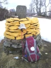
Quick update - phone battery low. I am now in Verdal. Crossing into Norway was interesting as the Swedish mountain section is still completely covered in snow - over 1m deep in places. Awkward without snowshoes. I camped near the border stone. The descent into Norway was far easier with only isolated snow patches. Spring much further on than in Sweden.
 
Ideal sleeping bag liner whether we want to add a thermal plus to our bag, or if we want to use it alone to sleep in shelters or hostels. Thanks to its mummy shape, it adapts perfectly to our body.

€46,-
The 2024 Camino guides will be coming out little by little. Here is a collection of the ones that are out so far.
It has been a great experience. Thank you to all who have sent me their good wishes and shared good advice with me for the journey. It has been good to walk with you.

Pax et bonum.
 
Perfect memento/gift in a presentation box. Engraving available, 25 character max.

❓How to ask a question

How to post a new question on the Camino Forum.

Featured threads

❓How to ask a question

How to post a new question on the Camino Forum.

Featured threads

Forum Rules

Forum Rules

Camino Updates on YouTube

Camino Conversations

Most downloaded Resources

This site is run by Ivar at

in Santiago de Compostela.
This site participates in the Amazon Affiliate program, designed to provide a means for Ivar to earn fees by linking to Amazon
Official Camino Passport (Credential) | 2024 Camino Guides
Back
Back
Top