• Remove ads on the forum by becoming a donating member. More here.

Search 74,075 Camino Questions

Strava heatmap

The focus is on reducing the risk of failure through being well prepared. 2nd ed.
Starngely beautiful images.
 
Thank you for the interesting article and the heat map showing the Camino.

It looks like there is more traffic on the Route Napoleon than the Valcarlos route and also more going down from the col to Roncesvalles by the trail than the road.
 
The 2024 Camino guides will be coming out little by little. Here is a collection of the ones that are out so far.
Jeff - thanks for posting, this is a fascinating illustration of a way in which the camino frances route is different from typical rural Spain.
BTW I just looked at parts of Donegal I know in NW Ireland. Practically all darkness there, except the beaches which are great smudges of light. Those power walkers have been laying their trail, goin' up and down, up and down...
cheers, tom
 
3rd Edition. More content, training & pack guides avoid common mistakes, bed bugs etc
It also shows that way too many people stay on the road out of O Pedrouzo. Grrrrr.
On the other hand, not a single bit of data on my street.

Can you clarify this? I'm doing my first Camino this spring but haven't gotten the guidebook I want to buy yet. Is there a more attractive option out of O Pedrouzo?
 
...and ship it to Santiago for storage. You pick it up once in Santiago. Service offered by Casa Ivar (we use DHL for transportation).
I would be happy to clarify, as this particular bit of the camino is a bit of a sore spot for me. Living in Santiago, and once upon a time having work near Arzua, I drove this stretch of road twice a day.

The town of O Pedrouzo is the last city of any size before Santiago and for many many pilgrims it is the last night before arriving. The crux of the problem is that the city isn't on the official camino in the strictest sense. It is 100m south of the camino.

The first trouble begins at the entrance to town where all day long pilgrims arrive to a junction with the N-547. Their options are to cross the N road and keep on the camino as it goes slightly north of town, or to turn left and follow the N road into town. Which way you should go depends entirely on where you are staying; for example the municipal albergue is the first building on your left when you follow the road. Other pensions may be closer to the official camino option. Adding to the confustion are 2 dozen accommodation signs doing their best to lure you to their property.

I should add now that following the camino into the forest to the north of town doesn't mean you miss the town. There is a road which connects it at the closest point and is only 100m (ish).

What this means is that everybody that stays the night in town needs to get back to the camino somehow. This is easy if you crossed the N-road because you know where the camino is and can just retrace your steps. However if you turned left to go into town you are left with the feeling that the road is the camino; and there are only 2 arrows indicating otherwise (on at the yellow correos box and another at the end of town which directs you to San Anton). These arrows are difficult to find and in the case of the latter arrow it is on the wrong side of the road for pilgrims who have been diligently abiding the Peatons on the Left signs.

Pilgrims who go back to the camino walk the "enchanted forest" portion of the camino, 3km or so to Amenal. Pilgrims who stay on the road walk the road. They walk with their back to the sun, and in the early morning oncoming traffic (I know) is staring into that sun. It is a recipe for disaster; already there have been fatalities at the start of town with so many pilgrims trying to cross the N-road (which is technically illegal outside of a crosswalk).

More arrows, and better directions by the albergue owners, could easily solve the problem.

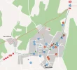
Attached is a map to illustrate the route. The circles are accommodation.Screen Shot 2018-01-31 at 07.39.24.webp
 
WisePilgrim - thanks, so nice to get a clear explanation. I didn't know you could cut up via San Anton, maybe try that next time..
I also notice:
- Quite a few people are taking the river route into Burgos, but looks like fewer than those taking the standard road route. Interestingly it looks like there are two points where people break off the main route (I always miss this!).
- Slightly more people taking the road route rather than the river walk after Fromista to Villasirga, on the way to Carrion (which is a shame as the river route is a lovely option)
- After Sahagun the El Burgo-Reliegos option is about eqaully popular as the recommended way via Calzadilla. But a significant amount of people are crossing over from the Calzadilla route where it comes close to Reliegos and taking the other route from there, which is a bit straighter into Mansilla.
- More people are taking the road out of Leon to Villadangos, on the way to Hospital de Orbigo, rather than the quieter (but slightly longer) route via Mazarife.
Of course these stats are incomplete as a record of pilgrim choices and open to many interpretations, one of which might be that fitbit-type users are more pragmatic than other pilgrims about taking the shortest routes to their required destination!
 
Thanks Wisepilgrim and Peregrino_Tom! All great stuff to first-timers like myself. Maybe this should be broken out into a separate thread called "Common first-timer route mistakes" or something like that. I'm sure many others would find it helpful.
 
3rd Edition. More content, training & pack guides avoid common mistakes, bed bugs etc
I would be happy to clarify, as this particular bit of the camino is a bit of a sore spot for me. Living in Santiago, and once upon a time having work near Arzua, I drove this stretch of road twice a day.

The town of O Pedrouzo is the last city of any size before Santiago and for many many pilgrims it is the last night before arriving. The crux of the problem is that the city isn't on the official camino in the strictest sense. It is 100m south of the camino.

The first trouble begins at the entrance to town where all day long pilgrims arrive to a junction with the N-547. Their options are to cross the N road and keep on the camino as it goes slightly north of town, or to turn left and follow the N road into town. Which way you should go depends entirely on where you are staying; for example the municipal albergue is the first building on your left when you follow the road. Other pensions may be closer to the official camino option. Adding to the confustion are 2 dozen accommodation signs doing their best to lure you to their property.

I should add now that following the camino into the forest to the north of town doesn't mean you miss the town. There is a road which connects it at the closest point and is only 100m (ish).

What this means is that everybody that stays the night in town needs to get back to the camino somehow. This is easy if you crossed the N-road because you know where the camino is and can just retrace your steps. However if you turned left to go into town you are left with the feeling that the road is the camino; and there are only 2 arrows indicating otherwise (on at the yellow correos box and another at the end of town which directs you to San Anton). These arrows are difficult to find and in the case of the latter arrow it is on the wrong side of the road for pilgrims who have been diligently abiding the Peatons on the Left signs.

Pilgrims who go back to the camino walk the "enchanted forest" portion of the camino, 3km or so to Amenal. Pilgrims who stay on the road walk the road. They walk with their back to the sun, and in the early morning oncoming traffic (I know) is staring into that sun. It is a recipe for disaster; already there have been fatalities at the start of town with so many pilgrims trying to cross the N-road (which is technically illegal outside of a crosswalk).

More arrows, and better directions by the albergue owners, could easily solve the problem.

Attached is a map to illustrate the route. The circles are accommodation.View attachment 39047
Finding my way to and through "The Enchanted Forest" was the only time I got lost on my first CF, in 2012. Signage was no better in 2017, but by then I knew what I was doing.
 

❓How to ask a question

How to post a new question on the Camino Forum.

Most read last week in this forum

Looking for recommendations. I dislike sleeping bags. I’m also not fond of sleeping bag liners. I own one of each and carried them on all my Camino's but I don't think I ever once slept in them...
Hi there! A few months ago, whilst doing first aid training our instructor mentioned that there were personal, one-use AED defibrillators on the market suitable for carrying in a back-pack. I...
Hallo, First of all - thanks to all of you in this warm and generous community. Every time I have had a question, I've found a thread where someone else asked the same question years ago and it...
While shopping this morning I noticed that Aldi's ski clothing special buys will include merino base layers, and zip and roll neck tops. Due in store this Thursday. I bought a merino top from them...
I will be doing the Camino Frances in May/June 2025. I’m trying to decide between Hoka Challengers and Merrill Accentors. The Challengers don’t seem to have a very robust sole as the middle part...

Featured threads

❓How to ask a question

How to post a new question on the Camino Forum.

Featured threads

Forum Rules

Forum Rules

Camino Updates on YouTube

Camino Conversations

Most downloaded Resources

This site is run by Ivar at

in Santiago de Compostela.
This site participates in the Amazon Affiliate program, designed to provide a means for Ivar to earn fees by linking to Amazon
Official Camino Passport (Credential) | 2024 Camino Guides
Back
Back
Top