Search 74,075 Camino Questions

Soto de luina to Cadavedo disused alternative

M

mikevasey

Guest
When I walked the above section in 2010, the hopitalero at the Soto de Luina albergue advised the pilgrims to go the road way and also to avoid the off road way, it being overgrown and poorly waymarked, being a good pilgrim I followed his advice and followed the road. However 3 pilgrims from Majorca got mixed up and went the not reccommended way, the Mountain Way, they later showed me their photos, they said it was hard but incredibly beautiful and waymarked. My day had not been that bad, but almost 23km on asphalt makes your feet sore and tender, I did have the advantage of being able every now and then to go into cafes, they did not. Since then every chance I get I look up this alternative route to see what is being said about it, most reviews seem to say it is doable, I recently saw the 2013 updated cicerone guide to the Norte and it advised pilgrims that it was not. To give some more balance to this I thought I would add this website I have just come across, it is in Spanish but can be translated into English www.xurdemoran.blogspot.co.uk/2014/06/el-camino-de-la-sierra-de-las-palancas.html
 
Ideal sleeping bag liner whether we want to add a thermal plus to our bag, or if we want to use it alone to sleep in shelters or hostels. Thanks to its mummy shape, it adapts perfectly to our body.

€46,-
¿Podría ser la etapa equivalente a Hospitales del Camino del Norte?. Salvando las distancias, claro.

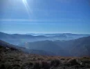
No hace mucho, estuve en la ermita de San Roque, nombrada en el blog, y te aseguro que las fotos no hacen justicia al paisaje que se ve desde ahí arriba. Pongo una fotos, aunque al ser echas con móvil, no van a decir verdad.

Could it be the equivalent stage Hospital of the Camino North ?. Relatively speaking, of course.

Not long ago, I was in the hermitage of San Roque, named in the blog, and I assure you that the photos do not do justice to the scenery you see from up there. I put a photo, but to be exclusively with mobile, they will not tell the truth.


Ermita de San Roque:

IMAG0295_zps5bc07515.jpg


IMAG0294_zps8d026e72.jpg


IMAG0292_zps4ac7c7db.jpg


IMAG0291_zps4fc795a7.jpg


IMAG0288_zps17948af6.jpg
 
I think its the unused Jewel of the Norte, its the historical route, a little hard , takes you in to the hills/ mountains overlooking the Asturias coast, is the entire routes highest point at around 720 metres, is on old cattle droving routes. I think there is a need for the road way, especially for people who can not walk long hard stages and also in bad weather, but not at the cost of the mountain way.
 
Last edited by a moderator:
Ideal pocket guides for during & after your Camino. Each weighs only 1.4 oz (40g)!
Y hablando de rutas históricas olvidadas, vuelvo a poner un reportaje del antiguo camino que, hasta no hace mucho, se utilizaba para pasar de Asturias a Galicia, ya que hasta hace 30 años no existía el puente que cruza la ría del Eo y que une Asturias y Galicia.
El camino , un poco antes de Tapia de Casariego, se dirigía hacia el interior pasando por las localidades de Tol (donde hay un albergue), Vegadeo, Abres (donde se pasa a Galicia) y Lourenzá, entre otras.

And speaking of historical routes forgotten I ever put a story of the old road, until recently, it was used to move from Asturias to Galicia, since until 30 years ago there was no bridge across the River Eo and linking Asturias and Galicia.
The road, shortly before Tapia de Casariego, heading inland through the towns of Tol (where a hostel) Vegadeo, Abres (where you pass Galicia) and Lourenzá, among others.


http://www.buscoenlaces.es/cosas_correos/historico.html

http://www.buscoenlaces.es/cosas_correos/vegadeo.html

Mejora de la señalización.

Improved signage.

http://www.buscoenlaces.es/cosas_correos/Campas.html

Saludos.
 
Last edited:
I think this route is 18-19 km long, 6-7km shorter than the lower level route BUT it is a very hard day, there is no facilities up there just hard walking in nature. There could be a side road up to the Ermtia that is in Angulero photos, so it may be possible to get picked up and dropped off again if the route appeals but seems to much in one go.
 
A selection of Camino Jewellery
Just a little hoof to let this years pilgrims see another option which is not in the English guides.
Thank you, Mike, I'm so glad I saw this thread. Last night I got the hard sell for the coastal route from Pepe, the very helpful hospitalaro in Soto de Luiña. Normally I would have automatically followed his advice, but having read the above, and it being an almost perfect autumn morning when I left today at 8am, the upper route beckoned. And I'm so glad it did. It was one of the best mornings of this camino (and there have been many very good ones). Up onto the ridge, a bit puffed, by 10am, with the sea down on one side and the inland hills on the other, just breathtakingly beautiful. The mójones at virtually every fork made getting lost almost impossible. The descent to San Pelayo was worse than the ascent, but nothing serious - and the only person I met all morning, a farmer on a handsome Lusitano, looking for his goats, kindly advised me to keep to the forest tracks, which come out at the same place, rather than take the now slightly overgrown camino.

All in all I really can't understand why they are trying to kill this option. To be taken with some care, and not in bad weather, but really nothing that any moderately fit walker should have a problem with.

DSC_0684.webp
 
Hi,

I did the Norte in 2011 and the hospitalero in Soto told us the same thing: don't try the "mountain way". I did try it, but found it too hard. I got exhausted because of the ups and downs. Then I came to a crossroad without any signs, or just one poorly visible arrow pointing,.. in another direction than what I could see in my guidebook. So I aborted the mission and took the first road to my right and just hoped to eventually get to the sea (or the road that goes along the sea) to take the other one, the "asphalt" option. Which I finally did. I passed the San Roque on my way, though. Does that mean I did the whole mountain way after all?? Cause I can see the San Roque Chapel on your pictures above.

According to the Eroski guide (in spanish, and it is one of the most used guides for those who read/speak spanish), "almost 100 %" of the pilgrims take the road and almost no one uses the mountain way anymore. They say that not even the Asociación of the Camino del Norte bothers to paint arrows or any other indications there anymore.

I agree it was beautiful but for me it was just too hard... :O(

/BP
 
Thank you, Mike, I'm so glad I saw this thread. Last night I got the hard sell for the coastal route from Pepe, the very helpful hospitalaro in Soto de Luiña. Normally I would have automatically followed his advice, but having read the above, and it being an almost perfect autumn morning when I left today at 8am, the upper route beckoned. And I'm so glad it did. It was one of the best mornings of this camino (and there have been many very good ones). Up onto the ridge, a bit puffed, by 10am, with the sea down on one side and the inland hills on the other, just breathtakingly beautiful. The mójones at virtually every fork made getting lost almost impossible. The descent to San Pelayo was worse than the ascent, but nothing serious - and the only person I met all morning, a farmer on a handsome Lusitano, looking for his goats, kindly advised me to keep to the forest tracks, which come out at the same place, rather than take the now slightly overgrown camino.

All in all I really can't understand why they are trying to kill this option. To be taken with some care, and not in bad weather, but really nothing that any moderately fit walker should have a problem with.

View attachment 22402
Hi, Alan, that looks very beautiful, and I wonder whether you recorded your GPS tracks because that would be one way people could find it. Someone needs to talk to Pepe! Buen camino.
 
The one from Galicia (the round) and the one from Castilla & Leon. Individually numbered and made by the same people that make the ones you see on your walk.
Hi, Alan, that looks very beautiful, and I wonder whether you recorded your GPS tracks because that would be one way people could find it. Someone needs to talk to Pepe! Buen camino.
I recorded the trail on wikiloc, which for some reason stopped working half way through, so the trail is described in 2 sections: Soto de Luiña to Busmarzo: 8 miles, 3 hours, 3000' of ascent; and then the downward bit, called "Soto de Luiña to Cadavedo part 2": 5 miles, 2200' of descent. 2.5 hours. If searching for the trail names doesn't work, they are also listed under my name (Alan Sykes).

Pepe is probably right 300+ days of the year, but by fluke I hit a day when taking the high road was absolutely glorious. And to answer bad pilgrim's question, taking the tarmac down past San Roque means you did about a third of the "mountain way". The arrows are now very faded but the old scallop mojónes are still in place.

And lots of water is important - there is none up there.
 
Having read Alan's post, I took the "Camino" (mountain) option this year, and I had a fantastic time. The route is indeed quite physically demanding--there are a lot of climbs in the first 2/3 of the walk and it concludes with a tricky descent--but the trail was totally fine and the waymarks were reliable. And the views? Wow, the views...

A few technical details: the route split occurs 1.3km after the albergue in Soto, immediately after the Hotel Cabo Vidío. The total distance to Cadavedo from Soto is roughly 21km, which involves a little backtracking at the end, as the route actually rejoins the "main" Camino just after Cadavedo. If you find that the route is too demanding, there is a bailout point, 9.37km from Soto. You can follow the paved road from there down to Ballota, and reconnect with the other route. Roughly 18km from Soto, the route crosses the N-632 and then joins a new dirt road. This was the most overgrown and muddiest stretch of the walk and I suspect some may prefer to just turn right on the N-632 and proceed straight into Cadavedo. This would trim a kilometer off the walk and save you some time and hassle. As noted above, there is no food or water on this route.

This route is roughly 2km longer than the road option. Also, for what it's worth, they've managed to get a good chunk of the "road" route off of pavement--roughly 8km's worth. I found that to also be an enjoyable walk, though I'm really enamored with the mountain approach.

I posted some pics on our Facebook page.
 
Perfect memento/gift in a presentation box. Engraving available, 25 character max.
Thank you Dave for having added this information on FB, and eventually on paper.
 
Ideal sleeping bag liner whether we want to add a thermal plus to our bag, or if we want to use it alone to sleep in shelters or hostels. Thanks to its mummy shape, it adapts perfectly to our body.

€46,-
There is the possibility of accommodation on this route while the Pandemic is on, a lady has very kindly offered to house up to a max of 3 pilgrims. Unfortunately for those of you who don't like facebook the link is on there.
 
This video should be watched by every pilgrim before arriving to Soto de Luiña, to be aware that there are two options to walk to Cadavedo, and I recommend the high route presented in the above video.

The first time I walked the national road option (mostly on asphalt) via Ballota, but the next time I chose the "mountain" option (which is the original Camino). It's beautiful, most of the time you're in the nature and the views are stunning. Although a kml/gpx/wikiloc track in your phone wouldn't hurt, as there is no one to ask for directions. And make sure to carry enough water for the entire stage. The only reason for not taking the high route would be a bad weather or physical limitations.
 
Last edited by a moderator:
Join the Camino cleanup. Logroño to Burgos May 2025 & Astorga to OCebreiro in June
I was glad to have had the forum’s alert when I arrived at Soto, so I was prepared to ignore all the negative commentary by the hospitalero. Someone told me that he had been the one to mark the non-mountain route, so maybe that explains his bias.

I walked the route with two others. It was a long day, no doubt about it, but oh so worth it. And by no means beyond the ability level of a strong walker. Nothing dangerous or technical involved.

The alternative is number 11 on this list I made up after walking the Norte for a second time, bound and determined to do what I could to avoid the asphalt:
 

❓How to ask a question

How to post a new question on the Camino Forum.

Most read last week in this forum

Planning on walking Norte-Primitivo starting about June 10, 2025. Are the albergues very busy at that time and also what will the weather be? I did this the end of August and September of 2017 and...

Featured threads

❓How to ask a question

How to post a new question on the Camino Forum.

Featured threads

Forum Rules

Forum Rules

Camino Updates on YouTube

Camino Conversations

Most downloaded Resources

This site is run by Ivar at

in Santiago de Compostela.
This site participates in the Amazon Affiliate program, designed to provide a means for Ivar to earn fees by linking to Amazon
Official Camino Passport (Credential) | 2024 Camino Guides
Back
Back
Top