Search 74,075 Camino Questions

Saint Jean Pied de Port to Roncesvalles in two days

Hiawatha

Active Member
Time of past OR future Camino
St Jean Pied de Port - Finisterra 2017
GR70 France 2018
Via Francigena 2019
Even though fit and used to walking long distances I am far too realistic to think that I can walk to Roncesvalles in one day without risking injury or strain . Jumping off an international flight and starting to walk the next day just screams eagerness induced injury to me . An overnight at Orisson is the obvious answer but my travel plans may fluctuate and flying from Australia allows for far too many variables to be able to make and use a firm booking .
The shuttle from Orisson back to SJdP sounds as if it is the most flexible of options . Am I right in believing that I could walk to Orisson then shuttle back to Sj and then return to Orisson the next morning ?
If so, is this something that must be booked in advance also ? If it is a casual hop on hop off service I would be very pleased . At the moment the plan is to walk starting in the second or third week of May 2017 .
Any advice and alternative suggestions would be most welcome ,
 
Last edited:
...and ship it to Santiago for storage. You pick it up once in Santiago. Service offered by Casa Ivar (we use DHL for transportation).
I haven't used this service, but have heard about it. The company you should contact is http://www.expressbourricot.com/. They get excellent reviews for their services. Their website says "Do you want to walk from St Jean Pied de Port to Roncesvalles in 2 days, but the refuge of Orisson is full? We have the solution." That is what you are looking for!
 
I am using Express Bouricot for my airport transfer from Biarritz on the 14/09. They do indeed provide a pickup up and drop off service from the Orrison as you have asked. At the moment I think it picks up at 1400 hrs at Orrison and sets off at 0830 from St Jean the following morning. Whether you have to pre book will be detailed in their website.
I booked my Camino only a few days ago and could not get into the Orrison for the 15/09 but could get into their sister venue the Kayola which is nearby. There are no meals at the Kayola but you can eat at the Orrison. Buen Camino
 
3rd Edition. More content, training & pack guides avoid common mistakes, bed bugs etc
Caroline at Express Bourricot is very reliable (I rode with her from Biarritz to SJPP), but consider instead to walk the Valcarlos route rather than the kerfuffle of shuttling back and forth. It seems much simpler. And it is very beautiful.

I understand that Valcarlos has an excellent albergue (I don't know directly, just what I read here--I walked to Roncesvalles in one day, so just passed through).
 
I would question your fear of injury by walking from St Jean to Roncesvalles in one day. It is eminently achievable and is not at all difficult. You are used to walking long distances, are fit, and so unless you suffer badly from jet lag I would have no hesitation at all in doing it.
 
I would agree with John Finn on this one. I have walked over that mountain many times and it is almost all road until you get to the top. The most difficult part, in fact, is the 400 meter descent down to Ronscesvalles. Just burns the quads! It is also possible to walk from SJPP all the way to Zibiri in one day, although it makes for a very long day of walking indeed!

Instead of the SJPP to Orisson to SJPP to Orisson route, why not just take an extra day in SJPP to rest before walking to Roncesvalles in one shot?
 
Get a spanish phone number with Airalo. eSim, so no physical SIM card. Easy to use app to add more funds if needed.
Hi Charles,
I have to agree with John Finn. I did St Jean to Roncesvalles in 1 day back in 2013. Fabulous day walking but towards the end it was a little tough on the legs especially the downhill section in the afternoon towards the end of this section. Walking poles were invaluable here. But what a start to our Camino. Getting to Orisson is relatively easy and a break for a coffee and getting on a fresh pair of socks. It would be a very short day walking and also back to St Jean to kill the rest of the day.

Really delighted we kept onwards and upwards with no going back. This is a day which will amaze you when you realize what you have just taken on and the atmosphere when you meet other pilgrims in the evening in Roncevalles. You can look back up that mountain and get more inspiration for the days ahead. Heading to start Camino Portugese in 2 weeks and already dying to be there !!
Buen Camino
Ger
 
Welcome Charles!

As an experienced long distance self sufficient backpacker, I agree that SJPdP to Roncesvalles in a day is more than doable but is it as enjoyable as strolling along, resting up at Orisson and then not being tired on the steep down into Roncesvalles? Hubby and I used to haul huge packs and long distances but really don't choose to do that anymore. It's not about fitness to us but a different way of journeying. Personal preference. You get to choose :rolleyes:

As an Aussie I can totally understand the brain fog after 27+ hours travelling across the planet (if you're lucky!). Also if you're used to long distance bushwalks, the unburdened and unbridled joy of NOT needing to carry all those litres/kilograms of water is indescribable :):D

My personal choice on a walk is not to backtrack (has got me into some strife occasionally) so perhaps look at availability at Orisson closer to your travel dates or consider the Valcarlos alternative route.
 
The first edition came out in 2003 and has become the go-to-guide for many pilgrims over the years. It is shipping with a Pilgrim Passport (Credential) from the cathedral in Santiago de Compostela.
The most difficult part, in fact, is the 400 meter descent down to Ronscesvalles. Just burns the quads!
Fabulous day walking but towards the end it was a little tough on the legs especially the downhill section in the afternoon towards the end of this section.
Ger

Currently the Pilgrim`s Office at SJPP emphatically does not recommend this descent. It is marked after Lepoeder pass with a big "X" in its map. Instead, it send us by the paved road to Ibañeta chapel, and a final, easy stroll by the forest. This paved road has almost no traffic. It is clearly signposted (see here in Google maps); you turn to your right. It adds a couple of km to the stage, but it is a easy walk, with pleasant views. It has some shortcuts cutting the loops, marked with the white and red stripes of the French GR paths.
Many pilgrims go anyway by the steep descent afer Lepoeder, either because of the tradition, the views, or because Roncesvalles seems (but only "seems") around the corner.
 
Last edited:
€2,-/day will present your project to thousands of visitors each day. All interested in the Camino de Santiago.
Even though fit and used to walking long distances I am far too realistic to think that I can walk to Roncesvalles in one day without risking injury or strain . Jumping off an international flight and starting to walk the next day just screams eagerness induced injury to me . An overnight at Orisson is the obvious answer but my travel plans may fluctuate and flying from Australia allows for far too many variables to be able to make and use a firm booking .
The shuttle from Orisson back to SJdP sounds as if it is the most flexible of options . Am I right in believing that I could walk to Orisson then shuttle back to Sj and then return to Orisson the next morning ?
If so, is this something that must be booked in advance also ? If it is a casual hop on hop off service I would be very pleased . At the moment the plan is to walk starting in the second or third week of May 2017 .
Any advice and alternative suggestions would be most welcome ,


OK ... well you could very well .. given your description of yourself .. walk the full day from St jean to Roncesvalles .... without difficulty .... OR you could take time to enjoy the journey .....
I too am travelling from OZ .... but maybe I am older ( does that mean wiser :) ... not necessarily ) .... have decided to enjoy the "Journey "whatever that may encompass ....
I am travelling via Valcarlos ... staying overnight ... probably could do it in one day ... BUT I am doing this to escape the hectic pace of my life so would seem counterproductive to rush :) ...

Napoleon way as other will advise ... either do in one day WEATHER PERMITTING ... OR stay overnight at Orisson or Hunto ... booking required ...

Final say ..... YOUR call.....

Cheers
Annie
 
Even though fit and used to walking long distances I am far too realistic to think that I can walk to Roncesvalles in one day without risking injury or strain . Jumping off an international flight and starting to walk the next day just screams eagerness induced injury to me . An overnight at Orisson is the obvious answer but my travel plans may fluctuate and flying from Australia allows for far too many variables to be able to make and use a firm booking .
The shuttle from Orisson back to SJdP sounds as if it is the most flexible of options . Am I right in believing that I could walk to Orisson then shuttle back to Sj and then return to Orisson the next morning ?
If so, is this something that must be booked in advance also ? If it is a casual hop on hop off service I would be very pleased . At the moment the plan is to walk starting in the second or third week of May 2017 .
Any advice and alternative suggestions would be most welcome ,


Ohh you are walking 2017 ... shall get back to you ... am leaving the land of OZ in two weeks ... via Paris > Bayonne > St Jean > Valcarlos ....... and beyond :rolleyes::eek::D.... hopefully ... will let you know

Annie
 
So many suggestions and good advice .
I turned sixty this May and I suspect that this and the shiny new ' Senior's card ' that arrived in the mail is playing havoc with my confidence .
I suspect I will do as I have done most of my life , jump in and do it .
Thanks for the replies .
 
Train for your next Camino on California's Santa Catalina Island March 16-19
Currently the Pilgrim`s Office at SJPP emphatically does not recommend this descent. It is marked after Lepoeder pass with a big "X" in its map. Instead, it send us by the paved road to Ibañeta chapel, and a final, easy stroll by the forest. This paved road has almost no traffic. It is clearly signposted (see here in Google maps); you turn to your right. It adds a couple of km to the stage, but it is a easy walk, with pleasant views. It has some shortcuts cutting the loops, marked with the white and red stripes of the French GR paths.
Many pilgrims go anyway by the steep descent afer Lepoeder, either because of the tradition, the views, or because Roncesvalles seems around the corner.
It may be clearly signposted but the first time when I came down the hill, I couldn't see the arrow that points to the right. After I passed the signpost and stopped again, I looked back up at the signpost and realized there was an arrow to the right. It took me a while to figure it out. The second time, three years later, I stood by the sign directing people to the right for over a half hour (I was waiting for someone to catch up to me.) Even with me pointing out the arrow, people still weren't sure that they were headed in the correct direction. Some people still went straight and on a rainy, foggy day, they had a rough trip down the mountain. I think that area could use better signage.
 
That shiny new 'Seniors Card' gets us free and subsidised public transport here in South Australia and takes us out or brings us back from many unscheduled training walks. Really helps the confidence ;)
 
It may be clearly signposted but the first time when I came down the hill, I couldn't see the arrow that points to the right. After I passed the signpost and stopped again, I looked back up at the signpost and realized there was an arrow to the right. It took me a while to figure it out. The second time, three years later, I stood by the sign directing people to the right for over a half hour (I was waiting for someone to catch up to me.) Even with me pointing out the arrow, people still weren't sure that they were headed in the correct direction. Some people still went straight and on a rainy, foggy day, they had a rough trip down the mountain. I think that area could use better signage.

Sorry to hear that...I only can say that, after some old pilgrims, being lost (or fearing to be lost) used to be part of the Camino experience. But I am not sure if it is actually a "good part".
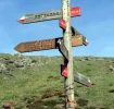
Well, I browsed again my photos, and I believe this is the Lepoeder signpost. Maybe other forum members have photos from the other side.
You are right, it could be clearer. It is marked as "alternativa suave" (literally, "soft alternative"). It should have read (imho): "Ibañeta", which is the generally recognised name for this alternative.
In the map given by the Pilgrims' bureau it was better indicated.
Anyway, I think the general rule to the Ibañeta alternative is that you follow the paved road to your right, and down the valley. There are white and red stripes marks on wooden posts along the road, because it is a GR (grand randonnée) path. This may be unnoticed by walkers not used to this convention. As further indication, in the first kms the Roncesvalles abbey is sometimes seen at the left.

Alternativa suave.webp
 
Last edited:
A selection of Camino Jewellery
It may be clearly signposted but the first time when I came down the hill, I couldn't see the arrow that points to the right. After I passed the signpost and stopped again, I looked back up at the signpost and realized there was an arrow to the right. It took me a while to figure it out. The second time, three years later, I stood by the sign directing people to the right for over a half hour (I was waiting for someone to catch up to me.) Even with me pointing out the arrow, people still weren't sure that they were headed in the correct direction. Some people still went straight and on a rainy, foggy day, they had a rough trip down the mountain. I think that area could use better signage.
That was my experience too. It simply was not obvious which was the preferred route. If I remember correctly, the path down (to the left) looked more well trodden and appeared to be the "main" route. I have done both, and the steep one is not so terrible, either, at least on a nice day.

I will repeat my mantra, that the SJPP-Roncesvalles day is do-able for anyone who is modestly fit, if they:
  1. Have tested their shoes and loaded backpack on at least one 20-km walk, preferably 2 days in a row.
  2. Keep backpack weight to 7-8 kg total with water; send half of that ahead in a different bag (wear your good pack) you are walking from SJPP to Roncesvalles on Day 1.
  3. Use 2 walking sticks.
If you skip any one of those 3 points, you might be creating trouble for yourself.
 
@Felipe - your picture appears to be taken from below the signpost - looking back at it. That's the problem with the sign. You have to walk past it and then turn around and read it. But the trail goes past the signpost and there is another camino stone marker straight ahead, showing the steep route down. So some people don't stop and turn around to see that the trail goes off to the right. If the pilgrim office really wants to close the steep route, it would help if they changed the trail markers in that area. I think we both agree about the alternate route, I was just suggesting that another reason people keep taking the steep route is the markings are not clear. You certainly will have helped new pilgrims on this forum, by showing them the sign to watch for!
 
i embraced the 10km walk straight up napoleon route but was so glad i had a reservation at orrisson. i would see if there is accommodation or take the valcarlos route in two....ease into your camino..you can haul ass when your camino legs are well broken in...aka the meseta
 
A selection of Camino Jewellery
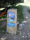
@Felipe - your picture appears to be taken from below the signpost - looking back at it. That's the problem with the sign. You have to walk past it and then turn around and read it. But the trail goes past the signpost and there is another camino stone marker straight ahead, showing the steep route down.

Exactly. I was quite tired, so I sat under the trees for a while -after the signpost, as you rightly deducted. And I was looking for this variant, too.
The stone marker indicates toward the forest descent, as you mention, and it is more well trodden, so it looks as the main way.
To follow the Ibañeta road, we actually have to let this stone marker behind us, going by the path seen in the photo. After a very short distance, it connects with the paved road.
And yes, someday I'd like to reach Roncesvalles by the forest descent, if I find a good day, with dry paths.
 

Attachments

  • Lepoeder-marker.webp
    Lepoeder-marker.webp
    166.5 KB · Views: 25
The shuttle from Orisson back to SJdP sounds as if it is the most flexible of options . Am I right in believing that I could walk to Orisson then shuttle back to Sj and then return to Orisson the next morning ?
If so, is this something that must be booked in advance also ? If it is a casual hop on hop off service I would be very pleased . At the moment the plan is to walk starting in the second or third week of May 2017 .
Any advice and alternative suggestions would be most welcome ,

There is simpler option - walk the lower trail and stop overnight in Valcarlos. The trek from SJPP to Valcarlos is not too taxing and the albergue in Valcarlos shouldn't require a reservation. Then strike out from there on your second day. The Valcarlos-Roncesvalles stretch is challenging enough. (If I was walking this route again I would keep walking through Roncesvalles to the next albergue. The Roncesvalles albergue is a new building with all the facilities, but it is noisy. The bunks are located in cubicles, open at the top, in large, long rooms, with bathrooms at the end. The result is that whenever someone walks to the bathroom, the noise from their flip-flops reverberates throughout the room - no problem if you are a sound sleeper, but it kept waking me up.)
 
Currently the Pilgrim`s Office at SJPP emphatically does not recommend this descent. It is marked after Lepoeder pass with a big "X" in its map. Instead, it send us by the paved road to Ibañeta chapel, and a final, easy stroll by the forest. This paved road has almost no traffic. It is clearly signposted (see here in Google maps); you turn to your right. It adds a couple of km to the stage, but it is a easy walk, with pleasant views. It has some shortcuts cutting the loops, marked with the white and red stripes of the French GR paths.
Many pilgrims go anyway by the steep descent afer Lepoeder, either because of the tradition, the views, or because Roncesvalles seems around the corner.
For me, the Ibaneta route was not clearly signposted in 2015. I was looking but never saw a definitive sign. I found the route because there were some Spanish pilgrims sitting at the intersection, who knew the way. As others have said, the steep route is the one that goes straight and appears to be the main route because it is so well trodden. It is beautiful, but "this paved route has almost no traffic" because it is difficult to recognize!
 
Join the Camino cleanup. Logroño to Burgos May 2025 & Astorga to OCebreiro in June
I went down the forest path as well thinking and heeding the pilgrims office request that I use it but I went down the steepness and beauty of the woods. I love how the Camino itself takes u in non logical turns and outcomes..
 
I've done the Napoleon twice (2013 & 2015) and Valcarlos once (2014). Both times, overnight at Orisson, and did both descents. (don't forget Kayola) The steep one to the left that is not recommended, is doable IF you have trekking poles and use them, it is GOOD weather and not muddy, and you are not fatigued, ill, or hurting! But it IS beautiful and quiet thru the old beech forest!! I found the descent by the road long and tiresome - but with beautiful views.
If going by Valcarlos, the first day is beautiful! And Arneguy is a fine place to stop for food, beverage and/or rest. In Valcarlos, the next morning, I failed to have a decent breakfast and found the second climb almost impossible due to insufficient energy. On reflection, however, that 2nd day route was also beautiful - up thru the beech forest, and not all that difficult. It seemed to me that coming down from Ibañeta to Roncesvalles was almost as hard on my knees as coming down from Lepoeder to Roncesvalles. Next time, I'll go by Valcarlos and take the road from Ibañeta - and make sure I have a good breakfast & carry sufficient food and water for the whole day. We may run into each other - I'll be starting from SJPP about the same time you will.
But, Charles, I'm 10 years older than you. You will have no problems walking either way in one or two days - but don't hurry - it's all too wonderful to hurry!
Buen Camino!
 
So many suggestions and good advice .
I turned sixty this May and I suspect that this and the shiny new ' Senior's card ' that arrived in the mail is playing havoc with my confidence .
I suspect I will do as I have done most of my life , jump in and do it .
Thanks for the replies .

I turn 60 on Camino .... Jumping in and just doing it sounds good to me ..... That or die in a nursing home .... Fairly easy decision

Anne
 
Join the Camino cleanup. Logroño to Burgos May 2025 & Astorga to OCebreiro in June
I just cancelled my Camino after 3 days. I developed a pinched erve in my left leg.

My first day saw all I could accomplish, taking 9 hours to make it to Orrison. I pleaded my case, unable to walk another step and advise that I would wait for a cancellation or a no show, or sleep outside the window beside me. I was booked in immediately. This was great news as some of my new friends were passing me, going downhill to the Orrison overflow dorm.

Next day, I was recommended to forward my pack to Roncesvalles, take a sandwich and take a cab the first 8 km from Orrison to the Cross, where the path leaves the road. That would mean reaching Spain in 10 km. This is what I did.

With a light day pack, I made it to Cize Pass fairly easily but then I made a mistake, one that most made that day. DO NOT TAKE THE LEFT PATH to Roncesvalles. Take the right path. It is in the papers that you receive at the Pilgrim Office in SJPP. Problem with me is I did not see it till suppertime in Roncesvales. The pitch downhill was like a doul=ble black diamond ski slope.

But for me, my nemesis came about 7 km from Zubiri on that third day. The shooting, immediate shreaking pain in my leg froze me to s single spot. I was on a downhill piece, just before a creek. I stopped for a half hour. When it felt I could move, I rose above the creek to the road and an interpretive map / sign. I could see the Camino path started off road again about 30 m away. But I was still quite hot and took shelter behind the sign, leaning against the post.

With my head down and feeling slightly better, I heard a woman's voice in Spanish. It repeated. Looking up, it was a supervisor of the road crew working in the creek structure. She was asking if I wanted a ride to Zubiri. She said, what I could understand, my face es roja (red). It concerned her quite a lot. It was when I accepted that ride that I knoew my Camino was over, for now.

What did I learn?

No amount of conditioning will prepare you unless you are a marathon runner. The best pack weight is no pack weight. hen I return, no tent, no sleeping bag, just a bag liner. Nothing mre than needed. Nothing. My bag objective is now 8 lb not including what I am wearing.

Finally, I would be remiss if I did not mention the Angels I met in that short time. Michael and Jan from Germany, Bessie, Margaret, Heiki and Doder from Denmark, Eric from Australia, Andy, Noel from Toronto, Sven from Denmark, the Spanish fellow who got me back on my feet just before Huunto. There are more whose names I never received, especially the lady who took me to Zubiri, pointed out the hospital and dropped me off at the Albergue Municipale.
 
The 2024 Camino guides will be coming out little by little. Here is a collection of the ones that are out so far.
Take a big breath! And another deep one ... and another ... and another. Now drink a big glass of something tasty (non-alcoholic or alcoholic, just treat yourself to something nice). Plan in a good evening meal, sort out a place to stay for a few days and rest. And THEN after those rest days make the decision if you really want to stop your Camino or carry on. Never decide things like this in a rush ;-) Buen Camino, SY
 
I just cancelled my Camino after 3 days. I developed a pinched erve in my left leg.

My first day saw all I could accomplish, taking 9 hours to make it to Orrison. I pleaded my case, unable to walk another step and advise that I would wait for a cancellation or a no show, or sleep outside the window beside me. I was booked in immediately. This was great news as some of my new friends were passing me, going downhill to the Orrison overflow dorm.

Next day, I was recommended to forward my pack to Roncesvalles, take a sandwich and take a cab the first 8 km from Orrison to the Cross, where the path leaves the road. That would mean reaching Spain in 10 km. This is what I did.

With a light day pack, I made it to Cize Pass fairly easily but then I made a mistake, one that most made that day. DO NOT TAKE THE LEFT PATH to Roncesvalles. Take the right path. It is in the papers that you receive at the Pilgrim Office in SJPP. Problem with me is I did not see it till suppertime in Roncesvales. The pitch downhill was like a doul=ble black diamond ski slope.

But for me, my nemesis came about 7 km from Zubiri on that third day. The shooting, immediate shreaking pain in my leg froze me to s single spot. I was on a downhill piece, just before a creek. I stopped for a half hour. When it felt I could move, I rose above the creek to the road and an interpretive map / sign. I could see the Camino path started off road again about 30 m away. But I was still quite hot and took shelter behind the sign, leaning against the post.

With my head down and feeling slightly better, I heard a woman's voice in Spanish. It repeated. Looking up, it was a supervisor of the road crew working in the creek structure. She was asking if I wanted a ride to Zubiri. She said, what I could understand, my face es roja (red). It concerned her quite a lot. It was when I accepted that ride that I knoew my Camino was over, for now.

What did I learn?

No amount of conditioning will prepare you unless you are a marathon runner. The best pack weight is no pack weight. hen I return, no tent, no sleeping bag, just a bag liner. Nothing mre than needed. Nothing. My bag objective is now 8 lb not including what I am wearing.

Finally, I would be remiss if I did not mention the Angels I met in that short time. Michael and Jan from Germany, Bessie, Margaret, Heiki and Doder from Denmark, Eric from Australia, Andy, Noel from Toronto, Sven from Denmark, the Spanish fellow who got me back on my feet just before Huunto. There are more whose names I never received, especially the lady who took me to Zubiri, pointed out the hospital and dropped me off at the Albergue Municipale.
I will add a prayer for your return.
Keith
 
Even though fit and used to walking long distances I am far too realistic to think that I can walk to Roncesvalles in one day without risking injury or strain . Jumping off an international flight and starting to walk the next day just screams eagerness induced injury to me . An overnight at Orisson is the obvious answer but my travel plans may fluctuate and flying from Australia allows for far too many variables to be able to make and use a firm booking .
The shuttle from Orisson back to SJdP sounds as if it is the most flexible of options . Am I right in believing that I could walk to Orisson then shuttle back to Sj and then return to Orisson the next morning ?
If so, is this something that must be booked in advance also ? If it is a casual hop on hop off service I would be very pleased . At the moment the plan is to walk starting in the second or third week of May 2017 .
Any advice and alternative suggestions would be most welcome ,

You are traveling a long distance so why not spend a night in SJPdP before beginning your walk. It is a delightful town. I have stayed there at Beilari twice and met the most wonderful people that became part of my Camino family. Both times I also stayed in Orisson which was also a wonderful experience. I would make a reservation and if you can't make it, just donate it and go to plan B. Most pilgrims I met were either glad they had stayed in Orisson or wished they had. Keep in mind that if you do decide to walk the entire way to Roncevalles it is very possible the albergue will be full. It was both times I walked (spring and fall). You can make a reservation at Roncevalles also.
One other thing to remember is that everyones walk is different. In the fall I had beautiful weather, but in the spring we had a 65mph head wind that made walking almost impossible. I can't imagine having to walk the entire route in those conditions.
The best advice I was given was "to start like an old woman and I would finish like a young one." This certainly worked for me and my friends. So my advice would be not to rush the first week and make it up later if needed.
 
Last edited:
3rd Edition. More content, training & pack guides avoid common mistakes, bed bugs etc
A marvellous piece of advice Susan .
"to start like and old woman and I would finish like a young one."
This is something I am going to suggest to some of the newer fellows that come bushwalking with us on occasion . It is sometimes difficult to rein them in , a little like an enthusiastic pup that strains at the leash .
Thank you .
 
Hello Charles
I did a week if the Camino France's this summer. As a mere 51 year-old but very generously proportioned I too was very concerned about the first days walk - too much for me I thought. Stayed overnight at StJPdP and had booked at Orrison. Set off nice and early, got to Orrison at 10.00 a.m. Couldn't countenance a day of idleness from thereon. Carried on the rest of the way and got in reasonably well. If you're not 100kg you should be able to skip it!
Buen Camino cobber.
 
Ideal sleeping bag liner whether we want to add a thermal plus to our bag, or if we want to use it alone to sleep in shelters or hostels. Thanks to its mummy shape, it adapts perfectly to our body.

€46,-
Stay at the Albergue in Orisson. They have a wonderful dinner and you will meet pilgrims who will become very good friends over the days following on the pilgrimage.
You must book in advance.
 
If so, is this something that must be booked in advance also ?

To answer your question, yes. You must book ahead for the shuttle service. They only have a certain number of seats, their office is almost next door to the pilgrims office.
 
Even though fit and used to walking long distances I am far too realistic to think that I can walk to Roncesvalles in one day without risking injury or strain . Jumping off an international flight and starting to walk the next day just screams eagerness induced injury to me . An overnight at Orisson is the obvious answer but my travel plans may fluctuate and flying from Australia allows for far too many variables to be able to make and use a firm booking .
The shuttle from Orisson back to SJdP sounds as if it is the most flexible of options . Am I right in believing that I could walk to Orisson then shuttle back to Sj and then return to Orisson the next morning ?
If so, is this something that must be booked in advance also ? If it is a casual hop on hop off service I would be very pleased . At the moment the plan is to walk starting in the second or third week of May 2017 .
Any advice and alternative suggestions would be most welcome ,
Hi
I am have the same question so I am reading too. I plan to start begin may 2017, can't wait go back to the Camino, new route .
Buen Camino !
 
Get a spanish phone number with Airalo. eSim, so no physical SIM card. Easy to use app to add more funds if needed.
I've done the Napoleon twice (2013 & 2015) and Valcarlos once (2014). Both times, overnight at Orisson, and did both descents. (don't forget Kayola) The steep one to the left that is not recommended, is doable IF you have trekking poles and use them, it is GOOD weather and not muddy, and you are not fatigued, ill, or hurting! But it IS beautiful and quiet thru the old beech forest!! I found the descent by the road long and tiresome - but with beautiful views.
If going by Valcarlos, the first day is beautiful! And Arneguy is a fine place to stop for food, beverage and/or rest. In Valcarlos, the next morning, I failed to have a decent breakfast and found the second climb almost impossible due to insufficient energy. On reflection, however, that 2nd day route was also beautiful - up thru the beech forest, and not all that difficult. It seemed to me that coming down from Ibañeta to Roncesvalles was almost as hard on my knees as coming down from Lepoeder to Roncesvalles. Next time, I'll go by Valcarlos and take the road from Ibañeta - and make sure I have a good breakfast & carry sufficient food and water for the whole day. We may run into each other - I'll be starting from SJPP about the same time you will.
But, Charles, I'm 10 years older than you. You will have no problems walking either way in one or two days - but don't hurry - it's all too wonderful to hurry!
Buen Camino!
Hi,
Which way do you recommand for a starter to Roncevalle? Walk from SJPP tot Valcarlos and then how further?
 
Hi,
Which way do you recommand for a starter to Roncevalle? Walk from SJPP tot Valcarlos and then how further?
To be honest, I can't really recommend one over the other! The Napoleon, in good weather, is fabulous! As The pilgrim Office will advise, DO NOT GO THAT WAY IF THE WEATHER IS BAD! The first day to Orisson can be tough - up hill for 5 mi/8 km. The 2nd day is more gradual up AFTER the initial km or 2. The Valcarlos route is very nice from SJPP to Valcarlos. This year I did not continue on foot after Valcarlos - there were no other pilgrims the day I walked, none at the albergue, and I didn't want to be alone on the highway nor on the two trails that went up thru the forests! I took a taxi to Roncesvalles.
Please go back and re-read @Susan Peacock - her advice is excellent!
Buen Camino!
 
Whilst I have read just about everything there is on the best way to tackle that first day, the best advice came from this forum and from my experiences on Mt Kili - pole pole (slowly slowly). So I am intending to stop at Orisson - even if it is a short day and then hopefully to walk through Roncesvalles to some place 3 or 5 km further - just avoid the Brierley stages.

BTW - can someone recommend a luggage transport company (from St Jean). I will have an extra bag that I intend to send to Pamplona and then when I arrive there do any "repacking" load-lightening and send this extra bag to Ivar. I will have a hotel in Pamplona to send the bag too. Thanks
 
Last edited:
Join the Camino cleanup. Logroño to Burgos May 2025 & Astorga to OCebreiro in June
Hi,
Which way do you recommand for a starter to Roncevalle? Walk from SJPP tot Valcarlos and then how further?
I have done both; by Valcarlos in two stages (not difficult); and Napoleon all the way from SJPP (tough, but doable for almost everybody).
Both ways are good. Valcarlos was pleasant and quiet, even lonely (which I liked).
The Napoleon has magnificent views and yes, there is "something" special about it. It is also really crowded, you walk with people before and behind you, all the time.
You don' t mention when are you intending to walk. It is an important factor to consider, too.
Buen camino!
 
I think people planning to cut the route into two parts (for what ever reason) should absolutely do so. I also think many who should spend two days crossing do not and then start talking from Zubiri onward how much problems they are having with their feet, knees, and back, and then start taking pictures of their blisters. There is a reason there is lodging available on both routes.

which one is a matter of taste and/or distance. I've heard great things about the beauty of both. I've heard great things about places to sleep on both. I myself wanted to spend the night at Orisson but impending bad weather changed my plans. I saw nothing to gain by walking the whole distance rather than splitting it up, and many on this forum said Orisson was not to be missed. talkiing with pilgrims who spent the night on valcarlos i now think there are great places there as well.

Walking Napoleon divides the walk roughly into 1/3 and 2/3 with a much steeper climb initially and through out most of the climb. You also eventually go higher than Roncesvalles and so have a descent. I missed the turn to the right (and was looking for it because I wanted to see the chapel)--I admit the weather was not optimal at that point; I did not enjoy the alternate descent and was grateful for my hiking poles. I'm sure it's nicer with nice weather--and it was not predicted to be bad when I walked. April is not a predictable month.

On Valcarlos the distances are more evenly divided, and there is less of a climb especially the first day and most of the second (but it is still upward the whole way)---however you still must eventually reach Roncesvalles so there is a very steep (relative to the rest) climb at the end. Of course, at the end of two days of walking this may be preferable to the steep climb immediately on the first day on the Napoleon.
 
I think most injures comes not from the long trek from SJPP, but from the steep final descent. Apparently, it could be slippery, walkers are tired and Roncesvalles seems around the corner. But my evidence is anecdotical.
I walked all the way from SJPP, and turned right in Lepoeder to take the Ibañeta variant. No problem at all; but again, this is anecdotical.
 
Perfect memento/gift in a presentation box. Engraving available, 25 character max.
I have done both; by Valcarlos in two stages (not difficult); and Napoleon all the way from SJPP (tough, but doable for almost everybody).
Both ways are good. Valcarlos was pleasant and quiet, even lonely (which I liked).
The Napoleon has magnificent views and yes, there is "something" special about it. It is also really crowded, you walk with people before and behind you, all the time.
You don' t mention when are you intending to walk. It is an important factor to consider, too.
Buen camino!
Thank you! I consider to walk begin may.
 
I agree the steep descent probably causes acute injuries (strains and sprains), but I don't think everyone (or even the majority) who complain about injury walked that route. Walking a long distance when you are not accustomed to it greatly increases your risk of injury vs walking a shorter distance. I do not think we do anyone any favors when we encourage those who may not be ready for a long walk the first day, or know they will be tired/jet-lagged to 'just do it'.
 
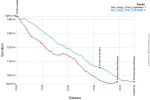
I didn't walk the Napoleon Route but from map data there does not seem to be much difference between the average steepness between the two routes down from Col Lepoeder. The road route through Puerto de Ibañeta is is blue below and the trail route is in blue. I've been told that the trail route can be slippery though.
two-ways.webp
 
Train for your next Camino on California's Santa Catalina Island March 16-19
I didn't walk the Napoleon Route but from map data there does not seem to be much difference between the average steepness between the two routes down from Col Lepoeder. The road route through Puerto de Ibañeta is is blue below and the trail route is in blue. I've been told that the trail route can be slippery though.
View attachment 29555
another urban myth debunked! I've only done the trail route but it was not fun in snow. I don't know how much fun the other way would be in snow, either. I was just sad to miss the chapel.
 
Is the 'trail' you mention the descent through the forest? If it is, then the other way is much less steep!
I've done the forest path twice, in good weather (the first time by mistake :rolleyes:) . This time (last June), there was no visibility, it had been raining and there was no way I wanted to go down that path! I found the 'road' much easier and very pleasant actually :)
yes, it is, and I did it in a snow storm. I recall being warned it was steep in the Pilgrims Office, and it was never my intention to be on it (if for no other reason, I wanted to see the chapel on the road) BUT numbers generally don't lie, and see the graph by @Rick of Rick and Peg above...it appears the way to the right is just as steep a descent. Perhaps the surface changes the feel.

edit: it may also be the first section of descent on the trail IS steeper, and this is what sets your memory of the entire distance
 
Holoholo automatically captures your footpaths, places, photos, and journals.
Ah well, I may be talking about another route... It starts on the road? And it's quite a bit longer as it zigzags around...
Definitely less steep, in my experience anyway, but hey, we all differ :)
 
certainly if the road zig-zags it will make the change in altitude feel less...I know it is praised as less steep and less hazardous. If I could have found it I definitely would have taken it.
 
Funny how our perceptions differ even when only one person is concerned... The first time I found the 'woodland' path exhilarating, I had NOT meant to take it but once on it I was very happy, there was dappled sunshine coming through the leaves, it was beautiful and what's more I had survived the climb from St Jean! :D
The 2nd time I chose to go down that way, again it was a beautiful Summer day. Well, I thought it was tedious and went on for ever :oops:

Last Summer because of the rain and the fog I definitely avoided it. I regularly walk in the UK, in woodland and in the English weather, on waterlogged, slippery forest paths :eek: :D

Anyway, I do recommend that other road if the weather is at all iffy, I loved it.
 
3rd Edition. More content, training & pack guides avoid common mistakes, bed bugs etc
If the pilgrim office really wants to close the steep route, it would help if they changed the trail markers in that area.
Actually... The pilgrim's office don't "want" anything, they inform, suggest and warn. It's a branch of a French association working with volunteers, which main purpose is to welcome and advise pilgrims on their first steps on the Camino.
Both routes exist and it's possible to chose either one to reach Roncevalles: the steep one may be the original route and the other one an alternative... I guess the pilgrim's office's suggestion is to save people the trouble to go by a more difficult route? This particular post (on the pic) is in Spain, so under Spanish associations/people's responsibility. Marking on the Camino is very territorial: mind the various king of marking from one province to the other :)
Up to everyone to get information, make choices, stay alert (to find the right makers ;) ) and follow the path they prefer!
Buen Camino!


full
 
I did mention that the AVERAGE slope of both ways was about the same but the trail through the woods does have more variability. The link below shows Open Street Map's interactive map of the area around Col Lepoeder. The road to Puerto de Ibañeta is NA-2033 going west. The trail/piste through the woods heads south.
http://www.openstreetmap.org/#map=16/43.0250/-1.2973
I think if you look closely you can still see the marks made by my bottom when I slipped at that first cut back on the forest trail:eek::oops:
 
The focus is on reducing the risk of failure through being well prepared. 2nd ed.
I didn't walk the Napoleon Route but from map data there does not seem to be much difference between the average steepness between the two routes down from Col Lepoeder. The road route through Puerto de Ibañeta is is blue below and the trail route is in blue. I've been told that the trail route can be slippery though.
View attachment 29555
I think the forest trail to Roncesvalles is shorter, so steeper.
 
Even though fit and used to walking long distances I am far too realistic to think that I can walk to Roncesvalles in one day without risking injury or strain . Jumping off an international flight and starting to walk the next day just screams eagerness induced injury to me . An overnight at Orisson is the obvious answer but my travel plans may fluctuate and flying from Australia allows for far too many variables to be able to make and use a firm booking .
The shuttle from Orisson back to SJdP sounds as if it is the most flexible of options . Am I right in believing that I could walk to Orisson then shuttle back to Sj and then return to Orisson the next morning ?
If so, is this something that must be booked in advance also ? If it is a casual hop on hop off service I would be very pleased . At the moment the plan is to walk starting in the second or third week of May 2017 .
Any advice and alternative suggestions would be most welcome ,

This July I walked from Sj to Orisson, spent the night there, very enjoyable, then walked on to Roncesvalles for night #2. My fitness is medium level and it was a great start to my Camino.
 
The one from Galicia (the round) and the one from Castilla & Leon. Individually numbered and made by the same people that make the ones you see on your walk.
This July I walked from Sj to Orisson, spent the night there, very enjoyable, then walked on to Roncesvalles for night #2. My fitness is medium level and it was a great start to my Camino.
Hi William,
How was your walk to Roncevalles? How many hours did it take you and was it doable? I Will do it the same way I think, in 2 stages.
 
I would question your fear of injury by walking from St Jean to Roncesvalles in one day. It is eminently achievable and is not at all difficult. You are used to walking long distances, are fit, and so unless you suffer badly from jet lag I would have no hesitation at all in doing it.
I went from St Jean to Roncesvalles in one day last May and I am 62 with Parkinsons disease - if I can do it, so can you! Just tack it easy, it's not a race, and enjoy the view! Buen Camino
 
If so, is this something that must be booked in advance also ?

To answer your question, yes. You must book ahead for the shuttle service. They only have a certain number of seats, their office is almost next door to the pilgrims office.
 
Ideal sleeping bag liner whether we want to add a thermal plus to our bag, or if we want to use it alone to sleep in shelters or hostels. Thanks to its mummy shape, it adapts perfectly to our body.

€46,-

❓How to ask a question

How to post a new question on the Camino Forum.

Most read last week in this forum

Ok so ... this past spring (2024) I decided to walk the "lower" route into Pamplona and became really lost. I just keep thinking about it and it really bugs me. Where did I go astray? At the...
Hi fellow wanderers, I would like a bit of input on this one please. I have finally decided to revisit the Camino Frances next year. I walked SJPDP to Santiago solo in 2016 and walked from...
I asked the tourist office for information about the statue of the pilgrim at the entrance to Carrión de los Condes. Here is their reply. auto-translated: "The Monument to the Pilgrims" is a...
I understand that footwear on the Camino is a personal choice. I will start my first Camino on the Camino Frances in the first part of April. With the varying weather conditions, what...
Hello. Earlier this year I saw photos of the streets being decorated for Corpus christi and I'm thinking that when I do my next camino, probably 2026, that it would be nice to help with the...
Hello, I am looking to continue a segment of the Camino Frances, that I started 10 years ago. I would be starting back up in Burgos. Is it possible to do this in January ? It seems like the...

Featured threads

❓How to ask a question

How to post a new question on the Camino Forum.

Featured threads

Forum Rules

Forum Rules

Camino Updates on YouTube

Camino Conversations

Most downloaded Resources

This site is run by Ivar at

in Santiago de Compostela.
This site participates in the Amazon Affiliate program, designed to provide a means for Ivar to earn fees by linking to Amazon
Official Camino Passport (Credential) | 2024 Camino Guides
Back
Back
Top