• ⚠️ Emergency contact in Spain - Dial 112 and AlertCops app. More on this here.
  • Remove ads on the forum by becoming a donating member. More here.

Search 74,075 Camino Questions

Ruta do Mar: equipment, route etc

Tia Valeria

Veteran Member
Time of past OR future Camino
Pt Norte/Pmtvo 2010
C. Inglés 2011
C. Primitivo '12
Norte-C. de la Reina '13
C. do Mar-C. Inglés '15
Having had time to reflect on our time along this Camino we thought some hints and tips might be useful to anyone else wanting to follow this route.

Firstly Equipment:-
1)
Our normal walking kit, waterproofs and rucksacks were all that we needed.
2) We had good boots and cushion sole socks but still found the route hard on the feet as there was far more tarmac etc than we expected. Good footwear with adequate cushioning is important, particularly if you find walking on hard surfaces difficult.
3) Good water bottles/hydration system as there are no fuentes and water needs carrying for much of the time. On some days there is nothing between the stages so food also needs carrying.
4) Any online guide/information which you can find and a good map. We had the relevent sections of the Mapas Militar, taking just the parts we really needed. The suggested route is not well waymarked in some places so for us the map would seem to be essential. We will post our actual stages here plus where the route should have been :).

There are ATMs in the larger towns but not in the small villages and this is still a 'cash economy' area, although many of the hotels will take a credit card. (We carried enough extra cash to pay the hotel if the card did not work for any reason)

A sleeping bag/liner and towel are not really needed until you reach the Camino Inglés as there are no albergues (apart from Ribadeo at the start) until you reach Neda. All accomodation before Neda is pension/hostal or hotel with bedding and towels provided.

Some Spanish is more than helpful as people here speak Gallego and Spanish with very little English. The food is local style, no menu de peregrino. We loved it.

Stages and relevent map etc to follow as we work our way through.......
 
Ideal sleeping bag liner whether we want to add a thermal plus to our bag, or if we want to use it alone to sleep in shelters or hostels. Thanks to its mummy shape, it adapts perfectly to our body.

€46,-
As this route aims to make a Camino along the coast from Ribadeo via San Andres de Teixido to join the Camino Inglés we took our CSJ credenciales and asked for stamps in the usual way. There is currently no 'special' credencial for the route (as for the Salvador) but as it intends to finish in Santiago this would seem to be expected. Some places have some interesting sellos and others were waiting for theirs to arrive. There is an awareness of the Camino although one host said that there was still work to be done as it is so new. Whether credenciales can be obtained in Ribadeo we cannot say, so ordering one before leaving home would seem to be best.

Note that our stages are not those given by the Lugo Amigos maps or any other online directions.

Days 1 and 2:-
Ribadeo to As Catedrais and San Cosme de Barreiros

There are 2 suggested routes out of Ribadeo, the one marked on the Lugo Caminos map (1) and another via the lighthouse recommended by the tourist office who said that the first route was bad to follow. The other suggestion made was to start at Rinlo, which we did - taxi from Ribadeo centre to Rinlo approx 9€. The tide at As Catedrais influenced this decision.

From Puerto de Rinlo we followed the lovely cliff path, signed to Os Castros and also to As Catedrais, until it joined the road near As Catedrais. If sleeping at Devesa/A Rochela go under the FEVE at the roundabout just before the car park (which is visible at the top of the rise) and at the next rdbt turn left. The O Lar de Carmiña is approx .5km back towards Ribadeo on the right hand side of the road. A roadhouse with rooms and food.

From Devesa return to the rdbt and turn right, under the FEVE and at the rdbt turn left - approx .5km to the car park at As Catedrais. Cross the road and walk along the boarded walk past Playa de Aguasantas. Follow the arrow left, cross the road and take the minor road. KSO until a white building with yellow shutters , turn right onto the track alongside a field. At the end turn right onto a minor road, then KSO until you can see the Hotel Amadora on the main road. The yellow arrow points down the minor road but it is worth going to the main road and having a coffee in the hotel cafe-bar. (2 interesting sellos and one of the Amigos del Camino). Return to the minor road and keep walking along this (between the N634 and the FEVE). Where the route touches the N634 (O Souto) there are 2 bars, one has cold bocadillos, the second has hot food. Follow the arrows, turn right and then continue along a side road until the arrows split. Do not go under the FEVE. Eventually, at another split, the route crosses the FEVE, however if sleeping in San Cosme de Barreiros turn left here onto a more major road into town. Turn right where the road reaches San Cosme - the cafe Bar Moderno is 50mts on the right.

Two options next day, return to the bridge over the FEVE, or take the advice from the Moderno and walk along the road until the route comes up to join it at the bridge. This means that you pass the supermarket which is very useful.

Edit) - The sheets of the Mapas Militar de España Serie L for this section are:-Hoja 9 -3 (from Ribadeo - As Catedrais - to A Cruz) and Hoja - 8-3 which covers (west of A Cruz) O Souto and through A Granda and A Estrada to San Cosme.

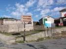
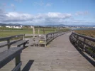
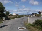
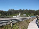
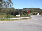
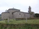
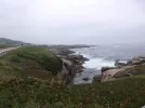
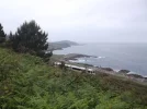
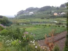
The photos show:-
Day 1 the sign and arrow at Porto de Rinlo. The sign to As Catedrais was behind us.
Day 2 (1)the boarded way and arrow; (2) the Amadora with Terry pointing to (3) the side road.
 

Attachments

  • day1.webp
    day1.webp
    124.5 KB · Views: 7
  • day2 -1.webp
    day2 -1.webp
    89 KB · Views: 4
  • day2 -2.webp
    day2 -2.webp
    104.7 KB · Views: 4
  • day2 -3.webp
    day2 -3.webp
    105.7 KB · Views: 4
Last edited:
Thank you for this information, and your blog. I'm hoping to do the coastal route in November, so any details on places to stay/eat etc is really helpful. It sounds a wonderful route, even if it is a bit under-developed - and it seems as if the FEVE can be a real lifeline if problems do crop up.
 
A selection of Camino Jewellery
The Mapas Militar are available from the Map Shop, Upton on Severn, UK. The sheets needed for the full walk as far as San Andrés are all Serie L, Nos 9-3, 8-3, 8-2,7-2, 7-3, and 6-2. We copied off the sections of each that we needed and marked our route. For copyright reasons we obviousy cannot re-produce them here but will list the places that we passed through, and where they divert from the arrows. The arrowed route in the post above did not follow the Lugo caminos map as it turned further north at Reinante, through Benquerencia. The arrows follow the lower route through A Granda. After crossing the FEVE it probably picks up the Lugo map route near A Aspera

Most of the places that we stayed in can be seen on Google maps were on Booking.com or Venere.com. The FEVE is a lifeline :) but the train times need checking as they changed recently.

Note that arrows are painted at junctions but, unlike other caminos, there are seldom any repeater arrows.
 
Last edited:
Day 3:-
San Cosme de Barreiros to Forxan (Foz)
To return to the route from Cafe-bar Moderno either
1) retrace your steps to the bridge over the FEVE (turn left out of the bar) and go back along the road you originally arrived along.
or
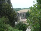
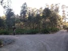
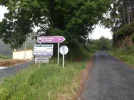
2) Take the bar owner's advice and turn right out of the bar and walk along the road which has a good pavement (sidewalk). You can pick up some supplies at the supermarket as you pass. Follow the road staying on the right hand pavement to the bridge. Photos 1 & 2) Here you pick up the signed route again passing through A Espineira and Vilaronte. There is a bar on the right as you go up the hill in Vilaronte and they sell bread. Useful if you are too early for the bread in San Cosme. After the bar the arrows sign the route off to the left down a mino road to Seoane. When we walked through there was an arrow missing on the bend where a track and narrow road turn off together to the right. Take the road (effectively 2nd right) steeply uphill, not the adjacent track.
(If you miss this turning and pass either the 'Carpenteria' on the left or the road signed to a Rua on the right you are going completely the wrong way. Retrace your steps and find the road which will now be 1st left!!)
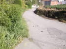
The next arrow is at the top of the hill. On the map it is left and almost immediately right uphill to O Carmen (cruceiro and chapel), keep straight on ignoring a right hand road to Rio. At the next right hand turn the minor road goes right ( a track/very minor road goes straight on). Turn right towards Vilar, KSO over the crossroads and then turn left to Vao. Turn right and follow the arrows which point along the road (photo 3) and then turn left and right again to bring you into San Martiño de Mondoñedo at the cathedral.

To gain entry to the cathedral go from the west (main) door round left and to the rear where the tourist office is situated. They have the key and will go through the cathedral to open the main door for you. If you want a drink and maybe food there is a bar on the left part way up the road opposite the church steps.

The arrows from San Martiño lead to the Hermitage of Obispo Santo, then towards Foz through Forxan going past what was the Hotel Spa Casa Conors (B&B plus some simple bar food in May 2015). This has since been renamed Hotel Buda Spa. (Point on Google or map if you are plotting your route is:- 'Carretera de Forxan, 30, 27789 Foz' and geographical location is: 43° 34' 29" North, 7° 16' 48" West) We had strayed at the missing mark in Seoane so took a taxi to the hotel as we were running late.

If seeking accomodation other than the spa continue beyond Forxan downhill following the arrows and turn right at the cross roads after the FEVE bridge into Foz along the main road, or continue to the T junction and turn right - approx 4kms by the coast path. There is no accomodation in Fazouro.

Mapas Militar Serie L Hoja 8-3 and Lugo Camino 2 this gives 2 routes from San Martiño - we were on the yellow one.

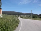
Photos:-
(1) the crossing over the river followed shortly by the signed turn to the left (2).
(3) the road approaching San Martiño de Mondoñedo
 

Attachments

  • day3 -1.webp
    day3 -1.webp
    122.9 KB · Views: 2
  • day3 -2.webp
    day3 -2.webp
    162.9 KB · Views: 2
  • day3 -3.webp
    day3 -3.webp
    104.4 KB · Views: 2
Last edited:
Day 4:-
Forxan (Foz) to Burela
If staying in the Hotel Buda (Casa Conors) then turn right out of the hotel and continue down the hill, finding a yellow arrow as you go. Continue on the road by the footbridge over the N642 and the FEVE and KSO at the next crossroads. Finally at the T junction turn left, there was a triple yellow arrow on the lamp-post at this junction in May 2015. Follow this minor road and coast path ignoring the green signs and arrows which mark a local walk. The red marker poles are OK but may not be the intended route, however there are no yellow arrows at all on this section.

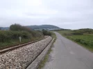
At the end of the road, where there is a right turn to the beach (Playa de Sarrido) turn left, then right coming out to walk alongside the FEVE (1) Eventually join the road and walk into Fazouro on the pavement. At the junction shortly after the 'Antiguidades' there is a turning left (LU151 to Ferreira and Alfoz) with a good bar. It is possible that the route as given by Lugo Caminos goes up the side road to the right at the bar but there are no arrows pointing that way, however according to the Mapa Militar (Serie L Hoja 8-3) that is the road to Lousada.

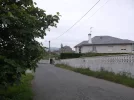
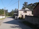
We went back to the main road and followed the coast route markers keeping between the road and the sea, past the Playa Arealonga. The road goes through Nois (2) where there is a Y junction at the church (3). Keep right to continue along a minor road until joining the N642 at A Raxoa. On reaching Cangas continue along the road and there is a bar-restaurant on the right. This is where we took a taxi into Burela, to the Hotel Sargo, as we did not want to continue walking this fairly busy road and there were still no arrows. The Lugo Camino 3 route from Fazouro is shown as coming into Cangas and following the roads into Burela, taking the right fork at K42 approx.

We searched in Burela for arrows to show the way out next day, but without success. Good cafes in town and also some food in the hotel.
 

Attachments

  • day4 -1.webp
    day4 -1.webp
    92.7 KB · Views: 2
  • day4 -2.webp
    day4 -2.webp
    87.4 KB · Views: 2
  • day4 -3.webp
    day4 -3.webp
    110.4 KB · Views: 2
Last edited:
The 2024 Camino guides will be coming out little by little. Here is a collection of the ones that are out so far.
If you have taken the alternative route on the Lugo Caminos Etapa 2 map (the purple route into Foz) then follow either the coast path to join the Forxan route or the purple route along the road towards Fazouro.
 
Day 5:-
Burela to O Castelo.
According to Lugo Caminos map 3 the route leaves Burela and goes through Sargadelos to Cervo and then (map 4) passes Rio Covo and near San Cibrao before reaching O Castelo.
Mapas Militar Serie L Hoja 8-2

We never found any direction signs out of Burela so decided that we would follow our map and use the coast path again. This had been part of the route previously and is reasonably well signed. We had expected to find some arrows shortly after leaving Burela on this route but there was nothing. We followed the paved path, which then turned into a minor road, a lot of hard surface but fairly flat. The final section passes through an industrial estate but the earlier sections were very scenic. When we reached San Cibrao we turned right and followed the road past the bank and into town and found the Hotel Buena Vista (or Boa Vista) which has an excellent restaurant upstairs. When making our plans we had decided not to stay here as it was off the route and booked into O Castelo instead.
Having had lunch we took a taxi to O Castelo rather than walk a fairly busy road and also the extra kms for being well out of our way. We had walked 12 kms and the taxi ride was approx 5kms so doable if walking from Burela. Take care to look for O Castelo at the junction of the LU862, N642 and the road out of San Cibrao - there is another O Castelo below the Embalse de Rio Cobo.
The signs came up to the junction but from a different direction to the one we had, possibly the road from Rio Covo.
Next day we picked up the best signing we had seen, right beside the Hotel O Castelo. Good accomodation and good food in the bar.
 

Attachments

  • 12-5a.webp
    12-5a.webp
    75.1 KB · Views: 2
  • 12-5b.webp
    12-5b.webp
    82.8 KB · Views: 2
  • 12-5d.webp
    12-5d.webp
    142.9 KB · Views: 2
  • 12-5c.webp
    12-5c.webp
    203.8 KB · Views: 3
Last edited:
Day 6:-
O Castelo to Xove (and Esteiro) Lugo Caminos map 4
and Mapas Militar Serie L Hojas 8-2 and 7-2

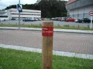
The signs for this section start at the corner of the O Castelo's car park (far right when facing the door to the bar) and are very clear stencils either on posts or on the road. When the route goes through the forest on a track this changes to the nature trail posts with red banded tops. The first one is slightly ambiguous (1), it is a left turn and there are short repeater posts, unbanded in May 2015. ( A brief check straight on showed that the forest track goes back downhill probably to a road. )
The route eventually comes back to the road through Vilar and A Aspera. Between these two villages in one place the sign (outlined in yellow on the photo) was so faded as to be almost invisible (2). The excellent signing so far on this etapa made us search around. This is a right turn at a fork and the route then passes the brick building and the white house (3). The good marking continues to the chapel and cross (4) - see next post.
 

Attachments

  • day6 -1.webp
    day6 -1.webp
    153 KB · Views: 4
  • day6 -2.webp
    day6 -2.webp
    219.5 KB · Views: 4
  • day6 -3.webp
    day6 -3.webp
    98.1 KB · Views: 4
Last edited:
Train for your next Camino on California's Santa Catalina Island March 16-19
When we reached the cross (4) near the Igl de Lago, on the Mapa Militar Serie L Hoja 8-2, we chose to follow the road into Xove. The Camino route is clearly marked to the left, a route that is probably less hard on the feet than the tarmac especially if you have come via the paved coastal route from Burela. We took a slight right turn and immediately left to follow the wide walkers route into Xove. (ie do not walk on past the church).

In Xove we stopped for drinks in one of the bars and also then followed the signs to the Concello. We have a sello from the Concello (behind the market area). The route then turns north from Xove, one reason why we had chosen to go into Xove itself, as it then appears to finish at Faro/Esteiro away from any 'habitaciones'.

It might be possible to walk the side road to Aguadoce or Celeira by following the map (Hoja 7-2) (through A Aceveda, Camba, etc) but we took the FEVE from Xove Pobe/Apdo (near the market/Concello). The station was signed but we also had the map from the town centre. There was a train at 12.27 which was very convenient. As it was near lunchtime we decided to go right into Viveiro, rather than part way and then walking again. This was good because walking down into town from the station we passed the hotel which we had booked for the next night and the weekend.

The bus station has a good menu del día and other food then we took a taxi up the coast to Aguadoce and the Hotel Aguadoce - Louzao, good bar food. As far as we could discover this is the nearest accomodation to the given end/beginning of stage at Esteiro. Walking around in the afternoon, past the lovely beach (5), we found the route from (and to) Faro is marked by coastal walk markers and, certainly at Aguadoce, is 'crazy paving' again (6). The route for next day was once again signed right by the road alongside the Hotel Aguadoce.

The cross at the chapel and juction near Xove (4)
The beach at the Hotel Aguadoce - Louzao (5)
The crazy paving (6)
 

Attachments

  • day6 -4.webp
    day6 -4.webp
    224.5 KB · Views: 3
  • day6 -5.webp
    day6 -5.webp
    75.6 KB · Views: 2
  • day6 -6.webp
    day6 -6.webp
    96.7 KB · Views: 2
Last edited:
NB:- I have edited both the posts for day 6 to include the place names in our directions.
 
Day 7:-
We set off along the marked route alongside the hotel and past the next beach with its shower and double fuente. The side road then comes up to the main road on the Lugo Caminos map 5. We had expected there to be a sign to the right here, although this varies from the caminos map. There was no sign in any direction so we turned right to briefly explore this side road. A van driver told us there was no way through so we went back up to the main road. There are no signs at the right fork either so we stayed on the main road to the petrol station. Here we were offered a lift by the receptionist from the hotel into Viveiro. If it is possible to turn right near the church etc then the fork might be best and use the map to find the way (it looks like - fork right, turn right then KSO to the dock area, then left and into Viveiro), or there may be a sign after the petrol station.

Viveiro is well worth a couple of nights at least as an interesting historic town. We stayed in the Hotel Vila (B&B) near the FEVE station which was a good choice.
 

Attachments

  • day7 .webp
    day7 .webp
    52 KB · Views: 2
Last edited:
3rd Edition. More content, training & pack guides avoid common mistakes, bed bugs etc
Stages Viveiro to Espasante/Ortegueira:-
The links for these stages are on the Lugo Caminos maps.
Mapas Militar Serie L Hoja 7-3

We had not planned to walk this section, lack of accomodation etc, but we did explore as far as Os Castelos beach in Covas. Leave Viveiro over the bridge and see the chapel directly ahead; either go to the roundabout and follow the road round to the right or else at the end of the bridge turn immediately right onto the waymarked Nature route marked by posts with red bands - this follows the water's edge round to Os Castros, then turn into town. Having walked the circuit along the road and back along the nature trail we found no arrows/camino signing at all. The first sign for the nature trail was partially hidden by the trees so needs looking for. These posts were the type we had followed in many places and are without direction pointers and we think that, maybe, where these are in place the route is not signed in any other way (see photos).

Accommodation is doubtful after Viveiro/Covas so we took the FEVE from Viveiro to Espasante where we stayed in the Pension Las Palomas - B&B plus bar with good food. The station is some way from the village - turn right out of the station and follow the road for approx 2kms.
Another alternative which was recommended to us is the Hostal La Perla in Ortegueira - on the FEVE but also off the marked route.
 

Attachments

  • post-1.webp
    post-1.webp
    354.5 KB · Views: 6
  • post-2.webp
    post-2.webp
    554.9 KB · Views: 2
Last edited:
Day 8:-
Espasante to Ponte Mera (FEVE)
Ponte Mera to San Andrés - our 8th walking day.
Mapas Militar Serie L Hoja 6-2
Lugo Caminos map 7
As posted above accomodation on the route is doubtful after Viveiro, needing a diversion to find somewhere to stay. The same is true after Ortegueira as there is no accomodation near Ponte Mera and nothing along the route from there - no food until San Andrés and neither food nor accomodation after that until Cedeira.

From Espasante we took the 8.25am FEVE to Ponte Mera to walk from there. We were told, by a cyclist pilgrim, that there are 2 bars in Ponte Mera, but we did not pass them as we came downhill from the FEVE station and at the bottom turned left and almost immediately right to follow the road signs to San Andrés.

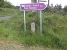
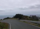
The road goes uphill through Viñan and finally at a crossroads, in Vigildo,a signed left turn picks up the marked route. From here it is easy to find the way following the road signs and the 'sardines' which mark the way. There is a right fork, private road, shortly before a left hand bend as you leave the village and the correct fork right is clearly marked after the bend (1). The route continues through/past Fabés, Pereira, A Cruz (2) -keep right, Lamelas, Viduido -fork right - and Candocia before reaching the Capilla de Socorro and a sharp left turn. Continue to follow the signs and after approx 1km you reach a left turn followed shortly by a right. Here the road finally levels out and then goes downhill. Ignore the road sign to Teixidelo. The road passes the turning for Cedeira and keeping to the road at the cruceiro above San Andrés (3) is better than the drop straight down the hill (overgrown and very steep). Some lovely views and countryside and good signing all day.

In places along this whole section the waymarks cut off road corners. Unfortunately when we were walking some of these tracks had been badly churned up by forestry work so we mostly kept on the road. There is 9+kms uphill followed by 3-4kms steeply downhill.

The lady at the first cafe on the right in San Andrés cooked us a lunch while we went to the church and she also called a taxi to take us to Cedeira (several places to stay and to eat) - mobile phones do not work at all after the car parks on the hill.

If continuing from San Andrés to Ferrol we have a note that there is still no food or accommodation (apart from going into Cedeira itself) until nearly to Ferrol, so if wanting to break the stages the only way is to go off the route and return next day.
 

Attachments

  • day 8-1.webp
    day 8-1.webp
    158.9 KB · Views: 3
  • day 8-2.webp
    day 8-2.webp
    197.7 KB · Views: 3
  • day 8-3.webp
    day 8-3.webp
    40.6 KB · Views: 3
Last edited:
Our aim had been to walk as much as possible of the route as far as San Andrés, avoiding where needed the sections which had no accomodation or food. We were also walking fairly short days and travelling light. The main difficulty with the Lugo Caminos stages is that they frequently finish where there is nothing, so it is best to plot your own stages to create walkable days ending at accomodation. Most people go to San Andrés as part of organised pilgrimages, chiefly using transport.

It looks as though the walkers route has been made with 'Sunday/weekend walkers' in mind rather than through walkers so hopefully this will change as the route develops. There is a real need for some indication as to which road to take in/out of some towns so as not to lose the signing, even if it is not practical to sign within the towns themselves. As said some sections are better marked than others, and some places are aware of the Camino while others are not. There is great enthusiam from the people locally about walking to San Andrés and also San Martiño de Mondoñedo which is very encouraging.

Hopefully as others walk this Camino and continue through to Ferrol and then to Santiago it will gain great recognition.

If anyone has any questions about the directions etc we can try to answer them here, or by PM.
Buen Camino peregrinos
 
...and ship it to Santiago for storage. You pick it up once in Santiago. Service offered by Casa Ivar (we use DHL for transportation).
Attached are the two lists of places the Lugo Caminos route passes through using their maps. Distances can be worked out using the Lugo Caminos maps (links above).

If you have not read all the previous posts then please note that these stages do not necessarily end where there is food or accomodation;
accomodation is doubtful after Covas;
there is no accomodation after Rio Major;
food is available in San Andrés itself;
at the far end of the route (San Andrés to Xubia) there is neither food nor accomodation.

We will also post a similar list of places we stayed in or passed through that were on our actual walked route
 

Attachments

❓How to ask a question

How to post a new question on the Camino Forum.

Featured threads

❓How to ask a question

How to post a new question on the Camino Forum.

Featured threads

Forum Rules

Forum Rules

Camino Updates on YouTube

Camino Conversations

Most downloaded Resources

This site is run by Ivar at

in Santiago de Compostela.
This site participates in the Amazon Affiliate program, designed to provide a means for Ivar to earn fees by linking to Amazon
Official Camino Passport (Credential) | 2024 Camino Guides
Back
Back
Top