• ⚠️ Emergency contact in Spain - Dial 112 and AlertCops app. More on this here.
  • Remove ads on the forum by becoming a donating member. More here.

Search 74,075 Camino Questions

Ruta do Mar-Camino Inglés (2015)

Tia Valeria

Veteran Member
Time of past OR future Camino
Pt Norte/Pmtvo 2010
C. Inglés 2011
C. Primitivo '12
Norte-C. de la Reina '13
C. do Mar-C. Inglés '15
The early stages of the Camino do Mar are fairly easy from Ribadeo, past As Catedrais to Reinante, Barreiros, Foz, Burela, Cervo and Xove. Accomodation is all in private rooms/hostales/hotels. There are no albergues. The waymark is said to be yellow arrows or red sardines, we will see if it is good but will have the mapas militar sections to help us (no GPS with us).

After Xove the route turns north and we plan instead to keep going due west to Viveiro instead of following the given way there. After Viveiro the terrain is more difficult and after Covas (2 kms from Viveiro) the accomodation is doubtful so we will take the FEVE to Orteguira. From here it would seem that there is no accomodation (apart from 3 hotels which are well off the route) and apart from San Andrés de Teixido itself there is no food either. Here we plan to take the FEVE to Ponte Mera and walk to San Andrés. Then we will take the Amigos advice to take a taxi the 12kms to Cedeira where there is accomodation and food.

We then will probably take the bus to Ferrol due again to accomodation problems and time constraints. We may start the Camino Inglés at the Covas near Ferrol or from Ferrol itself. Time will determine this as we will have taken time to visit places along the Camino do Mar and also want to see more of places we passed through previously on the Inglés (2011).

Much of our selection of places to stay has been done via booking.com, venere.com. turgalicia etc as well as the various 'concello' sites. So far so good.....we will add info here as needed. :)
 
Last edited:
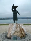
The focus is on reducing the risk of failure through being well prepared. 2nd ed.
The stages are given on the Lugo Amigos website at Camino del Mar with 9 stages, maps and distances but no other details. Note that in at least one instance there is a gap which is not accounted for in the maps.
The 'lost' blog said that after Covas it was doubtful if there was accomodation on the route (stages 4 - 6) and that after Rio Major there is no accomodation (stage 7 to San Andrés). There is a cafe/restaurant in San Andrés itself but still no accomodation. After San Andrés there is neither food nor accomodation (stages 8-9) and the advice was to take a taxi to Cedeira itself for the night where there are facilities, returning next day to San Andrés or picking up the route at Porto de Cabo. This last section in fact looks to be the most remote for the longest distance.
After Xubia, where the route joins the Camino Inglés there is accomodation and food as given in the guide to the Inglés.
Google maps is helpful as the satellite view gives some idea of the terrain if you do not have the Mapas Militar for the area. We intend to take the relevent sections of the paper maps as we do not 'do' GPS etc.
Interestingly the only place on our chosen itinerary that we have not yet found it possible to communicate with any accomodation is Miño. Presumably they are still closed for the winter so we hope to be able to find out more soon. Last time we slept at the albergue as we had our sleeping bags, but this Camino we will not be carrying them so the albergue is not an option.

Planning is interesting and fun so we trust it all works out well......:)
 
Train for your next Camino on California's Santa Catalina Island March 16-19
I wish you have good luck in your Camiño do Mar that i know you have been preparing for a long time.
I'm sorry I can´t help you in your different variants depending on acommadation, but in Miño i know Hotel Crisol de las Rias near the beach I was there in October four years ago It costs ( winter/spring) 44 euros breakfast included
 
We have heard from the O Cantiño in Miño so hopefully that will work out OK. We are looking forward to this time together and reaching Santiago again. It is like a long 'retreat' - time with God while walking the Caminos. We have tried to make sure that it is different to our first time on the Inglés, booking accomodation is part of that as well as concern about greater numbers. We are due to pay for our tickets so praying that all goes well, especially health wise, this time. So far, so good. :)
 
Holoholo automatically captures your footpaths, places, photos, and journals.
Thank you, @Tia Valeria, for sharing what you've learned. Both personally and publicly here on the forum. I know this kind of planning takes some time. The more I study it, the more I think I'm going to wait and try this route at a later time. Following in the footsteps of your research and seeing what you guys have to do in terms of trains, buses and taxis, I realized I am looking for something more continuous at this time. I think it makes more sense for me to wait until either, a) I'm ready to do it with a tent, b) can do it with vehicle support, or c) have the flexibility to explore it as you are. I have

However, it has absolutely captured my imagination. It just seems so logical that there could be an extension of the camino Norte along the sea that also has the benefit of making walking the Ingles part of a longer camino. I've driven the area and it is absolutely beautiful. I think it would be a very rewarding camino. I look forward to hearing about how it goes for you, and I hope that the route continues to develop.

I'd love to see you at the end and hear first-hand how it went.
 
Get a spanish phone number with Airalo. eSim, so no physical SIM card. Easy to use app to add more funds if needed.
We will let you know how we get on, hopefully meeting you when we are in Santiago We will certainly be posting here. Some folk might find walking our 'missing' sections reasonable but we are keeping our daily distances deliberately low. Hasta la vista. :)
 
I have been searching quite a bit about going from Naron to San Andres but the 40 km is not appealing. I walked the Ingles last Oct and was close to doing it. Will keep planning. This Sept I think maybe Portugese.
 
@krazeekuban - have you looked at walking to Cedeira and seeing if there are any other stop overs before then. There are places to stay in Cedeira itself (not cheap) but the route is marked to Porto de Cabo outside of Cedeira. From Cedeira it is about 12kms to San Andrés so you could walk out and back in a day. I calculate that from Xubia it is about 20kms to Porto de Cabo (Porto de Cedeira) and a further 2 kms into Cedeira itself. It is the lack of food that means we would have to carry more than we want (and timing) that has decided us to skip this section so we have not researched it to see how rough or strenuous this whole stretch is.
 
Perfect memento/gift in a presentation box. Engraving available, 25 character max.
We have our travel tickets and hopefully our accomodation sorted too. One bonus is that on our way home we think we will finally be able to visit the Museum of Prehistory in Santander. This has been closed for several years but our Brittany Ferries ticket has a 'privilege' card which will give us 10% off the admission and also gives the new address. Something to look forward to post-Camino.

Now for some serious preparation in the weeks ahead, and maybe that will mean less time posting here on the forum for a time. We also do not expect to post while walking but will do so on our return. We have been re-enthusing our family so they might put up something from any texts we send home, even if only to say we have reached Santiago.

Hasta la vista ....
 
Terry has been looking at our route out of Ribadeo. He opened Street View and found the 'No donkeys' sign for the autopista. Having seen this from the bus previously we will have to walk past it and get a photo, then use the bridge under the road to join the Camino westwards towards As Catedrais, and the tide should be out if we time it right. :)
 
Message from TerryB and Tia-Valeria: All went to plan but this is not a
route for the first timer. Good maps needed and working if basic Spanish.
Hard underfoot and signing isn't good enough in many places. However we
enjoyed it and made it to San Andres. Now on the Ingles.
 
...and ship it to Santiago for storage. You pick it up once in Santiago. Service offered by Casa Ivar (we use DHL for transportation).
Another message home from TerryB and Tia-Valeria.

They reached Santiago on Sunday afternoon and will be there until setting off for home on Wednesday. Tired feet but no blisters. They will post about it all when they are back. Meanwhile they say Buen Camino to those walking now :-)

Well done and safe trip home :)
 
We are just home and starting to unpack, look at photos etc. We will post gradually as we work through everything and hopefully find someone who can get photos off a corrupted camera card (post arrival in Santiago).
Thanks to all for your encouragement and 'our' hermit for posting the updates. :-)
 
First thoughts:-
A good journey out and on the FEVE. We were saddened to find that Oviedo has imposed charges to enter the cathedral and so just had our credencials stamped without visiting the Cámara Santa which is now just part of the cathedral/museum tour overall.
Our travel plans went well on to Ribadeo (FEVE) and the Ruta do Mar. We had checked the tide times and needed to reach As Catedrais for low tide so took a taxi to Rinlo to start walking. (Taxis seem to work out at approx 2€ per km in most places this year) This part was well marked, but many sections later on were either poorly marked or had no markers. Maybe we just never found them leaving towns but in some places we were walking the coast nature path (very hard on the feet) when maybe we should have been more inland. As we work through our photos and post, here and on our blog, we will check this out.
The scenery is beautiful and there are many places of interest too. Our Spanish is fairly good and we had sections of the Mapas Militar with us so were able to find our way when the signing wasn't obvious. All our stopping places were good and the local folk very friendly and helpful.
Our concern that calling a taxi from San Andrés itself might be difficult was right. Mobile phones do not work there but the lady at the café, where we had lunch, called one for us via their radio telephone link. In spite of our feet feeling bruised by the stone flags on much of the coast path we felt a great sense of satisfaction in reaching San Andrés as planned and the weather was very kind to us.
Are we glad that we did this? Yes, we are. However we would still say that it is not a route for first timers or those with no Spanish, and you do need those maps.
Photo:-
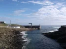
From the bridge at Rinlo where we started our walk
 

Attachments

  • rinlo.webp
    rinlo.webp
    148.3 KB · Views: 9
Ideal pocket guides for during & after your Camino. Each weighs only 1.4 oz (40g)!
I'm glad you liked your trip.
Mobile phones don´t work in San Andrés?
So, thousands of pilgrims that go from all over Galicia every year can't call. :mad:
Maybe, Movistar mobiles have coverage.
 
I'm glad you liked your trip.
Mobile phones don´t work in San Andrés?
So, thousands of pilgrims that go from all over Galicia every year can't call. :mad:
Maybe, Movistar mobiles have coverage.
The lady in the cafe definitely said that ordinary mobiles do not work and they have a special system. Our phones were picking up Movistar elsewhere. Many folk who go use transport of some kind to arrive I think so I would expect that their transport out is organised. The walking groups also seem to have back-up. The phone signal was OK about 2kms back up the hill at the Cedeira turning.:)
More when we reach that section in our daily feedback.
 
May 2nd to 6th. Travelling:-
We left home on the 2nd May in pouring rain and wearing our winter undies! By the time we reached Plymouth the rain had stopped although it was still cold and very windy. On the ferry we met other pilgrims heading for the Francés and the Norte. We arrived in Santander on time and contimued our journey next day to Oviedo and then on to Ribadeo, arriving there on Wednesday 6th ready to start walking on the 7th.

May 7th Rinlo to As Catedrais and Devesa:-
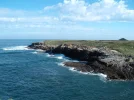
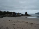
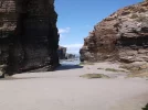
The tide times meant that low tide was at lunchtime (13.00) and we wanted to reach As Catedrais by then. Walking round the headland would have added several kms, and we did not want to walk the fairly busy road, so we took a taxi to Rinlo and started our walk from there. The first part was well signed with a yellow arrow and the red marker posts and signing too. It is 8kms to As Catedrais along the cliff tops and past the old shell-fish farm. A lovely walk and we reached the beach with a little time to spare, then had lunch at the cafe before slightly retracing our steps to go to O Lar de Carmiña at Devesa for the night - a total of 10.8kms for the day. Having missed the planned 'no carts' sign we were pleased to see one at the roundabout.
More on the blog.......
 

Attachments

  • track2.webp
    track2.webp
    112.2 KB · Views: 12
  • cliffs.webp
    cliffs.webp
    139.2 KB · Views: 10
  • no carts.webp
    no carts.webp
    49.6 KB · Views: 10
Last edited:
The one from Galicia (the round) and the one from Castilla & Leon. Individually numbered and made by the same people that make the ones you see on your walk.
As we post our daily stages here we will also update the blog with extra text maybe and photos:- Camino 2015
the blog address also forms part of my signature :)
 
May 8th - Devesa to San Cosme de Barreiros:-
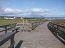
The walking was on the road again back to As Catedrais to pick up the signs. The path is boarded for a time then a yellow arrow points across the road. The signing needed watching as in some places it was hard to see (obscured by a hank of binder twine hanging up in one place!). However we found our way fairly easily and enjoyed a cafe con leche at the Casa Amadora. Very enthusiastic and gave us a double sello. The yellow arrow pointed right just before this, down the side road and was 'keep straight on' for some distance. A strong wind blowing in our faces made walking, mostly on the road, harder than it might have been so we were glad to reach the turning to San Cosmé (signpost) and leave the yellow arrows for a time. The Cafe-bar Moderno was again very friendly and helpful and we had a good menu del día, followed by cake after siesta. The sello here was a scallop shell designed for the cyclist's club.
 

Attachments

  • boardwalk.webp
    boardwalk.webp
    89 KB · Views: 5
  • reinante.webp
    reinante.webp
    104.7 KB · Views: 5
May 9th - Barreiros to Mondoñedo:-
The initial signing to day was good as far as the cafe-bar in Vigo. The walking was a mix of track and road with views across the ría. After the cafe-bar, where we bought some bread to go with the lomo bought in San Cosmé, the sign pointed left but the next sign approx half a km further on was missing. We walked about 2kms along a side road before we realised and had to turn back. Anyone else walking should note that there is more than one A Rúa and if you pass the carpentaria then the A Rúa sign you have missed the right turn. We should have taken the right turn up a road (a double right turn so not the first track) steeply uphill. We think the new gateway had removed the sign, but the locals pointed the way to us. Further up the road the route was signed again. We finally reached San Martiño and went round the back to the little tourist office, as the notice on the door said, for the key. A lovely church which deserves a post of its own. The church visit over we took a taxi to the hotel in Foz, then later realised it was actually on the Camino route. A good start for the next stage.
 

Attachments

  • ria 9-6.webp
    ria 9-6.webp
    127.7 KB · Views: 5
  • approaching mondonedo.webp
    approaching mondonedo.webp
    131.1 KB · Views: 5
€2,-/day will present your project to thousands of visitors each day. All interested in the Camino de Santiago.
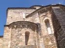
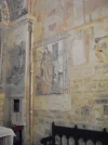
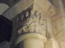
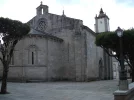
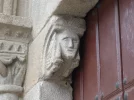
The lovely Basilica de San Martiño de Mondoñedo is Romanesque. With its carvings and both ceiling and wall paintings it was well worth visiting and has been well preserved. Just 3 photos here and these, plus the others, will go on the blog along with more information. You can also find out more about the basilica here, in Spanish.
 

Attachments

  • mondonedo2.webp
    mondonedo2.webp
    158.6 KB · Views: 9
  • mondonedo5.webp
    mondonedo5.webp
    74.9 KB · Views: 7
  • mondonedo7.webp
    mondonedo7.webp
    65.6 KB · Views: 7
Last edited:
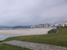
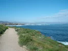
Our hotel was outside of Foz itself, near the FEVE station of Marzan, so we walked down the road, found tomorrow's yellow arrows but turned right along the coast path into Foz itself. This was our introduction to the paved walkway which we later came to really dislike. It was not quite even and really hard on the feet. However in Foz we found 2 sets of interesting statues and the church of Santiago. A few photos here, and the others will go on the blog. Rest day - 9kms total walked so we took a taxi back to the hotel.
 

Attachments

  • foz2.webp
    foz2.webp
    48.1 KB · Views: 6
  • foz4.webp
    foz4.webp
    93.9 KB · Views: 6
  • foz6.webp
    foz6.webp
    91.3 KB · Views: 6
  • foz3.webp
    foz3.webp
    70.1 KB · Views: 6
Thank you for your posts that I'm following with interest.
Let me explain the meaning of Foz in Galego. The usual would be "sickle" but in this case the meaning is "river mouth", like in Foz de Iguaçu (Brasil) and Figueira da Foz (Portugal). Unfortunately, this meaning is today unknown by most people in Galicia.
 
Holoholo automatically captures your footpaths, places, photos, and journals.
Thank you for your posts that I'm following with interest.
Let me explain the meaning of Foz in Galego. The usual would be "sickle" but in this case the meaning is "river mouth", like in Foz de Iguaçu (Brasil) and Figueira da Foz (Portugal). Unfortunately, this meaning is today unknown by most people in Galicia.

Interesting because in my native dialect (Yorkshire) FOSS = WATERFALL. There is a River Foss which joins the Ouse at York. Important in Roman times as it was navigable and remains of wharfs etc. have been found. It is suggested that the name most likely comes from the Latin word Fossa, meaning ditch.
I did wonder if the word had a Celtic background but apparently not . . . . :(

Blessings
Tio Tel
 
May 11th - Foz to Burela:-
The day started out well following the arrows we had seen previously. However after the triple arrow sign towards Fazouro the signing was poor and after Fazouro there were no more. We assume that the intention is for walkers to follow the coast path which has reasonable signing. However this was all on the 'split' paving so not easy for walking any distance although the views were lovely. Part of the route was on the road and alongside the FEVE for a short time and we also found a good bar - within sight - up a side road in Fazouro itself. A passing police car gave us a friendly hoot and a wave as we set off again. Using the map we found our way through Nois (keep right at the church) and eventually reached Cangas where we stopped for a drink and as it was nearly lunchtime took a taxi the rest of the way to Burela. We would have found it hard finding the hotel on foot but the taxi took us there.
 

Attachments

  • feve.webp
    feve.webp
    92.7 KB · Views: 2
  • nois.webp
    nois.webp
    110.4 KB · Views: 2
Interesting because in my native dialect (Yorkshire) FOSS = WATERFALL. There is a River Foss which joins the Ouse at York. Important in Roman times as it was navigable and remains of wharfs etc. have been found. It is suggested that the name most likely comes from the Latin word Fossa, meaning ditch.
I did wonder if the word had a Celtic background but apparently not . . . . :(

Blessings
Tio Tel

Yes, Foz, Foss coming from Fossa (hole) makes sense. That´s good news because we have celtic but also latin toponymic similarities :).
The meaning of Foz here in Spain is so unknown that some years ago the newspaper "El País" published a puzzle context with reward and one definition was "town that means river mouth".
 
The 2024 Camino guides will be coming out little by little. Here is a collection of the ones that are out so far.
Interesting because in my native dialect (Yorkshire) FOSS = WATERFALL.. It is suggested that the name most likely comes from the Latin word Fossa, meaning ditch.
I did wonder if the word had a Celtic background but apparently not . . . . :(

Over here in Cumbria the word for waterfall in "force", which is apparently derived from the Old Norse word "fors", from when the vikings were active in these parts. A Danish friend who visited was surprised at how many local words she recognised - fell for hill, beck for stream, clegg for horsefly, dale for valley, tarn for lake, scar for cliff and village names ending in -by etc.
 
Terry once bought me a pair of slippers in Norway, using East Yorkshire dialect, from a lady at a market stall. They understood one another easily.
 
Yes, You in England have to check always before the possibility of old Germanic origin.
We here in Galicia have some old Germanic toponomy: Allariz, Guitiriz,Mondariz (Alaric, Witeric,Mondaric), Baltar (Walter), Frexulfe, Friolfe from Fre Ulfe (Fre (wild?) Wolves) and more.
Anyway, in a high level language conversation;) I must correct a mistake: Foz in Galego doesn´t mean sickle as I said in other post. The word for that tool is Fouce. The reason for that mistake was because Foz is a "false friend" of Spanish Hoz (sickle) and in my case I'm far from agricultural tasks since many years ago. So, the only meaning for Foz in Galego as far as I know is River Mouth and in this case thanks to Terry I'm pretty sure that this word comes from latin Fossa.
 
Train for your next Camino on California's Santa Catalina Island March 16-19
Back to the Camino and another day of finding our way....
May 12th - Burela to San Cibrao:-
Having failed to find any signs at all during our afternoon wandering round Burela we left next morning by the coast path, hoping to find some signs as we went. However we never found any signing at all, just the coast path. The option of following the path round all the headlands on the stones led us to join the road when we came to it. Not the most inspiring walking day and all paving or tarmac on the Estrada Marosa, with a pavement alongside. We eventually reached San Cibrao having missed Sargadelos and Cervo, both named on our 'guide' list. Asking in town we actually had a very good menu del día in the restaurant of a hotel I had not booked into because it was off the route!!!. The idea of walking along the main road to O Castelo was not attractive so it was a taxi again to a very good road-house hotel. The route actually passed the corner of the car park, but we have no idea how it came here from Burela.
 

Attachments

  • 12-5b.webp
    12-5b.webp
    82.8 KB · Views: 2
  • 12-5c.webp
    12-5c.webp
    203.8 KB · Views: 2
Last edited:
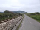
May 13th - O Castelo to Xove:-
Oh bliss - track through the woods and the best marking yet. This was a mix of road and track after the first wooded section. The signs were mostly very clear - stencilled yellow arrows. Some were the wooden nature trail posts but these also had short repeater marks so were easy to follow too. One arrow on the road was very faded, but we looked around for it as until this point all had been so good. Reaching the church near the outskirts of Xove we followed the road sign direct route rather than the yellow markers so went into town. This was the end of today's walk as from Xove the route turned north and then up to the coast with no apparent facilities. We had considered walking the road to Esteiro but as the FEVE was due we decided to take that instead arriving in Viveiro at lunchtime then taking the taxi up to Esteiro and the hotel.
 

Attachments

  • toXove1.webp
    toXove1.webp
    170.9 KB · Views: 4
  • yellowarrow.webp
    yellowarrow.webp
    92.8 KB · Views: 4
Last edited:
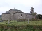
Aguadoce (Esteiro):-
A good hotel right near the beach. The route passes here (waymarked) coming down the coast and passing Faro. We explored a little, but not far, towards Faro as it was all the paving again and our feet complained. The route for next day was on the road towards Viveiro so we explored that a little instead.
Photos:- looking north towards Faro; those uneven slabs.
 

Attachments

  • Aguadoce1.webp
    Aguadoce1.webp
    100.5 KB · Views: 5
  • slabs.webp
    slabs.webp
    92.8 KB · Views: 5
Holoholo automatically captures your footpaths, places, photos, and journals.
May 14th - Aguadoce to Viveiro:-
Walking from Aguadoce on the 14th should have been easy, but again the signs disappeared. The first short walk along the side of the beach was on the minor road, then went uphill to join the main road. at a right turn there was no real sign and a passing delivery man said that it went no-where. The next road had no sign either so we stayed on the main road which winds its way into Viveiro instead of being a direct route. As we reached the petrol station our receptionist from the hotel called out and offered us a ride; gratefully received. She took us to the bus station and we then walked up the hill, past the church of Santiago to our hotel (booked by e-mail before we left home). This gave us plenty of time to start exploring Viveiro where we planned to spend 4 nights before taking the FEVE to Espasante, and finally Ponte Mera to walk on to San Andrés.
 

Attachments

  • towards Viveiro.webp
    towards Viveiro.webp
    64.5 KB · Views: 3
  • santiago Viveiro.webp
    santiago Viveiro.webp
    90.6 KB · Views: 3
Last edited:
Viveiro:-
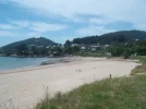
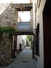
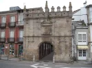
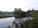
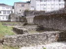
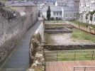
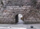
Viveiro is a fascinating little city with many ancient remains from its gateway to the old fortifications. We spent our days here exploring and walking both to Covas, to the Castelo beach and the Capilla de Misericordia, and along the river path.
 

Attachments

  • Viveiro fortifications.webp
    Viveiro fortifications.webp
    193.4 KB · Views: 6
  • Viveiro gateway1.webp
    Viveiro gateway1.webp
    126.4 KB · Views: 4
  • Viveiro oldest street.webp
    Viveiro oldest street.webp
    112.1 KB · Views: 4
  • Viveiro gateway2.webp
    Viveiro gateway2.webp
    121.1 KB · Views: 4
  • Covas.webp
    Covas.webp
    52.5 KB · Views: 4
  • Covas2.webp
    Covas2.webp
    120.2 KB · Views: 4
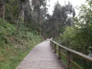
The walk along the river was enjoyable. We did like the locals and walked on the track at the side of the dreaded paving. :). The boarded section was very good and the scenery was lovely and with the eucalyptus in flower.There was also a section of track leading to a picnic area where we had a snack before walking back into Viveiro.
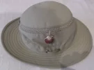
It was in Viveiro that I found a shell for my hat, in the enclosed convent. The display cabinet had numbers and to buy an item you rang the bell, spoke into the speaker, giving the number, and the nun put the item on an enclosed revolving tray. I put my money on in return. My little shell is very special and the shell I received in Santiago is almost identical, just larger. Thank you Johnnie and the Chaplaincy team for reviving the custom.
With so many photos from Viveiro we will be posting a further selection on the blog when we have completed the walk to San Andrés and on to Santiago..
 

Attachments

  • Viveiro river1.webp
    Viveiro river1.webp
    169.1 KB · Views: 5
  • Viveiro river2.webp
    Viveiro river2.webp
    182.3 KB · Views: 6
  • Viveiro river3.webp
    Viveiro river3.webp
    78.4 KB · Views: 5
  • Viveiro shell.webp
    Viveiro shell.webp
    33.8 KB · Views: 5
Ideal sleeping bag liner whether we want to add a thermal plus to our bag, or if we want to use it alone to sleep in shelters or hostels. Thanks to its mummy shape, it adapts perfectly to our body.

€46,-
In Franco´s time the oficial name was Vivero. Fortunately in democracy, the president of Xunta Manuel changed names into Galician names, So, Vivero- Viveiro, Cabañas - Cabanas, Cillero - Celeiro, etc.
 
Slightly off topic, but on the way home the little tourist advert train (another story) from Ferrol had both 'proxima parada' and 'vindeira parada' displayed for all the stations to Ribadeo.
Thanks to Pelegrin for correcting my Gallego :)
 
Last edited:
The 2024 Camino guides will be coming out little by little. Here is a collection of the ones that are out so far.
May 18th - Viveiro to Espasante:-
Our next stage was by FEVE round the coast to Espasante. The route given showed a walk over the hills and we had decided before leaving home that this was where we would miss the section, so giving us time for the break in Viveiro. With the signing as bad as it had been in some places , distance and apparent lack of acomodation we feel this was the correct decision for us.
Our hostess for the night said that the station at Espasante was well out of town and to call when we arrived there. She came herself to collect us and also insisted on taking us back next morning for the early train. So much kindness, as in all the places we have been.
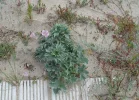
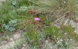
Elswhere on the forum some-one has said that there is not much mention of the flowers along the way, so here are some that Terry took in Espasante on the dunes.
 

Attachments

  • sea-holly.webp
    sea-holly.webp
    280 KB · Views: 5
  • hottentot-fig.webp
    hottentot-fig.webp
    235.6 KB · Views: 6
May 19th - Espasante to Ponte Mera and San Andrés:-
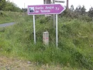
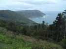
We left Espasante on the 8.27 train to Ponte Mera and set off from the station there just after 9.00am. (No sign to the village but it is the middle road straight downhill.) For the first time we had to get our ponchos out as it started to rain :(. However it quickly stopped to our great relief. We followed the road signs through Ponte Mera towards San Andrés (purple 'monument' signs) and the only place we saw an unmarked road the locals said no we needed the next one round the bend (in sight from the other at the bend) with both a purple sign and a red sardine. This is all road walking uphill for 9kms so it was slow but steady. Lovely views and a convenient heap of logs for a bocadillo (our tin of sardines on bread). Climbing ever upward past the Capilla de Socorro until the final 3kms which are all downhill. The only place where the 'sardines' marked an off-road section was so churned up through the forestry that we went over the bank and back on the road, as had others before us. We avoided the steep drop from the hilltop cruceiro and kept to the hairpins on the road (adding about 3kms to the distance) reaching San Andrés at 14.15.
Total distance via hairpins 15kms+.
 

Attachments

  • SanA signs.webp
    SanA signs.webp
    197.7 KB · Views: 8
  • capilla de s.webp
    capilla de s.webp
    132.7 KB · Views: 8
  • San Andres.webp
    San Andres.webp
    137.6 KB · Views: 8
Last edited:
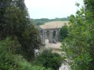
San Andrés de Teixido:-
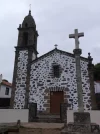
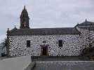
While a kindly cafe owner prepared us a meal we went down to the church, our destination reached. Then it was lunch and a taxi (called by radio-telephone) to Cedeira and a rest for our tired feet after walking 160kms of the Camino do Mar (plus sightseeing).
 

Attachments

  • San Andres3.webp
    San Andres3.webp
    74.4 KB · Views: 6
  • San Andres4.webp
    San Andres4.webp
    92.6 KB · Views: 5
  • San Andres5.webp
    San Andres5.webp
    72.1 KB · Views: 6
€2,-/day will present your project to thousands of visitors each day. All interested in the Camino de Santiago.
Slightly off topic, but on the way home the little tourist advert train (another story) from Ferrol had both 'proxima parada' and 'vedeiro parada' displayed for all the stations to Ribadeo.

According to the Galego dictionnary a videiro is a fortune teller:). I think that the phrase that you saw was "vindeira parada".
So, from the photos you found a few people in San Andrés (Santo André!). It seems that the whole bulk is at weekends.
 
Thank you for the correction Pelegrin - post duly edited. I had taken a photo of the information screen but sadly it was on the SD card which corrupted - I lost the photos of the train too.
There were very few people in San Andrés so as you say I think that most people must go at the week-end. The fact that we were walking was of great interest the whole way, so we think that most people go with transport, certainly from Ribadeo, even Ponte Mera and probably from Ferrol too.
It would be interesting to hear of some of the Lugo Amigos walking the route right through, without back-up transport, and then reporting back on the route - signing, accomodation etc. We realised from the reports that we read that they take a mini-bus to their start points and walk for the day, or weekend. This accounts for the gaps, not only in signs round or through towns but also in some cases between stages on the map/diagram.
When we have finished updating the blog and also our time on the Camino Inglés we will list the places we passed through, and where we differed from the path given. It was well worth walking and we found so many lovely places and people as we walked.
 
Priests in the parishes organize trips from all over Galicia to visit San Andrés and other places Last time I was there, there were several buses from the south of Galicia. San Andrés has a humble church, but before the relaunching of Camino de Santiago was by far much more popular as pilgrimage destination .
 
Get a spanish phone number with Airalo. eSim, so no physical SIM card. Easy to use app to add more funds if needed.
Cedeira:-
The distance from San Andrés to Xubia is approximately 34 kms, with a break around Porto de Cabo. The advice given to take a taxi from San Andrés to Cedeira and accomodation is good, however as previously noted there is no mobile phone signal in San Andrés. The village has its own system so the cafe owner called a taxi for us. (The mobile works at the top of the hill where the road is signed to Cedeira.)
Cedeira itself was worth visiting with its Casas Indianas and beach. Our hotel was about 4kms out of town, at Cordobelas, so we walked along the road at the side of the beach to catch the bus to Ferrol next day. After 2 nights in Ferrol we set off again on the Camino Inglés, so further posts will go on the Inglés section of the forum, then we will add more about Viveiro etc here later.
(Edit - there are more photos now on the blog as far as Cedeira)
 

Attachments

  • cedeira2.webp
    cedeira2.webp
    88 KB · Views: 5
Last edited:
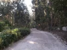
Thank you so much for posting all this wonderful information. As I walked the Ingles last year ,I was so intrigued by going to San Andres. Beautiful photos! Did you get any amulets in San Andres? Pretty shell for your hat.
 
Thank you so much for posting all this wonderful information. As I walked the Ingles last year ,I was so intrigued by going to San Andres. Beautiful photos! Did you get any amulets in San Andres? Pretty shell for your hat.
We didn't want amulets, although they are available, instead we have little medallions of San Andrés. They now hang on our packs with the similar ones from Covadonga (the Santina) and Santiago.
 
Holoholo automatically captures your footpaths, places, photos, and journals.
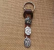
Medallions from top to bottom:-
The Santina (Virgen de Covadonga); Santiago; San Andrés de Teixido.
 

Attachments

  • medallions.webp
    medallions.webp
    194.7 KB · Views: 12
Reading your interesting blog. I would like to say that in my opinion the pronountiation of the "X" Galega is exactly the same as the English "SH".
Did you visit the three tube fountain in San Andrés?
In Galicia and North Portugal in every holy place there is a holy fountain. I wonder why there isn´t a holy fountain in Santiago. Maybe because Santiago was not a previous prechristian holy place.
 
3rd Edition. More content, training & pack guides avoid common mistakes, bed bugs etc
We did not go further down the hill past the church in San Andrés so did not go to the fountain, but we did see the fountain in Viveiro. :)
Also on Día de las Letras we saw a flower dance, but do not know what it represents. The 'tree' fell down 'dead' and was revived by the throwing of flowers.
I pressed 2 petals from the rose that I was given.
 

Attachments

  • Viveiro fountain.webp
    Viveiro fountain.webp
    116.2 KB · Views: 4
  • Viveiro dance.webp
    Viveiro dance.webp
    123.7 KB · Views: 3
The ritual in the fountain is you first ask for something to San Andres, after you drink from the three tubes, then throw bread crumbs to the pond. If the bread floats then your request will be accomplished.

The meaning of the dance on Dia das Letras maybe either had to do with a book written in Galego or was an alegoria about the renaissance of the literature in Galician Language.
 
Our journey home from Santiago via Ferrol, Ribadeo and Pravia is on the Inglés thread Our (slow) Camino Inglés May 2015. By the time we reached Pravia we wondered what else could happen, but from there onwards life returned to 'normal' - apart from losing photos when the camera card corrupted.
Time in Pravia will be on the blog, with maybe a single post here.
 
...and ship it to Santiago for storage. You pick it up once in Santiago. Service offered by Casa Ivar (we use DHL for transportation).
Great, great thread! Your attention to detail is so helpful, Tia.

Just a note to say that when I was taking a rest day on my Camino de Invierno, I spent a night at a casa rural on the Miño. Some of the guests were planning a visit to the Catedrais beach the next day and learned from the host that the Xunta has started to limit the number of visitors to the beach, during summer (from July 1) and in Semana Santa. Info in English here:
https://ascatedrais.xunta.es/monatr...1:prd-jboss-c02-0005-hc-001-server-05?lang=en

The limit is 4,812 (!) visitors a day, and low tide slots are of course the most likely to fill up quickly. I watched as someone tried to fill in the online reservation form for him and his six family members, and it was frustrating and very slow, requiring DNI numbers for each person, for example. This is the first year for this system, so there will undoubtedly be kinks to be worked out. Has anyone actually used this system yet?

Buen camino, Laurie
That should be interesting! There is a fairly big car park and a restaurant with just one set of access steps to the beach. I wonder how they are going to control
a) traffic
b) visitors not accessing the beach

Glad we went when we did as there were not that many there in May.
 
Over here in Cumbria the word for waterfall in "force", which is apparently derived from the Old Norse word "fors", from when the vikings were active in these parts. A Danish friend who visited was surprised at how many local words she recognised - fell for hill, beck for stream, clegg for horsefly, dale for valley, tarn for lake, scar for cliff and village names ending in -by etc.
In Norway the word for waterfall is foss. When I once visited York and Yorkshire I too was surprised ( and pleased) to find all these Old Norse words:-) And in Lake District I even found my own surname, Langdal, in Great and Little Langdale.
 
Ideal sleeping bag liner whether we want to add a thermal plus to our bag, or if we want to use it alone to sleep in shelters or hostels. Thanks to its mummy shape, it adapts perfectly to our body.

€46,-
Terry has just bought a book in Spanish, translated from Gallego, about the Celtic-British influence in N E Spain. It will be interesting to see if other words have crossed the language barrier as well as reading about the influence in the area we have just been walking through.
 
In Norway the word for waterfall is foss. When I once visited York and Yorkshire I too was surprised ( and pleased) to find all these Old Norse words:) And in Lake District I even found my own surname, Langdal, in Great and Little Langdale.

Just curious Tulle :- do you recognise the words "snoksnarl" and "rigg-welted". I am not even sure how to spell them, never having seen them written down!
I was delighted by the entrance and exit signs in Norway - "ingan" and "utgan" ( it is 40+ years ago so again not sure of the spelling). My childhood language would have used "gan in" and "gan oot". Lots of similarities in the East Riding of Yorkshire which was basically Scandinavian until after the Norman conquest.

Blessings
Tio Tel
 
Great, great thread! Your attention to detail is so helpful, Tia.

Laurie, (and others) If you are interested in walking this route you need to know that there are many, many kilometers of paved track! Not just alongside the beaches but also along the cliff tops.

DSCF3685.webp DSCF0104.webp

Of all my 6 caminos this was the only one where my feet really did hurt!! No blisters, just bruising on the balls of my feet. I think it was due to the slight uneven / unyielding surface of the paving. Sadly in many places there was no alternative. Even the tarmac road from Ponte de Mera up to San Andrés was better than the paving. The coastal scenery was marvellous, the local people generous and welcoming - if only there were no "improvements" to the coastal path!

As Catedrais is sadly not what it was. :( Some of the most impressive and accessible arches were destroyed in the winter storms. It is really only worth a visit at low tide when one can walk along the beach, otherwise it is no different to many other less written about and still beautiful coves along the Galician coast.

DSCF0039.webp DSCF0041.webp

Blessings
Terry
 
The focus is on reducing the risk of failure through being well prepared. 2nd ed.
Just curious Tulle :- do you recognise the words "snoksnarl" and "rigg-welted". I am not even sure how to spell them, never having seen them written down!
I was delighted by the entrance and exit signs in Norway - "ingan" and "utgan" ( it is 40+ years ago so again not sure of the spelling). My childhood language would have used "gan in" and "gan oot". Lots of similarities in the East Riding of Yorkshire which was basically Scandinavian until after the Norman conquest.

Blessings
Tio Tel
Sorry, I don't recognise the two words, I try to pronounce them but in vain. The words for entrance and exit are "inngang" and "utgang". You' ve got it almost correct, that's good after 40 years!
 
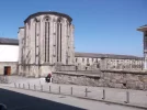
Having said that we would post some more about Viveiro here are some photos of the fortifications again. The site has been excavated and the footings of the houses inside the old walls can be seen. The tower itself is over the gateway, the lowest of those remaining and probably the oldest. It is possible to climb the outside steps of the tower to see over the wall to the old street below. This goes down between the walls to the plaza with the church and convent
 

Attachments

  • viveiro tower.webp
    viveiro tower.webp
    194.7 KB · Views: 1
  • from viveiro tower.webp
    from viveiro tower.webp
    176.4 KB · Views: 1
  • viveiro tower gateway.webp
    viveiro tower gateway.webp
    138.6 KB · Views: 1
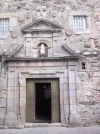
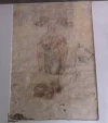
The church of Sta Maria do Campo has interesting carvings on the door arches. It stands at the end of the street coming from the tower and is next to the enclosed convent. The outer door of the convent leads to the hallway where the wall painting can be seen and the display cabinet where I found my shell, as explained in a previous Viveiro post.
The final photo is of Viveiro itself from the river bridge, which goes across to Covas and the Capilla de Misericordia.
 

Attachments

  • sta maria do campo.webp
    sta maria do campo.webp
    88.1 KB · Views: 4
  • sta maria do campo2.webp
    sta maria do campo2.webp
    113.1 KB · Views: 4
  • sta maria do campo3.webp
    sta maria do campo3.webp
    195 KB · Views: 4
  • Viveiro convent.webp
    Viveiro convent.webp
    135 KB · Views: 4
  • Viveiro convent wallpainting.webp
    Viveiro convent wallpainting.webp
    57.9 KB · Views: 4
  • viveiro.webp
    viveiro.webp
    66.7 KB · Views: 4
The focus is on reducing the risk of failure through being well prepared. 2nd ed.
I have struggled to think where is best to post about Pravia and Santianes, which we visited on our way home. As neither are strictly on the Camino, but are near Gijón I have decided that here is the best place. There are a number of other photos on the blog Camino 2015

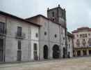
If you followed our Camino Inglés thread you will have seen that our train broke down in Navia and we arrived in Pravia in a taxi provided by RENFE/FEVE. A good hostal/pension right on the main roundabout into town and near the FEVE station. It was actually very quiet and run by very friendly folk. We visited the church of Sta Maria in the main plaza and also attended mass there on the Sunday.

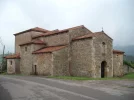
We had planned to walk out to Santianes but decided that a taxi out was better as it seemed that part of the route may have slipped into the river. The museum was closed so we walked out to the bird sanctuary which was very interesting, then back into Santianes itself. The museum was being opened up so we joined the other couple and then were also able to go into the church too. It is beautiful and was well worth the time and effort of going. (We learnt that you need to book the opening at the tourist office in Pravia, or phone them from Santianes and this includes Saturdays).

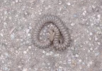
The walk the following day along part of the river walk was where we saw the iberian viper, and was it cross at being disturbed....

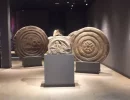
On the Monday it was FEVE again, with a fervent prayer for no more problems, via Oviedo to Arriondas and next day to Santander. There we finally were able to visit the Museum of Pre-history which is now in the town centre underneath the information office (entrance down the side street). Then it was the ferry home and time to make plans for next year, which will be with a car so that we can reach all those places (well some of them) that we could not walk to in previous years.
 

Attachments

  • Sta Maria.webp
    Sta Maria.webp
    89.8 KB · Views: 1
  • Santianes.webp
    Santianes.webp
    104.2 KB · Views: 2
  • viper.webp
    viper.webp
    224.3 KB · Views: 2
  • santander discs.webp
    santander discs.webp
    35.5 KB · Views: 2
Last edited:
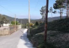
I must correct a mistake: Foz in Galego doesn´t mean sickle as I said in other post. The word for that tool is Fouce. The reason for that mistake was because Foz is a "false friend" of Spanish Hoz (sickle) and in my case I'm far from agricultural tasks since many years ago. So, the only meaning for Foz in Galego as far as I know is River Mouth and in this case thanks to Terry I'm pretty sure that this word comes from latin Fossa.
According to a sign in the town, it seems that the town's name comes from the Latin faucem, not fossa, river mouth rather than ditch.
 

❓How to ask a question

How to post a new question on the Camino Forum.

Featured threads

❓How to ask a question

How to post a new question on the Camino Forum.

Featured threads

Forum Rules

Forum Rules

Camino Updates on YouTube

Camino Conversations

Most downloaded Resources

This site is run by Ivar at

in Santiago de Compostela.
This site participates in the Amazon Affiliate program, designed to provide a means for Ivar to earn fees by linking to Amazon
Official Camino Passport (Credential) | 2024 Camino Guides
Back
Back
Top