• ⚠️ Emergency contact in Spain - Dial 112 and AlertCops app. More on this here.
  • Remove ads on the forum by becoming a donating member. More here.

Search 74,075 Camino Questions

LIVE from the Camino Rota Vicentina - April 2022

jungleboy

Spirit of the Camino (Nick)
Time of past OR future Camino
Some in the past; more in the future!
The Rota Vicentina is not a camino but it has its own sub-forum so we can still be live on it!

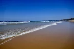
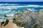
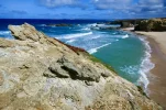
Today was Day 0 of our Rota Vicentina. We spent the day exploring the little beaches and coves near Porto Covo and in doing so we managed 10km of walking. It was quite windy but it was sunny for most of the day, the scenery was stunning, and we enjoyed our ‘soft’ introduction to being back on a long-distance walking trail.
67A36572-0FB1-4A02-A432-02863B3DCA27.webp

2955BA44-9E2C-4E69-B891-5A9B7538330F.webp

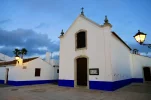
I had been to Porto Covo before but Wendy hadn’t. The village is small and pretty quiet at the moment (being out of season) but there’s an attractive main square where we had a drink after our walk today, and a few restaurants are open. This is the village church at nightfall yesterday:
B29C8FCB-AFBB-41FD-87C1-8FF1F305EEE4.webp

Tomorrow we start walking south on the ‘Fisherman’s Trail’ coastal route all the way to Sagres and eventually Lagos.
 
The 2024 Camino guides will be coming out little by little. Here is a collection of the ones that are out so far.
Loved the walk! Did it March 2016 from Santiago do Cacem (crossed over to Porto Covo on day two) and continued south on the Fisherman's Trail till the Cabo. Walked with an Italian I met in Porto Covo otherwise only saw a couple of people walking north. I'll be curious to hear if it's busier now.

We stayed in surfing hostels which were perfect, no need to bring a sleeping bag or towels.

Beautiful seaside scenery but zero culture. Your legs will get a good workout those first few days through sand.

Ultreia!
 
Last edited:
Join the Camino cleanup. Logroño to Burgos May 2025 & Astorga to OCebreiro in June
Rota Vicentina Day 1: Porto Covo - Vila Nova de Milfontes: ~20km

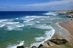
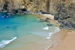
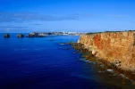
Today was a glorious day to start our RV - sunny but not hot (a high of 17 deg Celsius), and without the strong winds of yesterday. The entire walk was along the coast and the scenery really is fabulous. It’s very much ‘wild beauty’, with windswept cliffs and dunes towering over remote beaches and large rock formations rising out of the water and sand.

FBB4CC06-DA88-4CF5-B03A-20940F538F6A.webp

Coastal walking is new to us, so it was fun to take our shoes off at times and dip our feet into the ocean. Walking on soft sand for much of the stage made it a little difficult, but Wendy’s feet love soft surfaces so we’ll take sand over cobblestones any day of the week!

On the practical side, there is a fort about 3.5km out of Porto Covo and shortly after this the route turns inland. We were advised by multiple people to stay on the beach instead, and while most of the subsequent walking was on sand, some of it involved scrambling over large pebbles, which was less pleasant. After the surfer beach Praia do Malhão, we rejoined the official path and most of the rest of the stage was on dune-cliffs above the ocean, with spectacular views.

Vila Nova de Milfontes is larger than Porto Covo and does more of a tourist/surfer trade. Like Porto Covo, the buildings are whitewashed and the town centre is pleasant. We’re staying at Sol da Vila and have a nice en-suite double room for €35.

B7393CDF-A837-427C-A4A3-525DA1006888.webp

Finally, we have seen a few other hikers already in both directions, so the RV seems more popular than any other camino/walk we’ve done in Portugal except for the CP north of Porto.
 
Walked with an Italian I met in Porto Coco otherwise only saw a couple of people walking north. I'll be curious to hear if it's busier now.
It definitely seems to be. We have seen about 11 others going north-south so far, which is the more popular direction. And there also seem to be more hikers who checked in to our hotel today after us.
 
Last edited:
Coastal walking is new to us, so it was fun to take our shoes off at times and dip our feet into the ocean. Walking on soft sand for much of the stage made it a little difficult, but Wendy’s feet love soft surfaces so we’ll take sand over cobblestones any day of the week!
You could have written that about our walk on the Norte in 2018. My darling Rachel's feet also love the sand.
Thank you for the photos, they're fabulous!
 
A selection of Camino Jewellery
Rota Vicentina Day 2: Vila Nova de Milfontes - Almograve: ~12km

This short day was made even shorter by taking a boat across the river at Vila Nova de Milfontes rather than walking a 3.5km detour over the only bridge in town. The boat ride was quick but fun and it dropped us on the beach (Praia das Furnas) for another day of rugged coastline exploration.

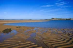
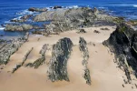
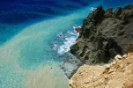
The scenery, trail and weather were all similar to yesterday so it was a really pleasant day once again. There were a couple of new elements to the scenery today which I enjoyed: unusual sand and water patterns at the mouth of the river to begin the day, and some sharp and dark (volcanic?) rock formations at various places along the way.

77B5F869-7F89-4F33-A2ED-55EAC8869882.jpeg

02E2C141-62AC-45DC-BD70-E84EFC5B0734.jpeg

Again we had the option a couple of times of going off the marked trail and walking on the beach instead. We did this once but have learned that these unofficial routes can be a bit tricky when it comes to rejoining the main path. We had to use a rope to scramble up a dune-cliff to leave the Praia das Furnas, and were told there was a difficult rope climb at the end of a subsequent beach later in the day so we opted to take the higher trail that time instead.

Almograve is another whitewashed town but it doesn’t seem to have that much to offer. We’re staying at the HI hostel and had booked in advance but another hiker was turned away for not having a reservation. It’s a huge place (as most HI hostels are) so I’m surprised that it’s full, but in addition to the RV hikers there are at least two other groups.
 
Last edited:
Get a spanish phone number with Airalo. eSim, so no physical SIM card. Easy to use app to add more funds if needed.
Rota Vicentina Day 3: Almograve - Zambujeira do Mar: ~22km

Another great day and one that was better than expected on a couple of fronts. Firstly, the forecast was for cloudy skies all day but after it started out that way, the sun came out and stayed out for the rest of the stage. And secondly, we hadn’t heard great things about the trail today owing to limited beach walking, some ascents on the soft dune sand and some roadside gravel walking, but we found none of that to be much of an issue.

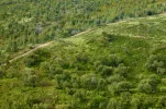
Most of the trail was on dune-cliffs, affording the usual stunning views of the cliffs and the ocean below, although we also walked through a pine forest briefly which made for a nice change of scenery.

68D559BE-B6E3-4A9B-8D25-A6FE88B5E3F7.jpeg

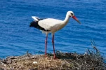
The other new element today was that we saw our first storks! And instead of the usual stork nests high up on church towers or telegraph poles, here they are spectacularly perched on cliffs. This also allows you to be eye-to-eye with the storks rather than straining your neck to look up at them, which was a very pleasant surprise!

D3D11947-58B8-47E6-8C71-DBB1418ABB29.jpeg

At Zambujeira do Mar, Hostel Nature is a very friendly family hostel that we highly recommend, with dorms and private rooms.
 
Last edited:
I’m curious as to why the preference is to go North - South? Do the websites promote it as such? I would think it might be a bit easier to walk north to keep the sun out of ones eyes....
 
I’m curious as to why the preference is to go North - South? Do the websites promote it as such? I would think it might be a bit easier to walk north to keep the sun out of ones eyes....
We have heard 90% of hikers go north-south. I assume it’s because people arrive in Lisbon and the northern trailhead is close by (a two-hour bus ride away). You also have tailwinds walking north-south though I’m not sure whether hikers are really aware of this when they make their decision. The waymarking signage goes both ways.
 
A selection of Camino Jewellery
Rota Vicentina Day 4: Zambujeira do Mar - Odeceixe: ~18.5km (but my phone says we did over 20km)

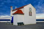
Today was a bit tough as we aren’t in proper walking shape yet and were already a bit sore from yesterday when we started out. It was forecast to rain in the early afternoon, so we left shortly after dawn to ensure that we made it to Odeceixe before the rain (and we did!). That also resulted in us seeing this sky behind the seaside chapel in Zambujeira as we were leaving:

311D5098-38C5-4897-9CE9-D6C48B2877EC.webp

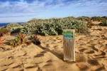
Despite the forecast and those ominous clouds, it was sunny for most of the stage. There was no beach walking today and much of the stage was on the dune-cliffs above the sea. Here’s what these soft-sand trails look like:

D50C9B52-831C-4AEF-B674-B95FB0CB27CA.webp

The last 4km of the stage was inland along a river to Odeceixe, which is similar to the other villages but probably the most interesting one we’ve passed through in a couple of days. It still hasn’t really rained yet but it looks like it could at any moment, and it’s supposed to continue into tomorrow. That’ll give us a chance to try out our new ponchos!
 
I’m curious as to why the preference is to go North - South? Do the websites promote it as such? I would think it might be a bit easier to walk north to keep the sun out of ones eyes....
Another possible reason is that not everyone walks the whole thing and the northern stages are considered the best ones for coastal scenery. So starting in Porto Covo and going as far south as time allows is what some hikers do.
 
Another possible reason is that not everyone walks the whole thing and the northern stages are considered the best ones for coastal scenery. So starting in Porto Covo and going as far south as time allows is what some hikers do.
I guess I’m so used to thinking of all the routes that go “north” to Santiago it’s hard for me to get my head around hiking “south”, lol.
 
Perfect memento/gift in a presentation box. Engraving available, 25 character max.
Rota Vicentina Day 5: Odeceixe - Aljezur: ~18.5km (inland)

With rain falling overnight and this morning and more forecast for this afternoon, we took the short option of the inland route today rather than attempting the coastal loop which would have added an extra 4-5km. We managed to completely avoid the rain and have lunch at a vegan restaurant in Rogil so what could have been a pretty ordinary day turned out to be a very successful one!

Today felt more like a camino than any other previous day on the RV. We walked through some pine forests and eucalyptus plantations and there was some ‘mud-caking’ on the dirt trails after the overnight rain, bringing back memories of the Camino de Madrid. There were even cobblestones in all three towns we passed through, which seemed to add authenticity, although Wendy wasn’t too impressed with them!

Aljezur is the most interesting and historic village on the RV so far, which also adds to the increased camino vibe. It’s built on the slopes of a hill with an old castle at the top. I was able to visit the castle before the rain started and I’ll hopefully go up and see it again in better light tomorrow morning.

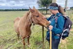
It wasn’t a great photo day today, given the conditions, but Wendy has a way with animals and she had this nice moment today with a horse that we met on the trail:

B755ECF1-BE94-4BF6-BF86-9C4E72AA02D6.webp
 
Rota Vicentina Day 6: Aljezur - Carrapateira: ~26.5km

Today showcased pretty much everything the Rota Vicentina has to offer: we started in a historic village, spent much of the day inland among fragrant pine trees after overnight rain, reached the coast in the afternoon for sweeping cliff-top views, and then descended onto a long beach for a stroll in the sand before reaching Carrapateira - and all of it in sunshine. The contrast in scenery was quite striking:

DB99306A-FEE4-483D-ADA9-1789B6DCD632.jpeg

C594A058-7FD4-47DE-A6D8-9D8B04FA652A.jpeg

It was our longest day yet on the RV because we skipped Arrifana entirely due to the route and the town being described as uninteresting, so we combined two days into one. That made it a long but worthwhile day.

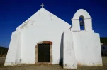
Carrapateira is more interesting than I would have thought and contains my favourite church on the RV so far: a small, whitewashed 16th-century structure that still boasts two original Manueline (pobre) door frames, including one that can be seen in this photo:

78792A44-1764-4680-9CA3-84BC95F24855.jpeg

More sunny adventures coming tomorrow!
 
Last edited:
Holoholo automatically captures your footpaths, places, photos, and journals.
Rota Vicentina Day 7: Carrapateira - Vila do Bispo: ~16km

Today we had the option of a shorter but more difficult coastal route or a longer (22km) inland route. We took the coastal route and that seemed to be the right choice, as it heads back inland eventually anyway so this was a ‘best of both worlds’ option. The official materials say the 16km coastal route is hard and takes 6.5 hours, and while there are a couple of steep ups and downs, I wouldn’t call it very hard and it only took us about four hours of walking time.

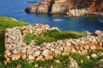
The main reason we chose the coastal route was to visit the ruins of a 12th-century Muslim fishing village, Ponta do Castelo. There wasn’t much to the ruins themselves - just foundations about a foot high - but the cliff-top location was spectacular. Plus, I am always interested in seeing Islamic cultural heritage in Portugal because there seems to be so little of it in general despite nearly 550 years of Muslim rule in parts of the country.

6D375235-9FD6-4D92-BA82-22CCAB110D60.webp

Vila do Bispo seems to be a pretty nondescript place but it has a Lidl and two veg-friendly restaurants so we’ll take it. Sagres and the southwestern-most point of mainland Europe tomorrow!
 
Rota Vicentina Day 8: Vila do Bispo - Sagres: ~20km

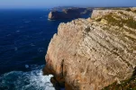
Although this wasn’t our last day on the RV, it felt a bit like a bit of a victory lap nevertheless. It was an easy and flat walk where for the first 14km, it felt less about the journey and more about getting to the destination: the Cape of St. Vincent, the southwestern-most point of the European continent.

E0FB2D7C-D6B3-4D48-9F94-2CA29B3E4CEA.webp

The Cape is basically the RV’s equivalent of Finisterre. It feels like an achievement to reach it and the ocean views are spectacular, but it’s overrun with tourists and gift shops and doesn’t feel anything like the rest of the walk. About 1km further on, there’s an old fort which only sees a trickle of visitors, so we had our picnic lunch there and were able to reflect on our walk in a quieter setting.

We then continued to Sagres, which I believe used to be the end of the route, but since it now extends to Lagos, we are continuing for two more days - only now we’ll be walking east along the south coast of Portugal rather than south along the west coast as we’ve been doing so far.
 
Jungleboy,

Thank you so much for posting your descriptions and splendid photos of this walk south on the RV.
For my husband and me it has brought back memories of driving down this coast during easier times.

As you turn east towards Lagos perhaps you and Wendy would enjoy a meal at Praia Camilo. Perched on the seaside is a very good simple fish restaurant, O Camilo. Don't miss it.
...Bom appetito!
 
Last edited:
Perfect memento/gift in a presentation box. Engraving available, 25 character max.
Jungleboy,

Thank you so much for posting your descriptions and splendid photos of this walk south on the RV.
For my husband and me it has brought back memories of driving down this coast during easier times.

As you turn east towards Lagos perhaps you and Wendy would enjoy a meal at Praia Camilo. Perched on the seaside is a very good simple fish restaurant, O Camilo. Don't miss it.
...Bom appetito!
Thank you, I’m glad it brought back nice memories for you!

As for the restaurant, unfortunately we don’t eat fish but we’ve been pleasantly surprised by how well we’ve eaten on this walk compared with previous caminos in Portugal.
 
As for the restaurant, unfortunately we don’t eat fish but we’ve been pleasantly surprised by how well we’ve eaten on this walk compared with previous caminos in Portugal.
Could be because the RV area (coastal/surfing) gets more tourism, and from a different demographic that has a group consistently looking for vegetarian/vegan options. Possibly not so common in the interior.
 
Could be because the RV area (coastal/surfing) gets more tourism, and from a different demographic that has a group consistently looking for vegetarian/vegan options. Possibly not so common in the interior.
Definitely, and I’d add some expatriates to that reasoning as well. But those areas are still very remote, the villages aren’t big and the tourism is small-scale, so I still didn’t expect this many options!
 
...and ship it to Santiago for storage. You pick it up once in Santiago. Service offered by Casa Ivar (we use DHL for transportation).
We have heard 90% of hikers go north-south. I assume it’s because people arrive in Lisbon and the northern trailhead is close by (a two-hour bus ride away). You also have tailwinds walking north-south though I’m not sure whether hikers are really aware of this when they make their decision. The waymarking signage goes both ways.

Didn't realize about the tailwinds.

Walking north south was an easy decision for me (although I did fly into Lisbon) cause I have a friend who lives close to the end of the route. Walking towards her house and spending a few days with her at the end seemed nicer than at the beginning. I personally also enjoyed having the sun on my face in March.
 
Rota Vicentina Day 8: Vila do Bispo - Sagres: ~20km

Although this wasn’t our last day on the RV, it felt a bit like a bit of a victory lap nevertheless. It was an easy and flat walk where for the first 14km, it felt less about the journey and more about getting to the destination: the Cape of St. Vincent, the southwestern-most point of the European continent.

View attachment 122290

The Cape is basically the RV’s equivalent of Finisterre. It feels like an achievement to reach it and the ocean views are spectacular, but it’s overrun with tourists and gift shops and doesn’t feel anything like the rest of the walk. About 1km further on, there’s an old fort which only sees a trickle of visitors, so we had our picnic lunch there and were able to reflect on our walk in a quieter setting.

We then continued to Sagres, which I believe used to be the end of the route, but since it now extends to Lagos, we are continuing for two more days - only now we’ll be walking east along the south coast of Portugal rather than south along the west coast as we’ve been doing so far.

Definitely agree.
After having walked many Caminos and often ending in Santiago, the arrival at the Lighthouse was quite anticlimactic. Luckily I was picked up by a friend who lives near Vila do Bispo and I spent a few days with her before heading back north by bus.
Nevertheless, the Rota Vicentina is spectacular!
 
Rota Vicentina Day 9: Sagres - Salema: ~18km

Today was the warmest day, by far, of our RV even though it only reached 18-19 degrees Celsius. Walking into the sun in the morning and the south coast not having the winds of the west coast made it seem warmer than it was and it was nice to walk in shorts and a t-shirt for the first time.

This is also the most difficult stage of the RV according to the official website because of the ups and downs from beaches to headlands and back, but once again we didn’t find it that hard.

There are suddenly a lot more people - hikers, surfers, van lifers etc - than we’ve been used to but it was mostly another peaceful coastal walk with lovely views back towards Sagres.

F825B91D-C86D-4EEB-9C2C-2332FFDF3454.jpeg

Salema to Lagos is listed as two very short stages on the official website but we are combining it into one tomorrow to go out with a bang on the last day of our Rota Vicentina!
 
A selection of Camino Jewellery
Rota Vicentina Day 10: Salema - Lagos: ~23km

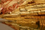
Today was really great stage to finish the Rota Vicentina. I especially liked the first couple of hours between Salema and Burgau, which felt much more remote than yesterday. The views were great, there was an old fort to explore, and I loved these weathered rocks on the beach at Salema:

2EEA7D11-B894-4A7B-8918-8FD1F4C14CF8.webp

Burgau and especially Luz are touristy places, and the mansions and people increased significantly around these areas. We had a great late breakfast in Luz before continuing towards Lagos, enjoying these unusual views of the ocean below:

08799CDE-7620-4BF6-8584-34244448B7F1.webp

There were a lot of people at the Ponta da Piedade, the cape near Lagos, but the views of rock formations rising out of the water was spectacular and that made for a wonderful final view of the ocean before we hit the town.

AD34A3CD-1711-4836-A9C1-26EA8768674F.webp

Once upon a time, 21 years ago, Wendy worked in a bar in Lagos for a few months and this is the first time she has been back since. It’s probably not really our kind of place these days but we’re having a rest day here tomorrow anyway before heading back to Lisbon.

Thanks to everyone who followed along with us!
 
Beautiful photos!

I was wondering whether the fact that it's nearly Easter and that there could be school holidays might explain the number of tourists. Would there be fewer people at other times of the year?

Thanks to everyone who followed along with us!
Thank you @jungleboy for sharing this walk! 😊
 
I was wondering whether the fact that it's nearly Easter and that there could be school holidays might explain the number of tourists. Would there be fewer people at other times of the year?
I’m sure the Easter period does exacerbate it a bit but certain parts of the Algarve coast are very touristy most of the year. That’s to be expected, of course, so it’s not a complaint, but walkers should be aware that after Sagres there is definitely a different vibe.

Thank you for all your support!
 
Join the Camino cleanup. Logroño to Burgos May 2025 & Astorga to OCebreiro in June
The RV would be perfect for your darling as it’s basically been all sand so far! 🤣
I walked the RV in April 2019. I love the sand in small doses, but I was very relieved to have the deep sand finally smooth out somewhat eventually on day 3 or 4 after leaving Porto Covo...whew!
 
Last edited:
@jungleboy, I've loved following along, better late than never, having just returned home from vacation. Your beautiful photos and route descriptions brought back many memories for me.
Thank you for sharing your experience on the RV!
 
Join the Camino cleanup. Logroño to Burgos May 2025 & Astorga to OCebreiro in June

❓How to ask a question

How to post a new question on the Camino Forum.

Featured threads

❓How to ask a question

How to post a new question on the Camino Forum.

Featured threads

Forum Rules

Forum Rules

Camino Updates on YouTube

Camino Conversations

Most downloaded Resources

This site is run by Ivar at

in Santiago de Compostela.
This site participates in the Amazon Affiliate program, designed to provide a means for Ivar to earn fees by linking to Amazon
Official Camino Passport (Credential) | 2024 Camino Guides
Back
Back
Top