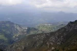
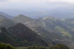
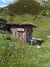
Not really on the Camino del Norte, but not far from it... I saw this video on YouTube and it looks stunning.

-
Get your Camino del Norte Guidebook here.
-
 ⚠️ Emergency contact in Spain - Dial 112 and AlertCops app. More on this here.
 -
Remove ads on the forum by becoming a donating member. More here.
Search 74,075 Camino Questions
You are using an out of date browser. It may not display this or other websites correctly.
You should upgrade or use an alternative browser.
You should upgrade or use an alternative browser.
Picos de Europa
- Thread starter ivar
- Start date
€2,-/day will present your project to thousands of visitors each day. All interested in the Camino de Santiago.
- Time of past OR future Camino
- 2012, 2013, 2014.
Wow.
Ideal sleeping bag liner whether we want to add a thermal plus to our bag, or if we want to use it alone to sleep in shelters or hostels. Thanks to its mummy shape, it adapts perfectly to our body.
€46,-
€46,-
- Time of past OR future Camino
- Recent:Norte/Muxia- Spring '23
MadridWay- Fall '23
I'm young at heart...but not young in reality.Absolutely stunning! But you'd have to be a young mountain goat

Tia Valeria
Veteran Member
- Time of past OR future Camino
- Pt Norte/Pmtvo 2010
C. Inglés 2011
C. Primitivo '12
Norte-C. de la Reina '13
C. do Mar-C. Inglés '15
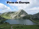
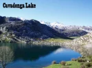
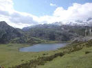
That google photo looks like almost the same photo as my screen background - the Lago de Enol, above Covadonga.
Beautiful area as are other parts of the Picos.
We went up to the lakes by car and walked to the mirador between the two lakes. Steep but rewarding. (Not a drive for the faint-hearted!) Lovely place and a good cafe/restaurant, just visible to the right in my photo. The second photo is the other lake from the mirador -Lago de la Ercina
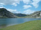
(Edit:- I have finally found the 'servicios' photo on my phone. Will transfer it and put in a new post later )
)
Beautiful area as are other parts of the Picos.
We went up to the lakes by car and walked to the mirador between the two lakes. Steep but rewarding. (Not a drive for the faint-hearted!) Lovely place and a good cafe/restaurant, just visible to the right in my photo. The second photo is the other lake from the mirador -Lago de la Ercina


(Edit:- I have finally found the 'servicios' photo on my phone. Will transfer it and put in a new post later
Last edited:
lovingkindness
Veteran Member
- Time of past OR future Camino
- .
...that brings back memories! so serene....
A selection of Camino Jewellery
- Time of past OR future Camino
- CF: 2001, 02, 04, 14. Ourense to Santiago 2019.
Loved it!
- Time of past OR future Camino
- CF: 2001, 02, 04, 14. Ourense to Santiago 2019.
Absolutely stunning! But you'd have to be a young mountain goat

Or, an old ewe.
- Time of past OR future Camino
- 2019
Very interesting video. I have done some parts of this video.
From the refugio de Vega Urriellu he passes near Torrecerredo peak, the highest of Picos, 2648 mts (I climbed it with a guide) then he continues to refugio in Jou de Cabrones down to Poncebos and Garganta del Cares (the most popular walk in Picos).
Doing the Torrecerredo peak was a fantastic experience. It is technically easy and you don't need to be a climber but is better to go with a guide (if you don´t have vertigo, of course).
...and ship it to Santiago for storage. You pick it up once in Santiago. Service offered by Casa Ivar (we use DHL for transportation).
NorthernLight
Veteran Member
- Time of past OR future Camino
- Le Puy-Santiago 2012-13; +++; Somport-Burgos 2023
Magnificently stunning!
Mike Savage
So many friends to meet . . . so little time
- Time of past OR future Camino
- Camino Francés,Inglés
Muxia/Finisterre
Português Coastal
Português Central
Sanabrés
Absolutely beautiful! Thanks for sharing this.
Anamya
Keeping it simple
- Time of past OR future Camino
- Frances (2015)
Portugues (2017)
Lebaniego (2019)
We passed through part of the Picos de Europa while walking our Camino Lebaniego this year (you can go higher if continuing on the Vadiniense).
It was one of the most stunning places I've ever seen in my life. And I've been to all continents, in some dozen different countries, so it was really a big deal. I am now considering the Salvador just to be around that region again.
It was one of the most stunning places I've ever seen in my life. And I've been to all continents, in some dozen different countries, so it was really a big deal. I am now considering the Salvador just to be around that region again.
Holoholo automatically captures your footpaths, places, photos, and journals.
F
Former member 49149
Guest
If only! As a little girl, my dream was to be a ballet dancer. As the same little girl, but considerably older, this short film captures another impossible dream! Thanks, Ivar.
Ideal pocket guides for during & after your Camino. Each weighs only 1.4 oz (40g)!
Dsavid Keyte
Member
- Time of past OR future Camino
- Camino de San Salavador (2015)
Camino de la Costa (2016)
Camino Lebaniego 2017
I look across to the Picos, every morning from my Terrace in León, a wonderful sight
I did not make it.. I found it on YouTubeFantastic video! Did you do all the photography yourself?
A selection of Camino Jewellery
SusanSmyth
Happy Member 😋
- Time of past OR future Camino
- 2017 2018 2019 2019 2023
We are on the Vadiniense right now, having completed the Lebaniego. This Camino is, for me at least, by far the most arduous and the most stunningly beautiful. Day 8 and we have met one other peregrino.
- Time of past OR future Camino
- 2019
Picos de Europa is in the border of three regions: Cantabria, Asturias
and León.
He starts his trip in Fuente Dé (Cantabria), next villages are Sotres, Bulnes and Poncebos all of them in Asturias. At the end of Senda del Cares (when he passes tunnels) is Cain (León) and finally back to Fuente De.
There are spectacular views of Naranjo peak. Naranjo is the Cantabrian name, but in Asturias it is called Urriellu (that means little hórreo).
The one from Galicia (the round) and the one from Castilla & Leon. Individually numbered and made by the same people that make the ones you see on your walk.
Luka
Veteran Member
- Time of past OR future Camino
- Next: Camino Sanabrés (May 2024)
I look at the Picos every day from the other side ;-)I look across to the Picos, every morning from my Terrace in León, a wonderful sight
Bob from L.A. !
Veteran Member
- Time of past OR future Camino
- CF 2012, 2014, 2016. CN 2018, 23 Via francigena 23
Great solitude there. Some photos looked like the Sierras here in California.
Thanks for posting
Thanks for posting
Just to point out that the beginning of the video is on the Vadiniense. If you walk the Lebañiego from San Vicente to Potes, and then continue on the Vadiniense, your first couple of days take you up to Fuente Dé and then on the Senda da Remoña through that lovely valley.
If the Vadiniense ever really took off, I’ll bet they could find a lot of off-asphalt alternatives, but there is a LOT of asphalt on this route after the Picos part, which joins up with the Francés in Mansilla de las Mulas.
If the Vadiniense ever really took off, I’ll bet they could find a lot of off-asphalt alternatives, but there is a LOT of asphalt on this route after the Picos part, which joins up with the Francés in Mansilla de las Mulas.
3rd Edition. More content, training & pack guides avoid common mistakes, bed bugs etc
Tia Valeria
Veteran Member
- Time of past OR future Camino
- Pt Norte/Pmtvo 2010
C. Inglés 2011
C. Primitivo '12
Norte-C. de la Reina '13
C. do Mar-C. Inglés '15
The focus is on reducing the risk of failure through being well prepared. 2nd ed.
Liz Drew
Member
- Time of past OR future Camino
- 2016 Coastal Portuguese
2018 Via de la Plata
(2019) del Norte
Wow! That is absolutely stunning! I knew they would be as I was walking within dinner got of them recently! Good on you. Really inspirationalNot really on the Camino del Norte, but not far from it... I saw this video on YouTube and it looks stunning.

- Time of past OR future Camino
- SJPP - Najera Sep 2017; Najera to Astorga Oct 2018
Wow, stunning scenery! Thanks for sharing the film, Ivar!
andylm65
Active Member
- Time of past OR future Camino
- 2018
I’m going to need another life for this one. Incredibly beautiful.Not really on the Camino del Norte, but not far from it... I saw this video on YouTube and it looks stunning.

...and ship it to Santiago for storage. You pick it up once in Santiago. Service offered by Casa Ivar (we use DHL for transportation).
Margaret Butterworth
Active Member
- Time of past OR future Camino
- 2013 (Pamplona to Burgos)
2014 (Burgos to Villafranca del Bierzo)
2015 (Villafranca to Santiago)
2016 (Le Puy to Conques; SJPP To Pamplona)
Could anyone provide a link to Rebekah's guide?
Try this. I think, but am not sure, that this version includes some of the updates we worked on together. But it is way out of date now, at least 6 years.Could anyone provide a link to Rebekah's guide?
If I had time and were back in the area, I would definitely consider a few nights in Fuente De for some more day walks. I took one in 1995 when I was traveling as a tourist, up from the parador on the teleférico, and even my jaded teenage kids were gobsmacked.
Ideal pocket guides for during & after your Camino. Each weighs only 1.4 oz (40g)!
Margaret Butterworth
Active Member
- Time of past OR future Camino
- 2013 (Pamplona to Burgos)
2014 (Burgos to Villafranca del Bierzo)
2015 (Villafranca to Santiago)
2016 (Le Puy to Conques; SJPP To Pamplona)
Thanks, the link works! I am not intending to walk that Camino - I'm just thinking of travelling around the region by bus and doing day walks. There aren't many guide books to the Picos.
Margaret,Thanks, the link works! I am not intending to walk that Camino - I'm just thinking of travelling around the region by bus and doing day walks. There aren't many guide books to the Picos.
If you want to splurge and stay at the parador in Fuente Dé (which is a modern building, not gorgeous by any means but well located and with great views), they have lots of information there on day walks and routes.
When I walked through, I later learned that the parador rate would not have been much more than for the hotel I stayed at across the street. When I started walking the next morning, I took a chance and found that the night clerk at the parador was happy to make me a cup of coffee, so I could get on my way. This was in my pre-electric coil days.
Tia Valeria
Veteran Member
- Time of past OR future Camino
- Pt Norte/Pmtvo 2010
C. Inglés 2011
C. Primitivo '12
Norte-C. de la Reina '13
C. do Mar-C. Inglés '15
We have a gude called 'Picos de Europa - car tours and walks' published by 'Sunflower'; ISBN 978-1-85691-386-7; published in 2010. There might b a later update.Thanks, the link works! I am not intending to walk that Camino - I'm just thinking of travelling around the region by bus and doing day walks. There aren't many guide books to the Picos.
it gives guides to various walks both long and short, good advice and some travel information.
We plan on using some of its suggestions ourselves in 2020.
Edit:-
Two links found -
Maps world wide ship worldwide and the updated book is from 2017.
Better still is Sunflower publishing's own site where you can pay for a pdf download or order a paper copy from Amazon uk. The Amazon uk site says that the paper copy takes up to 3 months for delivery.
Last edited:
Get a spanish phone number with Airalo. eSim, so no physical SIM card. Easy to use app to add more funds if needed.
- Time of past OR future Camino
- 2019
Thanks, the link works! I am not intending to walk that Camino - I'm just thinking of travelling around the region by bus and doing day walks. There aren't many guide books to the Picos.
Up there (from the Cablecab in Fuente De) there is a track easy to walk. I don't recommend to leave the track to walk on the rocky area unless you are an experienced mountaineer even If you had a guide (book).
- Time of past OR future Camino
- CFx5
Norte
Primitivo
CP
Le Puy-SJPP
Via F
A fantastic Spanish map of the Picos was available from Stanfords in London when we walked a 9 day circuit of the Picos in 2007 and we found a basic...very basic guide in the Lonely Planet "walking in Spain", but it had information re the refugios and hostals
Also as Tia Valeria said, the Sunflower books are excellent also
It is indeed an amazing place with some of the hardest walking we've ever done, including a few hairy bits that we would not even consider doing now!
In Cangas and Potes we saw some pilgrims ......not knowing at the time that they were probably walking the Vadiniense Camino...
Guess this is another one to add to the list of "to be walked caminos"!!
The list is growing I think.
Annette
Margaret Butterworth
Active Member
- Time of past OR future Camino
- 2013 (Pamplona to Burgos)
2014 (Burgos to Villafranca del Bierzo)
2015 (Villafranca to Santiago)
2016 (Le Puy to Conques; SJPP To Pamplona)
I never go anywhere without my electric coil! And I always stay at a Parador when I come across one!Margaret,
If you want to splurge and stay at the parador in Fuente Dé (which is a modern building, not gorgeous by any means but well located and with great views), they have lots of information there on day walks and routes.
When I walked through, I later learned that the parador rate would not have been much more than for the hotel I stayed at across the street. When I started walking the next morning, I took a chance and found that the night clerk at the parador was happy to make me a cup of coffee, so I could get on my way. This was in my pre-electric coil days.https://www.caminodesantiago.me/com...ric-coil-changed-my-life-on-the-camino.19167/
Join the Camino cleanup. Logroño to Burgos May 2025 & Astorga to OCebreiro in June
Kiwi-family
{Rachael, the Mama of the family}
- Time of past OR future Camino
- walking every day for the rest of my life
Question 1: is a tent necessary or could you use huts for the whole walk?
Question 2: how much of that rock scrambling holding on to ropes is there? I can see myself getting stuck, not able to go back or forwards!
Question 2: how much of that rock scrambling holding on to ropes is there? I can see myself getting stuck, not able to go back or forwards!
Last edited:
- Time of past OR future Camino
- 2019
I am not an expert in Picos but I know that there are several refugios where you can sleep, eat and have a hot shower. Also there are some huts. Tents are not permitted but I think that you don't need them.Question 1: is a tent necessary or could you use huts for the whole walk?
Question 2: how much of that rock scrambling holding on to ropes is there? I can see myself getting stuck, not able to go back or forwards!
In normal long walks in Picos (travesias), I don' t know anyone that requires a rope (rappel). Nevertheles it is possible in some stretches to get stuck if you lose the marks/cairns. Therefore, it wouldn't be a bad idea to carry a rope (6 or 7 meters) if you walk alone (without a guide) just in case.
SusanSmyth
Happy Member 😋
- Time of past OR future Camino
- 2017 2018 2019 2019 2023
We did the Lebaniego/Vadiniense in October. Of my four Caminos (Francés, Inglés, Madrid and L/V) I think this one is far and away the most spectacular and difficult. I would definitely do it again..... but never without GPS because there are mountain stretches with little or no markings. Without GPS some parts would have been dangerous, particularly between Fuente Dé and Puente la Reina.
Join the Camino cleanup. Logroño to Burgos May 2025 & Astorga to OCebreiro in June
- Time of past OR future Camino
- 2012
As has been said "Wild camping" is not permitted in the Picos (though "emergency bivouacs" are). That said the refugio network is pretty good and the alta villages like Sotres, Cangas, Tresviso etc all have accommodation options. The key is good route planning if you want to have a wander about. Potes, Espinama, Fuente De, Sotres, Bulnes, Las Arenas will give you a great hike. As would throwing a right from Sotres to Tresviso and the Sendera to La Hermida and back to Potes. Fuente De to Cares, Oseja, Cangas, Bulnes, Sotres... is a cracker too.Question 1: is a tent necessary or could you use huts for the whole walk?
Question 2: how much of that rock scrambling holding on to ropes is there? I can see myself getting stuck, not able to go back or forwards!
Never needed a rope on any route, just good maps, a compass and careful planning. Carry plenty of water, you're in limestone country. Oh, and check the snow line forecasts every day
- Time of past OR future Camino
- 2019
Never needed a rope on any route, just good maps, a compass and careful planning.
Yes, there is no need of rope in normal 'travesias' but there are very steep stretches. For example, in Fuente De - Poncebos there was a chain in Horcados Rojos to ease the descent .In Lagos de Enol - Poncebos, Canal de Trea is very very steep and long. In those stretches is very important don' t lose the way.
- Time of past OR future Camino
- 2019
Yes, there is no need of rope in normal 'travesias' but there are very steep stretches. For example, in Fuente De - Poncebos there was a chain in Horcados Rojos to ease the descent .In Lagos de Enol - Poncebos, Canal de Trea is very very steep and long. In those stretches is very important don' t lose the way.
On this video the first part (up) is Canal de Trea from Senda del Cares to refugio de Vega Ario.
I did it (down) 30 years ago from Lagos de Enol. There was a point in the middle not well marked, where some people had lost the way and got stuck.
Finally, I got to Senda del Cares and turned left to Poncebos (Asturias). Right is Cain (León).
The focus is on reducing the risk of failure through being well prepared. 2nd ed.
Planning to spend a couple of days hiking the Picos de Europa next June...after our Camino hike.
Question 1: is a tent necessary or could you use huts for the whole walk?
Question 2: how much of that rock scrambling holding on to ropes is there? I can see myself getting stuck, not able to go back or forwards!
Kia ora from Auckland familia Kiwi!
As Pelegrin said you have many well known and marked trails in Picos de Europa and mountain huts along the way (depending on season not all accessible due to snow) but keep in mind the video is an adventure covering 90 miles!...and often venturing into expert climbing territory. El Naranjo de Bulnes (the highest peek) is used by many people as preparation before they attemp climbs like Everest, and some parts of the video appear to be in that area.
La Ruta del Cares along the gorge of the river Cares (going through tunnels) is an amazing walk accessible to everybody as well as many other trails in Cabrales and along Lagos (lakes) de Covadonga.
On the cultural side, there are many historical sites in the area particularly Covadonga.
If you are interest in Paradors, the Parador of San Pedro de Villanueva a Romanesque 12th century monastery in Cangas de Onis by the river Sella is a great place to visit/stay.
Also, depending when you plan to visit you could be part of fastastic festivals as well, such as:
1/Certamen del Queso de Cabrales
Festival of touristic interest (30th August) Cabrales is very famous for its blue cheese.
2/Fiesta del Pastor en los Lagos de Covadonga. Festival of touristic interest (25 July) ...dia de Santiago, by the way.
3/Fiesta de la Virgen de Covadonga (8 September) Patron saint of Asturias so a festive day in the principality.
4/International Descent of the river Sella (8 August). A UNESCO world heritage tourism event with over 1,000 canoes and a train that travels at the speed of the canoes along the river to Ribadesella (on the camino del norte)
The bollos preñaos ("pregnant" bread rolls baked with chorizo inside) and asturian cider with gaitas, traditional dances and all night street fiesta follows....so no need for accommodation!
I can't advise on books/guides (other people have made suggestions) but every Officina de Turismo has plenty of information available in English.
Finally, I'll be posting this elsewhere but a number of local councils in that part of Asturias are working together to have an existing but forgotten Camino de Santiago route officially recognised as "La ruta de la Reconquista".
It is historically known that peregrinos passed through Picos de Europa (from Liebana) to Covadonga & then to Oviedo. They went to pray in Covadonga as this is the birthplace of modern christian Spain. It is also believed that the Asturian king (first to walk to Santiago on the camino primitivo) visited Covadonga to pray before his journey. So this "camino de la reconquista" route is incredibly significant in Spanish history.
Looking forward to hearing about your adventure!
Saludos y buen camino.
- Time of past OR future Camino
- 2019
Mima 1965, Very good description of Picos de Europa.
Only to say that Naranjo de Bulnes (2519) is not the highest.
The highest one is Torrecerredo. 2648 mts.
Naranjo is the most difficult. The west face is extraplomo (extrathin ?).
I climbed Torrecerredo 20 years ago with a guide., The final 50 mts are very impressive because is almost vertical but easy to climb.
The guide told me that I was able (after him) to climb Naranjo on its south face. But I haven't done it.
Mima 1965, Very good description of Picos de Europa.
Only to say that Naranjo de Bulnes (2519) is not the highest.
The highest one is Torrecerredo. 2648 mts.
Naranjo is the most difficult. The west face is extraplomo (extrathin ?).
I climbed Torrecerredo 20 years ago with a guide., The final 50 mts are very impressive because is almost vertical but easy to climb.
The guide told me that I was able (after him) to climb Naranjo on its south face. But I haven't done it.
Thanks for your contribution pelegrino. Yes, you are absolutely right! .... I'm relying on memory and what I thought was El Naranjo de Bulnes in the distance in the video....and a few people I knew who climbed the Naranjo's vertical south face ....and that is not a small achievement!
The video is spectacular with the scenery and the gorgeous refugios and villages from Fuente De to which I seem to recognise as Sotres and Bulnes ....fabada appears to be one of the meals!
Certainly no need for ropes to get to most of those places!
Gracias por tu aporte. Saludos
The focus is on reducing the risk of failure through being well prepared. 2nd ed.
Tia Valeria
Veteran Member
- Time of past OR future Camino
- Pt Norte/Pmtvo 2010
C. Inglés 2011
C. Primitivo '12
Norte-C. de la Reina '13
C. do Mar-C. Inglés '15
The parador is amazing. We had looked down on it when walking from Arriondas to Covadonga in 2013.
In 2018 we stopped there for a coffee, the last time we were in the area. The grass was being mown by a robot mower which was great fun to watch.
Sadly the church itself ws locked but the coffee was served in the cloisters and the exterior of the buildings was lovely.
In 2018 we stopped there for a coffee, the last time we were in the area. The grass was being mown by a robot mower which was great fun to watch.
Sadly the church itself ws locked but the coffee was served in the cloisters and the exterior of the buildings was lovely.
Walking Nature World
Active Member
- Time of past OR future Camino
- Camino del Norte (2018)
It is truly an amazing area to hike in, we discovered it while doing our Camino del Norte and saw the Picos from a far thinking that we need to get back and explore it. What are some of the best treks to do on the area? We would love to do some long distance ones if possible but of course not too extreme as with the backpacks it is going to be impossible. Is there some kind of Tour de los Picos when you are hiking through the best spots? Thank you in advance.
- Time of past OR future Camino
- I´ve got Camino plans until 2042,
- or till I fall flat on my face, whichever comes first !!
or just a mountain goatAbsolutely stunning! But you'd have to be a young mountain goat

BAAAAAHHHH...
Perfect memento/gift in a presentation box. Engraving available, 25 character max.
Tia Valeria
Veteran Member
- Time of past OR future Camino
- Pt Norte/Pmtvo 2010
C. Inglés 2011
C. Primitivo '12
Norte-C. de la Reina '13
C. do Mar-C. Inglés '15
You could try looking at this little guide book 'Walking in Picos de Europa'.It is truly an amazing area to hike in, we discovered it while doing our Camino del Norte and saw the Picos from a far thinking that we need to get back and explore it. What are some of the best treks to do on the area? We would love to do some long distance ones if possible but of course not too extreme as with the backpacks it is going to be impossible. Is there some kind of Tour de los Picos when you are hiking through the best spots? Thank you in advance.
Although many are linked by car it is also possible to use public transport to the start points. Mix of long and short walks. We have an older edition but this looks similar.
Carol Moody
Camino Carol
- Time of past OR future Camino
- Camino Portuguese 2018, Camino del Norte, Caminos to Finisterre and Muxia 2019
I plan to go to the Picos after I finish the CP about 26 April 2020. It's nice to see the information you have all contributed. I will have to read through it, then maybe pose a few questions. Gracias 
❓How to ask a question
How to post a new question on the Camino Forum.
Most read last week in this forum
Planning on walking Norte-Primitivo starting about June 10, 2025.
Are the albergues very busy at that time and also what will the weather be?
I did this the end of August and September of 2017 and...
Similar threads
- Replies
- 27
- Views
- 6K
- Replies
- 12
- Views
- 2K
- Replies
- 9
- Views
- 2K
- Replies
- 7
- Views
- 2K
- Replies
- 0
- Views
- 426
❓How to ask a question
How to post a new question on the Camino Forum.
Most downloaded Resources
-
“All” Albergues on the Camino Frances in one pdf“All” Albergues on the Camino Frances in one pdf
- ivar
- Updated:
-
A selection of favorite albergues on the Camino FrancésFavorite Albergues along the Camino Frances
- Ton van Tilburg
- Updated:
-
Profile maps of all 34 stages of the Camino FrancesProfile maps of all 34 stages of the Camino Frances
- ivar
- Updated:


