• ⚠️ Emergency contact in Spain - Dial 112 and AlertCops app. More on this here.
  • Remove ads on the forum by becoming a donating member. More here.

Search 74,075 Camino Questions

Mountain alternatives for the Vasco Interior

peregrina2000

Moderator
Staff member
There has been some recent forum chatter about alternatives and I thought I would start a new thread to see if I can get more clarity.

For the experts out there, first a question about terminology. Is it right that the Via Bayona starts in Bayonne, picks up the Vasco Interior in Irun, and then splits from the Vasco Interior after Puebla de Arganzón, with the Interior heading to Santo Domingo de la Calzada, and the Bayona heading to Burgos?

In any event, I hope to walk from Irún to Santo Domingo next year, and have been going through all of the Vasco Interior threads on the forum. My pal jpflavin tells me the Vasco has a LOT of asphalt, and that is not my preference. But there seems to be an alternative. After Hernani, head off the Camino to Lasarte. What is not clear to me is where to rejoin the Camino. One version of this suggests you can go all the way to Zegama on the mountain route, whereas another version suggests you head down to the official camino earlier, in Besaín. I see that Fatma seems to have walked the off-road alternative, but I am not clear on her starting point and stages, so @Fatma if you are out there, I’d love to hear from you.

I think that the forum members who have walked the Interior more recently took a slight detour at Segura to avoid road walking into Zegama (this alternative is shown on gronze), but I would like to get off the road as early as possible if it is feasible.

Any other help on this? Many thanks, buen camino, Laurie
 
€2,-/day will present your project to thousands of visitors each day. All interested in the Camino de Santiago.
...
For the experts out there, first a question about terminology. Is it right that the Via Bayona starts in Bayonne, picks up the Vasco Interior in Irun, and then splits from the Vasco Interior after Puebla de Arganzón, with the Interior heading to Santo Domingo de la Calzada, and the Bayona heading to Burgos?
...
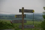
Yep, Via de Bayona is from Bayonne to Burgos while Vasco Interior is from Irun to Sto.Domingo de la Calzada. They are overlapping from Irun to just after the village of Estavillo. See attached photo, left for Vasco, right for Bayona.
IMG_6177.webp
 
Holoholo automatically captures your footpaths, places, photos, and journals.
Assume you've gone through the CSJ guides for the tunnel route? https://www.csj.org.uk/planning-your-pilgrimage/csj-guides-and-updates/ bit out of date but I think they mention the off road routes you're looking for.

https://hiking.waymarkedtrails.org/#?map=10!43.0235!-2.2163 might be of more use.

When I was going through the tunnel a local walking group were very concerned about where I was going (I was pushing a bike) and the distances involved, although familiar with the camino they didn't seem familiar with marked camino route which comes out at Zalduondo. Looking at the waymarkedtrails.org map I guess they thought I was walking the GR25 or GR282 which explains their concern.
 
After the descend from the St.Adrian's Tunnel you have at least two trails. I took the one on the asphalt road because everything else was so soaked from the rain I didn't want to have the same experience as walking up to the Tunnel (which was awful!!!).
 
The focus is on reducing the risk of failure through being well prepared. 2nd ed.
Yeah, there is some mish-mash of markings after the Roman road (after the tunnel). I kept my direction to the left and I safely descend into the valley.
 
Laurie, it's been a year and a half since the Beloved and I walked the Vasco from Irun to Santo Domingo ( blessed be the road-maker) but we don't remember a LOT of asphalt. Some for sure, the first day or so but then track, path and by-way.

The 'alternative' route ( in the CSJ guide) from Beasain to Segura is now the way marked route from the footbridge over the railway. We took the 'old' route in steady rain. One disagreement with the CSJ guide and other comments in this section is the Albergue in Zegama / Segama. It is not located in a Porto-cabin. It is the Polideportivo of the school - a few bunk beds along one side of the school gymnasium. The 'facilities' are the children's toilets in the ground floor level, no showers that we ever found.
At Salvatierra / Agurian when we were there the Hospitalero wasn't answering their 'phone and the telephone number posted on the door of the closed officina Tourismo was the number of the Officina de Tourismo, we could here it ringing when we were stood outside. The friendly staff at the municipal swimming pool, near the Albergue, we're sure they would be handed the keys 'next month'. The only pension was painfully expensive but very friendly.

We loved every metre of the Vasco, even the asphalt bits.
Is there alternative from Beasain to Segura??? I only know of Segura to Zegama alternative option.

And obviously Zegama albergue is no longer in pre-fab containers as I see on Gronze. Anyway it leaked in 2016 and we had a lot of buckets placed in the dorm ;)
 
The one from Galicia (the round) and the one from Castilla & Leon. Individually numbered and made by the same people that make the ones you see on your walk.
No help from me regarding alternative routs. I started from Biarritz airport to Irun (Markers after Saint-Jean-de-Luz). From Irun I followed the yellow arrows/Gronze map to Santo Domingo and then CF to Burgos. The route along the Orio river was mostly on asphalt, but did not worry me. The landscape itself was so beautiful that you did not think about it.
 
Is there alternative from Beasain to Segura??? I only know of Segura to Zegama alternative option.

And obviously Zegama albergue is no longer in pre-fab containers as I see on Gronze. Anyway it leaked in 2016 and we had a lot of buckets placed in the dorm ;)

Hi Kinky, you are right, the alternative (now way-marked) route starts in Segura. I was typing late at night without the benefit of my note book.
 
Hi Laurie
here's my three ha'pence worth, and an attempt to disentangle some of the recent posts:
1. nomemnclature for Vasco / Bayonne seems to have been sorted by Kinky's post and no-one yet has come back with a counter explanation
2. Gronze stage 4 Besain to Zegama leaves the valley floor after Besain and heads into the low hills via Olaberria. This is much longer than walking directly along the pedestrian paths beside the main roads and river on the valley floor. Consequently some people call the Olaberria route a mountain/hilly alternative. The elderly hospitalero volunteers at Besain (2015) were pretty much advising people to take the lower direct road route. But, as per Gronze, in anything but awful weather the hilly route by Olaberria is the one to take. We very much enjoyed it, passing through typical Basque countryside and villages and finding many ripe cherries beside the small roads at the end of June.
3. On the same stage is the mountain variant shown between Segura and Zegama, via Zerain. There's a whole thread about this, that I started and then concluded when I returned (in 2015) and I don't think any new info has been added anywhere on the forum about this since.
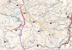
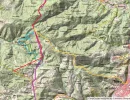
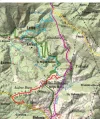
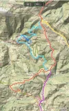
4. Back to your original post and mountain alternatives from Hernani to Zegama, which pretty much cuts out all of the discussion on points 2 and 3 above (as they would all be by-passed). There is an alternative route that is documented in the 2011 tourist guide to the northern caminos, which many of us have used as a supplementary guide for years. The PDF is still online and can be found here . The regular route and the two variant stages are described in basic terms on pages 138-145. You can see that the first part of the variant shows an elevation gain of about 900m. Nice.
Interestingly the second 'stage' suggests going to Zerain and then Segura and then to Zegama. But of course if you take the lovely mountain variant from Zerain you shorten the distance and follow a much nicer path (but miss out on the gothic horror of Segama, where sunflowers are pinned to the front doors to stop the evil spirits from entering... but maybe that's for another thread).
Finally, about asphalt on the Vasco. Yes, there is a lot and especially in the first few days, but lots of it is on pavements and pedestrian paths, and walking beside all the intensity of people, industry and commerce here is all part of the Basque experience and the development of Basque culture. For most people, good cushioned shoes and these typically short stages are enough to ameliorate this. I think this camino doesn't fit so neatly with the criteria by which we judge other caminos as being satisfying - it upsets the template a bit and that's no bad thing.
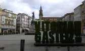
PS I always have to say this but it is essential to set aside enough time in Vitoria-Gasteiz to take the guided tour of the old Katedrala Santa Maria, still one of the most sensational experiences of any camino anywhere!
 
A selection of Camino Jewellery
Thanks to everyone! This is what I love about these less traveled routes, you can always find a couple of forum members with great memories and lots of tips. Actually, a better way to say this is that this is what I love about this forum! Having so many people to help with the less traveled routes.

I did not know that the Gronze route through Olaberria was actually an off-route alternative to the road option. That opens up this possibility:

1. Irún to Lasarte, 30 km (leave Camino at Hernani, it’s a short walk over to Lasarte from there)
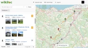
2. Lasarte to Bidania, off camino alternative https://es.wikiloc.com/rutas-senderismo/camino-vasco-lasarte-bidania-9365945 , 28 km
3. Bidania to Besaín (20) https://es.wikiloc.com/rutas-senderismo/camino-vasco-bidania-beasain-9366873 (at which point I am back on the official camino) (And if I’m feeling exuberant and raring to go, I could always walk on beyond Besaín.)
4. Besaín to Zegama, through Olaberria, Segura, and Zerain (17 km).

And then onward on the official camino exclusively, no more deviations or mountain alternatives that I can see, but maybe someone else has some ideas.

No matter how this plays out, I have heard enough about the cathedral visit in Vitoria to know that I will make sure to be there early enough on a day when it’s open in the afternoon. Thanks for that tip.

I’m wondering what time of year people have walked this route.

Mil gracias, buen camino, Laurie
 
Hi Laurie,
I walked the Camino Vasco twice (2013 and 2014) in July. It was great, I loved it.

Wishing you a wonderful time there,
Csutak
 

Attachments

  • Vegyes 157.webp
    Vegyes 157.webp
    549.7 KB · Views: 25
A selection of Camino Jewellery
In 2013 I had to sleep in the Polideportivo of the school in the school gymnasium -ALONE! It was not my best night. :oops:o_O
 

Attachments

  • Vegyes 170.webp
    Vegyes 170.webp
    745.5 KB · Views: 24
I'm not sure the Albergue de peregrinos de Zegama was open due to some kind of sporting (?) event the night I was there in May but Pensión Zegama was comfortable. My Spanish is dire but if I understood the lovely chap in the beautiful Albergue de peregrinos de Beasain correctly, Pensión Zegama was the only place to stay before the tunnel that night. Pancorbo, looked like an interesting place, I would have gone up to the fort if I had known it was here: http://www.pancorbo.es/lugares-de-interes/folleto-pancorbo-puntos-de-interes
 
I'm not sure the Albergue de peregrinos de Zegama was open due to some kind of sporting (?) event the night I was there in May but Pensión Zegama was comfortable. My Spanish is dire but if I understood the lovely chap in the beautiful Albergue de peregrinos de Beasain correctly, Pensión Zegama was the only place to stay before the tunnel that night. Pancorbo, looked like an interesting place, I would have gone up to the fort if I had known it was here: http://www.pancorbo.es/lugares-de-interes/folleto-pancorbo-puntos-de-interes
Thanks for the info. I checked on gronze, and it looks like Pancorbo is on the Bayona to Burgos after the split. I think I’m going to stay on the Vasco to Santo Domingo de la Calzada. But I’ll keep that in mind. These are pretty tentative plans at this point! ;)
 
Ideal pocket guides for during & after your Camino. Each weighs only 1.4 oz (40g)!
Thanks for the info. I checked on gronze, and it looks like Pancorbo is on the Bayona to Burgos after the split. I think I’m going to stay on the Vasco to Santo Domingo de la Calzada. But I’ll keep that in mind. These are pretty tentative plans at this point! ;)
Yep, Pancorbo is on Via de Bayona. It's the end of possibly the nicest stage of Bayona. Nice albergue too but very odd opening hours in that communal/youth center and there fore maybe hard to get the keys to the dorm.
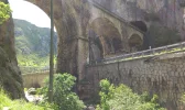
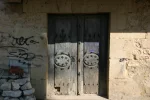
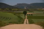
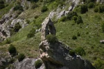
Just a little bit before Pancorbo is the most narrow passage where RR, highway, Camino and the river are sharing space. Some photos attached..
 

Attachments

  • 2016-06-01 14.13.59.webp
    2016-06-01 14.13.59.webp
    1.7 MB · Views: 31
  • 2016-06-01 14.15.51.webp
    2016-06-01 14.15.51.webp
    1.9 MB · Views: 31
  • 2016-06-01 14.21.18.webp
    2016-06-01 14.21.18.webp
    1.3 MB · Views: 31
  • 2016-06-01 14.24.31.webp
    2016-06-01 14.24.31.webp
    1.9 MB · Views: 30
  • 2016-06-01 14.43.37.webp
    2016-06-01 14.43.37.webp
    1.1 MB · Views: 29
  • 2016-06-01 17.54.24.webp
    2016-06-01 17.54.24.webp
    1 MB · Views: 31
  • 2016-06-07 20.14.09.webp
    2016-06-07 20.14.09.webp
    1 MB · Views: 32
Yep, Pancorbo is on Via de Bayona. It's the end of possibly the nicest stage of Bayona. Nice albergue too but very odd opening hours in that communal/youth center and there fore maybe hard to get the keys to the dorm.
Just a little bit before Pancorbo is the most narrow passage where RR, highway, Camino and the river are sharing space. Some photos attached..

Some breathtaking photographs there ...
Thank you, @KinkyOne !
 
The focus is on reducing the risk of failure through being well prepared. 2nd ed.
Thanks @chinacat but it's the scenery that's breathtaking ;)

Now, wait a minute, Kinky. I have a friend who is a good photographer (maybe not as good as you), and she once told me that she was so tired of people saying things like — your pictures are so beautiful, you must have a very good camera. So once she said to one of those friends — your food is so good, you must have a very good oven.

But more to the point — do you recommend the way through Burgos, then? I am really conflicted.
Hahahaha, good point. Wisely said!

Those are photos taken with my phone, not the DSLR camera which I carry on (new) Caminos. 2kg of additional weight but worth it. At least for me. I won't post those photos just yet ;)

Can't help you with Bayona vs Vasco suggestion because I only walked the first one but you would definitely hit Frances later if choosing Bayona. I don't know your plans for after that though.
 
€2,-/day will present your project to thousands of visitors each day. All interested in the Camino de Santiago.
OK, a few more from that particular stretch taken with DSLR :)


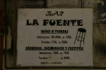
PS (The key to the Pancorbo albergue is in Bar La Fuente whose odd opening hours I mentioned and you could see on one of the photos.)
 

Attachments

  • IMG_6207.webp
    IMG_6207.webp
    270 KB · Views: 26
  • IMG_6209.webp
    IMG_6209.webp
    239 KB · Views: 25
  • IMG_6213.webp
    IMG_6213.webp
    549.4 KB · Views: 23
  • IMG_6216.webp
    IMG_6216.webp
    314.2 KB · Views: 23
  • IMG_6222.webp
    IMG_6222.webp
    386.2 KB · Views: 24
  • IMG_6229.webp
    IMG_6229.webp
    205.5 KB · Views: 25
  • IMG_6231.webp
    IMG_6231.webp
    857.2 KB · Views: 23
Left or right, that is the question (left for me)
9152E884-0A8F-4682-8DE2-5BED19B491F4.webp
 
3rd Edition. More content, training & pack guides avoid common mistakes, bed bugs etc
I have the same photo. :)
The question is: Do you want to finish the Vasco in Santo Domingo de la Calzada or in Burgos joining the Frances?
 
Last edited:
I have the same phpto. :)
The question is: Do you want to finish the Vasco in Santo Domingo de la Calzada or in Burgos joining the Frances?
I don’t really care where I end up because I am not going to be walking on the Francés anyway, but will transition somehow to the Olvidado. I see the difference in days, but I’m trying to figure out the tradeoffs, if you will.

To Santo Domingo goes to Haro.
To Burgos goes through Pancorbo and all the beautiful scenery Kinky posted pictures of.

That’s as far as I’ve gotten in my comparison. :)
 
3rd Edition. More content, training & pack guides avoid common mistakes, bed bugs etc
I also followed the road to Sto Domingo, but seeing your photos I have the feeling that I have missed out on something. ;)
 
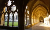
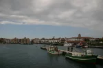
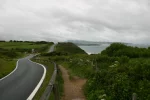
Few more...
 

Attachments

  • 0015-Cathedral Cloister (Bayonne, 17.05.2016).webp
    0015-Cathedral Cloister (Bayonne, 17.05.2016).webp
    719.5 KB · Views: 17
  • 0045-St.Jean-de-Luz from Ciboure (Bayonne-Ciboure, 18.05.2016).webp
    0045-St.Jean-de-Luz from Ciboure (Bayonne-Ciboure, 18.05.2016).webp
    330 KB · Views: 18
  • 0051-on the way to Hendaye  (Ciboure-Irun, 19.05.2016).webp
    0051-on the way to Hendaye (Ciboure-Irun, 19.05.2016).webp
    405.2 KB · Views: 19
  • 0077-above Oiartzun (Irun-Frantzesillaga, 20.05.2016).webp
    0077-above Oiartzun (Irun-Frantzesillaga, 20.05.2016).webp
    2 MB · Views: 18
  • 0095-San Sebastian from Santiagomendi (Frantzesillaga-Hernani, 21.05.2016).webp
    0095-San Sebastian from Santiagomendi (Frantzesillaga-Hernani, 21.05.2016).webp
    238.3 KB · Views: 17
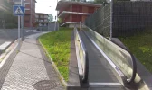
  • 0128-escalators on La Salle Hiribidea in Andoain (Hernani-Tolosa, 23.05.2016).webp
    0128-escalators on La Salle Hiribidea in Andoain (Hernani-Tolosa, 23.05.2016).webp
    1.2 MB · Views: 17
  • IMG_6045.webp
    IMG_6045.webp
    263.5 KB · Views: 17
  • IMG_6116.webp
    IMG_6116.webp
    471.7 KB · Views: 16
  • IMG_6126.webp
    IMG_6126.webp
    742.2 KB · Views: 18
  • IMG_6166.webp
    IMG_6166.webp
    633 KB · Views: 18
And 10 more ;)
 

Attachments

  • IMG_6302.webp
    IMG_6302.webp
    497.9 KB · Views: 18
  • 2016-05-26 09.47.49.webp
    2016-05-26 09.47.49.webp
    1.9 MB · Views: 18
  • 2016-05-26 13.33.50.webp
    2016-05-26 13.33.50.webp
    821.3 KB · Views: 17
  • 2016-05-26 13.41.16.webp
    2016-05-26 13.41.16.webp
    2 MB · Views: 17
  • 2016-05-30 10.15.46.webp
    2016-05-30 10.15.46.webp
    590.2 KB · Views: 16
  • 2016-05-31 15.22.29.webp
    2016-05-31 15.22.29.webp
    980.1 KB · Views: 15
  • 2016-06-01 11.34.11.webp
    2016-06-01 11.34.11.webp
    1.7 MB · Views: 16
  • 2016-06-01 13.27.55.webp
    2016-06-01 13.27.55.webp
    1.5 MB · Views: 16
  • 2016-06-08 10.42.17.webp
    2016-06-08 10.42.17.webp
    1.8 MB · Views: 15
  • 2016-06-09 15.11.07.webp
    2016-06-09 15.11.07.webp
    1.6 MB · Views: 13
€2,-/day will present your project to thousands of visitors each day. All interested in the Camino de Santiago.
After a hiatus of a few months, and some doubts about what I would be doing this year, I am finally back focusing on Vasco Interior (starting in Irún) to start my 2019 camino. I hope to walk to Santo Domingo this time, leave the Burgos option for another year.

Tom’s link to the euskadi guide has focused it all very well for me. https://tourism.euskadi.eus/conteni...os/2011/santiago/Caminos del Norte INGLES.pdf (look at stages 2B and3B, around page140 of the guide itself, around page 70 of the pdf.

I see there is a two-day alternative to the “normal” route.

Normal route possible stages:
1. Irún to Andoaín (32)
2. Besaín (30)
3. Zegama (short mountain variant throuh Zeraín) (17)

Alternative route:
1. Irún to Hernani (26) (no albergue) (Pensión Zinkoena) or carry on to Lasarte-Oria with other hotels-pensiones
2. Hernani to Bidegorán (28) (no albergue) (this hotel is there but likely to be expensive but nice —https://iriartejauregia.com/en/el-hotel)
3. To Zegama (34)

Alternative looks LOVELY (but so does the “normal” route).

Just wondering if anyone has accommodation ideas for those first two stages on the “alternative.”

(1) Either Hernani or Lasarte-Oria

(2) Bidegorán or someplace nearby. (There are lots of little towns after Bidegorán, but I am not having much luck finding accommodations).

Thanks! Buen camino, Laurie
 
Well, since I frequently talk to myself, I will post this answer to my question, just in case there are others out there with similar ideas.

For night one, out of Irún, there are pensiones (about 50 € double) in both Hernani and Lasarte-Oria. Hernani is about 26, Lasarte-Oria about 30.

Does anyone have a recommendation as between those two?

Day 2 is a bit trickier. The obvious stopping point is Bidegorán (Bidania). There is a four star fancy hotel, but it would break most pilgrims’ budgets. Double rooms close to 200 €. https://www.iriartejauregia.com/en/inicio

The more reasonable alternatives are
1. a casa rural that is in Errezil, which looks to be about 3 km away (but with google maps and rural places, I find the locationis not always accurate).So we conceivably could just walk or get a ride. https://turismo.euskadi.eus/es/alojamientos/casa-rural-letea/aa30-12375/es/

2. Taking a bus to Tolosa (which is on the “normal” Vasco and has an albergue). Next morning early (buses start late) hop in a cab back to Bidania, which should be reasonable since it is about 10 km away.

So, any insights or recommendations?

Buen camino.
 
...and ship it to Santiago for storage. You pick it up once in Santiago. Service offered by Casa Ivar (we use DHL for transportation).
Hi Laurie,
It looks like Bidania is a bit of a desert for budget accommodations. I was thinking maybe the ayuntamiento might know of a casa rural that is not listed on the web, but there is no accommodation section listed on the ayuntamiento site. I'm guessing you've already looked at the Escapada Rural website but am enclosing a link. I didn't see anything on there that looked better than what you've already found, but there is a link to the Errezil casa rural so you could email the owner to determine the exact location.
https://www.escapadarural.com/casas-rurales?q=pueblo:errezil&viz=map
The IGN map on Gaia shows some alternatives for the descent into town.
https://www.gaiagps.com/map/?layer=spainIGNTopo&lat=43.1676&lon=-2.1713&zoom=14
Good luck! It looks like a wonderful route.
 
Well, since I frequently talk to myself, I will post this answer to my question, just in case there are others out there with similar ideas.

For night one, out of Irún, there are pensiones (about 50 € double) in both Hernani and Lasarte-Oria. Hernani is about 26, Lasarte-Oria about 30.

Does anyone have a recommendation as between those two?

Day 2 is a bit trickier. The obvious stopping point is Bidegorán (Bidania). There is a four star fancy hotel, but it would break most pilgrims’ budgets. Double rooms close to 200 €. https://www.iriartejauregia.com/en/inicio

The more reasonable alternatives are
1. a casa rural that is in Errezil, which looks to be about 3 km away (but with google maps and rural places, I find the locationis not always accurate).So we conceivably could just walk or get a ride. https://turismo.euskadi.eus/es/alojamientos/casa-rural-letea/aa30-12375/es/

2. Taking a bus to Tolosa (which is on the “normal” Vasco and has an albergue). Next morning early (buses start late) hop in a cab back to Bidania, which should be reasonable since it is about 10 km away.

So, any insights or recommendations?

Buen camino.

If I recall correctly, Tolosa was a nice village. The albergue was clean but you have to turn on the hot water heater. You pick up key at Police station.
 
A selection of Camino Jewellery
I am trying to remember my stops on this route.

The first day was short because I traveled by train from Barcelona and started walking to Elizalde. A nice village but I had to stay in a hotel about 50 euro's.
Day two to Tolosa, Key at Police station, nice albergue, Donativo
Day 3 Tolosa to Besain easy day, mostly pedestrian pathway, Nice Albergue on the river.
At this point I am hooked on sidra.
Day 4 Besain to Zegama via Zerain, nice but tricky walk through the mountains. I recall having to climb over a few fences after Zerain. I went to the Albergue, sports stadium, but no hot water. There is a nice hotel 20 euro?
I believe that included dinner.
Day 5 - Zegama to Salvatierra the toughest climb on the trip. Should have been a short 20 km day but I went right after the roman road in the fog and sleet. 40 km's later I came out of the trees at a resort on the other side of the mountain. After eating and another 10 km walk down the mountain I took 3 different buses to get to Salvatierra. I stayed at Jose/marie 15 euros.
Day 6 Vitoria Gasteiz
Day 7 Vitoria Gasteiz to Berantevilla. Small town People in bar told me where to go for key. Slept on matts in school, nice hot shower, great meal at bar in town and the most unique tabernacle I have ever seen at mass that night.
Day 8 Berantevilla to Haro - absolutely the most scenic day on this walk. Coming down from the hills into wine country.
Day 9 Haro to Granon

I did this in 2012 so recollection probably not perfect. day 5 was truly a challenging day. The owner of the resort just laughed when I told him where I was trying to get too. It did not help that it was a cold sleety/rain day.

260.JPG
 
Last edited:
Hi Laurie
For the end of Day one: We quite enjoyed staying in the albergue at Santiagomendi (2015). In good weather it's a restful place as you can sit in the garden on the side of the hill with sweeping views all the way to San Seb and the sea beyond. We brought our own food and cooked and then walked along to a little bar about 10-15 mins away. However it is kitted out for groups of kids really, so worth checking in advance if it's going to be available - or not very restful at all!
Sorry I can't help with the exciting day 2/3 ideas, but watching keenly for what transpires...
PS I know I repeat myself on every Vasco thread, but it always has to be said: the guided tour of the old Santa Maria cathedral in Vitoria Gasteiz is not to be missed under any circumstances. It warrants a 'rest day' if you can't squeeze it in any other way (it only took us 4 leisurely hours to walk to La Puebla de Arganzon, the next stage). It still rates as one of the most special experiences in 10 years of camino-ing.
If you stay at the cathedral albergue next door you get either free or reduced admission (can't remember which).
 
The 2024 Camino guides will be coming out little by little. Here is a collection of the ones that are out so far.
...
For the end of Day one: We quite enjoyed staying in the albergue at Santiagomendi (2015). In good weather it's a restful place as you can sit in the garden on the side of the hill with sweeping views all the way to San Seb and the sea beyond. ...
I wonder how did you managed to find it, Tom??? I found the bar (which was closed but nevertheles I always manage to find a bar) but there were absolutely no markers for albergue.

Views are superb though!
 
Last edited:
Thanks so much to the Vasco veterans and helpers, you guys have been really helpful.

Of course since no good deed goes unpunished, I will follow up with more questions!

@islandwalker, thanks for that link. I have emailed, but I will call them next week to inquire if I don’t here backk. From these wikiloc tracks, and comparing them to the map you linked to, it looks like the camino will go right through Erezil, is that your impression, too? https://es.wikiloc.com/rutas-sender...saskarate-alto-de-mandubia-por-saiatz-5878829
If so, that would be one way to avoid the disruption that comes from a bus to Tolosa and a taxi back to Bidania. At the same time, though, Joe says Tolosa is nice and there is an albergue, so it’s a tough call.

@peregrino_tom , I had read a bit about Santiagomendi, but it is likely to be too short a day given my time constraints and how it would fit in with the route to Bidania. Of course, I know things happen, and it’s good to know the albergue is there. If things go well, though, I think we will push on to either Hernani or Orio-Lasarte. There is another little hamlet a few kms on, Zubieta, and I was delighted to see an albergue there. However, when I called to talk to them just to see how they operated, I learned that the albergue is in Zubieta, Navarra, many kms from this Zubieta, which is essentially a San Sebastián suburb. There is supposedly some kind of accommodation in the “right Zubieta,” but I haven’t found it. The options in Hernani and Orio-Lasarte are both 50 € for a double, which is not bad given that we are so close to San Sebastián.

@KinkyOne, your pictures of the Burgos option make me rethink the Santo Domingo alternative. I think it would require a couple of extra days, and that’s hard for me this year, but wow it looks gorgeous. I will go back and see about stages though. My initial eyeballing suggests Puebla to Pancorbo (35), Pancorboo to Quintanavides (38), Quintanavides to Burgos (33). Of course that would mean no monastery stay, so maybe the better idea is to hope that someday I can go back and do it more slowly. Your stages seem more sensible: https://www.caminodesantiago.me/community/threads/pancorbo-to-briviesca.57020/#post-645003. Looks like the albergue is not in the monastery, but it looks nice. https://www.gronze.com/castilla-y-l...odilla/albergue-peregrinos-monasterio-rodilla Did you visit the monastery?

@jpflavin1 I have seen mixed reports on the albergue/polideportivo in Zegama. Some have apparently found hot showers. Others, like you, didn’t. Having the hotel option is a nice back-up, since I do prefer hot showers if possible!

Looking at how the potential stages are playing out, my heart sank when I saw we would most likely be getting to Vitoria on a Sunday. But, good news, @peregrino_tom, the Vitoria cathedral apparently does Sunday afternoon visits!!! I suppose we should reserve in advance once we are on the camino. The website highly recommends that option, and I see some sold out days in the next couple of weeks, and it’s only February! https://www.catedralvitoria.eus
There are several tour options — cathedral and tower seems most appealing. Do you remember which you did?

Thanks again to everyone, it really helps to have multiple perspectives. IMO, there is no better way to fight winter doldrums and arctic temperatures than by focusing on little details that will make the real time camino decisions easier. Buen camino,Laurie
 
I wonder how did you managed to find it, Tom??? I found the bar (which was closed but nevertheles I always manage to find a bar) but there were absolutely no markers for albergue.
Well, it's going back a few years now, but I recall it as being easy to find. There were various municipal signs pointing the way to drive up to it as the high point. This google map shows it at the apex of a loop - and I think the loop was attached to the camino - non?
There are several tour options — cathedral and tower seems most appealing. Do you remember which you did?
Laurie - yes, you must do the cathedral and tower one, otherwise you might not shuffle along the high narrow gallery which was (bizarrely) designated as the place for pilgrims to sleep...
I seem to recall the guide saying that whoever booked the tour first got to choose the language. But we're going back a few years.
BTW there's a life size statue of Ken Follett by the tourist guide office, as his book The World without End was influenced by an incident at this cathedral, where structural problems meant a tower of the cathedral had to be rebuilt - or something like that!
 
Train for your next Camino on California's Santa Catalina Island March 16-19
Joe, I think you have more weather-related adventures than anyone I know on the forum. I’m thinking of your Madrid and Salvador, you are a weather magnet!

Laurie:

Not by choice, just lucky. Probably has something to do with the time of year I walk, Spring.
 
Hi Laurie,
Like you, I love planning for upcoming trips and visualizing the possibilities. The wikiloc track you sent is a great help for finding some specific info! Here are a few things that might help:
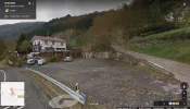
1. In this case, the Google map location for the Casa Rural Letea appears to be correct. If you zoom in on Google maps and choose "street view", the picture for that location exactly matches the photo in the Euskudai and Escapada Rural photos.
51639

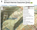
2. To see your Wikiloc track on the IGN map (like the Gaia one): on your computer, open up your Wikiloc track in full screen mode and choose "Mapa" (as opposed to Satélite) in the upper right corner. You should get the same IGN map view as the one on Gaia, but this time with your Wikiloc route on it. If the IGN map is not the view that pops up, you may need to use the "more maps" drop-down menu and choose "Mapa Raster (IGN)". It looks like your route passes about 1 kilometer above Errezil (as the crow flies; see below for "on the ground distance").

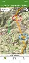
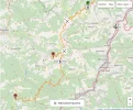
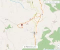
3. There are tracks decending to Errezil from your route at the points circled in red and blue in the photo below. The casa rural is marked with the green arrow.
51641
4. On the following wikiloc route: https://es.wikiloc.com/rutas-senderismo/errezil-hernio-gazume-jiva-2970625, it looks like it's 3.1 km from the red circled junction above town down to the road.

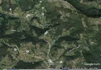
5. If you want to see all the connecting Wikiloc routes in an area, you can enable the Wikiloc symbols in Google Earth. https://www.wikiloc.com/wikiloc/googleearth.do I sometimes find this easier to use than the Wikiloc map search feature. The more you zoom in, the more routes show up.
51642

Have fun exploring!
Elaine
 
Last edited:
Hi Laurie,
Like you, I love planning for upcoming trips and visualizing the possibilities. The wikiloc track you sent is a great help for finding some specific info! Here are a few things that might help:
1. In this case, the Google map location for the Casa Rural Letea appears to be correct. If you zoom in on Google maps and choose "street view", the picture for that location exactly matches the photo in the Euskudai and Escapada Rural photos.
View attachment 51639

  1. To see your Wikiloc track on the IGN map (like the Gaia one): on your computer, open up your Wikiloc track in full screen mode and choose "Mapa" (as opposed to Satélite) in the upper right corner. You should get the same IGN map view as the one on Gaia, but this time with your Wikiloc route on it. It looks like your route passes about 1 kilometer above Errezil (as the crow flies).
  2. There are tracks decending to Errezil from your route at the points circled in red and blue in the photo below. The casa rural is marked with the green arrow.
View attachment 51641
  1. On the following wikiloc route: https://es.wikiloc.com/rutas-senderismo/errezil-hernio-gazume-jiva-2970625, it looks like it's 3.1 km from the red circled junction above town down to the road.
  2. If you want to see all the connecting Wikiloc routes in an area, you can enable the Wikiloc symbols in Google Earth. https://www.wikiloc.com/wikiloc/googleearth.do I sometimes find this easier to use than the Wikiloc map search feature. The more you zoom in, the more routes show up.
View attachment 51642

Have fun exploring!
Elaine
Wow, I will take a while to absorb all of this! I will have to wait till next week when I am back on my computer, but you can be sure I will be trying to figure it all out.

Thank you so so much, I really appreciate it.
 
Holoholo automatically captures your footpaths, places, photos, and journals.
Wow, I will take a while to absorb all of this! I will have to wait till next week when I am back on my computer, but you can be sure I will be trying to figure it all out.

Thank you so so much, I really appreciate it.
Just be prepared for inclines which Wikiloc or GoogleMaps don't show ;)

These distances are really as the crow flies! But then again you're Norte, Salvador, Olvidado etc. veteran so no big deal for you :)
 
Yes, indeed, they do look pretty steep! On the IGN map, the departure point for Errezil (red circle) looks like it is at about 840 meters and the casa rural in Errezil is at about 350 meters.

Happily, over the last year Wikiloc has added several new tools that make it possible to see accurate figures for elevation changes and distances on their website. Although I realize using GPX tracks is not something that everyone on the forum wants to do, for anyone who wants to investigate alternative trails to connect to accommodations, to detour around bad weather or trail obstructions, or to find intersecting trails, here are some hints that might help.

1. To see accurate elevation changes, one way is to open the Wikiloc track you are interested in on a computer and click on "map" view rather than "satellite" view in the upper right corner of the screen.
  • This changes the background for the Wikiloc track to an IGN map showing topographical lines in 10 meter gradients.
  • If the IGN background map is not the map view that pops up, you may need to use the "more maps" drop-down menu and choose "Mapa Ráster (IGN)".
  • Note that you have to zoom in quite a bit for the topo lines to be clearly visible. If you are too far out, the IGN map looks like a regular street map without topo lines visible.
  • There are also 9 other map choices in the drop-down menu labeled "more maps." Several of them have topo lines.
51649

Note: To see the IGN map on the Wikiloc app on your phone, you either have to be connected to wifi or have downloaded the IGN map for offline use. Click on the circular map symbol at the top right of the phone screen, and it takes you to your choices.

2. A second way to see elevation information on Wikiloc is to use the elevation graph at the bottom of the track window.
  • Move your cursor along the elevation line on the graph and you will see a blue dot appear. There will be a matching blue dot moving along the track on the map.
  • The two dots move simultaneously, giving a good picture of what the trail is actually doing in terms of distance and elevation since you can see both at once.
  • You can accurately measure elevation and distance on the ground between any two points on your track by using this blue dot feature.
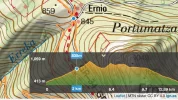
  • In the photo below, for example, the blue dot on the elevation graph matches the point where a track leaves the camino variant at Ernio and descends to meet the road at Errezil. This portion of the track leaves the GR 34 at an elevation of 835 meters and descends for 3 kilometers, meeting the main road at 413 meters. (This is the actual ground distance recorded by the GPS unit of the person who contributed the track to Wikiloc, not the "crow flies" distance.)
51653

These Wikiloc features have been quite useful for us; if anyone has any questions about how to use them, I'd be glad to help.
Elaine
 
Last edited:
Hallo Camino friends,

my name is Michael , I´m from Germany and a few minutes ago I decided to be a new member of this forum.

I learned English more than 30 years ago and use it only on the Camino. It´s not easy for me, to navigate in an englishspeaker forum - it´s a challenge🤔, so please forgive me a little bit.

I few words to my ways:

Since 2004, when I started my first way to Santiago in Cologne/Germany, I am addicted to the Camino.
We (3 friends and me) walked from Cologne to Luxembourg, crossed France by bike and than walked in two stages through Spain to Santiago. It was great, but I was a little bit jealous to the pilgrims who walked alone, because as a little group of 4 people you fill every little table in a bar by yourselve. And getting in contact to the other pilgrims is not so easy, especially when you are the only one who can speak another language than german, so you have to translate everything.
So in 2011, after we came home from our Camino, I decided to make it one more time, but alone.

I started 2012 in St. Jean and I was determined to walk alone - but that was not the plan HE had for me.
So after two days I met Gyula and Luca, two guys from Hungary and Italy, and the next day we walked together. And day after day we met one more pilgrim who fits to us. Christa from Holland, Betty from Romania, Ayi, a priest from India who lives is a parrish in Germany and Valerie and Dieter from Belgium. It was not possible to walk with such a group on the Camino and so we splitted, walked alone, as a duo or a tripple, but we kept in contact on the camino and since than. We meet every year in one country and the host shows us his home area. And a few of them have very nice home areas......... Budapest, Turin, Brussels and Bruges in Belgium, Transsylvanian mountains in Romania, the dutch Lowlands and my industrial area🥵 at the river Ruhr in Germany. And we live, from your point of view, very close to each other, so you can get a flight ticket from Germany to Italy, Hungary and Romania for less than 100€ both ways and the belgium and dutch friends I can visite by bike, if I train a little bit.
Since 2012 we made a biking tour around Lake Balaton in Hungary, a tour through the alps in Italy, hiking in the fantastic nature in the Karpathian Mountains in Romania. And we visited a coal mine and could go under the earth in my area. And last but not least we celebrated three weddings (Italy, Belgium, Romania) and one baptism and we are waiting for the next baby. It´s such a great gift and a blessing I have received on my Camino.
And until now, i was every year on a different Camino.
For this year i want to walk on the Camino Vasco interior from Irun to Burgos. As you know, there are not so many information about this way in the internet, so I decided to look on the international stage;)

And I think, I can give you some information, too.

There is a variante of the Vasco from Hernani through the natur to Zegama and you can find maps on the plattform www.outdooractive.com under the german key-words "Jakobsweg (Inland)"
7 maps of the "normal" etapes and in addition two maps of the variants.

In spanish it´s called Ruta de transhumancia (there are many in spain) or Variante de Saiatz.

It starts in Hernani, goes over Lasarte-Oria and Saskarate and ends on the first map in Bidania-Goiatz. The next day goes from there over Zerain to Zegama and then on the "normal" way.

I know different places to sleep between Irun and Zegama:

Agroturismo Arraspine, 3-4 km before Hernani


Casa Rural Saskarate, 17km after Hernani (is being renovated, I hope they are ready in may)


Albergue Ambiental de Beizama (17km from Saskarate)


Albergue Harizti-Erdi in Zerain (27km from Beizama)


I hope, I could help you a little bit.

Now it´s time to sleep in Germany. It takes much longer to write in english than in german, but, thanks to google translate, I hope it´s not too bad for your eyes.

Good night.

Michael
 
Get a spanish phone number with Airalo. eSim, so no physical SIM card. Easy to use app to add more funds if needed.
Yes, indeed, they do look pretty steep! On the IGN map, the departure point for Errezil (red circle) looks like it is at about 840 meters and the casa rural in Errezil is at about 350 meters.

Happily, over the last year Wikiloc has added several new tools that make it possible to see accurate figures for elevation changes and distances on their website. Although I realize using GPX tracks is not something that everyone on the forum wants to do, for anyone who wants to investigate alternative trails to connect to accommodations, to detour around bad weather or trail obstructions, or to find intersecting trails, here are some hints that might help.

1. To see accurate elevation changes, one way is to open the Wikiloc track you are interested in on a computer and click on "map" view rather than "satellite" view in the upper right corner of the screen.
  • This changes the background for the Wikiloc track to an IGN map showing topographical lines in 10 meter gradients.
  • If the IGN background map is not the map view that pops up, you may need to use the "more maps" drop-down menu and choose "Mapa Ráster (IGN)".
  • Note that you have to zoom in quite a bit for the topo lines to be clearly visible. If you are too far out, the IGN map looks like a regular street map without topo lines visible.
  • There are also 9 other map choices in the drop-down menu labeled "more maps." Several of them have topo lines.
View attachment 51649

Note: To see the IGN map on the Wikiloc app on your phone, you either have to be connected to wifi or have downloaded the IGN map for offline use. Click on the circular map symbol at the top right of the phone screen, and it takes you to your choices.

2. A second way to see elevation information on Wikiloc is to use the elevation graph at the bottom of the track window.
  • Move your cursor along the elevation line on the graph and you will see a blue dot appear. There will be a matching blue dot moving along the track on the map.
  • The two dots move simultaneously, giving a good picture of what the trail is actually doing in terms of distance and elevation since you can see both at once.
  • You can accurately measure elevation and distance on the ground between any two points on your track by using this blue dot feature.
  • In the photo below, for example, the blue dot on the elevation graph matches the point where a track leaves the camino variant at Ernio and descends to meet the road at Errezil. This portion of the track leaves the GR 34 at an elevation of 835 meters and descends for 3 kilometers, meeting the main road at 413 meters. (This is the actual ground distance recorded by the GPS unit of the person who contributed the track to Wikiloc, not the "crow flies" distance.)
View attachment 51653

These Wikiloc features have been quite useful for us; if anyone has any questions about how to use them, I'd be glad to help.
Elaine

Thanks for the encouragement, Elaine. I have learned how to switch back and forth to the IGN maps on wikiloc thanks to you. I am just not sure how much more facility I will have time to develop before I leave, but you do make a good case. I do already use wikilocs for the elevation profile and agree that it is really helpful and easy to use once you get the hang of it.

Elaine, did you put that track to Errezil on the map? Because when I go to the link of the alternative that you linked to, https://es.wikiloc.com/rutas-sender...saskarate-alto-de-mandubia-por-saiatz-5878829, I don't see the route down to Errezil.

And another random IGN question -- what are those red dots/dashes on the maps? Do they indicate trails or something else?

I am still playing around with this stage, and it may just be that the bus to Tolosa idea becomes the more attractive, even though it's not ideal.
 
Hallo Camino friends,

my name is Michael , I´m from Germany and a few minutes ago I decided to be a new member of this forum.

I learned English more than 30 years ago and use it only on the Camino. It´s not easy for me, to navigate in an englishspeaker forum - it´s a challenge🤔, so please forgive me a little bit.

I few words to my ways:

Since 2004, when I started my first way to Santiago in Cologne/Germany, I am addicted to the Camino.
We (3 friends and me) walked from Cologne to Luxembourg, crossed France by bike and than walked in two stages through Spain to Santiago. It was great, but I was a little bit jealous to the pilgrims who walked alone, because as a little group of 4 people you fill every little table in a bar by yourselve. And getting in contact to the other pilgrims is not so easy, especially when you are the only one who can speak another language than german, so you have to translate everything.
So in 2011, after we came home from our Camino, I decided to make it one more time, but alone.

I started 2012 in St. Jean and I was determined to walk alone - but that was not the plan HE had for me.
So after two days I met Gyula and Luca, two guys from Hungary and Italy, and the next day we walked together. And day after day we met one more pilgrim who fits to us. Christa from Holland, Betty from Romania, Ayi, a priest from India who lives is a parrish in Germany and Valerie and Dieter from Belgium. It was not possible to walk with such a group on the Camino and so we splitted, walked alone, as a duo or a tripple, but we kept in contact on the camino and since than. We meet every year in one country and the host shows us his home area. And a few of them have very nice home areas......... Budapest, Turin, Brussels and Bruges in Belgium, Transsylvanian mountains in Romania, the dutch Lowlands and my industrial area🥵 at the river Ruhr in Germany. And we live, from your point of view, very close to each other, so you can get a flight ticket from Germany to Italy, Hungary and Romania for less than 100€ both ways and the belgium and dutch friends I can visite by bike, if I train a little bit.
Since 2012 we made a biking tour around Lake Balaton in Hungary, a tour through the alps in Italy, hiking in the fantastic nature in the Karpathian Mountains in Romania. And we visited a coal mine and could go under the earth in my area. And last but not least we celebrated three weddings (Italy, Belgium, Romania) and one baptism and we are waiting for the next baby. It´s such a great gift and a blessing I have received on my Camino.
And until now, i was every year on a different Camino.
For this year i want to walk on the Camino Vasco interior from Irun to Burgos. As you know, there are not so many information about this way in the internet, so I decided to look on the international stage;)

And I think, I can give you some information, too.

There is a variante of the Vasco from Hernani through the natur to Zegama and you can find maps on the plattform www.outdooractive.com under the german key-words "Jakobsweg (Inland)"
7 maps of the "normal" etapes and in addition two maps of the variants.

In spanish it´s called Ruta de transhumancia (there are many in spain) or Variante de Saiatz.

It starts in Hernani, goes over Lasarte-Oria and Saskarate and ends on the first map in Bidania-Goiatz. The next day goes from there over Zerain to Zegama and then on the "normal" way.

I know different places to sleep between Irun and Zegama:

Agroturismo Arraspine, 3-4 km before Hernani


Casa Rural Saskarate, 17km after Hernani (is being renovated, I hope they are ready in may)


Albergue Ambiental de Beizama (17km from Saskarate)


Albergue Harizti-Erdi in Zerain (27km from Beizama)


I hope, I could help you a little bit.

Now it´s time to sleep in Germany. It takes much longer to write in english than in german, but, thanks to google translate, I hope it´s not too bad for your eyes.

Good night.

Michael

Hi, Michael,
Welcome to the forum and many thanks for this information. I am planning to walk the Saiatz alternative like you. I had not seen the Albergue Ambiental de Beizama, but it looks to me like it is about 6 km off the camino, on a road from Bidania (which is on the Camino). Is that your understanding as well? One alternative I have been playing around with is taking a bus from Bidania to Tolosa after walking to Bidania and then getting back to Bidania the next morning. Not ideal either, but I don't think I would want to walk 6 kms off route for a place to sleep if I could avoid it.

When are you planning to walk the Vasco Interior? And will you continue on after that?
 
Hola peregrina 2000.
I want to walk from Burgos to Leon and then on the Salvador to Oviedo. From aiport Asturias I will flight Home. Last year I walked the Lebaniego/Vadiniense over the Cantabrian Mountains and saw the
 
The 2024 Camino guides will be coming out little by little. Here is a collection of the ones that are out so far.
Elaine, did you put that track to Errezil on the map? Because when I go to the link of the alternative that you linked to, https://es.wikiloc.com/rutas-sender...saskarate-alto-de-mandubia-por-saiatz-5878829, I don't see the route down to Errezil.

Hi Laurie,
Sounds like you're doing great if you are making the IGN maps come up! They are so helpful, and the more you use them the easier it gets. Somewhere, I have a link to the map legend that shows what the symbols are. I'll try to find it and post it. But for now, yes, the red dashed line shows the GR 34 (Gran Recorrido) trail that you are following.

The link you want for the connecting trail is this one:

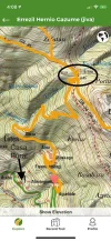
You don't need the track of the entire trail - just the part from your route down to the starting point. Zoom in until you find the spot on the IGN map where the track crosses an area labeled "Ernio" in small print. (There are, unfortunately several points labeled Ernio. You don't want the one by the orange flag.) The track you want crosses your red dashed route (the GR 34) right between two elevation points labeled 845 and 859. The orange track down to the road near Errezil leads off to the left from that point. It hits the road 3 kilometers later at the point of the sharpest zig-zag in the road. It looks like you'd have to walk on the road from there to the casa rural.

51765
 
Last edited:
Hola peregrina2000,

thank you for your warm welcome.

My answer on monday worked not as good as I want. I sent it from my new mobile and I´m not sooo good in using it.

You are right when you say it´s about 6km away from Bidania. But, when I look in my map, I would say (and I hope;) ) it´s only about 2-3km more to walk, because it´s not necessary to go at first to Bidania. You can make a kind of short cut. And the next day on my walk to Zerain I will save the same distance.

If I could get a place to sleep in Saskarate, it will be only a short etappe from under 20km, so there will be space for a few meters more.

It was not easy to find Hostels/Casa Rural etc. in general for this two variantes, and, of course these places should fit to my ability of walking.

Most of the germans have 26 - 31 days vacation time, like me with 31, and as I am very nice with my colleagues, it is normally not a problem to get more than 3 weeks of vacation in one block, So I have time enough to walk from Burgos to Leon on the Frances (may be a bus from Sahagun to Leon) and then climbing the Salvador to Oviedo.

I will start at may 22 and will flight home at june 15. In addition to our normal vacation days we have a few religous holidays too. It depends wether you live in a tradidionally more katholic or protestant federal state. Obviously I made the right choice, because in my state we have two days religious holidays in this periode and so I need only 16 days of vacation and have 3 weeks more to get this year😜

What is your period of walking? We may meet on the way.

All the best

Michael
 
Get a spanish phone number with Airalo. eSim, so no physical SIM card. Easy to use app to add more funds if needed.
Hi, Michael,
I am hoping to start from Irún in the first week of June. So you will be ahead of me.

I hope to walk the first day from Irún to Hernani or Oria-Lasarte and then the next day to Bidania, and then to Zegama, rejoining the "normal" Vasco. Are you using the IGN maps to see a shortcut to Beizama that does not go through Bidania? That is probably too tough for me, though I have gotten some instruction. There is also a casa rural in Errezil, which may be closer to the camino, have you seen that? If you look at the maps @islandwalker has posted, it seems pretty close. But I am still trying to figure all of this out.

If you plan to walk the Salvador, you should look at Ender's guide if you haven't already seen it. It is absolutely all you need to have a great time on the Salvador. https://drive.google.com/file/d/0B61VvtkuNOwEMXpaM280YWtTTXM/view?pref=2&pli=1
 
Hola peregrina2000,

I´m not so good in using computers and can´t put my map in the post. But to get an impression of what I mean, you can open

www.outdooractive.com

and search for "Jakobsweg (Inland)" and then choose the ....variante 2.

The way from Hernani or Lasarte/Oria to Bidania is a little less or more than 30 km, I don´t want to walk so long distances in the mountains, thats to long for me. I could manage it, I had to walk at the Camino del Norte 38km, because an Albergue was clossed, but it was not funny. I hope, Saskarate will be open in May, so I can sleep there.

Thank you for your tip to the maps of "islandwalker" and the information of Ender´s guide. It looks quite interesting.

Good night

Michael
 
Laurie, you have probably settled this question entirely by now, but since I was familiar with the area, I used it as an "experiment" to see how the new Wikiloc "search passing area" tool works (see separate post - it's marvelous in terms of what it opens up) and discovered some tracks that may be useful to you on your day ending in Errezil or Tolosa:
This one goes directly from the Ernio junction down to Errezil and on to Bidania with minimal road walking:
These two offer a different alternative. If you wanted to take the mountain route but end up in Tolosa rather than Errezil, there's an 11 km section of the route from the Ernio junction that connects to Tolosa:
The photos of the route look gorgeous!
 
A selection of Camino Jewellery
Laurie, you have probably settled this question entirely by now, but since I was familiar with the area, I used it as an "experiment" to see how the new Wikiloc "search passing area" tool works (see separate post - it's marvelous in terms of what it opens up) and discovered some tracks that may be useful to you on your day ending in Errezil or Tolosa:
This one goes directly from the Ernio junction down to Errezil and on to Bidania with minimal road walking:
These two offer a different alternative. If you wanted to take the mountain route but end up in Tolosa rather than Errezil, there's an 11 km section of the route from the Ernio junction that connects to Tolosa:
The photos of the route look gorgeous!

You are right that the trail to Tolosa looks lovely, but I doubt I would be able to add that onto the day from either Hernani or Lasarte. To Bidania it's about 1300 m elevation gain and 30+ kms. I think getting to Bidania will be my max, but I will definitely download these tracks just in case I am feeling a surge of energy. :). I think that realistically the bus to Tolosa or trying to figure out this casa rural near Bidania would be our best bet.

Maybe this will be easier for me once I can figure out how to get the wikilocs premium app on my ipad, but right now, from my computer, I am having trouble figuring out the differences between the two tracks I've linked in below, specifically in the part where they go from the peak at Hernio to Bidania. The author of one of them says his tracks go right to the front door of a hotel, and it looks to me like that hotel may actually be one of the casas rurales (Letea, for instance) that is near but not in Bidania. Is there a way to superimpose these tracks on each other? I tried downloading them into basecamp in the same file, but I can't get them to come up at the same time.

Tracks that pass through Bidania

Tracks that stop at the door of a hotel, but maybe actually not in Bidania

I know you offered to help, but I am not sure you knew what that would mean. :eek:
 
Hi Laurie,
This is just the kind of situation I love to investigate. As I work on your question, I learn all kinds of things that I can then apply to my own trip planning, so believe me, this is fun!

Getting two tracks to be superimposed
You're right, this is a piece of cake with the premium membership. Another solution is to download both tracks and then upload them to another spot like you tried with your Garmin. You could try Google Earth or Gaia. There is also a way to do it on the basic Wikiloc but it is iffy and tedious. I'm attaching photos of the two tracks supposed that I did by using "search passing areas" circles. Once you get this tool on your computer:
  1. Go to the world map search page.
  2. Put a circle around the area on the map where the two tracks you are interested in first coincide.
  3. Put the next circle around the area on the map where they diverge.
  4. Look in the sidebar on the left and click on the "eye" symbol for the two trails you want. They will then both appear on the same map.
See photos attached. I hope you can blow them up large enough to use. The two trails seem to be exactly superimposed except for the part around Bidiana (where one of them ends) and a few minor deviations along the way to there.
52549 52550 52551

Track to "hotel"
I agree with your assessment. I think this is much more likely a casa rural than a hotel. It's not right in Bidiana (see third photo above for where track ends). I can't find any references to it on any of the self-catering sites. Maybe there was a hotel there in 2014 and it closed? Are you still considering the casa rural in Errezil?

Elaine
 
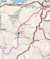
Here are photos of the above routes superimposed and color-coded on Gaia GPS.
  • red line = Camino Vasco Lasarte - Bidania, ending in "hotel" in Bidiana
  • purple line = Camino Vasco Interior- 3 Saskarate- Alto de Mandubia por Saiatz - much of this is hidden by the red line since they cover exactly the same ground for most of their length
  • blue line = Tolosa - Muñoaundieta - Herniozabal - Uraitz Gaina - Aizpel - Hernio - Portumatza - Asteasu - Villabona - portion of the trail that would take you to the casa rural in Errezil
  • yellow line = Erniopeko mendi ibilaldia, portion of the trail to Tolosa - you are right that this looks like overkill on a long day! I just put it on for comparison.
52557 52558 52559 52560

Gaia has free basic accounts that you can use on your computer, and I think uploads are part of the free accounts. So if there are tracks you want to superimpose, you could try downloading from Wikiloc and uploading to Gaia, and you will get results like those in the photos. You can superimpose as many tracks as you want onto one map (all on your computer, no phone needed).
 
Ideal pocket guides for during & after your Camino. Each weighs only 1.4 oz (40g)!
Oh, if you and Dougfitz ever combine forces, the world will have no garmin or wikiloc problems! Thanks so much. I have downloaded the premium app on my ipad. It only shows up sideways and I can’t get it to flip, but I guess that is a problem with the app. I have used the feature that allows you to see all posted trails in the area and have found what looks like an off-road alternative for Ponferrada to Peñalba de Santiago (last time I walked there was a long slog on asphalt near Ponferrada). That’s a great feature!

What I cannot figure out is how to get the premium version when I am online. I would much prefer to use the wikiloc.com rather than the sideways wikiloc app

Now to your specific point about where the above track ends. It looks like it ends in a parking lot, and it looks like it is in Erezil, so I think maybe it could be that Letea place that you found on the IGN maps.Is that possible?


I am so glad I am giving you such great educational opportunities, Elaine :)

Buen camino, Laurie
 
Hi Laurie,
Thank you for the kind words! There are so many helpful people on this forum, it is just a wonderful community to be part of.
I bet you've already made a lot of progress on your searches today, but here are some notes that might be helpful.
It only shows up sideways and I can’t get it to flip

Wikiloc will only open on my iPad in the vertical direction and will not flip to the horizontal direction. Is it showing in the vertical position on yours?

What I cannot figure out is how to get the premium version when I am online.

Were you able to get the premium version to open on the computer today by signing into the same account you are using to open it on the iPad?

It looks like it ends in a parking lot, and it looks like it is in Erezil, so I think maybe it could be that Letea place that you found on the IGN maps.Is that possible?

I don't think the casa rural near Bidiana (end of the red trail in the photo below) and Casa Rural Letea near Errezil (in the blue circle in the photo) are the same. They are about 5km apart.
52606


It seems that this trail (erniopeko-mendi-ibilaldia) passes very near the casa rural Letea just east of "downtown" Errezil. To get there you could cut off from your route at Ernio, walk SW 3 km on this trail (blue in the photo below), turn SE at the green circle, and walk along that little white road for a few feet, and you would be right at the casa rural Letea (circled in blue in the photo below).
52608

The following trail that you found ends closer to Bidiana and says in the description that it ends in a hotel, but I can't find any evidence that it is still a functioning hotel.

The end of the trail west of the village seems to be at a house (maybe once a casa rural? or maybe still? red circle in the photo below)
52609

I hope this all makes sense.
Elaine
 
3rd Edition. More content, training & pack guides avoid common mistakes, bed bugs etc
Hi, islandwalker,

It looks like there are actually two casas rurales within a km of the center of the village. This screen shot shows them both. I have spoken with the owner of the Letea and he assures me we will have no problem finding their place from the GR-34. The Izarre looks like a nicer place, actually, only a little more expensive, but the owners of Letea have been so kind to me I don't want to change. Rooms booked for three and maybe four of us! We were lucky to coincide on a weekday, because they are already all full for the weekend. So a word to anyone considering the mountain alternative, book well in advance. I will be there in early June, and she told me that the place is almost full for the entire months of July and August already!
52618
 
I will be there in early June, and she told me that the place is almost full for the entire months of July and August already!
It sounds like business must be good in that area - imagine already being nearly booked up for summer! Good thing you got right on the reservations. The Izarre does indeed look lovely, but I agree with you that kindness and helpfulness outweigh everything. You've got some great alternatives laid out for future walkers.
Elaine
 
Just checking back in to say that wikiloc is an amazing website — it has a feature that allows you to send messages to people who post tracks. So I was able to contact several of the people who have walked the Saiatz (mountain alternatives) stretch of the Vasco. They have encouraged us to give it a try, as has Michael (who had the misfortune of very bad weather a week or so ago). Anyway, they have told me about another mountain lodging possibility, in case anyone else wants to give this a try. We already have reservations at a place slightly off route, but this would be a great option.

6 km beyond Bidania, right on the Camino.
http://segore.com/

I hope to have much more complete information very soon, when I hope to actually walk this route!
 
A selection of Camino Jewellery
Anyway, they have told me about another mountain lodging possibility, in case anyone else wants to give this a try.

6 km beyond Bidania, right on the Camino.
http://segore.com/

That's a wonderful find! And not too long now you'll be passing by it in person

Like you, I've had good luck in getting responses by using the link function on Wikiloc to contact people who have uploaded tracks. Often they are local walkers and have loads of good info to share.

Hoping all goes well for you,
Elaine
 

❓How to ask a question

How to post a new question on the Camino Forum.

Featured threads

❓How to ask a question

How to post a new question on the Camino Forum.

Featured threads

Forum Rules

Forum Rules

Camino Updates on YouTube

Camino Conversations

Most downloaded Resources

This site is run by Ivar at

in Santiago de Compostela.
This site participates in the Amazon Affiliate program, designed to provide a means for Ivar to earn fees by linking to Amazon
Official Camino Passport (Credential) | 2024 Camino Guides
Back
Back
Top