• ⚠️ Emergency contact in Spain - Dial 112 and AlertCops app. More on this here.
  • Remove ads on the forum by becoming a donating member. More here.

Search 74,075 Camino Questions

Mar Stages

Dave

Veteran Member
Time of past OR future Camino
First: Camino Francés 2002; most recent: Norte/Primitivo 2019
Hi friends,

It's been a really long time since I've been in the forum. We've been in a holding pattern with our publisher on Northern Caminos for a while, though fortunately things are moving forward now, and I took on a second admin role at my school this year to help cover until we fill the job next year. The result has been professionally rewarding, though at the expense of pretty much everything else I'd like to be doing!

One thing we'll be moving forward is a guide focused primarily on the Inglés, but the main motivation for me with that is the opportunity to devote some attention to the Mar. In support of that, I've been devoting a ton of time to developing maps that cover all of the different routes--the Mar, the Cantábrico (and its coastal equivalent in Coruña), and the Mañon. This has been informed by my own gpx tracks from my scouting trip in 2016, the varied and conflicting gpx tracks online, skeletal maps developed by the Lugo Amigos, and a lot of virtual road-walking in Google Maps. In some stages, I had a much easier time of finding yellow arrows than I did when I was actually walking; I think it helped in those cases that Google's footage came from 2013.

What follows are the stages into which I'm breaking the Mar, with the distances that I've been able to pin down. Accommodation options for each stage are available here.

Stage 1: Ribadeo to Praia das Catedrais: 17.7km
>>In this stage, the Mar and Cantábrico are paired up. The Lugo Amigos' map suggests an inland approach from Ribadeo, but yellow arrows now show up on the coastal option and it's hard to find a compelling argument to take the interior approach.

Stage 2: Praia das Catedrais to Foz: 20.8km
>>Here, I suggest following the Cantábrico to the crossing of the Foz River, and then veering off onto the Mar in order to visit the basilica of San Martiño de Mondoñedo. From there, it's best to follow the direct road option into the center of Foz for the night, though it is possible to continue along the Mar, avoiding the center of Foz.

>>It is possible to take the Mar inland from Praia das Catedrais for the first half of the walk, though this is mostly road-walking and not nearly as scenic as the coast. Similarly, it's possible to stick to the coast for the full walk, but doing so would miss Mondoñedo, which is a major highlight of the route.

Stage 3: Foz to San Cibrao: 32.7km
>>Once again, I suggest a hybrid approach, following the Cántabrico along the coast from Foz to Burela, then turning inland, joining the Mar, and following it through the interesting Sargadelos park en route to San Cibrao. Those seeking a shorter day can easily break the walk in Burela.

>>This is the longest possible approach to the stage. If you follow the Mar directly, it's just 29km, though accommodation is much trickier. (The closest option en route from Mondoñedo is the Hotel Spa Mundo Buda.) Alternately, the Cantábrico direct to San Cibrao is 30.6km.

Stage 4: San Cibrao to Viveiro: 25km
>>The direct, inland route along the Mar avoids most of the coastline--it's a bit like tracing the outline of your palm while crossing over your fingers. It briefly hits the beach in Portocelo, but then veers in to Vilachá before returning to the coast in Esteiro.

>>Alternately, it's possible to follow the Cantábrico the full day, covering 29.3km and taking a few jaunts out to coastal viewpoints.

Stage 5: Viveiro to Cuiña: 31.1km
>>At this point, the differences between the Mar and Cantábrico become much more pronounced. The routes hold together through Covas, but then the Mar turns inland, cutting almost due west towards Cuiña/Ortigueira. The first half of the walk, through Riobarba and Ponte do Porto is almost entirely road-bound, but there's a bit more variety (a bit) after that. After the Ponte, the Mar overlaps with the Camiño de Mañón a Santo André de Teixido for significant stretches between here and Teixido, and then after that to Xubia/Ferrol

>>The coastal option, meanwhile, passes through O Vicedo, O Barqueiro, O Porto do Espasante, and Ortigueira, en route to Cuiña. All told, this covers 48.2km, so you'd need to devote two days to completing it.

Stage 6: Cuiña to Teixido: 21km
>>The two routes hold together for the first 10.5km of this walk. At that point, the Mar/Mañón veer inland, while the coastal option continues northward. Taking the coastal approach extends this stage to 38km, though it's possible to break the walk in Cariño.

Stage 7: Teixido to Xubia: 33.9km
>>The direct route here follows the Mañón, though it, too, splits partway through the walk, allowing you to intersect the Inglés in two different places near Xubia. Alternately, the Mar--in name, if not in marking--follows the coastline. This is a much larger trajectory, ultimately delivering you in Ferrol from the west, and spanning 79.7km. Obviously, you'll need to commit more than one day to this option, though there are good places to break up the walk in Cedeira, Valdoviño, Lavacerido, and Vila da Area.

If any of your experiences stand in contrast to any of this info, please get in touch! I don't expect this initial attempt to be flawless; indeed, my hope is to make it a bit more accessible for people eager to take the chance in order to continue generating more useful intel. More to come.

Dave
 
Perfect memento/gift in a presentation box. Engraving available, 25 character max.
I used your guidebook on my 2016 Norte/Primitivo route. I found it to be very useful and as such appreciated it immensely. Thank you for your newest efforts to draw more attention to a less traveled route.
 
Dave's back, hurray! We've been wondering where you've been and what was happening with the new edition. So glad to hear it will be out soon. And this new Mar/Inglés combo is a great idea.

I took a lot of the coastal options last summer, many thanks to you, Dave. Will your new edition include options like the Ruta del Flysch? If you look at my coastal alternatives thread, you'll see a few more options added by others. So many ways to get off the pavement! Buen camino, Laurie
 
Perfect memento/gift in a presentation box. Engraving available, 25 character max.
Hi friends,

What follows are the stages into which I'm breaking the Mar, with the distances that I've been able to pin down. Accommodation options for each stage are available here.

Dave
Our stages and overnight stops are on our blog for 2015. We aimed to follow the Ruta do Mar having traced the amigos outline onto the relevant Mapas Militar sections which we carried with us.
1) Ribadeo/ Rinlo to As Catedrais - stayed at Devesa (O Lar de Carmiña)
2) Devesa/As Catedrais to San Cosme de Barreiros (left route at FEVE bridge - Pension Moderno))
3) San Cosme (rejoined route at river bridge) to San Martiño de Mondoñedo (Hotel Spa Buda on route)
4) Spa Buda to Burela (Hotel Sargo)
5) Burela to San Cibrao (accommodation also at O Castelo and owner is an Amigo)
6) O Castelo to Xove (no accommodation in 2015) FEVE to Aguadoce and the Hotel Aguadoce)
7) Aguadoce to Viveiro
FEVE to Espasante (La Paloma - and then to Ponte Mera)
8) Ponte Mera to San Andres de Teixido

This was dictated by the distance we could sensibly walk each day and the available accommodation in early May as well as time available to include the Inglés.
We hope to re-walk some sections next year and maybe some of the coast that we missed by taking the marked inland route. :)
 
Hi Dave,
Have missed your podcasts during my morning workouts. Congrats on the new responsibilities, but remember to take time for yourself, too.
Janet
 
Thank you Chris and Janet--very kind. I keep thinking of new podcast episodes that I want to do, but I don't want to dive back in until I feel confident that I have the time to really see it through to completion. With the book stuff back in gear, that's definitely going to max out my bandwidth for the next couple of months, at least.

TV, thanks for typing up your stages again--you have been such a valuable resource for me throughout this process. Good to know about the owner of O Castelo--he didn't mention that in my email to him!

Laurie, I have almost every marked variant that is a reasonable (that is, not adding huge km and offering an advantage over the Camino) detour on my gpx tracks. It was a pretty big endeavor, going through the official Norte and its variants in one go, and it's been hard waiting since summer 2016 to be able to actually work these new maps into the guide. Here's an example of the gpx tracks in my map editor for the Zumaia stage.

upload_2017-12-28_7-29-55.webp

From here, the maps get worked through Cicerone's new map interface, which will generate nicer and much more usable maps for the guides. While we've been waiting on them to be ready for us, I've been manicuring the tracks to make them as precise and clear as possible. At some point (soonish?), all of the gpx tracks will be available on Cicerone's Northern Caminos page, so that people will at least be able to use them in that format.
 
Perfect memento/gift in a presentation box. Engraving available, 25 character max.
Great to see you back here Dave, and thanks for all your work on the book.
It was most generous of you to post so many updates on this forum, as well as on your website and Facebook. Very few authors go that extra mile! Wishing you well with the final stages of the project.
 
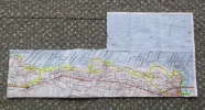
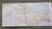
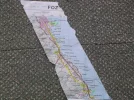
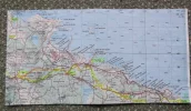
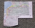
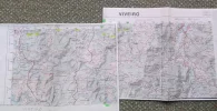
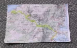
Hopefully the attached maps will be readable if you have the appropriate Mapas Militar. The yellow line is the Ruta do Mar from the Amigos outline. Any gray pencil lines are where we decided to take a diversion. In No 1 we took the lower route; and there are also variants marked on No 2, we took the yellow rather than the orange route. Number 6 with just spots is the section we did not plan to walk but marked the Amigos waypoints.
In some places poor marking left us still on the Cantabrico but as far as possible we followed the marked do Mar. The Cantabrico has some dreadful hard 'crazy' paving - tarmac was preferable. The do Mar has a mix of tarmac and track plus the sections where it combines with the Cantabrico (paved or not).
 

Attachments

  • 01-ribadeo.webp
    01-ribadeo.webp
    705.9 KB · Views: 52
  • 02-foz.webp
    02-foz.webp
    584.2 KB · Views: 46
  • 03-burela.webp
    03-burela.webp
    264.7 KB · Views: 41
  • 04-xove.webp
    04-xove.webp
    627.3 KB · Views: 41
  • 05-xove-viveiro.webp
    05-xove-viveiro.webp
    551.1 KB · Views: 38
  • 06-viveiro-ortegueiro.webp
    06-viveiro-ortegueiro.webp
    688.8 KB · Views: 36
  • 07-san andres.webp
    07-san andres.webp
    410.3 KB · Views: 32
Last edited:
Hopefully the attached maps will be readable if you have the appropriate Mapas Militar. The yellow line is the Ruta do Mar from the Amigos outline. Any gray pencil lines are where we decided to take a diversion. In No 1 we took the lower route; and there are also variants marked on No 2, we took the yellow rather than the orange route. Number 6 with just spots is the section we did not plan to walk but marked the Amigos waypoints.

I love that you still have all of these maps! Did you encounter many yellow arrows for the walk through Xove? I ask because, aside from the Lugos Amigos map, I can't find evidence of anyone else following this, and there are a number of yellow arrows on the route I tracked that proceeds through Portocelo and Vilachá.
 
The 2024 Camino guides will be coming out little by little. Here is a collection of the ones that are out so far.
After Vilar where the map shows a crossroads in the track we took the route north of the hill and TV aerial (orange on map 4). I believe that @alansykes followed the yellow arrows to the south of the same hill. The best marked section according to our blog notes was this one between O Castelo and Xove. We took the upper route to head direct into town for the FEVE.
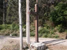
At the junction there was a cross on the corner where the lane went left (see photos) and we went straight on.
 

Attachments

  • 0118.webp
    0118.webp
    477.7 KB · Views: 9
  • 0120.webp
    0120.webp
    450.7 KB · Views: 8
I love that you still have all of these maps! Did you encounter many yellow arrows for the walk through Xove? I ask because, aside from the Lugos Amigos map, I can't find evidence of anyone else following this, and there are a number of yellow arrows on the route I tracked that proceeds through Portocelo and Vilachá.
@Terry B says can you tell us where Portocelo and Vilachá are, in relation to Xove, as he is trying to find them on our maps. We don't remember walking through them, we think they are the section we missed after Xove. He will also then post the map numbers.
Signs in Xove itself were good, certainly as far as the concello where we turned off to the station.

I'm pretty sure you didn't pass through them! They're much further to the north, away from your more direct westbound route. My suspicion is that "the route" (to the extent that this exists on the Mar) changed to get away from the highway. But I'll do some more Google Map surfing with your maps in mind.
 
Holoholo automatically captures your footpaths, places, photos, and journals.
Thanks. Terry has found them, they are on the marked route after Xove on the stage looping north to finishing in Aguadoce. The hotel/hostal in Xove had closed down in 2015 and there was no accommodation between O Castelo and Aguadoce, making the stage far too long for us. We took the FEVE to Viveiro then taxi to Aguadoce to walk back to Viveiro next day. Signs here started well but vanished half way into town where there should have been a right fork or turn. Instead of going down to the harbour side we had to follow the road past the petrol station :(
 
@Terry B says can you tell us where Portocelo and Vilachá are, in relation to Xove, as he is trying to find them on our maps. We don't remember walking through them, we think they are the section we missed after Xove. He will also then post the map numbers.
Signs in Xove itself were good, certainly as far as the concello where we turned off to the station.

Hi Dave,
The mapas militares that we have all came from the Map Shop here in the U.K.:- www.themapshop.co.uk
Starting at Ribadeo the numbers are:-
RIBADEO - SERIE L HOJA 9-3
FOZ - SERIE L HOJA 8-3
SAN CIBRAO - SERIE L HOJA 8-2
VIVEIRO - SERIE L HOJA 7-3
CELEIRO - SERIE L HOJA 7-2
CARIÑO - SERIE L HOJA 6-2
CEDEIRA (Xubia) - SERIE L HOJA 6-3

They are all 1:50.000 so farm / forest tracks are marked as thin black lines. For walking in unknown places I have yet to find anything better!

Blessings on your planning and writing :)
Tio Tel
 
Hi Dave,
The mapas militares that we have all came from the Map Shop here in the U.K.:-
Tio Tel

T&V,

Here's a close-up map of the Mar as I followed it:

upload_2017-12-30_10-42-40.webp

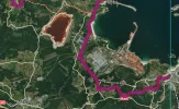
The purple is the Mar from San Cibrao. The place where it briefly hits the N-642 marker is where Hotel O Castelo is located. The dashed red line at the top is where the "official" Mar diverges (yellow arrows), rejoining the Cantábrico briefly in Portocelo before turning inland for Vilachá. So, as you can see, the route of the present doesn't go anywhere near Xove. An initial skim through Google Maps didn't turn up any yellow arrows in that stretch either, but that was very brief--I'll hunt around more later.

To thicken the plot, the Xove concello's website has an interesting bit on the Camiño do Mar. On that page, click on the Rutas Turísticas tab and then the sub-tab for the Mar. It offers this intriguing map of the Mar:

upload_2017-12-30_10-46-43.webp

So, according to this version, the Mar heads due south from Ortigueira and intersects the Inglés in Betanzos, which makes all kinds of sense for a medieval walker--why loop all the way over to Ferrol? I haven't found anything more on that possibility, but in searching I did find this route description, which comes close: https://caminoasanandres.com/ruta-pelerinaxes-i/

Curiouser and curiouser...
 
Train for your next Camino on California's Santa Catalina Island March 16-19
Interesting. We were told that the ancient route went from Viveiro to Santiago, probably via As Pontes but not Ortegueiro.
Does the route change make accommodation and distances easier? Although it was well signed with yellow arrows in 2015 if Xove lost its hotel permanently then we can see why the route would move from there.
 
Thinking back to preparing our stages on the C do Mar:-
We realised that the stages given at the time seemed to have been done as 'day walks' so did not necessarily start or stop where there was accommodation, although most did. We were able to create our own stages taking this into account.
One good thing was that they did pass through villages etc so that it was fairly easy to find drinks/food at some point each day.
Hopefully the new routing takes both needs into account as well as still passing through the places of interest as well as the coastal scenery. Will you be including the various options as already given in your original post?
 
. . . . . . . . . . . . . The Cantabrico has some dreadful hard 'crazy' paving - tarmac was preferable. The do Mar has a mix of tarmac and track plus the sections where it combines with the Cantabrico (paved or not).

The only Camino where I ended in Santiago de Compostela with aching feet was the Mar / Ingles. I blamed this on the "crazy paving" on much of the Cantábrico. :( I found the uneven paving far harder on the soles of my feet than tarmac. Anyone planning to walk this needs to take that into consideration. Much of the Cantábrico is along the cliff tops with good views and scenery. However, I would much prefer tracks and minor roads to the jarring of walking on paving. Just my point of view, but I am a countryman at heart and prefer a route through villages and hamlets where I can meet and talk to folk, rather than clifftops and coastal towns. If you walk the Mar, you will need to make your own choice. :)
Blessings
Tio Tel

DSCF3828.webp
The Cantábrico in Covas / Viveiro

DSCF3685.webp
Paving on the Cantábrico
 
The one from Galicia (the round) and the one from Castilla & Leon. Individually numbered and made by the same people that make the ones you see on your walk.
Thinking back to preparing our stages on the C do Mar:-
We realised that the stages given at the time seemed to have been done as 'day walks' so did not necessarily start or stop where there was accommodation, although most did. We were able to create our own stages taking this into account.
One good thing was that they did pass through villages etc so that it was fairly easy to find drinks/food at some point each day.
Hopefully the new routing takes both needs into account as well as still passing through the places of interest as well as the coastal scenery. Will you be including the various options as already given in your original post?

Yep, I don't think much consideration was given at all to accommodation in some of those Amigos stages! Not many people are going to be overnighting at Ponte do Porto.

My plan is to cover the Cantábrico, the Mar (as reflected in the Amigos plan, but with some subsequent modifications factored in, like the turn away from Xove), and the Mañon. I'm definitely curious about the diversion through As Pontes, but that will probably take more time and on-the-ground scouting. There's also the reality that the whole point in having an Inglés-focused guide is to be able to have a short guide, and the immediate interest in the Mar is pretty small. So, we can't justify going into too much detail out of the gates--I imagine we'll have to keep a lot of info web-based for a while. And that's totally cool with me; whatever gets the practical info to the people who need it, so that we can keep refining our understanding of the route and, eventually, bring some more resources to it.
 
There's also the reality that the whole point in having an Inglés-focused guide is to be able to have a short guide, and the immediate interest in the Mar is pretty small.
One possible difficulty we saw was recognition of the Mar as a Camino qualifying for a Compostela as it did not have that in 2015. Joining the Inglés at Xubia meant that this was not a problem for us, and we actually went to Ferrol itself. However for our Compostelas they recorded us as starting in Ferrol and the Inglés not Ribadeo and the Mar so I wonder what will happen if joining at Betanzos.
Is it likely to gain full recognition with the new route through As Pontes to Betanzos, or will those walking still have to reach Xubia (Neda/Naron) to gain a Compostela?
 
Last edited:
Hi friends,

It's been a really long time since I've been in the forum. We've been in a holding pattern with our publisher on Northern Caminos for a while, though fortunately things are moving forward now
Dave

Dave - any idea when a New Norte book might be published? I'm starting in Mid May and hoping to maybe get your new book before then. ps - I just looked on the cicerone website and it looks like it was updated in August of 2017!!
Thanks!!
 
Last edited:
Train for your next Camino on California's Santa Catalina Island March 16-19
Working on it now, Melissa. Our updates are due at month's end and we hope that the next printing will be out in time for this year's walking season, but it may be tight for your timeline. I imagine we'll have more clarity in March.

All of the major updates have been posted on northerncaminos.com, so you can always fill in the gaps there. Hope we can have something better for you, though.
 
Hi friends,

It's been a really long time since I've been in the forum. We've been in a holding pattern with our publisher on Northern Caminos for a while, though fortunately things are moving forward now, and I took on a second admin role at my school this year to help cover until we fill the job next year. The result has been professionally rewarding, though at the expense of pretty much everything else I'd like to be doing!

One thing we'll be moving forward is a guide focused primarily on the Inglés, but the main motivation for me with that is the opportunity to devote some attention to the Mar. In support of that, I've been devoting a ton of time to developing maps that cover all of the different routes--the Mar, the Cantábrico (and its coastal equivalent in Coruña), and the Mañon. This has been informed by my own gpx tracks from my scouting trip in 2016, the varied and conflicting gpx tracks online, skeletal maps developed by the Lugo Amigos, and a lot of virtual road-walking in Google Maps. In some stages, I had a much easier time of finding yellow arrows than I did when I was actually walking; I think it helped in those cases that Google's footage came from 2013.

What follows are the stages into which I'm breaking the Mar, with the distances that I've been able to pin down. Accommodation options for each stage are available here.

Stage 1: Ribadeo to Praia das Catedrais: 17.7km
>>In this stage, the Mar and Cantábrico are paired up. The Lugo Amigos' map suggests an inland approach from Ribadeo, but yellow arrows now show up on the coastal option and it's hard to find a compelling argument to take the interior approach.

Stage 2: Praia das Catedrais to Foz: 20.8km
>>Here, I suggest following the Cantábrico to the crossing of the Foz River, and then veering off onto the Mar in order to visit the basilica of San Martiño de Mondoñedo. From there, it's best to follow the direct road option into the center of Foz for the night, though it is possible to continue along the Mar, avoiding the center of Foz.

>>It is possible to take the Mar inland from Praia das Catedrais for the first half of the walk, though this is mostly road-walking and not nearly as scenic as the coast. Similarly, it's possible to stick to the coast for the full walk, but doing so would miss Mondoñedo, which is a major highlight of the route.

Stage 3: Foz to San Cibrao: 32.7km
>>Once again, I suggest a hybrid approach, following the Cántabrico along the coast from Foz to Burela, then turning inland, joining the Mar, and following it through the interesting Sargadelos park en route to San Cibrao. Those seeking a shorter day can easily break the walk in Burela.

>>This is the longest possible approach to the stage. If you follow the Mar directly, it's just 29km, though accommodation is much trickier. (The closest option en route from Mondoñedo is the Hotel Spa Mundo Buda.) Alternately, the Cantábrico direct to San Cibrao is 30.6km.

Stage 4: San Cibrao to Viveiro: 25km
>>The direct, inland route along the Mar avoids most of the coastline--it's a bit like tracing the outline of your palm while crossing over your fingers. It briefly hits the beach in Portocelo, but then veers in to Vilachá before returning to the coast in Esteiro.

>>Alternately, it's possible to follow the Cantábrico the full day, covering 29.3km and taking a few jaunts out to coastal viewpoints.

Stage 5: Viveiro to Cuiña: 31.1km
>>At this point, the differences between the Mar and Cantábrico become much more pronounced. The routes hold together through Covas, but then the Mar turns inland, cutting almost due west towards Cuiña/Ortigueira. The first half of the walk, through Riobarba and Ponte do Porto is almost entirely road-bound, but there's a bit more variety (a bit) after that. After the Ponte, the Mar overlaps with the Camiño de Mañón a Santo André de Teixido for significant stretches between here and Teixido, and then after that to Xubia/Ferrol

>>The coastal option, meanwhile, passes through O Vicedo, O Barqueiro, O Porto do Espasante, and Ortigueira, en route to Cuiña. All told, this covers 48.2km, so you'd need to devote two days to completing it.

Stage 6: Cuiña to Teixido: 21km
>>The two routes hold together for the first 10.5km of this walk. At that point, the Mar/Mañón veer inland, while the coastal option continues northward. Taking the coastal approach extends this stage to 38km, though it's possible to break the walk in Cariño.

Stage 7: Teixido to Xubia: 33.9km
>>The direct route here follows the Mañón, though it, too, splits partway through the walk, allowing you to intersect the Inglés in two different places near Xubia. Alternately, the Mar--in name, if not in marking--follows the coastline. This is a much larger trajectory, ultimately delivering you in Ferrol from the west, and spanning 79.7km. Obviously, you'll need to commit more than one day to this option, though there are good places to break up the walk in Cedeira, Valdoviño, Lavacerido, and Vila da Area.

If any of your experiences stand in contrast to any of this info, please get in touch! I don't expect this initial attempt to be flawless; indeed, my hope is to make it a bit more accessible for people eager to take the chance in order to continue generating more useful intel. More to come.

Dave
This is so helpful... thx bunches! I plan to walk this route in early June.
 
I'm starting the Camino del Norte around April 25, so it sounds like the new version of the guidebook will be too late for me. If you/Cicerone decide to release any ARCs, though, I'm happy to write a review. . . . :)
 
3rd Edition. More content, training & pack guides avoid common mistakes, bed bugs etc
Yep, I don't think much consideration was given at all to accommodation in some of those Amigos stages! Not many people are going to be overnighting at Ponte do Porto.

My plan is to cover the Cantábrico, the Mar (as reflected in the Amigos plan, but with some subsequent modifications factored in, like the turn away from Xove), ................
@Dave - Do you have a map/other info re the change away from Xove, presumably from O Castelo and the bar there. We might explore it later this year. Also the diversion through As Pontes. We will have transport and doing some walking so might get a chance to check these out while in Viveiro/Covas for a few days..
 
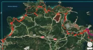
Here's what it looks like, big picture in rough editing form, but DM me your email address and I'll send you the gpx tracks so that you can zoom in. Along the northern coast, you'll see multiple options where Mar/Cantábrico split.

1518887618314.webp
 
Great - thank you. We don't do GPS but if this comes expandable we can zoo in and add a pencil line to our maps. PM following.
 
Get a spanish phone number with Airalo. eSim, so no physical SIM card. Easy to use app to add more funds if needed.

❓How to ask a question

How to post a new question on the Camino Forum.

Featured threads

❓How to ask a question

How to post a new question on the Camino Forum.

Featured threads

Forum Rules

Forum Rules

Camino Updates on YouTube

Camino Conversations

Most downloaded Resources

This site is run by Ivar at

in Santiago de Compostela.
This site participates in the Amazon Affiliate program, designed to provide a means for Ivar to earn fees by linking to Amazon
Official Camino Passport (Credential) | 2024 Camino Guides
Back
Back
Top