You
are Paddy Hopkirk and I claim my pint of Murphy's Stout!
Was that the kind of rallying where you had a pig in the boot and "got lost" near the border?


A few years ago I met up with a team from Ordnance Survey Ireland at a trade show in Dublin. They told me that a side benefit of the GFA was that cross border roads could be seamlessly mapped as some of the OSI and OSGB maps showed them misaligned.
I naively suggested that, when you went out on site, you could see the roads connected smoothly.
"Ah sure," the man said, "but it's not
our roads that were wrong!"
If you go to the National Library of Scotland site I referred to above, specifically
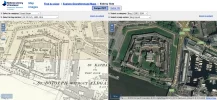
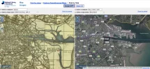
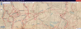
THIS BIT you can wallow in nostalgia as you compare modern satellite mapping with a paper map of the early 1940s. Covers the whole of Ireland: north, south, east and west! Use the cursor arrow on either side and the two maps move in tandem.
View attachment 55231


