• ⚠️ Emergency contact in Spain - Dial 112 and AlertCops app. More on this here.
  • Remove ads on the forum by becoming a donating member. More here.

Search 74,075 Camino Questions

Lourdes-Jaca via Portalet

Charl

Member
Time of past OR future Camino
Via Podiensis 2014
We're walking a Camino to Santiago in May 2015, starting in Lourdes. The route via Pourtalet looks very attractive, but Camino-specific info is quite scarce. We're particularly looking for information on accommodation and where to get passports stamped in for instance Laruns and Gabas. The complete route we intend taking so far is Lourdes-Asson-Arudy-Laruns-Gabas-Formigal-Biescas-Sabinanigo-Jaca. I've found some French documents that describe the route via GR trails quite well from a hiker's perspective, now just to fill in the pilgrim details.
 
€2,-/day will present your project to thousands of visitors each day. All interested in the Camino de Santiago.
Hi I walked to Lourdes from the Arles route and then onto Arundy and up the Ossau valley to Gabas, then because of the heavy day I had from Laruns to Gabas decided that instead of going over to Col de Somport that I would get a taxi to Sallent de Gallegos and restart there. The main reason was that I had on the way marked route to Gabas, on a couple of occasions had to cross a couple of unexpected wide and deep streams.This was on the 18 June.I met quite a few GR10 walkers who were staying in Gabas and they said it was very much the same at higher points where there was still snow at 2400 metres on the north facing side and was in the process of melting, if I had gone to Somport I would have to go through a pass at 2100 metres with peaks on either side of over 2600 metres.
The route from Lourdes to Arundy( where you turn off for the Ossau Valley is straight forward) is on the via Piedmont route so have a look at that topic, some forum members have posted quite good Information on there. I did it to Arundy in two days you more or less follow river for the 1st 20km, along the foothills of the pyrnees. I stayed in a hotel at the point the path started to go away from the river if I had continued for another 5-6 km I could have stayed in a Refugio type place provided for pilgrims. The next day I walked to Arundy about 25-6km from the hotel, where there is accmodation for pilgrims in a priests house. I will post some more details either later today or tomorrow, so it gives me a chance to go home and find my credential with telephone numbers on the stamp.
 
Thank you, very useful information. Even just the names of the places you stayed at would be most helpful thanks. It's one of my concerns, since we'll be doing this stretch in early May there could still be considerable snow on the ground. We'll just have to check the weather beforehand.
 
Holoholo automatically captures your footpaths, places, photos, and journals.
I will get myself on to a proper computer tomorrow instead of posting on my mobile, I will be able to check on places that the marking went a bit funny and it was quite a lot on the Spanish side, there is no yellow arrows until Sabananigo, and even then I only counted 4 between there and Jaca. They use red and white and confusingly yellow and white stripes most of the time.
 
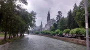
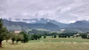
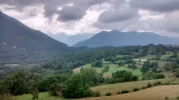
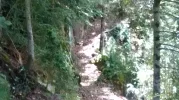
Hi I started from the Basillca at Lourdes, where I had filled my bottles from the healing water there. You head westward following the river, the chemin GR78 goes away from the river for a while, but I stayed with it and went on to Chemin Bois which is next to a campsite and eventually leads to a natural track which does not run more than 10 metres from the river. After a few Km it meets the GR78 again, when the path goes up to meet the road. For the next few km you stay on the road, there are the red and white markers which indicate the route. With an option coming in a place called Rives where I noticed a scallop shell sticker pointing left and the red and white markers indicating to go over the river on a bridge. I went over the bridge and after crossing a main road it led me to a natural track which led to a town called Saint Pe de Bigorre, there is a church, bakery and accommodation here, I passed through on a Sunday when I saw the bakery was open and having had many failed attempts in the previous weeks at finding anything open in France on any day of the week I jumped at the chance. The chemin heads through the village goes back over the river and rejoins the other Variant. The route follows the river again and eventually you come to Lestelle Betharran, there is pilgrim accommodation here, you will have to ask around for it, the route heads upwards as soon as it arrives here and does not go through it. I stayed with the river and went to a restaurant I could see, it is on the river side and with seats outside and looks like a good place to stop and eat but I was told it was complet so I head along to the next restaurant I could see about 30 metres on, this was very busy as well but after a little get together they found a table for me. The Restaurant is called O Quatre Saisons(05 33 11 15 11) they had accommodation as well and I stayed here for the night- 35 Euros. If you stay here then for a little trip I would walk to the Church of our Lady which is back on the Chemin and about 10 minutes walk further on , this is a pilgrimage place in itself and has maps indicating all the stations leading to it. I passed through early next morning and was not able to go inside.IMG_20140615_090752458_HDR.webp
 

Attachments

  • IMG_20140615_100723911.webp
    IMG_20140615_100723911.webp
    943.1 KB · Views: 22
  • IMG_20140615_105114736.webp
    IMG_20140615_105114736.webp
    546.3 KB · Views: 21
  • IMG_20140615_132219355_HDR.webp
    IMG_20140615_132219355_HDR.webp
    380.9 KB · Views: 21
Last edited by a moderator:
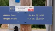
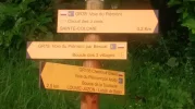
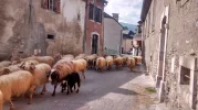
The next day I walked to Arundy, what I was using as a guide was a spreadsheet of distances and accommodation from a forum member Caminka who walked this way previously and headed up the Ossau Valley, she went over at Col des Moines. It felt like a long day, there was lots of switching backward and forward on different surfaces and climbs which felt like they were put in to make the route more exciting. You can stop in Asson about 5 km on, there is a shop and cafe there and they hold the keys to the refugio for pilgrims.A few km on is Bruges that has shops, accommoation and cafes. The next big place is Sainte Colome, you see it from a distance and are at roughly the same height as it but the chemins veers away downhill then comes back around to give you a along steep rocky path to go back up to it, In the village you have several options either to stay with the GR78, head straight up the Ossau Valley to Lovie Juzon or take the variant up it and go via Arudy, the latter is the way I took. It has albergue/house with the local priest, if he is not in you can get the keys of a neighbour a notice on the door tells you which one. To get there follow the chemin from Sainte Colome to Arudy, when you get to the river and the bridge any way marking disappears, head up Rue des Pyrenees, go on to Rue Barcajou, you arrive at a roundabout.It is near here I think on Rue de Moulin, his door has a scallop shell on it. This is good place to stay, he is an excellent cook, quite funny, his cat is spoilt he has had several book published on its and his adventures. He also has a mini library which has up to date guides on the various routes nearby. I bought a little pamphlet which had maps for the St Jacques route up the Ossau Valley and over to the Sallent and down to Jaca that way, it was dated 2008, but was in French and Spanish.
 
Last edited by a moderator:
€2,-/day will present your project to thousands of visitors each day. All interested in the Camino de Santiago.
I walked to Gabas in 2 days, the first day to Laruns is very easy you follow the priests instructions to get back to the river. You cross over when you come to the bridge at Louvie Jouzon and follow the left side/east bank of the Ossau river, it is on quiet country roads, it about 15km to Laruns. There may be options to be more adventurous but I was finding the sights around me not only beautiful but quite imposing, so I decided to go the easy way. I stayed at an Albergue Eurl L Embaradere(13 Ave De La Gare 0559054188)it has many dorm rooms and is quite busy , there was a large group of English Cyclists there and about 10 Mod Scooterists from Belgium who were making a pilgrimage to Santiago on their scooters. The food is good here, but the rooms felt a bit claustrophobic, so check them out, there is other options. I picked up a more detailed map from the Office de Tourisme which is about 30 metres from the the albergue.
 
Last edited by a moderator:
Ideal sleeping bag liner whether we want to add a thermal plus to our bag, or if we want to use it alone to sleep in shelters or hostels. Thanks to its mummy shape, it adapts perfectly to our body.

€46,-
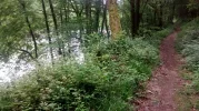
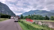
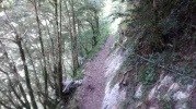
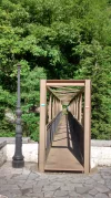
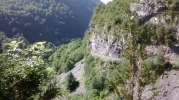
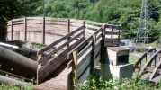
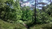
Laruns to Gabas is 15 km is a very difficult day, it particularly gets a lot more harder about 3 km after Eaux Chauds.You sometimes are hopping from one big stone to the next, sliding down slopes and fighting your way throw undergrowth, its after you go over a bridge that helps you get over a hydroelectric pipes it starts to become exhausting and slow work. With two people there will be less worry, it felt a bit dangerous doing it by myself. You can stay at Chez Vignau in Gabas 55 Euros demi pension, breakfast is at 7.30am, the refuge shut down a couple of years ago.IMG_20140618_085948211.webp IMG_20140618_091132697.webp IMG_20140618_102616619.webp IMG_20140618_103013312_HDR.webp IMG_20140618_105610665.webp
 
Last edited by a moderator:
The focus is on reducing the risk of failure through being well prepared. 2nd ed.
Wonderful photos, Mike Vasey! I am just now staying at a splendid gite near Aspet, Haut Garronde, seeing occasional yellow arrows and camino shells on assorted trail heads.. wondering which camino I am seeing. (they seem to be everywhere I go.) Is this a variant of the Arles? I am rather ignorant of the French camino geography, alas.
 
It could the Piedmont route the GR78, I tried checking on Peter Robins site but my mobile and his site do not get on.
 
Ideal sleeping bag liner whether we want to add a thermal plus to our bag, or if we want to use it alone to sleep in shelters or hostels. Thanks to its mummy shape, it adapts perfectly to our body.

€46,-
Thank you SO much, your descriptions nicely fill in the missing pieces of my planning up to Formigal. We may stay over for a day in Gabas, especially if there's still a lot of snow around (here in South Africa proper snow is a rarity) so we can do a walk or two into the mountains. Your remarks regarding flooding is noted; I suppose we'll keep an eye out on the weather at that time. Now, may I be a bother and ask for info on the stretch from to Jaca? You said there are very few markings? May I ask where you stayed over? Lastly, we'll be passing through in early May, I presume bookings aren't necessary for that time of year?
 
Hi I won't be able to fill the details until probably next Wednesday or thursday, I am in lovely Lille at the moment which is having an Indian summer seeing my girlfriend, her computer is broken(probably to stop me looking at the Camino forum)so will post details as soon as I get back. There is a thread called Where did I Walk Today and I posted some photos on that of the the section from Sallent De Gallego where I left the taxi to walk 11-12 km to Hoz de Jaca. If I get a chance while I am here will try to supply as much Info as I can. Need to look on a full scale map and find the name of the beautiful church I passed on the 2nd day, which was perched on top of a cliff face and you access it via Ferrata. It is about 3 or 4 km past Hoz de Jaca.
 
Well I certainly wouldn't want to intrude on time with your lady... had a look at your pics and they give a nice idea of what we'll be walking through... the pic of what looks like a mountain pass before Gabas looks nice and steep... Enjoy Lille!
 
Join the Camino cleanup. Logroño to Burgos May 2025 & Astorga to OCebreiro in June
Hi I don't know if you have seen this website http://vppyr.free.fr/ossau.htm I did not use it, but that was because I was not sure what I was going to do until I did it. The bit down the Sallent is where I think the route differs from the way they went.
 
So after waking up in the morning at Gabas, I realised that the advice given to me at Arudy by the priest not to go this way was probably meant in good heart and not him worrying too much. So I decided that I would go the alternate GR108 way to Sallent de Gallegos but get a taxi over the top on the high level road connecting France and Spain.
I arranged a taxi at Chez Vignau but had to wait a few hours, the taxi driver was out delivering morning supplies of bread, papers whatever else was needed by remote homesteads up there.
The taxi drive was something else after climbing for a few km past a dam, you start to hit high level plateaus, which I think you will be walking across, the scenery is too much to remember, every part was dramatic and beautiful, but from a practical side I think there will be places to stop while walking, on the border there seemed to be lots of shops or units of some kind, which had quite a few visitors around. The road was quite busy so there will always be traffic to flag down if the weather turns on you, the plateaus were being used as pastures and many cattle were roaming on to and across the road, we had to stop a few times. The road itself after the climb will be safe enough to walk on ,it is quite wide and you can easily step off.

I had asked for Sallent but If I had looked at the pamphlet I had I would have seen Fromigal was before it and got off there.
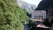
Sallent is very scenic and the buildings have those steep roofs to stop snow building up.IMG_20140619_101705428.webp
 
Perfect memento/gift in a presentation box. Engraving available, 25 character max.
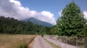
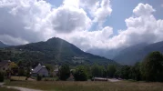
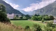
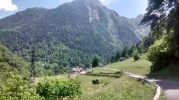
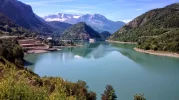
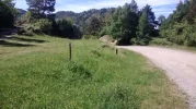
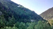
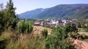
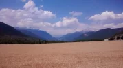
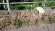
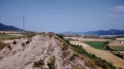
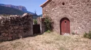
The top photo shows Embalse de Lanuza, you are looking Southward, the direction you will be going. You leave from the centre square of Sallent and walk down the east side of the river(left) on a asphalt road after about 1.5km the you will come to a dirt track, the one you see in the 2nd picture go on to it. You will go to the left of the village and hill that you can see in the middle left hand side of the 1st picture, stay with it and you will come to a vista of the Emblaise de Bubal after about 4km You have an option where the way divides, the way marking was positioned so you were not quite sure, I went right which was the wrong way, it leads down to a road, if you head left on the road it will bring you to El Puyeo de Jaca.
 
Last edited by a moderator:
Absolutely gorgeous and I am enjoying every word too!
 
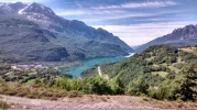
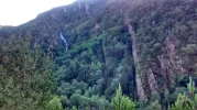
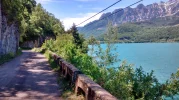
Their are way markings but not very frequently, they start of with red and white stripes, but occassionaly later on alternate with yellow and white stripes for no obvious reason. You will have to use common sense or pot luck on occasion's. I have looked at a map and if I had gone the left way I believe it would have stayed on the track and swung around and up to a place called Panticoasa then dropped down to the far end of Pueyo where I rejoined it. The third picture shows the Embalse de Bubal you are looking southward again, and same as before you transverse it on the left side.You can see Pueyo on it.
 
€2,-/day will present your project to thousands of visitors each day. All interested in the Camino de Santiago.
I do not know about accommodation options in Fromigal, Sallent from 1st hand experience but when I was looking at maps today it was showing accommodation options at several places. I have a feeling there is quite a few private albergues because of the opportunity in this area for group activities, kayaking, skiing, hiking, mountain biking etc, at all times of the year. When I came to to the end of El Pueyo de Jaca there was a youth albergue, I was tempted to stay there, but thought I would give it a few more km. I think the albergue is www.alberguedelpueyo.es/
 
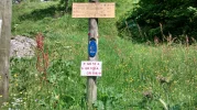
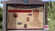
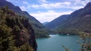
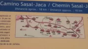
At the end of El Pueyo I came back to the Camino with several wooden boards pointing in several directions and also an explanatory board saying what was ahead. I decided to stay with the road which you can not see in the bottom picture but runs at base of steep wooded slopes at the waters edge.If you follow it for about 3-4km you eventually come after a steep climb to a a place called Hoz de Jaca which has a platform type mirador before it. The day I think started in Sallent at around 1500m went down to about 1000m then I think I had nearly got back up to 1300 in Hoz, the mountain peaks which had looked very close in Sallent, had seemed reassuringly distant in El Pueyo had now a nearness about them again.
 
Last edited by a moderator:
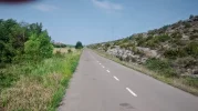
tmp_28503-image-1812418816.webp tmp_28503-image-467366805.webp The 1st picture shows the road alongside Bubal, it was a very nice walk with no traffic. And the 2nd is taken near the mirador. I stayed at a bar with rooms above it in Hoz called the El Mirador, 25 euros for me and it would have been 40 if there had been two, rooms quite clean and modern, en suite. I had my first menu del dia for two years and was glad to be back on standard Spanish fare after a month of my stomach not quite settling with the sometimes too rich ( but excellent) French food. The family that run this place are very friendly.
 
Last edited by a moderator:
€2,-/day will present your project to thousands of visitors each day. All interested in the Camino de Santiago.
The next day I walked to Sabinanigo, it took me about 12 hours, was on a main road for an hour feeling very vulnerable and didn't have a clue where I was on a couple of occasions, it was all down to me not trusting the path to be safe and wanting to take shortcuts which had the opposite effect.
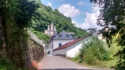
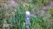
When you leave Hoz follow the road through it, it takes you downhill and after a few hundred metres you will see a waymarking post take you left into bushes on a rough track. I ignored it and followed the road, I was a bit put off by the imposing cliffs and peaks I could see ahead of where the track was heading . I had looked at the pamphlet and it showed that the path came out near the dam where the road crossed it so I decided to stay with the road, which with hindsight was not the best choice. After going downhill for about 2km I came to the dam and realised there was no way to get back to the Camino, it was a security controlled area. So I followed the road over the dam , through a tunnel and onto the busy road(A136), several times I tried to get of it but I had to stay on it for several km where I was able to cross an historic bridge which led after a few hundred metres to a dolomen site. The Camino rejoined here. What I had missed was probably a very beautiful route which goes by the Ermita de Santa Elena, which I could see from the road on the other side of the valley standing atop of cliff face looking over the valley.
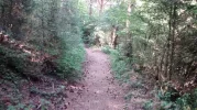
After rejoining the Camino I followed it to Biescas on a mostly beautiful natural track, going over little bridges with streams in full torrent from melting snow further up. Once arriving on the northern edge of Biescas way marking finished so I headed to the church whose spire I could see in the centre. There are several shops,bars and accommodation here.
 
Last edited by a moderator:
Htmp_28503-image-1799008304.webp IMG_20140620_094043047_HDR.webp tmp_28503-image-1424282038.webp tmp_28503-image-331775023.webp tmp_28503-image-861283340.webp
The first picture is the way post which I ignored,the 2nd is the Ermita, the 3rd is the cliff under it and a stream which I assume must have a bridge over it, the 4th is the path after rejoining it near the dolomen, and the 5th is Biescas
 
Last edited by a moderator:
I was not sure which way to head out of Biescas, the maps in the pamphlet could be ambiguous at times, the thickly drawn line indicating the Camino seemed to go south on the now opening plain next to or near the river. So heading out of the central square I headed south and was able to walk on pedestrian only paths for a couple of Km, when I was looking at maps yesterday online it showed the GR16 heading south east out of Biescas going to the lower valley slopes on the east side of the now ever widening valley plain. I have a feeling that the Camino now goes that way. I walked to Oros Alto on quiet country roads and then followed the road to Oros Bajo, where I rejoined the a GR route and the way markings for the Camino. at the far end of Oros Bajo is a car park and a playground with posts indicating that the Camino was continuing on the valley slopes to a place called Olivan, my pamphlet showed the Camino heading west from here, heading along roads and going a 'quicker' route to Sabininago. I followed the map and ended up after a few km running into road construction, so for next hour or two tried to navigate a way around it to get to a place called Larrede where the way marking from the Camino rejoins. From here I walked west crossing two rivers , one was across a wooden bridge and the other I had to wade through a shallow river of about 30 metres wide. The way marking will eventually take you to the eastern edge of Sabinanigo, and you have a walk through a narrow industrial estate road with large vehicles flying down. I stayed in Hotel Ciudad de Sabinanigo, its OK but would normally expect to pay 50-60 euros for a single room there, but because of a large cycling event all rooms in all places had been booked up for 8 months and my room was at least double that. There is an albergue and other hotels but they were full up.Sabinanigo is very industrial at one end but at the other end is very pretty with vistas of the mountains.
 
3rd Edition. More content, training & pack guides avoid common mistakes, bed bugs etc
tmp_8450-image-1812418816.webp tmp_8450-image-1799008304.webp tmp_8450-image-1424282038.webp
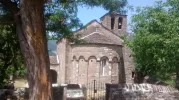
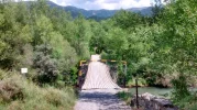
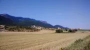
The 1st picture is the church at Oros Alto, the 2nd is looking north back up the Gallegos valley, just after Larrede and the 3rd is the wooden bridge about 2km after Larrede.
 
Getting to Jaca is straight forward, if you stay or find the hotel I stayed in, on the opposite side is a path which heads upwards and then through a tunnel to a place called Sabinanigo Alto. I saw my first yellow arrow here, the route follows a long straight minor road, with open fields on your left and a large land mass past them, on your right is a large narrow rock outcrop called LA Val Estrecha, this runs the entire length of the road. While I was walking the road I was tempted to climb it and see if there was a possible path running along it, which I did later, but realised I was quite near the end of it. At the end of it the road divides, I went left and went through a place called Ulle, you can go the other way and it may be quicker but my pamphlet was was showing that as I got near Jaca I probably would be on the main road. When I was staying at the albergue in Jaca the hospitalera said there was a route which did not go on the road, she showed me a A4 sheet which showed it going the way I did then cutting across fields after Sabinanigo alto, at the time I was on the look out for this but there was no obvious spot where it happened and the way marking was infrequent on the minor road but there.
 
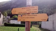
tmp_8450-image-331775023.webp tmp_8450-image1889075249.webp tmp_8450-image1525579892.webp tmp_8450-image1713901363.webp tmp_8450-image589317107.webp tmp_8450-image1487303225.webp 1. The first yellow arrow 2.The boards that are all along the route 3.The road which is long and straight 4. The fields and land mass to you your left, possible other Camino way marking in there. 5. On the top of the La Val Estreda looking back eastward, it may be possible to join it earlier and walk along the top rather than the road. 6. The church at Ulle I stopped here for midday and sent my thoughts for those recently deceased and for the Camigo meeting in Exeter.
 
Last edited by a moderator:
...and ship it to Santiago for storage. You pick it up once in Santiago. Service offered by Casa Ivar (we use DHL for transportation).
Thank you once again. This now means I've got all the pieces of the Camino puzzle. I'm sure we'll get lost once or twice but your info has been a GREAT help. Countryside looks very pretty!
 
Thank you Mike! I'm excited to see your photos and piece together yet another Camino hike. This will be a lot of fun to plan for next summer.
 
The 2024 Camino guides will be coming out little by little. Here is a collection of the ones that are out so far.

❓How to ask a question

How to post a new question on the Camino Forum.

Featured threads

❓How to ask a question

How to post a new question on the Camino Forum.

Featured threads

Forum Rules

Forum Rules

Camino Updates on YouTube

Camino Conversations

Most downloaded Resources

This site is run by Ivar at

in Santiago de Compostela.
This site participates in the Amazon Affiliate program, designed to provide a means for Ivar to earn fees by linking to Amazon
Official Camino Passport (Credential) | 2024 Camino Guides
Back
Back
Top